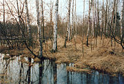
List of geotopes in the Gifhorn district
The list of geotopes in the Gifhorn district contains the geotopes in the Gifhorn district in Lower Saxony . Some of these geotopes are also protected as natural monuments (ND), landscape protection areas (LSG), nature reserves (NSG) or part of these.
| Geotope no. | designation | place | comment | Coordinates | image |
|---|---|---|---|---|---|
| 3129/03 | Sinkhole " Bullenkuhle " | approx. 1.4 km west of Bokel | Geotope type: sinkhole. Length 100 m, width 80 m. Stratigraphy: Quaternary. Petrography: an earth funnel covered with bog. |
52 ° 48 '46.8 " N , 10 ° 31' 1.2" E |
 more pictures |
| 3628/01 | Dune area with peat holes | S of the railway line between Müden and Wilsche | Dune area. Stratigraphy: Quaternary Holocene. Petrography: from yellow and brown fine sands. Geological region: Upper Allern lowlands. |
52 ° 30 '7.9 " N , 10 ° 22' 43.3" E | |
| 3629/01 | Valley sands of the Vistula glacial ( Gifhorner Heide ) | approx. 1 km W Gifhorn | Dune area. Length 900 m, width 300 m. Stratigraphy: Quaternary Holocene. Petrography: heavily moved dune terrain with locally muddy dune valleys on the edge of the Aller lowlands. Nature reserve NSG-LÜ 013 "Gifhorner Heide". |
52 ° 28 '10.9 " N , 10 ° 30' 13.3" E |

|
| 3630/01 | " Vogelmoor " high and low moor | approx. 1 km N Barwedel | High moor, low moor. Area 129.8 ha. Stratigraphy: Quaternary Holocene. Petrography: raised bog thickness of 1–2 cm, bog is composed of strongly decomposed sedge and alder forest peat. Nature reserve NSG-BR 026 "Vogelmoor". |
52 ° 32 '3.1 " N , 10 ° 45' 36" E |
 more pictures |
| 3431/01 | Small gable moor | west of Kaiserwinkel , Giebel area free of parish | Moor. Length 1100 m, width 350 m. Stratigraphy: Quaternary Holocene. Petrography: 1–2 cm thick sedge peat. In the nature reserve NSG BR 016 "Giebelmoor". |
52 ° 31 '24.6 " N , 10 ° 56' 13.2" E |

|
| 3431/02 | Swelling meadows with artesian springs with pouring cones | opposite the Holzmühle farm, approx. 1.2 km SW Tülau -ahrenhorst | Source. Length 70 m, width 150 m. Two artesian springs located approx. 200 m apart, which drain into the small Aller. |
52 ° 33 '47.5 " N , 10 ° 51' 37.1" E | |
| 3431/03 | Large gable moor | approx. 2 km SW Kaiserwinkel , community-free area Giebel | Moor. Length 900 m, width 1700 m, area: 670.0 ha. Stratigraphy: Quaternary Holocene. In the nature reserve NSG BR 016 "Giebelmoor". |
52 ° 30 '14.8 " N , 10 ° 56' 1.7" E |

|
See also
- List of nature reserves in the Gifhorn district
- List of landscape protection areas in the Gifhorn district
- List of natural monuments in the Gifhorn district
- List of protected landscape elements in the Gifhorn district
Web links
Commons : Geotopes in the Gifhorn district - collection of images, videos and audio files