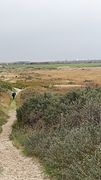
List of geotopes in the district of Wittmund
The list of geotopes in the district of Wittmund names the geotopes in the district of Wittmund in Lower Saxony . Some of these geotopes are also protected as natural monuments (ND), landscape protection areas (LSG), nature reserves (NSG) or part of these.
| Geotope no. | designation | place | comment | Coordinates | image |
|---|---|---|---|---|---|
| 2210/01 | NSG " Flinthörn " | Southwest part of Langeoog Island . | Geotope Type: Island Landing. Size 150 ha. NSG-AU 16 nature reserve. |
53 ° 43 ′ 34.5 " N , 7 ° 28 ′ 25.5" E |
 more pictures |
| 2410/01 | Moor lake " Eternal Sea " | in the border area of the districts of Wittmund and Aurich near the village of Eversmeer . | Geotope type: lake, raised bog. Shape: oval with bulges. Length 1600 m, width 800 m. With 88.7 hectares of water, it is the largest raised bog lake in Germany. About 8.5 m above sea level. Bounded by an extensive complex of unused bog areas, which still show the actual high bog profile and together with the water body form the 1,180 hectare nature reserve NSG "Eternal Sea and Surroundings". |
53 ° 32 '44.2 " N , 7 ° 25' 54.1" E |
 more pictures |
| 2513/03 | Ground moraine lake " Black Sea " | in the Marx district , Friedeburg municipality . | Geotope type: lake. Area 15.0 ha. Nature reserve NSG-WE 121 "Ground moraine lake Black Sea". |
53 ° 24 '45 " N , 7 ° 53' 10.9" E |
See also
- List of nature reserves in the Wittmund district
- List of landscape protection areas in the district of Wittmund
- List of natural monuments in the Wittmund district
- List of protected landscape components in the district of Wittmund
Web links
Commons : Geotopes in the district of Wittmund - collection of images, videos and audio files