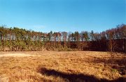
List of geotopes in the Lüchow-Dannenberg district
The list of geotopes in the Lüchow-Dannenberg district contains the geotopes in the Lüchow-Dannenberg district in Lower Saxony . Some of these geotopes are also protected as natural monuments (ND), landscape protection areas (LSG), nature reserves (NSG) or part of these.
| Geotope no. | designation | place | comment | Coordinates | image |
|---|---|---|---|---|---|
| 2831/01 | Boulder ( sacrificial stone by Plumbohm ) |
0.3 miles north of Plumbohm , Gohrde | Geotope type: boulder. Length 5 m, width 3.5 m, height 2.5 m. Stratigraphy: Quaternary Pleistocene, Saale Glaciation. Petrography: coarse granite, gray-red, with red feldspars 2–3 cm in diameter, bluish-gray quartz up to 0.5 cm biotite, 2 pieces are next to it. |
53 ° 7 '3 " N , 10 ° 57' 7.2" E | |
| 2831/02 | Section from the Klötzie (steep bank of the Elbe Valley) | approx. 1 km NW Tiesmesland, Hitzacker (Elbe) | 53 ° 11 '25.4 " N , 10 ° 58' 40.8" E | ||
| 2831/04 | The Klötzie (steep bank to the Elbe) | around Tießau , Hitzacker (Elbe) | Height 30 m. Petrography: sandy, gravelly mineral soil. |
53 ° 10 '49.1 " N , 10 ° 59' 2.4" E | |
| 2832/02 | Klötzie (steep bank of the Elbe) | northwest of Hitzacker (Elbe) | 53 ° 9 ′ 57.6 " N , 11 ° 0 ′ 32.4" E | ||
| 2932/01 | " Maujahn " sinkhole with raised bog | approx. 0.8 km ONO Thunpadel , Dannenberg (Elbe) | Geotope types: raised bog, sinkhole. Height 2.5 m. Area 37.0 ha. Nature reserve NSG LÜ 168 "Maujahn". |
53 ° 5 '39.1 " N , 11 ° 2' 34.8" E |
 more pictures |
| 3032/02 | Salt flora area | near Schreyahn , Wustrow (Wendland) | Geotope type: sinkhole lake. Nature reserve NSG LÜ 016. |
52 ° 55 '52 " N , 11 ° 4' 44" E |
 more pictures |
See also
- List of nature reserves in the Lüchow-Dannenberg district
- List of landscape protection areas in the Lüchow-Dannenberg district
- List of natural monuments in the Lüchow-Dannenberg district
- List of protected landscape components in the Lüchow-Dannenberg district
Web links
Commons : Geotopes in the Lüchow-Dannenberg district - collection of images, videos and audio files