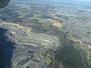
List of geotopes in Osnabrück
The list of geotopes in Osnabrück contains the geotopes in the independent city of Osnabrück in Lower Saxony . Some of these geotopes are also protected as natural monuments (ND), landscape protection areas (LSG), nature reserves (NSG) or part of these.
| Geotope no. | designation | place | comment | Coordinates | image |
|---|---|---|---|---|---|
| 3614/02 | Part of a quarry | approx. 2 km NNW Osnabrück-Eversburg, Piesberg. | Geotope type: outcrop. Width 30 m. Stratigraphy: carbon. Petrography: quartzitic sandstone, slate, sandstones, Johannisstein seam with coal, sandstone, slate. |
52 ° 18 ′ 56.9 " N , 8 ° 0 ′ 49.3" E | |
| 3614/20 | Stone grave called " Karlsteine " | Bundesstraße 68 Osnabrück in the direction of Bramsche, Wallenhorst. At the end of town, turn right into Oldenburger Landstrasse towards Lechtingen. Shortly before the B68 bridge, a path goes right into the forest. | Geotope type: boulder. cuboid; Length 0.9 m, width 2.5 m, height 4.5 m. Stratigraphy: carbon. Petrography: coarse-grained sandstone with rounded milk quartz, native carbon, conglomerate layers. Natural monument ND OS-S 16. |
52 ° 18 '57.6 " N , 8 ° 2' 11.8" E |
 more pictures |
| 3614/21 | Boulders "Oestringer Stones I" | 750 m N Osnabrück-Dodesheide. | Geotope type: boulder. 30 boulders; Length 2.5 m, width 2 m, height 0.9 m. Stratigraphy: Quaternary Pleistocene, Saale glaciation. Petrography: 30 strings, reddish gneiss and granite, mostly angular shapes 10 strings. with a diameter of more than 2 m. Natural monument ND OS-S 17. |
52 ° 18 '53.6 " N , 8 ° 4' 52.9" E |

|
| 3614/22 | Boulders "Oestringer Stones II" | 750 m N Osnabrück-Dodensheide, N street. | Geotope type: boulder. 30 boulders. Stratigraphy: Quaternary Pleistocene, Saale glaciation. Petrography: 30 rows, 30 rows predominantly gneiss, besides granite, greyish u. reddish colors. Natural monument ND OS-S 18. |
52 ° 18 ′ 53.6 " N , 8 ° 4 ′ 45.8" E |

|
| 3614/23 | Standing, native rock, cliffs N-slope | Piesberg , 500 m WSW Klöcknersiedlung | Geotope type: directional profile. Length 30 m, width 100 m. Stratigraphy: carbon. Petrography: carbon quartzite. Natural monument ND-OS-S 30. |
52 ° 19 ′ 19.2 " N , 8 ° 1 ′ 12" E |
 more pictures |
| 3614/24 | Black water | 750 m N Osnabrück-Dodensheide, N street. | Geotope type: sinkhole. Almost rectangular in shape. Length 120 m, width 60 m. Stratigraphy: Quaternary Holocene. Natural monument ND OS-S 33. |
52 ° 19 ′ 54.1 ″ N , 8 ° 0 ′ 18 ″ E | |
| 3713/05 | abandoned quarry in the LSG "Heller Berg" | 1.8 km ENE Hasbergen , Heller-Berg | Geotope type: layer profile 1.6 sediment st. Length 50 m, width 30 m. Stratigraphy: Triassic Muschelkalk. Petrography: limestone, platy, weakly fissured, gray colors, 1 yellow layer, severely disturbed, dip at about 70 ° to S-SW. Natural monument ND-OS-S 29. In the landscape protection area LSG “Heller Berg”. |
52 ° 15 ′ 0 ″ N , 7 ° 58 ′ 48 ″ E | |
| 3714/04 | Stone grave gen. " Devil stones " about 4,000 years old | 1 km north of Osnabrück-Düstgrop | Geotope type: boulder. Length 2.5 m, width 1.3 m, height 0.6 m. Stratigraphy: Quaternary Pleistocene, Saale Glaciation. Petrography: grave 3.5 m × 20 m, 15 carrier stones, 4 cap stones, mostly granite. Natural monument ND OS-S 28. |
52 ° 15 '59.4 " N , 8 ° 6' 26.6" E |
 more pictures |
| 3714/05 | Stone grave called " Gretescher stones " | in Lüstringen, N Gretescher Turm | Geotope type: boulder. Length 3 m, width 2.6 m, height 0.9 m. Stratigraphy: Quaternary Pleistocene, Saale Glaciation. Petrography: 13 girder stones, 5 cap stones, 1 cap stone on the slope; Granite cap stones, carrier stones predominantly gneiss. Natural monument ND OS-S 21. |
52 ° 16 '16.7 " N , 8 ° 7' 2.3" E |
 more pictures |
| 3714/06 | Stone grave " Sundermann stones " | Lüstringen, 1.2 km NNE Gretesch Castle | Geotope type: boulder. Length 2.7 m, width 1.8 m, height 1.3 m. Stratigraphy: Quaternary Pleistocene, Saale Glaciation. Petrography: 19 carrier stones, 3 cap stones (4?), Mainly gneiss, next to granite. Natural monument ND OS-S 32. |
52 ° 16 '58.4 " N , 8 ° 7' 48" E |
 more pictures |
| 3714/07 | Clay pit in Hellern, Kramer brickworks mine | on the street "An der Wihohikirche", behind the sports field | Geotope type: directional profile. Length 150 m, height 6 m. Stratigraphy: Jura, Lias. Petrography: mudstone, black-gray, finely peeling off with individual geodes, e.g. Sometimes running to banks together. |
52 ° 15 '28.1 " N , 8 ° 0' 3.6" E |
See also
Web links
Commons : Geotopes in Osnabrück - collection of images, videos and audio files