List of natural monuments in Osnabrück
The list of natural monuments in Osnabrück contains the natural monuments in the city of Osnabrück in Lower Saxony .
On December 31, 2016, there were a total of 71 natural monuments in the area of responsibility of the Lower Nature Conservation Authority of the city of Osnabrück.
Natural monuments
| number | designation | location | comment | Coord. | image |
|---|---|---|---|---|---|
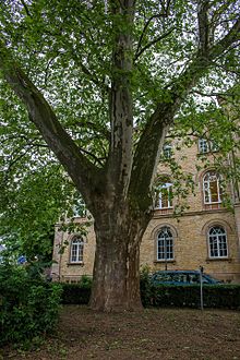
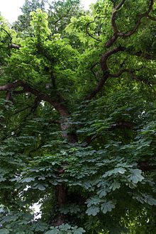
| ND-OS-S 01 | 1 plane tree | Front yard of the regional court , Kollegienwall | 52 ° 16 '22.1 " N , 8 ° 3' 0.4" E | ||
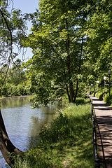
| ND-OS-S 04 | Trees on the Herrenteichswall | Tree population of the historic city wall (Herrenteichswall) | Size about 1.6 ha | 52 ° 16 ′ 41.7 " N , 8 ° 2 ′ 49.6" E | |
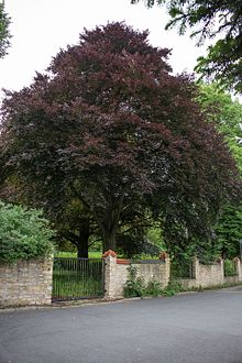
| ND-OS-S 06 | 1 red beech | Parish garden at the Katharinenkirche | 52 ° 16 '22.1 " N , 8 ° 2' 37.3" E | ||
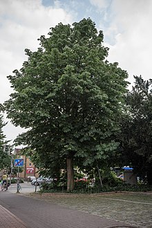
| ND-OS-S 07 | 1 plane tree | Natruper Strasse, opposite Gutenbergstrasse | 52 ° 16 ′ 49.5 " N , 8 ° 2 ′ 13.5" E | ||
| ND-OS-S 08 | 1 ginkgo tree | Former Philipsontscher Park, Gutenbergstrasse 27 | 52 ° 16 '47.8 " N , 8 ° 2' 4.1" E | ||
| ND-OS-S 09 | 1 yew tree | Former Philipsontscher Park, Lürmannstrasse 40 | 52 ° 16 '47.8 " N , 8 ° 2' 4.1" E | ||
| ND-OS-S 10 | 1 manna ash | Former Philipsontscher Park, Lürmannstrasse 40 | 52 ° 16 '49.9 " N , 8 ° 1' 58.5" E | ||
| ND-OS-S 11 | 1 oak and 2 more oaks | At the former Everskotten and in the vicinity | Chest circumference of 7.24 m (2014) | 52 ° 18 ′ 13.7 " N , 8 ° 0 ′ 44.5" E | |
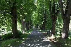
| ND-OS-S 13 | Tree population of the von Kerssenbrockallee, u. a. Oak trees | Alley of trees between the streets "Die Eversburg" and "Bahnstraße" | Size approx. 0.4 ha | 52 ° 18 ′ 29.8 " N , 7 ° 59 ′ 56.1" E | |
| ND-OS-S 14 | Cross in mockery with a group of beech trees around | West of the Oldenburger Landstrasse, approx. 300 m south of the city limits | 52 ° 18 '55.4 " N , 8 ° 2' 12.1" E | ||
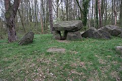
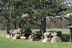
| ND-OS-S 16 | Karlsteine | West of Oldenburger Landstrasse, approx. 150 m south of the city limits | 52 ° 19 '0.8 " N , 8 ° 2' 15.4" E | ||
| ND-OS-S 17 | Oestringer Steine - south of the Östringer Weg | 52 ° 18 '53.6 " N , 8 ° 4' 52.9" E | |||
| ND-OS-S 18 | Oestringer Steine - north of the Östringer Weg | 52 ° 18 ′ 53.6 " N , 8 ° 4 ′ 45.8" E | |||
| ND-OS-S 19 | 4 oaks | In the Bleeken | 52 ° 18 '38.3 " N , 8 ° 2' 41.1" E | ||
| ND-OS-S 22 | 2 linden trees | On the southern footpath of Lotter Kirchweg | 52 ° 16 '28.1 " N , 8 ° 0' 13.2" E | ||
| ND-OS-S 23 | 1 linden tree | Northern sidewalk on Lieneschweg, behind the Handelstrasse junction | 52 ° 16 '54.1 " N , 8 ° 0' 36.7" E | ||
| ND-OS-S 24 | Long wall | Rosskastanienallee and row of beeches north of the cable metal works between Knollstrasse and Gartlager Wald | Size approx. 2.9 ha | 52 ° 17 '8.5 " N , 8 ° 3' 25.9" E | |
| ND-OS-S 25 | Barrows | Wooded area west of the former Bundeswehr hospital on Sedanstrasse | Size approx. 0.7 ha | 52 ° 17 ′ 29 ″ N , 8 ° 0 ′ 5 ″ E | |
| ND-OS-S 26 | 1 oak | West of Hardinghausstrasse, near Grothausweg | ? | ||
| ND-OS-S 27 | 1 oak | On the Finkenhügel, the plot boundary 80 m south of the house at Max-Reger-Straße 29 | 52 ° 16 ′ 46.2 " N , 8 ° 0 ′ 25.4" E | ||
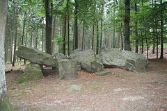
| ND-OS-S 28 | Teufelssteine large stone grave and surroundings | 110 m south of the Heideweg on the Teufelsheide | Size approx. 0.2 ha | 52 ° 15 '55.1 " N , 8 ° 6' 27.4" E | |
| ND-OS-S 29 | Shell limestone dry cracks | West and north wall of the old quarry on the north slope of the Heller Berg | 52 ° 14 '59.6 " N , 7 ° 58' 55.2" E | ||
| ND-OS-S 30 | Johannis stones | Between the northern edge heap and the Piesberg quarry | Size approx. 0.4 ha | 52 ° 19 '25 " N , 8 ° 1' 18.5" E | |
| ND-OS-S 31 | Gretescher stones | Opposite the Gretescher tower | 52 ° 16 '13.1 " N , 8 ° 7' 8.8" E | ||
| ND-OS-S 32 | Sundermann stones | South of Belmer Straße, near Hof Sundermann | 52 ° 16 '58.4 " N , 8 ° 7' 44.8" E | ||
| ND-OS-S 33 | Black water | East of the road "Zum Pyer Moor", approx. 200 m south of the intersection with the Moorweg | Size approx. 0.6 ha | 52 ° 19 ′ 54.1 ″ N , 8 ° 0 ′ 18 ″ E | |
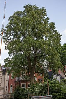
| ND-OS-S 34 | 1 plane tree | In front of the Stüvehaus at Heger Tor | 52 ° 16 ′ 34.8 " N , 8 ° 2 ′ 15.2" E | ||
| ND-OS-S 35 | 1 linden tree | South of Honeburger Weg, north of the former city nursery | 52 ° 18 '34.4 " N , 8 ° 1' 45.6" E | ||
| ND-OS-S 36 | 1 oak | Langenkamp / corner of Voxtruper Strasse | 52 ° 15 '6.5 " N , 8 ° 4' 56.6" E | ||
| ND-OS-S 37 | 1 beech | Turmstrasse 21 | 52 ° 16 '42.2 " N , 8 ° 2' 30.1" E | ||
| ND-OS-S 38 | 1 oak | Field road on the limestone hill | 52 ° 15 '29.5 " N , 8 ° 1' 51.4" E | ||
| ND-OS-S 39 | 1 beech | Parish garden at the Luther Church | 52 ° 15 ′ 38.5 " N , 8 ° 3 ′ 32" E | ||
| ND-OS-S 40 | 1 oak (royal oak) | At the home for the deaf and dumb on the Königshügel | 52 ° 17 '18.3 " N , 8 ° 3' 37.5" E | ||
| ND-OS-S 41 | 1 oak | Pagenstecher Strasse opposite Römereschstrasse | 52 ° 17 '31.6 " N , 8 ° 1' 13.6" E | ||
| ND-OS-S 42 | 1 oak | Clay pit path south of Muskamp | 52 ° 15 '12.8 " N , 8 ° 0' 3.1" E | ||
| ND-OS-S 44 | Kronenpohl (pond and bank area) | “Am Kronenpohl”, 150 m west of the motorway | Size approx. 0.5 ha | 52 ° 17 '15.3 " N , 7 ° 56' 6.1" E | |
| ND-OS-S 45 | Grove of trees (4 beeches, 1 maple) | Bremer Strasse 101 | 52 ° 17 '10.7 " N , 8 ° 4' 46.6" E | ||
| ND-OS-S 46 | 1 oak | Property line behind Blumenhaller Weg No. 42 | 52 ° 16 '8.4 " N , 8 ° 1' 18.5" E | ||
| ND-OS-S 47 | 1 maple | On the edge of the old quarry south of the radiation clinic | 52 ° 16 '45.5 " N , 8 ° 1' 58.8" E | ||
| ND-OS-S 48 | 1 beech | On the "Green Way" west of the old city wall | 52 ° 16 '46.7 " N , 8 ° 2' 9.7" E | ||
| ND-OS-S 49 | 1 plane tree | “At the Katharinenkirche” No. 8a, private garden | 52 ° 16 ′ 21.8 " N , 8 ° 2 ′ 32.8" E | ||
| ND-OS-S 51 | 1 yew tree | Gutenbergstrasse 37, private garden | 52 ° 16 '49.4 " N , 8 ° 1' 58.8" E | ||
| ND-OS-S 52 | 1 copper beech | Lürmannstrasse 36–40, Radiation Clinic | 52 ° 16 '47.3 " N , 8 ° 2' 0.2" E | ||
| ND-OS-S 53 | 1 oak | Side room of Haneschstraße behind the Nettebrücke (out of town) | 52 ° 18 '23.9 " N , 8 ° 3' 12.5" E | ||
| ND-OS-S 54 | 1 ginkgo tree | Dielinger Straße, inner courtyard of the renovation block 5/1 | 52 ° 16 '34.7 " N , 8 ° 2' 27.2" E | ||
| ND-OS-S 56 | 1 oak | North of the greenhouses at Hermann-Ehlers-Straße 30, near Neue Straße / Middenkamp | 52 ° 14 '25.2 " N , 8 ° 1' 51.7" E | ||
| ND-OS-S 57 | Grove of trees (3 oaks) | North of the property entrance "Zum Attersee" No. 45 east of the motorway underpass | 52 ° 17 ′ 55.8 " N , 7 ° 56 ′ 38" E | ||
| ND-OS-S 58 | Marl pit at Rubbenbruchsee | About 120 m southwest of the inlet of the Landwehr ditch into the Rubbenbruchsee | Size approx. 0.2 ha | 52 ° 16 ′ 53 ″ N , 7 ° 59 ′ 15 ″ E | |
| ND-OS-S 59 | 1 red oak | southeast of the Mindener Strasse workshop | 52 ° 16 '8.3 " N , 8 ° 5' 39.5" E | ||
| ND-OS-S 60 | 1 red beech | West of the Wall Trail between Lürmannstrasse and Gutenbergstrasse | 52 ° 16 '48.9 " N , 8 ° 2' 4.7" E | ||
| ND-OS-S 61 | 1 oak | District Administrator-von-Ostman-Strasse | 52 ° 17 '59.3 " N , 7 ° 58' 35.8" E | ||
| ND-OS-S 62 | 2 linden trees | In Strothe No. 2, private garden, on the border with Landrat-von-Ostman-Straße | 52 ° 18 '0.8 " N , 7 ° 58' 31.4" E | ||
| ND-OS-S 63 | 1 hornbeam | Along the footpath between Gutenbergstrasse and Lürmannstrasse | 52 ° 16 '48.7 " N , 8 ° 2' 6.8" E | ||
| ND-OS-S 64 | 1 chestnut | Along the footpath between Gutenbergstrasse and Lürmannstrasse | 52 ° 16 '49.7 " N , 8 ° 2' 6.8" E | ||
| ND-OS-S 65 | 1 group of trees, consisting of 2 beeches and 1 pedunculate oak | Along the footpath between Gutenbergstrasse and Lürmannstrasse | 52 ° 16 '49.8 " N , 8 ° 2' 8.5" E | ||
| ND-OS-S 66 | Forest area in the Steerte | Forest between the road Im Steerte and Hörner Weg | Size approx. 2.3 hectares | 52 ° 15 '4.6 " N , 8 ° 0' 12.5" E | |
| ND-OS-S 68 | 1 copper beech | On Schepeler Strasse | 52 ° 16 ′ 2.2 " N , 8 ° 3 ′ 20" E | ||
| ND-OS-S 69 | Spawning waters at the Kuhlbreite | At the Kuhlbreite | Size approx. 6.0 ha | 52 ° 17 ′ 47.9 " N , 7 ° 56 ′ 27" E | |
| ND-OS-S 70 | High bank and oxbow lake of the Nette | At the Östringer Esch | Size approx. 2.2 ha | 52 ° 18 '56.9 " N , 8 ° 4' 33.8" E | |
| ND-OS-S 71 | 2 horse chestnuts | Two horse chestnuts at Arndtplatz on the corner of Martinistraße / Arndtstraße | 52 ° 16 '19.2 " N , 8 ° 2' 15.7" E | ||
| ND-OS-S 72 | 1 copper beech | Voxtrup, Holsten-Mündruper-Straße 16 | 52 ° 15 '9 " N , 8 ° 5' 50.9" E | ||
| ND-OS-S 73 | 1 hornbeam | Hauswörmannsweg 156, private garden | 52 ° 14 '58.3 " N , 8 ° 2' 47.7" E | ||
| ND-OS-S 74 | 4 English oaks | Eikesberg 1, Osnabrück-Atter | 52 ° 17 ′ 38.5 " N , 7 ° 56 ′ 50.2" E | ||
| ND-OS-S 75 | 2 English oaks | At Pyer Kirchweg, opposite house no.2 | 52 ° 19 '17.5 " N , 7 ° 58' 33.6" E | ||
| ND-OS-S 76 | 1 English oak | In the area of the streets “Landwehrstraße”, “Am Mühlenholz” / “Die Eversburg” in a public green area | 52 ° 18 '27.3 " N , 7 ° 59' 29.4" E | ||
| ND-OS-S 77 | 1 English oak | On Hasberger Weg, opposite the “Dieckriede” street in the grassland | 52 ° 15 '6.4 " N , 7 ° 58' 35.9" E | ||
| ND-OS-S 78 | 1 copper beech | Bergstrasse 28, in the private garden | 52 ° 16 '40 " N , 8 ° 2' 5.8" E | ||
| ND-OS-S 79 | 2 English oaks | Voxtrup, Am Gut Sandfort | 52 ° 15 ′ 8.3 " N , 8 ° 6 ′ 37.2" E | ||
| ND-OS-S 80 | 1 English oak | Hellern, Lengericher Landstrasse 31 | 52 ° 14 '49.4 " N , 7 ° 58' 56.9" E | ||
| ND-OS-S 81 | English oak | Nahne, at the end of Meller Strasse on the Thiesing property | 52 ° 15 '13.7 " N , 8 ° 5' 19" E | ||
| ND-OS-S 82 | Tulip tree | In a private garden on Heger-Tor-Wall | 52 ° 16 ′ 28.5 " N , 8 ° 2 ′ 20.2" E | ||
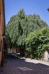
| ND-OS-S 83 | Weeping beech | In front of the building of the former Hanover train station | 52 ° 16 '35.6 " N , 8 ° 3' 9.4" E |
See also
Web links
Commons : Natural monuments in Osnabrück - collection of images, videos and audio files
- Lower Saxony Ministry for the Environment, Energy and Climate Protection: The nature reserves of Lower Saxony on the interactive environmental map
Individual evidence
- ↑ Number of natural monuments in the area of responsibility of the lower nature conservation authorities (status: December 31 , 2016) on nlwkn.niedersachsen.de (accessed on November 5, 2017)
- ↑ a b c d e f g h i j k l m n o p q r s t u v w x y z aa ab ac ad ae af ag ah ai aj ak al am an ao ap aq ar as at au av aw ax ay az Ordinance on the safeguarding of natural monuments in the area of the city of Osnabrück of January 28, 1958 (Official Journal 1958, page 114 ff.), last amended by Ordinance of November 21, 2006 pdf (104 kB; accessed on March 29, 2015)
- ↑ a b c d e f g h i j k l m n o p q r s t u v w x y z aa ab ac ad ae af ag ah ai aj ak al am an ao ap aq ar as at au av aw ax ay az ba bb bc bd be bf Lower Saxony Ministry for the Environment, Energy and Climate Protection: The nature reserves of Lower Saxony on the interactive environmental map (see web links, accessed on November 5, 2017)
- ^ Entry in the directory of monumental oaks . Retrieved January 10, 2017
- ↑ not shown on the environmental map. It is questionable whether it still exists.
- ↑ a b c Ordinance on the protection of natural monuments "Tree population between Gutenbergstrasse and Lührmannstrasse" in the city of Osnabrück of February 1, 1983 (Official Gazette 1983, p. 191) in the version of June 19, 2001 pdf (79 kB; accessed on 1. April 2015)
- ↑ Ordinance for the protection of the natural monument No. 66 "Waldgebiet Im Steerte" in the city of Osnabrück of April 23, 1985 (Official Gazette 1985, p. 545) amended by an ordinance of June 19, 2001 pdf (86 kB; accessed on April 1, 2015 )
- ↑ Ordinance on the protection of natural monuments "Blutbuchen an der Schepelerstraße No. 5" in the city of Osnabrück of May 30, 1986 (Official Journal 1986, p. 560 f.), Last amended by an ordinance of June 19, 2001 pdf (95 kB; accessed on April 1, 2015)
- ↑ Ordinance on the protection of the natural monument "Laichgewässer an der Kuhlbreite" in Osnabrück-Atter of September 12, 1986 (Official Gazette 1986, p. 987), last amended by an ordinance of June 19, 2001 pdf (96 kB; accessed on April 1, 2015 )
- ↑ Ordinance on the protection of the natural monument "Hochufer und Altarm der Nette am Oestringer Esch" in Osnabrück-Haste of November 11, 1986 (Official Journal 1987, p. 127) last amended by an ordinance of June 19, 2001 pdf (87 kB; accessed on 1 April 2015)
- ↑ Ordinance of the city of Osnabrück for the protection of the natural monument No. 71 "2 horse chestnuts" (Official Gazette 1990, p. 412), last amended by ordinance of June 19, 2001 pdf (81 kB; accessed on April 1, 2015)
- ↑ a b c d e f g h i Ordinance on Safeguarding Natural Monuments in the City of Osnabrück of July 10, 2012 (Official Journal 2012, page 47 ff.) Pdf (1080 kB; accessed on April 1, 2015)
- ↑ a b c Ordinance on the Safeguarding of Natural Monuments in the City of Osnabrück from May 20, 2014 (Official Gazette 2014, page 39 ff.) Pdf (325 kB; accessed on April 1, 2015)


