List of natural monuments in the Harburg district
The list of natural monuments in the Harburg district contains the natural monuments in the Harburg district in Lower Saxony .
Natural monuments
On November 25, 2019, the Harburg district will list 24 natural monuments on its website.
| number | designation | place | comment | Coordinates | image |
|---|---|---|---|---|---|
| ND WL 00001 | 2 English oaks | Job | Fachenfelde; only three of the four trees that were once existed | 53 ° 23 '36.8 " N , 10 ° 4' 31.2" E | |
| ND WL 00002 | 2 English oaks | Job | Fachenfelde; only three of the four trees that were once existed | 53 ° 23 '36.6 " N , 10 ° 4' 27.6" E | |
| ND WL 00003 | Pine , called "chandelier" | Jackdaw | on the southern edge of the Wilseder Weg near the district boundary, west of Döhle | 53 ° 9 ′ 51.7 " N , 9 ° 59 ′ 58.4" E | |
| ND WL 00004 | juniper | Hanstedt | Near Waldbad Hanstedt; not available anymore; Time of destruction unclear | 53 ° 14 ′ 45.8 " N , 9 ° 59 ′ 58.4" E | |
| ND WL 00005 | English oak and spruce , called "married couple" | Hanstedt | south of Nindorf am Walde, west of the L 213 on the roadside | 53 ° 13 '44 " N , 10 ° 1' 14.9" E | |
| ND WL 00006 | Summer linden tree | Buchholz in the north heath | Bahnhofstrasse | 53 ° 19 '30 " N , 9 ° 52' 49.8" E | |
| ND WL 00007 | Passage grave "Kleckerwald" | Buchholz in the north heath | The barren bed in the Klecker Wald , west of the K 12, consists of a 48 m long and 6 m wide burial mound from the Neolithic period and 76 surrounding stones. | 53 ° 20 '43.1 " N , 9 ° 56" 27.6 " E | |
| ND WL 00008 | "Small barrow 'Klecker Wald'" | Buchholz in the north heath | Barrow in the Klecker Wald, south of the K 54 | 53 ° 20 '3.9 " N , 9 ° 56" 18.5 " E | |
| ND WL 00009 | Hiking block | Schatzendorf | east of the Botenberg in a small wooded area; Hillside location, 10 m from the eastern edge of the forest | 53 ° 12 '31.1 " N , 10 ° 3' 57.1" E | |
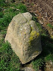
| ND WL 00010 | Hiking block | Schatzendorf | on the Botenberg; Ice Age boulder made of sandstone , protruding 30 cm from the ground. The hole in the surface measures 20 cm in diameter and 25 cm in depth; Perimeter of the stone at the surface of the earth: 5.50 m. "A cultural-historical significance is not known." | 53 ° 12 '30 " N , 10 ° 3' 11" E | |
| ND WL 00011 | "Karlstein" boulder | New Wulmstorf | about 200 m north of the Rosengartenstraße (K 52), southeast of Schwiederstorf | 53 ° 24 '24.9 " N , 9 ° 49' 23" E | |
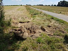
| ND WL 00012 | "Part of the hiking block of Nordic origin with a carved cross" | rose Garden | northwest of Sieversen | 53 ° 24 '40.7 " N , 9 ° 52' 12.2" E | |
| ND WL 00013 | "Part of the hiking block of Nordic origin with carved cross and coat of arms of the Lords of Heimbruch" | rose Garden | in the forest northwest of Sieversen on the northern edge of the road; the official title with recourse to the depiction of the said coat of arms has been questioned: the setting up of the row of boundary stones is presumably related to church rights of ownership and use of the forest in this area. Besides the three used different sign of the cross, the two different tripartite character set, however, "probably" the Laurentius - grates of the old monastery Buxtehude is. | 53 ° 24 '39.3 " N , 9 ° 52' 20.7" E | |
| ND WL 00014 | "Part of the hiking block of Nordic origin with a carved cross" | rose Garden | in the forest northwest of Sieversen; on the northern edge of a forest path parallel to the Heidschnuckenweg to the north | 53 ° 24 '39.4 " N , 9 ° 52' 28.9" E | |
| ND WL 00015 | "Part of the hiking block of Nordic origin with carved cross and coat of arms of the Lords of Heimbruch" | rose Garden | Heidschnuckenweg, north of Sieversen, on the northern edge of the tournament area; not available anymore;
the official title with recourse to the depiction of the said coat of arms has been questioned: the setting up of the row of boundary stones is presumably related to church rights of ownership and use of the forest in this area. Besides the three used different sign of the cross, the two different tripartite character set, however, "probably" the Laurentius - grates of the old monastery Buxtehude is. |
53 ° 24 '39 " N , 9 ° 52' 52.6" E | |
| ND WL 00016 | "Part of the hiking block of Nordic origin with a carved cross" | rose Garden | north of the junction Heidschnuckenweg / Quellenweg, north of Sieversen, northwest of Klein-Leversen | 53 ° 24 '38.9 " N , 9 ° 53' 9.4" E | |
| ND WL 00017 | "Part of the hiking block of Nordic origin with a carved cross" | rose Garden | Barque Thickness, northwest of Klein-Leversen; At the end of July 2018, the theft of the stone was noticed | 53 ° 24 '44.4 " N , 9 ° 53' 15.4" E | |
| ND WL 00018 | "Part of the hiking block of Nordic origin with a carved cross" | rose Garden | northwest of Klein-Leversen, approx. 70 m southeast of ND WL 17 on the Barkendicke road, | 53 ° 24 '42.9 " N , 9 ° 53' 18.6" E | |
| ND WL 00019 | "Part of the hiking block of Nordic origin with carved cross and coat of arms of the Lords of Heimbruch" | rose Garden | On the Mergelberg, northwestern edge of Klein-Leversen;
the official title with recourse to the depiction of the said coat of arms has been questioned: the setting up of the row of boundary stones is presumably related to church rights of ownership and use of the forest in this area. Besides the three used different sign of the cross, the two different tripartite character set, however, "probably" the Laurentius - grates of the old monastery Buxtehude is. |
53 ° 24 '32.8 " N , 9 ° 53' 39" E | |
| ND WL 00020 | "Part of the hiking block of Nordic origin with a carved cross and coat of arms of the Lords of Heimbruch and 2 wolf fishing rods " | rose Garden | Rosengarten, northwest of Klein-Leversen;
the official title with recourse to the depiction of the said coat of arms has been questioned: the setting up of the row of boundary stones is presumably related to church rights of ownership and use of the forest in this area. Besides the three used different sign of the cross, the two different tripartite character set, however, "probably" the Laurentius - grates of the old monastery Buxtehude is. |
53 ° 24 '38.2 " N , 9 ° 53' 35.4" E | |
| ND WL 00021 | "Part of the hiking block of Nordic origin with a carved cross" | rose Garden | next to ND WL 00020 | 53 ° 24 '38.2 " N , 9 ° 53' 35.4" E | |
| ND WL 00022 | Location of the checkerboard flower | k. A. | - | - | |
| ND WL 00023 | Location of the real marsh pore | k. A. | - | - | |
| ND WL 00024 | 2 oaks | Borstel | Schwalbenweg 3, Winsen (Luhe) | 53 ° 20 '58 " N , 10 ° 13' 46.1" E |
Hints
- No coordinates are available for natural monuments in nature reserves such as the Lower Seeveniederung or the Rauhen Moor .
- The natural monuments ND WL 00012–00021 located in Rosengarten are also under monument protection as cultural monuments ( architectural and art monuments : small monuments ) . In 1955 they were placed under nature protection by ordinance on natural monuments in the Harburg district , which was drawn up in accordance with the provisions of the Reich Nature Conservation Act of 1935 . The 1991 rededication of the stones to cultural monuments, with which the historical dimension of the objects was emphasized, did not take place seamlessly insofar as a change to the ordinance on natural monuments in the Harburg district is apparently still pending and the stones from the district are still like before are also listed as natural monuments.
See also
- List of nature reserves in the Harburg district
- List of landscape protection areas in the Harburg district
- List of protected landscape components in the Harburg district
- List of geotopes in the Harburg district
Web links
Individual evidence
- ↑ a b c d e f g h i j k l m n o p q r s t Protected objects. Retrieved November 25, 2019 .
- ↑ a b c d e f g h i j k l m n o p q r s t u v Lower Saxony Ministry for the Environment, Energy and Climate Protection: [1] (accessed on November 25, 2019)
- ↑ a b natural monument "2 English oaks in place" . Retrieved May 9, 2016 .
- ^ Lower Saxony environmental maps. ( DGK 5 historical with overlaid orthophotos ) Retrieved on March 27, 2018 .
- ^ Telephone information from the Harburg district, Nature Conservation / Landscape Management Department on March 7, 2016
- ↑ passage grave Kleckerwald (accessed on 2 June 2018)
- ^ A b c d e Lower Saxony State Museum Hanover & Lower Saxony Homeland Association (ed.): Natural monuments in Lower Saxony. Project for the digitization and indexing of the slide collection through an image database. Selbstverlag, Hannover (database on DVD, year of publication not given, probably 2011; author of the description: Harald Kröber).
- ↑ Course of the border from the 15th century (“S-stones”). Retrieved May 19, 2016 .
- ↑ Stolen historic landmark. Harburg district files a complaint. In: Kreiszeitung Nordheide Wochenblatt , August 1, 2018, p. 10
- ↑ Stolen historic landmark. Harburg district files a complaint. In: Kreiszeitung Nordheide Wochenblatt. Retrieved on August 4, 2018 (online edition of the article in the print edition (p. 10) of August 1, 2018).
- ↑ Stolen historic landmark. In: Focus ONLINE Local. Retrieved August 7, 2018 .
- ^ Lower Saxony State Office for Monument Preservation: Monument protection and monument preservation in Lower Saxony. (PDF; 3.1 MB) Lower Saxony State Office for Monument Preservation, 2015, p. 21 , accessed on March 24, 2017 .
- ^ Werner Voss: Old boundary stones and heaps of earth. Information about the history of Verdisch-Bremen monasteries, monasteries, villages and forests in the Rosengarten area. Reprint from the Stader yearbook 1995 and 1996. Self-published, Rosengarten, Brahmhof 5 1999, p. 96 .


