List of natural monuments in the district of Cloppenburg
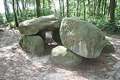
The list of natural monuments in the district of Cloppenburg contains the natural monuments in the district of Cloppenburg in Lower Saxony .
On December 31, 2016, there were 97 natural monuments in the Cloppenburg district according to the Cloppenburg district and 61 natural monuments according to the statistics of the Lower Saxony State Office for Water Management, Coastal Protection and Nature Conservation . The environmental map of the Lower Saxony Ministry for the Environment, Energy and Climate Protection shows 57 natural monuments in the district of Cloppenburg, some of which consist of several individual objects.
| number | designation | place | comment | Coord. | image |
|---|---|---|---|---|---|
| ND CLP 00001 | 2 yew trees | eat | Long Street 56 | 52 ° 43 '8.3 " N , 7 ° 56' 16.2" E | |
| ND CLP 00002 | Oak | Cappeln | Osterhausen. On the sheep field | 52 ° 46 ′ 47.6 " N , 8 ° 9 ′ 15.1" E | |
| ND CLP 00003 | Gallows Moor | Cloppenburg | Gallows Moor | 52 ° 50 ′ 28 " N , 8 ° 0 ′ 58.3" E | |
| ND CLP 00004 | Heathland with Schlatt | Cappeln | Heerdamm | 52 ° 45 '53.9 " N , 8 ° 1' 23.1" E | |
| ND CLP 00006 | 2 cemetery walls as a location for rare plants | Alleviate | Kirchstrasse | 52 ° 50 '42.9 " N , 7 ° 46' 55.4" E | |
| ND CLP 00009 | Wall hedge | eat | Loeninger Strasse | 52 ° 43 ′ 43.5 " N , 7 ° 54 ′ 51.5" E | |
| ND CLP 00010 | Cemetery wall as a location for rare plants | Cappeln | Dr.-Niemann-Strasse | 52 ° 48 ′ 41.8 " N , 8 ° 6 ′ 53.7" E | |
| ND CLP 00013 | 6 yew trees | Emstek | Cemetery, Margarethenstrasse | 53 ° 0 ′ 43.7 " N , 7 ° 52 ′ 21" E | |
| ND CLP 00014 | Bird protection wood | Friesoythe | Meeschenstrasse | 53 ° 0 ′ 43.7 " N , 7 ° 52 ′ 21" E | |
| ND CLP 00015 | Bird protection wood with clay pit | Scharrel | Saterland | 53 ° 4 '24.5 " N , 7 ° 40' 53.9" E | |
| ND CLP 00016 | Schlatt | Emstek | Alte Bundesstrasse 7, east of the B72 | 52 ° 49 '43.1 " N , 8 ° 7' 33.7" E | |
| ND CLP 00022 | former clay pit | Scharrel | Ziegeleistraße. Saterland | 53 ° 4 ′ 14.8 " N , 7 ° 40 ′ 48.5" E | |
| ND CLP 00025 | former clay pit | Scharrel | To the moor. Saterland | 53 ° 4 '9.4 " N , 7 ° 40' 24.8" E | |
| ND CLP 00026 | Old Arm of the Big Rabbit | eat | 52 ° 43 '20.7 " N , 7 ° 53' 56.8" E | ||
| ND CLP 00027 | Bird protection wood | Friesoythe | Barßeler Strasse | 53 ° 4 ′ 13.4 " N , 7 ° 50 ′ 20" E | |
| ND CLP 00028 | Dune terrain | Scharrel | 53 ° 4 '5.1 " N , 7 ° 41' 47.7" E | ||
| ND CLP 00029 | Five-stem pod | Loeningen | At Gravenholt | 52 ° 45 ′ 20.5 " N , 7 ° 45 ′ 21.2" E | |
| ND CLP 00030 | Oak | eat | Osteressener Strasse | 52 ° 42 '25.2 " N , 7 ° 58' 37.9" E | |
| ND CLP 00032 | Pollen boom | eat | Cloppenburger Strasse / Felder Strasse | 52 ° 43 '59.8 " N , 7 ° 56' 53.7" E | |
| ND CLP 00033 | Sand hill | Cappeln | Big break | 52 ° 44 '24.7 " N , 7 ° 59' 14.4" E | |
| ND CLP 00034 | Oak | eat | High castle | 52 ° 41 '10.3 " N , 7 ° 55' 0.1" E | |
| ND CLP 00035 | 2 oaks | eat | Borger Street | 52 ° 41'22.3 " N , 7 ° 54'43.1" E | |
| ND CLP 00037 | Oak | eat | Bunner Strasse | 52 ° 42 '40.7 " N , 7 ° 52' 30.9" E | |
| ND CLP 00038 | Schlochterdeich | eat | Schlochterdamm | 52 ° 41 ′ 56.5 " N , 7 ° 58 ′ 44.2" E | |
| ND CLP 00040 | Klünenmoor | Molbergen | southeast of Molbergen | 52 ° 50 ′ 52.5 " N , 7 ° 57 ′ 24" E | |
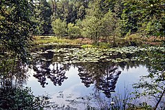
| ND CLP 00041 | Schlatt ("water lily Schlatt") | Emstek | at Kokenmühle | 52 ° 52 '7.1 " N , 8 ° 15' 5.6" E | |
| ND CLP 00042 | Bald cypress and 2 sequoias | Cappeln | Cloppenburger Strasse 2 | 52 ° 48 '42.5 " N , 8 ° 6' 48.1" E | |
| ND CLP 00044 | 3 oaks and 1 beech | Loeningen | Go to Hollrah 9 | 52 ° 41 ′ 19.2 " N , 7 ° 46 ′ 58.1" E | |
| ND CLP 00048 | Bird protection wood | Friesoythe | Pehmertanger way | 53 ° 0 '11.1 " N , 7 ° 51' 32.4" E | |
| ND CLP 00050 | Bird protection wood | Friesoythe | Oak alley | 52 ° 56 '20.4 " N , 7 ° 50' 3.7" E | |
| ND CLP 00051 | 3 oaks | Friesoythe | Barßeler Strasse | 53 ° 4 '8.4 " N , 7 ° 50' 15.1" E | |
| ND CLP 00052 | Pod grove with oaks and spruces | eat | To Brokhagen traffic jam | 52 ° 42 '3.3 " N , 7 ° 57' 54.3" E | |
| ND CLP 00055 | Schlatt | Emstek | Low trail, northwest of VION | 52 ° 50 '5.1 " N , 8 ° 6' 30.9" E | |
| ND CLP 00056 | 2 yew trees and 8 pods | Essen / Oldenburg | Bartmannsholter way | 52 ° 45 ′ 23.2 " N , 7 ° 59 ′ 17.6" E | |
| ND CLP 00057 | Plane tree and other trees | eat | Good location at Dinklager Strasse | 52 ° 42 '15.4 " N , 8 ° 3' 27.7" E | |
| ND CLP 00058 | Trees | eat | Good location | 52 ° 42 '17.9 " N , 8 ° 3' 26.2" E | |
| ND CLP 00059 | Big Schlatt | Friesoythe | 53 ° 4 ′ 23.8 " N , 7 ° 52 ′ 40" E | ||
| ND CLP 00060 | 9 boulders | Loeningen | Avenue of lime trees | 52 ° 44 '9.6 " N , 7 ° 45' 30.2" E | |
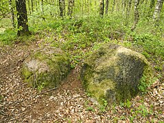
| ND CLP 00063 | Boulder | Friesoythe | Augustendorf. Village street | 53 ° 0 ′ 21.6 " N , 7 ° 58 ′ 30" E | |
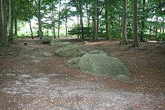
| ND CLP 00064 | 5 boulders | Evil | Paddock | 53 ° 1 '58.7 " N , 7 ° 55' 22.3" E | |
| ND CLP 00070 | Boulder | Loeningen | Neuenbunnen, St. Michael 5 | 52 ° 43 '48.3 " N , 7 ° 51' 33.8" E | |
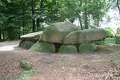
| ND CLP 00072 | Stone grave | Molbergen | To the megalithic grave, Bischofsbrück | 52 ° 53 '54.2 " N , 7 ° 48' 48.7" E | |
| ND CLP 00073 | Stone grave | Lastrup | Oldendorfer Fuhrenkamp. Hünensteine 1 | 52 ° 47 '5.3 " N , 7 ° 49' 52.2" E | |
| ND CLP 00074 | Stone grave | Lastrup | Oldendorfer Fuhrenkamp | 52 ° 46 '50.7 " N , 7 ° 49' 11.2" E | |
| ND CLP 00075 | Stone grave | Lastrup | Oldendorfer Fuhrenkamp | 52 ° 46 '51.5 " N , 7 ° 49' 14.4" E | |
| ND CLP 00076 | Stone grave | Lastrup | Oldendorfer Fuhrenkamp | 52 ° 46 '49 .8 " N , 7 ° 49' 16.1" E | |
| ND CLP 00077 | Whale stones | Alleviate | 52 ° 51 '32.4 " N , 7 ° 45' 54.8" E | ||
| ND CLP 00078 | Giant stones | Alleviate | north of the K357 | 52 ° 50 '24 " N , 7 ° 45' 22.7" E | |
| ND CLP 00079 | High stone | Alleviate | Megalithic tomb, southwest of Garen | 52 ° 48 '26.8 " N , 7 ° 45' 7.3" E | |
| ND CLP 00080 | At the high stone | Alleviate | Megalithic tomb, southwest of Garen | 52 ° 48 ′ 28.8 " N , 7 ° 44 ′ 55" E | |
| ND CLP 00086 | Foundling group | Evil | On the hook | 53 ° 0 '6.9 " N , 7 ° 57' 57.6" E | |
| ND CLP 00089 | Boulder | Evil | In the sandwitten | 53 ° 0 ′ 21.6 " N , 7 ° 58 ′ 30" E | |
| ND CLP 00092 | Foundling group | Evil | Garreler Strasse | 53 ° 0 '9.2 " N , 7 ° 59" 14.5 " E | |
| ND CLP 00093 | Boulder | Evil | Hölker Weg / Jahnstrasse | 53 ° 0 ′ 15.8 " N , 7 ° 57 ′ 21.8" E | |
| ND CLP 00094 | Boulder | Alleviate | Auen, Am Stein 1 | 52 ° 50 '36.9 " N , 7 ° 43' 59.1" E | |
| ND CLP 00096 | Drakamp-Schlatt | Barßel | 53 ° 9 '57.7 " N , 7 ° 49' 44.4" E | ||
| ND CLP 00097 | Tateberg | Evil | Steinbergsweg | 53 ° 3 '15.2 " N , 7 ° 56" 19.5 " E |
See also
- List of nature reserves in the district of Cloppenburg
- List of landscape protection areas in the district of Cloppenburg
- List of protected landscape components in the district of Cloppenburg
- List of geotopes in the district of Cloppenburg
Web links
Commons : Natural monuments in the district of Cloppenburg - Collection of images, videos and audio files
Individual evidence
- ↑ Protected areas / natural monuments (as of December 31 , 2016) on the website of the district of Cloppenburg (accessed on November 5, 2017)
- ↑ Number of natural monuments in the area of responsibility of the Lower Nature Conservation Authority ( status: December 31 , 2016) on nlwkn.niedersachsen.de (accessed on November 5, 2017)
- ↑ a b c d e f g h i j k l m n o p q r s t u v w x y z aa ab ac ad ae af ag ah ai aj ak al am an ao ap aq ar as at au av aw ax ay az ba bb bc bd be bf Lower Saxony Ministry for the Environment, Energy and Climate Protection: The nature reserves of Lower Saxony on the interactive environmental map (accessed on November 5, 2017)
