
Molbergen
| coat of arms | Germany map | |
|---|---|---|

|
Coordinates: 52 ° 52 ' N , 7 ° 56' E |
|
| Basic data | ||
| State : | Lower Saxony | |
| County : | Cloppenburg | |
| Height : | 35 m above sea level NHN | |
| Area : | 102.52 km 2 | |
| Residents: | 8944 (Dec. 31, 2019) | |
| Population density : | 87 inhabitants per km 2 | |
| Postal code : | 49696 | |
| Primaries : | 04475, 04479 | |
| License plate : | CLP | |
| Community key : | 03 4 53 012 | |
| LOCODE : | DE 76M | |
| Community structure: | 6 districts | |
| Address of the municipal administration: |
Cloppenburger Strasse 22 49696 Molbergen |
|
| Website : | ||
| Mayor : | Witali Bastian (independent) | |
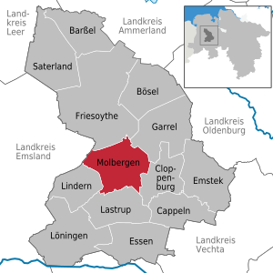
| Location of the community of Molbergen in the district of Cloppenburg | ||
  |
||

Molbergen is a municipality in the district of Cloppenburg in Lower Saxony . The districts of Dwergte, Ermke, Grönheim, Peheim , Resthausen and Stalförden belong to the community .
The community has a rural character, but the proportion of residents who live in closed settlements - often in new building areas - in the main town of Molbergen is increasing. Accordingly, the number of inhabitants has risen steadily in recent years. The economic mainstay of the municipality are increasingly small and medium-sized companies, which often process products from the traditionally dominant agriculture. As a result of the increasing number of companies settling in, the community has seen a high increase in jobs subject to social security contributions and an increase in trade tax .
geography
Community structure
In addition to the main town Molbergen the community has six districts, most of which farming communities are: Dwergte, Ermke, Grönheim, Peheim , Resthausen and Stalförden.
Neighboring communities
The neighboring municipalities of the municipality of Molbergen are in the north the town of Friesoythe , in the northeast the municipality Garrel , in the east the district town Cloppenburg , in the south the municipality Lastrup , in the southwest the municipality Lindern (all district Cloppenburg ) and in the west the municipality Vrees ( district Emsland ) .
| Friesoythe (19 km) | Garrel (12 km) | |
| Vrees (11 km) |

|
Cloppenburg (8 km) |
| Lindern (10 km) | Lastrup (8 km) |
The distance information relates to the distance to the town center.
climate
Due to its proximity to the North Sea, the climate in Molbergen is strongly Atlantic with moderately warm summers and relatively mild winters. Climate data from the closest measuring station of the German weather service in Friesoythe-Altenoythe (53 ° 04 'N, 07 ° 54' E) indicate a long-term temperature mean of 9.6 ° C and an average rainfall of 784 mm / year for the reference period 1981 - 2010. In general, summer and autumn are more humid, while winter and spring are somewhat drier (maximum June: 78 mm; minimum April: 45 mm).
history
The peasantry Ermke was first mentioned in a deed as "Armike" in 947th In 1080 Molbergen, "Moltberghe", was mentioned in a church document. Dwergte, Grönheim ("Gronnin" or "Gronem") and Peheim appeared in a fiefdom directory in 1275.
In the Middle Ages, Molbergen was part of the County of Tecklenburg from 1252 to 1400 and after the peace treaty of 1400 it came to the Principality of Münster at the time of Count Nicholas II . In 1803, Molbergen came to the Grand Duchy of Oldenburg as a result of the Reichsdeputationshauptschluss .
In 1890, an eleven-year-old shepherd found coins from the 16th century on the east bank of the Marka (200 paces south of the Chaussee between Peheim and Vrees).
Although Molbergen, like the whole of the Oldenburger Münsterland , was a stronghold of the center , a local branch of the NSDAP was founded on February 12, 1928 . It was the first local NSDAP group in the Oldenburger Münsterland. Representatives of the NSDAP, u. a. the later Gauleiter Carl Röver , appeared here for the first time in public in the Oldenburger Münsterland. The political significance of the Molberg local group for the Oldenburg state politics remained just as marginal as its influence on local politics before 1933.
Resthausen and Stalförden only became part of Molbergen in 1933 when the municipality of Krapendorf was dissolved .
Population development
According to current data from the Lower Saxony State Statistical Office and the Demographic Change Foundation, Molbergen is the only municipality in Germany with a total fertility rate of around 2.127 that has enough births to allow the population to grow steadily without immigration. With the current fertility a permanent growth rate of 1.62% is achieved, i.e. the population doubles every 44 years (assuming a generation gap of 30 years).
The background to this is the high influx of Russian Germans to Molbergen since 1990. Every second community member in Molbergen comes from a ethnic German repatriate family .
| year | 2019 | 2010 | 2000 | 1990 | 1980 | 1970 |
|---|---|---|---|---|---|---|
| Residents | 8923 | 7672 | 6987 | 4856 | 4673 | 4470 |
politics
Municipal council
The council of the municipality of Molbergen consists of 20 council members. This is the specified number for a municipality with a population between 7001 and 8000 inhabitants. The council decided not to increase this figure for the time being, despite the larger population. The 20 council members are elected by local elections for five years each. The current term of office began on November 1, 2016 and ends on October 31, 2021.
The full-time mayor Vitali Bastian (non-party) is also entitled to vote in the municipal council.
The last local election on September 11, 2016 resulted in the following:
| Political party | Sept 11, 2016 | Sep 10, 2011 | Sept 11, 2006 | ||||||
|---|---|---|---|---|---|---|---|---|---|
| CDU | 65% | 7673 | 13 seats | 86% | 8883 | 17 seats | 89.6% | 8131 | 18 seats |
| SPD | 15% | 1774 | 3 seats | 10.9% | 1123 | 2 seats | 10.4% | 947 | 2 seats |
| Green | 1.7% | 203 | - | 3.1% | 320 | 1 seat | - | - | - |
| center | 18.3% | 2155 | 4 seats | - | - | - | - | - | - |
| voter turnout | 64.52% | 62.25% | 57.9% | ||||||
mayor
In the mayoral election on June 16, 2019, Vitali Bastian (independent) prevailed against two opposing candidates as full-time mayor. In the first ballot on May 26, 2019, none of the three candidates could achieve an absolute majority, which is why there was a runoff. His term of office began on November 1, 2019 and will last until the local elections in September 2026.
| candidate | June 16, 2019 | May 26, 2019 | ||
|---|---|---|---|---|
| Witali Bastian (independent) | 59.70% | 2472 | 36.01% | 1553 |
| Imke Märkl (CDU) | 40.30% | 1669 | 38.30% | 1652 |
| Job Westermann (independent) | - | - | 25.69% | 1108 |
| voter turnout | 63.57% | 65.92% | ||
List of Mayors of Molbergen
- since November 1, 2019: Witali Bastian (independent)
- 2003–2019: Ludger Möller (CDU)
coat of arms
The coat of arms of the municipality of Molbergen shows two black cross bars in silver, from the top of which a red lion grows, below above the bars there is a green heraldic three-mountain.
Culture and sights
Buildings

- Teufelssteine Bischofsbrück
- Gut Stedingsmühlen, built in 1548 by Wilke Steding , Drost von Cloppenburg in the Niederstift Münster
- Catholic Church of St. Johannes Baptist in neo-Gothic style, built 1899–1904
- Transmitter Peheim , transmission mast of Deutsche Telekom AG near Peheim
Parks
The Molberg multigenerational park was inaugurated in 2018. A park landscape with a large pond was created on the site in the center of the village. The park also has a fairground that is used for several events a year. The true-to-scale baker's mill is reminiscent of the original cap windmill built around 1870, which burned down in 1940.
Swimming lakes
In the district of Dwergte there is a publicly accessible swimming lake with approx. 6000 m² of water and a maximum depth of 4.30 m. The lake is surrounded by a 4000 m² beach landscape.
Sports
Sport is also enjoyed and varied in the community.
- Fishing : A fishing club in Dwergte.
- Billiards : An annual club championship takes place in Molbergen.
- Football : The big popular sport is practiced at SV Molbergen, but also in the smaller towns at BC BW Ermke and SV Peheim-Grönheim.
- Golf : A golf course in the Thülsfelder dam in Resthausen.
- Athletics : A well-known and successful national division of SV Molbergens.
- Equestrian sports: Equestrian sports are offered in the Dwergte district by the Dwergte e. V. offered.
- Shooting : Molbergen, Peheim and Ermke have a shooting club .
- Tennis : In Ermke there is a facility with three sand courts (slag courts ).
- Table tennis : teams from SV Molbergen and SV Peheim-Grönheim.
Regular events
Economy and Infrastructure
economy
In a central traffic location in Molbergen, areas for trade , commerce and services are designated and developed. They are available to companies of all kinds - including industrial companies. Molbergen is a location for many medium-sized companies. The focus is on the construction industry , plastics processing , metal processing , the food industry , tourism and culture .
A total of three business parks are available in the community. The “Molberger Busch” industrial park is located on the south-eastern edge of the village of Molbergen. It covers a total of approx. 12 hectares between Cloppenburger Straße - L 836 in the north and the “Zum Gewerbegebiet” road in the south. The “K 157 - Kneheimer Weg” industrial park is located south of the town of Molbergen, immediately west of the “Kneheimer Weg” (formerly K 157) and is bounded in the north by the “Ermker Weg”. A total of approx. 16 hectares are available. To the south of the town of Peheim is the industrial park “Peheim - east of Linderner Strasse”, immediately east of “Linderner Strasse” (L 831). The area covers a total of approx. 2.3 hectares.
tourism


The Thülsfeld dam borders on the municipality of Molbergen. The Soeste flows through the dam and in parts of the municipality is accompanied by the Geestweg long-distance hiking trail , which leads from Meppen to Bremen . In the district of Dwergte, various holiday apartments are being offered for rent in "Dwergter Sand", which are increasingly used by Dutch tourists. Various bike trails are located in the municipality. In Resthausen there is a large, natural campsite for guided youth groups.
In the Molberger Dose nature reserve between Molbergen and Peheim, a 2.5 kilometer long educational moor trail has been set up.
The Molli Bär play park, which has been located in the industrial area since 2005, has over 4000 m² of indoor and outdoor areas, and is well-known nationwide.
traffic
Molbergen is connected to the B 213 federal road via the L 834 and L 836 roads. In the north of the municipality is the federal road B 72 , which leads to the Cloppenburg junction of the A1 motorway .
education
There are four kindergartens in Molbergen , including one in Peheim, and a day nursery .
Molbergen runs two primary schools (Molbergen and Peheim) and one high school, the Anne Frank School. The Anne Frank School has been running a student exchange program with the Christelijken Schoolengemeenschap Vincent van Gogh School in Assen , the Netherlands , since 1996 .
A public library with over 6000 media is available in Molbergen and Peheim.
media
- Münsterland daily newspaper
- Northwest Newspaper
- Oldenburg People's Newspaper
- Cloppenburger Wochenblatt
- Cloppenburger Sunday paper
Personalities
- Sons and daughters of the church
- Wilke Steding (around 1500, 1577), born on Gut Stedingsmühlen, mercenary in the service of the diocese of Münster and Drost of the diocese in Cloppenburg and Vechta
- Johann Theodor Peek (* May 2, 1845 in Grönheim, † 1907) founded the clothing store Peek & Cloppenburg in Rotterdam in 1869 together with Heinrich Cloppenburg
- Heinrich Wienken (born February 14, 1883 in Stalförden, † January 21, 1961 in Berlin ) was Bishop of Meissen from 1951 to 1957
- Bonaventura Kloppenburg (born November 2, 1919 in Molbergen, † May 8, 2009 in Vale do Sinos , Brazil ) was Bishop of Novo Hamburgo from 1986 to 1995
- Manfred Carstens (born February 23, 1943 in Molbergen) is a German politician (CDU)
- Franz Hartmann (born April 28, 1946 in Molbergen, † April 7, 2010 in Bremen ), educator and trade unionist
- Anne Ratte-Polle (* 1974 in Peheim ), actress
- Mario Stevens (born July 2, 1982), show jumper
Web links
Individual evidence
- ↑ State Office for Statistics Lower Saxony, LSN-Online regional database, Table 12411: Update of the population, as of December 31, 2019 ( help ).
- ↑ Mean values website DWD, accessed on November 4, 2019.
- ^ History website of the municipality of Molbergen, accessed on October 30, 2018.
- ↑ Konrad Schneider: The treasure trove of Molbergen . In: Oldenburg Yearbook. Volume 87 for 1987 . Oldenburg Regional Association for History, Natural History and Local History, pp. 41–46 ( PDF; 1.6 MB ).
- ↑ Renée Willenbring: Russians on the flat country . In: Deutschlandfunk Kultur (online), May 12, 2009, accessed October 30, 2018.
- ↑ Local elections 2016. Accessed April 27, 2020 .
- ^ Lower Saxony Municipal Constitutional Law (NKomVG) in the version of December 17, 2010; Section 46 - Number of MPs , accessed on October 10, 2014.
- ↑ Local election 2016 . Molbergen municipality website, accessed October 30, 2018.
- ↑ Mayoral election 2019 website of the KDO, accessed on August 25, 2019.
- ↑ Main statutes of the municipality of Molbergen , accessed on October 10, 2014
- ^ Carl Heinrich Nieberding , History of the former Niederstift Münster and the neighboring counties , Vechta 1841, second volume, p. 498
- ↑ a b Kindergartens of St. Johannes Baptist . Website of the Catholic Parish of St. John Baptist, accessed January 3, 2020.
- ↑ Mill model. Website of the Thülsfelder Dam, accessed on October 30, 2018.
- ↑ Dwergter Badesee Website of the Thülsfelder Dam, accessed on October 30, 2018.
- ↑ Northwest Travel Magazine: Molberger Dose Moor Trail. Nature reserve
- ^ Schools and kindergartens website of the municipality of Molbergen, accessed on October 30, 2018.
- ^ Aloys Landwehr: Anne Frank School in the Netherlands . In: Nordwest-Zeitung (online), April 17, 2013, accessed on October 13, 2018.
- ↑ Libraries of St. John Baptist . Website of the Catholic Parish of St. John Baptist, accessed January 3, 2020.
Barßel | Evil | Cappeln (Oldenburg) | Cloppenburg | Emstek | Essen / Oldenburg | Friesoythe | Garrel | Lastrup | Lindern (Oldenburg) | Loeningen | Molbergen | Saterland