
Saterland
| coat of arms | Germany map | |
|---|---|---|

|
Coordinates: 53 ° 5 ' N , 7 ° 42' E |
|
| Basic data | ||
| State : | Lower Saxony | |
| County : | Cloppenburg | |
| Height : | 6 m above sea level NHN | |
| Area : | 123.62 km 2 | |
| Residents: | 13,701 (Dec. 31, 2019) | |
| Population density : | 111 inhabitants per km 2 | |
| Postal code : | 26683 | |
| Primaries : | 04492, 04498 | |
| License plate : | CLP | |
| Community key : | 03 4 53 013 | |
| LOCODE : | DE SLD | |
| Community structure: | 4 parts of the community | |
| Address of the municipal administration: |
Hauptstrasse 507 26683 Saterland |
|
| Website : | ||
| Mayor : | Thomas Otto (independent) | |
| Location of the municipality of Saterland in the district of Cloppenburg | ||
  |
||

The Saterland ( Sater Frisian : Seelterlound ) is a municipality in the district of Cloppenburg , Lower Saxony . The smallest recognized language minority in Germany , the Sater Frisians, live here .
geography
Geographical location
The Saterland is located in the northwest of the Oldenburger Münsterland , in the triangle Leer , Cloppenburg , Oldenburg . In the south, the Saterland is bordered by the coastal canal , in the north and northwest it connects to the historical landscape of East Frisia . In the north, the Leda, which flows from east to west, essentially limits the Saterland to East Frisia. In the west, the Saterland is delimited by the village of Idafehn, which belongs to the municipality of Ostrhauderfehn . These Fehn villages are located in the area that used to be the difficult-to-pass moor around the Saterland. In the east, the Saterland is closed by the Elisabethfehn Canal, which forms a geographical border over the entire length of the Saterland. The former Fehn municipality Elisabethfehn on the Elisabethfehn Canal, which belonged to Saterland until the referendum of 1949 (1951) , now belongs to the municipality of Barßel .
The Saterland is traversed by the Sagter Ems from south to north and divides it into the two dominant moors, Wester-Moor and Oster-Moor.
Neighboring communities
The neighboring municipalities of the Saterland clockwise:
Community structure
The previously independent municipalities of Strücklingen, Ramsloh and Scharrel were merged into the municipality of Saterland during the territorial reform in 1974. The former community of Scharrel consisted of the current districts of Scharrel and Sedelsberg.
The municipality of Saterland today consists of the four parts of the municipality (in brackets the Sater Frisian name, which can also be found on the town signs):
- Ramsloh ( Roomelse ) with the localities Ramsloh-Ort, Ramsloh-Nord, Ramsloh-Ost, Hoheberg, Raake, Hollen, Hollen-Brand and Hollenermoor. In June 2006 Ramsloh had 4582 inhabitants. Today Ramsloh is the seat of the municipal administration of the Saterland.
- Scharrel ( Skäddel or Schäddel ) with the villages of Scharrel-Ort, Bätholt, Langhorst, Neuwall and Heselberg. In June 2006 Scharrel had 2,478 inhabitants.
- Sedelsberg ( Seedelsbierich ) with the villages Sedelsberg-Ort, Kolonie, Hüllen I, Hüllen II, Fermesand and Heselberg. In June 2006 Sedelsberg had 2947 inhabitants. Sedelsberg does not belong to Saterland in terms of linguistic history and was part of Scharrel until the regional reform.
- Strücklingen ( Strukelje ) with the localities Strücklingen-Ort, Bollingen I, Bollingen II, Utende, Wittensand and Bokelesch. In June 2006 Strücklingen had 3296 inhabitants.
Scharrel and Sedelsberg have the telephone code 04492, Ramsloh and Strücklingen can be reached via the code 04498.
history


The Saterland lies on a 15 kilometer long and one to four kilometer wide sand island in the middle of moors. As a result, it was very isolated for a long time and until the 19th century could only be reached by ship via the Sagter Ems . Between 1100 and 1400 the Tecklenburger Grafschaft Sögel, which included today's Saterland and parts of the Hümmlings , was settled by Frisians from today's East Frisia . It is controversial whether a few settlers of Westphalian origin lived in the area before. The Saterland ("Sagelter Land") also takes its name from the county of Sögel ( Comitia Sygeltra ).
Due to the isolation, the Saterland's own language has developed or preserved. The Sater Frisian language is a dialect of the Frisian language , which has otherwise been extinct in eastern Friesland for centuries.
In the Middle Ages, Saterland had its own constitution and jurisdiction. For example, a written regional court order has been preserved from 1587, but its origins or predecessors were significantly older. This was made possible by Charlemagne , who, according to legend, guaranteed the Frisians some privileges (see: Frisian freedom ). The Saterland was counted among the symbolic Seven Zealand and had an almost democratic administration similar to the other Frisian state communities: once a year the Twelve Council was elected, which then headed administration and jurisdiction.
Since the Frisians did not conquer the Saterland until late, the area was not free of domination. First the Counts of Tecklenburg were the sovereigns, later the Lower Monastery of Münster , then the Prince-Bishop of Münster . The Saterland nevertheless had extensive freedoms and was therefore a very independent area even under foreign sovereignty. The Frisians knew how to preserve their traditional freedoms for a very long time. Here, too, the isolated situation did the rest.
In 1803 the Saterland was added to the Duchy of Oldenburg in the course of the secularization of the Monastery of Münster . A little later there was a brief French interlude under Napoleon . In 1934 a community Saterland was established for the first time , to which, however, in addition to Ramsloh and Scharrel, Neuscharrel, which today belongs to Friesoythe , also belonged. Finally, on March 1, 1974, the municipality of Saterland was created in its current form as part of the local government reform.
The three municipalities that were independent until the territorial reform in 1974 were Strücklingen, Ramsloh and Scharrel. The Sedelsberg colony area was part of Scharrel and, in terms of language, did not belong to the Saterland.
When the three main communities were amalgamated, it was about the distribution of the priorities, Strücklingen should become the focus of business, Ramsloh received the secondary and secondary school with an orientation level and the community administration remained in Scharrel. Today the priorities have turned a bit; Strücklingen and Scharrel have given all important institutions to Ramsloh.
The appearance of the villages has changed over time. In 1821, for example, a major fire raged in Scharrel and destroyed 27 houses, of which only 12 were allowed to be rebuilt. In April 1945, 17 houses were destroyed by bombs, of which only a few were rebuilt at the old location.
The largest land consolidation in Germany (12,500 ha) and the relocation of the agricultural farms from the center made it possible to use the vacated land to improve the infrastructure. The farms relocated from the town center were given new locations in the peasant communities. The image of the village that existed until around 1945 can hardly be found today. In addition, new housing estates have emerged in the last few decades.
politics
Municipal council
The council of the municipality of Saterland currently consists of 25 council members. They are elected by local elections for a five-year term. The current term of office began on November 1, 2016 and ends on October 31, 2021.
The full-time mayor Thomas Otto (independent) is also entitled to vote in the municipal council.
The last local election on September 11, 2016 resulted in the following:
| Political party | 11th September 2016 | ||
|---|---|---|---|
| CDU | 69.36% | 10,522 | 18 seats |
| SPD | 14.00% | 2.125 | 4 seats |
| AfD | 7.34% | 1,114 | 1 seat |
| Green | 5.02% | 762 | 1 seat |
| UWG Saterland | 4.26% | 647 | 1 seat |
| voter turnout | 5,289 of 10,585 | ||
| 49.96% | |||
mayor


- Mayor : Thomas Otto (independent)
- Representative representation of the mayor:
- Deputy Mayoress: Marianne Fugel (honorary)
- Deputy Mayor: Leonhard Rosenbaum (honorary)
- Deputy Mayor: Rainer Fugel (honorary)
- Administrative representative of the mayor:
- 1. Jens Gralheer municipal councilor
Former mayor
1999-2017: Hubert Frye (CDU)
coat of arms
Blazon : “It shows in red on a golden throne chair a sitting, youthfully curled king figure (Karolus Rex) in a blue robe with a golden hem, golden cover and golden shoes, in the left a golden scepter, in the raised right a golden orb. Leaning against the throne is the Reichsschild, a black double-headed eagle in gold. "
The coat of arms shows Charlemagne ("carolus magnus"), who, according to legend , had guaranteed the Frisians their far-reaching freedom .
flag
The municipality's flag is blue / gold (yellow) / blue with the municipality's coat of arms in the middle of the middle yellow field. The ratio of the blue marginal stripes to the wider yellow central stripe is 1/5: 3/5: 1/5. Blue stands for the water of the Sagter Ems, yellow for the sand ridge. The flag was designed by Bernd Stolle from Scharrel and approved in 1991 by the district of Cloppenburg.
Town twinning
Środa Śląska (German Neumarkt in Silesia), Poland
Culture and sights
Buildings


_02_ies.jpg)
The brick chapel of the former settlement of the Order of St. John in Bokelesch dates from the 13th century and is the only one of its kind. All other Frisian comedians of the order perished in the Reformation, the buildings were destroyed. The chapel in the monastery bush, consecrated to St. Anthony , is a cultural and historical gem. It is not only the oldest Catholic church in the community, but also the oldest building in Saterland. In 2005 it was extensively restored.
In Ramsloh there is the Catholic Church of St. Jakobus , which was built in 1899/1900 as a neo-Gothic hall church by the Münster architect August Rincklake .
The Catholic Church of St. Peter and Paul in Scharrel is a neo-Gothic hall church and was built from 1858 to 1860 by the architect Johann Bernhard Hensen .

The old train station in Scharrel has been converted into a Sater Frisian cultural center and houses an archive and a branch of the Ems-Vechte-Welle radio station . The station is the stop of the museum railway . Also in Scharrel there is a gallery Dutch windmill from 1870 with a local history museum and carriage depot. The mill has been a station on the Lower Saxony Mill Road since 2008 . There are also various architectural monuments in the village. There is also the natural monument Langhorster Esch and the largest rook colony in Germany.
The Catholic Church of St. Georg in Strücklingen was built in 1899/1900 according to plans by the Münster architect Hilger Hertel the Elder. J. built in neo-Gothic style. The historicist colored glazing on the west facade comes from the Wilhelm Derix workshop .
The Rhauderfehn naval radio station of the German Navy is also located in Saterland . It is the tallest accessible structure in Western Europe. The eight 354.8 meter high red and white masts can be seen from a distance of more than 20 kilometers. The special conductivity of the moist peat soil played an important role in the choice of location. The naval radio station remained a blank spot on the map for military reasons for a long time. In 1973 the Saterlanders were still happy that they had prevented a bomb dropping site planned at the same location, but now they are concerned that the building could cause significant radiation exposure.
sport and freetime

The leisure activities in Saterland are extensive. A wide variety of sports can be practiced in 27 clubs. There are 13 sports fields, three tennis facilities and a tennis hall, four sports halls and three riding halls. There is also a skater track, an indoor go-kart track and an outdoor go-kart track, which are located in the Ramsloh district. Swimming and bathing opportunities are available in the leisure pool in the Ramsloh district and in the Hollener See . In the Strücklingen part of the municipality there is a “paddle and pedal” station as a contact point for cycling and water walks. In the Sedelsberg part of the municipality there are multiple outdoor sports facilities (basketball, etc.) as well as a beach volleyball field and a skater track.
societies
There is a lively club life in Saterland. There are 27 sports and shooting clubs as well as three carnival clubs in the community. There are also numerous social and cultural groups, such as the Heimatverein “Seelter Buund”, which takes care of the interests and culture of the Sater Frisians.
Regular events
- Carnival with parade in Ramsloh
- Shooting festivals in Bollingen, Ramsloh (until 2009 Hollen), Scharrel, Sedelsberg and Strücklingen
- Krammarkt in Ramsloh
- Christmas markets in Ramsloh, Scharrel, Sedelsberg and Strücklingen
- Strücklinger Deichpartie (second Saturday in September)
religion
Since the Saterland belonged politically to the Niederstift Münster until 1803 , it has a Catholic character. The Sater Frisians are among the few Frisians who are predominantly Roman Catholic. During the Reformation the Sater Frisians became Lutheran , but after the Peace of Westphalia they were re-Catholicized. East Frisia , immediately west of the Saterland , remained Protestant .
As a result of the Second World War , many refugees from the formerly German eastern areas settled in Saterland. Just like the influx of ethnic repatriates from Russia, they changed the confessional landscape. Today there are again Lutheran and - more recently - also an Evangelical Free Church congregation ( Baptists ) in Saterland.
There is also an Islamic community in Ramsloh .
Roman Catholic parish of St. James
Since April 27, 2008 there is only one Roman Catholic parish in Saterland. It was formed from the previously independent parishes of St. Georg (Strücklingen), St. Jakobus (Ramsloh), SS. Peter and Paul (Scharrel) and St. Petrus Canisius (Sedelsberg). The amalgamation happened on the basis of a decree of the Bishop of Münster , through which on the one hand the abolition of the mentioned parishes and on the other hand the establishment of the new parish " St. Jakobus in Saterland" with seat in Ramsloh was decided under canon law . The rectorate of St. Antonius, Bokelesch, had already been abolished in 2006 and merged with St. Georg, Strücklingen.

The parish church of Saterland is the St. Jakobus Church in Ramsloh. In the tower of the Jakobus Church there are three bronze bells from the Otto bell foundry from Hemelingen / Bremen from 1920 and 1949. They sound with the following sequence of strikes: f sharp - a - h and have the following diameters: 1105 mm, 929 mm, 890 mm.
The areas of Ostrhauderfehn and Elisabethfehn, which were separated from the political community in the municipal reform, continue to belong to the Roman Catholic parish .
As part of the diocese of Münster, the Roman Catholic parish of the Saterland is subordinate to the Bischöflich Münsterschen Official , based in Vechta .
Evangelical Lutheran parishes
The eastern part of Strücklingen is assigned to the Lutheran Christ Church in Elisabethfehn , the western part, as well as the district of Ramsloh, belong to the Lutheran parish of Idafehn, today Ostrhauderfehn . The Evangelical Lutheran Trinitatis Church of the parish of Friesoythe is located in Sedelsberg .
Free Churches

The Evangelical Free Church Community of Sedelsberg is one of the youngest communities in the Evangelical Free Church Regional Association of Northwest Germany . From a legal point of view, it is a subsidiary of the Evangelical Free Church Community of Elisabethfehn and is supported in its internal and external structure by the Ems-Jade Mission . It was created at the beginning of the 21st century through a tented mission and now gathers in a rented shop church . Together with the mother community, she has her own cemetery in Barßel-Reekenfeld .
Economy and Infrastructure

traffic
It is connected to the nationwide road network through federal highways 72 , 401 and 438 . By Saterland leading railway Westerstede / Ocholt-Sedelsberg the Emsland Railway . It has only been used for freight traffic for a long time, and museum trains also run here. The nearest train station for passenger traffic is in Augustfehn in the municipality of Apen .
Inland navigation between the Ems and Hunte rivers is operated on the coastal canal adjacent to the south . The so-called c-Port , an industrial park with a port for the Oldenburger Münsterland region, was built on the coastal canal by the association for the Intercommunal Industrial Park Coastal Canal, which originally included the communities of Barßel, Bösel and Saterland, the city of Friesoythe and the district of Cloppenburg . Barßel and Bösel no longer belong to the association.
education
The Saterland has four primary schools in Ramsloh, Scharrel, Sedelsberg and Strücklingen. The Saterland school center with secondary school and secondary school is located in the Ramsloh district. The Laurentius-Siemer-Gymnasium is located on the premises of the Saterland school center .
Special
Saterland hit the headlines in the course of investigating the murder of Christina “Nelly” Nytsch from the Strücklingen part of the community. The eleven-year-old girl was abducted on March 16, 1998. Five days later her body was found near Lorup , as well as a knife as a murder weapon. The investigation led to the largest genetic test in the history of the Federal Republic of Germany at the time, in the course of which the two-time murderer Ronny Rieken was caught.
Personalities
- Hermann Bitter (born September 26, 1897 in Ramsloh; † November 21, 1982 ibid), Mayor of Ramsloh and district administrator
literature
- Annette Heese: The Saterland - A foray through history. Saterland 1988, ISBN 3-9801728-0-5 .
- Hans Mahrenholtz: Literature about the Saterland. Self-published, Hanover 1963, DNB 453180469 .
- Dieter Stellmacher : The Saterland and the Saterland. Isensee Verlag, Oldenburg 1998, ISBN 3-89598-567-8 .
- Johann Gottfried Hoche : Journey through Osnabrück and Niedermünster to Saterland, East Frisia and Gröningen. Bremen 1800. (Reprint: Verlag Theodor Schuster, Leer 1977, ISBN 3-7963-0137-1 )
- Hanne Klöver: Searching for traces in Saterland. A reader on the history of a community of Frisian origin in the Oldenburger Land. Soltau-Kurier, Norden 1998, ISBN 3-928327-31-3 .
- Miroslaw Piotrowski (ed.): The Johanniterkapelle in Bokelesch. Isensee Verlag, Oldenburg 2007, ISBN 978-3-89995-213-1 .
- Municipality of Saterland: Gouden Dai, Moin and Guten Tag: Saterland - the region with the three languages. In: Heimatbund für das Oldenburger Münsterland (ed.): Yearbook for the Oldenburger Münsterland 2014. Vechta 2013, ISBN 978-3-941073-14-2 , pp. 9-22.
Web links
- Internet presence of the municipality of Saterland
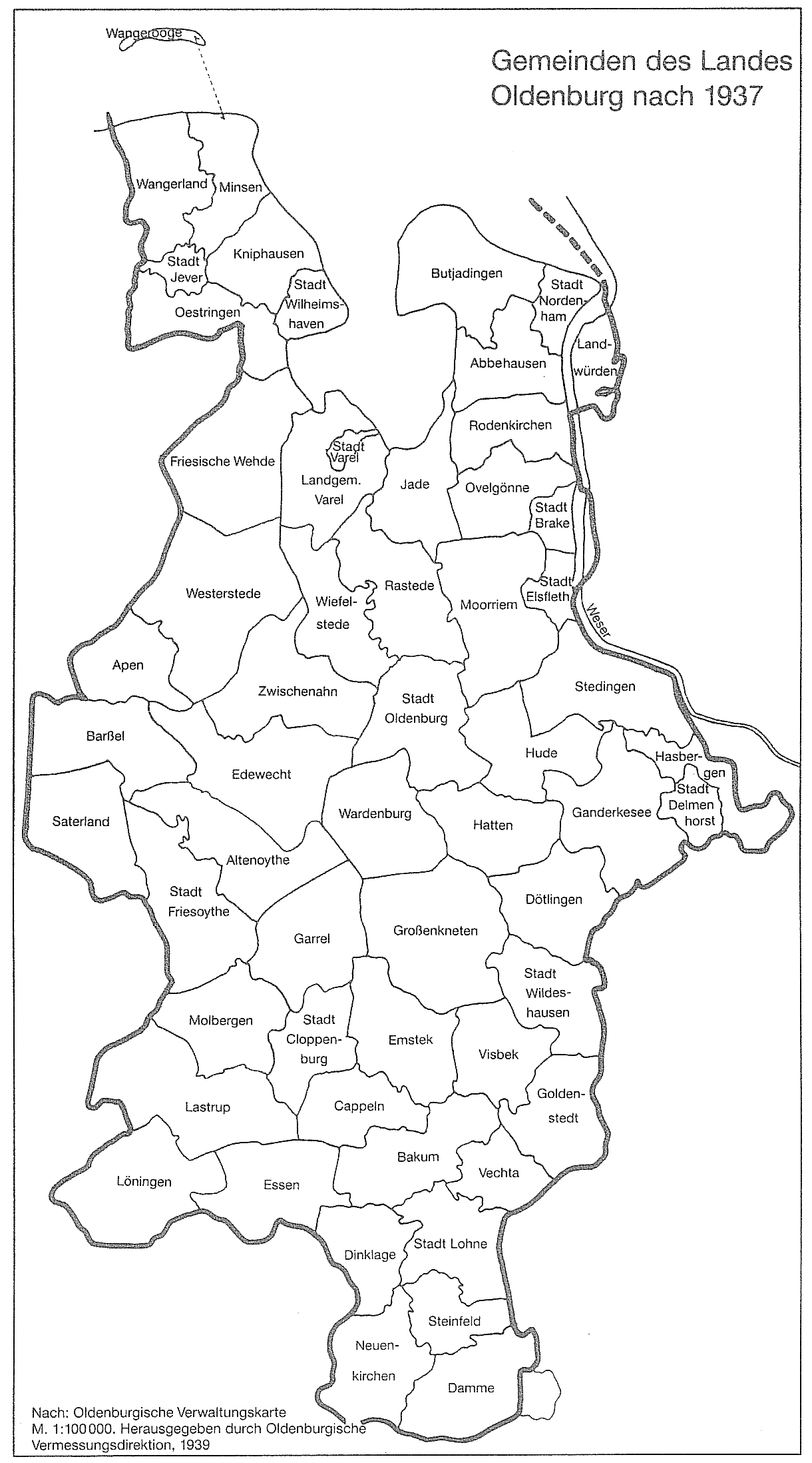
- Municipality map of the state of Oldenburg (1937)
Individual evidence
- ↑ State Office for Statistics Lower Saxony, LSN-Online regional database, Table 12411: Update of the population, as of December 31, 2019 ( help ).
- ^ Federal Statistical Office (ed.): Historical municipality directory for the Federal Republic of Germany. Name, border and key number changes in municipalities, counties and administrative districts from May 27, 1970 to December 31, 1982 . W. Kohlhammer GmbH, Stuttgart / Mainz 1983, ISBN 3-17-003263-1 , p. 275 .
- ↑ Thomas Otto is the new mayor of Saterland. Retrieved March 7, 2018 .
- ↑ Hans Passmann: Flag has been blowing for 25 years , NWZ online, July 17, 2016 , accessed on July 27, 2016.
- ↑ Georg Dehio (abbreviation): Handbook of German art monuments - Bremen Lower Saxony. Deutscher Kunstverlag, Munich / Berlin 1992, ISBN 3-422-03022-0 , p. 1106.
- ↑ Georg Dehio (abbreviation): Handbook of German art monuments - Bremen Lower Saxony. Deutscher Kunstverlag, Munich / Berlin 1992, ISBN 3-422-03022-0 , p. 1164.
- ↑ Lower Saxony Mill Road: Hanekamps Windmill
- ↑ Georg Dehio (abbreviation): Handbook of German art monuments - Bremen Lower Saxony. Deutscher Kunstverlag, Munich / Berlin 1992, ISBN 3-422-03022-0 , p. 1261.
- ^ Gerhard Reinhold: Otto bells. Family and company history of the Otto bell foundry dynasty . Self-published, Essen 2019, ISBN 978-3-00-063109-2 , p. 588, here in particular S 521, 546 .
- ↑ Gerhard Reinhold: Church bells - Christian world cultural heritage, illustrated using the example of the bell founder Otto, Hemelingen / Bremen . Nijmegen / NL 2019, p. 556, here in particular pp. 484, 503 , urn : nbn: nl: ui: 22-2066 / 204770 (PhD thesis at Radboud Universiteit Nijmegen).
Barßel | Evil | Cappeln (Oldenburg) | Cloppenburg | Emstek | Essen / Oldenburg | Friesoythe | Garrel | Lastrup | Lindern (Oldenburg) | Loeningen | Molbergen | Saterland