Scharrel (Saterland)
|
Scharrel
Saterland parish
|
||
|---|---|---|
| Coordinates: 53 ° 4 ′ 18 ″ N , 7 ° 42 ′ 26 ″ E | ||
| Residents : | 2478 (2006) | |
| Incorporation : | March 1, 1974 | |
| Postal code : | 26683 | |
| Area code : | 04492 | |
|
Location of Scharrel in Lower Saxony |
||

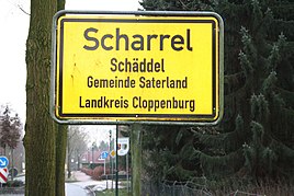
Scharrel ( Sater Frisian Skäddel or Schäddel ) is a district of the municipality of Saterland in the district of Cloppenburg in Lower Saxony .
geography
The village is enclosed east of the B 72 and west of the Cloppenburg – Ocholt railway line . The northern neighbor is Ramsloh .
To the north of the village is the Scharrel nature reserve of the same name and the Hollener Moor nature reserve to the northeast .
history
After 29 houses burned down in Scharrel in 1821, a new settlement was founded six kilometers south under the name Neu-Scharrel . Scharrel had 1,359 inhabitants in the 1850s, who were divided between the farmers Neu-Scharrel (453) and Scharrel (755) with Fermesand (72) and Sedelsberg (79). In 1910 Scharrel had 1,049 inhabitants and Neu-Scharrel had 489.
In Scharrel there were two schools in the 1850s, one in Scharrel with 157 students and one in Neu-Scharrel with 92 students.
Incorporations
Due to the regional reform, Scharrel was combined with Ramsloh and Strücklingen on March 1, 1974 to form the municipality of Saterland.
Web links
Individual evidence
- ↑ a b c Karl Georg Böse (Ed.): The Grand Duchy of Oldenburg . topographical-statistical description of the same. Gerhard Stalling, Oldenburg 1862, p. 554 f . ( Digitized in Google Book Search [accessed November 10, 2017]).
- ↑ Municipal directory Germany 1900. Grand Duchy of Oldenburg - Duchy of Oldenburg - Friesoythe office. Retrieved November 10, 2017 .
- ↑ Numbers, data, facts. Retrieved November 10, 2017 .


