List of geotopes in the Hanover region
The list of geotopes in the Hanover region contains the geotopes in the Hanover region in Lower Saxony . Some of these 33 geotopes are also protected as a natural monument (ND), landscape protection area (LSG), nature reserve (NSG) or part of these.
| Geotope no. | designation | place | comment | Coordinates | image |
|---|---|---|---|---|---|
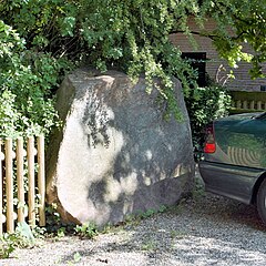
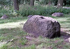
| 3322/01 | Boulder | Neustadt am Rübenberge | see. ND-H 175. reddish granite boulder of 1.5 × 1.5 × 1.8 m | 52 ° 36 '46.4 " N , 9 ° 27' 27" E | |
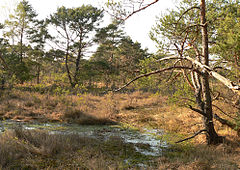
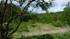
| 3323/01 | High moor with dunes " Blankes Flat " | Neustadt am Rübenberge | see. NSG HA 003 | 52 ° 36 ′ 54 " N , 9 ° 36 ′ 38" E | |
| 3421/07 | "Paul-Woldstedt-Stein" boulder | Neustadt am Rübenberge | see. ND-H 128. The large stone, weighing more than 20 t, near Mardorf is attributed to the ice age researcher Prof. Dedicated to Paul Woldstedt , who in 1928 recognized the Schneeren Mountains as part of the terminal moraine that stretched as far as the Emsland. Gneiss granite, reddish-gray, with large potassium feldspar crystals, home: Central Sweden. 3.5 × 1.7 × 1.6 m | 52 ° 29 ′ 56.6 " N , 9 ° 19 ′ 31.8" E | |
| 3422/03 | Boulders | Neustadt am Rübenberge | see. ND-H 176. 2 boulders 2 km east of Schneeren : a red granite gneiss with elongated red feldspades and quartz streaks. A light red gneiss granite with a fresh, wind-polished surface. 1.7 × 1.5 × 0.9 m | 52 ° 32 '6.6 " N , 9 ° 21' 40.2" E | |
| 3423/01 | Old river noose of the leash with a bulging slope | Neustadt am Rübenberge | see. NSG HA 184 Evenser Moor . Genesis, facies, fossil content. The most recent deepening of the river loop with the formation of an impact slope. | 52 ° 34 ′ 55 " N , 9 ° 30 ′ 49" E | |
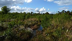
| 3423/04 | " Helstorfer Moor " raised bog | Neustadt am Rübenberge and Wedemark | see. NSG HA 056 | 52 ° 32 ′ 11 " N , 9 ° 35 ′ 51" E | |
| 3423/05 | " Otternhagener Moor " high moor | Neustadt am Rübenberge and Wedemark | see. NSG HA 034 | 52 ° 30 ′ 38 " N , 9 ° 34 ′ 52" E | |
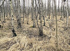
| 3424/01 | " Bissendorfer Moor " raised bog | Langenhagen and Wedemark | see. NSG HA 046 | 52 ° 30 '10.5 " N , 9 ° 40' 59.1" E | |
| 3424/02 | Sand and gravel pit | Wedemark | see. LSG-H 009 "Brelinger Berge". Compression scales | 52 ° 34 '39 " N , 9 ° 41' 39.2" E | |
| 3521/03 | " Hagenburger Moor " high moor | Wunstorf | see. NSG HA 027 | 52 ° 26 ′ 42 " N , 9 ° 18 ′ 6" E | |
| 3521/07 | "Goliath stone " boulder | Neustadt am Rübenberge | see. ND-H 173. The Davidstein near Mardorf is officially referred to as the "Goliathstein". It is one of the largest erratic boulders in the region. Gray-red, medium-grain granite gneiss. 4.5 × 3.5 × 1.1 m | 52 ° 29 ′ 40.8 " N , 9 ° 19 ′ 53.5" E | |
| 3522/01 | Boulder | Wunstorf | see. ND-H 149. Medium-grained light red granite, origin Småland, southern Sweden. 1.7 × 1.5 × 1 m | 52 ° 26 '4.4 " N , 9 ° 23' 48" E | |
| 3522/02 | Sigmundshall shaft and potash works | Wunstorf | geoscientific, (cultural) historical objects | 52 ° 25 ′ 8.9 ″ N , 9 ° 22 ′ 9 ″ E | |
| 3523/06 | dune | Garbsen | see. ND-H 185 and ND-H 186 in Ricklingen Castle . From Quaternary Holocene | 52 ° 25 '42.3 " N , 9 ° 30' 13.6" E | |
| 3523/07 | Bog and dune area with a dredging pond | Garbsen | Parts of LSG-H 61 "Garbsener Moorgeest" and NSG-HA 113 Brandmoorwiesen . Fen, dune landscape from the Quaternary Holocene | 52 ° 25 '31.5 " N , 9 ° 32' 0.7" E | |
| 3523/10 | Sand-gravel pit | Garbsen | see. LSG-H 63. At the Schröder mixing plant, Engelbostel . Sands with gravel, red-brown boulder clay, light brown fine sand above red. From Quaternary Pleistocene, Saale Glaciation | 52 ° 26 '52 " N , 9 ° 38' 23" E | |
| 3525/01 | "Oldhorster Moor" high moor | Burgwedel | see. LSG H 00046 | 52 ° 27 '56.5 " N , 9 ° 55' 56" E | |
| 3525/02 | " Altwarmbüchener Moor " raised bog | Burgdorf , Hanover , Isernhagen | see. NSG HA 044 | 52 ° 25 '23 " N , 9 ° 53' 25" E | |
| 3623/06 | Gehrdener Berg | Gehrden | in LSG H 00024. Fossil-bearing marl limestone | 52 ° 18 ′ 52.4 " N , 9 ° 35 ′ 8" E | |
| 3624/01 | Boulder | Hanover | see. ND-H 224. Red Växjö granite, 1 area with glacier ridges. 3.8 × 1.7 × 2.4 m. The boulder on the exhibition grounds is one of the largest on the southern edge of the former glacier area from the Saale glaciation in Lower Saxony. | 52 ° 19 ′ 21.8 " N , 9 ° 48 ′ 29.5" E | |
| 3624/02 | Boulder | Hanover | see. ND-H 227. Kirchrode, Tessenowweg 11. Red granite, wind-cut stone | 52 ° 22 ′ 37 " N , 9 ° 49 ′ 49" E | |
| 3624/03 | Boulder | Hanover | in Hermann-Löns-Park , northeast of the Anna pond. Medium to coarse-grained, reddish granite from Småland. 1.6 × 1.1 × 0.9 m. Surrounded by smaller boulders. Formerly protected as a natural monument. | 52 ° 22 ′ 19 ″ N , 9 ° 49 ′ 2 ″ E | |
| 3624/07 | North side of a hill made of gravel sand | Hanover | in LSG HS 09 "Mardalwiese" in Kirchrode | 52 ° 21 ′ 40 " N , 9 ° 49 ′ 4" E | |
| 3625/04 | Pit II of the Hanoverian Portland-Cementfabrik AG | Hanover | Upper Cretaceous with fossil deposits: layers with petrified sea urchins, ammonites, shells, etc. Sequence: limestone, glauconite marl, 2 × limestone, marlstone, limestone | 52 ° 23 '20 " N , 9 ° 51' 59" E | |
| 3625/08 | Sand pit in the NSG " In the seven mountain parts " | Taught | Under 1 to 3 m thick red-brown till there are approx. 3 m of meltwater sand, including marl limestone. Upper Cretaceous, including Campan to Quaternary - Pleistocene, Elster Cold Age | 52 ° 23 '48 " N , 9 ° 54' 52" E | |
| 3626/02 | In the kingdom of heaven | Taught | see. NSG HA 045. Area 9 ha. Quaternary-Pleistocene rocks. | 52 ° 22 '32 " N , 10 ° 1' 9" E | |
| 3723/04 | Former quarry | Wennigsen | 150 m west-southwest of the Taternpfahl. Jurassic, Lower Korallenoolith, Lower Coral Bank. Fossil location | 52 ° 14 ′ 30 " N , 9 ° 34 ′ 27" E | |
| 3723/05 | Former quarry | Jump | Storage conditions: Jura, Serpulit (Obermalm 6). Size 20 m². At the Kalenberg im Deister | 52 ° 13 '59 " N , 9 ° 35' 17" E | |
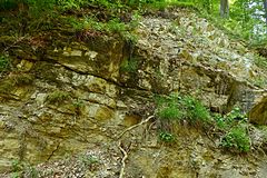
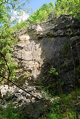
| 3723/06 | Outcrops of the Bielstein cliffs | Jump | Directional profile. Jurassic, Heersumer Strata and Lower Coral Olith. Fossil deposits. 200 m long, 25 m high | 52 ° 14 '5.8 " N , 9 ° 33' 30.4" E | |
| 3723/08 | Outcrops on the Samkeweg | Jump | Rock, storage conditions (Jura, Malm (Weißjura), Korallenoolith to Münder marl). 450 m length, 20 m height | 52 ° 14 ′ 28 " N , 9 ° 32 ′ 20" E | |
| 3723/23 | Boulder (local debris) | Wennigsen | 4 × 2 × 2 m large sandstone cuboid. Weak parallel stratification, on the west side approx. 2 mm thick calcite joint layer. Recovered in the Feldmark north-west of Wennigsen and placed at the entrance to the village. | 52 ° 16 '40.7 " N , 9 ° 33' 42.3" E | |
| 3823/05 | Ridge and steep slope region of the Kleiner Deister in the NSG " Saupark " | Jump | Forms caused by subrosion, Upper Jurassic, Korallenoolith and Heersumer layers | 52 ° 11 '8 " N , 9 ° 33' 55" E | |
| 3823/10 | "Holzmühle" quarry | Jump | see. NSG HA 090. Limestone with marl banks, from Jura, Unterer Kimmeridge (Malm) | 52 ° 9 ′ 24 ″ N , 9 ° 36 ′ 19 ″ E |
See also
- List of nature reserves in the Hanover region
- List of landscape protection areas in the Hanover region
- List of natural monuments in the Hanover region
- List of protected landscape components in the Hanover region
Web links
Commons : Geotopes in the Hanover region - collection of images, videos and audio files
Individual evidence
- ↑ a b c d e f g h i j k l m n o p q r s t u v w x y z aa ab ac ad ae af ag Region Hannover. Environment department. Nature conservation team 36.04, 36.05 AG landscape framework plan: landscape framework plan for the Hanover region. Status 2013 pp. 383–384 (pdf, 16.4 MB; accessed on May 13, 2015)
- ↑ a b c d e f g h i j k l m n o p q r s t u v w x y z aa ab ac ad ae af ag ah ai Geotopes on the NIBIS map server. (see web link), accessed June 14, 2015; (Note: The coordinates given in the information about the location appear to be those of the center of the respective district, not those of the actual geotope.)
- ↑ a b c d e f g h i j k cf. Landscape master plan. Soils with historical significance (pdf; 8.08 MB; accessed on May 13, 2015)
- ↑ Note: The position described is not on Springer, as mentioned in the source, but on Wennigs territory


