List of geotopes in the Wesermarsch district
The list of geotopes in the Wesermarsch district names the geotopes in the Wesermarsch district in Lower Saxony .
| Geotope no. | designation | place | comment | Coordinates | image |
|---|---|---|---|---|---|
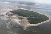
| 2214/01 | Mellum Island | between Jade and Weser, approx. 8 km east-northeast Schillig | Geotope type: Wadden island. Oval shape, length 5000 m, width 3000 m. Stratigraphy: Quaternary Coastal Holocene. Nature reserve. |
53 ° 43 '15.6 " N , 8 ° 8' 56.4" E |
 more pictures |
| 2616/01 | Strohauser Plate Island | Located at the level of Rodenkirchen on the west bank of the Weser. | Nature reserve "Strohauser Vorländer und Plate". | 53 ° 22 '58.8 " N , 8 ° 28" 58.8 " E |

|
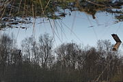
| 2815/01 | Gellener Peat Moörte | in the area of the cities of Elsfleth (Wesermarsch district) and Oldenburg (Oldbg) and the municipality of Rastede (Ammerland district). | Geotope type: fen. Size: 120 ha, of which 107.4 ha in the Wesermarsch district. Petrography: low moor with residual high moor areas, lies between two raised bogs. Nature reserve NSG-WE 137 "Gellener Torfmöörte". |
53 ° 11 ′ 24 ″ N , 8 ° 19 ′ 12 ″ E |
 more pictures |
See also
- List of nature reserves in the Wesermarsch district
- List of landscape protection areas in the Wesermarsch district
- List of natural monuments in the Wesermarsch district
- List of protected landscape components in the Wesermarsch district
Web links
Commons : Geotopes in the Wesermarsch district - collection of images, videos and audio files