
Bar wand
| coat of arms | Germany map | |
|---|---|---|

|
Coordinates: 52 ° 31 ' N , 10 ° 47' E |
|
| Basic data | ||
| State : | Lower Saxony | |
| County : | Gifhorn | |
| Joint municipality : | Boldecker Land | |
| Height : | 58 m above sea level NHN | |
| Area : | 19.8 km 2 | |
| Residents: | 1020 (Dec. 31, 2019) | |
| Population density : | 52 inhabitants per km 2 | |
| Postal code : | 38476 | |
| Area code : | 05366 | |
| License plate : | GF | |
| Community key : | 03 1 51 002 | |
| LOCODE : | DE BW7 | |
| Address of the municipal administration: |
Am Funkberg 5 38476 Barwedel |
|
| Mayor : | Siegfried Schink (BWG) | |
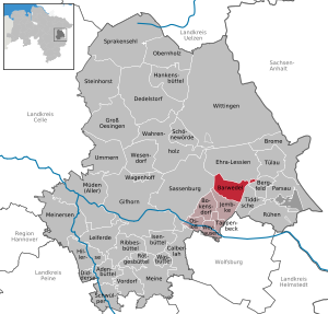
| Location of the municipality of Barwedel in the district of Gifhorn | ||
  |
||

Barwedel is a municipality in the Gifhorn district in Lower Saxony . It belongs to the Boldecker Land municipality .
Neighboring communities
The neighboring communities of Barwedels are (starting north in a clockwise direction):
history
Barwedel was first mentioned in a document in 1309 as Berewedel . The original village shape was that of a Wendish round . According to a settlement register from around 1850, there were 31 farms at that time.
Place name
Former place names of Barwedel were in the years 888 Beriuuidi , 1309 Bereweden , 1495 Barwedel , 1535 Barwedel , 1566 Barweddell and 1609 Barwede . The current spelling has been handed down from 1625. The designation is one of the place names resulting from field names and there is a compound that breaks the place name into "Beri-widi". The dialectal pronunciation Barwee can be attributed to the Middle Low German wede or altniederdeutsch Widu traced back to the forest. The basic word is "widu". "Wede" is supposed to mean "forest". "Bêr, bâr, ber, beier, beer" means "boar". The place name probably means "pig forest", based on the acorn fattening.
politics
advice
The council of the municipality of Barwedel consists of 11 council members, including the part-time mayor.
| BWG | CDU | SPD | total | |
| 2016 | 5 | 5 | 1 | 11 seats |
(As of: local elections November 2016)
coat of arms
Blazon : "In green with a slanted golden fern frond."
The fern frond indicates the Vogelmoor nature reserve in the municipality , in which numerous rare plants and especially ferns such as king fern, lady fern and bracken can be found. It also stands for the still largely undestroyed nature.
flag
On a wide yellow central panel, lined with two narrower green stripes, slightly shifted towards the flag bridge, a green shield with a slanting yellow fern frond.
education
The place has a kindergarten. Officially responsible educational institutions are: Elementary School Jembke, Oberschule Weyhausen, IGS Sassenburg or the Humboldt-Gymnasium in Gifhorn .
Bundeswehr listening post

The place is characterized by the former reconnaissance tower of the Bundeswehr . The radio monitoring system was used during the Cold War to eavesdrop on military radio traffic in the GDR . The radio reconnaissance in Barwedel had been around since 1970, albeit as a mobile system. In 1976 the stationary monitoring system was built on the highest point, the so-called Hohe Berg , which is in the middle of Barwedel at 120 m above sea level. NN lies. The facility consists of a tower that is around 70 meters high, as well as a two-story operating building and several ancillary buildings. During the operating period, the system was strictly secured and guarded around the clock. As a result of reunification and the withdrawal of Soviet troops from the former GDR, the plant was operated with fewer staff and was eventually decommissioned. The tower is currently used by cell phone operators and some local associations. Further towers of the radio monitoring system on the former inner-German border were blown up after the end of the Cold War . However, the tower in Barwedel is located within the village and near a kindergarten: it was not blown up in order not to damage the surrounding buildings.
Two identical Bundeswehr listening systems were also located on surveys directly on what was then NATO's eastern border. The facility on the Hoher Meissner near Kassel was blown up in 2002; near the border with Czechoslovakia there was a station on the Großer Kornberg near Schwarzenbach an der Saale in the Fichtelgebirge .
Web links
Individual evidence
- ↑ State Office for Statistics Lower Saxony, LSN-Online regional database, Table 12411: Update of the population, as of December 31, 2019 ( help ).
- ^ Jürgen Udolph (research): The "place name researcher". (No longer available online.) In: Website NDR 1 Lower Saxony . Archived from the original on December 28, 2014 ; accessed on August 2, 2019 .
- ^ Samtgemeinde Boldecker Land - Local council Barwedel. Retrieved July 23, 2020 .
Adenbüttel | Bar wand | Bergfeld | Bokensdorf | Brome | Calberlah | Dedelstorf | Didderse | Ehra-Lessien | Gifhorn | Groß Oesingen | Hankensbüttel | Hillerse | Isenbüttel | Jembke | Leiferde | My | Meinersen | Tired (of all) | Obernholz | Osloß | Parsau | Ribbesbüttel | Rötgesbüttel | Rüh | Sassenburg | Schönewörde | Sultry | Sprakensehl | Steinhorst | Tappenbeck | Tiddish | Tülau | Numbers | Vordorf | Wagenhoff | Wahrenholz | Wasbüttel | Wesendorf | Weyhausen | Wittingen
Unparished area in Giforn Giebel county