Sassenburg
| coat of arms | Germany map | |
|---|---|---|

|
Coordinates: 52 ° 32 ' N , 10 ° 37' E |
|
| Basic data | ||
| State : | Lower Saxony | |
| County : | Gifhorn | |
| Height : | 68 m above sea level NHN | |
| Area : | 88.41 km 2 | |
| Residents: | 11,894 (Dec. 31, 2019) | |
| Population density : | 135 inhabitants per km 2 | |
| Postal code : | 38524 | |
| Primaries : | 05371, 05378, 05379 | |
| License plate : | GF | |
| Community key : | 03 1 51 025 | |
| LOCODE : | DE SUG | |
| Community structure: | 6 districts | |
| Address of the municipal administration: |
Bokensdorfer Weg 12 38524 Sassenburg |
|
| Website : | ||
| Mayor : | Volker Arms ( SPD ) | |
| Location of the municipality of Sassenburg in the Gifhorn district | ||
Sassenburg is a municipality in the district of Gifhorn in Lower Saxony .
geography
In the transition area between Harz and Heide , the area of the municipality of Sassenburg extends east of Gifhorn and northwest of Wolfsburg . The Aller flows through it in its southern area in an east-west direction . The Elbe Lateral Canal cuts through the municipality in a north-south direction . Today's municipality extends over an area of 8,840 hectares, of which 17% is settlement and traffic area.
geology
The landscape is defined in the north-west by the Great Moor , a largely peat high moor , which was partially declared a nature reserve in 1984. To the east it turns into a gently undulating hill country, to the south into the Aller - glacial valley .
Neighboring communities
Neighboring communities are (clockwise, starting in the north): Wahrenholz , Ehra-Lessien , Barwedel , Jembke , Bokensdorf , Osloß , Calberlah , Gifhorn .
The closest larger cities are Wolfsburg and Braunschweig .
Community structure
The community includes the districts of Dannenbüttel , Grußendorf , Neudorf-Platendorf , Stüde , Triangel and Westerbeck (including Neuhaus residential area ). The town hall is located in front of the eastern outskirts of Westerbeck.
history
Sassenburg is a unified municipality in the district of Gifhorn, which emerged as part of the Lower Saxony regional reform on March 1, 1974 from the previously independent municipalities of Dannenbüttel, Grußendorf, Neudorf-Platendorf, Stüde, Triangel and Westerbeck. The community got its name after the Sassenburg of the same name , which was a low- rise castle shaped as a ring wall . Your location is on the Aller near Dannenbüttel. The castle site is now an irregular area with small elevations. So far there is no historical or archaeological evidence for the existence of the fortification. The former castle area is now part of the Gifhorn district.
Population development
According to the Lower Saxony State Office for Statistics , 10,973 people lived in Sassenburg in 3146 buildings with a total of 4466 apartments with an average living space of 44.1 m² per person. Since the municipality was founded, the number of inhabitants has grown steadily, both due to positive natural population growth and positive net migration. 24.40% of the population were under 18 years old in 2005, 7.70% between 18 and 25, 31.60% between 25 and 45, 23.10% between 45 and 64, and 13.20% were 65 years old or older older. The unemployment rate averaged 9.5% (men: 7.5%, women: 12.4%). 3,705 people regularly commute out of the community, 609 in.
On December 31, 2019, the population was 11,894.
politics
Municipal council
Following the local elections on September 11, 2016, the following parties and voter groups are represented in the Sassenburg council:
- SPD 11 seats
- CDU 09 seats
- List for Sassenburg (LiSa) 1 seat
- Citizens Interest Community (BIG) Sassenburg 4 seats
- Alternative for Germany (AfD) 1 seat
mayor
With the local elections in 2001, the new Lower Saxony municipal constitution came into effect in Sassenburg. With it ended the traditional personal separation between mayor (politics) and community director (administration), instead the "single track" was introduced. For the first time, the mayor was directly elected by the population and is head of administration and politics rolled into one.
This office held:
- 2001-2006: Wolfgang Stein (CDU)
- since 2006: Volker Arms (SPD)
Local councils
Each of the six districts has a local council headed by a local mayor . These bodies do not have a quorum. The local councils are to be heard on important matters affecting the locality. However, the final decision on a measure rests with the municipal council.
badges and flags
Blazon : "Divided by blue and green above a golden castle with a silver gate and palisade wall, below a silver cogwheel covered by golden peat cutlery in an oblique crossing and two golden ears of wheat on both sides."
The castle symbolizes the former fortifications on the Aller, with each of the palisades representing one of the localities of the municipality. The peat cutlery points to the traditional peat extraction in this region and the cogwheel points to the industrial settlement in the area of the village of Triangel. The green color scheme and the ears of wheat indicate agricultural use and the blue background in the upper area indicates the moor.
The coat of arms was designed by Arnold Lange, approved by the municipality council on November 8 and officially confirmed on December 21, 1977.
The flag of the municipality of Sassenburg bears the municipality colors green and blue in two longitudinal stripes of the same width from left to right and is covered with the coat of arms in the middle field.
Partner municipality
Sassenburg's partner community is Hohenleipisch in Brandenburg .
Culture and sights
The Bernsteinsee recreation area is located in Stüde . At Dannenbüttel there is the Beversee. In 2013 the cultural association of the community Sassenburg KusS (Kulturschmiede Sassenburg) was founded in the Alte Schmiede in Triangle .
education
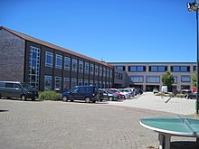
The Integrated Comprehensive School Sassenburg with a gym and sports field is located on the main road (near the intersection with Bundesstraße 188 ) . Generous new buildings and extensions to accommodate a total of more than 1000 schoolchildren as well as fire protection renovations were carried out between 2012 and 2018. The cafeteria in the new building has a stage so that it can also be used as an event hall.
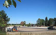
The primary school that once existed on the site was last used as a Pestalozzi special school. This has now moved back to Gifhorn. The building was demolished in 2018 and the open space has now been converted into the school's new bus stop.
media
The Sassenburg has been an official bulletin since the community was founded . The content of the sheet has always gone far beyond mere official communications. a. diverse club announcements.
literature
- The district of Gifhorn. Edited by the Lower Saxony State Administration Office. Bremen 1972. (The districts in Gifhorn, vol. 26. ISBN 3-87172-327-4 .)
Web links
- Official website of the municipality of Sassenburg on sassenburg.de
Individual evidence
- ↑ State Office for Statistics Lower Saxony, LSN-Online regional database, Table 12411: Update of the population, as of December 31, 2019 ( help ).
- ↑ a b Lower Saxony Institute for Economic Questions e. V. (Ed.): Regional report 2006: Economic area Braunschweig - Salzgitter - Wolfsburg . IHK Braunschweig, Hanover 2006. ( PDF; 1.4 MB ( Memento of the original of July 10, 2007 in the Internet Archive ) Info: The archive link has been inserted automatically and has not yet been checked. Please check the original and archive link according to the instructions and then remove this notice. ).
- ^ Federal Statistical Office (ed.): Historical municipality directory for the Federal Republic of Germany. Name, border and key number changes in municipalities, counties and administrative districts from May 27, 1970 to December 31, 1982 . W. Kohlhammer GmbH, Stuttgart / Mainz 1983, ISBN 3-17-003263-1 , p. 226 .
- ↑ Many citizens believe that the Sassenburg was on the elevation between Dannenbüttel, Westerbeck and Triangel, where the Sassenburg School is today.
- ↑ archäologie-region-gifhorn.de
- ↑ State Office for Statistics Lower Saxony, LSN-Online regional database, Table 12411: Update of the population, as of December 31, 2019 ( help ).
- ↑ Wall system of the Sassenburg on museen-gifhorn.de
- ^ Arnold Rabbow: New Braunschweigisches Wappenbuch. Braunschweiger Zeitungsverlag, Meyer Verlag, Braunschweig 2003, ISBN 3-926701-59-5 , pp. 68/69.


