
Räbke
| coat of arms | Germany map | |
|---|---|---|

|
Coordinates: 52 ° 12 ' N , 10 ° 53' E |
|
| Basic data | ||
| State : | Lower Saxony | |
| County : | Helmstedt | |
| Joint municipality : | North Elm | |
| Height : | 134 m above sea level NHN | |
| Area : | 11.35 km 2 | |
| Residents: | 702 (Dec. 31, 2019) | |
| Population density : | 62 inhabitants per km 2 | |
| Postal code : | 38375 | |
| Area code : | 05355 | |
| License plate : | HE | |
| Community key : | 03 1 54 017 | |
| Address of the municipal administration: |
Steinweg 15 38373 Süpplingen |
|
| Mayor : | Rainer Angerstein | |
| Location of the municipality of Räbke in the Helmstedt district | ||
  |
||

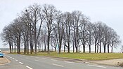
Räbke is a municipality in the combined municipality of Nord-Elm in the Helmstedt district in Lower Saxony , which is first mentioned in 1153 as Ridepe . The village on the northeastern edge of the Elm is a local recreation area with an extensive network of hiking trails, starting in the headwaters of the Schunter .
history

prehistory
Artefacts made of flint , stone tools and flint axes found in the vicinity of Räbke suggest a human presence of hunters and gatherers in the Paleolithic and Mesolithic .
Of a Neolithic settlement by farmers and ranchers numerous artifacts found on the fields such as green stone axes, grindstones and testify shoe lasts wedges . During excavation work for a water pipe in 1950, a human skeleton was discovered in the southern area of Räbke at a depth of about one meter. It was about a burial of a middle-aged woman in a back-stool position, which was probably carried out in the Neolithic Age . The excavation was carried out by the conservationist Franz Niquet from the Braunschweigisches Landesmuseum für Geschichte und Volkstum . As early as 1938, a human skull was found in the immediate vicinity of the site, which indicates a prehistoric burial ground.
Räbker finds from the Bronze Age are a hand ax, a blade and a needle made of bronze.
Legacies from the 3rd to 6th centuries exist in the form of the Ole Hai burial mound field on the edge of the Elm between Räbke and Lelm . As early as 1778, pastor Johann Christian Dünnhaupt from Lelm described urn finds on the burial ground.
Surname
Räbke is first mentioned as Ridepe in a document signed by Bishop Ulrich von Halberstadt at Gatersleben Castle , when he confirmed the possessions of the St. Johannes monastery on December 2, 1153 . After that, the monastery owned houses and farmland in Räbke, among other things. In other documents, Räbke is mentioned in 1225 as Redepe , 1333 as Rideppe and 1399 as Redepke . The place name at that time is based on the term rid-apa , which meant Rietwasser. The Riet stands for Riede, which means a small stream . The name is probably based on the Schunter, which passes the place and is still a small body of water around 1 km after its source.
middle Ages
There were a total of three settlements around Räbke, which were abandoned in the late medieval desert phase. This included the Dittenrode settlement southwest of the village . After a spring had dried up, the residents moved to Räbke, so that the settlement fell into desolation between 1345 and 1461 .
Mill history

Due to its location on the Schunter, Räbke has been a preferred location for water mills since the 13th century . In 1939 the mill cadastre listed the following seven watermills in the village: Obermühle , Amtsmahlmühle , Mönchsmühle , Ölmühle , Prinzhorn Mill , Mittelmühle and the Liesebach watermill, which is operational again today . Another mill was the lower mill, which fell into desolation in the 18th century .
In the 18th and 19th centuries Räbke was an important place in the national production of paper with the branch of paper mills on the Schunter . This was due to the location near the source with clean Schunterwasser and the proximity to the University of Helmstedt with its considerable paper requirements for books. At the beginning of the 18th century, four of the at least eight water mills in the village were paper mills, more than anywhere else in what is now Lower Saxony in such a small area.
20th century

1970 joined the community Räbke the group formed this year Samtgemeinde at North Elm, since it was clear that she was no longer capable of future management tasks. The decisive factor in the decision to join by the Räbker municipal council was that the municipality was largely able to retain its independence. While administrative tasks relating to taxation and schooling, cemetery management, sewage and fire protection were given up, financial sovereignty was retained.
The village image with the building stock of half-timbered houses and farms from the 19th century remained almost the same until the middle of the 20th century. After the Second World War , the population doubled from 600 people in 1938 to over 1,300 people in 1952. The influx of people was displaced from the eastern regions of the German Reich and bombed out from the big cities. During the housing shortage caused by the influx after the Second World War, only a few residential buildings were built in the early 1950s. The first new building area was the "Am Heergarten" building area, which was built between 1960 and 1975. In 1976 the number of inhabitants had leveled off again at the pre-war level and had declined by 530 by 1980. At the time, the village had fewer inhabitants than 1750. In the mid-1980s, the number of inhabitants rose again due to new building areas. From 1979 to 1999 the “Am Kirchberg” building area was built. The "Bischofsberg" building area has been under construction since 2017.
On the outskirts of the Elmhang, the Nord-Elm holiday park was built from 1978 to 1981 as a local recreation facility with an outdoor pool, the Schuntersee, a campsite and a larger holiday home area .

The townscape of Räbke with Schunter and St. Stephen's Church
Thieplatz by Räbke on the outskirts

Village center with Schunter
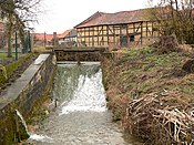
Branch from the Schunter to the Mühlengraben (in the foreground)


politics
mayor
According to the records of the municipality of Räbke, the following mayors have been in office since the 20th century:
| from | to | Surname |
|---|---|---|
| 1889 | 1923 | Heinrich Vahldiek |
| 1923 | 1933 | Fritz Weibusch |
| 1933 | 1943 | Heinrich Kremling |
| 1943 | 1945 | Karl Langemann |
| 1945 | 1946 | Fritz Weibusch |
| 1946 | 1952 | Robert Probst (Community Director) |
| 1947 | 1948 | Herbert Homann |
| 1948 | 1952 | Wilhelm Raschke |
| 1952 | 1979 | Willi Siems |
| 1979 | 1981 | Siegfried Helmhold |
| 1981 | 1991 | Gerhard Hube |
| 1991 | 1996 | Werner Borkam |
| 1996 | 2006 | Klaus Röhr |
| 2006 | Rainer Angerstein |
economy
In earlier times, the inhabitants lived mainly from agriculture or ran businesses and small craft businesses. In 1950 there were 41 traders, the number of which had decreased to 10 in 1976 and then continued to decline. In 2007 there were five full-time and three part-time farms in the agricultural sector. The fertile soils in the district ensure productive arable farming with sugar beet, rape and grain.
As of 2007, there was a mechanical engineering company and a joinery with a wood sawmill.
The banking institute and post office closed around the year 2000. The temporarily five existing restaurants are all closed today (2019).

- Water pipeline cooperative
The place has its own drinking water production and supply by the Räbker Wasserleitungsgenossenschaft eG . It was founded in 1893 by 66 landowners to replace water extraction from wells. The drinking water was obtained from a well above the village and piped into the village. The line was initially operated with its own pressure through a natural gradient. Due to the increase in the number of inhabitants in Räbke after the Second World War, a new well 12 meters deep was drilled in 1949 and built over with a pump house. It was not until 1975 that all customers were equipped with water meters for calculating consumption.
Sights and culture

The village is characterized by numerous four-sided courtyards , most of which were built in the 19th century. In Räbke there is an above-average number of architectural monuments in the historic center. The place stands out from the other villages of the Elm-Börde region with its well-preserved half-timbered houses .
In the historic center of the village there is a network of small paths with preserved limestone paving. The Schunter runs in two parts through the village. The creek has been exposed again in parts and in places restored with old materials through bridges and paving. There is a large population of linden trees in the village.
The local church of St. Stephen was built in 1801 after a dilapidated previous church was torn down. Because of its square shape, which differs from the churches in the area, the church is popularly known as a coffee grinder .
Räbke's approximately 70 × 70 meter Thieplatz on the northern edge of the village is the only Thie in the Braunschweig region that has been preserved in its former size.
Village competitions

In 1994 Räbke won the competition Our village should be more beautiful in the Helmstedt district . In 2007 the village took part in the competition Our village has a future . When he participated again in 2019, Räbke was nominated for the national competition with two other villages in Lower Saxony. As a result, Räbke was awarded a silver medal along with 14 other villages. To participate in 1994, a memorial stone was erected in the center of the village on the Schunter, which was renewed after the award in 2019.
Location
Räbke has so far been the location for the following films:
- 1973: Escalation under the working title battue , based on a detective novel by Dieter Wellershoff
- 1977–1982: News from Uhlenbusch
- 2008: Böseckendorf - The night in which a village disappeared
literature
- Joachim Lehrmann : The early history of the book trade and publishing in the old university town of Helmstedt and the history of the once important paper mills at Räbke am Elm and Salzdahlum / Helmstedter and Räbker book and paper history. Taught 1994, ISBN 978-3-9803642-0-1
- Förderverein Räbker Chronik: (Ed.): Räbke. A village on the edge of Elmes , Helmstedt, 2005
- Joachim Lehrmann: Räbke. Lower Saxony's old papermaking village. Once the location of important paper mills. Ed .: Räbker Förderverein Mühle Liesebach eV, 2014
Web links
- Official website
- Location description at Samtgemeinde Nordelm
- Räbke on Brunswick tours
- Joachim Lehrmann: Small village with a great paper history!
Individual evidence
- ↑ State Office for Statistics Lower Saxony, LSN-Online regional database, Table 12411: Update of the population, as of December 31, 2019 ( help ).
- ^ Franz Niquet: Excavation of a probably Neolithic skeleton in: Förderverein Räbker Chronik: (Ed.): Räbke. Ein Dorf am Elmesrand , Helmstedt, 2005, pp. 163–165
- ↑ D. Rohde: Pre- and early historical finds in and around Räbke in: Förderverein Räbker Chronik: (Ed.): Räbke. Ein Dorf am Elmesrand , Helmstedt, 2005, pp. 166–167
- ↑ Klaus Röhr: The construction areas arms series and Am Heergarten in: Räbke. Ein Dorf am Elmesrand , Helmstedt, 2005, pp. 177–179
- ↑ Klaus Röhr: The building area "Am Kirchberg" in: Räbke. Ein Dorf am Elmesrand , Helmstedt, 2005, pp. 180–181
- ^ The mayors in the last century in: Förderverein Räbker Chronik: (Ed.): Räbke. Ein Dorf am Elmesrand , Helmstedt, 2005, p. 298
- ^ The Räbker Wasserleitungsgenossenschaft in: Räbke. Ein Dorf am Elmesrand , Helmstedt, 2005, pp. 35–41
- ↑ 22nd state competition "Our village has a future" 2005/2007 (pdf)
- ↑ "Our village has a future": Winnigstedt, Räbke and Warberg continue on regionalWeltenbüttel.de from June 6, 2018
- ↑ Lower Saxony village competition decided , press release from Lower Saxony . Ministry of Food, Agriculture and Consumer Protection of August 31, 2018
- ^ "Our village has a future" - rain of medals for Lower Saxony Press release from the Lower Saxony Ministry of Food, Agriculture and Consumer Protection from July 11, 2019
- ^ Film locations in the Braunschweig region near Braunschweig Ostfalen region
- ↑ Parish Räbke near Samtgemeinde Nord Elm
Bahrdorf | Beierstedt | Danndorf | Frellstedt | Gevensleben | Grafhorst | Grass life | Groß Twülpstedt | Helmstedt | Jerxheim | Königslutter am Elm | Teaching | Mariental | Querenhorst | Räbke | Rennau | Schöningen | Söllingen | Süpplingen | Süpplingenburg | Velpke | Warberg | Wolsdorf
Municipality-free areas in the Helmstedt
Brunsleberfeld district |
Helmstedt |
Königslutter |
Mariental |
Schöningen