
Bahrdorf
| coat of arms | Germany map | |
|---|---|---|

|
Coordinates: 52 ° 23 ' N , 11 ° 0' E |
|
| Basic data | ||
| State : | Lower Saxony | |
| County : | Helmstedt | |
| Joint municipality : | Velpke | |
| Height : | 77 m above sea level NHN | |
| Area : | 40.6 km 2 | |
| Residents: | 1825 (Dec. 31, 2019) | |
| Population density : | 45 inhabitants per km 2 | |
| Postal code : | 38459 | |
| Primaries : | 05364, 05358 | |
| License plate : | HE | |
| Community key : | 03 1 54 001 | |
| LOCODE : | DE BL2 | |
| Community structure: | 4 districts | |
| Address of the municipal administration: |
Grafhorster Strasse 6 38458 Velpke |
|
| Website : | ||
| Mayor : | Heinz-Udo Liedtke ( SPD ) | |
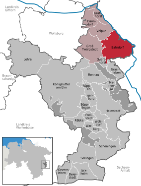
| Location of the municipality of Bahrdorf in the Helmstedt district | ||
  |
||

Bahrdorf is a municipality in the Helmstedt district in Lower Saxony and a member municipality of the Velpke municipality .
geography
location
Bahrdorf lies between the Elm-Lappwald and Drömling nature parks .
Municipal area
The municipality is rich in sandy soils. Mixed and pine forests determine the forest appearance. Grain and sugar beet are predominantly grown, and rapeseed is also increasingly being grown. The land is defined by smaller hills. The highest hill is the Steinberg at 115 m above sea level. NN.
Community structure
The districts of the municipality are:
- Core town Bahrdorf with Blanken
- Mackendorf with clinker factory (brickworks)
- Rickensdorf
- Saalsdorf with Altena
Another place to live is Bullerbü (one kilometer from Rickensdorf).
history
In 973 the community was first mentioned as "Bardorp" when it was donated to the Bishop of Magdeburg . In the 13th century, the then bishop of Magdeburg appealed to it and demanded extradition from the de Bardorpe family of knights, who lived in Bahrdorf. When it did not meet the requirements, there was a siege by the Archbishop of Magdeburg and the feudal lord of Oebisfelde, but the Bahrdorf castle survived. The castle fell into disrepair and was converted into a ducal estate in the 18th century that still exists. Only the keep of the old castle is preserved.
For the development of the postal system in Bahrdorf, see: Braunschweig – Calvörde postal route .
Incorporations
On July 1, 1972, the communities Mackendorf, Rickensdorf and Saalsdorf were incorporated.
Place name, origin
Old names: 8./9. Century "Bardorf", 937 "Bardorp", mid-11th century "Barthorpa", 1209 "Bardorp", 1189 "Barthorp", 1328 "Bardorp", 1344 "Bardorpe".
The place name could go back to Wald-Dorf. It may contain baeru, baero for forest, Germanic barwa for conifer, whale. Another way of interpreting the place name is the Polish word bara for swamp. Due to the location of the place in the forest and in the floodplain of the Lapau, or the former foothills of the Drömling, the origin of the place name cannot be clearly determined.
politics
Municipal council
The municipal council is the local people's representative body for the municipality of Bahrdorf. Every five years, citizens decide on the allocation of the eleven seats in local elections.
mayor
The honorary mayor has been Hans-Hubertus Broistedt since 2016.
coat of arms
Split into blue and gold, inside a four-leaf oak with three acorns in mixed up colors.
Culture and sights

- Evangelical Lutheran St. Stephen Church in Bahrdorf
- Domain (former moated castle)
Religions
The Evangelical Lutheran St. Stephen's Church is located in the village of Bahrdorf and belongs to the Provosty of Vorsfelde . Other churches are located in the districts of Mackendorf, Rickensdorf and Saalsdorf.
Since after the Second World War refugees and displaced persons from Catholic areas settled in Bahrdorf and the surrounding villages, the Catholic parish vicarie Bahrdorf, belonging to the Velpker Church Immaculate Conception , was founded in 1946 . In addition to Bahrdorf, she was also responsible for the villages of Mackendorf, Papenrode , Querenhorst, Rickensdorf and Saalsdorf. A Catholic church was not built in Bahrdorf; the services took place in the pastor's apartment or in the Protestant church. 1966 the parish vicarie Bahrdorf was dissolved again and came back to the parish Velpke.
traffic
Bahrdorf is east of the federal highway 244 . Bahrdorf was on the disused Helmstedt – Oebisfelde railway line in this area .
literature
- Willi Scherfise: 1000 years of Bahrdorf . Kühne, Helmstedt 1973
Web links
Individual evidence
- ↑ State Office for Statistics Lower Saxony, LSN-Online regional database, Table 12411: Update of the population, as of December 31, 2019 ( help ).
- ^ Federal Statistical Office (ed.): Historical municipality directory for the Federal Republic of Germany. Name, border and key number changes in municipalities, counties and administrative districts from May 27, 1970 to December 31, 1982 . W. Kohlhammer, Stuttgart / Mainz 1983, ISBN 3-17-003263-1 , p. 271 .
- ^ Jürgen Udolph (research): The "place name researcher". In: website NDR 1 Lower Saxony . Archived from the original on December 28, 2014 ; accessed on August 3, 2019 .
- ↑ Results of the municipal council election 2016 Samtgemeinde Velpke
- ^ Peter Eppert: 75 years of St. Marien Velpke. Grafhorst 2004, p. 10 u. 12.
Bahrdorf | Beierstedt | Danndorf | Frellstedt | Gevensleben | Grafhorst | Grass life | Groß Twülpstedt | Helmstedt | Jerxheim | Königslutter am Elm | Teaching | Mariental | Querenhorst | Räbke | Rennau | Schöningen | Söllingen | Süpplingen | Süpplingenburg | Velpke | Warberg | Wolsdorf
Municipality-free areas in the Helmstedt
Brunsleberfeld district |
Helmstedt |
Königslutter |
Mariental |
Schöningen
Bahrdorf (core town with Blanken ) | Mackendorf | Rickensdorf | Saalsdorf (with Altena )