Schunter
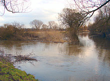
The Schunter is a river in Lower Saxony . From its source at Räbke on the Elm ridge to its confluence with the Oker between Walle and Groß Schwülper northwest of Braunschweig , it is around 58 kilometers long.
Surname
In 781 the river is mentioned as Schuntra ; In 803 he is called Scuntra . The name could be traced back to the old Slavic word Sukatora , which means: with many angles, probably an indication of the winding river course. Another name interpretation can be traced back to the Old Norse word scunda . This means as much as to hurry or to flow quickly and, historically, goes back to 500 BC. BC back.
geography
Schunterquelle
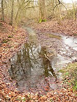
The source of the Schunter lies at the northeast foot of the most important saddle of the Elm mountain range . The river and the adjoining valley are followed by a road southeast of which - about one kilometer above Räbke at the level of the Zur Schunterquelle house - several strong springs emerge near a holiday home park. The water jumps out here in a mostly dry ditch as well as in an earthfall-like short side valley rather inconspicuously. Nevertheless, the pouring of the springs emerging from the karst limestone layers is so strong that after a few meters the stream bed is two meters wide and in earlier centuries the water supply was sufficient to operate mills there. Clean, abundant spring water was particularly important for the paper mills in Räbke during the 18th and 19th centuries . (See: Räbker Mühlengeschichte ). The Schunterquelle is a natural monument .
course
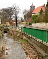
The Schunter first flows from its source in an easterly direction through Räbke and bends north-northwest behind Frellstedt at the elevation or the Elz forest . There it takes the Laagschunter coming from Warberg from the right and reaches Süpplingenburg , where the long wave that rises on the western edge of the Lappwald flows into it. It follows the course of the Dorm in a north-westerly direction , behind which it takes the Uhrau coming from Mariental . From the left the Lutter and other streams of the northern Elmrand flow into it. The Schunter passes the Hasenwinkel landscape on its west side, is supplemented by the Scheppau and at Hattorf changes the direction of flow to the west to Flechtorf . There it divides Alt- and Neudorf and flows around Campen Castle with two arms .
From here it continues to the southwest and leaves Lehr to the south. Before Wendhausen , it divides into a northern and southern arm, which flow around the historic town center and Wendhausen Castle . Before Hondelage , the two parts of the river unite, pass the village and then Dibbesdorf and Querum . The honeycomb from the Reitlingstal flows here from the south . The Schunter turns north, passes Rühme , Bienrode , Wenden and crosses under the Mittelland Canal . At Frickenmühle near Thune it changes its course to the west and passes Harxbüttel and Walle .
Between Groß Schwülper and Walle, the Schunter flows into the Oker after a path of 58 kilometers and an altitude difference of around 114 meters. The mean gradient is 0.2%.
Catchment area
The Schunter is the longest tributary of the Oker. Its catchment area covers about a third of the entire Oker catchment area and extends it east to the Lappwald. Its right tributary Laagschunter , west of Warberg, lies on this side of the watershed between the catchment area of the Weser , to which the Schunter belongs, and that of the Elbe . The Missaue , which rises just a little more than a kilometer to the east and also rises near Warberg, flows over the Schöninger Aue towards Bode and thus ultimately to the Elbe.
Tributaries
| Left tributaries | Right tributaries |
|
|
| The place of the confluence with the Schunter in brackets. | |
Water quality
The water quality of the Schunter is monitored by the Lower Saxony State Agency for Water Management, Coastal and Nature Conservation (NLWKN), which divides it into two water bodies: The approximately 12-kilometer-long upper course from the source to the confluence of the Lange Welle with the identification 15059 is of the type Loess-loam-shaped lowland stream , and the other 46 kilometers to the confluence with the Oker under no. 15051 are of the sand- and loam-shaped lowland river type .
A relatively natural course is found in the spring area, but the Schunter falls dry in summer. In the entire course of the river, the structural quality is rated as “severely damaged”, which can be attributed to numerous straightening, bank reinforcements and missing or poor bank vegetation. However, many deficiencies can be eliminated. Since 1994, in the course of the Schunter between Wendhausen , Hondelage, Dibbesdorf and Querum, various measures have been taken to renaturate the course of the water. In 2010, an extensive renaturation in the catchment area of the Sandbach estuary, supported by the city of Braunschweig, the Federal Environment Foundation and other sponsors, was completed.
The chemical quality is given overall as “good”, but the limit value for the orientation value phosphate has been exceeded. This is due to the fact that over 56% of the chemical discharges come from arable land, i.e. from fertilizers. The total ecological potential, which includes the fish population and the oxygen balance, is stated as "unsatisfactory" as of 2009.
Mills
In the past, the water from the Schunter was also used to power many mills. In Räbke these were the upper mill, the mill Willecke, the upper official mill, the lower official mill, the watermill Liesebach , the mill Prinzhorn, the middle mill and the lower mill ( see : Räbker mill history ). Other mills were the Laag mill in Walsdorf, the oil mill in Frellstedt, the upper mill in Frellstedt, the Rotemühle in Frellstedt and the Süpplinger mill in Frellstedt. In Süpplingenburg it was the manor mill. There were two mills in Groß-Steinum. Other mills were the Ochsendorfer Mühle, the Puritzmühle in Rieseberg, the Gutsmühle in Gientorf, the Teichmühle in Heiligendorf, the Klostermühle in Heiligendorf, the Hattorfer Mühle, the Beienroder Mühle, the Flechtorfer Mühle , the Lehrer Mühle, the Wendhausen Mühle, the Querumer Mühle , the Bienroder Mühle, the Wendenmühle and the Frickenmühle in Thune.
shipping

From the mid-18th century, there were persistent and sometimes successful efforts in the Principality of Brunswick-Wolfenbüttel , the Schunter for rafting of firewood from the Elm and the Dorm to use and other for transporting goods such as lumber to make and stones navigable - up for the construction of railways and better roads for this most economical mode of transport.
In May 1746 was tentatively firewood was scarce in Braunschweig, from the Dorm from east doctrine located Campen (Rotenkamp) schunterabwärts rafted to Braunschweig; an experiment with wood from the Elm from Süpplingen had already been successful. Duke Karl I then commissioned his master builder Martin Peltier de Belfort with the planning of the continuous making the Schunter navigable from Braunschweig to the Elm, which was approved in 1746. The Schunter Canal was dug between the Mittelriede, which flows into the Schunter near Gliesmarode, and the eastern part of the city of Braunschweig, and a wooden yard was laid out in the area of today's Botanical Garden. The six ships built for use on the Schunter were 11.50 meters long, 1.70 meters wide and 0.60 meters deep.
In January 1748, the Schunter was expanded from Braunschweig to Frellstedt to a width of 2.90 meters. In 1758 the manor Beienrode was granted the right to maintain its own ship on the Schunter without paying customs and sluice fees; Also, like the Hattorf manor located further down the Schunter, the estate was given its own storage area in Braunschweig.
Shipping and rafting flourished until the 1770s and finally ended in 1788. In the summer of 1803 the efforts were finally given up by the sovereign.
Castles and sights

There are several historical sites along the Schunter, such as Süpplingenburg , ancestral seat of Emperor Lothar von Süpplingenburg, near Königslutter . The Groß Steinum am Dorm, located just a few kilometers downstream, also looks back on a history from pre-Franconian times and has a large stone grave to show.
Campen Castle was built in the 13th century near Flechtorf in the Schunteraue between two arms of the river .
In the Querum district of Braunschweig, the Borwall testifies to the early settlement and fortification of the Schunter area. At the confluence of the Schunter in the Oker near Walle , remains of the Scheverlingenburg can still be seen. This is not only mentioned in a document in 1091, but excavations have brought to light traces from pre-Roman times.
In the northern city area of Braunschweig, the district Schunteraue , was created in 1937, the Schuntersiedlung . It is a small district of about 15 streets near the Schunter.
Since 2018, the Schunter Water Week has been held annually in the river's catchment area with events in the towns between the source and the mouth.
In 2019, the approximately 70 km long Schunter cycle path was opened, which leads from the mouth of the river into the Oker, near Groß Schwülper, upstream to the source in the Elm near Räbke.
literature

- Theodor Müller: Shipping and rafting on the Schunter in the 18th century. In: Research on Braunschweig history. 1954, pp. 135-159.
- Gunnhild Ruben : Duke Karl I and the shipping canal from the Elm to Braunschweig. Braunschweig 2002.
- Uwe Kleineberg: Chronicle 975 years of turning. Braunschweig 2006, p. 135 ff.
Web links
- Map of the Schunter at openstreetmap.org
- Description of the source on Braunschweig tours
- Brief description and photos on the Schuntersiedlung website
- Brochure "Lebendige Schunter" of the Förderkreis Umwelt und Naturschutz Hondelage eV (PDF; 1.5 MB)
- NLWKN website for the implementation of the EU WFD, processing area Oker
- NLWKN water body data sheet 15051 Schunter with recommendations for action
- NLWKN water body data sheet 15059 with recommendations for action
Individual evidence
- ↑ a b Land surveying and geographic base information Lower Saxony: Top. Map 1: 50,000 Lower Saxony / Bremen. As of 2001.
- ↑ a b Inventory of the implementation of the EU Water Framework Directive, surface water, Oker processing area. Tab. 2.
- ↑ NLWKN : Area directory for the Lower Saxony hydrographic map. Status 2010, p. 62 ( Umwelt.niedersachsen.de PDF) accessed on August 19, 2013.
- ^ German Hydrological Yearbook Weser-Ems 2014. Lower Saxony State Office for Water Management, Coastal Protection and Nature Conservation, p. 181, accessed on October 4, 2017 (PDF, German, 8805 kB).
- ↑ Herbert Blume : Oker, Schunter, Wabe. In: Braunschweigisches Jahrbuch für Landesgeschichte. Volume 86, Braunschweig 2005, p. 24 ff.
- ↑ NLWKN: Water body data sheet 15051 and 15059 Schunter. As of 2012, ( water body data sheets for waters priority 3 May 24, 2013).
- ↑ Nature recaptures the Schunterauen. In: Braunschweiger Zeitung. September 24, 2010.
- ^ Rüdiger Hagen: Mill construction and mills in the Braunschweiger Land, a remarkable bridge between tradition and modernity. Braunschweigische Heimat (96) 2010, issue 1, pp. 20-27.
- ↑ Schunter Water Week


