
Borkum
| coat of arms | Germany map | |
|---|---|---|

|
Coordinates: 53 ° 36 ' N , 6 ° 42' E |
|
| Basic data | ||
| State : | Lower Saxony | |
| County : | Empty | |
| Height : | 6 m above sea level NHN | |
| Area : | 30.97 km 2 | |
| Residents: | 5078 (Dec. 31, 2019) | |
| Population density : | 164 inhabitants per km 2 | |
| Postal code : | 26757 | |
| Area code : | 04922 | |
| License plate : | LER | |
| Community key : | 03 4 57 002 | |
| LOCODE : | DE BMK | |
City administration address : |
Neue Strasse 1 26757 Borkum |
|
| Website : | ||
| Mayor : | Jürgen Tönjes Akkermann (independent) | |
| Location of the city of Borkum in the district of Leer | ||
  |
||


Borkum is the westernmost and with almost 31 square kilometers largest of the East Frisian Islands . Parts of the island and the adjacent mudflats are part of the Lower Saxony Wadden Sea National Park . The island is also the area of the city of Borkum, which as a state-recognized North Sea spa has numerous spa facilities.
Like all other East Frisian islands, Borkum led a political and mostly economic shadowy existence in the county of East Frisia , which belonged to Prussia from 1744 onwards, until the advent of the bathing industry in the 19th century . An exception was whaling , which helped the island to some prosperity in the 18th century, but had to be stopped in 1782. The economic depression that followed lasted for several decades. Only the bathing tourism that began around 1830 and took on greater proportions from around 1870 turned this situation into the opposite. Since then, the island has been almost completely dependent on tourism. This enables the residents to have a steady livelihood, but due to the seasonal operation it leads to more fluctuations in unemployment over the course of the year. In 2018, 311,786 vacationers came, and 2,565,570 overnight stays were counted. On average, the guests spent 8.23 days on the island.
From 1902 to 1996, with short interruptions after the First and Second World War , Borkum was the location of naval units , which at times were of greater economic importance for the island.
In the first half of the 20th century, Borkum was a stronghold of bath anti-Semitism .
geography
Geographical location


Borkum is part of the East Frisian Islands . As the westernmost island in the chain of islands, Borkum lies between the two arms of the mouth of the Ems . In total, the island is 32 square kilometers, 10 kilometers long and a maximum of seven kilometers wide.
To the east are Juist , Memmert , Brauer- and Kachelotplate , on the western side the Dutch Rottumeroog, which belongs to the West Frisian Islands, are the neighboring islands. The Ems Fahrwasser runs between Borkum and Rottumeroog .
The distance to the Dutch coast is about 12 kilometers. It is about 20 kilometers to the German mainland. The city of Borkum has about 5200 inhabitants and is the westernmost city in Lower Saxony .
The shape and position of the island change due to the ocean currents. For around 130 years, people have been trying to put a stop to these changes through structural measures. There are extensive bank reinforcements in particular on the west side. In order to reduce the destructive effects of storm surges , 35 groynes were built, and a beach wall was built in 1929.
Geology and shape of the island

Like the East Frisian Islands as a whole, Borkum is not a fragment of an earlier mainland and in this respect differs from the North Frisian Islands . The East Frisian Islands have never formed a closed chain either. The tidal current between them is far too strong for that.
During the Vistula Ice Age , the water level was around 120 meters lower than it is today. A large part of the southern North Sea including the area on which the island of Borkum extends today was dry and overgrown with steppe-like vegetation. Over the centuries, the wind blew in the deck sands that still cover large parts of the North Sea floor.
As the glaciers melted , the sea level rose. At the same time the land subsided. Little by little, the area of today's southern North Sea was flooded. About 8000 years ago the coastline reached the area of the island chain of the East Frisian Islands. After that, the rise in sea level slowed down and even reversed in phases. At the edge of the shallow water area of the Wadden Sea , sand and silt were deposited over elevations of the original geest landscape due to the tidal current and at low tide due to the influence of the wind . So initially a flood-free plate was created, on which the first chains of dunes formed. On the south and south-east sides protected by them, further silt was deposited by the tidal current and thus steadily enlarged the island. Compared to the other rather elongated East Frisian islands (Baltrum is the remainder of what was once a much larger island), Borkum owes its horseshoe shape to its position between the two arms of the mouth of the Ems with its forces that transport and remove sand. These also ensure that the island is relatively stable.
Borkum lies on a base formed in the Pleistocene and then in the Holocene . The area of the island was part of the Oldenburg-East Frisian Geestrücken formed in the Saale Ice Age, which today continues undersea to Borkum-Riffgrund. It consists of moraine material as well as debris washed out from it and stands out clearly from the sea floor. This geest landscape, which originally consisted of moors and forests, is now located around the island under a ten-meter-thick layer of sand and silt. The predominant soil types are Regosol and Kleimarsch and to a lesser extent also Gley . The low-vegetation dune chains are of great importance for the production of drinking water: They consist of Holocene dune and mudflat sediments. This allows rainwater to seep almost unhindered and get into the freshwater lens under the island.
In 1863 Borkum still consisted of two separate islands, Westland and Ostland, which were separated from each other by a tidal creek . The Tüskendör ("in between") shows the old dividing line. The two parts of the island clearly show the horseshoe-shaped shape of the concentric dune chains that are open to the Randzel Watt. The interior of the dune arches is filled with diked marshes , mostly consisting of grassland and salt marshes, in front of the sea dike . In the west of the island is the Greune Stee ("green spot"), an extensive swamp forest with dunes in dry places. The eastern tip of the island is the Hoge Hörn ("elevated corner"), which, with the eastern lagoons that are flooded by salt water during storm tides, provides the habitat for a large number of breeding and resting birds.
City structure
The town of Borkum includes the town of the same name in the west of the island and the smaller districts of Ostland (in the east of the island) and roadstead (in the southeast at the port).
Neighboring communities
.png)
Due to its island location, Borkum has no direct neighboring communities, but does have neighboring islands and neighboring mainland. The neighboring islands are Rottumeroog ( Netherlands ) in the west and Juist , Lütje Hörn , Memmert and the Kachelotplate in the east. The last three are uninhabited islands. The Kachelotplate is a sandbank that is no longer regularly washed over by water and is therefore seen as an island in the process of being formed.
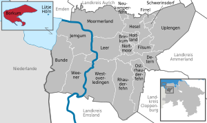
The nearest coast belongs to the Netherlands, there is a direct ferry connection to the local seaport of Eemshaven . On the German side, Emden is the ferry port for Borkum. Since the island is far out in the mouth of the Ems, the ferry time from Emden to Borkum is longer than to any other inhabited German North Sea island, with the exception of Heligoland . It depends on the tides and the direction of travel: In the direction of Borkum, the ferries use the current of the Ems, so they travel downstream and are therefore faster. In contrast to some other North Sea islands, the depth of the fairway in the Outer Ems ensures a connection independent of the tide at all times. The closest community on the German mainland is the Krummhörn in the Aurich district , from Greetsieler Hafen there was also a ferry connection to the island in the past.
Land use
| use | surface |
|---|---|
| Buildings and open spaces | 258 |
| including living space | 122 |
| including commercial and industrial areas | 10 |
| Operating areas | 9 |
| Recreational areas | 31 |
| including green spaces | 22nd |
| Traffic areas | 183 |
| of which streets, paths, squares | 86 |
| Agricultural land | 667 |
| Bodies of water | 162 |
| Forest areas | 56 |
| Areas of other use | 1730 |
| including cemeteries | 2 |
| of it land | 1654 |
| total area | 3097 |
The land use table on the right with data from 2011 shows that 53.4% of the total area of Borkum is “Unland”: This means the numerous dunes on the island. With 667 of 3,097 hectares, the agricultural area only accounts for a share of around 21.5%, which is below average for Germany. The proportion is higher than on any other East Frisian island. This can be attributed to the marshes that have settled in the south of the island , which is protected from storm surges . At almost two percent of the total area (corresponds to 56 hectares), the proportion of forest is higher than on the other East Frisian Islands.
climate
The climate classification of Wladimir Peter Köppen According to Borkum is in the classification Cfb. This classification according to climate zone (C), climate type (Cf) and climate subtype (b) gives Borkum a warm and humid temperate climate with warm summers due to the prevailing cyclonic westerly winds .
As a whole, the Borkum climate is shaped by the Central European west wind zone. The prevailing wind direction is southwest and caused by low pressure areas over Iceland and Greenland . In spring and early summer, the cool North Sea weather hinders the formation of clouds. This means that during this period there is most of the sunshine, while in autumn, when the water temperatures are relatively warm, more cloud formation occurs.
The island of Borkum is located in the area of the temperate, cool summer maritime climate influenced by the Gulf Stream and thus in the direct influence of the North Sea. With small temperature fluctuations, there is high humidity. On average, the temperatures in summer are below and in winter above the values measured on the mainland. The average annual temperature calculated from the values from 2006 to 2015 is 10.2 ° C. The coldest month is February with an average temperature of 3.0 ° C, while August is the warmest month with a monthly high temperature average of 17.5 ° C. The average annual rainfall is around 844 millimeters, with February, March and April being the driest months on average, while August is the wettest month with an average rainfall of 118 mm.
| Borkum | ||||||||||||||||||||||||||||||||||||||||||||||||
|---|---|---|---|---|---|---|---|---|---|---|---|---|---|---|---|---|---|---|---|---|---|---|---|---|---|---|---|---|---|---|---|---|---|---|---|---|---|---|---|---|---|---|---|---|---|---|---|---|
| Climate diagram | ||||||||||||||||||||||||||||||||||||||||||||||||
| ||||||||||||||||||||||||||||||||||||||||||||||||
|
Average monthly temperatures and precipitation for Borkum
Source: Wetterdienst.de: Klima Borkum - Station Borkum-Flugplatz (3 m)
|
||||||||||||||||||||||||||||||||||||||||||||||||||||||||||||||||||||||||||||||||||||||||||||||||||||||||||||||||||||||||||||||||||||||||||||||||||||||
Flora and fauna
Flora and fauna
| Distribution of the biotope types on Borkum | ||
|---|---|---|
| Biotope type | Area (ha) | Surface (%) |
| Rush quarry foredune | 26th | 0.9 |
| Beach grass white dune | 138 | 5.0 |
| Sea buckthorn-elder-coastal bushes | 81 | 2.9 |
| Gray dune grass corridor | 442 | 16.1 |
| Coastal dune heather | 6th | 0.2 |
| Coastal dune bushes | 248 | 9.0 |
| Moist dune valley | 111 | 4.1 |
| Wood of the humid dune valleys | 151 | 5.5 |
| Upper salt marsh | 267 | 9.7 |
| Lower salt marsh | 150 | 5.5 |
| Grassland | 668 | 24.3 |
| Ruderal and semi- ruderal corridor | 6th | 0.2 |
| Unlocated, planted wood (a) | 22nd | 0.8 |
| Settlement areas | 398 | 14.5 |
| Waters | 32 | 1.2 |
| Sum of the biotope area | 2747 | 100.0 |
Borkum has the greatest biodiversity of all East Frisian islands due to its size and the associated landscape diversity. In the dune areas there are all stages of primary dunes (low dunes between the waterline and the higher white dunes) through secondary dunes (white dunes) to tertiary dunes (gray and brown dunes). As on the other East Frisian islands, the typical plants include beach grass on white dunes and sea buckthorn on brown dunes . The gray and brown dunes are partly overgrown with coastal dune bushes and forested mainly in their valleys. The largest forest area is the artificially reforested, about 60 hectare Greune Stee with its moor birches, black alders and willows. The wold dunes are the oldest dunes on the island. They are partly overgrown with heather. Salt marshes and dune transition areas developed on the Ronden Plaat. There are also larger salt marshes east of the island railway embankment and in the southeast of the island. Grassland makes up around 25 percent of the island's area. It is located in four diked and so sweetened areas that were created around 1600 (inland meadows), 1769 (Ostland), 1932 (inland pasture), 1977/1978 (airfield and area around the Tüskendörsee).
So far, 837 fern and flowering plants, 173 different mosses and 142 different lichens have been identified. When it comes to fauna, Borkum is also at the top of the island chain with around 5,000 documented animal species. 27 mammal species live on Borkum, some of which (Hungarian hares, rabbits, roe deer and deer) were released into the wild or unintentionally introduced (hedgehogs, shrews and vole species, brown rats). Few species, especially bat species and the muskrat, have colonized the island independently from the mainland. In addition, 18 freshwater fish species and 120 breeding bird species were found on the island.
Protected areas
Borkum is located in the Lower Saxony Wadden Sea National Park , which has been a UNESCO World Heritage Site since June 26, 2009 . The national park extends from Dollart in the west over the Ems estuary, the East Frisian Islands and the Jade Bay to the Elbe estuary in the east.
With the exception of the settlement and infrastructure areas and the airfield, the island of Borkum is part of the national park. The island is divided into three protection zones.
Large parts of the island, especially in the east, belong to protection zone I (quiet zone), which can only be entered on designated paths all year round. Entry into protection zone II (intermediate zone) is permitted outside the breeding season, but species protection has priority here too. Protection zone III (recreation zone) includes in particular the bathing beach sections in the south, west and north of the island.
history


The East Frisian Islands and thus also Borkum probably originated around the time of the birth of Christ. At first it was simple high sands from which today's islands gradually developed, which were then settled in the course of the Middle Ages. There are no finds from earlier periods to date.
The first archaeological excavation was in 2008 in the area of the old Borkum churchyard, the center of the village until the church was abandoned.
middle Ages
In 1227 and 1270, crusader fleets anchored off the island to wait for better weather. It is unclear whether the island was already inhabited at the time. A population is first mentioned around 1406 in a peace treaty with the Hanseatic League.
From the Cirksena to the Prussians
From 1464 Borkum was under the reign of the Counts of East Friesland . When Groningen had to join the Seven Netherlands in 1594 , the political division into East and West Frisian islands arose. After the death of Prince Carl Edzard , the last male representative of the House of Cirksena , East Frisia, and with it Borkum, fell in 1744 due to the 1694 of Emperor Leopold I , the Elector of Brandenburg Friedrich III., Later King Friedrich I. von Prussia , granted entitlement to the Kingdom of Prussia . After the Peace of Tilsit , Borkum became part of the Kingdom of Holland from 1807 to 1810 and part of the French Empire until 1813 . At that time, a French coastal battery was built to enforce the continental barrier . With the end of the Wars of Liberation in 1813, Borkum fell back to Prussia. As early as 1815, after the Congress of Vienna , the island was assigned to the Kingdom of Hanover . When King George V of Hanover was dethroned after the Peace of Prague in 1866, East Frisia and thus Borkum fell back to Prussia.
At the beginning of the 18th century, the Borkum island population discovered the economic possibilities of whaling for themselves. Every year between 150 and 300 men went out to sea to hunt whales near Greenland and in the Davis Strait . Twelve Borkum captains have been handed down for the year 1747 and about thirty for the year 1782. In addition, the crews, from the twelve-year-old ship's boy to the 70-year-old experienced old man, drove on ships that were mostly on behalf of Dutch, Hamburg , Altona or Emden shipowners. First and foremost, Dutch clients should be mentioned, which is primarily due to the geographical proximity to the neighboring country, but also due to the common language - as in all of western East Frisia, Dutch was the standard language of Borkum at the time.
The outbreak of the Anglo-Dutch Sea War , which lasted from 1780 to 1784 , was a major setback that set the island back economically for decades and plunged large parts of the population into extreme poverty . In 1782 all Borkum Greenlanders were taken prisoner by the British for a year, from which they were released without their ships. In addition, three ships, most of whose crews came from the island, crashed in the same year, so that because of these accidents alone, more than 50 widows and orphans were left without the main breadwinner. The Borkum whaling never recovered from these blows and was finally stopped. Many of the whalers emigrated to Hamburg or Altona, in the hope of being able to continue their profession under their neutral flags.
Connection of the two parts of the island
As a result of the accumulation of sand and silt, the Tüskendör priel narrowed between the two island parts Westland and Ostland from 1830 onwards. In addition, efforts have been made by the local population to accelerate this natural process through bundles of straw and plantings. On the initiative of the responsible government in Hanover, it was finally possible in 1863/1864 to close the gap by building a dam with the help of additional workers from the mainland. This island area "Interwall" was later incorrectly called "Hinterwall".
Development into a seaside resort after 1830
After Norderney had already become a state seaside resort in 1797 and the island subsequently experienced an economic boom, Borkum was the second of the East Frisian islands to follow this trend. At first, guests were still sporadically taken to the island by ferry, mostly from Greetsiel, the official seat of the Greetsiel Office, to which Borkum belonged at the time. In 1843, the steamship company Concordia was founded in Emden , which subsequently started regular ferry operations between the seaport city, Delfzijl , Borkum and Norderney. The island ferrymen with their sailing boats, who are dependent on wind and weather, had little to oppose the steamers, especially in terms of reliability and speed. The sailing ferry connection with Greetsiel was discontinued, since then Emden has been the German ferry port for Borkum. The opening of the Hanoverian Westbahn from Rheine to Emden with connections to Osnabrück and Hanover as well as to Westphalia gave the emerging tourism business additional impetus.
Health reasons led the ornithologist Ferdinand von Droste zu Hülshoff to the island several times between 1863 and 1868. During these recreational stays, he wrote his description of the bird world of Borkum, published in 1869, which he self-published and which made the island and its bird world known beyond the borders of Germany.
Imperial Era and First World War

On June 15, 1888, the Borkumer Kleinbahn and the new port began operations. Only this convenient connection made it possible for Borkum to become a major seaside resort.
In 1900, the Borkum coastal radio station was the first officially operated coastal radio station in the world. It was operated by the Reichspost . The first communication transmission took place between the coastal radio station and the passenger steamer of the North German Lloyd Kaiser Wilhelm der Große . The transmitted sea radio telegrams were transmitted to the radio station on the island of Borkum via the lightship Borkumriff lying off Borkum . Then it was passed on to the mainland network.
In 1902, Borkum was given the status of a sea fortress by Kaiser Wilhelm II because of its exposed location. The island was provided with gun emplacements and bunkers and its own naval railway , the Ostland Railway, was connected to the Borkumer Kleinbahn . The length of the line on the island grew over time to over 40 kilometers, and the main line of the Borkum Kleinbahn was expanded to double-track. It is the only narrow-gauge railway with double-track operation in Lower Saxony.

On January 7, 1918 due to a strong storm and lack of navigational aids stranded five patrol boats of the returning Ems - Flotilla on the Borkumriff. Three of the boats were released, while the mayor Pauli and the Lister Tief remained on the reef. Due to the heavy surf, the Borkum lifeboat Otto Hass was unable to get to the two boats, so that the Dutch motor lifeboat C. N. de Tex was eventually used. Nevertheless, 21 crew members of both boats died. While the wreck of the Lister Tief was later demolished on site, a similar process from Mayor Pauli has not been recorded.
Anti-Semitism on Borkum

Already at an early stage and in the context of bath anti-Semitism , Borkum acquired a special position with the title “Jew-free”. Greeting postcards highlighted the rejection of Jews. In the island guide for Borkum from 1897 one advertised to be "Jew-free". The “Borkumlied” was devised, which was played daily by the spa band and sung by the guests. It says:
“At Borkum's beach only German is valid, the banner is only German. We keep the Germania badge of honor for and for! But whoever approaches you with flat feet, with crooked noses and curly hair, shouldn't enjoy your beach, he has to go out, he has to go! "
Borkum was known as a stronghold of the anti-Semites. There were signs on hotels that read “Jews and dogs are not allowed in here!”, And inside there was a “timetable between Borkum and Jerusalem (return cards are not issued)”. A travel guide published in 1910 about the North Sea baths advised "Israelites" against visiting Borkum, "because otherwise they would have to be prepared to be harassed in the most ruthless manner by the sometimes very anti-Semitic visitors."
In the context of isolated attempts to put a stop to open anti-Semitism, the district government in Aurich banned the playing of the “Borkumlied” in 1924. Police were used to enforce this ban. But the district court of Emden and then also the Prussian Higher Administrative Court lifted the gambling ban. Since the police ban was directed against the spa orchestra and the melody also served as the basis for other texts, the instrumental playing of the song does not entail any responsibility for the content of the Borkum song.
Weimar Republic

The Borkumlied was also played during this time, which now read, among other things:
"Borkum, the North Sea's most beautiful ornament, stay clear of Jews, leave Rosenthal and Levinsohn in Norderney alone."
While the Borkum song mainly used anti-Semitic clichés before the First World War without directly mentioning Jews, the versions now became more direct and openly incited against Jews and proclaimed Borkum to be “free of Jews”. With the openly displayed anti-Semitism, Borkum won "nationalist" guests and used racial baiting in the competition against the seaside resort of Norderney . Anti-Semitic incidents increased when, from 1920 onwards, the "Borkum pastor" and later "Reich speaker of the NSDAP" Ludwig Münchmeyer made aggressive hate speech.
In the course of the Prussian district reform in 1932, the island of Borkum was spun off from the dissolved district of Emden on October 1, 1932 . Considerations to annex the island to the district of Leer or the district of Norden ended with the connection to Leer. The decisive factor for this was that the connection from Borkum by ship to Emden and then by train to the district towns spoke in favor of Leer, which is a little closer. Borkum and Lütje Hörn are the only islands in the Leer district, which otherwise only consists of mainland communities and also has little coastline.
National Socialism and World War II
On 19./20. December 1934 two copies of the A2 rocket, called "Max" and "Moritz", were launched near the Ostbake. The liquid rocket engines developed by rocket pioneer Wernher von Braun were the first in the world to reach a height of over two kilometers and lay the foundation for the later large rockets. After the successful Borkum tests, German rocket research was continued in Peenemünde .

On August 4, 1944, an American bomber of the type Boeing B 17 G ("Flying Fortress") of the 486th Bombardment Group had to make an emergency landing on the north beach of Borkum. The seven US crew members remaining on board were captured immediately after the successful emergency landing . Contrary to the international agreement on the treatment of prisoners of war in captivity, the US soldiers were initially badly mistreated and then murdered by an army soldier who happened to be present on Borkum (see: Air Murders (Borkum) ). The German guards of the US soldiers did not help the prisoners of war under their care. In early 1946, 15 people involved were tried in Ludwigsburg and several death sentences and prison sentences were imposed. On August 4, 2003, an additional memorial stone in memory of the seven killed members of the bomber crew was unveiled on the square with the war memorial for the fallen soldiers of the First and Second World Wars on the island of Borkum.
After 1945


After the end of the war, the Allied occupation troops razed the numerous bunkers on the island, which gave the islanders, who were now mostly without a living, the opportunity to exploit the raw materials in the bunkers. They laboriously removed the reinforcements from the reinforced concrete and the copper from communication lines, and the gravel from the access roads was also removed and brought to the mainland. Remnants of these bunkers were still visible more than ten years after the end of the war and were only removed later.
After the Second World War, the Netherlands sought the entire Ems estuary including the island of Borkum as war compensation . The port of Emden was to be dried out in the course of this annexation. The plans failed because of the Western Allies who, in the face of the strengthening Soviet Union, did not want to weaken West Germany any further.
On March 28, 1946, the newly appointed municipal council of the island spoke out in favor of reversing the incorporation of Borkum into the district of Leer in 1932. The distance between the island and the district town of Leer is too great, the visit to the district building in Leer is a matter of two days for the Borkumers: by ship to Emden and from there by train to Leer and back the next day. Rather, the island should be attached to the city of Emden, its ferry port. The wish met with open ears in Emden. Concerns under local law about incorporating a municipality into a district town were answered in Emden to the effect that the administration would be reformed after the war anyway and thus a municipality could also become part of an independent town. The Leeraner district council, however, spoke out against the wishes of the Borkumers with a narrow majority. The island has therefore remained part of the district of Leer and has belonged to the then newly founded state of Lower Saxony since 1946 . The municipality of Borkum received its town charter in 1954.
Since the island suffered very little damage during the war, Borkum took in many people who were expelled from the east after 1945. In 1946, 1,093 of the total of 6,120 inhabitants (17.9%) were refugees. The number grew significantly until 1950: At that time, 1,404 of the 6,215 inhabitants were refugees, the rate rose to 22.6%. A special feature of Borkum was the high proportion of Catholic refugees, most of whom came from Silesia . On Borkum, the number of Catholic refugees exceeded that of Protestant refugees by six times. This concentration probably goes back to the actions of the refugee pastor Leo Christoph in Aurich , who wanted to concentrate the Catholic refugees in the strongly Protestant diaspora East Friesland in as few places as possible in order to guarantee pastoral care. This was often not possible in other regions of East Frisia due to their remote traffic.
The first bathers came back to the island in 1947. As everywhere in Germany before the currency reform in 1948, they did not pay for their stay in cash, but in kind : "For potatoes or vegetables, meat or eggs, there are vacation days in the fresh sea air."
From 1958 the island was again the location of the navy: two years after the establishment of the Bundeswehr , the first units moved to the newly built naval base in Borkum . Most of the units belonged to the amphibious group . As the last unit, the seamanship training group withdrew in 1996, since then Borkum has only been a small naval location. But the helipad, which the Naval Aviation Squadron 5, based in Nordholz, operates on the remaining naval site, is still used for SAR operations.
Population development
In the 18th century, the population of Borkum increased continuously, as whaling brought prosperity to many Borkumers. In the 19th century, whaling initially subsided and was finally stopped due to the Dutch-English naval war . As a result, poverty set in on the island and many residents left their homes. The population reached a low of 406 around 1811. After Borkum became a seaside resort, the number of inhabitants rose again from 1850. The population reached a peak of 8,495 in 1975. The sharp decline between 1980 and 1990 can be explained by the different counting methods, especially for second home owners.
| year | 1821 | 1848 | 1871 | 1885 | 1905 | 1925 | 1933 | 1939 | 1946 | 1950 | 1956 | 1961 | 1970 | 1980 | 1990 | 2000 | 2005 | 2010 | 2015 |
|---|---|---|---|---|---|---|---|---|---|---|---|---|---|---|---|---|---|---|---|
| population | 485 | 421 | 573 | 898 | 2258 | 4950 | 3977 | 5499 | 5976 | 6215 | 5199 | 5784 | 6051 | 8185 | 5714 | 5650 | 5513 | 5158 | 5473 |
| source |
Development of the community name
The island name appears for the first time in Strabo (* about 63 BC; † after 23 AD). In his geography he names an indefinite number of islands off the East Frisian coast, one of which is called Byrchanis . Pliny the Elder mentions in his Naturalis historia , created around 77 AD, islands off the North Sea coast and among the best known ("insulae nobilissimae") Burcana , although nothing is known about their exact location. Modern research associates it with the island of Bant, which was lost around 1743 .
The name of today's island was first mentioned in 1227 as Borkna , then in 1398 as Borkyn , and the name Borkum has been in use since 1554 . The name probably developed from the Old Norse burkn for bracken (cf. Icelandic : Burkni = blackberry bushes), to which the ending -um for home was added later .
Religions

Under the political and cultural influence of the Netherlands since the Reformation, the population of Borkum was predominantly Protestant reformed . The first Protestant church was built in 1550. Unlike on the mainland, the sovereign right of patronage applied on the island . Today's Reformed Church in neo -Gothic style dates from 1896/1897 and can accommodate 800 visitors. Concerts on the Schuke organ take place regularly . It is the only reformed island church in East Frisia. The congregation has around 1800 members and belongs to the Synodal Association of Northern East Friesland within the Evangelical Reformed Church .
It was not until the spa tourism that began in the 19th century that Evangelical Lutheran and Catholic population groups moved in. The Evangelical Lutheran population was initially looked after by the local Reformed pastor. The Evangelical Lutheran Christ Church Congregation was only founded on October 1, 1903, and set up the first parish office in 1908 and completed the Christ Church in 1899 after just eleven weeks of construction . About 1200 members belong to the community, which is part of the Lutheran church district Emden-Leer within the Evangelical Lutheran regional church of Hanover .
In addition to the two Protestant parishes, there is the Roman Catholic Church. Maria Meeresstern was built as a neo-Gothic chapel from 1880 to 1882, but underwent three extensions so that it now has 450 seats. The congregation has around 800 members and has formed a parish community with the “Christ König” congregation in Emden since 2014, which belongs to the Deanery of East Friesland in the Diocese of Osnabrück .
The three congregations cultivate an active ecumenical movement .
There are also on Borkum an Apostolic Church , the 1976 inaugurated the Kingdom Hall of Jehovah's Witnesses and a meeting room of the Brethren movement .
- Church and community assembly building on Borkum

Ev.-luth. church

Catholic Church

New Apostolic Church

Assembly room of the Brethren Movement

Kingdom Hall of Jehovah's Witnesses


politics
City council
The council of the city of Borkum consists of 16 council women and councilors. This is the specified number for a city with a population between 5001 and 6000 inhabitants. The 16 council members are elected by local elections for five years each. The current term of office began on November 1, 2016 and ends on October 31, 2021.

| Diagram showing the election results and the distribution of seats | |
|---|---|
|
Result of the local election on September 11, 2016
A total of 16 seats
|
|
The full-time mayor Jürgen Akkermann is also entitled to vote in the city council.
mayor
From July 1, 2005, Kristin Mahlitz (SPD) was the first full-time mayor of the city of Borkum. Born in Wilhelmshaven, she was elected until October 31, 2011 and did not run again. In the mayoral election on September 11, 2011, the independent candidate Georg Lübben sat down with 52.5% of all votes against his competitors Derk-Michels Steemann (37.2%), Susanne Kaminski (8.8%) and Katharina Mareike Neumann (1 , 5%). A new election was held on September 8, 2019, Mayor Georg Lübben did not run again, Jürgen Tönjes Akkermann (independent) won the election with 54.5 percent of the vote. SPD candidate Markus Stanggassinger came to 23.5 percent, individual applicant Derk Michels Steemann to 21.4 percent.
Representatives in the Land and Bundestag
Borkum belongs to the state constituency of Leer / Borkum . 15 parties ran for the state elections in Lower Saxony in 2017 . Five of them had put up direct candidates. The directly elected MP is Johanne Modder ( SPD ).
Borkum belongs to the Bundestag constituency Unterems (constituency 25), which consists of the district of Leer and the northern part of the district of Emsland. The constituency was redesigned for the 1980 federal election and has remained unchanged since then. So far, only representatives of the CDU have prevailed as direct candidates in this constituency. The constituency is represented in the Bundestag by the directly elected CDU MP Gitta Connemann from Leer. Markus Paschke (SPD) also moved from the constituency to the Bundestag via the parties' list .
Coat of arms, city flag and official seal
|
|
Blazon : "Split of green and silver, and with a golden thread board provided; in front, one above the other, two silver whales, behind, on blue and silver waves, a red lighthouse; A golden banner with the words "MEDIIS TRANQUILLUS IN UNDIS" in black capital letters is arched above the shield. This Latin motto is taken from the old church seal of Borkum and translates as: calm in the midst of the waves . " |
| Reasons for the coat of arms: The coat of arms was awarded in 1951. The whales are supposed to symbolize the earlier important catch of the animals. The lighthouse goes back to an old church seal that was included in the Borkum flag. The colors are taken from the city flag, which was set 20 years before the coat of arms. |

The flag shows a white bar cross in green, the arms of which are 3/13 the width of the flag's height. In the Gösch there are three horizontal stripes in the East Frisian colors black-red-blue, on the intersection of the cross arms the old church seal in a simplified version. It shows a circular blue disk with a diameter of about half the height of the flag, on it a red lighthouse, from which yellow light beams emanate on both sides. The tower stands on a floating green hill with white wavy beams underneath. The sentence MEDIIS TRANQUILLUS IN UNDIS on a wide white edge of the disc in black . The flag was set on September 28, 1929 and was first hoisted on Borkumer Strand on July 31, 1930. The teacher Jakob Everts Teerling designed it. The green color of the cloth symbolizes the "Green Island", as Borkum was still called around 1930. The white cross indicates the purity of the white beach and the healthy air. The official seal contains the coat of arms and the signature: City of Borkum - District of Leer .
Partner municipality
Borkum has had a town partnership with the Dutch municipality of Warffum (part of Eemsmond , merged to Het Hogeland in 2019 ) since 1989 . However, contacts have existed since 1985. Since then, several mutual visits by delegations have taken place. Community representatives finally sealed the cooperation in November 1989 halfway between Eemshaven and Borkum during a trip on the lightship “ Borkumriff ” by signing the partnership document. The connection is mainly maintained by sports clubs, dance groups and the volunteer fire brigades.
Culture and sights
On Borkum, like on the neighboring West Frisian Islands Texel , Vlieland , Terschelling , Ameland and Schiermonnikoog , some age-old traditions have been preserved that are believed to go back to pre-Christian times. While these have often turned into tourist attractions on the other North Sea islands, a large part of the customs on the islands mentioned could be shielded from external influences. This is attributed to the islands' isolation from the outside world for centuries.
Regular events


The traditional customs of the island include the Osterfür or Paaskefür on the evening before Easter Sunday , the setting up of the May boom on the evening before Pentecost Sunday on the square on Süderstraße and -pfad by members of the Borkumer Jungens association with the traditional costume group dancing and Klaasohm on the evening before Nicholas .
The custom of going to the Paaskedelle (= Easter meadow) at Easter to play with Easter eggs is probably of pre-Christian origin. When Kullern and spin it, the goal is to let the eggs as long as possible undamaged. Another Easter custom is the burning of winter, symbolized by a straw doll.
On the Saturday before Pentecost, the Pinkster Festival is celebrated in Borkum, on which (unlike elsewhere in East Friesland on the night of May 1st) the May or Pentecost tree is set up. In its original form it was "a mast with wide-spreading yards [and] equipped with all sorts of other ship accessories, but it lacked any greenery, since in earlier times there were no or only a few trees on the island". In the meantime, however, it has been decorated with green branches and has since looked like a mast with a flared sail. Traditionally, a basket with a stolen rooster is attached to the tree , which is said to predict a fruitful summer for the islanders with its crows at sunrise.
Especially the St. Nicholas custom on Borkum differs greatly from that on the mainland traditions. On the night of December 5th to 6th, the island of Klaasohm (= Ohm (uncle) Klaas (Klaus)) celebrates. A custom that probably dates back to the time of the whalers. During the night, six young men disguised as Klaasohm from the Borkumer Jungens association - two small, medium and large as well as another in the role of Wiefke , who accompanies the great Klaasohm - walk around the island. The Klaasohms wear barrel-shaped helmets up to one meter high, covered with sheepskin, and pasted with feathers and gull wings. After the Klaasohms of the three groups have been dressed in different places, they move with their companions to the large operating hall of the Borkumer Kleinbahn amid great noise . A stage has been set up there, on which women and strangers are excluded (only men born in Borkum are allowed in) in ritualized battles to decide who will take the lead this year. The defined roles will not be changed until the end of the festival. Then the train across the island begins, with great sympathy from the population. The parade traditionally ends in the center of the village, on a square named after D , which is the center of an intersection. On this square there is an advertising pillar , from the flat top of which all “Klaasohms” and finally “Wiefke” rush into the crowd below, where they are always caught by many poor people. Before jumping into the crowd, the individual Klaasohms and mostly Wiefke are celebrated by the audience.
The more recent events include swimming , with which the local DLRG opens the bathing season on the last Saturday in April, the cross-island jazz festival at Whitsun, the kite festival in August, the Borkumer Meilenlauf on the first weekend of September and the Borkumer Bluesnight at the end of the year.
greeting
Young people from Borkum greet each other by shouting “Öy”. The conventional greeting is Moin, which is independent of the time of day . The simple Öy is also used on the other East Frisian islands.
Sights and buildings


Due to its location in the Ems estuary have been early on Borkum navigational aids to mark the Ems fairway built. There are three lighthouses and other direction finding facilities on the island.
The old lighthouse was built in 1576 . This makes it the oldest building on the island and its landmark. The 45 meter high, rectangular tower was built on the foundations of the old Borkum church tower and initially only served as a day stamp. It was not until 1817 that the “old lighthouse” received a light source that was operated with the help of parabolic mirrors and 27 oil lamps. In February 1879, the lighthouse's beacon was destroyed by a fire in the tower. Thanks to its solid construction, the tower could be preserved and served as a lookout tower until it had to be closed around 2016 due to a lack of fire protection.
The New Borkum Lighthouse is located on the west side of the island and was built in 1879 in a record time of only six months after the old lighthouse burned. The still active lighthouse has been used for orientation in front of the Ems estuary since November 15, 1879. At the same time, since October 1, 1891, the lighthouse has had a cross- branding light with the name Westerems , which indicates a change of course for the ships sailing in the Außenems from the Westerems fairway to Randzelgat . Around 1.5 million black-brown bricks were used to build the 60.3-meter-high round tower. 319 steps lead to the top. When the lighthouse was commissioned, it was fitted with a three-meter high rotating lens lamp. After a retrofit in 2004, it has six large lens fields that generate three pairs of beams with a light intensity of 2 million candelas per beam. The nominal range is 24.4 nautical miles (= 40 kilometers). Despite the impressive values, the beacon is only operated with a single 400 watt metal halide lamp. The lighthouse is open daily during the season and can be visited.
Next to the New Lighthouse is the Berlin Wall Memorial with the inscription Berlin 1961 - 1989 . The date of installation is unknown, but there are photos from Willy Brandt's visit on August 4, 1965 with the wall in the background.
The small lighthouse Borkum on the south beach is the third lighthouse on Borkum and was built in 1888/1889 as a beacon for the two approach waters of the Ems, Hubertgat and Westerems. The red and white lighthouse was created as a prototype of a series of nine prefabricated lighthouses built in Germany, is composed of individual, 27 millimeter thick segments made of cast iron , so-called tubbing, and is 27.9 meters high. It was nicknamed "the electric one" because it was the first lighthouse in Germany to be built for electric operation. Since 1970 it has served as an antenna carrier for the Ems traffic safety system, which is operated in German-Dutch cooperation. It was decommissioned in the summer of 2003 because the fairway in the area of the Ems estuary had changed due to sediment shifting.
The dune cross-brand fire is located about 220 meters from the small lighthouse . It was added in 1928 as a supplement to other Leitt
Three more direction finding devices for shipping were built in 1872 after the Franco-Prussian War . The Große Kaap and the Kleine Kaap or Westkaap are located on the Westland and are historical beacons made of red clinker bricks with wooden top marks . They are 23.4 meters and 11.7 meters high. The beacons had to be controlled in a three-point procedure, so that the Osterems control buoy had to be on the "Großes Kaap - Alter Leuchtturm" line and the Westerems control buoy on the "Kleines Kaap - Alter Leuchtturm" line. At the northeast end of the island there is another stone beacon, the Ostbake , on a 7.5 meter high dune in the Ostland dunes and is 19 meters high.
There are three churches on the island, all of which were built between 1882 and 1899. The Catholic Church Maria Meeresstern is a neo-Gothic brick hall church with a transept, which was completed in 1882 and expanded in 1905, 1954 and 1987/1988. The long sides with large ogival windows are structured by buttresses and the gables are decorated with panels . The building is dominated by a high octagonal bell tower. The Reformed Church (1896/97) already shows features of Art Nouveau , especially in the window design. In 1973 Karl Schuke created the organ with 18 voices behind a seven-axis prospect . In accordance with Reformed tradition, the interior is oriented towards the pulpit. In front is a votive ship donated in 1781 . The Lutheran Christ Church from 1899 is a one-room hall with arched stained glass windows and a flat gable roof. In 1958, a church tower was built across the nave, with small windows at the bottom and the arched arcades at the top. In 1980 Rudolf Janke built an organ with 16 registers on the west gallery .
In 1886 the Achilleion was built on private property on Süderstraße . The client was the physician Alexander Freiherr von Exterde, who planted a large number of different conifers on the walled garden area. In 1909 the property was sold and named after the Greek country estate Achilleion by its new owners . In the 1930s and in the post-war period until 1967, the municipal kindergarten was housed in the Achilleion. The property is now privately owned again. The listed Hotel Bodeewes dates from 1892.
The Emmich memorial for General of the Infantry Otto von Emmich, who died in 1915, has been in the interior of the island since 1917 .
The former lightship Borkumriff has been in the Borkum protective harbor since 1989 . It was decommissioned on July 15, 1988 as the last German lightship and has since served as an information facility for the Lower Saxony Wadden Sea National Park . The technical support for the national park ship is provided by the Borkumriff development association . The ship is open to visitors all year round.
The local history museum Dykhus (= dyke house) is in the immediate vicinity of the old lighthouse. Access to the museum through a gate by two tall pillars jaws of Wales is formed. The whale bones are reminiscent of the earlier tradition of the Borkum people as whalers. The museum shows various departments and rooms in which the varied and interesting history of Borkum is exhibited in numerous exhibits. The museum is looked after and operated by the Heimatverein der Insel Borkum eV .

On Borkum, fences made of whaled whale bones are evidence of whaling. The former house of Roelof Gerritz Meyer, the most successful whaling captain from Borkum, is located on Wilhelm-Bakker-Strasse. His property is surrounded by a fence made of whale innladen, which he brought from his whaling trips in 1715–1782. The remains are slowly weathering, which is why the Borkumer Heimatverein has been campaigning for the preservation of the jaws for several years.
Since 2009 a memorial has been commemorating the Drinkeldodenkarkhoff , a former cemetery for the homeless .
In the buildings of the former naval seamanship teaching group of the German Armed Forces , which until the 1990s was an important naval base and largest employer on the island, the German Youth Hostel Association has been operating the youth hostel "Am Wattenmeer" with 770 beds since October 1996 . With an area of around 20 hectares, it is the largest of its kind in Europe.
When it was inaugurated, the Gezeitenland swimming pool was the largest seawater wave indoor pool in Europe. Since its renovation and reopening in summer 2005, it has been used as a modern “ leisure pool ”. Since then there is no longer a wave function.
Germany's most north-westerly land point is located on the beach promenade between the Nordbad and the Jugendbad. It is marked by a symbolic border post and provided with information boards.
Sports
The Turn- und Sportverein Borkum von 1890 eV (TuS Borkum) is the largest club on the island with almost 800 members. The club operates 17 different sports departments. What sets it apart is that TuS Borkum is also the operator of sports holiday facilities. Organizationally, the club (like other sports clubs on the island) is affiliated with the Stadtsportbund Emden and not the Kreisportbund Leer for geographical reasons. The footballers, for example, are represented in the football district of Emden.
Economy and Infrastructure
During the Hanseatic era, the island was considered a pirate refuge . It is said in the literature of the famous pirate Klaus Störtebeker that he buried a treasure south of the island. The islanders were in constant dispute with the Counts of East Friesland over the payment of shares in beach goods , which at that time represented almost the Borkum's only source of income.
In the 18th century, whaling brought a certain wealth to many Borkumers, most of whom were successful captains and harpooners on Dutch whaling ships. Many street names on Borkum, but also fences made from whale pine (the most imposing “whale fence” includes the former house of Roelof Gerritsz Meyer, who with his team killed around 270 whales on 42 trips) and similar relics bear witness to this time. In the 18th century, however, whaling initially subsided and was finally stopped due to the Anglo-Dutch naval war . As a result, poverty set in on the island and many residents left their homes. The population reached a low of around 400 people around 1811.
military
From the beginning of the 20th century, Borkum was an important military base . In 1902 the island received the status of a sea fortress. The Navy also expanded the scope of the Borkumer Kleinbahn with several cross connections on the island for its material transport. In 1934 Wernher von Braun began with rocket tests on Borkum, which were later continued in Peenemünde .
In 1957, the newly founded German Navy established the Borkum naval base , which in the next few years was mainly home to landing craft . There were also several land troops in the Navy, including the seamanship teaching group from 1969. As a result, numerous jobs were created in the armed forces, which made up over 20 percent of the island's permanent employment contracts subject to social insurance. In 1996 the seamanship teaching group was dissolved and all jobs in the German Navy were lost. The military training tasks were mainly relocated to Stralsund ; Many Bundeswehr members from Borkum also moved there .
tourism


After the brief interlude of Napoleonic rule in the period from 1810 to 1813, the first holidaymakers came to the island from 1834, mainly wealthy citizens from Emden . Ten years later, in 1844, the first bathing facilities were built and tourism was discovered as a source of income. Since then, the number of tourists who choose Borkum as a holiday, recreation and spa destination has risen continuously. While only 252 visitors were counted in 1850, when the registration of holidaymakers began, well over 200,000 people came by the end of the 20th century.
During the Second World War there were restrictions for those seeking relaxation, as the island on the north-west German border had an important military and strategic importance. After the end of the war, numerous legacies had to be removed. Old bunkers prevented the use of the sandy beach for decades. The removal was associated with considerable costs. Due to its location on a main shipping route and its size, the island was attractive to many holidaymakers, especially from the Ruhr area, despite the long journey. The climatic conditions allowed the operation of spa facilities , which significantly strengthened the island's economic power. In 2018, 311,786 vacationers came, and 2,565,570 overnight stays were counted. On average, the guests spent 8.23 days on the island.
In 2009, after an extensive risk assessment by the International Life Saving Federation , the city of Borkum received the banner “ Lifeguarded Beach / Bewachter Badestrand ” for its four bathing beaches. The island is the first municipality on the German North Sea coast to be awarded this certificate.
Borkum has joined the marketing organization " The North Sea " in Schortens for the tourist marketing of the island . The company represents the seven East Frisian Islands and 15 coastal towns in Lower Saxony. It is responsible for joint press work, marketing, holding trade fairs and events, creating print media and classifying private holiday accommodation.
media

The Borkumer Zeitung , a small, traditional daily newspaper , appears on Borkum . The supraregional cover pages are supplied by the Nordwest-Zeitung , which appears in Oldenburg . Other media on the island are the Borkum Aktuell magazine , which appears eleven times a year, and the Burkana magazine, which appears six times a year . Borkum is also in the circulation area of the only regionally published daily newspaper in East Friesland, the Ostfriesen-Zeitung . Due to the traffic connection to Emden, the Emder newspaper is also of interest. It also reports on important matters on the island and is therefore also read on Borkum.
On June 14, 2012, the Inselradio Borkum IRaBo went on air. In addition to music and hourly news, it provides information about the weather, tides and events on the island.
Healthcare
The island has six specialist clinics and one hospital. The Inselkrankenhaus Borkum is one of the four hospitals in the district of Leer.
With 301 beds, the Borkum specialist clinic is the island's largest specialist rehabilitation clinic. She has one clinic for adults and one for children and parents. Specialized indications are allergology , dermatology , pediatrics and pulmonology .
The Knappschafts-Klinik Borkum is a rehabilitation facility with 150 beds. It is run by the Deutsche Rentenversicherung Knappschaft-Bahn-See . The diseases treated belong to the areas of internal medicine , gynecology - oncology and allergology - dermatology .
The Nordseeklinik Borkum is a rehabilitation clinic with 185 single rooms. It is run by the Deutsche Rentenversicherung Rheinland. Specialist focuses are internal medicine-pneumology and psychosomatics - indications .
The Borkum Clinic Borkum Riff Rehabilitation Center is a rehabilitation clinic with 190 beds. Specialist indications are dermatology and internal pulmonology . It is run by the German Federal Pension Insurance .
There is also the specialist clinic “Helena am Meer” and the mother-child specialist clinic “Sancta Maria”.
The Inselkrankenhaus Borkum is a plan hospital with a specialist department for internal medicine. There are eight beds set up. The owner is the Klinikum Leer gGmbH.
Children's and youth institutions and schools
The "Börkumer Kinnertune" is the kindergarten on the island of Borkum, and there is also the "Lüttje Kanuetjes" association for children from Borkum. The youth center is the contact person for the fire brigade for young people.
The elementary school is in close proximity to the old lighthouse and the Inselschule Borkum, as a high school with a high school offer and support center can be found in Upholmstraße. The only independent vocational school on a German North Sea island are the Borkum vocational schools (BBS Borkum) in Deichstrasse. It provides training in a total of 16 commercial and manual professions.
traffic
In addition to air traffic, there are national traffic connections by train and ship. Buses, long-distance and local trains run between the Emden Außenhafen train station , which is right next to the ferry terminal in Emden, and the main train station in Emden . There is also a ship connection to and from Eemshaven in the Netherlands. Through the connection to the Intercity network in Emden and the use of fast catamarans , the travel time to Borkum has been shortened significantly over time. The actual travel time between Bremen and Borkum is now only three hours.
Shipping


There is an international shipping route north of the island . Accordingly, ships of different sizes can be observed from the island.
The traffic to the Lower Saxony mainland to Emden outer harbor takes place via car ferries . The journey time is around two hours. There are also catamarans as pure passenger ferries that cover the same distance in about an hour. At Emden Außenhafen train station , the ferries connect to trains via Emden Hbf in the direction of Rheine or Bremen . Eemshaven in the Netherlands is also served by car ferries; there are connecting trains to Groningen from the Eemshaven train station there opposite the terminal .
All these trips are carried out by the shipping company AG Ems . The timetables are independent of the tide , which means that the departure times are not influenced by the water level (although the duration of the trip and thus the arrival times do). In addition, there are several ships on Borkum that are used for excursions, for example to the neighboring islands. The largest is the coat of arms of Borkum .
The Emslotsen of the Lotsenbrüderschaft Emden operate a pilot station on Borkum, from which they are used for piloting tasks with the Frya and Fresena pilot boats on the Außenems .
Motor vehicle traffic
Apart from Norderney, the island is the only East Frisian island on which private vehicles can be driven. However, private motor vehicle traffic is heavily regulated during the summer season. For this purpose, two zones have been set up in the town: The town center as a red zone is completely closed to private car traffic. The rest of the area may not be used with private vehicles between 9 p.m. and 7 a.m.
Rail and bus transport


The seven-kilometer-long, mostly double-track island railway line with a gauge of 900 millimeters was completed in 1888 and connects the place with the stations “Borkum” and “Jakob-van-Dyken-Weg” with the station “Borkum-Reede” at the ferry terminal. It is the only still operating double-track narrow - gauge railway in Lower Saxony. In addition to the "main line" mentioned, there was a more extensive network of railways at times, which functioned as a naval railway and established a connection with various fortifications. This also included the Ostlandbahn , the first meters of which can still be seen at the city station, and which led into the so-called Ostland.
In the 1970s, the small train got into economic turbulence, but its importance increased as a result of the ever-increasing tourism so that in the 1990s numerous new acquisitions were made for the fleet. The Borkumer Kleinbahn has four locomotives with combustion engines that run on rapeseed oil . In addition, there is a bus service almost parallel to the small train route, with non-timed trips offered approximately every hour. Some buses run to the Ostland district .
air traffic
East of the city is the Borkum airfield , which is served by scheduled and charter flights from Emden and Hamburg, for example. The flight time from Emden is around 15 minutes. The airport is also used by private planes.
Rescue station of the DGzRS
.JPG)
The German Society for Rescue of Shipwrecked People (DGzRS) has been present on Borkum with a rescue station for sea rescue since 1868 . After the ALFRIED KRUPP was decommissioned , the HAMBURG has been lying on Bridge II in the protective harbor since April 2020 . It is the new construction of a rescue cruiser of the current 28-meter class .
power supply

To cover its own energy needs, Borkum obtains electricity, gas and fuel from the mainland. The connection to the power grid to the mainland takes place via three 24 km long submarine cables in a transformer station near the youth hostel. In charge of the distribution are the Stadtwerke Borkum , an own establishment of the city of Borkum. For the supply of natural gas which is EWE Netz responsible. The energy consumption amounted in 2017 to 170 GWh , of which 30 GWh of electricity and 140 GWh of gas.
In 2030, Borkum wants to be an island with as few emissions as possible and climate neutrality is the goal.
Two Enercon E-66 wind turbines were built at the port in 2002. They are operated by the Borkum and Münster municipal utilities and generate around 6.8 million kilowatt hours. The towers have graduated blue rings above the foundation. On land, the rings at Enercon are usually green.
A photovoltaic open space system with an output of approx. 1.4 MW p went into operation in 2011.
The Riffgat offshore wind farm with 30 wind turbines is located around 15 kilometers northwest of Borkum and can be seen on the horizon from the island. The wind farm went into operation in 2014 and feeds the electricity into Emden.
The project development company wpd is building a new operations management center with residential quarters for over 100 offshore service employees in the port, planned by the architects Delugan Meissl .
Coast station

On the initiative and at the expense of North German Lloyd , radio technology was used commercially on Borkum for the first time in Germany and thus worldwide . The Borkum coastal radio station, which was put into operation on May 15, 1900, consisted of a wireless connection between the lightship Borkumriff and the small lighthouse on Borkum. The transmission and its wired forwarding to Bremerhaven was used to report sighted Lloyd ships in order to be able to estimate their arrival in the port of destination more precisely.
The small lighthouse Borkum was converted into a radar station in 1966. The transmitter mast next to the lighthouse serves as a radio link for transmitting the radar data to the Ems traffic control center in Emden .
particularities
On Borkum, as on other holiday islands in the North Sea, different holiday times apply. The summer vacation has been shortened to four weeks and the autumn vacation has been extended to four weeks. The reason for this special regulation is to relieve the parents of school-age children who work in tourism by taking shorter vacations in the high season.
Personalities
Honorary citizen
The honorary citizenship is the highest honor of the city of Borkum. The city has awarded ten people:
- Georg Koehler (Hotelier)
- Franz Habich senior (engineer)
- AC Meyer (benefactor)
- Paul von Hindenburg (October 2, 1847 - August 2, 1934), Field Marshal General and President of the Reich
- Tönjes Kieviet (community leader)
- Wilhelm Feldhoff (benefactor)
- Berend de Vries (born December 31, 1883 - † November 25, 1959), writer, Cross of Merit on Ribbon (1958), conferred honorary citizenship in 1958
- Rudolf Bensch (doctor)
- Fritz Klennert (Mayor)
Sons and daughters of the island
The following people were born on the island of Borkum:
- August Dierks (born May 19, 1899 - March 16, 1983), Managing Director of the Bremerhaven Chamber of Commerce and Industry
- Enno Heyken (born February 17, 1906, † October 19, 1987), German Lutheran clergyman and regional historian
- Wolfgang Ontijd (born March 8, 1937), German politician ( CDU )
- Hermann Janßen (born October 23, 1937), from 1974 to 2000 spa director of Titisee-Neustadt
literature
- Frank Bajohr : “Our hotel is free of Jews”. Baths anti-Semitism in the 19th and 20th centuries . Fischer, Frankfurt am Main 2003, ISBN 3-596-15796-X .
- Klaus Barthelmess: The whale bones of the North Sea island of Borkum: On the cultural history of the important monuments from the heyday of European Arctic whale fishing with considerations on their conservation . Verlag Books on Demand, Norderstedt 2008, ISBN 978-3-8370-2625-2 .
- Ferdinand von Droste zu Hülshoff : The bird world on the North Sea island of Borkum . (Reprint of the original edition from 1869), Verlag Schuster, Leer 1974, ISBN 3-7963-0054-5 .
- Karl Herquet : “The island of Borkum” from a cultural and historical perspective . (Reprint of the original edition from 1886), Verlag Schuster, Leer 1974, ISBN 3-7963-0096-0 .
- B. Huismann: The North Sea island of Borkum then and now . (Reprint of the original edition from 1897), Verlag Schuster, Leer 1979, ISBN 3-7963-0174-6 .
- Friedrich-Wilhelm Schaer: The economic and social structure of the East Frisian island population before the boom in the bathing industry in the 19th century . In: Emder Jahrbuch , Volume 63/64 (1984), pp. 74-118.
- Burghart Schmidt : The East Frisian Islands at the beginning of the 19th century. A French military report on the strategic location, geography, demography, economy and social structure in the context of the Napoleonic continental barrier . In: Emder Jahrbuch , Volume 78 (1998), pp. 188-231.
- Jan Schröter : Borkum. Edition Temmen, Bremen 1995, ISBN 978-3-86108-416-7 .
- Hans Peter Wegmann: Borkum: history of the island, shipping and sea, animals and plants . Self-published by Wegmann, Borkum 1991, without ISBN.
Web links
- Borkum - North Sea island with an offshore climate. Business operations of the city of NSHB Borkum GmbH, accessed on September 27, 2013 .
- Tide forecast for Borkum, Südstrand. Federal Maritime and Hydrographic Agency, December 17, 2012, accessed on September 27, 2013 .
- The lighthouse on the island of Borkum. Lower Saxony State Archives, accessed on September 27, 2013 .
Individual evidence
- ↑ State Office for Statistics Lower Saxony, LSN-Online regional database, Table 12411: Update of the population, as of December 31, 2019 ( help ).
- ^ Health resorts on Borkum
- ↑ Tourism on the East Frisian Islands (information from the spa administrations). (PDF) IHK Emden, June 17, 2019, accessed on November 19, 2019 .
- ↑ Volker Ullrich: When Borkum was “judenrein”. Die Zeit, June 5, 2003, accessed on August 29, 2018 .
- ↑ a b c d e f g Claudia Thorenmeier: Borkum's treasures of nature. ISBN 978-3-9812209-3-3
- ↑ wsa-emden.de
- ↑ a b Johannes Walter: The East Frisian Islands, seminar on the regional geography of Northwest Germany. (PDF; 3.93 MB) University of Stuttgart / Institute for Geography, 2001, p. 9 ff , accessed on January 17, 2009 .
- ^ A b Karl-Ernst Behre: Ostfriesland - The history of its landscape and its settlement . ISBN 978-3-941929-09-8 ; P. 38.
- ^ Richard Pott: The North Sea. A natural and cultural history. ISBN 978-3-406-51030-4 , p. 39.
- ^ Ortschronisten Ostfriesischen Landschaft: Borkum 1/13 Borkum, island community and city, district of Leer. (PDF) Retrieved September 5, 2015.
- ↑ State Office for Mining, Energy and Geology: Hydrogeological areas and sub-areas in Lower Saxony. (PDF) Retrieved September 5, 2015.
- ↑ Eastern lagoons and Hoge Hörn. Retrieved July 27, 2018 .
- ↑ Source: State Office for Statistics and Communication Technology Lower Saxony , direct link to the page is not possible. Procedure: Click on “Regional database”, without logging in “Next”, as a guest “Next”, select “Survey area” and “Define time and region”, click “Unity / Samtgemeinde”, select Borkum (scroll down quite a bit), click from "Creating and Displaying a Table," Retrieved September 2, 2012
- ↑ Markus Kottek: Effective climate classification according to Wladimir Peter Köppen. (GIF; 143 kB) University of Veterinary Medicine, Vienna, accessed on September 5, 2015 .
- ↑ a b Wetterdienst.de: Klima Borkum - Station Borkum-Flugplatz (3 m) . Retrieved September 5, 2015.
- ↑ a b The flora and fauna of the East Frisian Islands. Borkum. Carl von Ossietzky University; Faculty V, Institute for Biology and Environmental Sciences, Oldenburg, February 4, 2010, accessed on September 9, 2015 .
- ↑ The flora and fauna of the East Frisian Islands. The floristic biodiversity of the East Frisian Islands. Carl von Ossietzky University; Faculty V, Institute for Biology and Environmental Sciences, Oldenburg, February 4, 2010, accessed on September 9, 2015 .
- ↑ The flora and fauna of the East Frisian Islands. Weave. Carl von Ossietzky University; Faculty V, Institute for Biology and Environmental Sciences, Oldenburg, February 4, 2010, accessed on September 9, 2015 .
- ↑ The flora and fauna of the East Frisian Islands. Overview of the fauna of the East Frisian Islands. Carl von Ossietzky University; Faculty V, Institute for Biology and Environmental Sciences, Oldenburg, February 4, 2010, accessed on September 9, 2015 .
- ↑ The flora and fauna of the East Frisian Islands. The land mammals of the East Frisian Islands (Mammalia). Carl von Ossietzky University; Faculty V, Institute for Biology and Environmental Sciences, Oldenburg, February 4, 2010, accessed on September 9, 2015 .
- ↑ The flora and fauna of the East Frisian Islands. The freshwater fish of the East Frisian Islands (Osteichthyes). Carl von Ossietzky University; Faculty V, Institute for Biology and Environmental Sciences, Oldenburg, February 4, 2010, accessed on September 9, 2015 .
- ↑ World natural heritage recognized . In: Norderneyer morning . No. 190 , June 27, 2009, p. 1 ( online edition PDF; 1.24 MB).
- ↑ Map with the boundaries of the national park and the three different protection zones. National Park Administration Nds. Wadden Sea, accessed October 5, 2012 .
- ↑ Wadden Sea National Park at www.borkum.grunewald.info
- ↑ a b c Michael Krecher: Archaeological Service of the East Frisian Landscape : Borkum 2008 , viewed on April 1, 2012
- ^ Special exhibition "Land of Discoveries" by the Heimatverein Borkum: heimatverein-borkum.de
- ^ Island history. In: Borkum.de. Retrieved November 18, 2019 .
- ^ Rainer Krawitz: East Frisia. DuMont Landscape Guide, Cologne 1982, page 304
- ↑ a b c Schaer (1984)
- ^ Ferdinand von Droste zu Hülshoff: The bird world on the North Sea island of Borkum , accessed on February 10, 2011
- ^ Hans Schweers: The Borkumer Kleinbahn and the ships of the AG "Ems" . Schweers + Wall, Cologne 2007, ISBN 978-3-89494-132-1 , p. 22
- ^ Anti-Semitic poem on Jew-free Borkum and Germany. Retrieved August 12, 2017 .
- ↑ Borkumlied at volksliederarchiv.de
- ↑ a b Textbook case Borkum-Lied in Legal Tribune Online
- ↑ Stephan Schmidt: East Frisia played an inglorious role . In: Ostfriesen-Zeitung of November 2, 2013, accessed on September 2, 2015.
- ↑ Book reviews on anti-Semitism
- ↑ Volker Apfeld: Borkum - Fortress in the Sea , Rumeln Maritim, Hamburg 2018.
- ↑ Local history museum Borkum: information boards in the local history museum by Wilfried Krahwinkel jr.
- ↑ Fallen memorials: Borkum (Memorial), District of Leer, Lower Saxony , accessed on August 15, 2012
- ↑ Herbert Kolbe: 1945/1946. When everything started all over again. Gerhard-Verlag, Emden 1984, ISBN 3-88656-006-6 , p. 91 ff.
- ↑ a b Ortschronisten der Ostfriesischen Landschaft: Borkum , PDF, p. 1, accessed on September 2, 2012.
- ↑ Bernhard Parisius : Many looked for their own homeland. Refugees and displaced persons in western Lower Saxony (Treatises and lectures on the history of East Frisia, Volume 79). Verlag Ostfriesische Landschaft, Aurich 2004, ISBN 3-932206-42-8 , p. 99 f.
- ↑ Herbert Kolbe: 1945/1946. When everything started all over again . Gerhard-Verlag, Emden 1984, ISBN 3-88656-006-6 , p. 96.
- ↑ C. PLINII SECVNDI natvralis historiae liber IV 96.
- ^ Arend Remmers : From Aaltukerei to Zwischenmooren. The settlement names between Dollart and Jade . Verlag Schuster, Leer 2004, ISBN 3-7963-0359-5 , p. 239.
- ↑ Menno Smid: East Frisian Church History . Self-published, Pewsum 1974, p. 479 (East Frisia under the protection of the dike; 6).
- ↑ Synodalverband Nördliches Ostfriesland , viewed on February 15, 2012.
- ↑ Evangelical Lutheran Church Council Borkum (Ed.): 70 Years Evangelical Lutheran Christ Church Community on Borkum . Borkum 1973.
- ↑ Andreas Langkau: Church between heaven and sea - Maria Meeresstern, the Catholic Church on Borkum. Borkum 2014, p. 33.
- ^ New Apostolic Church Borkum , accessed on February 15, 2012.
- ↑ Inaugurations of Kingdom Halls in Germany ( memento of January 9, 2008 in the Internet Archive ), viewed on February 15, 2012.
- ^ Churches of the Brethren Movement in Lower Saxony , accessed on July 1, 2015.
- ^ Lower Saxony Municipal Constitutional Law (NKomVG) in the version of December 17, 2010; Section 46 - Number of MPs , accessed on December 28, 2016.
- ↑ City council elections Borkum 2016 , accessed on December 28, 2016.
- ↑ New Year's Eve 2010 address by Kristin Mahlitz
- ↑ Direct election for mayor 2011: final result , accessed on December 28, 2016.
- ↑ https://www.ndr.de/nachrichten/niedersachsen/oldenburg_ostfriesland/Borkum-Juergen-Toenjes-Akkermann-wird-Buergermeister,borkum550.html
- ^ District administration Leer: State election 2017 constituency 84 first votes
- ↑ Results of the 2017 Bundestag election in the constituency, broken down by cities and municipalities
- ↑ Bundestag election: These MPs represent our region. Nordwest-Zeitung , September 26, 2017, accessed on April 18, 2020 .
-
↑ a b c coat of arms of Borkum. In: stadt-borkum.de. Retrieved May 25, 2015 . City of Borkum: Main statutes of the city of Borkum , viewed on May 25, 2015.
- ↑ Borkum.de: twinning , seen on September 3, 2012th
- ↑ a b c d Andrea Akkermann: Traditions and customs on the Wadden Sea islands from Texel to Borkum (PDF; 349 kB). Diploma thesis submitted to the Johannes Gutenberg University Mainz in the Department of Applied Linguistics and Cultural Studies in Germersheim, viewed on September 3, 2012.
- ↑ Deutsche Welle: " Klaasohm rules on Borkum "
- ↑ DLRG Anschwimmen a complete success , accessed on October 17, 2009.
- ^ Borkum miles run
- ↑ Old Borkum lighthouse
- ↑ The island's oldest structure in danger. heimatverein-borkum.de, accessed on September 7, 2017
- ↑ Big lighthouse Borkum
- ↑ Modernization of the beacon equipment of the large Borkum lighthouse (WSA Emden)
- ↑ Banks worldwide # 9: Berlin Wall on Borkum. Retrieved on July 6, 2020 (German).
- ↑ Small lighthouse Borkum
- ↑ wsa-emden.de
- ↑ "Große Kaap" on Borkum
- ↑ "Kleine Kaap" on Borkum
- ^ Borkumer Ostbake
- ↑ Borkum Church. Retrieved April 18, 2020 .
- ^ Borkum history from 1702 to 1899
- ^ History of the Borkum Kindergarten
- ↑ Katharina Pütz: Unique relics - Borkums Walkinnladen. (PDF) Remnants from the whaling era become victims of the weather. Borkum Magazin, April 2008, accessed on April 18, 2020 .
- ↑ Turn- und Sportverein Borkum von 1890 eV. Accessed on April 18, 2020 .
- ↑ Tourism on the East Frisian Islands (information from the spa administrations). (PDF) IHK Emden, June 17, 2019, accessed on November 19, 2019 .
- ↑ Guarded beach
- ↑ Die Nordsee GmbH - We about us ( Memento from November 26, 2011 in the Internet Archive ), accessed on July 11, 2011.
- ↑ IRaBo Inselradio Borkum
- ↑ a b Statistical Reports Lower Saxony, State Office for Statistics Lower Saxony, Hospital locations in Lower Saxony 2015: statistik.niedersachsen.de . Retrieved May 2, 2017.
- ↑ Fachklinikum Borkum: Imprint . Retrieved July 21, 2015.
- ↑ Fachklinikum Borkum: Arrival . Retrieved July 21, 2015.
- ↑ Knappschafts-Klinik Borkum. Knappschaft-Bahn-See, accessed on April 18, 2020 .
- ^ Federal Working Group for Rehabilitation: / rehastaette / 897 Knappschaftsklinik Borkum . Retrieved July 21, 2015.
- ↑ North Sea Clinic Borkum: Imprint . Retrieved July 21, 2015.
- ↑ North Sea Clinic Borkum: Indications . Retrieved July 21, 2015.
- ↑ departments . Retrieved May 2, 2017.
- ^ Specialist clinic "Helena am Meer": Specialist clinic Helena am Meer . Retrieved July 21, 2015.
- ^ Sancta-Maria-Borkum: Our specialist clinic . Retrieved July 21, 2015.
- ↑ Ferry trips - travel times. AG Ems, accessed on November 15, 2017 .
- ↑ Stadtwerke Borkum. Retrieved April 18, 2020 .
- ↑ Emission-free energy supply through North Sea wind and water. (PDF) In: Press release. Nordseeheilbad Borkum GmbH, October 16, 2018, accessed on January 1, 2019 .
- ↑ Felicitas Boeselager: Climate protection - Borkum wants to be emission-free by 2030. Deutschlandfunk , January 7, 2019, accessed on April 18, 2020 .
- ↑ Local climate protection: Borkum. In: klimaschutz.de. August 3, 2018, accessed January 1, 2019 .
- ↑ Generating plants - wind energy. Stadtwerke Münster , accessed on April 18, 2020 .
- ↑ Borkum solar park. Retrieved April 18, 2020 .
- ↑ Topping- out ceremony at Borkum: New living concept for service employees of offshore wind farms. In: ee-news.ch. March 9, 2020, accessed April 6, 2020 .
- ↑ Information on the summer and autumn vacation dates and information on the special regulations on the North Sea islands .
- ^ Heinrich GJ Vieth: Berend (Bernhard) Janssen de VRIES. (PDF) Biographical Lexicon for East Friesland , 2007, accessed on October 21, 2012 .
- ^ Hermann Janßen, 70 years old - ex-spa director, jazz musician and local historian. In: Schwärzenbach near Titisee-Neustadt in the Black Forest. Ekkehard Kaier, February 27, 2012, accessed February 20, 2013 .
Borkum | Bant | Lütje Hörn | Brauerplate | Tile plate | Memmert | Juist | Norderney | Baltrum | Langeoog | Spiekeroog | Wangerooge | Minsener Oog | Mellum
Borkum | Brinkum | Bundles | Detern | Filsum | Firrel | Hesel | Holtland | Jemgum | Leer (East Frisia) | Moormerland | Neukamperfehn | Nortmoor | Ostrhauderfehn | Rhauderfehn | Schwerinsdorf | Uplengen | Weener | Westoverledingen
Community-free area in the district of Leer
Lütje Hörn
|
The next island to the west: Rottumeroog ( NL ) ( West Frisian Islands ) |
East Frisian Islands |
The next island to the east: Lütje Hörn |