Texel
 flag |
 coat of arms |
| province |
|
| mayor | Michiel Uitdehaag ( D66 ) |
| Seat of the municipality | Den castle |
|
Area - land - water |
463.16 km 2 162.18 km 2 300.98 km 2 |
| CBS code | 0448 |
| Residents | 13,533 (Jan 31, 2019) |
| Population density | 29 inhabitants / km 2 |
| Coordinates | 53 ° 5 ' N , 4 ° 49' E |
| Important traffic route |
|
| prefix | 0222 |
| Postcodes | 1791-1797 |
| Website | Homepage of Texel |
| Satellite image of Texel at low tide | |
Texel [ ˈtɛsəl ] ( ) (West Frisian Tessel ) is a North Sea island in the Dutch province of North Holland and the name of the municipality on it . The island is the largest and most westerly of the West Frisian Islands . It is a popular tourist destination; its varied landscape is home to a rich flora and fauna.
geography
location
Texel belongs to the chain of West Frisian Islands that stretches along the Frisian and North Holland coast. Its northern neighbor is Vlieland , to the south-west there is only the small, uninhabited sandbank of Noorderhaak , separated from Texel by the narrow Molengat lake . In contrast to the other islands, whose longitudinal axis points more in an east-west direction, Texel is oriented north-south, so that the west coast lies on the open North Sea, the east coast on the Wadden Sea . On the mainland you will find the port of Den Helder on the southern side of the Marsdieps and the dike that separates the IJsselmeer from the North Sea.
Texel belongs geographically to the West Frisian Islands, but politically not to the province of Friesland, but to Noord Holland. The development of the island of Texel also differs from that of the other Wadden Islands. If the latter are the product of wandering dunes in the mudflats, Texel is a weathered remnant from Ice Age geest deposits, a piece of marl boulder in the sea. The Hoge Berg near Oudeschild (15 meters) is a relic from the era and not a dune.
landscape
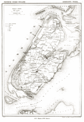
The island is 23.7 km long and 9.6 km wide, its area is 169.82 square kilometers . The highest point of the island is not, as one might suspect, de Hoge Berg (15 m above sea level ), but the dune "Bertusnol" (also "Nol van Bertus") located in the National Park Duinen van Texel with 19.6 m. The landscape is diverse ("all of Holland on one island") and is roughly divided into three zones:
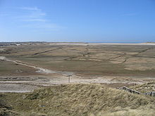
The west coast is characterized by direct contact with the open North Sea. An approx. 30 km long sandy beach with a multi-chain dune belt stretches from the northern to the southern tip . This is quite wide in the north, albeit broken in places ( De Muy and De Slufter , see below), significantly narrower in the middle and again very wide in the south. The seaward dunes are still open white dunes, the rear overgrown gray and brown dunes, some of which merge into heather and south of De Koog into forest landscapes. At the southern tip there is a sand and dune area several kilometers wide, De Hors .
On the other hand, the east coast only has contact with the calmer Wadden Sea and therefore no particularly pronounced natural structures; it is largely built on with dikes . There are only smaller sand and gravel beaches below the dykes.
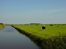
Between the two coasts lies the inland area of the island, which is flat except for the region around the Hoge Berg and largely arose from polders . It is characterized by its use for fields and pasture areas. In the middle of the island there is a wetland called the Rommelpot .
Settlement
13,614 people live on Texel (as of April 1, 2016). The population density is 85 inhabitants / km², based on the land area. Since the municipality consists for the most part of water, the population density in relation to the land area is 80 inhabitants / km². About 7000 inhabitants live in Den Burg , a little south of the center of the island , the only place with a truly urban character, in which the island administration, other official institutions and many shops are also located. To the north-west lies De Koog , the largest tourist center on the island, on the edge of the dunes . Oudeschild east of Den Burg is characterized by fishing and a little industry, De Cocksdorp on the northern tip of the island is a smaller coastal town. Other villages are Oosterend , Den Hoorn , De Waal , Zuid-Eierland , Midden-Eierland , 't Horntje and Oost , there are also many scattered single houses and farms as well as more recently the bungalow parks and other out-of-town accommodation options for tourists.
history
The All Saints in 1170 broke through the Dutch coast south of the present island of Texel, separated both Texel and Wieringen from the mainland and extended by a previous storm surge arising Zuiderzee . Between Texel and Wieringen, the flood tore so much bog out of the “Moerwaard”, the marsh bog between Wieringen and Texel, into the North Sea that the Marsdiep lake was created from a bog river and the two islands were separated from each other.
In the 13th century Texel consisted only of boulder clay fillings around the Hoge Berg . These soils were often criss-crossed by tides , while lower-lying areas were regularly flooded. The small island Eierland was originally separated from it in the north . In 1415 Texel received city rights.
Dikes were made on the island until the 16th century . The most important were Waal and Burg, between Den Burg, De Koog and De Waal, which were made first in 1532 and then again in 1617.
By order of the States General , a dike was built between the dunes at De Koog and the island of Eierland in 1629/1630 . By planting beach grass , drifting sand was retained, and new dunes and creeks were created. This made it possible to create new sand dunes on the west side. In the Anglo-Dutch War (1672–1674) there was the sea battle off Texel in 1673 , which the Dutch won. In the naval battle of Texel in the Palatinate War of Succession , there was a French victory in 1694.
In 1835 Eierland was polded in, and around 1850 there must have been a closed row of dunes along today's coastline. In 1851 this row of dunes broke in three places during a storm surge, creating De Muy and De Slufter .
During the First World War , a naval battle took place off Texel in 1914 , which the British won against the German Reich. During the Second World War the Georgian uprising broke out on Texel : between April 4 and May 20, 1945 - 15 days after the Germans surrendered in the Netherlands - Georgians who were originally recruited as auxiliary troops and who were stationed on Texel attempted an uprising against the German occupation forces to gain control of the island. However, this failed because they could not capture the crucial artillery positions. 3,000 people, including 117 civilians, died in the fighting. They were the last victims of the Second World War in Europe. 565 Georgians found a resting place in the Ehrenfriedhof on the Hoge Berg. A rose was planted for each of these Georgians.
Most of the killed German soldiers were buried in part of the general cemetery in Den Burg. In 1949 they found their final resting place in the Ysselsteyn military cemetery in Venray (Limburg).
In the second half of the 20th century, Texel was increasingly shaped by tourism.
nature
Mammals
Texel has been an island since the All Saints Flood in 1170, which makes settlement difficult, so the mammal fauna is now clearly laid out. The medieval mammal fauna can only be partially reconstructed. Currently there are mainly small rodents such as five different species of mice, rats, as well as representatives of the hare-like wild rabbits and brown hares , the latter are also the largest land mammals, if the farm animals are excluded. Predators such as ermines and ferrets are found on Texel, as well as hedgehogs as representatives of the insect eater . As on many North Sea islands, feral domestic cats are a problem and a threat especially to the avifauna . Bats are also found on Texel, so far 3 species have been identified. Apparently there are no red fox , mole and squirrel. Mammals whose main habitat is the sea include the harbor seal , gray seal and porpoise , which can be seen quite regularly. Time and again, sperm whales are washed ashore on the island's beaches.
De Hoge Berg
The Hoge Berg was created approx. 130,000 years ago through ice age boulder clay fillings, over which several layers of deck sand were deposited. Its highest point is 15.3 m above sea level. The area around the Hoge Berg has been under landscape protection since 1968. The meadows around the Hoge Berg are leased to farmers by the State Forestry Administration.
The only insect sanctuary in the Netherlands, De Zandkuil ( Sand Hollow ), is located on the Hoge Berg. It's an old sand and clay pit. The diversity of insects is favored by the sunny location of the pit, where the sand can get very warm. Rare digger wasps and bees are found . The State Forestry Administration maintains the insect reserve through careful pesting and mowing.
sand dunes
The dunes of Texel have emerged in its present form largely by human influence: along the embankments accumulate by the wind from the sea towards sand accumulations on which then bins couch grass and beach Salzmiere settle and give them consolidate. If rainwater then collects, the beach grass will settle . In the meantime, behind these young, seaward dunes, there is an older dune belt of different widths depending on the coastline, which is more overgrown, including heather and forests. The dune area is under nature protection, but there are many cycling and hiking trails.
Further dune formation can currently only be found on Texel on De Hors, at De Slufter and near the lighthouse . In order to prevent dune shrinkage, sand is artificially added elsewhere and longitudinal groynes are built.
The dune belt has been part of the Duinen van Texel National Park since 2002 .
De Muy and De Slufter
North of De Koog are the nature reserves De Muy and De Slufter . During a severe storm in 1851, the sea broke through the chain of dunes. The more southerly breakthrough, the Muy, could be sealed again and thus nowadays consists only of wet valleys between the dune chains, which, however, already form a valuable natural area. The attempts to seal off the Sluftergat (breakthrough on the Slufter) were unsuccessful, so that here a wide plain between the dune chains is open to the sea. There is a central slump permanently filled with water and many side creeks. The water level is strongly tidal - and seasonally dependent , sometimes large areas are under water.
Due to the penetrating salt water, a lot of sea lavender grows here , which is responsible for a widespread purple color of the area in July and August, as well as the beach carnation and the samphire .
Many birds find their rest especially during migration ( wigeons and pintail , wilters and plover species , thrush species , blackcap and many more) or breed ( spoonbill , lapwing , black godwit ).
Attractions
Sheep barns
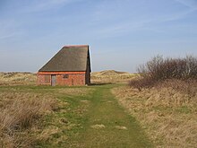
The Texel sheep stays outdoors even in very cold weather . In rough weather, the animals find shelter in the slipstream of the sheep barns , which have their entrance to the northeast - against the main wind direction. Some sheep barns are listed, others are in the way of farmers and neglected.
Gulf houses
Many houses on Texel resemble pyramids because of the shape of their roof . The sloping roof on all sides prevents the constantly blowing wind from exerting too much pressure. In contrast to the past, the living area is separated from the livestock accommodation as an annex.
"Ecomare"
The Ecomare is a museum that deals with life on an island and the sea. It houses a bird and seal sanctuary. Oil-smeared birds and young seals (howlers) left behind by their mothers and other weak seals are accommodated here. Around 25 seals are taken in and released each year. A permanent group of 20 seals that could no longer get used to the free life lives here.
In the "water room" you can see North Sea inhabitants in mostly open aquariums, among other things you can also touch small dog sharks and look at the seals underwater.
In the exhibition “Living on an Island” you can follow the expansion of Texel from the last Ice Age to the present day and into the future, and understand the slowly changing relationships between people and the island. Bones of mammals from the Ice Age, information on the work of the first conservationists on Texel ( Jac. P. Thijsse ) and birds from the island can be viewed.
“View of the Sea” deals with shipping , dyke construction , oil production and fishing on and on the North Sea .
"Kaap Skil"
The second larger museum on the island is the Kaap Skil , a marine and wrecking museum in Oudeschild. It provides information about the history of Texel in relation to the sea, including the time of the roadstead for ocean- going ships in Oudeschild and beach robbery . The museum also has a windmill.
Replica of a moai
There is a replica of a moai in Zuid-Eierland .
Economy and Infrastructure
traffic
In contrast to some other Frisian islands, Texel is allowed to be driven on by motor vehicle . There is a main road network connecting all important places as well as many smaller roads down to drivable dirt roads.
The transport company Connexxion operates bus route 28 on Texel, which connects the ferry port with Den Burg and De Koog every hour. All other places can use the Texel Hoppers are reached, a taxi bus system is, that can be ordered by phone or online app and every day 5:30 to 22:00 in operation.
The network of cycle paths is at least as well developed as the motor vehicle roads, which also take you to many areas of the dune area .
From the mainland there is an hourly car ferry connection from 6:00 a.m. to 9:30 p.m., during peak hours every half hour via the Marsdiep with Den Helder (travel time approx. 20 minutes) with the TESO ferries ( Texel's own Stoomboot Onderneming) . From De Cocksdorp you can take a passenger ferry to Vlieland in the summer months .
There is a small airfield near Zuid-Eierland.
economy
Today tourism shapes the economy of the island. In addition, there is a lot of agriculture, especially sheep breeding, and a small wool processing industry. Fishing is secondary. There are many culinary specialties made on the island.
research
Texel is the main location of the Netherlands Institute for Marine Research (Koninklijk Nederlands Instituut voor Zeeonderzoek - NIOZ), founded in 1876 .
Sports
The annual Ronde om Texel is the largest catamaran - regatta in the world.
Cable television
The towns and villages on the island of Texel are connected to a cable network operated by the cable operator Kabeltex and households are supplied with cable TV , Internet and telephone.
Press
Texel has its own newspaper, the Texelse Courant , which appears twice a week . The newspaper has been published since 1887 and is one of the few regional newspapers in the Netherlands that is still independent.
politics
Distribution of seats in the municipal council
The local elections on March 21, 2018 resulted in the following distribution of seats:
| Political party | Seats | |||
|---|---|---|---|---|
| 2006 | 2010 | 2014 | 2018 | |
| Texel's concern | 4th | 2 | 3 | 4th |
| VVD | 3 | 2 | 3 | 3 |
| PvdA | 2 | 3 | 3 | 2 |
| GroenLinks | 2 | 1 | 1 | 2 |
| CDA | 3 | 2 | 1 | 2 |
| D66 | 1 | 2 | 1 | 1 |
| Texel 2010 | - | 3 | 2 | 1 |
| Island concern | - | - | - | 0 |
| Alternatief | - | - | - | 0 |
| Sterk Texel | - | - | 1 | - |
| BEZEM | 0 | - | - | - |
| total | 15th | 15th | 15th | 15th |
mayor
Michiel Uitdehaag ( D66 ) has been the acting mayor of the municipality since January 21, 2016 . His colleagues include the alderman Edo Kooiman ( Texels Belang ), Hennie Huisman-Peelen ( VVD ), Sander van Knippenberg ( GroenLinks ) and the community secretary Theo van Waes.
Personalities
- Jac. P. Thijsse (1865–1945), teacher on Texel and pioneer of nature conservation in the Netherlands
- Willem Hendrik Keesom (1876–1956), physicist
- Inge Lievaart (1917–2012), poet
- Cornelis de Jager (* 1921), astronomer
- Jan Wolkers (1925–2007), writer and visual artist
- Imme Dros (* 1936), author of children's books
- Rene Daalder (1944–2020), film director and screenwriter
- Jan Knippenberg (1948–1995), ultramarathon runner and historian
- Monica Maas (* 1953), children's book illustrator
- Ingrid van Lubek (* 1971), triathlete
- Sieme Zijm (* 1978), soccer player
- Alice Blom (* 1980), volleyball player
- Dorian van Rijsselberghe (* 1988), windsurfer
Texel in literature and film
- In her role as town clerk in Mainz, Gabriele Wohmann shot the film diary Unterwegs for ZDF in 1985 , which also shows stays on Texel. The book version with the same title was published in 1986 by dtv-Verlag, ISBN 978-3-423-61672-0 .
- Volker Dittrich's novel Operation Texel is mostly set on the island and refers to the Georgian uprising on Texel (Dittrich-Verlag 1996, ISBN 3-920862-00-7 . First edition 1990 under the title Lola Langeland - I feel like screaming ).
- The novella Zomerhitte Verlag De Bezige Bij, 2005, ISBN 978-90-234-2685-1 by the Dutch writer Jan Wolkers is set on Texel. (Originally published as a free gift from the Dutch book trade as part of Boekenweek ). The material was filmed under the same title in 2008 (German title: Seductive Game ), screenplay: Edwin de Vries, director: Monique van de Ven ; the shooting took place on Texel.
- The Dutch-Belgian-Georgian film De viegenierster van Kazbek (English title The Aviatrix of Kazbek ) from 2010, (screenplay: Arthur Japin , Ineke Smits, director: Ineke Smits) is set on Texel at the time of the Georgian uprising . Some of the recordings (mainly outdoor and landscape photos) were taken on Texel.
- There is some documentary literature or documentary films about the Georgian uprising on Texel , s. there.
- Gabriele Wohmann , Photos: Walter Mayr : Texel: Toy Days. In: Geo-Magazin . Hamburg 1979, 10, pp. 110-126. Informative experience report. She found a "variety of paradise".
Web links
- Website of the municipality (Dutch, German, English)
- Tourist board website (German, Dutch, English)
- Ecomare website (German, Dutch, English)
- Texelse Courant newspaper website (Dutch)
- Website of the Netherlands Institute for Marine Research (English)
- Log book with stories about Texel (German)
Individual evidence
- ↑ Bevolkingsontwikkeling; regio per maand . In: StatLine . Centraal Bureau voor de Statistiek (Dutch)
- ↑ Holland's North Sea Islands, travel know-how. 3rd edition 2001. pp. 92 and 95.
- ↑ Bloodbath in the dune paradise. In: Der Spiegel.
- ↑ Texel - Schafscheunen ( Memento of the original from March 19, 2016 in the Internet Archive ) Info: The archive link was inserted automatically and has not yet been checked. Please check the original and archive link according to the instructions and then remove this notice.
- ↑ Texelhopper website
- ↑ www.texel.net ( Memento of the original from November 17, 2015 in the Internet Archive ) Info: The archive link was inserted automatically and has not yet been checked. Please check the original and archive link according to the instructions and then remove this notice. , texelairport.nl
- ↑ Result of the local elections: 2014 2018 , accessed on May 18, 2018 (Dutch)
- ↑ Allocation of seats in the municipal council: 2006 2010 2014 2018 , accessed on May 18, 2018 (Dutch)
- ↑ Texel heeft zijn jonge burgemeester. In: Texelse Courant. November 5, 2015, accessed May 18, 2018 (Dutch).
- ↑ Samenstelling college Gemeente Texel, accessed on May 18, 2018 (Dutch)
- ↑ dittrich-verlag.de


