Oudeschild
| province |
|
| local community |
|
|
Area - land - water |
1.1 km 2 1.1 km 2 0 km 2 |
| Residents | 1,235 (Jan. 1, 2017) |
| Coordinates | 53 ° 2 ' N , 4 ° 51' E |
| prefix | 0222 |
| Postcodes | 1791-1794 |
| Location of Oudeschild in the municipality of Texel | |
With 1,235 inhabitants, Oudeschild is the third largest town in the municipality of Texel on the Wadden Sea island of the same name in the Netherlands . Oudeschild is at the eastern end of the island.
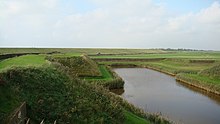
Here is a marina with 200 berths and a fishing port. In 1780, a dike breakthrough was made for the first time in Oudeschild and a port was built. Before that, the internationally known Texel roadstead was located off the coast of Oudeschild, where merchant ships were supplied with water and pilots boarded for the onward journey to the Dutch ports. Fort De Schans is of historical importance.
In the village there is a restored windmill and the Kaap Skil , a marine and beach goods museum.
Web links
Commons : Oudeschild - collection of images, videos and audio files
Individual evidence
- ↑ Kerncijfers wijken en buurten 2017 Centraal Bureau voor de Statistiek , accessed on May 18, 2018 (Dutch)


