
Salt marsh


Salt marshes , also known regionally as Heller , Inge or Groden , are stocks of herbaceous plants ( salt plant vegetation ) that are periodically or irregularly flooded by the sea . They form the natural transition and the biological boundary between land and sea on tidal alluvial soft substrate soils (alluvial soils). According to German mapping instructions, these are assigned to the semi-terrestrial soil type of the raw march .
Salt marshes or salt marshes can be found worldwide, in the temperate climate zone on flat coasts with little flow in the area of the medium flood lines, under tropical climatic conditions with appropriate geomorphological conditions as mangrove forests . The species-rich communities of salt plants (halophytes) and the animals living in salt marshes are highly adapted to the flooding and high salt content of the sea water and the soil.
But also inland - at those inland salt points where the saline groundwater that emerges forms moist to alternately humid locations - salt marshes can form (habitat type “salt marshes inland” according to the Habitats Directive ).
Conditions of origin
A basic requirement for the formation of salt marshes is the regular supply of fine material. A sufficient tidal range serves to supply the sediments . The current and the influence of storm surges must not be too strong in order not to erode the accumulated material . A sea floor that only rises slowly towards the coast, as well as the lowering of the coast or the gradual rise of the sea level are also part of the prerequisites, since only then are new sediments continuously deposited. The hinterland also has to be flat, as otherwise the tributaries develop too much force and sand and rubble would be brought in.
distribution

Every continent (with the exception of Antarctica ) has shallow tidal coasts that feature salt marshes and vegetation with halophytes. The respective combination of geomorphological factors, climate, fauna and flora makes each of these salt marsh groups a unique habitat. In Europe they can be found along the North and Baltic Sea coasts and the Atlantic. The salt marshes of the North Sea area differ from those of the North Atlantic . Here they are the only natural meadows outside of grass steppes and the high mountains. Examples of salt marshes are also the arctic salt marshes, the Mediterranean salt marshes, the salt marshes in the Pacific region (Japan, Siberia and China) and the salt marshes of Australia and Tasmania or those on the east and west coasts of North America. Mangroves form under tropical conditions with similar geomorphological conditions.
Salt marsh types
Salt marshes are only formed in the protection of natural barriers, through which the force of the waves is softened.
A distinction is made between the following six types:
- Lagoons -Salzwiesen: They arise in areas such as by spits be included. They are only connected to the sea through a small opening. On the North Sea coast, the Jade Bay and the Dollard are particularly important.
- Sand-salt meadows : They form under the protection of sandbanks or dunes. Landing occurs through sedimentation and sand drift. Larger dunes also act as such barriers, on whose tidal flats salt marshes can form. Sand-salt meadows usually only have a thin layer of silt or bran. The subsoil is mostly sandy. They are characterized by a diverse vegetation.
- Leeseiten -Saltzwiesen: They arise in the slipstream of the islands and are typical of the East Frisian and Dutch Wadden Sea . The islands take their power off the coast from storm surges and enable the formation of salt marshes on the mainland coast.
- Estuary Salt Meadows: Probably the most common in the world. Every river delta in the middle and high latitudes develops salt marshes. They are protected by a bend in the river or are protected by the alluvial cone of the river. They are subject to the influence of the relatively lower and strongly fluctuating salt content of the water.
- Foreland salt marshes: They are created through land reclamation measures and can develop into near-natural salt marshes. They are often found as foreland of dikes on the coast of the mainland, in bays or in front of marsh islands. Their vegetation is poorer in species than that of the sand-salt meadows.
- Artificial salt marshes: They form on excavated soil that has been dredged from shipping channels or washed up during coastal protection measures.

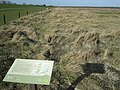
Salt marshes on Baltrum with a drainage ditch
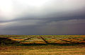
Colorful salt marsh on Langeoog during a thunderstorm
Lagoon salt meadow in the Jade Bay in front of Cäciliengroden

Sand salt meadow in front of Sankt Peter-Ording

Salt meadow near Osterhever on Eiderstedt

Estuary salt marsh on the Atlantic coast in North America

Sand salt meadow in the Divjaka-Karavasta National Park , Albania


Salt marshes on the North Sea coast


The Wadden Sea of the southern North Sea stretches from the North Holland island of Texel to the Ho Bay near Esbjerg in Denmark and, with an area of 8625 km², is the world's largest contiguous tidal landscape. On the North Sea coast, the salt marshes cover around 46,000 hectares (ha). They are spread over the states of the Netherlands with 6,550 ha, Great Britain (east coast up to the Canal) with 14,000 ha and Denmark with 7,270 ha. In Germany they are spread over the federal states Schleswig-Holstein with 10,000 ha and Lower Saxony and Hamburg with 8,150 ha.
History of origin
It is believed that in Europe, salt marsh plants were able to outlast the ice ages in the southern estuaries of the Loire and in the Gironde , on the west coast of France. Around 12,000 years ago, the ice finally receded, temperatures rose and the water from the melting ice sheets filled the North Sea around 8,500 years ago. The sea level rose by forty meters to today's sea level. This interrupted the land connection between England and the continent. Currents and waves led to the formation of beach walls parallel to the coast, which developed into dunes. Extensive moors initially formed behind these protective walls . As the sea level continued to rise, they were partially flooded and, for the past 6,000 years, covered with the sediments that form the tidal flats today. The salt marshes of the North Sea coast could only develop in connection with the mudflats. A salt marsh is created when plants gain a foothold in the higher areas that are not flooded as often and for a long time. The inflow and outflow of the water is via creeks that run through the mud flats and salt marshes.
Zoning of the North Sea salt marshes
For the salt marshes are beach Lilac , the beach wormwood , the beach Aster and halimione portulacoides characteristic. The following zoning can be found in the salt marshes of the North Sea coast:
- In the extreme area, the Samphire zone ( Salicornietum ) is about 40 centimeters below to the middle of the high tide line, i.e. the area is under water for several hours at high tide. There are only two blooming plants growing here: the silt grass and the samphire .
- This is followed by the Andel grass lawn ( Puccinellietum maritimae ) in the silting zone above the flooding area, the actual start of the salt marsh. This salt marsh zone is reached at every spring tide or other slightly elevated water level, so that it is flooded about 100 to 200 times a year. It extends up to about 40 centimeters above the mean flood line. The Andelgrass ( Puccinellia maritima ) shows the delimitation of the zone in which salt-tolerant species such as the beach sod , the beach trident or the beach aster grow.
- The red fescue zone ( Festucetum rubreae ) lies in the diversity zone that is rarely reached by salty seawater, about 25 to 50 times a year. Here the number of plant species is continuously increasing and is also characterized by the salt-tolerant salt meadow red fescue and various types of rushes .
Location adjustments

For adjustments to the salt factor, see: Salt plant
In addition to the formative influence of salt, strong mechanical factors such as flooding, washing around or wind enriched with grains of sand and a lack of oxygen also play an important role in maritime biotopes . Therefore, different representatives of the salt flora in the root area have special supporting tissue, which consists of dead cells with extremely thickened cell walls, so-called sclerenchymas . A special air tissue, the aerenchyma, develops for the oxygen supply . Long rhizomes prove to be the best remedy against continual overburdening of dune sand in order to evade its suffocating effect. At the same time, numerous secondary roots help to secure the dune sand and to better utilize the nutrients it possesses.
During storm surges, a salt marsh often sinks completely into the churned sea. The plants have to withstand enormous forces in these moments. For this reason, beach lavender and sea rush have a hard tissue consisting of elongated cells made of thick, lignified, brown membranes . Sklerenchyma often arise in the development phase (elongation growth) of the plants from the living, elastic collenchyme and run through the entire plant body. They are therefore very firm, but they are arranged in a characteristic way depending on the type of plant. In the deep anchor roots of the salt plants, the sclerenchymal fibers are distributed either centrally or in single strands over the root cross-section in order to be able to withstand tensile forces and prevent them from being flushed out. In herbaceous stems, on the other hand, the fibers are arranged peripherally because they have to be resistant to bending, usually in the form of individual strands or as closed cylinders.
The plants of the salt marshes are also adapted to the conditions of the environment with regard to the leaves and shoots. The stronger mechanical effect of the wind on the sea coast means that the stem axis is more stable than inland. Basically, in salt plants, in addition to the sclerenchyme, succulence is pronounced on the trunk and leaf to counteract the drought.
Most of the time, the open locations also only offer a few shaded areas, meaning that the incidence of light is intense. Due to this fact, almost all representatives of the salt vegetation belong to the extreme light plants , that is, they only reach the maximum photosynthetic output at high light intensities. They have small, hard leaves with thick, multilayered palisade and sponge fabrics and a cuticle resting on the epidermal cells . The grana and stromal koids , the chloroplasts that are regularly arranged around the cell membrane, are relatively poor in chlorophyll and contain only a few pigment collectives, as the light factors enable the compensation point to be reached quickly.
Ecological importance

Salt marshes are resting and breeding areas for numerous bird species. Many species of insects also visit salt marshes. A large part of it needs the plants growing there for reproduction. An example of this is the holm Lilac shrew weevil , which in the eroded exposed roots of the beach lilac lays its eggs. Some insects use the hollow stems of dead plants in the salt marshes as a refuge when they are flooded. Salt marshes should not be entered or only on approved paths. In Germany, the salt marshes are in the strictly protected quiet zones of the Hamburg , Schleswig-Holstein and Lower Saxony Wadden Sea national parks . One of the richest and largest inland salt Brandenburg form the Luchwiesen in Storkow .
natural reserve
In view of numerous technical coastal protection measures , salt marshes have become an important field of activity for nature conservation in the context of the national park programs in recent years .
Salt marshes are endangered by various factors in terms of their existence and natural development. Dikes reduce the remaining areas. Drainage measures and grazing are often associated with considerable interference with the species composition of the salt marsh. Failure to provide a suitable control system for tourists, in addition to disturbances for breeding and resting birds, often results in damage to the vegetation and associated erosion. The anthropogenic increase in nutrient concentrations, especially in the seawater of the North Sea, leads to an increase in production rates and a lower number of species in the salt marsh. Species that complete their vegetation cycle quickly are thereby favored. When sod is removed from the salt marshes, for example in order to repair the dike cover, vegetation of a younger succession stage initially settles there - due to the resulting degradation of the soil. A vegetation comparable to the previous state can only develop again there if the degree of sediment input is greater than in the higher salt marsh areas. Continuous entry of oil through seawater causes salt marsh plants to die off in the long term and also prevents new colonization.
literature
- Hong-bo Shao [Ed.]: Salt Marshes: Ecosystem, Vegetation and Restoration Strategies. Nova Science Publishers, 2014. ISBN 978-1-63321-331-9 (eBook)
- Wolfgang Gedat : Salzwiesengeflüster - a fairytale-like plant identification book. Verlag Ergon Kreativ Handel, Marl 2009, ISBN 978-3-9812642-0-3 .
- Thorsten-D. Künnemann: Salt marshes. Survival between land and sea. With illustrations by Gunnar Gad. Isensee Verlag, Oldenburg 1997, ISBN 3-89598-414-0 .
- Richard Pott : Color Atlas North Sea Coast and North Sea Islands. Selected examples from the southern North Sea from a geobotanical perspective. Ulmer Verlag, Stuttgart 1995, ISBN 3-8001-3350-4 .
Web links
- Salt meadows, parts 1 to 3, a contribution from the Biology Department of Leibniz University Hannover
- Profiles of the habitat types occurring in MV from Annex I of the Habitats Directive
- Inland salt mines in Brandenburg. Nature conservation and landscape management in Brandenburg 2 2010 Issue 1 (PDF; 7.1 MB)
- Leaflet EU-Life-Projekt inland salt stations in Brandenburg. State Environment Agency Brandenburg (PDF; 315 kB)
Individual evidence
- ↑ T.-D. Künnemann, G. Gad: Survival between land and sea. Salt marshes. Pp. 10, 172 f.
- ↑ Jürgen Newig, Hans Thede (ed.): Flora and fauna in the Wadden Sea. Edition Ellert & Richter, Hamburg 2000, ISBN 3-89234-931-2 , p. 8.
- ↑ T.-D. Künnemann, G. Gad: Survival between land and sea. Salt marshes. P. 172 f.

Forests : Tropical Rainforest | Subtropical rainforest | Cloud and cloud forest | Mangrove forest | Monsoon forest | Laurel forest | Temperate rainforest | Deciduous deciduous forest | Mixed deciduous and coniferous forest | Mountain forest | Boreal coniferous forest
Transitional biomes: tropical / subtropical dry forest | Moist savannah | Oasis | Hard foliage vegetation | Forest steppe | Forest tundra
Open country : dry savannah | Briar savannah | Hot semi-desert and desert | Winter-cold semi-desert and desert | Steppe | Highland desert steppes | Salt marsh | Tundra | Cold desert