North Atlantic
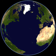
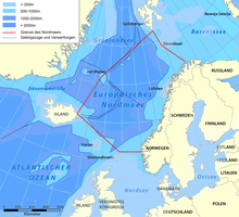
The North Atlantic is the northern part of the Atlantic Ocean . In the north it borders on the European Arctic Ocean , in the south on the Central Atlantic, which separates West Africa from northern South America and southern North America . 16 European and two North American states lie on its coasts .
geography
The greatest width (of the whole ocean) is 9000 km between Senegal and the Gulf of Mexico , the smallest 1500 km between Norway and Greenland . The boundaries are the Arctic Circle and the equator .
Archipelagos and islands in the North Atlantic are Azores , Bermuda , British Isles , Faroe Islands , Greenland , Ireland , Iceland , Canary Islands , Cape Verde , Madeira and Newfoundland . Sable Island, notorious as the cemetery of the Atlantic, lies 200 km off the coast of Canada .
Unlike the South Atlantic, the North Atlantic has large tributaries : the English Channel , the American Mediterranean , the Irish Sea , the Mediterranean , the North Sea , the Baltic Sea and the Gulf of Saint Lawrence .
meaning
The North Atlantic plays a prominent role in modern world history . The Vikings and Christopher Columbus discovered the New World through him . The Pilgrims of the Mayflower founded New England and the 200-year-old WASP -Führung the United States . On August 27, 1866, the first transatlantic submarine cable was laid between Ireland and Newfoundland . The first German submarine cable since the end of 1900 ran from Emden via the Azores to New York City .
During the emigration of the 19th and 20th centuries, millions of Europeans came to North America on overcrowded ships . Since the three emperor year , the Hamburg-American Packetfahrt-Actien-Gesellschaft under Albert Ballin has become the largest shipping company in the world. With the largest (and fastest) ships of the Imperator class , HAPAG dominated the transatlantic passenger and freight traffic. In the First World War of the Triple Entente of reduced "successful", the increased tonnage of HAPAG fleet before the Great Depression back to 1,114,826 gross tons with more than 100 ships.
The North Atlantic is still one of the busiest seas . It connects Europe with the United States and Canada . So the NATO - the North Atlantic Treaty Organization - a safety and community of values that is based in the catastrophes of the 20th century. Ronald Reagan and Mikhail Gorbachev met in 1986 halfway in Reykjavik at a summit to the Cold War on Disarmament to negotiate.
With its abundance of fish , the North Atlantic is also of immense economic importance as a source of food . Like whaling and the Greenland voyage in the past , deep-sea fisheries of all nations are fighting for catch quotas and fishing areas. Immediately after the Second World War, in the 1950s and 1973, explosive conflicts arose over fishing rights in Iceland's territorial sea .
Strategic pivot
Both world wars were decided in the North Atlantic. Friedrich Ruge described the North Atlantic as the “Mediterranean of our time”, a cultural area that can only guarantee peace and orderly freedom with good cooperation and mutual understanding. In both world wars, the Soviet Union was still "powerless" land power . After the Second World War in fourth place after the United States Navy , the Royal Navy and the French Navy , the Soviet Navy was systematically expanded during the Cold War . Admiral Sergei Georgijewitsch Gorschkow - for Helmut Schmidt one of the most notable personalities of modern times - put it in second place in two decades. In terms of number of ships (not in terms of tonnage ), it even surpassed the US Navy. With the Northern Fleet, the Baltic Fleet and the Black Sea Fleet , it had drawn an offensively oriented protective wall around its sphere of influence that had been pushed far into the Atlantic. Reconnaissance aircraft , surface units, special vehicles and oceanographic research vessels constantly monitored the movements of a good 2000 ships in the North Atlantic every day. Strategic submarines were always off the American east coast. They could only get into the North Atlantic through the Norwegian Sea and the Denmark Strait . The hydrographic observation of these waters was therefore of central strategic importance even in peacetime - for both sides.
At the same time, the Soviet Union had put a pair of pincers around Western Europe that stretched from the Barents Sea to the eastern Mediterranean . The Soviet Navy threatened the bridge function of the North Atlantic and with it the lifelines of the NATO alliance. It not only endangered the flanks , but also the (German) center; because "if the flanks fall, the center also falls" ( Carl von Clausewitz ).
Current threat
In December 2017, it became known that the Russian naval fleet was scouting the transatlantic submarine cables. Stuart Peach , chairman of the NATO military committee , warned of the catastrophic consequences of their interruption. Royal Navy HMS St Albans (F83) piloted an Admiral Gorshkov-class frigate through the North Sea. Helicopters watched other Russian ships.
Historic sea routes
Sailors
The routes of the sailing ships depended on the seasonal winds .
There were two main routes from Europe to North America. In winter and spring, the northern latitude was 46 ° to 50 ° north . From about 34 ° west longitude we headed southwest to the 43rd latitude on which it between the Grand Banks and the Gulf Stream to the west went. With the south-westerly coastal current , the sailors then reached the port of destination. In summer and autumn the captains sailed even further north. At 55 ° N it was only possible from 25 ° W. L. to the south.
Less robust sailors took the southern route. West of Madeira they tried to reach the trade winds . With them they stayed between 22nd and 28th parallel. At 60 ° w. L. they headed past Bermuda to the port of destination.
On the way home they tried to cross the coastal stream as quickly as possible and leave the Gulf Stream to the north.
Steam boat
The heavy traffic between New York Harbor and the English Channel and the frequent fog at the Newfoundland Bank caused many accidents . That is why the large English, German and Dutch shipping companies set certain steam routes in 1892 . The departure went from January 15 to July 14 from Fastnet or the Isles of Scilly on the great circle to the intersection of 47 ° w. L. and 42 ° n. Br., From there to Sandy Hook . The lightship Nantucket had to be passed 20 nautical miles south. From July 15th to January 14th the steamers drove on the great circle up to 49 ° w. L. and 46 ° north, then to Sandy Hook at 55 nautical miles from the notorious Sable Island .
The journey home went from Sandy Hook to 70 ° w throughout the year. L. and 40 ° 10 '. In the first half of the year it was 47 ° w. L. and 41 ° n. Br. And on the great circle to Fastnet, in the 2nd half of the year to 60 ° w. L. and 42 ° 5 'and on the great circle to Fastnet or Scilly.
Accidents on the North Atlantic voyage
Storms , icebergs and fog endanger merchant shipping and deep-sea fishing in the North Atlantic.
See also
literature
- Anne Biernath: Norway, Denmark and Iceland joined NATO. Causes, motivations and their consequences. Munich 2011, ISBN 978-3-656-03788-0 .
- Sérgio Costa: From the North Atlantic to the Black Atlantic. Postcolonial Configurations and Paradoxes of Transnational Politics. Bielefeld 2007, ISBN 978-3-89942-702-8 . GoogleBooks
- Artur Dieminger: About fjords and fjord types of the North Atlantic. Bruck 1936. GoogleBooks
- Dan van der Vat: Battlefield Atlantic. Heyne Verlag, Munich 1990, ISBN 3-453-04230-1 .
Web links
- The North Atlantic as part of the Earth system
- North Atlantic Oscillation
- FAO Northeast Atlantic fishing area
- Marine protected areas in the Northeast Atlantic (Federal Agency for Nature Conservation)
Individual evidence
- ↑ a b c d e f Brockhaus´ Konversations-Lexikon , 14th edition (1901)
- ↑ Albert Ballin ( Memento from February 11, 2013 in the web archive archive.today ).
- ↑ Cod War (Ulrich Groenke) (PDF; 115 kB).
- ^ A b Günter Luther : The maritime security interests of the North Atlantic Alliance , in: German Marine Institute (ed.): The sea in the focus of the eighties . Herford 1982, ISBN 3-8132-0150-3 , pp. 26-45.
- ↑ Harry D. Train II : The importance of the north flank for the strategic situation in the Atlantic , in: German Marine Institute (Hrsg.): The Soviet Union's exit gate to the oceans . Herford 1985, ISBN 3-8132-0202-X , pp. 51-60.
- ↑ Russian submarines have data cables in their sights in the North Atlantic (Welt N24)
- ↑ Alexandra Leistner: Threat to the West: Russia "could cut submarine cables" (euronews)
- ↑ British Navy monitors Russian warship (World N24)
- ^ Wilhelm von Freeden : About the steamboat routes between the canal and Newyork. According to the journal excerpts of the steamers of Norddeutscher Lloyd in the years 1860–1867. In addition to wind and weather at the same time (= communications from the North German Seewarte. Vol. 3, 1870). Friedrichsen, Hamburg 1870.
Coordinates: 47 ° N , 33 ° W


