
Walkenried
| coat of arms | Germany map | |
|---|---|---|

|
Coordinates: 51 ° 35 ' N , 10 ° 37' E |
|
| Basic data | ||
| State : | Lower Saxony | |
| County : | Goettingen | |
| Height : | 320 m above sea level NHN | |
| Area : | 20.97 km 2 | |
| Residents: | 4297 (Dec. 31, 2019) | |
| Population density : | 205 inhabitants per km 2 | |
| Postal code : | 37445 | |
| Primaries : | 05525, 05586 | |
| License plate : | GÖ , DUD, HMÜ, OHA | |
| Community key : | 03 1 59 036 | |
| LOCODE : | DE WLD | |
| Community structure: | 3 localities | |
| Association administration address: | Bahnhofstrasse 17 37445 Walkenried |
|
| Website : | ||
| Mayor : | Dieter Haberlandt ( non-attached ) | |
| Location of the municipality of Walkenried in the district of Göttingen | ||
  |
||

Walkenried is a unified municipality in Lower Saxony on the edge of the southern Harz in the district of Göttingen .
geography
Geographical location
Walkenried is on the Wieda . Until the reunification , Walkenried was located directly on the inner-German border, which ran south and east of the community. Walkenried and the district of Zorge are state-approved climatic health resorts ; Wieda is considered a health resort with a healthy climate .
The municipality of Walkenried lies in the triangle of federal highways 4, 27 and 243 on the southern edge of the Harz Mountains .
The originally wooded Walkenried marshland was transformed from the 12th century by the monks of the adjacent Cistercian monastery Walkenried into a rich pond landscape with fertile farmland. Today 50 of them are still detectable. All ponds are located in a nature and bird sanctuary and are now partly managed by the local sport fishing club.
The area of the municipality is between 280 and 710 m above sea level. NN .
Closest cities
- 15 km from Nordhausen
- 25 km from Duderstadt
- 30 km Osterode am Harz
- 30 km from Wernigerode
- 40 km from Goslar
- 48 km from Göttingen
Community structure
The following localities belong to the municipality of Walkenried (population in brackets on December 31, 2015):
- Walkenried with Wiedigshof (2258)
- Wieda (1295)
- Zorge (984)
Neighboring communities
- Ellrich 3 km
- Bad Sachsa 6 km
- Bad Lauterberg 16 km
- Nordhausen 18 km
history

Walkenried was first mentioned in 1085 . The historical center is the Walkenried monastery, built by Cistercians in 1127 . The originally wooded Walkenried marshland was converted from the 12th century by the monks of the monastery into a rich pond landscape with fertile farmland. 365 ponds were created by the monks in order, according to tradition, to have one pond available for fishing every day of the year. Today, however, only 50 of them are detectable. All ponds are located in the “ Priorteich / Sachsenstein ” nature reserve . Some of the ponds are now managed by the local sport fishing association.
For the Brunswick Duke August Wilhelm from 1725 to 1730 a hunting lodge was built from rubble stones of the monastery by the state master builder Hermann Korb south of the monastery grounds. The solid walls, which encompass the garden of the palace in the south and west, date from the time when the Wildenhof monastic stud farm was located there before the palace was built. The Walkenried hunting lodge that has been preserved is now privately owned and used as a hotel guesthouse.

The place became known throughout Germany after the Second World War , when one of the most important railway border crossings between the British and Soviet occupation zones was located here on the so-called southern Harz line between Ellrich and Walkenried .
For the development of the postal system in Walkenried, see: Braunschweig-Blankenburg postal route
On November 1, 2016, the member communities of the combined community Walkenried , Zorge , Wieda and Walkenried merged to form the Walkenried community, the Walkenried joint community was dissolved. With the merger of the districts of Osterode am Harz and Göttingen on the same day, this municipality belongs to the district of Göttingen .
etymology
The name originally referred to Alt-Walkenried, which was a settlement 1.5 km north of the monastery and was converted into a grangie in the 12th century (1205: "grangiam, que dicitur Vetus Walkenredde"). An "Alden Walkenride" is documented in 1473.
As a compound of Old Saxon valk- and -hriod , the name means reed swaying in the wind . The genesis of the toponym (in excerpts): 1085 "Walkenreit", 1172 "Walkenriede", 1496 "Walckenrid", 1630 for the first time as today "Walkenried".
Religions
At around 56%, the majority of residents belong to the Evangelical Lutheran Church, 10% are Catholic, and around 34% do not belong to either of these two denominations ( census in the European Union 2011 ).
The Evangelical Lutheran parish Walkenried belongs to the provost of Bad Harzburg . The chapter house of the former Cistercian monastery has been used for Protestant services since 1570.
The Catholic Holy Cross Church was built in 1960. After 1945 a Catholic parish was formed in Walkenried, which celebrated its services in the chapter house of the former monastery until the church was built. Today the Holy Cross Church is a branch church of the parish of St. Benno in Bad Lauterberg .
politics
Municipal council
|
Municipal election 2016
Turnout: 56.85% (2011: 60.31%)
% 40 30th 20th 10
0
34.37%
30.39%
11.33%
10.29%
8.71%
2.20%
1.89%
0.83%
n. k.
Gains and losses
compared to 2011
% p 12 10 8th 6th 4th 2
0
-2 -4 -6 -8th -10 -12 -14 -0.67 % p
-12.10 % p
+ 11.33 % p
-1.38 % p
+ 8.71 % p.p.
-1.45 % p
-2.74 % p.p.
+ 0.83 % p.p.
-2.52 % p
Remarks:
g Single applicant Steffen Blau
h Individual applicant Kurt-Rainer Beikirch
|
|
Distribution of seats in the municipal council
A total of 14 seats
|
After the local elections on September 11, 2016, the municipal council has been composed of 14 council members and the full-time mayor since November (change to the 2011 joint municipal council election). The election for the 2011 joint municipal council is used as a comparison value for the parties' profits and losses.
Distribution of seats
- SPD : 5 seats (± 0)
- CDU : 4 seats (−2)
- Citizen list Walkenried and Südharz: 2 seats (+2)
- Citizens' Association Zorge: 2 seats (± 0)
- AfD : 1 seat (+1)
- Single applicant Steffen Blau: 0 seats (−1)
Municipal Mayor
The full-time mayor of the Walkenried community has been Dieter Haberlandt since 2016. He was the only applicant to receive 69.2% of the vote. His deputies are Andreas Viehweger (CDU) and Ulrich Kamphenkel (SPD).
Chronicle of the incumbents
|
|
Local council
(+ 0.31 % p )
(-20.20 % p )
( n. K. )
(-6.30 % p )
( n.k. )
(-1.43 % p )
In addition to a local council, which is responsible for the entire community of Walkenried, a local council was also elected to take on political tasks for the town of Walkenried of the same name.
Following the local elections on September 11, 2016, the local council has been made up of five councilors since November.
Distribution of seats
Local mayor
The local mayor of Walkenried is Claus Eggert (SPD). His deputy is Marius Klenner (SPD).
coat of arms
The municipal coat of arms of the Walkenried municipality was composed of the main symbols of the coats of arms of its three localities. The coat of arms, which previously belonged to the municipality of Walkenried, was approved on May 14, 1975 by the Hildesheim district president. On November 1, 2016, the Walkenried municipality took over the coat of arms of the Walkenried municipality.
|
|
Blazon : "Under a blue shield head , in it a floating golden abbot's staff with silver velum and downward curvature, split by an ascending, curved golden tip , on the right in red a half- striding silver stag , on the left a red-silver boxed field." |
| Foundation of the coat of arms: Walkenried, famous for its monastery ruins, was once the center of a small spiritual state in the Holy Roman Empire of the German Nation. That is why the golden abbot, which reminds of the abbots, plays the main role in the coat of arms that tells the history of Walkenried's territory. The half-striding silver stag reminds of the former affiliation to the county of Klettenberg , later to the county of Hohnstein- Klettenberg, which led the red and silver field in the coat of arms. The golden tip only serves to separate the two lower fields. |
traffic
Rail transport
Walkenried is on the southern Harz line . Regional trains of the DB Regio to Northeim and Nordhausen stop every hour at the new train station in the town center . The old station is a short distance further in the direction of Northeim, where all passenger trains ended up to the turn. The meter- gauge narrow - gauge railway Walkenried – Braunlage / Tanne also began in Walkenried , but was later replaced by today's bus route 470. In 1963 the last section of the route was finally closed.
Public transport
Walkenried is connected to the surrounding area by 2 bus lines, but only line 470 runs on Sundays and public holidays. Line 470 also connects to the remote district of Zorge, while line 472 also connects to the remote district of Wieda. There are small bus stations at the train station and in the center of the former monastery . Both bus lines are operated by Hahne Reisen.
- 470: Bad Sachsa - Walkenried - Zorge - Hohegeiß - Braunlage
- 472: Bad Sachsa - Walkenried - Wieda
Culture and sights
- The cultural-historical pond landscape is made accessible to hikers.
- The former Cistercian monastery Walkenried from the 12th century has been extensively renovated and can be visited. The Walkenried cloister concerts have been held there every year since 1983 and the Walkenried monastery market since 2008 .
- The princely hunting lodge of Walkenried, owned by the Dukes of Braunschweig-Wolfenbüttel, was a forestry office from 1756 to 1966 and has been a hotel and guest house since 1976.
- In the listed mansion Walkenried the former monastery domain on July 22, 2020 from was the Lower Saxony Economics Minister Bernd Althusmann the first World Heritage -Informationszentrum the Foundation UNESCO World Heritage in the Harz opened.
- Walkenried is located in the southern Harz gypsum karst area and has some geological peculiarities, including the "dwarf holes", which are unique in Germany, gypsum swelling caves that are formed by bulges during the conversion of anhydrite into gypsum . Not far from the village are the nature reserves " Gipskarstlandschaft Bad Sachsa and Walkenried " and " Priorteich / Sachsenstein "
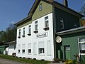
former SHE station Walkenried

former Walkenried state railway station

Gatehouse of the former Cistercian monastery

Priortich west of Walkenried


societies
- TV Friesen Walkenried e. V.
- Support group Kloster Walkenried e. V.
- German Shepherd Association Local group Walkenried
- We Walkenrieder - Walkenrieder for Walkenried e. V.
- March of the Volkenried Voluntary Fire Brigade
- Walkenried volunteer fire department
- Walkenried youth fire brigade
Personalities
Sons and daughters of the church
- Johann Friedrich Kleemann (1729–1788), Braunschweig-Wolfenbüttelscher Oberamtmann.
- Johann Ernst Gottfried Kleemann (1759–1805), Schwarzburg-Sondershausenscher District and Commission Councilor and land rent master.
- Walther Hans Reinboth (1899–1990), painter, poet and local researcher
- Günther Kaiser (1928–2007), legal scholar and criminologist
- Hanns HF Schmidt (1937–2019), writer, composer and painter
Web links
- Official website
- Exhibits from the Walkenried local history collection at museum-digital
- Article Walkenried In: GenWiki.de
Individual evidence
- ↑ State Office for Statistics Lower Saxony, LSN-Online regional database, Table 12411: Update of the population, as of December 31, 2019 ( help ).
- ↑ Lower Saxony State Chancellery (Ed.): Law on the reorganization of the Walkenried community, Osterode am Harz district . Lower Saxony Law and Ordinance Gazette (Nds. GVBl.). No. 02/16 . Hanover February 25, 2016, p. 36 ( digital version [PDF; 524 kB ; accessed on May 4, 2019] p. 6).
- ↑ Uwe Ohainski, Jürgen Udolph : The place names of the district of Osterode (= publications of the Institute for Historical Research at the University of Göttingen . Volume 40 ). Publishing house for regional history, Bielefeld 2000, ISBN 3-89534-370-6 , p. 170–173 ( adw-goe.de [PDF; 2.6 MB ]).
- ↑ Municipal election Walkenried 2016. In: Internet site of the Göttingen municipal services. Retrieved September 13, 2016.
- ↑ a b Walkenried municipal council. In: Website of the Walkenried community. Retrieved May 4, 2019 .
- ↑ Local council election Walkenried 2016. In: Internet site of the municipal services Göttingen. Retrieved September 13, 2016.
- ↑ a b local council (Walkenried). In: Website of the Walkenried community. Retrieved May 4, 2019 .
- ^ Arnold Rabbow: Braunschweigisches Wappenbuch . The coats of arms of the communities and districts in the urban and rural districts of Braunschweig, Gandersheim, Gifhorn, Goslar, Helmstedt, Peine, Salzgitter, Wolfenbüttel and Wolfsburg. Ed .: Braunschweiger Zeitung, Salzgitter Zeitung and Wolfsburger Nachrichten. Eckensberger & Co. Verlag, Braunschweig 1977, DNB 780686667 , p. 117 .
- ↑ Main statutes of the Walkenried community. (PDF; 130 kB) § 2 Coat of arms, flag, official seal. In: Website of the Walkenried community. November 10, 2016, p. 1 , accessed May 4, 2019 .
- ↑ Minister Althusmann opens the first World Heritage information center in the Harz Harz Kurier : July 22, 2020.
- ↑ Matthias Reimann, Firouz Vladi : On the development of the so-called dwarf church on Sachsenstein near Walkenried, district of Osterode am Harz, Lower Saxony and comparative observations on the recent formation of spring caves in an abandoned gypsum quarry near Dingwall, Nova Scotia, Canada . In: Communications of the Association of Cave and Karst Researchers , Edition 49 (3), Munich 2003.
- ^ "Priorteich / Sachsenstein" nature reserve. In: Website of the Lower Saxony State Agency for Water Management, Coastal Protection and Nature Conservation. Retrieved August 23, 2011 .
Adelebsen | Bad Grund (Harz) | Bad Lauterberg in the Harz Mountains | Bad Sachsa | Bilshausen | Lake Constance | Bovenden | Charging | Dransfeld | Duderstadt | Boar idols | Elbingerode | Friedland | Gieboldehausen | Same | Göttingen | Hann. Münden | Hattorf am Harz | Herzberg am Harz | Hörden am Harz | Jühnde | Krebeck | Landolfshausen | Niemetal | Obernfeld | Osterode am Harz | Jump | Rollshausen | Rosdorf | Rüdershausen | Scheden | Seeburg | Seulingen | Staufenberg | Waake | Walkenried | Wollbrandshausen | Wollershausen | Wulften am Harz
Community-free area in the district of Göttingen
Harz (district of Göttingen)