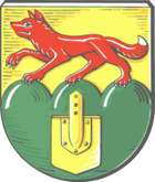
Renkenberg Mountains
| coat of arms | Germany map | |
|---|---|---|

|
Coordinates: 52 ° 54 ' N , 7 ° 23' E |
|
| Basic data | ||
| State : | Lower Saxony | |
| County : | Emsland | |
| Joint municipality : | Lathen | |
| Height : | 14 m above sea level NHN | |
| Area : | 18.98 km 2 | |
| Residents: | 695 (Dec. 31, 2019) | |
| Population density : | 37 inhabitants per km 2 | |
| Postal code : | 49762 | |
| Area code : | 05933 | |
| License plate : | Tbsp | |
| Community key : | 03 4 54 043 | |
| Community structure: | 3 districts | |
| Address of the municipal administration: |
Wahner Strasse 19 49762 Renkenberge |
|
| Website : | ||
| Mayor : | Heinrich Bojer ( CDU ) | |
| Location of the municipality of Renkenberge in the district of Emsland | ||
Renkenberge is a municipality in the Emsland district in Lower Saxony . It belongs to the Lathen municipality , which has its administrative seat in the Lathen municipality .
geography
Geographical location
Renkenberge lies between Papenburg and Meppen on a side canal of the nearby Dortmund-Ems Canal .
Neighboring communities
Neighboring communities in the north are the communities Kluse and Wippingen in the integrated community Dörpen , in the east the communities Werpeloh and Sögel in the integrated community Sögel , in the south the communities Lathen and Lathen-Wahn and in the west the communities Fresenburg and Sustrum .
Districts
The districts of the community are Renkenberge, Gutshof and Melstrup-Siedlung.
history
Emergence
The community emerged from 1932 as part of the Emsland cultivation from the new settlements Kluse and Melstrup-Siedlung and was declared an independent community in 1934 , which initially bore the name Kluse . With effect from October 1, 1938, the municipality of Kluse was given the new name Renkenberge in order to prevent it from being confused with the neighboring district of Kluse in the former municipality of Ahlen. The name Renkenberge was derived from a hill ("mountain", about 26 m above sea level ) on the site of a farmer named Renken.
First settlers
Renkenberge emerged from swamp and moorland areas that were burned down for cultivation. As a result, new young hirers or farmer's sons who could not expect any property after the succession could move into a farm. Most of the settlers in the community came from the region around Lingen. Each farmer received farms of 12 to 15 hectares. A total of 33 families settled in Renkenberge. Since the late 1920s, however, a few settlers tried to cultivate the land.
politics
Municipal council
The local council from Renkenberge consists of 9 councilors.
(As of: local election on September 11, 2011)
Local elections 2016:
- CDU: 8 seats
- SPD / GRÜNE group: 1 seat
mayor
Heinrich Bojer (CDU) was elected as honorary mayor.
Economy and Infrastructure
traffic
Renkenberge can be reached via federal highway 70 . There is still a motorway connection to the nearby A31 motorway .
literature
- Werner Kaemling: Atlas on the history of Lower Saxony , Gerd J. Holtzmeyer Verlag, Braunschweig 1987, ISBN 3-923722-44-3
- Hermann Abels: The place names of the Emsland, in their linguistic and cultural-historical significance , Ferdinand Schöningh Verlag, Paderborn 1929
- Ernst Förstemann, Hermann Jellinghaus (editor): Old German name book , Volume II, 1 and 2: Place names , Bonn 1913/1916 (Reprint: Volume II, 2, Hildesheim 1967/1983, ISBN 3-487-01733-4 )


