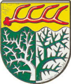
Dohren (Emsland)
| coat of arms | Germany map | |
|---|---|---|

|
Coordinates: 52 ° 39 ' N , 7 ° 35' E |
|
| Basic data | ||
| State : | Lower Saxony | |
| County : | Emsland | |
| Joint municipality : | Heart sheet | |
| Height : | 24 m above sea level NHN | |
| Area : | 25.64 km 2 | |
| Residents: | 1141 (Dec. 31, 2019) | |
| Population density : | 45 inhabitants per km 2 | |
| Postal code : | 49770 | |
| Area code : | 05962 | |
| License plate : | Tbsp | |
| Community key : | 03 4 54 009 | |
| Association administration address: | Neuer Markt 49770 Herzlake |
|
| Mayor : | Johannes Dieker (UWG) | |
| Location of the municipality of Dohren in the district of Emsland | ||
Dohren is one of the three municipalities of the Herzlake joint municipality in the Emsland district . The mean height above sea level is 25 m (North German Plain). The community is predominantly rural.
geography
Geographical location
The municipality of Dohren is located in the eastern part of the Emsland district in Lower Saxony .
Neighboring communities
Neighboring communities are in the north the community Herzlake , in the east the community Berge in the joint community Fürstenau in the district of Osnabrück , in the south the community Wettrup in the joint community Lengerich and in the west the town Haselünne .
Community structure
The community was created on January 1, 1963 from the merger of the two former communities Groß Dohren and Klein Dohren.
history
The two farming communities Groß and Klein Dohren were part of the Dohren-Felsener Mark in the Middle Ages, along with the farming communities Bakerde, Jödenstraße / Bookhof, Felsen and Neuenlande. This is first mentioned in the 14th century. It is believed to have originated between the 11th and 13th centuries. The area of the Dohren-Felsener Mark lies on an Ice Age moraine ridge, which is a continuation of these structures of the Hümmling lying to the right of the river Hase . The individual farmers consisted of around nine hereditary farms or so many full and partial heirs that a total of around nine heir equivalents resulted, for example seven full heirs and four half-heirs. While the full inheritance is probably older than the mark itself - it was formed by them - the partial inheritance for the most part probably arose later, the smaller their share of the mark was. The division of the mark was probably completed in the 15th century.
There has been evidence of employment since the 16th and 17th centuries. The hirers were farmers without their own property. As a rule, they work for an hereditary farm, on whose land they work a piece of land for themselves and in whose wage house they live. The proportion of these hirers grew in the following period until the middle of the 19th century, until it made up around 60% of the population here.
In the second third of the 19th century, population pressure led to massive emigration of around a third of the population, particularly to the southern United States . Between 1850 and 1860 there was a so-called division of marks, in which the common property of the hereditary farms (the mark!) Was divided between the hereditary farm owners and some other entitled persons. The hiring workers came away empty-handed. However, because of the larger supply, they were now better able to buy their own property . This fact promoted the development of the so-called self-employed , who often practiced a craft alongside agriculture as small self-employed people.
In the 1920s, the introduction of artificial fertilizer together with the establishment of a water association and the associated improved drainage of the soil brought better harvests. This led to an economic upturn in agriculture. The two world wars in the 20th century caused deaths and missing among the drafted soldiers in Dohren and the surrounding area, but only minor material damage.
In the 1950s, with the rapidly growing number of jobs outside of agriculture, the end of the trainee period began. By 1970 this system had dissolved. This dissolution was promoted by the land consolidation, which, in addition to the rounding up of the fragmented agricultural areas, led to the formation of a number of settler farms, especially in the drained former moor areas. The settler farms were filled with former hirers, war refugees and former hereditary farmers who had been resettled. Today (2005) only a small part of the Dohrener works in agriculture. Around 90% of the employees are out-commuters and work in the nearby towns of Haselünne, Herzlake and Fürstenau .
Municipal council
The municipal council has eleven elected members. As of September 27, 2011, three parties and electoral groups belong to it.
Regular events
Every year on the second or third weekend in October, as the end of the season in German speedway racing, the international floodlit speedway race on the 235 m long, circular speedway track of the MSC Dohren.
literature
- Werner Kaemling - Atlas on the history of Lower Saxony , Gerd J. Holtzmeyer Verlag, Braunschweig 1987, ISBN 3-923722-44-3
- Hermann Abels - The place names of the Emsland, in their linguistic and cultural-historical significance , Ferdinand Schöningh Verlag, Paderborn 1929
- Ernst Förstemann, Hermann Jellinghaus (editor) - Old German name book , Volume II, 1 and 2: Place names , Bonn 1913/1916 (Reprint: Volume II, 2, Hildesheim 1967/1983, ISBN 3-487-01733-4 )


