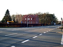
Bundesstrasse 70
The federal highway 70 (abbreviation: B 70 ) is one of the longer federal highways in North West Germany and runs through the states of Lower Saxony and North Rhine-Westphalia of East Frisia up to the Lower Rhine .
course
The B 70 begins at the Neermoor junction of the federal motorway 31 (A 31) in the middle of East Frisia and leads through the town of Leer (nine kilometers) to Papenburg (30 km) and further - always parallel to the Ems and the Dutch border - through flat land Meppen (78 km).
To the west around Meppen it runs for about 6.5 km as a four-lane, motorway-like bypass road. Here it crosses the Ems twice in quick succession.
From Meppen the road runs right next to the Dortmund-Ems Canal for 15 km and then reaches Lingen (101 km). Now it leads a little away from the Dutch border, after 128 km crosses the state border from Lower Saxony to North Rhine-Westphalia and shortly afterwards arrives at Rheine (132 km).
Here the road crosses the A 30 (junction Rheine Nord) and is then a motor road until the junction of the L 580 at the roundabout in Neuenkirchen . In December 2013, the B 70 bypass in the municipality of Wettringen was approved.
In Rheine, the road crosses the Ems for the last time, which it has been following since the beginning, and turns to the southwest. The long route continued via Ahaus and Stadtlohn (173 km) to Borken (204 km).
However, since January 1, 2010, the northern branch of the B 70 has ended at the A 31 (Heek junction). The southern branch begins about eleven kilometers south of Gronau (Westphalia) on the B 54 and leads via Vreden and Südlohn-Oeding to the B 525 . There the B 70 swings to the previous route in the direction of Borken. From there, the B 70 leads on a scenic route just north of the Ruhr area through the Hohe Mark-Westmünsterland nature park to Wesel on the Lower Rhine, where it ends in the east of the city on the B 58 .
The total length of the former B 70 was 234 km.
history
Reichsstraße 70 originally ran from Norddeich on the East Frisian North Sea coast to Rheine, but was soon continued to Wesel. Instead, it became shorter in 1995 after the construction of the A 31 in the far north: The section from Norddeich near the East Frisian city of Norden to Emden became a section of the B 72 and the B 210 , the section from Emden to Neermoor became the A 31.
Planning
Road traffic in the Aurich area is to be reorganized on a large scale according to the current federal traffic route plan. A new direct connection between Aurich and the A 31 is to create a northern extension of the B 70 from the Riepe junction. It should end at the B 72 / B 210 southwest of Aurich. The " 2 + 1 system " is planned for the section of the B 70 from the A 31 to its new end . The connections to the existing road network are largely made with motorway-like junctions. The overall project is being managed by the Lower Saxony state authority for road construction and transport under the working title “Bundesstraße 210 new”.
See also
Web links
Individual evidence
- ↑ Wettringen bypass is ready. State Office for Road Construction North Rhine-Westphalia, December 20, 2013, accessed on December 20, 2013 .
- ↑ Administrative region of Münster (Hrsg.): Official Gazette for the Reg.-Bez. Munster . No. 50 . Münster December 11, 2009, p. 535 ff . ( bezreg-muenster.nrw.de [PDF; 124 kB ; accessed on November 3, 2011]). bezreg-muenster.nrw.de ( Memento from September 6, 2014 in the Internet Archive )
- ^ Conti-Atlas from 1934


