Bundesstrasse 455
| Bundesstrasse 455 in Germany | ||||||||||||||||||||||||||||||||||||||||||||||||||||||||||||||||||||||

|
||||||||||||||||||||||||||||||||||||||||||||||||||||||||||||||||||||||
| map | ||||||||||||||||||||||||||||||||||||||||||||||||||||||||||||||||||||||
| Basic data | ||||||||||||||||||||||||||||||||||||||||||||||||||||||||||||||||||||||
| Operator: |
|
|||||||||||||||||||||||||||||||||||||||||||||||||||||||||||||||||||||
| Overall length: | approx. 100 km | |||||||||||||||||||||||||||||||||||||||||||||||||||||||||||||||||||||
|
State : |
||||||||||||||||||||||||||||||||||||||||||||||||||||||||||||||||||||||
|
Course of the road
|
||||||||||||||||||||||||||||||||||||||||||||||||||||||||||||||||||||||
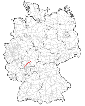
The federal highway 455 (abbreviation: B 455 ) is a federal highway in Germany . It leads from the Wiesbaden district of Mainz-Kastel to Schotten .
course
Bundesstraße 455 begins at the Theodor-Heuss-Brücke in Mainz-Kastel , a district of Wiesbaden , and runs northeast through Wiesbaden suburbs towards Taunus . In the Taunus, the federal highway 455 crosses the federal motorway 3 (A 3) and continues through Eppstein and Königstein im Taunus over the Königsteiner roundabout , past the Opel Zoo and Kronberg im Taunus in the direction of Oberursel (Taunus) . It leads around Oberursel on what is known as the “northern bypass” and then merges into the A 661 . The section of the A 661 from the beginning to the Bad Homburg junction and the section of the A 5 from the Bad Homburg junction to the Friedberg junction are now replacing the federal road. By Rosbach , Friedberg and Woelfersheim the road continues through the Wetterau . After Harb bei Nidda the federal road 455 leads to Schotten .
Changes to the course and gradations for other reasons
The federal highway 455 originally ran through Oberursel, where it was downgraded to a district road (K 772) or a state road (L 3004) due to the construction of the “northern bypass” . Almost at the same time, the graduation from the end of the autobahn A 661 to the Friedberg junction of the A 5, where it has since been downgraded to a municipal road or a state road (L 3057) in the areas of Bad Homburg vor der Höhe and Friedrichsdorf , took place. Nevertheless, the signs continue to show both Königstein and Friedberg from Bad Homburg .

