Bundesstrasse 33
| Bundesstrasse 33 in Germany | |||||||||||||||||||||||||||||||||||||||||||||||||||||||||||||||||||||||||||||||||||||||||||||||||||||||||||||||||||||||||||||||||||||||||||||||||||||||||||||||||||||||||||||||||||||||||||||||||||||||||||||||||||||||||||||||||||||||||||||||||||||||||||||||||||||||||||||||||||||||||||||||||||||||||||||||||||||||||||||||||||||||||||||||||||||||||||||||||||||||||||||||||||||||||||||||||||||||||||||||||||||||||||||||||||||||||||||||||||||||||||||||||||||||||||||||||||||||||||

|
|||||||||||||||||||||||||||||||||||||||||||||||||||||||||||||||||||||||||||||||||||||||||||||||||||||||||||||||||||||||||||||||||||||||||||||||||||||||||||||||||||||||||||||||||||||||||||||||||||||||||||||||||||||||||||||||||||||||||||||||||||||||||||||||||||||||||||||||||||||||||||||||||||||||||||||||||||||||||||||||||||||||||||||||||||||||||||||||||||||||||||||||||||||||||||||||||||||||||||||||||||||||||||||||||||||||||||||||||||||||||||||||||||||||||||||||||||||||||||
| |
|||||||||||||||||||||||||||||||||||||||||||||||||||||||||||||||||||||||||||||||||||||||||||||||||||||||||||||||||||||||||||||||||||||||||||||||||||||||||||||||||||||||||||||||||||||||||||||||||||||||||||||||||||||||||||||||||||||||||||||||||||||||||||||||||||||||||||||||||||||||||||||||||||||||||||||||||||||||||||||||||||||||||||||||||||||||||||||||||||||||||||||||||||||||||||||||||||||||||||||||||||||||||||||||||||||||||||||||||||||||||||||||||||||||||||||||||||||||||||
| map | |||||||||||||||||||||||||||||||||||||||||||||||||||||||||||||||||||||||||||||||||||||||||||||||||||||||||||||||||||||||||||||||||||||||||||||||||||||||||||||||||||||||||||||||||||||||||||||||||||||||||||||||||||||||||||||||||||||||||||||||||||||||||||||||||||||||||||||||||||||||||||||||||||||||||||||||||||||||||||||||||||||||||||||||||||||||||||||||||||||||||||||||||||||||||||||||||||||||||||||||||||||||||||||||||||||||||||||||||||||||||||||||||||||||||||||||||||||||||||
| Basic data | |||||||||||||||||||||||||||||||||||||||||||||||||||||||||||||||||||||||||||||||||||||||||||||||||||||||||||||||||||||||||||||||||||||||||||||||||||||||||||||||||||||||||||||||||||||||||||||||||||||||||||||||||||||||||||||||||||||||||||||||||||||||||||||||||||||||||||||||||||||||||||||||||||||||||||||||||||||||||||||||||||||||||||||||||||||||||||||||||||||||||||||||||||||||||||||||||||||||||||||||||||||||||||||||||||||||||||||||||||||||||||||||||||||||||||||||||||||||||||
| Operator: |
|
||||||||||||||||||||||||||||||||||||||||||||||||||||||||||||||||||||||||||||||||||||||||||||||||||||||||||||||||||||||||||||||||||||||||||||||||||||||||||||||||||||||||||||||||||||||||||||||||||||||||||||||||||||||||||||||||||||||||||||||||||||||||||||||||||||||||||||||||||||||||||||||||||||||||||||||||||||||||||||||||||||||||||||||||||||||||||||||||||||||||||||||||||||||||||||||||||||||||||||||||||||||||||||||||||||||||||||||||||||||||||||||||||||||||||||||||||||||||||
| Start of the street: |
Willstätt ( 48 ° 32 ′ N , 7 ° 55 ′ E ) |
||||||||||||||||||||||||||||||||||||||||||||||||||||||||||||||||||||||||||||||||||||||||||||||||||||||||||||||||||||||||||||||||||||||||||||||||||||||||||||||||||||||||||||||||||||||||||||||||||||||||||||||||||||||||||||||||||||||||||||||||||||||||||||||||||||||||||||||||||||||||||||||||||||||||||||||||||||||||||||||||||||||||||||||||||||||||||||||||||||||||||||||||||||||||||||||||||||||||||||||||||||||||||||||||||||||||||||||||||||||||||||||||||||||||||||||||||||||||||
| End of street: |
Ravensburg ( 47 ° 46 ′ N , 9 ° 35 ′ E ) |
||||||||||||||||||||||||||||||||||||||||||||||||||||||||||||||||||||||||||||||||||||||||||||||||||||||||||||||||||||||||||||||||||||||||||||||||||||||||||||||||||||||||||||||||||||||||||||||||||||||||||||||||||||||||||||||||||||||||||||||||||||||||||||||||||||||||||||||||||||||||||||||||||||||||||||||||||||||||||||||||||||||||||||||||||||||||||||||||||||||||||||||||||||||||||||||||||||||||||||||||||||||||||||||||||||||||||||||||||||||||||||||||||||||||||||||||||||||||||
| Overall length: | approx. 120 km | ||||||||||||||||||||||||||||||||||||||||||||||||||||||||||||||||||||||||||||||||||||||||||||||||||||||||||||||||||||||||||||||||||||||||||||||||||||||||||||||||||||||||||||||||||||||||||||||||||||||||||||||||||||||||||||||||||||||||||||||||||||||||||||||||||||||||||||||||||||||||||||||||||||||||||||||||||||||||||||||||||||||||||||||||||||||||||||||||||||||||||||||||||||||||||||||||||||||||||||||||||||||||||||||||||||||||||||||||||||||||||||||||||||||||||||||||||||||||||
|
State : |
|||||||||||||||||||||||||||||||||||||||||||||||||||||||||||||||||||||||||||||||||||||||||||||||||||||||||||||||||||||||||||||||||||||||||||||||||||||||||||||||||||||||||||||||||||||||||||||||||||||||||||||||||||||||||||||||||||||||||||||||||||||||||||||||||||||||||||||||||||||||||||||||||||||||||||||||||||||||||||||||||||||||||||||||||||||||||||||||||||||||||||||||||||||||||||||||||||||||||||||||||||||||||||||||||||||||||||||||||||||||||||||||||||||||||||||||||||||||||||
| Development condition: | two-lane | ||||||||||||||||||||||||||||||||||||||||||||||||||||||||||||||||||||||||||||||||||||||||||||||||||||||||||||||||||||||||||||||||||||||||||||||||||||||||||||||||||||||||||||||||||||||||||||||||||||||||||||||||||||||||||||||||||||||||||||||||||||||||||||||||||||||||||||||||||||||||||||||||||||||||||||||||||||||||||||||||||||||||||||||||||||||||||||||||||||||||||||||||||||||||||||||||||||||||||||||||||||||||||||||||||||||||||||||||||||||||||||||||||||||||||||||||||||||||||
|
Course of the road
|
|||||||||||||||||||||||||||||||||||||||||||||||||||||||||||||||||||||||||||||||||||||||||||||||||||||||||||||||||||||||||||||||||||||||||||||||||||||||||||||||||||||||||||||||||||||||||||||||||||||||||||||||||||||||||||||||||||||||||||||||||||||||||||||||||||||||||||||||||||||||||||||||||||||||||||||||||||||||||||||||||||||||||||||||||||||||||||||||||||||||||||||||||||||||||||||||||||||||||||||||||||||||||||||||||||||||||||||||||||||||||||||||||||||||||||||||||||||||||||
The federal highway 33 (abbreviation: B 33 ) is a federal highway in Baden-Württemberg . It connects the Upper Rhine Plain with the Lake Constance region and crosses the Black Forest . It is part of the European route 531 between Offenburg and the Donaueschingen triangle .
history
origin
The road from Strasbourg to Schaffhausen was expanded into a highway around 1757 through a joint initiative of the neighboring small states . In 1760 the first stagecoach drove between Strasbourg and Ulm on this newly built road.
Previous routes and names
The road between Kehl and Schaffhausen was called Baden State Road No. 28 in 1901 . The road to Ludwigshafen branching off in Donaueschingen was called Baden State Road No. 57 . The long-distance road 33 (FVS 33) introduced in 1932, renamed Reichsstraße 33 (R 33) in 1934, did not end in Ravensburg , but in Constance .
course
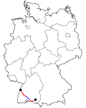
The federal road 33 branches off from the B 28 at Willstätt and leads via Offenburg through the Kinzig valley in the Black Forest . In Haslach it meets the B 294 and runs congruently with it to Hausach . At Hausach it leaves the Kinzig valley and follows the Gutach valley , at Triberg it bends in the direction of Villingen . At Bad Dürrheim it meets the B 27 and runs congruently with it as far as Hüfingen . There it leaves the B 27 and runs congruently with the B 31 to the Geisingen junction on the A 81 .
On the common course with the B 27 and the B 31, however, almost all indications of a co-course of the B 33 are now missing.
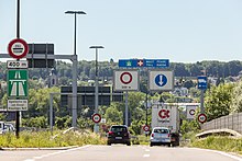
It only leaves the A 81 at the Hegau interchange ( A 81 , A 98 ). It takes over the function of the Bodenseeschnellweg between the Hegau and Konstanz motorway junction after plans from the 1970s were abandoned to continue the A 81 there. At times, this section was also planned as the A 881 motorway .
It is between the motorway junction Hegau including the bypass Radolfzell until the end, exit at Allensbach West expanded highway like . Between the Hegau interchange and Singen / Steißlingen it is signposted as a federal road to the south, and as a motorway to the north.
The plan approval procedure was completed in 2007 for the further four-lane expansion of the federal road from Allensbach-West towards Konstanz. An RQ 20 is planned , i. H. a four-lane lane without a hard shoulder. As a noise protection measure, several tunnels are also planned, which will make the overall expansion cost around 112 million euros. The expansion in this area was divided into the construction phases A – F. In November 2015, the expansion of sections A, B and E began. The plan is to open these sub-areas by 2021.
Between Radolfzell and Konstanz it leads along Lake Constance to Staad . The federal highway 33 between Staad and Meersburg is interrupted by a ferry connection across Lake Constance. From Meersburg it continues to Ravensburg . From the so-called Kindle image node at the gates of the city of Konstanz (here the B 33 crosses with the dam to the island of Reichenau ) to the German-Swiss border , the B 33 has been expanded to four lanes.
Open to traffic
By 1991, the B 33 between Gremmelsbach and Triberg was expanded for 72.2 million DM and three smaller tunnels were built: the Sugar Loaf Tunnel (194 m), the Steinbis Tunnel (163 m) and the Himmelreich Tunnel (129 m ). As a result, some loops of the Gutach are shortened and in particular the village of Schonachbach and the sawmill on the B 33 are freed from through traffic on the federal road.
The bypass for the town of Hausach, which cost a total of DM 107.7 million, was released in 1995; it runs in the northern arc around the town through the 1,085 m long summer mountain tunnel.
The Hornberg bypass was released on July 3, 2006 . According to the Federal Ministry of Transport, the approximately 2.5-kilometer section cost 50 million euros. Part of this bypass is an approximately 1.9 km long tunnel.
The four-lane section between Offenburg and Gengenbach -Nord has been open to traffic since 2017 .
See also
literature
- Klaus Schefold, Alois Neher (Ed.): 50 years of motorways in Baden-Württemberg. A documentation. On behalf of the Autobahn Office Baden-Württemberg. Baden-Württemberg motorway office, Stuttgart 1986.
Web links
- Detailed route description of the Bodenseeschnellweg, which was previously planned as the 881 federal motorway
- Site plans of the planned expansion near Allensbach (pdf)
Individual evidence
- ↑ Hegau – Allensbach with four lanes similar to a motorway
- ↑ https://rp.baden-wuerttemberg.de/rpf/Abt2/Ref24/Seiten/B33-Allensbach.aspx
- ↑ http://static5.suedkurier.de/storage/scl/einzelbilder/10258927_w720h480q75s1v53511_1.jpg?version=1447836403
- ↑ http://www.suedkurier.de/region/kreis-konstanz/allensbach/B-33-bei-Allensbach-Spatenstich-fuer-ein- Jahrhundert-Projekt; art372433,8312424
- ↑ http://dip21.bundestag.de/dip21/btd/12/040/1204068.pdf
- ↑ Landratsamt Schwarzwald-Baar-Kreis: subdivisions of the road construction office . In: lrasbk.de . Archived from the original on April 2, 2015. Retrieved March 4, 2015.
- ↑ http://dip21.bundestag.de/dip21/btd/13/058/1305850.pdf

