
Rotach (Lake Constance)
|
Rotach upper course name up to Wilhelmsdorf Mühlbach |
||
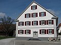
 The Rotach in Friedrichshafen |
||
| Data | ||
| Water code | DE : 21552 | |
| location | Baden-Wuerttemberg , Germany | |
| River system | Rhine | |
| Drain over | Rhine → North Sea | |
| source | of the upper course millstream at Illmensee -Birkhof 47 ° 51 '30 " N , 9 ° 23' 49" O |
|
| Source height | approx. 763 m above sea level NHN | |
| muzzle | East Friedrichshafen in Lake Constance Coordinates: 47 ° 38 '59 " N , 9 ° 29' 43" E 47 ° 38 '59 " N , 9 ° 29' 43" E |
|
| Mouth height | 395 m | |
| Height difference | approx. 368 m | |
| Bottom slope | approx. 9.3 ‰ | |
| length | 39.4 km | |
| Catchment area | 136.317 km² | |
| Discharge at the Friedrichshafen A Eo gauge : 132 km² Location: 1.2 km above the mouth |
NNQ (08/24/2003) MNQ 1947/2009 MQ 1947/2009 Mq 1947/2009 MHQ 1947/2009 HHQ (09/22/1968) |
113 l / s 345 l / s 1.83 m³ / s 13.9 l / (s km²) 34.7 m³ / s 75.9 m³ / s |
| Medium-sized cities | Friedrichshafen | |
The Rotach is a tributary of Lake Constance in southern Upper Swabia in Baden-Württemberg , Germany . As a tributary of Lake Constance, it belongs to the river system of the Rhine .
geography

The Rotach arises west of Wilhelmsdorf in the municipality of Illmensee in the district of Sigmaringen at the Birkhof under the name Mühlbach . Initially flowing to the northeast, it soon changes to the Wilhelmsdorf area in the Ravensburg district, where it drains the Pfrunger-Burgweiler Ried . It turns to the right on the southern course from the center of Wilhelmsdorf and is called Rotach after about 4.8 km . This flows through the Harttobel near Horgenzell , the Benistobel before Urnau and the municipality of Oberteuringen , until it finally reaches Friedrichshafen , where it flows into Lake Constance one kilometer east of the city center on the western border of the Eriskircher Ried . Its catchment area is around 130 km².
Places on the Rotach


- Wilhelmsdorf
- Hasenweiler (district of Horgenzell )
- Urnau (to Deggenhausertal )
- Neuhaus (to Oberteuringen)
- Oberteuringen
- Sub-price rings
- Ittenhausen (to Ailingen )
- Friedrichshafen
Tributaries
From the source to the mouth, the Rotach receives the following tributaries in addition to many unnamed streams:
- Mühlbach , upper course to Wilhelmsdorf
- Gattenmühlebach (l); Coordinates of the mouth "Gattenmühlebach"
- Bruckenbach (r), near Ringenhausen; Coordinates of the mouth "Bruckenbach"
- Aubach (r), west of Hasenweiler; Coordinates of the mouth "Aubach"
- Weihenbach (l), east of Sießen; Coordinates of the "Weihenbach" mouth
- Pfärrenbach (l); Coordinates of the "Pfärrenbach" estuary
- Buchbach (r); Coordinates of the mouth "Buchbach"
- Burgerbach (r), north of Jonistobel; Coordinates of the mouth "Burgerbach"
- Schachenbächle (r), near Benistobel; Coordinates of the mouth "Schachenbächle"
- Schwendebächle (r), in the Tobel near Weißenbach; Coordinates of the mouth "Schwendebächle"
- Riedbach (r), northwest of Urnau; Coordinates of the mouth "Riedbach"
- Bombenbach (r), in Urnau; Coordinates of the mouth "Bombenbach"
- Hirsenbach (l), in Urnau; Coordinates of the "Hirsenbach" estuary
- Schupelbach (r), east of Urnau; Coordinates of the mouth "Schupelbach"
- Kübelbach (r), near Lindenberghof; Coordinates of the mouth "Kübelbach"
- Schwendebach (r), near Schwende; Coordinates of the mouth "Schwendebach"
- Fiselbach (l), southeast of Geigen; Coordinates of the "Fiselbach" estuary
- Eckbach (l), northwest of Oberteuringen; Coordinates of the "Eckbach" mouth
- Rohmbach (r), west of Oberteuringen; Coordinates of the "Rohmbach" mouth
- Taldorfer Bach (l), south of Oberteuringen; Coordinates of the mouth "Taldorfer Bach"
- Unnamed (l), southern Reinach; Coordinates of the mouth " Untitled "
- Tobelbach (l), near Ittenhausen; Coordinates of the mouth "Tobelbach"
- Rohrbach (r), near Meistershofen; Coordinates of the "Rohrbach" mouth
- Allmannsweiler Bach (l), near Löwental; Coordinates of the mouth "Allmannsweiler Bach"
economy
Mills
The banks of the Rotach were once lined with 22 grinding and sawmills . In today's urban area of Friedrichshafen alone, eight mills were in operation in the mid-19th century.
- Rotachmühle , southeast of Wilhelmsdorf: The mill property from 1363 or 1783 with a four-meter-high overshot waterwheel, up to 140 year old mill machines and a crooked hip roof is now a designated cultural monument .
- The Haslachmühle from 1282 is today a school and residence for people with multiple disabilities. In the associated chapel you can see sacred mill art objects by Andreas Felger .
- Book mill
- Schönemühle is 1.2 kilometers from Urnau at the entrance to the Benistobel; no longer in operation
- Ramsenmühle
- Brick mill on Landstrasse 204, around 900 meters before Neuhaus, fully operational; the mill has been described as a fiefdom of the Salem monastery since 1347 ; later belonging to the Weißenau monastery , which bought the four-course mill in 1274 from the Salem monastery for eleven pounds denarii; 1838 mill with 15 inhabitants
- The owners of the Oberteuringer Mühle have been completely documented since 1432. In 1846 it was expanded and got its current appearance, in 1957 operations were stopped. As part of the state renovation program, the mill was renovated until 2002, inaugurated on the occasion of Oberteuringen's 1250th anniversary and given its new purpose; Since then, the building has served various cultural groups and associations for celebrations and celebrations.
- Weilermühle : 1391 sold to the Predigerkloster in Konstanz , later to the Weißenau monastery; 1838 a grinding and sawmill with six residents; changed hands several times over the centuries; Used as a spinning mill , pasta factory, ice cream factory, grinding plant for leather waste or a power station, the mill was the most powerful system on the Rotach until 1975 with 28 kW ; out of order today, the weir was blown up at the turn of the 21st century
- Reinachmühle : The building, built as a (tanning?) Mill in 1837, was converted into the Reinach pumping station in 1906 and has since served the communities of Ailingen, Raderach and Schnetzenhausen as a drinking water supply. After a turbine was installed in 1936 , the Technischen Werke Friedrichshafen (TWF) took over the plant in 1970. With an output of around five kilowatts , it has been working for regenerative energy generation ever since .
- The Ittenhausen mill, which was in operation until 1984 - has been in use since 1198 and is the oldest mill in Friedrichshafen - is now a cultural monument and has been reactivated. She was at a height of four meters with a 15 PS strong Francis turbine equipped.
- Brielmayer machine factory
- Meistershofen Mill
- The Trautenmühle used to be on the current TWF site . In 1837 this area with sawmill and mill was bought by King Wilhelm I of Württemberg, and an art mill was later built. In 1903 a fire destroyed the buildings. Rebuilt, the property fell victim to fire again in 1908. The company, which was rebuilt, came into the possession of Zeppelin Wohlfahrt in 1917. During the air raids in 1942 and '43 all buildings were destroyed.
- Rundelmühle : A mill of the Löwental Monastery has been handed down here since the Middle Ages . In 1634, during the Thirty Years' War , the building was destroyed by the departing Swedes. After the reconstruction in 1709, the round mill with a saw and oil mill as well as a tanning and four grinding operations is one of the larger facilities on the Rotach. Eugen Rundel acquired the mill in 1900 and set up a house chapel in the building in 1924. After the Second World War, the mill, damaged by an air raid in 1944, remained in operation for a long time. The mill canal and the associated weir can still be seen today.

Mill Oberteuringen

Hamlet mill

Weir in front of the Reinachmühle

At the Reinachmühle
Ittenhausen Mill


Renaturation
The former weirs to Ittenhauser Mühle and Reinachmühle (2014) were razed in the past and ascent aids were built parallel to them for the fish migrating upstream.

level
In Friedrichshafen city is located at river kilometer 1.15 to the level Friedrichshafen / rotách the flood forecasting center Baden-Württemberg and the State Institute for Environment, Measurements and Nature Conservation Baden-Württemberg (LUBW); The operator is the Tübingen regional council . The level zero point is 396.95 m above sea level. NN .
Statistical values
- Lowest water level (discharge) in 1982–2003 on May 27, 1990: 0.05 m / 0.13 m³ per second
- Average value of the lowest water levels (runoffs) from 1982–2003: 0.15 m / 0.35 m³ per second
- Average water level (discharge) from 1980–2003: 0.32 m / 2.01 m³ per second
- historic high, flood on December 21, 1997: 2.62 m
literature
- Edwin Grünvogel : On the valley history of the Lake Constance tributaries Rotach, Schussen and Argen due to their slope , in: Writings of the Association for the History of Lake Constance and its Surroundings , 76th year 1958, pp. 103–151 ( digitized version )
- Peter Möbius, Peter Foss: Rescue operation for the Lake Constance lake trout. Members of the Friedrichshafen fishing club provide assistance with the immigration of Lake Constance lake trout to the Rotach . In: Leben am See, 21st year 2004, pp. 250–257.
- Lothar Zier: The Pfrunger Ried . 2nd Edition. Schwäbischer Heimatbund, Stuttgart 1998, ISBN 3-88251-255-5 .
Web links
Individual evidence
- ↑ a b c d State Institute for the Environment Baden-Württemberg (LUBW) ( information )
- ^ German Hydrological Yearbook Rhine Region, Part I 2009 State Institute for Environment, Measurements and Nature Conservation Baden-Württemberg, p. 74, accessed on January 22, 2016 (PDF, German, 1.85 MB).
- ↑ Elmar L. Kuhn : "Eitelhans Ziegelmüller, the Peasant War and Oberteuringen"
- ↑ Description of the Tettnang Regional Office / Chapter B 18
- ↑ Culture in the Oberteuringen Mill ( Memento of the original from December 3, 2011 in the Internet Archive ) Info: The archive link was inserted automatically and has not yet been checked. Please check the original and archive link according to the instructions and then remove this notice.
- ↑ Description of the Oberamt Tettnang / Chapter B 2
- ↑ www.muehle-ittenhausen.de
- ↑ Information board of the Friedrichshafen history trail