Bundesstrasse 7

from Wikipedia, the free encyclopedia
Template: Infobox high-ranking street / Maintenance / DE-B
Bundesstrasse 7 in Germany
Bundesstrasse 7
map
Course of the B 7
Basic data
Operator: GermanyGermany Federal Republic of Germany
Start of the street: Düsseldorf
( 51 ° 14 ′  N , 6 ° 42 ′  E )
End of street: Rochlitz
( 51 ° 3 ′  N , 12 ° 47 ′  E )
Overall length: 453 km

State :

2010-05-22 IHK Sparkasse.JPG
Bundesstrasse 7 in Wuppertal
(Bundesallee in 2010 with Stadtsparkasse and Chamber of Industry and Commerce . Today the latter is largely covered by the construction of a new office and business complex . From July 21, 2014 to July 10, 2017, the B 7 was in the course of the Döppersberg - Conversion blocked. From 2014 to 2017 the substitute bus stop Ohligsmühle (main station) was located here on the otherwise blocked B 7)
Course of the road
State of North Rhine-Westphalia
Independent city of Düsseldorf
Autobahn end Transition off A52
Start of expressway Transition in DüsseldorfB7
Junction Düsseldorf-Heerdt
Junction Düsseldorf-Oberkassel
flow Rhine ( Theodor Heuss Bridge 1271 m)
node Düsseldorf-Kennedydamm B1 B8
Locality beginning Beginning of  Düsseldorf
bridge Ruhr Valley Railway , Cologne – Duisburg railway line
node Mörsenbroicher egg B1 B8
flow Northern Düssel
Locality Grafenberg
bridge Troisdorf – Mülheim-Speldorf railway line
Locality Ludenberg
Locality Gerresheim
Village end End of Düsseldorf
Junction (18)  Mettmann A3 E35
Mettmann district
Bypass Mettmann bypass 
bridge Railway bridge Railway line Düsseldorf-Derendorf – Dortmund Süd
bridge Düsseldorf-Derendorf – Dortmund Süd railway line
flow Düssel
bridge Railway bridge Railway line Düsseldorf-Derendorf – Dortmund Süd
bridge Railway bridge railway line Wuppertal-Vohwinkel-Essen-Überruhr
Independent city of Wuppertal
Locality Wuppertal- Vohwinkel
flow ( Lüntenbeck ) 
Junction (11)  Wuppertal- Dornap A535
Locality beginning Entrance to  Wuppertal
bridge under A46
Locality Nützenberg B228
Locality Elberfeld-West
Street as Friedrich-Ebert-Straße
Street as Robert-Daum-Platz
Locality Elberfeld
Street as a federal avenue
flow Wupper (3 ×)
Locality Barmen
Street as Friedrich-Engels-Allee
crossing old market
Locality Mercy
Street as mockery
Street than Berliner Strasse
Village end End of Wuppertal
Junction (93)  Wuppertal-Langerfeld A1 E37 B483
Autobahn beginning replaced by A1B54
Independent city of Hagen
Roundabout Altstadtring B54
Locality Remberg
Locality Eppenhausen
bridge under A45 E41
Locality Hohenlimburg
bridge Ruhr-Sieg route
flow Lenne
Locality Hagen-Elsey
Village end End of town Hagen
Junction (44)  Hagen-Elsey A46
Autobahn beginning replaced by A46
Märkischer Kreis
Junction (49)  Hemer A46
Locality Hemer
Locality Becke / Oese
Locality Menden (Sauerland) B515
bridge Hönnetalbahn
flow Hönne
Locality Brockhausen
Soest district
Locality Wickede - Wimbern B63
flow Wimberbach
Hochsauerlandkreis
Locality Vosswinkel
flow Stakelberger Bach
Locality Bachum
flow Bachum Bach
Locality Bergheim
bridge Upper Ruhr Valley Railway
flow Dysentery
Junction (62)  Arnsberg- NeheimA46
Autobahn beginning replaced by A46
Hochsauerlandkreis
Junction (71)  Bestwig A46
Locality Bestwig OT Velmede
flow Valme
Locality Bestwig
flow Elpe
flow Dysentery
Locality Bestwig OT Nuttlar
bridge Nuttlar – Frankenberg railway line
Locality Olsberg OT Antfeld B480
bridge Railway bridge ( Obere Ruhrtalbahn )
Locality Brilon OT Altenbüren
flow Hillbringse
Bypass Brilon bypass  B480 B251
bridge Almetalbahn
Locality Brilon OT Rösenbeck
Locality Marsberg OT Bredelar
Locality Marsberg
Locality Marsberg OT Westheim
Junction (63)  Marsberg A44 E331
Höxter district
flow Hammerbach
crossing Scherfede-West B252
Locality Warburg OT Scherfede B68
bridge Railway bridge ( Obere Ruhrtalbahn )
Locality Warburg OT Rimbeck
Locality Warburg OT Ossendorf
flow Naure
crossing B252
Locality Warburg
flow Diemel
Locality Warburg OT Calenberg
Locality Warburg OT Herlinghausen
State of Hesse
District of Kassel
flow Ruhrbach
Bypass Niederlistingen bypass 
Start of expressway Beginning of the motor road
Junction Obermeiser
flow Warmth
Junction Westuffeln
Expressway end End of the highway
flow Nebelbeeke
Template: AB / Maintenance / Empty Symbol: flight Kassel-Calden Airport
Locality Calden
Template: AB / Maintenance / Empty together with B83direction KasselSymbol: Down
Junction Espenau OT Schäferberg
bridge Kassel – Warburg railway line
Junction Vellmar
flow ancestor
Junction Nieder-Vellmar
bridge Railway bridges high-speed line Hanover – Würzburg and Hannöversche Südbahn
Independent city of Kassel
Locality kassel
Street than Holländische Strasse
crossing Dutch placeB251
flow ancestor
crossing B3 (Weserstrasse)
flow Fulda
Template: AB / Maintenance / Empty together with B83direction EspenauSymbol: Up
flow Wahlebach
District of Kassel
flow Losse
Junction (78)  Kassel East A7 E45
Bypass Kaufungen bypass 
flow Diebachsgraben
flow Losse
bridge Kassel – Waldkappel railway line
flow Setzebach
Bypass Helsa bypass  B451
parking spot Symbol: leftSymbol: left Waldhof car park
crossing Eschenstruth
flow Losse
Werra-Meißner district
Locality Hessisch Lichtenau OT Fürstenhagen
flow Losse
Locality Hessian Lichtenau B487
Junction (76)  Hessian Lichtenau-West A44
Autobahn beginning replaced by A44
Junction (78)  Hessisch-Lichtenau-Ost A44
flow Weirs (3 ×)
Locality Kitchens
Locality Hasselbach
flow Weirs
Locality Harmuthsachsen
Locality Waldkappel
flow Weirs
Junction (79)  Waldkappel A44
Locality Waldkappel OT Bischhausen
Locality Wehretal OT Oetmannshausen B27
flow Weirs
flow Sontra
bridge Göttingen – Bebra railway line
crossing B452
flow Netra
Locality Sontra OT Wichmannshausen B27
flow Netra
Locality Ringgau OT Datterode
Locality Ringgau OT Röhrda
Locality Ringgau OT Netra
Locality Ringgau OT Rittmannshausen
Free State of Thuringia
Wartburg district
Locality Ifta
crossing Beautiful view B250
Locality Creuzburg L 1017
flow Werra
flow Girl
Locality Lengroden
Roundabout Krauthausen - Deubachshof L 1017
Junction (39)  Eisenach- WestA4 E40 B19
Autobahn beginning replaced by A4 E40
Template: AB / Maintenance / Empty downgraded to state road L 3007
Junction (42)  Gotha A4 E40
Locality Gotha B247
flow Mill moat
bridge Railway bridge railway line Gotha – Leinefelde
Bypass Siebleben bypass
Locality Siebleben L 2147N
Bypass Tüttleben bypass 
Locality Gamstädt L 1044
District-free city of Erfurt
crossing Frienstedt
Junction (13)  Erfurt- BinderslebenA71
Autobahn beginning replaced by A71
Street as part of the Erfurt Ring
Start of expressway Motorway
node (7)  Erfurt-North A71
Junction Red mountain
Junction Ringelberg L 1055
bridge via the Halle – Bebra railway line and the
new Erfurt – Leipzig / Halle line
Junction Linderbach L 1052
Expressway end End of the highway
flow Linderbach
Locality Linderbach
Start of expressway Motorway
Junction Vieselbach freight center
Weimarer Land district
Junction Mönchenholzhausen -West
Junction Klettbach / Hayn L 1056
Expressway end End of the highway
Locality Utzberg
Locality Nohra B85
Template: AB / Maintenance / Empty together with B85Weimar
Independent city of Weimar
Junction Weimar -West
crossing Tröbsdorf
bridge Railway bridge Halle – Bebra railway line
flow Asbach
crossing Gaberndorf
crossing Ettersburger Strasse L 1054
Template: AB / Maintenance / Empty together with B85direction Nohra
Roundabout Schondorf B85
Bypass Weimar-Ost bypass
bridge Railway bridge Halle – Bebra railway line
and Weimar – Gera railway line
Locality Weimar
flow Ilm
bridge Weimar – Gera railway line
Weimarer Land district
Locality Umpferstedt B87
Locality Frankendorf
Bypass Hohlstedt bypass 
Independent city of Jena
Roundabout Business park Isserstedt L 1060
Bypass Isserstedt bypass  L 1060
Locality beginning Beginning of  Jena
flow Leutra
crossing At the Anger B88
bridge Railway bridge Saalbahn
flow Saale
Locality Fewjena
flow Gembdenbach
Village end End of Jena
Locality Wogau
Saale-Holzland district
Locality Großlöbichau
Locality Rodigast L 2316
Locality Bürgel OT Gniebsdorf
flow Tracks
Locality Bürgel
Locality Droshka
Locality Despite L 1070
Locality Hainspitz
Junction (22)  Eisenberg L 3007A9 E51
Template: AB / Maintenance / Empty downgraded to state road L 3007
Autobahn beginning replaced by A9 E51 A4 E40
Altenburger Land district
Junction (60)  Ronneburg L 1081A4 E40
flow Grossensteiner Sprat
Locality Untschen
Locality Burkersdorf
Locality Steinsdorf
Locality Castle
Locality Schmölln L 1361 L 1358
Locality Zschernitzsch
Bypass Großstöbnitz bypass
Locality Großstöbnitz
Locality Burkersdorf
crossing Altenburg -Schmöllnsche Landstrasse L 2171
Start of expressway Motorway
Junction Altenburg-South B93
Template: AB / Maintenance / Empty together with B93
Junction Altenburg-East B180
bridge via the Leipzig – Hof railway line
Junction Altenburg-North B180
Template: AB / Maintenance / Empty together with B93
Junction Windischleuba B93
Expressway end End of the highway
flow Pleiße
crossing Junction Pöppschen L 1353
Bypass Bypass Frohburg (to A72)
Free State of Saxony
District of Leipzig
Locality Eschefeld
crossing Junction Frohburg S 51
flow Wyhra
Locality Streitwald
Locality Roda
Junction (23)  Geithain A72
Locality Niedergräfenhain
flow Eula
Locality Geithain S 44 S 242
flow Eula
bridge via the Neukieritzsch – Chemnitz railway line
Central Saxony district
Locality Königsfeld S 49
Locality Rochlitz OT Poppitz B107
  • Under construction
  • In planning
  • Traffic control system
  • The federal road 7 (abbreviation: B 7 ) leads from the Büderich junction on the federal motorway 52 (A 52) to Rochlitz near Chemnitz . It is about 500 kilometers long. The western end of the route was originally Leuth-Schwanenhaus on the Dutch border near Venlo .

    history

    The trunk road 7 originally set up in 1932 , Reichsstrasse 7 from 1934 , led east of Schmölln east of Schmölln via Meerane , Glauchau , Chemnitz and Freiberg to Dresden , where it merged into Reichsstrasse 6 . The historic route between Chemnitz and Dresden was included in the mid-1930s in the Reichstrasse, now Bundesstrasse 173 .

    Origins

    In the Sättelstädt - Gotha - Erfurt section , federal road 7 follows the historical course of the Via Regia .

    In the Electorate of Hesse , the street west of Kassel, which was classified as the main first class street in 1831, was called Holländische Straße , between Kassel and Helsa as Berliner Straße and east of Helsa as Gothasche Straße .

    Expansion to Chaussee in the 18th and 19th centuries

    The section between Wuppertal and Hagen was completed in 1788, making it one of the oldest art roads in West Germany. The section between Iserlohn and Menden (Sauerland) was built between 1816 and 1817. The middle section of the route through the upper Ruhr valley was expanded into the Chaussee by the neighboring communities between 1808 and 1818 and taken over as the Staatschaussee in 1822.

    Situation since 2000

    In some areas, federal highway 7 will be replaced by motorways. The section between Nettetal - Breyell and Büderich now has a parallel motorway. In the further course, for example, the A 46 between Hagen-Hohenlimburg and the current end of the motorway in the eastern city of Iserlohn ( Hemer / Iserlohn-Löbbeckenkopf exit ) and between Neheim-Hüsten and Bestwig.

    The so-called old B 7 - today as L 29 - still connects Nettetal-Kaldenkirchen with the district of Breyell, runs parallel to the A 61 in the direction of Viersen-Dülken, crosses under the A 61 at the exit of V.-Dülken, becomes the inner-city expressway in Viersen, circling Viersen to the east, only to come across the B 57 at the Mönchengladbach-Nord feeder. From the BAB Kreuz Neersen, the former B 7 runs along the Old North Canal from 1804 to Kaarst and then on to Neuss as the L 230.

    The western beginning of the B 7 is now the end of the A 52 at the Büderich junction. There the signs change from blue (A 52) to yellow (B 7). The B 7 runs in Düsseldorf over the Theodor-Heuss-Brücke ("Nordbrücke"), then a short section in the Derendorf district together with the B 1 and the B 8 to the " Mörsenbroicher Ei " junction . After crossing the districts of Grafenberg, Gerresheim and Ludenberg, the B 7 leaves the state capital in the direction of Mettmann. In Mettmann it has been leading via the newly built southern bypass since 2008 and then continues via Wuppertal to Hagen and Iserlohn. In the Schwelm – Hagen area it leads over the A 1, between Iserlohn – Hemer and Arnsberg – Meschede via the A 46, the old B 7 was downgraded to a state road there. In Bestwig, it starts again at the end of the A 46 motorway and then heads towards Kassel.

    On December 8, 2006, the Marsberg junction on the A 44 from Kassel to Dortmund was released on the state border between Hesse and North Rhine-Westphalia . It connects the B 7 with the A 44 .

    In Calden which is on the B 7 Kassel-Calden Airport . To the north and east of the village, a 5 km long bypass will be built between 2016 and probably 2022. It will contain three new bridges: two long brook bridges (330 and 232 m long) and a short road bridge (underpass of the K 47 branching off from it and newly to be routed to the B 83 in the direction of Burguffeln ).

    The first section of the A 44 east of Kassel near Hessisch Lichtenau was opened in October 2005. But there are also lawsuits from environmentalists against the project, as the motorway is supposed to run through the Frau-Holle-Land Geo-Nature Park . Since August 5, 2005, an all-day passage ban for transit trucks has been in force on a route length of 157 km. This regulation applies for one year between the Kassel-Ost junction ( A 7 ) and Wehretal . An exception applies to vehicles that are loaded or unloaded in the Werra-Meißner district and the Kassel district or in the city of Kassel .

    Between Kassel and Eisenach-West the road leads through the Ringgau , as a result of the aftermath of the German division , this section to Ifta is currently still a bottleneck (without bypasses, sometimes only two-lane expansion).

    On January 9, 2010, in the course of the relocation of the A 4, the course of the B 7 in Eisenach and in the Wartburg district was changed. The previous route through Eisenach, Wutha-Farnroda to Gotha was partially withdrawn or downgraded to state road 3007 under construction work by the Free State of Thuringia.

    In Erfurt the B 7 was downgraded from the A 71 -AS Erfurt-Bindersleben to Linderbach to Kreisstraße 16 after the Erfurt Ring was completed . At the same time it was relocated from Linderbach to the four-lane L 1052 (Erfurt east bypass) from AS Linderbach to A 71 -AS Erfurt-Nord.

    Since summer 2007 there have been five stationary surveillance systems (" speed cameras ") on the B 7 on the section between Kassel-Ost and Hessisch Lichtenau to control the maximum speed of 80 km / h. This step was taken because more people were killed on this section.

    From July 21, 2014 to July 10, 2017, the Wuppertal through-traffic (Döppersberg / Bahnhof) between Brausenwerth and Kasinostraße was closed.

    Since January 1, 2015, federal highway 7 between the Eisenberg junctions on BAB 9 and Ronneburg on BAB 4 has been downgraded to a state road. According to the state office, the reason is the lack of long-distance traffic significance of the route when running parallel to federal motorways.

    The plan was to relocate the B 7 in Hagen from Wehringhauser Straße (from Bodelschwinghplatz) and the Graf-von-Galen-Ring and now via the new Hagen station access point from Bodelschwinghplatz behind the station to the bridge over the DB on Eckeyeser Straße respectively. A first, smaller section was opened in July 2014, and the full release took place on March 13, 2020. On January 1, 2015, the section between Schwelm and Hagen was stepped down to form Landesstraße, so that the new station rear access will not become part of the B 7.

    The three-lane Tüttleben bypass was built near Gotha from 2018 to 2020 and opened on June 9, 2020. A continuation as the Gotha-Siebleben bypass is listed as an urgent requirement in the Federal Transport Infrastructure Plan 2030 .

    Between the Hessisch Lichtenau-Ost and Waldkappel motorway junctions on the A44, the B7 was downgraded to District Road 33 after this section was opened. The lane width has been reduced in the course of the downgrade since October 2019.
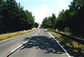
    additional

    The B7 cave in Iserlohn-Grüne, discovered in 1965, is named after her.

    Web links

    Commons : Bundesstrasse 7  - Collection of pictures, videos and audio files

    Individual evidence

    1. ^ A road from west to east Grenzlandkurier July 22, 2008 p. C3
    2. Annals of geography, ethnology and national studies. Born in 1830, p. 537.
    3. ^ Official Journal for the Reg.Bez. Düsseldorf, Volume 192 No. 1, January 14, 2010 (PDF; 3.6 MB)
    4. Rheinische Post from August 2, page C1 (Grenzland-Kurier): Farewell to the B 7
    5. ^ Official Journal for the Reg.Bez. Düsseldorf, Volume 189 No. 51, December 20, 2007 ( Memento from January 6, 2014 in the Internet Archive ) (PDF; 3.6 MB)
    6. ^ Rheinische Post of September 26, 2008: Money for bypass roads
    7. B 7 - Calden bypass including new construction of the L 3214 and K 47 , accessed on May 30, 2019, on mobil.hessen.de
    8. ^ General decree of the State Office for Building and Transport ... Thuringian State Gazette No. 2/2010, p. 34
    9. Road map of Thuringia as of May 2013
    10. Decision - the B7 will be closed ( Memento from July 29, 2014 in the Internet Archive )
    11. Andreas Boller: Döppersberg: The goal is still a long way off. In: Solinger Tageblatt. July 24, 2017. Retrieved July 25, 2017 .
    12. Gabi Ramme: B7 in Wuppertal released again . July 10, 2017 ( wdr.de [accessed July 24, 2017]).
    13. ^ Report of the project on the website of the city of Hagen ( Memento from May 7, 2013 in the Internet Archive )
    14. ^ Train station experience . Retrieved June 9, 2020 .
    15. ^ Official Journal of the Arnsberg District Government
    16. Deutscher Tele Markt GmbH internet and advertising agency: Three kilometers for a better quality of life: The B7 Tüttleben bypass is open to traffic. Retrieved June 9, 2020 .