Bundesstrasse 102
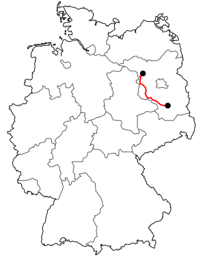
The national highway 102 (abbreviation: B 102 ) is a German national road . It begins on the B 5 in Bückwitz , ten kilometers southeast of Kyritz and ends in Luckau at the intersection of the B 96 and the B 87 .
history
The 102 trunk road (FVS 102) set up in 1932, known as Reichsstrasse 102 from 1934 , originally only ran from Brandenburg an der Havel to Luckau. The section north of Brandenburg was completed in 1896 between Premnitz and Pritzerbe , but was only elevated to a federal highway much later.
particularities
The section between Jüterbog and Dahme / Mark runs partly directly on the mountain range of the Niedere Fläming. On the last part of the route, between Dahme / Mark and Luckau , there is the transition from Fläming to the Lausitz border wall and thus to the Brandenburg region of Niederlausitz .


