
Brandenburg on the Havel
| coat of arms | Germany map | |
|---|---|---|

|
Coordinates: 52 ° 25 ' N , 12 ° 34' E |
|
| Basic data | ||
| State : | Brandenburg | |
| Height : | 32 m above sea level NHN | |
| Area : | 229.71 km 2 | |
| Residents: | 72,184 (Dec. 31, 2019) | |
| Population density : | 314 inhabitants per km 2 | |
| Postcodes : | 14770-14776 | |
| Area code : | 03381 | |
| License plate : | BRB | |
| Community key : | 12 0 51 000 | |
| NUTS : | DE401 | |
| City structure: | 8 districts, 8 districts | |
City administration address : |
Old town market 10 14770 Brandenburg on the Havel |
|
| Website : | ||
| Lord Mayor : | Steffen Scheller ( CDU ) | |
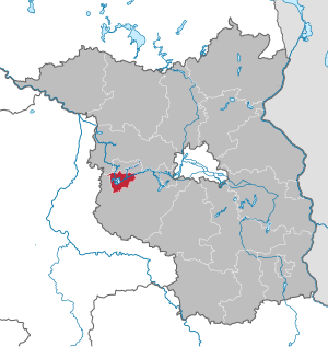
| Location of the city of Brandenburg an der Havel in Brandenburg | ||
  |
||


With around 72,000 inhabitants, Brandenburg an der Havel is the third largest and, in terms of area, the largest independent city and one of the four regional centers of the German state of Brandenburg . The Slavic eponymous Brandenburg was first mentioned in writing in 928 or 929. Urban structures did not develop until after the German conquest in the 12th century. A document from 1170 names the old town in Brandenburg for the first time as a city under German law. Because of its long history and because it gave its name to the whole of Brandenburg, it is also known as the “cradle of the Mark ”.
geography
.jpg)
location


Brandenburg an der Havel is located on an area of 228.8 square kilometers in the west of the state of Brandenburg, about 70 kilometers from Berlin and belongs to its agglomeration area .
The city is located on the Havel River, which is important for inland shipping, between Potsdam and the confluence with the Elbe near Havelberg . In the urban area, the Havel branches out into several branches and canals that form some islands that shape the cityscape. There are also ten natural lakes, most of which the Havel flows through or are connected to. Only the Gördensee and Bohnenländer See, located in the glacial Bohnenland-Görden-Rinne , as well as the Heilige See have no natural inflow and outflow to the Havel. These are drained via artificial ditches, the Bohnenländer See via the Eisengraben from the Butter Laake , and the Gördensee via the Quenzgraben . The largest lakes in the urban area are the Plauer See with an area of around 640 hectares and the Beetzsee , which can be seen on the map as the northeastern tip of the urban area. In the lakes there are several islands such as Buhnenwerder between Plauer, Breitling and Möserschem See . Also groynes Werder is the name of an island in Beetzsee. The Riewendsee , northeast of the Beetzsee, is an exclave of the city. Although it belongs to Brandenburg, it is completely surrounded by other municipal or urban areas. Conversely, the narrow area corridor of Beetzsee and Riewendsee separates the Beetzsee municipality almost completely from the rest of the Potsdam-Mittelmark district . The Havel in turn separates the historic landscapes of Havelland in the north and Zauche in the south. The city owns shares in both landscapes. Other natural rivers besides the Havel are the Plane rivers, which have their source in Fläming, and their tributaries Temnitz or Sandfurthgraben and the Buckau and their tributaries Verlorenwasser . Plane and Buckau each flow into the Breitlingsee . The river Emster , which flows into the Havel between the districts of Wust and Gollwitz , was expanded and widened like a canal in the 19th century. There are also some canals, such as the Jakobsgraben , the Brandenburg City Canal and the Silo Canal , which were created as waterways at different times.
The highest point in the urban area with over 70 meters is at the southern end of the urban area south of the motorway. In the city center, the Marienberg reaches a height of almost 68 meters. It was the highest elevation up to the incorporation of Mahlke in 1993 and belongs to a chain of ice age hills in the ice edge layer 1 c of the Brandenburg phase of the Vistula glaciation . The 63 meter high vineyard near Klein Kreutz , which was later used for viticulture, was built in peripheral location 2 . In the south-east of the urban area, Brandenburg between Kirchmöser and Mahlenzien has a share in the high plateau of the Karower Platte formed in the main ice- edge location . On this, for example, lies the Mühlenberg , which, like the Marienberg, was historically used as a Telegrafenberg.
The soils are generally rather sandy and sometimes not very fertile. Around 75 percent of the urban area is used for agricultural purposes, swamp areas or bodies of water. The agricultural areas of the city also include the forests of Gördenwald, Neustädter Heide and Neu-Plauer Forst, which together with smaller forest areas make up around 20 percent of the communal area. The dominant planting in these areas is the monoculture of the pine , although lately more and more people have moved away from them and have switched to planting mixed vegetation.
City structure
Brandenburg an der Havel is divided into eight districts, two of which are referred to as city or districts. The three medieval city centers today form the districts of Altstadt , Neustadt , to which the districts of Göttin and PAINKE have belonged since 1993 , and the cathedral with Klein Kreutz and Saaringen since 1993 and Gollwitz and Wust since 2003 . In the 20th century, three new districts were planned in the historic district of the old town. These were Görden in the 1920s, north from 1959 and finally the Hohenstücke slab construction area from 1972 . In 1952 the independent town of Plaue and the municipality of Kirchmöser were incorporated, which are now part of the town or district. The Mahlenzien district has belonged to Kirchmöser since 1993 . In total, the city is divided into around 50 city and districts, localities and residential areas. In the north of the municipality of Beetzsee is the Brielower extension , to the west of this Butterlake and again to the north of Bohnenland .
Neighboring districts, cities and municipalities
The independent city of Brandenburg an der Havel is almost completely surrounded by the Potsdam-Mittelmark district . Over a few kilometers in the extreme northwest and northeast, the Havelland district also borders the urban area. The neighboring cities and communities are clockwise: in the northwest the community Milower Land in the Havelland district, in the north the city Havelsee and the communities Beetzsee and Roskow in Potsdam-Mittelmark. Beetzseeheide , Päwesin in Potsdam-Mittelmark and the Havelland town of Nauen are located to the north and northeast , respectively, on the shores of the Beetzsee and Riewendsee lakes, which are part of the city . The community of Groß Kreutz borders Brandenburg in the east, Lehnin , Wollin and Wenzlow monasteries to the south and Rosenau , Wusterwitz and Bensdorf to the west . They are all in turn in the district of Potsdam-Mittelmark.
Environment and nature protection
Protected areas
In the 1990s, the lowlands of the Fiener Bruch and adjacent areas were designated as an EU bird sanctuary Fiener Bruch as part of the Natura 2000 network . In the extreme southwest, Brandenburg an der Havel has a small share of this bird sanctuary.
The island of Buhnenwerder in the Beetzsee is designated as the seagull island of Buhnenwerder as a nature reserve. It was declared a nature reserve on April 1, 1930 by an ordinance of the district president. This makes it the oldest nature reserve in the city of Brandenburg. On the island there was a large breeding colony of black-headed gulls , which was the aim of the protection. The Volksbund Naturschutz had leased Buhnenwerder as early as 1929 and set up an observation station. During the egg-laying period, the breeding colony was monitored and protected from the clutches being looted. Buhnenwerder was also the subject of scientific work on black-headed gulls at an early stage. Young animals and migratory behavior were documented in this way.
During the Second World War , the clutches on the island were massively looted and Buhnenwerder was used as a military training area, which led to the disappearance of the breeding colony. However, after the area was placed under protection again after the end of the war, the birds were quickly reintroduced. However, stocks have been declining since the late 1950s. Other animal species on the island, Tern , Reed Warbler , Reed Bunting , Bittern and European pond turtle .
Landscape change

Since around 1180, the Havel has been dammed by dams on Brandenburg Cathedral Island in order to operate water mills, south of Mühlendamm between Cathedral Island and Neustadt, north of three dams along Krakauer Straße. Because of the low gradient of the river, the Brandenburg mill dam caused the water level to rise by more than a meter 64 km upstream in Spandau . As a result, wetlands were created by human hands on the central Havel , while the high-medieval development of the country was characterized elsewhere by the drainage of marshland .
In the north of the urban area, in the old town forest, are the Gördensee and the Bohnenländer See, which formed in a glacial channel, the Bohnenland-Görden-Rinne. The lakes have no natural runoff. Since the creation of drainage ditches, the iron ditches from Bohnenländer and the Quenzgraben from Gördensee, both have lost significantly in volume and area, and the lakes are affected by a pronounced and unnatural silting process. In the late 18th century, for example, the Gördensee was about twice as long from north to south and about 50 percent larger water area than at the beginning of the 21st century. The lost bodies of water are covered by boggy, swampy soils and an extensive belt of reeds. Due to the advancing siltation, both lakes are described as dying lakes.
climate
The city of Brandenburg has a temperate climate. This is influenced from the east by the continental climate and from the west by the Atlantic maritime climate . The significant rainfall is distributed over the whole year. There are no pronounced dry months. The average annual rainfall for Havelsee is 539 mm. The driest month is February with a rainfall of 32 mm, whereas the most rainfall falls in June with an average of 64 mm. The annual average temperature is 9.1 ° C. The warmest month in comparison is July with an average temperature of 18.4 ° C. In January, the coldest month of the year, the average temperature is −0.2 ° C.
| Brandenburg on the Havel | ||||||||||||||||||||||||||||||||||||||||||||||||
|---|---|---|---|---|---|---|---|---|---|---|---|---|---|---|---|---|---|---|---|---|---|---|---|---|---|---|---|---|---|---|---|---|---|---|---|---|---|---|---|---|---|---|---|---|---|---|---|---|
| Climate diagram | ||||||||||||||||||||||||||||||||||||||||||||||||
| ||||||||||||||||||||||||||||||||||||||||||||||||
|
Average monthly temperatures and precipitation for Brandenburg an der Havel
Source: Climate-Data.org
|
||||||||||||||||||||||||||||||||||||||||||||||||||||||||||||||||||||||||||||||||||||||||||
Etymology of the city name
The oldest written mention of the name Brandenburg is in the deed of foundation of the Diocese of Brandenburg . It speaks of the foundation of the bishopric in the civitate Brendanburg . It is dated to the year 948 (historians' dispute see Middle Ages). The chronical first mention of the name is in the chronicles of Widukind von Corvey from the year 967. Here the conquest of the Brennaburg is spoken of. Possible interpretations of the name could now be: Slavic origin of the name bran "Swamp, Morast" or the Germanic origin of branda "Brand". The lack of cult around this saint in the Brandenburg area speaks against a derivation of the name from Saint Brendan . But the name could have been transferred from the West Franconian area during the Carolingian era in the course of the Frankonization of the place names and thus go back to a cult of saints widespread elsewhere. More recent attempts at interpretation also refer to a word of Indo-European origin: brendh for "swell" or "swell". In this case, the interpretation is based on a water body designation, with the addition of the ending -burg .
In all likelihood, the name Brennabor is fictitious . In 1677 the Bohemian Jesuit priest Bohuslaus Balbinus tried to reconstruct the names of the places in the former Slavic settlement areas in order to prove their Slavic origin: “Brandenburg was at that time by the Slavs: Branny Bor, d. H. silvae custodia, guard of the forest. ”( Otto Tschirch ) Background: For ethno-political reasons, the Bohemian Slav replaced the unpopular German“ burg ”with the Slavic, similar-sounding but not documented“ bor ”. Because of the "castle" in the place name, it can be assumed with certainty that the Slavic residents of Brandenburg called their castle wall differently, but how, that is unknown. The freely invented “Brennabor” was only able to stubbornly establish itself because the Brennabor company of the same name in the city of Brandenburg an der Havel had been producing its bicycles under this name with great success since 1892 .
The name of the city itself has fluctuated in its recent history between Brandenburg (older Brendanburg), Brandenburg a./Havel, Brandenburg (Havel) and - so the name since 1993 - Brandenburg an der Havel.
history
Prehistoric times
The Paleolithic evidence can be said to be extremely thin, as the glacial deformation of the area during the Vistula Ice Age exported all the existing artifacts to inaccessible deep layers of soil.
There are only sparse archaeological findings from the Germanic settlement phase. For example, skull burials, "[...] the circumstances of which suggest a cult or victim (?) [...]", are mentioned in the Brandenburg-Neuendorf district.
In the 4th to 3rd century BC, the area of today's city of Brandenburg an der Havel "[...] formed the limit of the mass occurrence of both late Hall city and Celtic imported goods." From this one can draw the conclusion that the Havel crossing north of the Marienberg was very much For a long time it was the crossroads of important trade routes.
In his work De origine et situ Germanorum ( Germania ), Tacitus settled the Suebian tribe of the Semnones in the Elbe-Havel area , but the majority of the population should have left their old homeland by the end of the second century AD during the early migration period . Assumptions that suggest the existence of a Frigga or Freyja sanctuary on the Marienberg are purely speculative and can no longer be archaeologically proven or excluded since the kettle was built on the top of the Marienberg in the 1960s.
For the period between the emigration of the Germanic population and the massive influx of the Slavs from the south and east, a settlement-free area is assumed for about 150 years. Between the 5th and the 7th century, excavation findings in the Brandenburg area, among other places, still show a modest amount of Germanic settlement, which contradicts the theory that there was no settlement at all. From the 6th century onwards, Slavic tribes from the Silesian and Bohemian regions took over the land. The remaining remnants of the Germanic population are layered, assimilated and ultimately absorbed by the newcomers. Above all, names of waters such as those of the Havel, Spree, Elbe and others from the Germanic language class are preserved, while field and settlement names are reassigned by the Slavs.
middle Ages


The central Brandenburg ( Brendanburg ) of the Slavic Heveller , which was conquered by King Heinrich I in 928/929, was located on the Cathedral Island . Otto I established the diocese of Brandenburg and the associated imperial principality Hochstift Brandenburg here in 948 . Since the end of the 1990s there have been individual historians such as Dietrich Kurz or Helmut Assing who doubt that the diocese was actually founded in 948 and suspect that the diocese was only founded in 949 or 965.
In the great Slav uprising of 983 , in addition to the Brandenburg , the areas east of the Elbe were recaptured. Thus, the newly established imperial rule by the Liutizenbund after the first German invasion was initially eliminated. For the now Slavic region, this resulted in a halt to Christianization for the next 150 to 200 years. The diocese continued to exist formally with a continuous occupation of titular bishops in exile in Magdeburg and returned after the reconquest in 1157.
The last Heveller prince, Pribislaw-Heinrich , who had already converted to Christianity , ruled from the castle with St. Peter's Church on Cathedral Island. He called the Premonstratensians to Brandenburg, who before 1147 settled in the merchant settlement of Parduin near the St. Gotthardt Church .
After his death in 1150, the land fell to Margrave Albrecht the Bear by inheritance . Initially, however, the Polish vassal Jacza von Köpenick occupied the castle and the land. While Emperor Friedrich Barbarossa led a campaign against Poland in 1157, Albrecht the Bear conquered the promised legacy of Pribislaw and founded the Mark Brandenburg . The two Dom kietze as well as the Altstädter and Neustädter Kietz should have been built soon afterwards. The Premonstratensians moved to Castle Island in 1165, today Cathedral Island, where the construction of the cathedral began that same year.
The settlement around the Gotthard Church expanded after 1160 to the old town on the road from Magdeburg via Köpenick and Lebus to Posen . In 1170 Brandenburg was mentioned as a city in a document issued by Margrave Otto I. To the west of the old town, the Nikolaikirche in the village of Luckenberg, built before 1173, indicates an old merchant settlement. South of the old town, the new town with the Katharinenkirche was laid out according to plan at the end of the 12th century (first documented mention in 1196). Both cities were walled separately and formed two independent municipalities. These belonged to the secular margraviate of Brandenburg, while Brandenburg Cathedral was in the meantime the capital of the ecclesiastical bishopric of Brandenburg. The Havel formed the border between the two principalities .
In the old town the Franciscans founded the St. Johannis monastery after 1234 , in the new town the margravial court was given to the Dominicans in 1286 for the construction of the St. Pauli monastery . A burgrave family that was probably installed in the middle of the 12th century has disappeared from tradition since 1243. As the capital of the Margraviate of Brandenburg, as the seat of a bishopric, as the location of a Schöppenstuhl that has been called upon from afar and attested to since 1326, and as a long-distance trading town, the two cities of Brandenburg together formed the undisputed center between the Elbe and Oder in the late Middle Ages .

The Jewish community, pointing to long-distance trade, was severely persecuted around 1350, 1446 and 1510. The first Roland mentioned in 1402 on the Neustadt market expressed the city's freedoms; since 1230 the higher courts have been in the hands of bourgeois Schulzen and Schöppen.
On June 21 and 22, 1412, Friedrich I , the previous burgrave of Nuremberg and first Prince of the Mark from the House of Hohenzollern , moved into the city as the new elector via the important military road from Brandenburg to Magdeburg . In honor of him or this event , a memorial was later erected on the then border of the Mark in the Neustädter Heide of the Hohenzollernstein . Against interference from the new sovereigns, both Brandenburg cities concluded a city league with Berlin, Kölln and Frankfurt (Oder) in 1431 . Until 1518 they belonged to the Hanseatic League .
Modern times up to the 18th century
In 1521, Elector Joachim I officially confirmed the title of Chur and capital for Brandenburg an der Havel. In addition, he laid down the order of the Brandenburg cities in homage and in the field. The order here was: Brandenburg Old and New Town, Berlin, Kölln, Stendal, Prenzlau, Perleberg, Ruppin, Frankfurt (Oder) and Cüstrin. As a result, there were disputes of rank with Berlin on hereditary tributes until the 19th century.
Between 1536 and 1555 the Reformation prevailed in the city and cathedral chapter, the diocese was secularized and in 1571 the Brandenburg Monastery was incorporated into the Electorate of Brandenburg . At the same time, the cities lost their leading position due to the rise of Berlin to the electoral residence city.


In 1619 the free election of the council was abolished, the deterioration of the coins caused riots among the urban population in 1622. The destruction and decline in the Thirty Years' War (1618–1648) could only be made up after 1800. Of the 10,000 inhabitants before the war, only 3,000 lived in 1648. The settlement of Huguenots in 1685 brought with the tannery and leather processing an economic revival; a reformed church came into being. The establishment of the Brandenburg army in the late 17th century made both Brandenburg garrison towns (see also the history of Brandenburg ).
In the early 18th century, in 1704, with the consent of the king, the cathedral monastery founded the knight academy as a training center for the nobility for civil and military service. In 1715, by order of the Prussian King Friedrich Wilhelm I, Brandenburg's old town and Brandenburg Neustadt were united into one city. There was now a common city administration, but each city kept its councilors. The growing together of the two previously independent cities was a lengthy process. Brandenburg Cathedral continued to be an independent municipality and did not yet belong to the unified city of Brandenburg.
1800-1933
After the defeat of the Prussian army in the battle of Jena and Auerstedt , French troops occupied the city from 1806 to 1808. Napoleon forced occupied cities like Brandenburg to go into debt. Only with industrialization in the second half of the 19th century ( Wilhelminian era ) could the debts be paid off. With the Prussian administrative reforms after the Congress of Vienna , the city was assigned to the newly created administrative structures from 1816, the district of Westhavelland in the administrative district of Potsdam , part of the province of Brandenburg (since 1939 "Mark Brandenburg").
In 1846 Brandenburg received its first rail connection to Berlin and Magdeburg . During the Revolution of 1848 , the Prussian National Assembly, expelled from Berlin by the King, met in the Brandenburg Cathedral from November 8 until its dissolution on December 5, 1848 . The Reichstein brothers founded the Brennabor factory in 1871 , which began with the manufacture of prams, but eventually mainly produced bicycles and cars.
With the industrial rise, the population doubled in the last decades of the 19th century due to influx from the area around the city, but also from the Ruhr area , from East and West Prussia , from Gdansk , Pomerania and Silesia . On April 1, 1881, the city of Brandenburg left the Westhavelland district and from then on formed its own urban district .
The infrastructure was expanded in parallel to the industrial development around 1900, while at the same time several bicycle factories, a shipyard, an iron foundry, factories for tin toys, textiles and furniture were located in Brandenburg. The first horse-drawn tram ran in 1897. The Westhavelländische Kreisbahnen opened three small railways in 1901/1912 to develop the surrounding area . With the opening of the Brandenburg city railway from Rathenow to Belzig in 1904, Brandenburg became a railway junction. The silo canal to bypass the city center was opened in 1910. A steel and rolling mill was built on this site in 1913 , while an old cloth and silk weaving mill was closed .
At the beginning of the 20th century, Brandenburg was shaped by the steel, metal, textile and toy industries. The growing importance of the city was also enhanced by the stationing of the fusilier regiment “Prince Heinrich of Prussia” (Brandenburg) No. 35, field artillery regiment “General Feldzeugmeister” (1st Brandenburg) No. 3 and the cuirassier regiment “Kaiser Nikolaus I. of Russia "(Brandenburgisches) No. 6 taken into account.
Shortly before the outbreak of the First World War, the newly founded Brandenburgische Flugzeugwerke GmbH opened its plant at what would later become the Brandenburg-Briest airfield to manufacture Etrich Taube aircraft . The company, which merged to form Hansa-Brandenburg in 1914 , had to give up aircraft construction after the Second World War . The world economic crisis that broke out in 1929 also hit the city hard.
time of the nationalsocialism
Due to its convenient location and the already established steel production, Brandenburg was developed into an increasingly important location for aircraft and truck production in 1933. As part of the armament of the Wehrmacht , the aircraft manufacturer Arado set up branches at the Briest airfield from 1934, especially for seaplanes in the Neuendorf district. The Brandenburg Opel factory on the Silokanal followed in 1935 to manufacture “Blitz” trucks for the Wehrmacht .
During the Nazi era, one of the first concentration camps was housed in the old Brandenburg prison in 1933/34 . The Brandenburg-Görden prison was a prison and place of execution for numerous resistance fighters until it was liberated by Soviet troops on April 27, 1945. Between 1940 and 1945, 1,772 people were executed in the penitentiary during the Nazi era. For this reason, it houses a documentation center for the victims of the Nazi justice system.
The special unit of the army construction training company z. b. V. 800 had its seat in Brandenburg a. d. Havel. On June 1, 1940, the size of the association reached a size that made it necessary to rename the Brandenburg teaching regiment z. b. V. 800 made sense. Only now, after numerous missions, did the name Brandenburger become synonymous with German command units . In addition to this special unit, the Infantry Regiment were 68 (as part of the 23rd Infantry Division), the Artillery Regiment 59, the anti-aircraft regiment 22 and a pioneer stationed -Bataillon here.
In Brandenburg there is a state clinic for psychiatry on Anton-Saefkow-Allee (formerly: "Landesirrenanstalt", then: "Brandenburgische Psychiatrische Landesanstalt Görden", later only briefly "Landesanstalt Görden"). Its director at the time, Professor Hans Heinze , was one of the main perpetrators of the various forms of the murders of the sick under National Socialism . The clinic was directly involved in the T4 euthanasia campaign. Most of the murders were carried out in the killing center located directly in front of the historic old town , and some in the successor facility in Bernburg . 9,772 patients were murdered in the Brandenburg killing center. There was also systematic murder in the children's department set up in the Görden State Institution .
Towards the end of the Second World War, air raids in 1944/1945 and the ground fighting in the course of the closure of the Berlin ring in April 1945 caused considerable destruction in the urban area of Brandenburg. Around 70 percent of the industrial plants were destroyed. Practically all of the larger industrial companies (mainly steel processing companies) were used to manufacture armaments during the Second World War . They were targeted several times in the air.
After 1945
Brandenburg became part of the Soviet Zone from 1945 . In many places the Soviet Union dismantled industrial plants on a large scale and transferred them from Germany to the Soviet Union as reparations . In Brandenburg, among other things, the Opel truck plant was dismantled or demolished. The barracks on Magdeburger Strasse previously used by the German military were used by the group of Soviet armed forces in Germany until they were finally withdrawn in the 1990s . Here, in addition to the barracks, there was, among other things, an officers' house , a school and a grocery store (магазин).
The 1950s were years of a new industrial start. The construction of the rolling mill in Kirchmöser from 1949 and the steel and rolling mill in Brandenburg from 1950 gave the city its heavy industry again. The steel, mechanical engineering and construction industries as well as the Deutsche Reichsbahn in Kirchmöser became symbols of the city. The population increased continuously until 1989.
In 1990 the SPD politician Helmut Schliesing was elected Lord Mayor in the first free election after the political change in the GDR . After the German reunification which took Treuhandanstalt , the privatization , downsizing or closure of many state-owned enterprises (VEB) in Brandenburg. This went hand in hand with pronounced de-industrialization. The population fell and the unemployment rate rose far above the national German average.
On May 25, 2009, the city received the title “ Place of Diversity ” awarded by the federal government . In 2015, Brandenburg an der Havel was one of the venues for the 2015 Federal Horticultural Show .
Urban structure development
The partially independent old and new towns were merged in 1715.
Incorporations
The municipalities of Dom Brandenburg and Neuendorf were incorporated into Brandenburg in 1929. The place Wilhelmsdorf followed in 1937. In the GDR, on July 1, 1950, the places Göttin, Klein Kreutz, Mötzow and Malerke were districts of Brandenburg, before they became independent communities again just two years later, on July 25, 1952. On the same date, the municipality of Kirchmöser and the city of Plaue became districts and districts. The place Saaringen was incorporated into Klein Kreutz on January 1, 1957, which in turn was incorporated into the city of Brandenburg an der Havel on December 6, 1993, together with Malerke and Göttin. On October 26, 2003, the villages of Gollwitz and Wust were incorporated into the city.
Population development


The two cities of Brandenburg (old town and new town) already had a few thousand inhabitants in the Middle Ages . The population grew only slowly, but fell again and again due to the numerous wars, epidemics and famine. By 1600 it rose to around 10,000, but by 1648 it fell to only 3,000 residents due to the effects of the Thirty Years' War . The pre-war level was not reached again until 1715. With the beginning of industrialization in the 19th century, the city's population grew very quickly. In 1818 there were just 12,800 people living in the city, with the 19th century significantly more people settled in the small town. From there on, around 50,000 people lived here. With the aftermath of World War II, the city lost 18 percent of its population, and thus around 15,000 people. The population fell from 84,000 in 1939 to around 69,000 in December 1945. In 1952, as many people lived in the city as there were before the war.
By 1988 the population of the city of Brandenburg rose to its all-time high of around 95,000. After that, however, the population fell sharply again. Since the political turning point in the GDR in 1989, there has been a regression in population development, as the water town lost around 24 percent of its residents (over 22,000 people) by the end of 2013 due to emigration and a decline in the birth rate. From 2014 this trend was reversed, the population stabilized at a good 71,000 and even increased again.
The following overview shows the number of inhabitants according to the respective territorial status. Up to 1830 it is mostly an estimate, then census results (¹) or official updates from the State Central Administration for Statistics of the GDR (until 1990), the State Office (1991–2000) and the State Office for Statistics and Data Processing Brandenburg (2001–2006) and the Office for Statistics Berlin-Brandenburg (from 2006). From 1871, the information relates to the “local population”, from 1925 to the resident population and since 1966 to the “population at the place of the main residence”. Before 1871, the number of inhabitants was determined according to inconsistent survey procedures.
|
|
|
|
Desolation in the urban area and the surrounding area
In the current urban area, there are several locations that, for various reasons, have fallen desolate , abandoned or taken over by expanding urban space in the course of history .
Some of these desolations have been proven to be related to the source, others are mentioned uncertainly, such as the hamlet of Harlungate on the western slope of the Marienberg.
In some deserted areas, the village location can be roughly localized, such as Luckenberg, whose church, the Nikolaikirche basilica, still testifies that Luckenberg may be given market and town rights in the future, i.e. should lead to a medieval town being founded. The Vorwerk silo, on the other hand, has to be precisely determined topographically. Other village locations can only be localized vaguely, such as Wendgräben on the Buckau, Derenthin near the Gränert , Görne in the area of today's Görden district, Schmölln in the area of the old plan mouth, Blosendorp in the Neuendorf district, Steenow on the Mühlenfeld between Brandenburg on the Havel and the district of Klein Kreutz, the Krug Krakow in the course of the Alte Heerstraße northeast of the Krakow suburb.
Other locations, such as the presumed Stutzdorf, which used to be seen as a Slavic Fischerkietz on the outskirts of the Neustadt, but has been identified as a German settlement center through more recent archaeological excavations, are barely comprehensible due to the complete overbuilding and survived at best as a street name. The Deutsches Dorf street that accompanies the south-eastern section of the Brandenburg city wall now runs over the settlement area of the old Stutzdorf . For the time being, archeology was able to substantiate the legitimacy of the street name. However, Reinhard E. Fischer assigns the name Stutzdorf a Slavic origin and translates it as “place where there are pikes” (cf. the Polish word for pike Szczupak pospolity or Russian Щука, Schtschuka). The topography of Stutzdorf near the banks of the Havel does not contradict Fischer's interpretation. A similar fate happened to the settlement of Parduin , from which the later old town emerged.
Further devastation in the vicinity of the city of Brandenburg an der Havel are the village of Beetz, which gave the Beetzsee its name and was located on its western bank between Brielow and Radewege , Deutsch Briest on the western bank of the Havel, Planow, Duster Reckahn, Borsdorf ( Prützke district ), Ludekendorf (also Prützke district), Rokitz / Rotscherlinde . Another submerged village of Görne is suspected to be southeast of the current location of Prützke, on the Görnberg above the Görnsee of the same name . When the Reichsautobahn was built in 1934, “late Slavic shards, gray ware, remains of houses and flocks and 110 graves from the village cemetery” were found. Some authors consider this village of Görne to be identical to the already mentioned Ludekendorf.
One reason for the difficult location of many deserted areas is that geographical information in the often late medieval sources was not dealt with as a matter of priority. Most of these places were mentioned in the context of economic concerns. Alternatively, officials from the respective localities could also be named as witnesses in connection with the creation of documents. The fact that at the time of the fall of the desert, as a rule, only the houses of worship were solidly built, but all other buildings were made of perishable material, makes the exact localization difficult, since during archaeological excavations and excavation cuts one generally does not follow up in a targeted manner for financial reasons can look for such findings. In these cases, archeology is more dependent on findings that are made in the target area in advance of planned construction, development or other measures.
religion
As in large parts of the state, the majority of the population in Brandenburg an der Havel is non-denominational.
Christianity

There are a total of eight Protestant parishes in the city, which belong to the Evangelical Church Berlin-Brandenburg-Silesian Upper Lusatia and its parish of Mittelmark-Brandenburg, one of which, however, has its pastoral office outside the city limits. These communities are the Domgemeinde ( Brandenburger Dom ), the St. Gotthardtgemeinde in the old town, the St. Katharinengemeinde in the Neustadt as well as the communities in the districts of Gollwitz, Plaue, Kirchmöser and, for Goddess, the municipality of Krahne . The Protestant church also has a district youth pastoral office. On the initiative of the Brandenburg Cathedral Foundation, a Protestant elementary school, which is housed in the Cathedral Foundation buildings, and a grammar school were set up. These institutions are supported by the School Foundation of the Evangelical Church in Berlin-Brandenburg-Silesian Upper Lusatia . The cathedral monastery owns and manages a forest , the Seelensdorfer Forst with the associated forestry office and sawmill in Seelensdorf . A cathedral estate in Mötzow was leased on a long-term basis. There is also a Protestant youth center in a building belonging to the cathedral monastery.
Two parishes in Brandenburg an der Havel belong to the Roman Catholic Church . It is important to note here that the diocese border between Magdeburg and Berlin runs through the city. The district of Kirchmöser belongs to the diocese of Magdeburg . This is where the St. Ursula family vacation home and the Church of the Holy Spirit parish, which belongs to the Stendal deanery , are located. The other areas of the city belong to the Archdiocese of Berlin and the Dean's Office of Brandenburg. There you will find the parish of the Holy Trinity, which, in addition to the parish church, has other churches in and outside the city. A senior center, a youth center and a hospital are also under Catholic ownership.
In Brandenburg an der Havel belongs to the German eparchy of the Russian Orthodox Church the community of Our Lady - joy of all afflicted . In the absence of a church of its own, the St. Bernhard Church on Thüringer Straße was used.
The New Apostolic Church Berlin-Brandenburg has a congregation with around 500 members in the city, which, after the consecration of its newly built church on October 1, 2011, united from the two previous congregations in the city. The former churches in the Neustadt and on the Görden were given up.
The city also has two congregations of the Federation of Evangelical Free Churches , an Adventist congregation , The Church of Jesus Christ of Latter-day Saints , Jehovah's Witnesses and others.
Judaism


Since the 1990s, a Jewish community has grown again in Brandenburg an der Havel after the pre-existing one was destroyed by the National Socialists. The number of parishioners is around 200, which is roughly the same as before the Second World War. Most of them come from the area of the former Soviet Union .
During the Reichspogromnacht from November 9th to 10th, 1938, the Brandenburg synagogue , which was built between 1882 and 83 in the Große Münzenstrasse, was destroyed. Only the southern outer wall of the building remained. This outer wall is part of the border around the school yard of the Frederic Joliot Curie School and was designed as a memorial in the GDR. The Jewish community building in front of the synagogue , which is used as a synagogue, was retained for the town's community .
There are two Jewish cemeteries in the city . The cemetery on Geschwister-Scholl-Strasse , which was laid out in 1747, was used by the city's Jewish community. The National Socialists devastated it in 1938 as part of the pogroms of the Reichskristallnacht . As a result, the Brennabor plants planned to build a company sports facility on the site of the cemetery, but this was not realized due to the end of the Second World War. In the GDR, the cemetery was designed as a Holocaust memorial . For example, memorial plaques were attached to Jews who died from Brandenburg an der Havel. The names of the people buried in the cemetery are also noted. A second, smaller Jewish cemetery of the Görden State Institution was laid out for patients of the Jewish faith and operated from 1922 to 1941.
politics
of Brandenburg an der Havel 2019
City Council
The city council has 46 members. The term of office of the city council is five years. After the election, the new assembly must meet no later than the 30th day thereafter.
| Party or electoral alliance | Seats |
|---|---|
| CDU | 12th |
| SPD | 8th |
| Alternative for Germany | 7th |
| Alliance 90 / The Greens | 6th |
| The left | 6th |
| BVB / Free Voters / Garden Friends | 5 |
| FDP | 2 |
| total | 46 |
All lists that stood for election (parties, electoral associations, political associations and list associations) have each founded their own parliamentary group.
mayor
The Lord Mayor has been Steffen Scheller ( CDU ) since March 2, 2018 , who has headed the city as Mayor since 2017 after the previous Lord Mayor Dietlind Tiemann left . He was elected on February 28, 2018 with 66.6% of the valid votes for a term of office of eight years. He is also a member of the city council.
Town twinning
Brandenburg maintains four city partnerships:
-
 1963 Ivry-sur-Seine
-
 1988 Kaiserslautern
-
 1989 Magnitogorsk
-
 2017 Ballerup municipality
coat of arms
_alt.jpg)
In 1990 the city chose the historic double coat of arms again, which was officially approved on March 13, 1995. It is a double coat of arms from the historical coats of arms of the old town and the new town. The old town's coat of arms is on the left in the plan view, heraldic on the right. The coat of arms of the old town shows a red castle on a white, silver background in the blazon . The castle gate is black with the golden portcullis raised. The four tinned towers of the castle are provided with green pointed roofs. The tops of the roofs are kneaded with gold. The two central towers are each covered with a silver shield. There is a black eagle in the right shield and the left shield in the top view, and a red eagle in the left shield. In the coat of arms of the new town there is also a red castle on a silver background. This has a crenellated wall and five tinned towers of different sizes. The pointed roofs are covered with blue and also have gold knobs on the tips. In the open archway, on a black background, stands a silver armed man with a shouldered sword in his right hand and a raised silver pointed shield in his left hand. There is a red eagle in the shield. The coat of arms is an alliance coat of arms and is intended to illustrate the union of the old and new towns in 1715.
From 1950 to 1990 the city had a coat of arms, which shows two pairs of red chimneys over a simplified red city silhouette up to the head of the shield, from which black smoke draws heraldically on the left , in the plan view on the right. The base of the shield was wavy blue-white-green.
Motto
There is no official motto. However, the phrase “In trinitate robur” was let in as a mosaic below the Bismarckwarte / Friedenswarte. In general, this motto is ascribed to Bismarck's motto, which translates loosely as: "My strength in the triune God". The explanation is plausible, but does not fundamentally contradict the also widespread interpretation that the motto refers to the unification of the former tri-city of Brandenburg (old town, new town, cathedral) in the years 1715 and 1928. Nevertheless, under the inscriptions of the Bismarckwarte was another unofficial motto which is present to the present day and is also used again and again on official occasions: “ Hie guet Brandenburg allewege ”, also in the march of the same name. This phrase probably comes from a mercenary slogan from the era of the consolidation of the rule of the Hohenzollern in the Mark Brandenburg. It is not clear whether the city or the mark was meant explicitly. This motto may have been used as required. Brandenburg an der Havel uses the phrase "Brandenburg - the city in the river" as its slogan.
Culture and sights
theatre
The Brandenburger Theater is the city theater. It has not had its own ensemble since the mid-1990s , but it does have its own symphony orchestra . It is the home of the Brandenburg Symphony Orchestra and has guest performances .
The Event Theater is an independent theater in the city, for example, the Fontane club operates a cultural center, which has a small stage , a cinema home and gastronomy. The Stahlpalast is Brandenburg's largest multi-purpose event hall. Among other things, it is used for concerts.
Brandenburg Symphony Orchestra
The events in the Brandenburg Symphony Orchestra are an integral part of Brandenburg's cultural life. In Brandenburg an der Havel the symphony concerts and special concerts are among others. in the industrial museum, Brandenburg Cathedral, St. Pauli monastery or the open air at the Beetzsee fixed program items in the cultural life of the city.
The orchestra not only acts as a symphony orchestra, but also at opera performances in Brandenburg an der Havel and has played for years in the opera productions of the Rheinsberg Castle Chamber Opera. The Brandenburger Symphoniker perform regularly in Berlin (Konzerthaus, Philharmonie), Potsdam (Nikolaisaal), Frankfurt (Oder) (Kleist Forum), Stendal (Theater der Altmark) as well as in other cities in the state of Brandenburg, but also make guest appearances throughout Germany and in Foreign countries. Guest appearances have taken the orchestra to the USA , Japan , South Africa , Spain and China . The Brandenburg Symphony Orchestra are regular guests at the MúsicaMallorca Festival in Palma de Mallorca .
The Jacaranda Ensemble (founded in 1997) is a German instrumental ensemble made up of five musicians and soloists from the Brandenburg Symphony Orchestra. The ensemble would like to build a bridge between the cultures of the world with its music. Concert tours have taken the Jacaranda Ensemble across Europe, the USA and Asia.
Event venues
The home of the Brandenburg Theater is the CulturCongressCentrumm on Grabenstrasse. Outside the theater, this can be used for various events. Trade fairs and celebrations take place in the premises.
The Officers' House (BTE) is a socio-cultural center that regularly hosts concerts, dance events and workshops. A large number of well-known artists have already performed in the BTE.
Museums

The State Archaeological Museum in the Pauli Monastery was opened on September 24, 2008. It presents around 130,000 years of history in the Brandenburg region.
The cathedral museum in the cathedral chapel houses, among other things, the documents of the first mention of the cities of Kölln and Berlin . Above all, it preserves sacred art such as chalices and liturgical vestments.
The Brandenburg Industrial Museum is located in the former VEB steel and rolling mill on the silo canal . The steelworks was the last in Western Europe to produce steel using the Siemens-Martin process until 1993 . In addition to the old technology for the Siemens-Martin process, the industrial museum houses the “ Brennabor in Brandenburg” exhibition , which offers an insight into the company's history. With the museum, the city is also part of the European Route of Industrial Culture .
The Brandenburg City Museum is located at two locations. The museum in the Frey-Haus as a branch of the city museum houses the city history museum. This is located in the former Frey House of Colonel Ewald Weding von Massow in Ritterstraße 96 in the old town of Brandenburg. It was created after the industrialist Ernst Paul Lehmann made the Frey House building available in 1922. Among other things, it houses the so-called Katte sword . In the permanent exhibition The Climbing Monkey Tom , mechanical tin toys made in Brandenburg are shown, among others from the Lehmanns toy factory. The museum in the Steintorturm , which is also affiliated with the city museum, offers permanent exhibitions on the Brandenburg Havel shipping. In addition, the gate tower is an observation tower with a view over the city.

The Brandenburg an der Havel museum harbor was set up at the port of the former Wiemann an der Havel shipyard between the old town and the new town . Ships on display are, for example, the steam tugs Nordstern from Nordstern Reederei and Luise from Historischer Hafen Brandenburg a. d. Havel e. V.
The Brandenburg Memorials Foundation maintains the Brandenburg-Görden prison memorial and the memorial for the victims of the euthanasia murders in the city .
In the psychiatric-neurological Asklepios Fachklinikum Brandenburg in the Görden district , a psychiatry museum is open to the public.
The tram museum of Verkehrsbetriebe Brandenburg in a former depot in Bauhofstrasse shows exhibits from the over 100-year history of the tram in Brandenburg.
The Slawendorf open-air museum on the right bank of the Havel river downstream from the old town is operated by Zeitreise Brandenburg UG , which was founded for this purpose, together with BAS, which is active in various areas of social work. Various village and other buildings from the medieval Slav period before 1157 were reproduced in it.
Buildings
In the list of architectural monuments in Brandenburg an der Havel , in the list of architectural monuments in Brandenburg an der Havel (outdoor areas) and in the list of ground monuments in Brandenburg an der Havel are the cultural monuments entered in the list of monuments of the state of Brandenburg.
The city is a member of the “Cities with Historic Town Centers” working group and part of the European Route of Brick Gothic .
Churches


The cathedral church of St. Peter and Paul rises on the cathedral island, until the 20th century this was the separate municipality of Brandenburg Cathedral . The parish church for the secular residents of Brandenburg Cathedral has been the St. Petri Chapel since 1320 , which emerged from the castle chapel of the Margrave's seat, which, however, had been relocated to Brandenburg Neustadt in 1230.
The St. Katharinen Church is the Protestant parish church of the Neustadt and an outstanding example of brick Gothic from the 15th century. The Dominican monastery and church of St. Pauli is located on the site of the former margravial court in the southwest of the new town. After the reconstruction of the monastery complex, which was badly damaged in World War II, the complex has housed the State Archaeological Museum since November 2007 .
St. Gotthardt , the Protestant parish church in the old town, is one of the oldest church buildings in the city and was also used as a bishop's church before the cathedral was built. It includes three architectural styles. The portal was built in Romanesque style, the nave is Gothic, the tower is Baroque . St. Johannis is located on the southwestern edge of the old town and was the church of the Franciscan monastery. It stands at the so-called Salzhof on the north bank of the Havel. In the Second World War badly damaged it was only restored to the Federal Garden Show, 2015.
Medieval churches were also built in front of the city gates. The Nikolaikirche is just 300 m in front of the Plauer Tor in the old town. The Romanesque brick basilica with an open roof was built from 1170. It is said to have been intended for the only documented settlement of Luckenberg, possibly a merchant town that was not realized at that time. The chapel of St. Jacob's Cathedral , located about 400 m west of the New Town's stone gate, is popularly known as the Crazy Chapel because the entire structure was moved eleven meters to the west when the road was widened in 1892. In January 2005, the Jakobskapelle was named “Monument of the Month” by the “Cities with Historic Town Centers” working group . From 1220 to April 20, 1722, the four-tower St. Mary's Church , a well-known pilgrimage church with an attached Premonstratensian canon monastery, was located on the Harlunger- or Marienberg .


The Catholic parish church of the Holy Trinity in the New Town was furnished with modern glass art, a cycle by the London artist Graham Jones creation. from dark to light (2005/2006). The catholic church St. Elisabeth auf dem Görden belongs to the Trinity parish . The Catholic St. Bernhard Chapel in the listed rolling mill settlement was profaned in 2014.
The Protestant Christ Church , which was built in the New Objectivity style, is located in the rolling mill settlement . The Evangelical Church of the Resurrection is located on the Görden . The most modern church building in Brandenburg is the New Apostolic Church on Mühlengraben , which was consecrated in 2011 .
The parish church of Plaue was built in the late Romanesque style at the beginning of the 13th century and expanded into a two-aisled hall church in the 16th century in the brick Gothic style . She was the burial place of several noble families who owned Schloss Plaue . Crypts and the tomb of Lily Countess von Koenigsmarcks are a reminder of this. The Catholic Church of the Holy Spirit in Kirchmöser belongs to the parish of St. Marien in Genthin in Saxony-Anhalt and to the diocese of Magdeburg . The background is the fact that Kirchmöser historically belonged to the district of Jerichow II in the Prussian province of Saxony .
Several village churches came to the city area in the course of incorporation. The Neuendorf village church is a small baroque hall church. There is a neo-baroque school and prayer house in Wilhelmsdorf . The lower parts of the tower of the Klein Kreutz village church originate from the Gothic period , while the rest of the church was rebuilt in the 19th century in a mixed neo-Romanesque and neo-Gothic style in place of the previous building. In the church there is a Marian altar and picture panels from the previous building. The Mahlenzien village church is a Romanesque stone church . It dates from the 13th century. The baroque interior of the church dates from the 18th century. Noticeable is the lack of paint on the pulpit altar , the patronage and other church stalls and the gallery.
Secular buildings

The completely separate medieval wall rings of Brandenburg's old town and new town have been preserved in parts. There are also four city gate towers. The town fortifications of the old town include the Rathenower Gate Tower and the Plauer Gate Tower , named after the destinations of the country roads that begin here. The other two gate towers belong to the Neustadt: The Steintorturm is the largest gate tower in Brandenburg and has controlled traffic in a south-westerly direction via Heerstrasse to Magdeburg. The exit over the Mühlendamm to the cathedral and further to the northeast was monitored from the Neustadt Mühlentorturm .

The old town hall on the old town market is an outstanding example of 15th century brick Gothic . In contrast to the New Town Hall, it remained undamaged during the Second World War and is now home to the city council and the mayor's office. The adjoining Ordonnanzhaus at Schusterstraße 6 is a Gothic building, the oldest parts of which date from the 14th century. It is considered to be the oldest civil secular building in the Mark Brandenburg. Other buildings on the market are the Secretariat and Syndikatshaus , a twin house with an impressive Renaissance gable , and the Inspector's House , a single-storey baroque building with a mansard roof .
The Gothic House on the corner of Ritterstrasse and Johanneskirchgasse in the old town, with its almost completely original, late medieval cubature and structure, is one of the most important examples of secular architecture in the North German brick Gothic . Another important building is the Quitzowhaus on Bäckerstraße, at the corner of Schusterstraße, as the only surviving Renaissance half-timbered building with decorative half-timbering in Lower Saxony in Brandenburg. At the beginning of the 20th century, the renaissance portal of Carpzow's house from Neustadt was added to the old school building of the old town Latin school Saldria on Gotthardtkirchplatz . The house of the manufacturer Ernst Paul Lehmann on Plauer Straße has been an outstanding example of Art Nouveau architecture since the renovation and furnishing by the Berlin architect Bruno Möhring (* 1863; † 1929)
Carpzow's house at Steinstrasse 57, the ancestral seat of the Carpzov family of scholars, is one of the secular buildings of the new town . The house is a gable-independent Renaissance building from 1563. The old Neustadt school of scholars on Katharinenkirchplatz is an early classical building and houses the town's registry office . In the Packhofstraße is a former Tattersall (stables for guest horses), which was in 1939 acquired by the New Apostolic congregation and used as a church by 2008.
The Brandenburg Cathedral exam dates back to the Romanesque period. One of the Gothic wings has retained its character, one was redesigned in a simple baroque style, and one was replaced by a neo-Gothic school building in the 19th century. The Cathedral Curia V has an elaborately designed Gothic brick gable and, despite changes from the 20th century, also has Gothic details on the long sides. The rest of the cathedral curia are kept in a simple baroque style. One is the rectory of the cathedral parish.
In addition to individual buildings of remarkable architectural history, the city of Brandenburg also has some architecturally closed city quarters:
The oldest of these quarters and at the same time the oldest settlement core of the city is the cathedral island . Here are:
- the cathedral,
- the St. Peter's Chapel,
- the cathedral exam (cathedral monastery)
- Cathedral curia or canon houses,
- Remains of Brandenburg Castle
The Temnitz district between Sankt-Annen-Straße and the Paulikloster is a successful work of modern reconstruction after the Second World War. After heavy fighting in the last days of the Second World War, the old monastery district was completely destroyed. Between 1952 and 1958 it was rebuilt as a compact, uniform ensemble. The planning competition, the 1st prize of which was won by Professor Wagner from the Weimar University of Architecture and the 2nd prize by the Brandenburg architects Kluge and Stolze, required strict alignment with the requirements of Berlin's Stalinallee . Even though significantly fewer funds were available for decorating the facades than was the case with Stalinallee, sculptor Hans Klakow could still be won over to design special ashlar elements. With their barely neoclassical handwriting with special consideration of local traditions, the architects were able to implement an "adapted, site-specific expression", "which cannot be said to have 'Stalinist architectural forms'."

As a result of the Second World War, the electoral house in the Neustadt was so badly damaged that the ruins were subsequently torn down. In the course of the incorporation, several castles and mansions came to the city over the decades . The castle Plaue originated in the early 18th century in the Baroque style, however, is already in a medieval castle back, in turn, its origins already in a Slavic fortress had. The Gollwitz manor , which is also baroque, dates from the second half of the 18th century . The Mahlenzien manor is a classicist building from the early 19th century.
Some high-rise buildings in the city of Brandenburg an der Havel are also exemplary for their era. Like many other buildings in the newer residential areas, they have been extensively renovated from the 1990s onwards by the municipal housing company Wobra, the legal successor to the former VEB Gebäudewirtschaft of the City of Brandenburg. The skyscraper Sankt-Annen-Strasse, formerly Friedensstrasse, at the southern entrance to the city of Neustadt (Sankt-Annen-Strasse 10-12), was built in 1959 and 1960 according to plans by the architect Gerhard Herrmann. An eleven-story building on Brielower Straße at the northeast entrance to the city was built in 1963 under the same architect. As the largest of the Brandenburg skyscrapers, the so - called book high-rise was built in 1977 in what is now Kreyssigstrasse, also an eleven-storey house with 108 residential units in panel construction .
Works of art in public space
Roland

The Roland von Brandenburg was erected in 1474 on the market square of the Neustadt and has a height of 5.35 meters. In 1716 the sandstone figure was moved to the town hall because it disturbed the Prussian garrison troops while they were exercising . Since the Roland had been relocated and buried in an external property of the city since 1941 during the Second World War , it was not affected by the destruction of the New Town Hall in the bombing in 1945 and found its current place in 1946 next to the portal of the Old Town Hall. In addition to emphasizing urban independence, the establishment of the Brandenburg Roland was also an expression of the city's economic prosperity. This Roland from 1474 had a probably wooden predecessor from 1402. A copy of the Brandenburg Roland was made in 1905 for the Märkisches Museum Berlin and erected in front of the entrance portal.
Memorials and memorials
Several memorials in Brandenburg commemorate the victims of National Socialism:
- The memorial for those persecuted by the Nazi regime was created by the sculptor Hans Klakow and is located on Gertrud-Piter-Platz. The park-like square is named after a resistance fighter who, despite long torture in the Brandenburg concentration camp, did not betray her fellow campaigners.
- The memorial stone for two resistance fighters against National Socialism, Hermann Friedrich and Karl Miethe , is in the Plaue district.
- A memorial on the grounds of the old prison refers to the victims of National Socialist euthanasia
- On the site of the former Jewish cemetery on Geschwister-Scholl-Strasse there is a memorial for the Jewish victims of the Nazi regime.
- A memorial for murdered Protestant Christians is located in the crypt of St. Peter and Paul Cathedral on Cathedral Island.
- On the northern slope of the Marienberg, the memorial for the anti-fascist resistance fighters executed in the Brandenburg-Görden prison commemorates the prisoners in Brandenburg-Görden, built between 1927 and 1935, mainly because of political activities or racist reasons. Of the 2,743 men executed in prison under the Nazis, 1,789 were “political”.
- Another memorial for the political Nazi prisoners in the Brandenburg penitentiary stands in the Leuepark .
- Memorial stone on the north cemetery Hohenstücke for the murdered slave laborers from the Soviet Union, Poland, Serbia and Czechoslovakia
There is a Soviet cemetery of honor on the Wusterau peninsula .
A memorial for the victims of the Soviet-Stalinist secret police was created in Neuendorfer Strasse by T. Fischer.
The 32-meter-high Friedenswarte observation tower is on the Marienberg . During the GDR era, the old "Bismarckwarte" was blown up here and the new tower was built on its foundations in 1974.
More works of art in the open air
The bronze sculpture Peace on the south rise of the Marienberg was created by the sculptor Karl Mertens , Rathenower honorary citizen and holder of the Johannes R. Becher Medal . The bronze bust of Heinrich Heine , also by Karl Mertens, which has stood on Heinrich-Heine-Ufer since 1960, was stolen in December 2014 and was replaced by a replica.
Since 2015 there have been several sculptures of wood boobs by the artist Clara Walter all over the city . The wood pug character goes back to the Brandenburg humorist Loriot .
Parks

The Humboldthain extends along the medieval city wall from the bank of the Salzhof to the Plauer gate tower. Previously called "Johannispromenade", it was given its current name on the occasion of Alexander von Humboldt's 100th birthday . This is the former double-barreled moat in the southwest of the old town of Brandenburg, which was almost leveled on the course of today's Humboldthaines and was popularly called "Ratzenwall" until the 19th century. It offers many dendrological peculiarities, which are provided with writing boards, among others. the ginkgo biloba .
The subsequent part of the drained double fortification ditch between Plauer and Rathenower gate tower has been preserved as a wall promenade. This wall section was also called Kurfürstenwall.
The next and last section of the fortifications accompanying the city wall has been redesigned to become the Walther-Rathenau-Platz park (initially “district garden”). It extends from the Rathenower gate tower to the connection of the former double trench to the Brandenburg Niederhavel, about one hundred meters north of the Homeyen bridge.
The Leue-Park on Marienberg is a people's park that was redesigned in the 1970s on the highest elevation in the city. The Friedenswarte observation tower and an excursion restaurant from the imperial era are in the immediate vicinity. A terrace-shaped staircase leads up from the street Am Rosenhag, on the floors of which there are water features, such as B. the mussel grotto. The park is spacious on the mountain itself. The open-air theater , built in 1956 and reconstructed in 2007, is located on top of it. On the western side there is still Marienbad and at the foot of the mountain on the northern side there is also the memorial for the victims of the National Socialist tyranny in the Brandenburg prison with a bronze sculpture of a tied warrior by Albert Treyne.
The Krugpark is a park in the Wilhelmsdorf district that was created in 1825 on the initiative of City Councilor Johann Gottfried Bröse, named after the nearby restaurant Zum Neuen Krug. The park is particularly characterized by its closeness to nature. It resembles a mixed deciduous forest. There is also a nature conservation center on its premises.
With a temporary park between the former Packhof and the Havel, the extensive park areas on the Marienberg and the Johanniskirche as a flower hall, Brandenburg was one of the host cities of the 2015 Federal Horticultural Show.
The Pushkin Park is a former churchyard around the Nikolaikirche.
The Gertrud-Piter-Platz next to the courthouse, which is crossed by Magdeburger Strasse, is named after a resistance fighter and, for the most part, is also a park. Unfortunately, it is defaced by a car park in the middle of the southern part.
The Schlosspark Plaue is an English landscape garden in the town and district of Plaue. This is where the world's oldest preserved clay pigeon shooting range is located . The Plauer Fontaneweg also leads through the park.
Natural and soil monuments

The city has a botanical landmark with a bald cypress avenue on Grillendamm . The first cypress trees were planted as early as 1841. Nowadays this type of plant occurs naturally only in North America. Significantly damaged by storms, some of the bald cypress trees had to be felled in the early 21st century. Trees were replanted at considerable expense. The avenue is designated as a natural monument .
On the city limits to the municipality of Beetzsee, there are the Swedish walls or Swedish entrenchments, which are protected as a ground monument . These are a late medieval or early modern defense system between the northern Bohnenländer See and the Grönschen Bruch Brielow. The two ramparts and three trenches were created by the old town of Brandenburg as a Landwehr and later popularly named with their current name in the course of the Thirty Years War .
Another ground monument is the medieval moth of Mahlenzien , the stables of a wooden castle in the southwest. In the city's list of monuments, it is shown as a Slavic rampart .
Sports

Because of the geographical location in the immediate vicinity of many lakes and rivers, it is justified that a number of water sports clubs are located in the city. In addition to the water sports rowing and canoeing , football , rugby , handball , water polo , tennis , martial arts and hockey are particularly popular in Brandenburg .
The best-known athlete and honorary citizen of the city is the canoeist Birgit Fischer , who won eight gold and four silver medals at the Olympic Games, making her the most successful German Olympic athlete in history.
Biggest club in town is the SG Stahl Brandenburg with the departments of disabled sports , bowling , billiards , table tennis , weight training , fin swimming , boxing , gymnastics affiliated and rugby the club. The former football division, which played for a long time in the GDR Oberliga and took part in the UEFA Cup in 1986 , and handball, also for several years in the Oberliga , were spun off from the club in the 1990s as BSV Stahl Brandenburg . After the BSV went bankrupt , FC Stahl Brandenburg was founded. In the 1980s and 1990s, the handball section, which played at times in the upper league of the GDR and the 1st Bundesliga, has been dissolved.
In addition to Stahl Brandenburg, the city's most successful and well-known football club is the Brandenburger SC Süd 05 . The PSG Dynamo Brandenburg center was known for its section judo. The women's team fought in the 1st Bundesliga and was four times German champions . The men's team of water polo players at ASC Brandenburg played in the German Water Polo League , among others . After the demise of the Stahl Brandenburg team, the most successful handball club in the city is SV 63 Brandenburg-West .
The Beetzsee regatta course is an internationally important competition venue , where the junior world championships in rowing in 1985 and 2005 , the U23 world championships in rowing in 2008 and the European championships in canoe racing in 2009 as well as numerous German championships in various water sports were or will be held. National and international competition venues in the city area are also the athletics and football stadium, the Stadion am Quenz , in which football and rugby international matches, a national cup final and UEFA cup games have already been played and which is the home ground of FC Stahl, the football stadium of the Brandenburger SC Süd 05 Werner-Seelenbinder-Sportplatz , a multi-purpose hall on Anton-Saefkowallee, in which, for example, handball games of SV 63 Brandenburg-West are played, Marienbad Brandenburg (former Volksbad am Marienberg), in which ASC Brandenburg plays its point games and in the 1979 the GDR swimming championships were held, a sports complex on Neuendorfer Sand, where the Bundesliga matches of the PSG Dynamo Brandenburg Mitte took place, and the Brandenburg / Mühlenfeld glider airfield . Today's Stahlpalast , a communal event hall and former sports hall, was the venue for the Stahl Brandenburg handball team in the upper and national leagues until the 1990s. Furthermore, three games of the men's handball world championship in 1974 took place in it. In the recent past, for example, European championships in pool have been held in it.
Brandenburg an der Havel is the official seat of the German Sumo Association, which is responsible for the 2016 European Sumo Championships for Cadets in the Dreifelderhalle on Marienberg in the north of Brandenburg an der Havel. Other international sumo point tournaments such as the Roland Cup are held regularly in Brandenburg an der Havel .
Regular events and folk festivals
The Havelfest has been a large folk festival that has been taking place for over 40 years with several stages on both sides of the Havel in Neustadt including the election of the Havel Queen. In 2005 the Havel Festival reached one of the highlights with around 200,000 visitors in three days. Other important folk festivals in Brandenburg are the "Rolandfest" as a medieval spectacle in the Slavic village, the "Fischerjakobi" in Plaue in the last week of July around the commemoration day of St. James the Elder , the historic harbor festival in August with many historic ships to commemorate the history of shipbuilding in Brandenburg an der Havel and membership in the Hanseatic League. Furthermore, the Brandenburg Monastery Summer takes place annually in June and July. This is a theater festival in the St. Pauli Monastery and other historical venues in the city. Another regular event is the Brandenburg Jazz Festival, which took place for the first time in 1996. The Heimwerts cabaret festival has been taking place since 2012. At this event, artists mainly from the city of Brandenburg perform in smaller locations.
education and Science
Universities

There are two universities in Brandenburg an der Havel. The Technical University of Brandenburg was the first university in the city to be founded in 1992. It is a university of applied sciences and its campus is in the west of the old town on a former barracks area that is more than 100 years old. The range of courses is primarily geared towards business administration, engineering and computer science courses.
On October 28, 2014, the Brandenburg Medical School was founded with the two university locations Neuruppin and Brandenburg. A start of university operations in human medicine planned for the winter semester 2013/14 had to be canceled after the intervention of the university council. Training in psychology and human medicine began in the 2015 summer semester. In 2019, around 410 students studied at the private university.
schools
There are three grammar schools in Brandenburg. The von Saldern-Gymnasium Europaschule was founded in 1991 as Gymnasium Neustadt. The grammar school emerged from the previously existing extended high school "Johann Wolfgang von Goethe" and sees itself in the tradition of Saldria , a school facility that existed in Brandenburg from the early modern period until the end of the Second World War. In 1991 the Bertolt-Brecht-Gymnasium was also founded in the northern district. The third municipal high school, which was founded in 1991 and later renamed the Märkisches grammar school "Friedrich Grasow", was closed in 2009 or merged with the Brecht grammar school. The Evangelical Gymnasium at Brandenburg Cathedral has existed since 2006 , a private school that is still the only denominational secondary school in the city. Furthermore, there are nine primary schools , four secondary schools , three special schools , two upper school centers , two technical schools and a medical school in Brandenburg an der Havel .
Libraries
Libraries in the city of Brandenburg are the cathedral monastery library , the Fouqué library as the city library, the university library of the Technical University of Brandenburg , the library of the Brandenburg Higher Regional Court founded in 1994, the library in the von Saldern-Gymnasium European school and the library of the city museum in Frey-Haus in the Ritterstrasse. A special library with about 3,000 volumes with a metallurgical focus is located in the Brandenburg Industrial Museum .
Formerly important libraries that were relocated during the Second World War are the Franciscan Library , which is now located in Krakow, Poland , and the Schöppenstuhl Library , which was moved to Berlin .
Economy and Infrastructure
traffic
Private transport
Brandenburg an der Havel is affected south of the federal highway 2 . The distance to the motorway is around ten kilometers. In the city is the intersection of the federal highways B 1 and B 102 . In addition, the Deutsche Alleenstrasse runs through the city.
In the middle of the 19th century, the train station was built south of the Neustadt, which resulted in an urban expansion of Brandenburg towards the south. The train station was reached from the Steintor via Grosse Gartenstrasse. The Bauhofstraße ran almost parallel to this and ended as a dead end on the Havel until 1891. Since the city had also expanded to the west, it became necessary to build a second Havel bridge , which spanned the lock canal and the Havel and flows into Luckenberger Straße on the old town side. As a result, traffic over the Long Bridge, which was increasingly becoming the bottleneck, had been relieved since the end of the 19th century. At the end of the 1980s, it was decided to build a new Havel bridge in continuation of Zanderstrasse to bypass the city center of Brandenburg. It led to Otto-Sidow-Straße and over this to the main train station.
Rail transport

In 1846, Brandenburg was connected to the railway network by the Berlin-Potsdam-Magdeburg Railway Company with the Berlin – Magdeburg railway line . In 1901 the city was also connected to the Westhavelländische Kreisbahnen . One line ran from Brandenburg Krakauer Tor station to Nauen-Röthehof, and from 1904 a second from Brandenburg-Altstadt station to Roskow. The Brandenburg city railway was opened in 1904. Their Brandenburg Neustadt station was located directly next to the Brandenburg main station and later merged with it. The city railway ran from Treuenbrietzen via Belzig , Brandenburg (Havel), Rathenow to Neustadt (Dosse) . While the circular railways were dismantled after 1945, the last-mentioned route between Brandenburg and Rathenow is still in operation today. It has been served by the ODEG since December 2011 .
Brandenburg Hauptbahnhof has been served by the Regional Express Line 1 on the ( Eisenhüttenstadt -) Frankfurt (Oder) –Berlin – Potsdam – Brandenburg route since the mid-1990s , which runs about every 30 minutes, but only every second one at all subway stations holds. Every second train goes beyond Brandenburg in the direction of Genthin - Burg - Magdeburg. Long-distance traffic is restricted in contrast to previous decades. In 2014 an Intercity stopped once a day on the Cottbus – Berlin – Potsdam – Magdeburg – Hanover – Emden outer harbor in Brandenburg.
Currently (as of September 2018) the Brandenburg main station is still served by two supraregional rail connections for national and international long-distance traffic. This is once a day NJ 471 to Zurich main station and the Intercity-Express ICE 949 between Berlin-Ostbahnhof and Cologne main station .
Railway stations
There have been four railway stations in Brandenburg since the connection to Belzig was closed. The largest is Brandenburg Central Station in the south of Neustadt on the Berlin – Magdeburg railway line. In it branches off a regional train connection to Rathenow. This regional train connection was originally housed in a separate terminus, the Brandenburg Neustadt station, which was integrated into the main station. Earlier names were state train station and Reichsbahnhof.
The Brandenburg-Altstadt station was an important freight and marshalling yard on the urban railway. Among other things, the trains to the Westhavelländische Kreisbahnen, to the steel and rolling mill and to the port of the city branched off from here. With the end of the circular railways and extensive de-industrialization of the city, the volume of traffic fell sharply. Since the renovation of the regional railway line to Rathenow, it has primarily been a stop on this connection, but as a freight station it is still important for the ports on the silo canal, the electric steelworks and other industrial companies. Another stop after Rathenow is the Görden train station. The regional train station Kirchmöser is on the route to Magdeburg.
Former stations in the urban area were the Brandenburg Krakauer Tor station or Brandenburg Cathedral as the terminus of the Westhavelländische Kreisbahnen, the Brandenburg Silokanalbrücke station also on the circular railway, the Bohnenland station on the route to Rathenow and the Göttin stop on the disused line to Bad Belzig.
Shipping

The city is connected to the European waterway network for commercial shipping via the Havel, the Silokanal and the Elbe-Havel Canal . It has several ports in the urban area on the Silokanal as well as another industrial port in the Kirchmöser district ( Plauer See (Brandenburg) ). The largest port is the public port on the Silo Canal on the area of the SWB industrial park with 36,000 square meters, a draft of 3.80 meters, a quay length of 400 meters, a crane load of 50 tons and berths for six goods motor ships and a pier with seven electric - and three fresh water connections.
There are also some waterways, such as the city canal, which was used by commercial shipping until the silo canal was completed, and which are only available for leisure and sports traffic.
There are three lock structures in the urban area . The Brandenburg city lock in the area of the city canal is now used as a sport boat lock and the Brandenburg suburban lock, primarily for commercial shipping, locks ships over the mill dams built in the city in the Middle Ages. The Plaue lock in the Woltersdorf Alt Canal , the eastern end of the former Plau Canal , was decommissioned with the expansion of the Elbe-Havel Canal and the construction of the Wusterwitz lock . The lock chambers are still in good condition, so that renovation and recommissioning for recreational shipping would be possible. For the passage through the canal, however, another lock would have to be built in the old canal at a second barrage.
Ferry traffic
The Neuendorf ferry is a ferry connection in the city of Brandenburg. As a cable ferry, it connects the town of Neuendorf, which belongs to the city, and the Buhnenhaus residential area across the Havel . It is a car ferry that does not move freely and is guided on a steel cable.
Another ferry connection is operated by the Nordstern shipping company. This ferry connection in excursion traffic connects the Salzhof stations in the city center with the groynes at the mouth of the Havel in the Breitlingsee and the Malge on the south bank of the Breitling. The ship Anna , built in 1930, is used . In 2014 the Frieda was in use.
air traffic

In the east of the city, on the district of the Stenow desert , east of the Krakower suburb or west of the Klein-Kreutz district, the Brandenburg / Mühlenfeld Airport (EDBE) is a special landing field. It is primarily used for gliding. In the west between the district of Görden and the district of Plaue north of the federal highway 1 was the Brandenburg-Briest airfield (EDUB), which was also designated as a special airfield and had the potential to become a regional airport . It was a military airfield in use since 1914, but its military use was given up in the early 1990s. Until 2009 it was available as a special airfield for civil aviation. Then the deed took place. Recommissioning is no longer planned.
In 1990, during the GDR era, Brandenburg was the location of a rescue helicopter . This was part of the first nationwide network. An airfield with a hangar hall was set up on the Marienberg directly behind the municipal clinic on the site of a former roller-skating rink by September 1994 . A Eurocopter EC 135 is stationed on it as a rescue helicopter with the nickname Christoph 35 , official identification D-HZSK. The rescue helicopter is operated by the Federal Ministry of the Interior .
Urban transport

The Brandenburg tram was opened as a horse-drawn tram in 1897 and switched to electrical operation in 1911. There are currently two tram lines, twelve bus lines and three night lines.
Two thirds of the passengers use the tram, which has a route length of 18.9 kilometers and is operated in meter gauge. The two tram lines (1 and 6) all start at the main train station. Due to the full closure of the "20th Anniversary" bridge, line 2 is currently not served.
The future of the tram in the city is currently being discussed. The city of Brandenburg plans to keep it until 2020 if the future is uncertain.
bridges

Brandenburg has 58 bridges. Only part of it can be crossed under with a boat. The largest are the Millennium Bridge, which was called the Long Bridge until 1928 and provided the main connection between the old and new towns of Brandenburg, the Luckenberger Bridge and the Seegarten Bridge in Kirchmöser. The semi-circular Gottfried-Krüger-Brücke arching over the Pumpergraben along the south bank of the Havel, which is popularly known as the “abdominal pain bridge” because of its shape, has achieved particular fame . Manufacturer Krüger chose this type of bridge in order to guarantee the former delivery traffic by water between the Havel and the Mostrichmühle adjacent to the Pumpergraben. Also of importance is the Homeyen Bridge , which, with its location, describes an old weir system of the old town mill gate in front of the town gate. A nice example of a riveted steel girder construction is the old Plauer bridge , which once led the federal highway 1 near Plaue over the Havel. This bridge is closed to motor traffic due to its desolate condition, but can be used by pedestrians and cyclists.
Economy and business
In 2016, Brandenburg an der Havel generated a gross domestic product of 2.160 billion euros within its city limits . The GDP per capita in the same year was 30,164 euros per capita (Brandenburg: 26,887 euros, Germany 38,180 euros) and thus below the national average. The GDP per labor force was 56,222 euros. In 2016, around 38,400 people were employed in the city. The unemployment rate was 8.1% in December 2018 and thus above the Brandenburg average of 5.9%.
Between 1898 and 1933, Brandenburg was the seat of the Brandenburg Chamber of Commerce and Industry . A branch of the IHK Potsdam has been located in the historic chamber building since the 1990s .
Until the end of the GDR in 1990, the city was primarily a location for heavy industry. The steel and rolling mill was the most important and largest employer. Other large companies were the transmission works and the works of the Reichsbahn in Kirchmöser.
As a result of the extensive de-industrialization from 1990 onwards, only an electric steelworks and the transmission plant (see below) have been preserved. The former works of the Reichsbahn in Kirchmöser are now rail technology companies. The steelworks became the SWB commercial and industrial park. In the Brandenburg Industrial Museum there , steel production is documented using the Siemens-Martin process . The business location is one of 15 regional growth centers in the state of Brandenburg. This promotes selected future-oriented industries.
Still important branches of industry and employers in the city are the steel industry with the Brandenburg electric steelworks of the Riva Group , mechanical engineering with ZF Friedrichshafen and Heidelberger Druckmaschinen AG , among others, railway equipment with RAIL.ONE GmbH and Pfleiderer track systems in the Kirchmöser district the energy supply by the Stadtwerke Brandenburg and e.ON . The main sponsor of the municipal housing construction is the wobra housing company of the city of Brandenburg an der Havel mbH, legal successor of the former VEB building management of the city of Brandenburg. Johanna Solar Technology GmbH has been producing thin-film solar modules for solar technology since 2008 . The company was continued as Bosch Solar CISTech GmbH from 2010 and wound up in 2016.
Brandenburg an der Havel is the seat of the brand association RFT , under whose roof today's companies RFT Kabel Brandenburg GmbH and RFT elkom Brandenburg GmbH, also based in Brandenburg an der Havel, work.
In the course of the construction of the large Tesla factory in Grünheide , the new stock company Tesla Manufacturing Brandenburg SE was founded, which is based in Brandenburg an der Havel.
Medical institutions

There are four hospitals in Brandenburg. The Asklepios Fachklinikum Brandenburg is a neurological and psychiatric specialist clinic in the Görden district. It was built from 1911 to 1915 away from the city in the old town forest under the name Landesirrenanstalt. It was later called the Brandenburg State Psychiatric Institute in Görden, the District Neurological Clinic and the Brandenburg State Clinic. During the Nazi era, the hospital participated in the T4 euthanasia of mentally handicapped children. Today the specialist clinic is home to, among other things, the clinic for forensic psychiatry, the so-called Brandenburg / Havel prison , in which mentally ill offenders are treated. A psychiatry museum is also open to the public.
The Brandenburg Hospital , the largest medical facility in the region is a hospital specialized care . It was opened on July 1, 1901 at the foot of the Marienberg in the old town. The main building was built by the Berlin building officer Heino Schmieden in the style of the north German neo-renaissance. It is one of the three university hospitals of the Brandenburg Medical School.
The Catholic-denominational Sankt Marienkrankenhaus, also located below the Marienberg, is a special geriatric hospital. The latest hospital facility is the Helios Klinik Hohenstücke as a neurological rehabilitation center for children and adolescents.
Authorities
The city is the seat of the General Public Prosecutor's Office of the State of Brandenburg, the Central Subsidy Office for Retirement Assets (ZfA) of the German Pension Insurance Federation and the Brandenburg Higher Regional Court and the Brandenburg Labor Court . The correctional facility is in the Görden district.
The Federal Office for Foreign Affairs was also set up in Brandenburg an der Havel on January 1, 2021 .
media
The only local daily newspaper is the Märkische Allgemeine Zeitung , published in Potsdam, with a local section for Brandenburg, the editorial office of which is based in the city. The PREUSSENSPIEGEL , an advertising paper that had only appeared on Sundays since 2014 and was discontinued at the end of March 2018, had existed since 1991 . Furthermore, the Brandenburger Wochenblatt ( BRAWO for short ) has existed since 1995 , an advertising paper of the Märkischer Verlag and Druckhaus , which is also checked for circulation and appears on Wednesdays and Sundays. The city marketing department publishes the city magazine Zacharias with a program booklet every quarter .
There is also a local TV station, SKB Stadtfernsehen , which is broadcast via cable and the Internet. It is an advertising-financed private broadcaster owned by entrepreneurs Klaus-Peter Tiemann ( CDU ) and his son Stefan Tiemann (CDU) with daily reporting. The city has also had the online news portal Meetingpoint Brandenburg since 1998.
Personalities
See below:
- List of honorary citizens of Brandenburg an der Havel
- List of the city leaders of Brandenburg an der Havel
- List of the bishops of Brandenburg
- List of personalities of the city of Brandenburg an der Havel
literature
Generally
- Marcus Cante et al. (Ed.): City of Brandenburg an der Havel. Part 1: Cathedral Island - Old Town - New Town. (= Monument topography Federal Republic of Germany. Monuments in Brandenburg. Volume 1.1). Wernersche Verlagsgesellschaft, Worms am Rhein 1994, ISBN 3-88462-105-X .
- Udo Geiseler, Klaus Heß (ed.): Brandenburg an der Havel. Lexicon on the history of the city (= individual publications of the Brandenburg Historical Commission e.V. Volume XIII ). Lukas Verlag, Berlin 2008, ISBN 978-3-86732-001-6 .
- Friedrich Grasow: Brandenburg the millennial city, a walk through the culture and architecture of past centuries. City of Brandenburg, Brandenburg 1928. (Reprint: Schmidt-Römhild, Brandenburg 1992, ISBN 3-7950-1503-0 )
- Gerd Heinrich: Steel and Brennabor. The city of Brandenburg in the 19th and 20th centuries . (= Library of Brandenburg and Prussian History; Volume 3). Berliner Wissenschaftsverlag, Berlin 1998, ISBN 978-3-8305-0170-1 ( online )
- Sebastian children, Haik Thomas Porada on behalf of the Leibniz Institute for Regional Geography and Saxon Academy of Sciences in Leipzig (ed.): Brandenburg an der Havel and surroundings . A geographical inventory in the area of Brandenburg an der Havel, Pritzerbe, Reckahn and Wusterwitz (= Landscapes in Germany. Values of the German homeland . Volume 69 ). Böhlau Verlag, Cologne 2006, ISBN 3-412-09103-0 .
- Wolfgang Kusior (edit.): Chronicle of the city of Brandenburg. Edited by the Urban History Working Group in the Brandenburgischer Kulturbund e. V. Neddermeyer, Berlin 2003, ISBN 3-933254-40-X .
- Wolfgang Kusior: The city of Brandenburg in retrospect of the century. Side lights through a turbulent time. B. Neddermeyer, Berlin 2000, ISBN 3-933254-28-0 .
- Otto Tschirch : History of the Chur and capital Brandenburg on the Havel. Festschrift for the city's millennium in 1928/29. 2 volumes. Book and art print shop J. Wiesike, Brandenburg (Havel) 1928. (3rd edition 1941; Potsdam 2012, ISBN 978-3-88372-044-9 )
- Otto Tschirch: Under the protection of Roland. Cultural-historical forays through old Brandenburg . 4 volumes. J. Wiesike, Brandenburg (Havel) 1922–1929. (2nd edition in one volume. 1938)
Monument topographies
-
Monument topography Federal Republic of Germany . Monuments in Brandenburg 1: City of Brandenburg an der Havel :
- 1.1: Marcus Cante: Cathedral Island - Old Town - New Town . Wernersche Verlagsgesellschaft , Worms 1994, ISBN 3-88462-105-X .
- 1.2: Marie-Luise Buchinger et al .: Outer districts and incorporated places . Wernersche Verlagsgesellschaft, Worms 1995, ISBN 3-88462-115-7 .
- Marie-Luise Buchinger, Marcus Cante: Monument topography Federal Republic of Germany. Monuments in Brandenburg. District of Potsdam-Mittelmark 14.1 = Nördliche Zauche: communities Groß Kreutz, Kloster Lehnin, Michendorf, Schwielowsee and city Werder (Havel) as well as Gollwitz and Wust (city Brandenburg an der Havel) . Wernersche Verlagsgesellschaft, Worms 2009, ISBN 978-3-88462-285-8 (for the districts of Gollwitz and Wust).
- Brandeburg . In: Matthäus Merian : Topographia Electoratus Brandenburgici et Ducatus Pomeraniae ( Wikisource )
Web links
- Official website of the city of Brandenburg an der Havel
- Lost treasures of the city of Brandenburg. (Special edition of the Prussian Landbote )
- Link catalog on Brandenburg an der Havel at curlie.org (formerly DMOZ )
- Literature from and about Brandenburg an der Havel in the catalog of the German National Library
Remarks
- ↑ Parduin comes from Dutch and is pronounced “Parduhn”.
Individual evidence
- ↑ Population in the state of Brandenburg according to municipalities, offices and municipalities not subject to official registration on December 31, 2019 (XLSX file; 223 KB) (updated official population figures) ( help on this ).
- ↑ Nature conservation between 1918 and 1945 (PDF) bsn-kiosk.de; accessed on September 14, 2014.
- ^ Sebastian children, Haik Thomas Porada (ed.): Brandenburg an der Havel and surroundings. 2006, p. 246.
-
↑ a b Winfried Schich: The Havel as a waterway in the Middle Ages. (PDF; 299 kB)
- (P. 7): Landweg Magdeburg - Köpenick - Lebus - Posen
- (P. 22): Dating of the mill jam based on the rise in water in Spandau
- ^ Friedrich Wilhelm Karl Graf von Schmettau : Schmettausches maps . Second half of the 18th century.
- ↑ Geiseler / Hess; Keyword “Gördensee”, p. 132
- ↑ de.climate-data.org: Climate: Brandenburg an der Havel
- ^ Chronicle of the City of Brandenburg. ed. from the Urban History Working Group in the Brandenburgischer Kulturbund e. V., B. Neddermeyer, Berlin 2003, ISBN 3-933254-40-X .
- ↑ 1050 years of Brandenburg , ed. von Domstift und Historischer Verein Brandenburg (Havel), p. 21.
- ↑ a b Otto Tschirch: History of the Chur and capital Brandenburg on the Havel. 2 volumes. Book and art print shop J. Wiesike, Brandenburg (Havel) 1928.
- ↑ Bohuslaus Balbinus: epitomae historica rerum Bohemicarum . Lib. I, Prague 1677, p. 23.
- ↑ Otto Tschirch: In the protection of Roland - cultural-historical expeditions through old Brandenburg. 2nd Edition. J. Wiesike, Brandenburg an der Havel 1938.
- ^ The chronicle of the "cradle of the Mark Brandenburg" ( memento from March 20, 2015 in the Internet Archive ) on Stadt-Brandenburg.de.
- ↑ a b Author collective: The Germanic peoples - history and culture of the Germanic tribes in Central Europe. (= Publications of the Central Institute for Ancient History and Archeology of the Academy of Sciences of the GDR ) Part 1, 3., unchanged. Edition. Akademie-Verlag, Berlin 1979.
- ^ Ingo Materna , Wolfgang Ribbe (ed.): Brandenburg history. Akademie Verlag, Berlin 1995, ISBN 3-05-002508-5 .
- ↑ Winfried Schich: The Havel as a waterway in the Middle Ages: bridges, dams, mills, flood channels (PDF; 292 kB), on edoc.hu-berlin.de.
- ^ Heinrich Gottfried Philipp Gengler: Regesten and documents on the constitutional and legal history of German cities in the Middle Ages. Erlangen 1863, p. 271. Restricted preview in Google book search.
- ↑ The Hohenzollernstein information board .
- ↑ Christopher Clark : Prussia. P. 58.
- ^ Official Journal of the Government in Potsdam , 1881, p. 103; Text archive - Internet Archive
- ^ Beatrice Falk: Brandenburg-Görden. History of a psychiatric hospital. 2007, ISBN 978-3-937233-33-8 .
- ↑ Frank Brekow (editorial): Brandenburg an der Havel - city guide 2011. Published by the Brandenburg employment promotion and structural Entwicklungsgesellschaft mbH (BAS).
- ^ Little Moscow in Brandenburg - the Soviet Army in Brandenburg / Havel . In: Berlin's Taiga . September 22, 2017 ( berlinstaiga.de [accessed September 25, 2017]).
- ^ City archive Brandenburg an der Havel, administrative and archive history
- ↑ a b Federal Statistical Office (ed.): Municipalities 1994 and their changes since January 1, 1948 in the new federal states. Metzler-Poeschel publishing house, Stuttgart 1995, ISBN 3-8246-0321-7 .
- ^ StBA: Changes in the municipalities in Germany, see 2003
- ↑ a b c d e f g h i j k l m n o p q r s t u v w x y z aa census result
- ↑ Statistical Yearbook of the German Democratic Republic 1990. P. 9.
- ↑ a b Reinhard E. Fischer : The place names of the states of Brandenburg and Berlin. (= Brandenburg historical studies. Volume 13). Be.bra Wissenschaft Verlag, Berlin-Brandenburg 2005, ISBN 3-937233-30-X , ISSN 1860-2436 .
- ^ Marie-Luise Buchinger, Marcus Cante: Monuments in Brandenburg, Potsdam-Mittelmark district, Part 1: Nördliche Zauche . In: on behalf of the Ministry for Science, Research and Culture of the State of Brandenburg from the Brandenburg State Office for Monument Preservation and State Archaeological Museum (ed.): Monument topography of the Federal Republic of Germany . 1st edition. tape 14.1 . Wernersche Verlagsgesellschaft, Worms am Rhein 2009, ISBN 978-3-88462-285-8 , p. 464 .
- ↑ Sebastian Kinder, Haik Thomas Porada (ed.): Brandenburg an der Havel and surroundings - a landscape inventory in the area of Brandenburg an der Havel, Pritzerbe, Reckahn and Wusterwitz. (= Landscapes in Germany - values of the German homeland. Volume 69). Böhlau Verlag, Cologne / Weimar / Vienna 2006, ISBN 3-412-09103-0 .
- ^ Felix Biermann, C. Theune: Central place-surrounding area relationships in medieval Brandenburg - archaeological case studies. (PDF) (No longer available online.) Archived from the original on December 30, 2013 ; Retrieved November 25, 2015 .
- ↑ Population and households. (PDF) District-free city of Brandenburg an der Havel. In: statistik-berlin-brandenburg.de. May 9, 2011, p. 7 , accessed May 3, 2017 .
- ^ Jewish cemeteries in Berlin and Brandenburg
- ↑ a b Result of the local elections on May 26, 2019. stadt-brandenburg.de; accessed on June 10, 2019
- ↑ § 4 of the Brandenburg Local Election Act
- ^ Result of the mayoral election on February 28, 2018
- ↑ § 6 of the Brandenburg Local Election Act
- ↑ Konrad Gappa: coat of arms - technology - economy. Mining and metallurgy, mineral and energy extraction as well as their product utilization in emblems of public coats of arms. Volume 1: Germany. Edited by the German Mining Museum, Bochum 1999.
- ↑ Coat of arms information on the service portal of the state administration of the state of Brandenburg
- ^ Official website of the city of Brandenburg an der Havel. In: stadt-brandenburg.de. City administration Brandenburg an der Havel, May 20, 2016, accessed on May 20, 2016 .
- ^ History of the museum in the Frey House
- ↑ Brandenburg City Museum on the Havel . stadt-brandenburg.de; accessed on May 23, 2015.
- ↑ Eckart Roloff , Karin Henke-Wendt: A place of remembrance and remembrance. (Psychiatry museum of the Asklepios specialist clinic.) In: Visit your doctor or pharmacist. A tour through Germany's museums for medicine and pharmacy. Volume 1: Northern Germany. Verlag S. Hirzel, Stuttgart 2015, ISBN 978-3-7776-2510-2 , pp. 37-39.
- ^ Tram museum of the Brandenburg transport company
- ^ Slawendorf Brandenburg on the Havel . slawendorf-brandenburg.de; accessed on January 27, 2018.
- ↑ KK Bajun: A big day for a small chapel. In: Prussian Landbote. January 19, 2005.
- ↑ Bauhaus University Weimar → Archive of Modernism → Weimar University of Architecture and Construction ( page no longer available , search in web archives )
- ^ Author collective: From Trümmerberg to Hohenstücke - Housing construction and urban development in Brandenburg an der Havel from 1945 to 1990 . Ed .: Urban history working group in the Brandenburger Kulturbund e. V. 1st edition. Self-published by the Urban History Working Group in the Brandenburger Kulturbund e. V., Brandenburg an der Havel 2008, ISBN 978-3-00-023967-0 , p. 55 ff .
- ↑ Anna Determann: WOBRA - My city - My Home (Festschrift for the 20th anniversary of the municipal housing company and -dienstleisters) . Ed .: wobra housing company of the city of Brandenburg an der Havel mbH. 1st edition. Self-published, Brandenburg an der Havel 2011.
- ^ STG-Brandenburg: Memorial for the liberation of the Brandenburg-Görden prison
- ↑ Lothar Schröder: Düsseldorf helps Heine's return to the east. In: Rheinische Post . March 8, 2016.
- ↑ Bundesgartenschau 2015. ( Memento from May 11, 2013 in the Internet Archive ) In: buga-2015-havelregion.de.
- ^ Sebastian children, Haik Thomas Porada (ed.): Brandenburg an der Havel and surroundings. 2006, p. 154.
- ^ The departments of the SG. sg-stahl.de; Retrieved January 3, 2014.
- ^ The association Jazzfreunde Brandenburg e. V. jazzfest-brandenburg.de; accessed on January 6, 2014.
- ↑ hEimWeRTs - Brandenburg Cabaret Festival . kleinkunst-brandenburg.de; accessed on January 6, 2014.
- ↑ dpa / aerzteblatt.de: For the time being no medical university in Brandenburg. In: aerzteblatt.de . October 25, 2013, accessed December 26, 2014 .
- ↑ mhb-fontane.de
- ↑ School landscape in the city ( Memento from January 23, 2015 in the Internet Archive ) stadt-brandenburg.de; accessed on March 21, 2015.
- ^ The Medical School . Klinikum-brandenburg.de; accessed on March 21, 2015.
- ↑ Anneliese Schmitt: The incunabula of the Brandenburg Schöppenstuhl library. In: 1. – 2. Annual report of the Historisches Verein Brandenburg (Havel) e. V. (1994) pp. 73-87.
- ↑ Timetable (valid from December 9th, 2018). Retrieved December 17, 2020 .
- ↑ Complete closure of the bridge on the Altst. Railway station. Retrieved December 17, 2020 .
- ↑ Photo gallery with the bridges
- ↑ Current results - VGR dL. Retrieved January 7, 2019 .
- ^ Federal State of Brandenburg. Federal Employment Agency, accessed on January 7, 2019 .
- ↑ Psychiatry Museum, on stadt-brandenburg.de
- ↑ Eckart Roloff , Karin Henke-Wendt: A place of remembrance and remembrance. (Psychiatry museum of the Asklepios specialist clinic Brandenburg an der Havel) In: Visit your doctor or pharmacist. A tour through Germany's museums for medicine and pharmacy. Volume 1: Northern Germany. S. Hirzel, Stuttgart 2015, ISBN 978-3-7776-2510-2 , pp. 37-39.
- ↑ The Federal Office for Foreign Affairs is to be set up. German Bundestag, accessed on May 31, 2020 .
- ↑ Johannes Leithäuser: Foreign Outside . faz.net January 5, 2021; accessed on January 8, 2021

Counties: Barnim | Dahme-Spreewald | Elbe Elster | Havelland | Märkisch-Oderland | Oberhavel | Oberspreewald-Lausitz | Oder-Spree | Ostprignitz-Ruppin | Potsdam-Mittelmark | Prignitz | Spree-Neisse | Teltow-Fläming | Uckermark
Independent cities: Brandenburg an der Havel | Cottbus | Frankfurt (Oder) | Potsdam