Möserscher See
| Möserscher See | ||
|---|---|---|

|
||
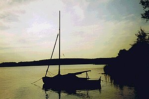
| Evening mood at "Gränert", a beach on Lake Möserschen | ||
| Geographical location | Brandenburg an der Havel , Brandenburg, Germany | |
| Tributaries | from Breitlingsee | |
| Drain | to the Plauer See | |
| Islands | Kälberwerder , Kiehnwerder | |
| Data | ||
| Coordinates | 52 ° 23 '1 " N , 12 ° 27' 16" E | |
|
|
||
| Maximum depth | > 6 m | |
The Mösersche See connects to the west of the Breitlingsee , from which it is separated by the islands of Kiehnwerder and Buhnenwerder . Like Breitlingsee, it belongs to the Lower Havel waterway as a federal waterway and belongs to waterway class III from Breitlingsee to Kirchmöser Ost. The Brandenburg Waterways and Shipping Office is responsible .
On the west bank of the lake is the Brandenburg district of Kirchmöser , whose residential and industrial areas are grouped around the Holy Lake , which is connected to Lake Möser. The Wusterau peninsula forms the continuation of its west bank to the north . The island of Kälberwerder is located in the middle of the Mösersche See . The greatest depth of the lake is stated to be over 6 m.
See also
Individual evidence
- ↑ Directory E, Ser. No. 60 of the Chronicle ( Memento of the original from July 22, 2016 in the Internet Archive ) Info: The archive link was inserted automatically and has not yet been checked. Please check the original and archive link according to the instructions and then remove this notice. , Federal Waterways and Shipping Administration
- ↑ Udo Geiseler, Klaus Heß (Ed.): Brandenburg an der Havel. Lexicon on city history (= individual publications of the Brandenburg Historical Commission eV Volume XIII ). Lukas Verlag, Berlin 2008, ISBN 978-3-86732-001-6 , keyword "Möserscher See" p. 246 .
