
Lower Havel waterway


Untere Havel-Wasserstraße (UHW) is a collective name for congestion-regulated Havel routes with numerous penetrations , lakes and canals from the confluence of the Spree into the Havel in the Berlin district of Spandau to the confluence of the Havelberger Schleusenkanal in the Elbe in the federal states of Berlin, Brandenburg and Saxony-Anhalt . It is a federal waterway . The Berlin Waterways and Shipping Office is responsible up to kilometer 16.40 ( Krughorn ) , followed by the Brandenburg Waterways and Shipping Office .
course
In its first section the UHW follows Spandau- Plaue from the Spree mouth of Pichelsdorfer Havel with Pichelssee, the Kladower lakes path and the Jungfernsee to the beginning of Sacrow-Paretzer channel at Nedlitz (20 km), the channel with White Lake crosses the Schlänitzsee, the belongs to the Wublitz , and flows into the so-called “Brandenburger Oberhavel” at Paretz (12.5 km); the UHW follows this with the Trebelsee to the beginning of the Silo Canal in Brandenburg (24 km), the canal flows into the Quenzsee (5 km); the UHW continues through the Quenzsee and Plauer See to the Plauer bridge in Plaue (6.5 km).
In its second section Plaue-Elbe, the UHW corresponds to the course of the Havel with some lake-like extensions and ends with the confluence of the Havelberger Schleusenkanal in the Elbe at kilometer 422.79 (80 km). The Havelberg lock enables the gradient difference between the Elbe and Havel to be overcome.

The UHW has a total length of 148 kilometers and has six barrages, in Brandenburg with the suburban lock Brandenburg and the city lock Brandenburg , in Bahnitz with the lock Bahnitz , in Rathenow with the main lock Rathenow and the city lock Rathenow , in Grütz with the lock Grütz , in Garz with the Garz lock and in Havelberg with the Havelberg lock . The kilometers of the waterway run down to the valley. It begins at the mouth of the Spree and ends at the Elbe.
The following federal waterways are legally part of the UHW:
- Great Wannsee
- Potsdamer Havel ( Jungfernsee , Tiefer See , Templiner See , Großer and Kleiner Zernsee)
- with Petziensee, Schwielowsee , Glindowsee and Wublitz
- Nedlitzer old trip with Lehnitzsee and Krampnitzsee
- Ketziner Havel
- Brandenburg city canal
- Beetzsee-Riewendsee waterway
- Brandenburg Niederhavel
- Breitlingsee , Möserscher See and Plauer See
- Rathenower Havel (Rathenower City Canal)
- Hohennauen waterway
- Estuary of the Lower Havel
Permitted ship sizes
The Lower Havel waterway from Spandau to Plaue has waterway class IV with restrictions (exception: Silokanal Vb). In accordance with the Inland Navigation Road Regulations, Chapter 22, it is for the area from kilometer 20.00 (beginning of the Sacrow-Paretzer Canal) to kilometer 66.70 ( Elbe-Havel Canal branch ) when using the Sacrow-Paretz Canal and the Silo Canal for Sizes of vehicles and units (push units and coupled vehicles) of 125 meters in length and 9 m in width or 156 meters in length and 8.25 meters in width are permitted.
The Lower Havel waterway from Plaue to the Elbe only has inland waterway class III. Only vehicles and associations up to 67 m long and 8.25 m wide are permitted in this area.
Planned partial expansion of the Lower Havel waterway
The German Unity Transport Project No. 17 envisages the expansion of 280 kilometers of waterways on the Wolfsburg - Magdeburg - Berlin route . According to the project, the entire stretch is to be dredged to a depth of four meters and, depending on the bank profile, to 42 to 55 meters (in curves up to 72 meters) water level width. This is intended to enable pushed convoys 180 meters long, 11.40 meters wide and 2.80 meters unloading depth, according to inland waterway classification Vb, to sail.
In the course of the Lower Havel waterway, the Sacrow-Paretz Canal was therefore to be dredged on its north bank to widen it and to deepen its entire length. The Havel would have been affected by these expansion measures in the area from the confluence of the Sacrow-Paretz Canal to the Silo Canal. In addition, the Havel was to be straightened in the area of the “Deetzer knee” and widened at the “Deetzer piercing”. This construction work was abandoned, but plans are still being made to deepen the fairway to four meters. In the area of the Sacrow-Paretz Canal, the north bank has so far been re-paved and the canal bottom between the Schlänitzsee and the mouth of the Havel Canal has been partially dredged, smoothed and fortified. The first construction work has started on the south bank. (As of December 2015)
For the Berlin-Spandau area, a reduced expansion compared to the original plan was decided. The Untere-Havel-Wasserstraße will be deepened from km 0 to km 4.3 from 2018 and corrected in some places. Instead of four meters as originally planned, the fairway is now being deepened to 3.5 meters. The expected construction time is given as three years.
The Lower Havel and the Potsdamer Havel are not affected by the direct construction work. A long-term influence on these stretches of water of the Lower Havel waterway is not yet foreseeable.
In the region there were protests against the expansion, because the widening and deepening of the Havel can lead to unforeseeable negative changes in the water balance of the entire region, and thus to far-reaching consequences for the living world ( flora and fauna ). Due to the suspected increased water runoff, a lowering of the water level of the Jungfernsee by two to nine centimeters was expected, so that even in the state capital Potsdam the waterway expansion is now being rejected. In 2010, environmentally relevant tests were carried out as part of the planning approval procedure. Studies commissioned in the early 1990s to forecast a possible expansion and efficiency of inland freight shipping have so far been negative.

The Sacrow-Paretz Canal

Confluence of the Sacrow-Paretz Canal into the Havel
The silo channel

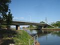
The Havel in Rathenow


See also
Web links
- In the inland waterway traffic regulations (BinSchStrO) anchored legal regulations for the use of the UHW
- Website of the new waterway construction office in Berlin on the expansion project "Lower Havel waterway ..."
Individual evidence
- ↑ a b Federal Waterways and Shipping Administration: Directory E, Ser. No. 60 of the Chronicle ( Memento of the original from July 21, 2014 in the Internet Archive ) Info: The archive link was inserted automatically and has not yet been checked. Please check the original and archive link according to the instructions and then remove this notice. on wsv.de (PDF)
- ↑ a b Federal Waterways and Shipping Administration: Structure of federal waterways. ( Memento of the original from January 21, 2016 in the Internet Archive ) Info: The archive link was inserted automatically and has not yet been checked. Please check the original and archive link according to the instructions and then remove this notice. - Lengths (in km) of the main shipping routes (main routes and certain secondary routes) of the federal inland waterways.
- ↑ Federal Waterways and Shipping Administration: Directory F of the Chronicle ( Memento of the original of July 21, 2014 in the Internet Archive ) Info: The archive link was inserted automatically and has not yet been checked. Please check the original and archive link according to the instructions and then remove this notice. on wsv.de (PDF)
- ^ Inland waterways order, legal regulations for the use of the UHW
- ↑ News in brief - shipping . In: Berliner Verkehrsblätter . No. 7 , 2016, p. 139 .