Quenzsee
| Quenzsee | ||
|---|---|---|

|
||
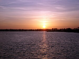
| Quenzsee seen from the north, January 2007 | ||
| Geographical location | Brandenburg an der Havel , Brandenburg, Germany | |
| Tributaries | Silokanal , Quenzgraben from Gördensee | |
| Drain | to the Plauer See | |
| Data | ||
| Coordinates | 52 ° 24 ′ 32 " N , 12 ° 29 ′ 4" E | |
|
|
||
| surface | 68 ha | |
| Maximum depth | 3 m | |

|
||
The Quenzsee is a Havel - Lake in the western city of Brandenburg an der Havel .
location
The Quenzsee is located at the western exit of the Silo Canal , which since 1910 has spared shipping the passage of the partly narrow Brandenburger Niederhavel, which runs south through the urban area of Brandenburg , and has saved 2 km of the journey. The Quenzsee is part of the federal waterway Untere Havel waterway of waterway class IV, for which the Brandenburg Waterways and Shipping Office is responsible. In the south, the lake is connected to the Plauer See lake district . It forms the end of the so-called glacial Bohnenland-Görden-Rinne . In addition to the silo canal, the Quenzgraben from the nearby Gördensee also flows into the Quenzsee .
Expansion and depth
The Quenzsee covers an area of around 68 hectares (see list of lakes in Brandenburg ). Other authors give 90 ha. Outside the approx. 1.3 km long fairway, its maximum depth is just over three meters.
Origin and age
The Quenzsee was created together with the Breitlingsee , the Plauer See and the Möserschen See after the melting of the glacier in the Brandenburg stage of the Vistula Ice Age about 19,000 years ago as a ground moraine lake .
Surname
The meaning of the name is uncertain. Some authors attribute it to the Old Polish "kwet'ny" from kvet = "flower", which would translate as "flower, colored" (compare Russian: цвет "color", цветка "flower").
Others
A settlement area of the city of Brandenburg was named “Der Quenz” after the Quenzsee. The Quenz is predominantly dominated by the location of an electrical steelworks. This steel mill is located on the east bank of the Quenzsee.
literature
- Sebastian Kinder, Haik Thomas Porada (ed.): Brandenburg an der Havel and its surroundings - a landscape inventory in the area of Brandenburg an der Havel, Pritzerbe, Reckahn and Wusterwitz (= landscapes in Germany - values of the German home of the Leibniz Institute for Regional Geography and of the Saxon Academy of Sciences in Leipzig, Volume 69) Böhlau Verlag, Cologne / Weimar / Vienna, 2006, ISBN 978-3-412-09103-3 .
- Hans-J. Uhlemann: Berlin and the Märkische Wasserstraßen transpress Verlag, Berlin, various years, ISBN 3-344-00115-9
- Writings of the Association for European Inland Shipping and Waterways e. V. various years. WESKA (Western European Shipping and Harbor Calendar), Binnenschifffahrts-Verlag, Duisburg-Ruhrort
- Folke Stender: Editing of Sportschifffahrtskarten inland 1 . Nautical Publication Verlagsgesellschaft, ISBN 3-926376-10-4 .
Individual evidence
- ↑ Directory E, Ser. No. 60 of the Chronicle ( Memento of the original from July 22, 2016 in the Internet Archive ) Info: The archive link was inserted automatically and has not yet been checked. Please check the original and archive link according to the instructions and then remove this notice. , Federal Waterways and Shipping Administration
- ↑ a b c Sebastian Kinder, Haik Thomas Porada (ed.): Brandenburg an der Havel and its surroundings - a landscape inventory in the area of Brandenburg an der Havel, Pritzerbe, Reckahn and Wusterwitz (= landscapes in Germany - values of the German home of Leibniz- Institutes for Regional Geography and the Saxon Academy of Sciences in Leipzig, Volume 69) Böhlau Verlag, Cologne / Weimar / Vienna, 2006, ISBN 978-3-412-09103-3 , p. 265.
