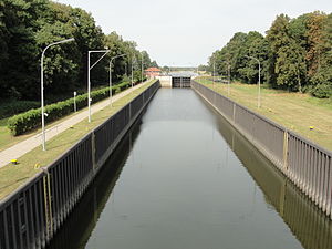
Lock Havelberg
| Lock Havelberg | ||
|---|---|---|
| location | ||
|
|
||
| Coordinates | 52 ° 49 '56 " N , 12 ° 3' 20" E | |
| Country: |
|
|
| Place: | Havelberg | |
| Waters: | Lower Havel waterway | |
| Water kilometers : | km 147.09 | |
| Data | ||
| Owner: | Federation | |
| Responsible WSA : | WSA Brandenburg | |
| Start of planning: | before 1934 | |
| Construction time: | about 2 years | |
| Start of operation: | May 4, 1936 | |
| lock | ||
| Type: | Inland lock | |
| Is controlled by: | Rathenow lock control center remote-controlled | |
| Average height of fall : |
depending on the Elbe water level max. 5.35 m | |
| Upper gate: | sealing on both sides | |
| Lower gate: | sealing on both sides | |
| Others | ||
| Was standing: | Call channel UKW 21 or +49 3385 539830 | |
The Havelberg lock is an inland lock that has been connecting the Havel waterway and the Elbe since 1936 . It is located at kilometer 147.09 of the Lower Havel waterway in the German state of Saxony-Anhalt . The usable chamber length is 225 meters, the usable chamber width 20 meters. The door width is specified as 12 meters.
history
Up until the beginning of the 1930s there were major shipping and water management problems in the Havel estuary. The undammed Havel was subject to the direct influence of the Elbe. In times of flooding, the damaging effects of the current could be felt as far as Garz and often even as far as Rathenow . The construction of weirs and a sluice should seal the mouth of the Havel in a flood-proof manner. With the construction of the Gnevsdorf receiving water as an artificial Havel drain and the relocation of the backwater point of the Havel downstream, the risk of flooding in the hinterland was to be minimized. This flood protection system includes the four weirs at Quitzöbel (old arm and piercing weir ), Neuwerben and Gnevsdorf as well as the Havelberg lock. Furthermore, the Havel was straightened and deepened. The construction of the weir system required the construction of a tow lock near Havelberg in order to overcome the difference in gradient between the Elbe and Havel. The lock was built in a newly created lock channel that connects the Havel, which has been laid in a breakthrough, with the Elbe at kilometer 422.80. The lock has the staggered heads typical of tow locks. They consist of reinforced concrete and the chamber walls of steel sheet piles. The bottom of the lock consists of “a filter-like cover between reinforced concrete bars that stiffen the walls against each other”. The maximum height of fall in the lock is 5.35 meters. As a flood protection measure, the outer head of the lock was integrated into the Elbe dam.
literature
- Hans-Joachim Uhlemann: Berlin and the Märkische waterways. transpress publishing house for transport, Berlin 1987, ISBN 3-344-00115-9 .
- Western European shipping and port calendar. Binnenschifffahrts-Verlag GmbH. Duisburg-Ruhrort OCLC 48960431
cards
- Sportschifffahrtskarten Binnen 1 Nautical Publication Verlagsgesellschaft, ISBN 3-926376-10-4 .
- W. Ciesla, H. Czesienski, W. Schlomm, K. Senzel, D. Weidner: Shipping maps of the inland waterways of the German Democratic Republic 1: 10,000. Volume 4. Editor: Waterways Authority of the GDR, Berlin 1988, OCLC 830889996 .
Web links
- Havelberg lock accessed on January 17, 2015
Individual evidence
- ↑ Quote: Hans-Joachim Uhlemann: Berlin and the Märkische Wasserstraßen. Page 148

