
Bensdorf
| coat of arms | Germany map | |
|---|---|---|

|
Coordinates: 52 ° 25 ' N , 12 ° 20' E |
|
| Basic data | ||
| State : | Brandenburg | |
| County : | Potsdam-Mittelmark | |
| Office : | Wusterwitz | |
| Height : | 31 m above sea level NHN | |
| Area : | 34.33 km 2 | |
| Residents: | 1239 (Dec. 31, 2019) | |
| Population density : | 36 inhabitants per km 2 | |
| Postal code : | 14789 | |
| Area code : | 033839 | |
| License plate : | PM | |
| Community key : | 12 0 69 028 | |
| Community structure: | 5 districts | |
| Office administration address: | August-Bebel-Strasse 10 14789 Wusterwitz |
|
| Mayor : | Bernd König (Free Citizens and Farmers) | |
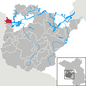
| Location of the community of Bensdorf in the Potsdam-Mittelmark district | ||
  |
||

Bensdorf [ ˈbɛnsdɔʁf ] is a municipality with over 1200 inhabitants in the west of Brandenburg . The community was created on July 1, 1950 through the merger of the four communities Altbensdorf, Neubensdorf, Woltersdorf and Vehlen . The name goes back to Altbensdorf, which was called Bensdorf until Neubensdorf was founded in the early 19th century. The community belongs to the Wusterwitz office .
As far as is known, Bensdorf, Vehlen and Woltersdorf were first mentioned in the 14th century. Sights in the towns of the municipality are, for example, village churches. In addition, individual farmsteads are listed as historical monuments . The economy is largely agrarian. Individual areas of the community are designated as protected areas.
geography

Geographical location
Bensdorf is located in the far west of the state of Brandenburg and the district of Potsdam-Mittelmark on the border with the state of Saxony-Anhalt and the district of Jerichower Land . The community is located about ten kilometers west of the city of Brandenburg an der Havel , the regional center of the region and ten kilometers east of the town Genthin. Berlin is about fifty kilometers to the east . Furthermore, Bensdorf is located on the extreme western edge of the metropolitan region Berlin / Brandenburg . The parish has an area of over 34 square kilometers. The highest point of the municipality is 71.8 meters, the hill of the glacially formed Vehlenschen mountains , the lowest elevation of about 29 meters is located in the southeast along the banks of the Governing lake . Bensdorf belongs with Wusterwitz and Rosenau to the Wusterwitz office.
Community structure, neighboring cities and communities
The community consists of the five districts Altbensdorf, Herrenhölzer, Neubensdorf, Vehlen and Woltersdorf. There are also the Dunke residential areas (historically also Genzhof) north of Vehlen, Dorotheenhof and Neu Woltersdorf near Woltersdorf.
The following cities, municipalities and places border the municipality of Bensdorf in a clockwise direction: in the east the independent city of Brandenburg an der Havel with its urban and district Plaue , in the south the municipality of Wusterwitz belonging to the Potsdam-Mittelmark district, in the west the municipality of Jerichow im District Jerichower Land belonging districts Kade , Demsin and Schlagenthin and in the north the district Nitzahn belonging to the community Milower Land in the district Havelland with the municipality part Knoblauch .
geology

The landscape of Bensdorf was shaped or reshaped during the last glacial period , the Vistula glaciation , by the inland ice advancing from Scandinavia . The chain of hills of the Vehlenschen Berge about 2.5 kilometers long in north-northwest-south-southeast orientation, which tower above the fore and hinterland by twenty to forty meters, and the 57 meter high vineyard to the south of them mark the ice edge location 1b of Brandenburg phase , the second behind the main ice edge. Thrusts , steep positions, folds and shearing as constriction structures prove and determine the character of the Vehlenschen Berge as compression moraine . There are sand, gravel and boulders . The mountain flank is covered with boulder clay . To the east of the Vehlenschen Berge, fine sandy sediments and ligament silts indicate a former meltwater lake on the edge of the ice.
Floors
The soils are typical of landscapes shaped by the Ice Age. Wide spaces of gleys and gleyic Cambisols coined. The ridge of the Vehlenschen Mountains is covered with brown earth. Between Alt- and Neubensdorf, north of Altbensdorf and in the southeast to Wendsee there are smaller areas with Podsol brown earth. Podsols can be found on a strip in the south, on an area in the west towards the state of Saxony-Anhalt and on a small area in the northeast. Between the Vehlenschen mountains and the vineyard, north of Woltersdorf and in the east, Anmoorgley prevails. There are submerged peat bogs in various places on the municipal areas. In Herrenhölzer there is a small area with Kalkgley in the far north in dunks with a fluvic gleysol and immediately west of the mountains Vehlenschen one with Fahl earth . A high or very high yield potential is only ascribed to the smaller part of the municipal area. Only a small area at Dunke has a very high yield potential. The areas with Kalkgley, Podsolen and some of the lower earth bogs have a high yield potential.
Land use
| Land use 2012 | Area in ha |
|---|---|
| Buildings and open spaces | 90 |
| including living space | 54 |
| including commercial and industrial areas | 13 |
| Traffic areas | 125 |
| of which streets, paths, squares | 125 |
| Bodies of water | 72 |
| Agricultural land | 1850 |
| Forest areas | 1242 |
| Operating areas | 2 |
| of which mining areas | 2 |
| Recreational areas | 11 |
| including green spaces | 4th |
| Areas of other use | 38 |
| including cemeteries | 1 |
| of it land | 37 |
| total area | 3430 |
The community of Bensdorf has a rural character. More than 90 percent of the community area consists of forest and agricultural land. 53.9 percent are designated as agricultural land. The proportion is slightly higher than the state average in Brandenburg, which is around 49 percent. The proportion of forest areas is around the national average, at 36.2 percent. This makes up 35.6 percent throughout Brandenburg. Forest areas of different sizes are practically everywhere in the municipality, for example on the Vehlenschen Mountains or in the west to the state border.
2.1 percent of the municipality is water. This primarily affects canal stretches and melioration trenches . With its share of water bodies, Bensdorf is below the national average of the state with many bodies of water. This is 3.4 percent. Only a small proportion of the area in the municipality of Bensdorf is built on. The main development areas are the five town centers. The type of land use actually made is itemized in the 2012 table of land use .

Waters
The waters in the municipality are primarily man-made canals and drainage ditches. In the south are the Woltersdorfer Altkanal (WAK) as the eastern part of the Plauer Canal and the Elbe-Havel Canal . The Plauer Canal was a waterway that was built from 1743 to 1745 on the instructions of Friedrich II between the Havelsee Wendsee, the Stremme and the Ihle, to the Elbe . The reason was the shortening of the route between Berlin and Magdeburg by a distance of around 150 kilometers and the bypassing of part of the Elbe with its strong current. An important destination for shipping at that time were the salt deposits near Magdeburg near Schönebeck (Elbe) . Furthermore, the canal was of great importance in the development of peat deposits in the Fiener Bruch . After the canal no longer met the requirements of shipping and the limits of its performance had been reached, a law on the construction of the Elbe-Havel Canal was passed in 1920. This canal construction was completed by 1938 using further sections of the Plauer Canal. The Woltersdorfer Altkanal south of Woltersdorf was not part of the new building. Instead, a straight route to the Wendsee was created. The Wusterwitz lock was built there directly on the municipal boundary between Woltersdorf and Wusterwitz . The existing Plauer lock in the old canal immediately behind the municipal boundary has been converted into a weir. Since the 1990s, the Elbe-Havel Canal shipping route has been expanded as the German Unity Transport Project No. 17. The Wusterwitz lock was renewed. As a federal waterway, the Elbe-Havel Canal has waterway class IV, on developed stretches Vb, the Woltersdorf oxbow lake, which is used as a berth for recreational shipping and can be navigated from the west, class 0.

There are three systems of drainage ditches in Bensdorf. The Plauer Schleusengraben , which drains the area with its ditches, runs almost parallel to the north of the canals . The ditch begins west of Herrenhölzer, flows south past the vineyard, between Herrenhölzer and Neubensdorf and shortly immediately south past Woltersdorf to the east. It flows into the Wendsee about 150 meters north of the Woltersdorfer Altkanal. The trench system of the Plauer Schleusengraben is controlled by a total of six weirs in the municipality . The fur trench begins only 200 meters north of the lock trench . This flows in an east-northeast direction initially between Weinberg and Vehlenschen mountains. In the further course it leads directly north to Altbensdorf, rather it flows into the urban area of Brandenburg an der Havel. At Neu Plaue it flows directly into the Havel. The fur trench system in Bensdorf is also controlled by six weirs. The third trench system is that of the Königsgraben and the Vehlener Hauptgraben . The Vehlener Hauptgraben begins east of Vehlen and flows down to the north. In the former wetland northeast of Vehlen, it takes up a large number of lateral branch channels. It forms the border between the districts of Potsdam-Mittelmark and Havelland for about one and a half kilometers. At Dunke the Vehlener Hauptgraben joins the Königsgraben directly on the state border with Saxony-Anhalt. This begins south of Schlagenthins in Saxony-Anhalt. After about three kilometers, it forms the state border between Brandenburg and Saxony-Anhalt for almost two kilometers. In Havelland, the Königsgraben flows into the Havel as Schlagenthiner Königsgraben near Milow.
climate
There is a typical Central European temperate climate for Germany, which is influenced by the continental climate in the east and the Atlantic maritime climate in the west. The precipitation is distributed relatively evenly over the year with a maximum in the summer months. There are no dry months in which there is no precipitation. The average annual rainfall in Bensdorf is 528 mm. The driest month is February with a rainfall of 31 mm. Most of the precipitation falls on average in June with 63 mm. The annual average temperature is 9.1 ° C. The warmest month is July with an average of 18.2 ° C. In January, the coldest month, the average temperature is −0.1 ° C.
|
Average monthly temperatures and rainfall for Bensdorf
Source:
|
|||||||||||||||||||||||||||||||||||||||||||||||||||||||||||||||||||||||||||||||||||||||||||||||||||||||||||||||||||||||||||||||||||||||||||||||||||||||||||||||||||||
history
Prehistory and early history
On the basis of various archaeological finds, a settlement in the municipal area of Bensdorf is already documented for prehistoric times. During canal construction work south of Woltersdorf, several remains of settlements were found that could be dated to the Neolithic period . For example, a prehistoric burial ground was secured and a Neolithic cremation grave was documented from 2005 to 2006. Other settlement finds date from the Bronze Age .
In his work Germania , Tacitus described the area east of the Elbe up to the Oder as a settlement area of the Suebian tribe of the Semnones . With the exception of a few remaining groups, they left their old settlement area on the Havel in the direction of the Rhine before or at the latest during the time of the Great Migration from the 3rd or 4th century . From the 5th or 6th century, Germanic settlement activity largely came to a standstill. From this time until the 8th century there are only a few archaeological finds. At the beginning of the 8th century, Slavs immigrated to the area largely devoid of settlements after the Germans had emigrated . Remnants of the Germanic peoples were absorbed in the Slavic majority population.
Middle Ages and modern times to the 18th century
In the 10th century the area of Bensdorf came under German rule for the first time and in 1157 permanently. In the meantime, after an uprising in 983 , the country was again under Slavic rule for almost 200 years.
The first written records come from the second half of the 14th century. Bensdorf was named in 1363 as "Bentsdorp" and in 1475 as "Bentczendorf". Only a short time later, Woltersdorf ("Woltersdorp") and Vehlen ("Velem") were first mentioned in the feudal registers of the Magdeburg Archbishopric from 1368 to 1381. Because of this Lehnsregister Bensdorf belonged as a fief a "Heyso of Krakow" and Woltersdorf two members of the family of Sandow, which is based in the east of the Havel situated castle Plaue had. There were two manors in Bensdorf since the late Middle Ages .
Since the 16th century, the ore monastery of Magdeburg, to which the towns belonged, came increasingly under the influence of Brandenburg. By the middle of this century the von Britzke family owned both estates in Bensdorf and the village with all rights. The family also held the church patronage for the parish church , which has been documented since the early 16th century . Woltersdorf with a manor and church patronage was owned by the von Werder family, who lived on the Rogäsen manor . The church was a branch church of the church in Plaue. In the 1560s, the Reformation was introduced in the ore monastery of Magdeburg .
During the Thirty Years' War in the summer of 1631, the Swedes moved through the area between the Havel and Elbe under their King Gustav II Adolf . This resulted in destruction and looting. As a result, there was great famine. A large part of the population died as a result of them and the plague . In 1650, two years after the end of the war, in Bensdorf, for example, of the previous 21 households with an average of around ten people, only ten remained. As a result of the Peace of Westphalia of 1648, which marked the end of the Thirty Years War, the Archbishopric of Magdeburg and with it Bensdorf, Woltersdorf and Vehlen after the death of the last administrator in 1680 fell to the Electorate of Brandenburg as the Duchy of Magdeburg , which in 1701 became the heart of the Kingdom of Prussia .

In 1735 the von Schlabrendorf family acquired one of the two manors in Bensdorf. Also in the 18th century, Herrenhölzer was laid out south of Bensdorf as a Vorwerk . The estate belonged to the von Görne zu Möser family. Under canon law it was assigned to the Woltersdorf parish. To the south of Herrenhölzer and Woltersdorf, an artificial waterway, the Plauer Canal , was created between 1743 and 1746, which significantly shortened the route between the cities of Berlin and Magdeburg. In 1782 there were 148 people in Vehlen, 254 in Bensdorf, 199 in Woltersdorf and 26 people in Herrenhölzer. The residents of Vehlen were either subjects of the Altenplathow office or of the von Hüncke family, who had their seat on the Möthlitz manor . There was a mill by the place. At this time, the Vehlener church patronage was held by the Bensdorf landowner families von Britzke and von Schlabendorf.
19th century

At the beginning of the 19th century the Herrenhölzer manor district became independent. In 1810 a major fire broke out in Bensdorf , which destroyed large parts of the village. In the same year the Prussian Agrarian Constitution was changed and serfdom , the subservience to the estate, abolished. There was also a separation , as a result of which the old goods were partially re- parceled out. The Woltersdorf community bought the manor from the von Werder family. The former estate of the family of Schlabendorf in Bensdorf belonged around 1820 a bailiff Susemiehl that in Herrenhölzer an innkeeper repentance from Brandenburg an der Havel, who had bought it from the family of Görne. Ten years after the major fire, Bensdorf had around 170 inhabitants, while Vehlen had 152 people. The Vehlensche church patronage had passed to the Lords of Hünecke on Möthlitz. The "Genzenhof" belonging to Vehlen was mentioned as a farmyard formed by separation of the heirs of Schulzen Genz with 10 inhabitants. 144 inhabitants were counted in Woltersdorf.
After the victory in the Wars of Liberation over Napoleonic France and the associated political and geographical changes, provinces were formed in the Kingdom of Prussia in 1815. The former Duchy of Magdeburg was incorporated into the new Prussian province of Saxony . A year later the Jerichow II was formed, to which the villages previously belonging to the Jerichowschen district were connected.

From 1817 to 1823 the major trunk road between Bensdorf and Woltersdorf was expanded as a road . This road was the main connection between Berlin via Brandenburg an der Havel to Magdeburg and a daily express mail coach ran on it. A merchant from the nearby Plaue acquired the small heath, part of the land that was formerly part of the Bensdorf manor of the von Britzke family directly on Berliner Chaussee. He had the Neubensdorf settlement built on the trunk road, which in its course corresponds to Bundesstrasse 1 , from 1823 onwards. In this context, the pre-existing medieval Bensdorf was renamed Altbensdorf. In the middle of the 19th century Altbensdorf had its own school and there were two windmills and a distillery in the village. There were 34 households in Woltersdorf and there was also a school and a windmill. A bridge keeper's house on the Plauer Canal also belonged to the place.
20th and 21st centuries

During the First World War between 1914 and 1918, more than 60 inhabitants of the villages lost their lives as soldiers. There are officially records of 24 dead from Altbensdorf, 19 from Neubensdorf, 11 from Woltersdorf and 7 from Vehlen. On September 30, 1928 the manor district Herrenhölzer was united with the rural community of Neubensdorf.
In 1934 the road from Berlin to Magdeburg became part of the new Reichsstrasse 1 , the most important east-west connection. Furthermore, the construction of the Elbe-Havel Canal began in the 1930s. The existing Plauer Canal was integrated into the new building project over long stretches. South of the part of the Plauer Canal in the municipality of Woltersdorf, however, a deviating, straight route was chosen in the direction of Wendsee, which roughly followed the southern municipality boundary. The resulting Woltersdorfer Altkanal lost its importance and function and was only used by commercial shipping as a winter berth. In the newly built section of the Elbe-Havel Canal, the Wusterwitz lock was built on the municipal boundary between Woltersdorf and Wusterwitz . A shipyard is located on the canal near Woltersdorf. The population of the place rose to 610 by 1939. Altbensdorf had 592 residents.
The first immediately noticeable consequence of the Second World War was the rationing of food, which began immediately after the start of the war. Many residents lost their lives in the war. On September 17, 1943, bombs fell on the area of the Altbensdorf community for the first time . There were also several German crashes, the Brandenburg-Briest airfield was only about six kilometers to the east, and American fighter planes in or near the villages. On April 5, 1945, the Red Army reached the villages from the north. The night before, the last SS associations had withdrawn so that the villages could be surrendered without a fight.
After the end of the war in 1945, the locations were in the Soviet occupation zone . Due to newcomers and displaced people , the population in the villages had risen sharply within a very short time. Immediately before the outbreak of war there were a total of 1,860 people living in the villages, and immediately afterwards, in 1946, despite the many fallen villagers, 2,284 people lived in the villages. The places were incorporated into the newly founded Saxony-Anhalt in 1946 .
In the course of the land reform in the Soviet zone of occupation from 1945 onwards, over 100 hectares of land were expropriated, this primarily affected the landowners. Land reform land, for example, in Altbensdorf became an estate with 168 hectares and in Herrenhölzer the former manor with 448 hectares. No expropriations in the course of the land reform are known from Neubensdorf, Vehlen and Woltersdorf due to the existing, smaller structures. The areas in Altbensdorf were divided up between the landless and land poor. Several new farmers settled here permanently. The manor Herrenhölzer was only partially divided, if at all. The largest part became a state-owned, later publicly owned property (VEG). In addition, the mill was expropriated from the Altbensdorf miller Erich Sengespeick.
In 1952 an administrative reform was carried out in the GDR , which was founded in 1949 on the territory of the Soviet occupation zone . The existing country broke it and formed instead of those districts . In this context, a district reform also took place , which led to the dissolution of the existing districts and to restructuring or reorganization. Jerichow II, to which the places belonged until then, were dissolved and the communities were integrated into the new Brandenburg (Land) district in the Potsdam district . In the same year, on July 23, Altbensdorf, Herrenhölzer, Neubensdorf, Woltersdorf and Vehlen were merged to form the newly founded municipality of Bensdorf.
In the 1950s, farmers in the communities founded the first agricultural production cooperatives (LPG) by order of the state . So an LPG "Peace" of type III, with this type the entire agricultural operation with land, cattle and equipment was integrated, founded in Bensdorf. In addition, there was still type I LPG in the districts, where only agricultural production areas went into the cooperative. The LPG "Heideland" in Altbensdorf and the LPG "Heimattreue" in Woltersdorf were founded as type I LPG. These were taken over by the LPG "Frieden" in the 1960s. At that time, the Bensdorfer LPG cultivated an area of 810 hectares. In 1960, the nationally owned Herrenhölzer estate cultivated 270 hectares of cultivated land. 66 people worked on the estate. In the 1970s, a cooperative plant production department was created from the plant productions of the LPG in the area . Only a few years later this was dissolved and LPG plant production Bensdorf was founded with four brigades in Altbensdorf, Neubensdorf, Vehlen and Woltersdorf. In 1989 about 140 people were employed in this LPG. The LPG "Frieden", which had kept animal production, had 120 employees.

From 1950 the schools in the villages were merged into a so-called school combine. Different age groups were taught in each of the four school buildings. The first two classes for Altbensdorf, Neubensdorf and Woltersdorf were taught in the school building in Neubensdorf, and the 3rd and 4th grades in Woltersdorf. The Vehlen students initially stayed in their own town for four years. The 5th to 8th grades were finally taught for all four locations in Altbensdorf. From 1960, 9th and 10th grade students went to school in Wusterwitz. In Wusterwitz, a new polytechnic high school was built for the 1971/72 school year , in which from then on pupils were taught from the 5th grade. The Altbensdorf School, built in 1906, was subsequently used for grades 1 to 4.
After the fall of the Wall and the peaceful revolution in the GDR , there were further profound changes. In 1990 the districts were dissolved and the states renewed. Like the entire Potsdam district, Bensdorf came to Brandenburg. A little later, the GDR joined the Federal Republic of Germany. In the same year, the LPG were dissolved or transferred to other legal forms. The nationally owned estate in Herrenhölzer was sold and in 1992 the Wusterwitz Office was established. A year later, in 1993, the Brandenburg district was incorporated into the newly founded Potsdam-Mittelmark district. Despite a strong emigration, the community also benefited from the suburbanization of the city of Brandenburg an der Havel. This resulted in new residential complexes with single and multi-family houses. Nevertheless, due to the low birth rate in the period after the reunification and correspondingly the few pupils in 1997, the primary school in Altbensdorf was closed. In 2004, a motor road was opened as a feeder to Federal Motorway 2 in the west of the municipality.
Municipality and place names
The name Bensdorf is interpreted as a medieval German. It is believed to go back to a person named Benzo, a short form of the name Bernhard. Bensdorf would therefore be the village of Bernhard or a village in which a Bernhard lives (e). In the first written mentions, Bensdorf was written “Bentsdorp” or “Bentczendorf”. In the 19th century, after the Neubensdorf settlement was founded on Berliner Chaussee, the existing medieval village of Bensdorf was renamed Altbensdorf or Alt-Bensdorf. The community founded in 1952 by the union of several villages was again given the old name Bensdorf.
Woltersdorf is also a German place name. The name goes back to a person called Wolter, the Low German form for Walter. Woltersdorf was therefore the village of Walter or a village in which a Walter lives (s). In its first written mention, Woltersdorf was written as "Wolterstorp".
Vehlen is probably the only place name of Slavic origin. It is assumed that the name goes back to the personal name Welim, and that this describes his place of residence. In its early mentions the village was spelled “Velem” and “Ffelim”.
The German place name Herrenhölzer is of more recent origin. This name probably goes back to an old field name from the 16th century. In 1577 a pasture was described as "Mr. Holtzunge". It is assumed that Herren or Herr developed from the Dutch Heren for hornbeam . Herrenholz would therefore be a hornbeam forest. The Vorwerk was first mentioned in the 18th century.
Dialects
The regional language has changed dramatically over the past two centuries. Until the 19th or 20th century, the regional dialect was a Mark-Brandenburg dialect , which is part of the Low German language . For example, during Theodor Fontane's time and his wanderings through the Mark Brandenburg in the second half of the 19th century, most of the area's population spoke to him in everyday life. Typical of the dialect was, for example, speaking a p instead of an f (for example Dbod instead of village). Further, it was often a t was used instead of s-sounds and ch as k spoken (e.g., Grot instead of large). Differences to standard German when speaking vowels were the long ie and u instead of the diphthongs ei and au (for example Huus instead of house).
Starting in the second half of the 19th century, the language initially switched from Berlin to cities such as Brandenburg an der Havel and from there, increasingly from Low German to the Berlin dialect, influencing the surrounding villages . This process of change in everyday language has largely been completed, so that Low German is now almost extinct in the area around the city of Brandenburg. An example of the language of the 20th and 21st centuries in the area is that the au is spoken to an o ( lofen instead of walking) and the z to the voiceless s ( sitrone instead of lemon). The frequent paraphrase of the genitive is also typical . For example, many people in the area say "Anne her child" instead of "Anne's child".
population
At the 2011 census , the community of Bensdorf had 1294 inhabitants. 12 residents of the municipality were foreign nationals, with Poles and Turks making up the largest group of foreigners with 3 people each. The proportion of foreigners was thus 0.9 percent. 226 inhabitants belonged to the Protestant , 33 to the Catholic Church . This corresponded to 17.5 percent and 2.6 percent respectively. When asked about religious affiliation, the remaining population was summarized under “other, none, no information”. A statement about other religious communities is therefore not possible on the basis of these census data. 49.8 percent of the residents of Bensdorf were male, 50.2 percent female. Bensdorf had a high average age. 22.4 percent of the population were 65 or older and 13.2 percent under 20.
Population development
|
In 1782, before industrialization , there were significantly fewer than 1,000 people in the villages of Bensdorf, Vehlen and Woltersdorf and in the Herrenhölzer estate . The villages had a total of 627 inhabitants. In the following decades the population grew rapidly, so that the number of inhabitants had more than doubled by 1890. The population continued to grow until the 1940s. The locations reached their all-time high in 1946, immediately after the Second World War, with the influx of displaced persons from the areas east of the Oder or the Sudetenland . The maximum value was 2284 inhabitants. Already in the 1950s there was a sharp decline in the population due to moving away and aging. In the 1980s, the population loss in the villages slowed. However, Bensdorf fell in the population statistics until 1993. In that year the community had 1,131 inhabitants. Due to the construction of new apartments and single-family houses, Bensdorf benefited from the suburbanization of the city of Brandenburg an der Havel. By 1999 the population rose again to 1,440 inhabitants. Since then, however, there has been another drop. The exact population figures are shown in the table of population development in Bensdorf .
politics
Community representation
| Election 2014 | number | % | +/- | Seats | +/- | ♀ |
|---|---|---|---|---|---|---|
| Eligible voters | 1093 | |||||
| Voters | 629 | 57.5 | +1.5 | |||
| Invalid votes | 11 | 1.7 | −2.1 | |||
| Valid votes (up to three per voter) | 1844 | 97.7 | +4.8 | |||
| Free citizens and farmers | 844 | 45.8 | +45.8 | 5 | +5 | 1 |
| Voting group for Bensdorf | 388 | 21.0 | −26.7 | 2 | −3 | 0 |
| Independent group of voters Bensdorf | 372 | 20.2 | +20.2 | 2 | +2 | 0 |
| THE LEFT | 240 | 13.0 | −6.8 | 1 | −1 | 1 |
Ten community representatives and the honorary mayor belong to the community council. The last election for community council took place on May 25, 2014. It was a combined choice of people and lists. Each voter could cast up to three votes. The turnout was 57.5 percent. This was 1.5 percentage points more than in the 2008 election and 11.3 percentage points more than the national average. The turnout was 46.2 percent across Brandenburg.
Free citizens and farmers were able to unite 844 of 1844 votes. This gave them a result of 45.8 percent. In the previous local elections in 2008, this group of voters had not yet run. With the result, free citizens and farmers were able to win half of the seats. The group of voters Für Bensdorf came second. This achieved 21 percent with 388 votes. This worsened it by 26.7 percentage points compared to the area code, when it had become the clear winner. Accordingly, the number of seats won decreased from five to two. In third place, only a little behind the group of voters for Bensdorf, came the independent group of voters Bensdorf. For the first time it received 372 votes (20.2 percent). This also brought her two seats. The last vacant seat was won by DIE LINKE, which received 240 votes or 13 percent. This means that the only party that took part deteriorated by 6.8 percentage points and lost one seat compared to the previous legislative period. A total of two women and eight men were elected to the local parliament. Community representatives are Katrin Menke from Free Citizens and Farmers and Bärbel Merx from DIE LINKE.
mayor
Mayor of the community of Bensdorf is Bernd König from the electoral association Free Citizens and Farmers. He was elected for a further five-year term in the mayoral election on May 25, 2014 and prevailed with 63.3% of the valid votes against his two competitors Mike Petzold from the Für Bensdorf group and André Wlodarski from the Bensdorf independent group. Of the 622 valid votes, 394 went to König. It is already the second term of office for König after he was elected mayor of the municipality in 2008. King's predecessor was Udo Krüger.
Sights and culture
Buildings

There are six architectural monuments in the community of Bensdorf . In addition to these, there are technical structures that are worth seeing.
The churches in Altbensdorf, Vehlen and Woltersdorf were each built in the 19th century. The Vehlen village church is a neo-Gothic church building. The hall church is unplastered and was made of red bricks . The decorative elements of the nave are eye-catching stepped gables with gables , buttress-like pilasters and a lattice-like masonry frieze under the eaves . Large lancet windows are covered with lead glazing . A polygonal apse adjoins the nave to the east . The tower of the church is designed with panels in pairs with various openings. The individual floors are separated by cornices . There are also pilaster strips as design elements. The church tower was extended over the edge of the roof by a brick parapet . Corner pilaster strips run out as battlements.

The village church Woltersdorf was built from 1826 to 1827. The master builder of the classical church building was a Brandenburg town planner von Thümen . The church is not built in the otherwise typical west-east orientation. Rather, the tower with the church portal is in the south and the ship connects to the north. Forty years after it was built, the ship was enlarged. In the 2000s to the 2010s, the last fundamental renovation of the village church took place, the demolition of which was discussed in 1971. The church windows are lead-glazed arched windows that are roofed with a slight profile. Decorative elements are cornices, which are more strongly profiled, especially between the floors of the tower. To the north is a polygonal, five-sided apse. Inside is an organ from Friedrich Wäldner's workshop . The altarpiece shows the resurrection of Jesus Christ . In the northeast corner of the ship is a cast iron stove with a decorative surface design.
The village church of Altbensdorf also dates from the 19th century . This church is a sober classical building. In 1810 a major fire broke out in Bensdorf, which destroyed a large part of the village and the pre-existing medieval village church. As a result, services were held in the village school. After the end of the wars of liberation, the planning of the new building began and the plastered building was erected from 1819 to 1820. The surrounding walls of the destroyed church were integrated into the new building. The classic tripartite division of the nave, choir and apse was preserved. The windows have been converted to rectangular windows . Inside there is an organ by the Stendal master organ builder Robert Voigt from 1875. After the First World War, a multi-part memorial stone for the 24 fallen Altbensdorfs was installed on the southern outer wall of the tower.

The Wusterwitz lock is located on the municipal boundary of Wusterwitz along the Elbe-Havel Canal. It is a double lock . The north chamber was built in the course of the canal construction from 1927 to 1930. The tow lock has a length of 225 meters and a width of 12 meters. The head is closed with a flap gate , the lower head with a stem gate . The height of fall, the difference in water levels to be sluiced, is between 4.75 meters and 2.95 meters, depending on the water level in the Unterhavel. As part of the German Unity Transport Project No. 17, a second lock or lock chamber was built to the south. This has a width of 12.50 meters and a usable length of 190 meters. The head and the lower head are closed by stem gates. Construction of the southern chamber began in 2008. Work is suspended due to construction defects.

In Altbensdorf there is one of only two mills that are still in commercial operation in the old district of Brandenburg. The Bensdorfer Mühle dates back to a windmill operation from 1829. In 1912 a steam mill was built after the previous building had burned down. This mill was the largest in the district of Jerichow II. In 1935, a 32-meter high grain silo for 1000 tons of grain was built, which towers over the nearby tower of the village church Altbensdorf. In 1946 the Soviet military administration expropriated the mill owner Erich Sengespeick. The mill was electrified until 1947 and operated by the consumer cooperative from 1950 . After the reunification, privatization took place. In 1994 Bernd Xenodochius acquired the Bensdorfer Mühle. The mill specialized in grinding organic products.
The directory of all listed architectural sights can be found in the list of architectural monuments in Bensdorf . The soil monuments are listed in the list of soil monuments in Bensdorf .
Events
Regular events are traditional bonfires such as Easter bonfires and autumn bonfires , which are carried out by the volunteer fire brigade in cooperation with associations. The Bensdorf parish organizes an annual summer festival.
Sports
Bensdorf has a long tradition of sports clubs. A workers gymnastics club in Altbensdorf from 1925 was banned when the Nazis came to power in 1933. In 1966, the BSG Traktor Bensdorf was founded in the community as a company sports association of the LPG. Equestrian sport was an important section of the BSG . Between 1975 and 1990, the Bensdorf company sports association held the GDR championship in vaulting six times . Bensdorf was able to achieve third places twice. In show jumping or in team races, top placings at district and district championships have repeatedly been achieved. After the political change, the LPG and with it the BSG were dissolved. In the following years new clubs were founded. There are two riding clubs in the municipality. The Märkische Voltigierverein Vehlen and the Reit- und Fahrverein Bensdorf continue the tradition of the BSG tractor.

In 2004 the Motocross Club Bensdorf-Kade was founded. A racing and training facility was built north of Altbensdorf. State championships have been held repeatedly on the site. The sports, games and cultural association "Old School - New Life" uses the sports hall of the former Altbensdorf school as a training room. For example, table tennis and weight training are offered.
Protected areas
Several areas in the municipality of Bensdorf are designated as protected areas, with the various protection assignments sometimes overlapping. The south-east, especially between the Woltersdorfer Altkanal and the Elbe-Havel-Kanal, is part of the landscape protection area Brandenburg Forest and Lake Area, which extends to the city of Brandenburg and other communities in Potsdam-Mittelmarks. The Woltersdorfer Altkanal is also placed under protection as a protected landscape component . Another protected part of the landscape is the thief's dark in the west of the municipality, immediately north of federal highway 1. Bensdorf has a share in two FFH areas , European fauna-flora-habitat areas. In the northeast, part of the FFH area Pelze lies on the municipal area, in the extreme southeast a small area of the FFH area Middle Havel addition. Bundesstraße 1 is a protected avenue for about six kilometers . Other areas are declared as protected biotopes .

| Protection expulsion | Surname | Size in ha |
|---|---|---|
| Landscape protection areas | Brandenburg forest and lake area | 9,980 |
| FFH areas | Furs | 51 |
| Middle Havel addition | 2,524 | |
| Protected landscape components | Old canal | |
| Thief Darkness |
economy
Agriculture is the most important industry in Bensdorf. Over 50 percent of the land is used for arable farming or cattle breeding. Immediately after the political change in 1989/90 and due to the changes, the agricultural production cooperatives (LPG) were dissolved or transferred to other legal forms. In 1989 plant production in the municipality still produced 2,300 tons of grain and 4,000 tons of seed potatoes. The cooperative's fleet of vehicles consisted of forty tractors , seven combine harvesters , four extra choppers and two damaged mowers . The animal production provided 5 million liters of milk, 7,000 kilograms of wool and 10,000 pigs. The herd included 950 cows, 612 sows, 900 sheep and 30 horses. 250 people were employed in the factories. In 1987 Bensdorf animal production was recognized as the best LPG in the Brandenburg district. The annual turnover at the end was about 25 million marks , the profit was 5 million marks and the cooperative was not burdened with any loans and was free of debt. On July 28, 1990, the LPG became the Märkisch Ceres Agrar e. G. spun off. Cultivation areas and livestock were reduced. Around 180 jobs were lost. The new cooperative had 22 members. In 1998 the company went bankrupt . The successor company was Agrar GmbH Märkisch Bensdorf.

In 1993 a mushroom cultivation facility was built in a former sheepfold within Märkisch Ceres Agrar . After the insolvency of the cooperative, the plant continued to operate and in 2006 came to the Max F. Dohme Pilzanbau company, which converted it to the production of organic mushrooms. 25 employees work in the company. The Bensdorfer Mühle as one of only two commercial mills in the former Brandenburg district employs four people. In the mill, rye, but also wheat, is processed into organic baked meal and wholemeal flour . Gut Herrenhölzer Mönich & Streit GbR is located on Gut Herrenhölzer. Special crops such as asparagus , strawberries and blueberries are primarily grown on the estate's agricultural land , and these are also sold through our own farm shop .

A large part of the working population commutes to work in the nearby Brandenburg an der Havel. Larger industrial companies are not located in the community. Two mining areas have been designated in the Vehlenschen Mountains and in the south near the Elbe-Havel Canal. They are used to extract sand and gravel in open-cast mining .
Tourism only plays a minor role. In Vehlen there is a country inn with overnight accommodation, which was operated by Märkisch Ceres Agrar until bankruptcy. Other restaurants, some with overnight accommodation, are located in the other districts. A section of the Bunter Dörferweg cycle path , which connects the Wusterwitz train station via country roads and dirt roads with Herrenhölzer, Vehlen, Alt- and Neubensdorf and Woltersdorf, leads through the community. At three stations along the cycle path, information boards are set up with information, for example, on local history and buildings.
Infrastructure
traffic
Road traffic

Bensdorf is located on Bundesstraße 1 (B 1), which leads from Küstrin-Kietz via Berlin and Magdeburg to Aachen and cuts the community from east to west. The district of Neubensdorf is located directly on the two-lane main road, which goes back to an important medieval long-distance trade route and Reichsstraße 1 . The villages of Altbensdorf and Vehlen are to the north, Woltersdorf and Herrenhölzer to the south of the main road . The second major main road is Landesstraße 96 (L 96). This runs in a north-south direction and has a connection to the federal motorway 2 (A 2) near Ziesar . The state road is developed in the municipality as a two-lane and intersection-free motor road and bypassing the town . There are two junctions , one between Vehlen and Altbensdorf and one to the B 1, in Bensdorf. The L 96 ran through the villages of Woltersdorf, Neu- and Altbensdorf until the road was expanded.
Local transport / bus
Like the entire state of Brandenburg, the municipality of Rosenau has been part of the Berlin-Brandenburg transport association (VBB), the largest transport association in Germany , since 1999 . In the VBB it is possible to travel in local transport with different modes of transport, for example from the cities of the state or Berlin, using a single ticket to the municipality or in the opposite direction. Bensdorf is a surrounding municipality in tariff zone C of the city of Brandenburg an der Havel. The regional bus routes can be used in the VBB tariff . Three bus lines operated by the Belzig transport company run through the villages. The district Woltersdorf is served by line 560, which runs from Brandenburg an der Havel via Bensdorf and Wusterwitz to Ziesar. Woltersdorf is approached six or nine times on school days in the directions of travel, and less often during the holiday season. Line 560 is the only bus line that also runs on weekends and public holidays. In addition to this, buses are also used on lines 563 and 571. 563 runs exclusively, 571 primarily with schoolchildren . In addition to trips on school days, the 571 bus runs once in each direction on holidays. 571 goes to Vehlen, Alt- and Neubensdorf and Woltersdorf, 563 all districts.
Waterways

The Elbe-Havel Canal federal waterway with the Wusterwitz lock is located in the south of Bensdorf . The waterway class is indicated with IV or Vb on developed sections. The Elbe-Havel Canal is part of the continuous shipping connection from the Rhine in the west to Berlin and on to the Oder in the east. The canal is being expanded continuously to a width of 55.50 meters, a depth of 4.00 meters and a water cross-section of 170.00 square meters as part of the German Unity No. 17 traffic project . After completion of the expansion, single vehicles up to a length of 110.00 meters, a width of 11.40 meters, a draft of 2.80 meters and a load capacity of around 2,400 tons should be allowed to enter the canal. For push convoys , the dimensions of length 185.00 meters, width 11.40 meters, draft 2.80 meters and carrying capacity about 3,700 tons are set. The lock times at the Wusterwitz lock are year-round, Monday to Saturday 6 a.m. to 10 p.m. and Sunday 7 a.m. to 10 p.m.
The Woltersdorfer Altkanal is also designated as a federal waterway. A passage is not possible due to the Plauer lock which has been converted into a weir and a second weir near its branch from the Elbe-Havel Canal. In the municipality of Bensdorf, it is possible to navigate the old canal with boats. It is primarily used to regulate the water level of the Elbe-Havel Canal and below the Plaue lock as a berth for pleasure craft. It is designated with the waterway class 0.
Education and Public Institutions
Since the closure in Altbensdorf in 1997, Bensdorf has not had its own school. The closest elementary school is the Wilhelm-Götze-Schule in Wusterwitz, where the children of the community are usually taught until the end of the 6th grade. Secondary schools such as the vocational high school Kirchmöser or grammar schools are located in the city of Brandenburg an der Havel. There are also special needs schools . The closest universities in Brandenburg an der Havel are the Brandenburg Medical School and the Brandenburg Technical University . In Altbensdorf there is a day-care center , the Kita Sonnenschein.
The volunteer fire brigade of Bensdorf has several fire stations with fire engines and emergency vehicles in the districts. The meeting place of the community council is the village community center Altbensdorf. The responsible authorities in the Wusterwitz Office are located at August-Bebel-Straße 10 in Wusterwitz.
Medical institutions
The nearest resident doctors, dentists and physiotherapists are in Wusterwitz. The closest hospitals are the Klinikum as a hospital providing special care, the Sankt-Marien-Krankenhaus as a geriatric one , the Asklepiosklinik as a neurological and psychiatric special hospital and the Heliosklinik Hohenstücke as a neurological rehabilitation facility in the city of Brandenburg an der Havel. For the rescue service is rescue stations in Brandenburg responsible. The nearest rescue helicopter location is also in the city of Brandenburg.
media
The Märkische Allgemeine (MAZ) based in Potsdam is the largest daily newspaper in the western state of Brandenburg. The local editorial office responsible for the Brandenburger Landkurier and thus the local news of the community is based in Brandenburg an der Havel. In addition to the MAZ, there are the two free newspapers, the Brandenburger Wochenblatt (BRAWO) and the PreussenSpiegel , which publish regional and local news, which are financed through advertisements .
Personalities
- Emil Hartwich (1801–1879), railway engineer and construction clerk, born in Bensdorf
literature
- Sebastian children, Haik Thomas Porada on behalf of the Leibniz Institute for Regional Geography and Saxon Academy of Sciences in Leipzig (ed.): Brandenburg an der Havel and surroundings . A geographical inventory in the area of Brandenburg an der Havel, Pritzerbe, Reckahn and Wusterwitz (= Landscapes in Germany. Values of the German homeland . Volume 69 ). Böhlau Verlag, Cologne 2006, ISBN 3-412-09103-0 .
- Gerhard Vinken et al. (Ed.): Dehio-Handbuch der deutschen Kunstdenkmäler: Brandenburg. Deutscher Kunstverlag, Munich / Berlin 2000, ISBN 3-422-03054-9 .
Web links
- Chronicle Altbensdorf . (PDF; 1.8 MB)
- Wusterwitz Office (ed.): Bensdorf .
Individual evidence
- ↑ Population in the State of Brandenburg according to municipalities, offices and municipalities not subject to official registration on December 31, 2019 (XLSX file; 223 KB) (updated official population figures) ( help on this ).
- ↑ Federal Statistical Office (Ed.): Municipalities 1994 and their changes since 01.01.1948 in the new federal states . Metzler-Poeschel, Stuttgart 1995, ISBN 3-8246-0321-7 , pp. 56 .
- ↑ a b Part of the Northwest Protected Areas. (PDF) In: Landkreis Potsdam-Mittelmark landscape framework plan. Office for Environmental and Landscape Planning, archived from the original on August 7, 2011 ; Retrieved October 16, 2013 .
- ^ Service portal of the state of Brandenburg
- ^ Roland Weisse : Contributions to the Weichselkaltzeitlichen morphogens of the Elbhavelwinkel. Series of publications by the Faculty of Mathematics and Natural Sciences at the University of Potsdam, Potsdam April 2003, ISBN 3-935024-73-8 , pp. 32–36.
- ↑ Part sheet Northwest Special Soils. (PDF) In: Landkreis Potsdam-Mittelmark landscape framework plan. Office for Environmental and Landscape Planning, archived from the original on August 7, 2011 ; Retrieved May 4, 2013 .
- ↑ Part sheet Northwest Floors. (PDF) In: Landkreis Potsdam-Mittelmark landscape framework plan. Office for Environmental and Landscape Planning, archived from the original on August 7, 2011 ; Retrieved October 16, 2013 .
- ^ Partial sheet Northwest Biotope, Flora. (PDF) In: Landkreis Potsdam-Mittelmark landscape framework plan. Office for Environmental and Landscape Planning, archived from the original on July 14, 2014 ; accessed on May 2, 2015 .
- ↑ Survey of area according to type of actual use in the State of Brandenburg 2012 . Statistical report. Office for Statistics Berlin-Brandenburg, Potsdam, June 2013. pp. 24 and 25.
- ↑ Allocation of the federal inland waterways serving general traffic to the waterway classes, based on the WSV. (PDF) (No longer available online.) In: Lengths of the main shipping lanes of the federal inland waterways. Federal Ministry of Transport and Digital Infrastructure, March 13, 2015, archived from the original on March 2, 2014 ; accessed on July 27, 2015 . Info: The archive link was inserted automatically and has not yet been checked. Please check the original and archive link according to the instructions and then remove this notice.
- ^ Partial sheet Northwest Surface Waters. (PDF) In: Landkreis Potsdam-Mittelmark landscape framework plan. Office for Environmental and Landscape Planning, archived from the original on August 7, 2011 ; Retrieved October 16, 2013 .
- ↑ Water network. In: MetaVer. Free and Hanseatic City of Hamburg; State Office for Geoinformation and Surveying, accessed on July 27, 2015 .
- ↑ a b Climate: Altbensdorf. AmbiWeb GmbH, accessed on July 27, 2015 .
- ^ Wusterwitz and Woltersdorf, Elbe-Havel Canal (2005/2006). Archäologie Manufaktur GmbH, accessed on July 26, 2015 .
- ↑ List of monuments of the State of Brandenburg: District of Potsdam-Mittelmark (PDF) Brandenburg State Office for Monument Preservation and State Archaeological Museum.
- ↑ Felix Biermann, Stefan Dalitz, Karl-Uwe Heussner: The fountain of painke, city of Brandenburg ad Havel, and the absolute chronology of the early Slavic settlement in north-east Germany. In: Praehistorische Zeitschrift, Volume 74 (1999), Issue 2, ISSN 0079-4848 , pp. 219-244 passim .; Following them expressly Thomas Kersting: Slavs in Brandenburg: an archaeological snapshot. In: Joachim Müller, Klaus Neitmann, Franz Schopper (eds.): How the Mark came about. 850 years of the Mark Brandenburg. BLDAM, Wünsdorf 2009, ISBN 978-3-910011-56-4 , pp. 15–31, here p. 23.
- ↑ a b Reinhard E. Fischer : The place names of the states of Brandenburg and Berlin. Age - origin - meaning. be.bra Wissenschaft, Berlin 2010, ISBN 978-3-937233-30-7 , p. 173.
- ↑ From the story. (PDF) In: Chronicle Altbensdorf. P. 5 , accessed on July 25, 2015 .
- ^ A b Johann Ludwig von Heineccius: Detailed topographical description of the Duchy of Magdeburg and the County of Mansfeld, Magdeburgischen Antheils. Pp. 256, 272, 297 and 300. Decker, 1785 in Berlin.
- ^ Karl von Seydlitz: The government district of Magdeburg. Geographical, statistical and topographical manual, Magdeburg 1820, pp. 215, 222, 237–239.
- ^ Heiko Klatt: Bensdorf-Altbensdorf, Potsdam-Mittelmark district, Brandenburg. Online project Memorial Monuments, August 2006, accessed on July 25, 2015 .
- ^ Andreas Krüger: Neubensdorf, community Bensdorf, district Potsdam-Mittelmark, Brandenburg. Online project Memorial Monuments, June 9, 2011, accessed July 25, 2015 .
- ^ Heiko Klatt: Bensdorf-Woltersdorf, Potsdam-Mittelmark district, Brandenburg. Online project Memorial Monuments, August 2006, accessed on July 25, 2015 .
- ^ Heiko Klatt: Bensdorf-Vehlen, Potsdam-Mittelmark district, Brandenburg. Online project Memorial Monuments, June 2006, accessed on July 25, 2015 .
- ↑ Administrative region of Magdeburg (Ed.): Official Gazette of the Government of Magdeburg . 1928, ZDB -ID 3766-7 , p. 223 .
- ↑ From the story. (PDF) In: Chronicle Altbensdorf. P. 26 , accessed July 25, 2015 .
- ^ Black Book of Land Reform - Contained Communities and Places ( Memento from December 28, 2010 in the Internet Archive )
- ↑ S. Children, HT Porada (ed.): Brandenburg an der Havel and surroundings. 2006, p. 62. Fig. 16. (Design by S. Kinder)
- ^ A b S. Children, HT Porada (ed.): Brandenburg an der Havel and surroundings. 2006, p. 134.
- ↑ S. Children, HT Porada (ed.): Brandenburg an der Havel and surroundings. 2006, pp. 133-136.
- ↑ S. Children, HT Porada (ed.): Brandenburg an der Havel and surroundings. 2006, pp. 133-134.
- ^ A b S. Children, HT Porada (ed.): Brandenburg an der Havel and surroundings. 2006, p. 135.
- ↑ Joachim Wiese: Dialects and colloquial language . Published in S. Kinder, HT Porada (Hrsg.): Brandenburg an der Havel und Umgebung. 2006, p. 73 f.
- ↑ Population and households. (PDF) Bensdorf municipality on May 9, 2011. In: 2011 census. Berlin-Brandenburg Statistics Office, 2013, accessed on July 27, 2015 .
- ↑ Historical municipality directory of the state of Brandenburg 1875 to 2005. (PDF) Potsdam-Mittelmark district. In: Contribution to statistics. State Office for Data Processing and Statistics Information Management Department, December 2006, pp. 14-17 , accessed on May 28, 2016 .
- ^ Population in the state of Brandenburg from 1991 to 2014 according to independent cities, districts and communities. (PDF) (No longer available online.) Berlin-Brandenburg Statistics Office, 2015, archived from the original on March 3, 2016 ; accessed on May 28, 2016 . Info: The archive link was inserted automatically and has not yet been checked. Please check the original and archive link according to the instructions and then remove this notice.
- ↑ a b Announcement of the results of the election for municipal council on May 25, 2014. (PDF) Ramona Mayer, election supervisor, June 2, 2014, accessed on July 27, 2015 .
- ^ Statistical report. (PDF) Local elections in the state of Brandenburg on September 28, 2008 Elections to the local councils. Statistics Office Berlin-Brandenburg, p. 114 , accessed on September 2, 2014 .
- ↑ Elections of the district assemblies of the districts and city councils of the independent cities on May 25, 2014 in the state of Brandenburg. Country results table. (No longer available online.) The State Returning Officer for Brandenburg, 2014, archived from the original on July 14, 2014 ; accessed on June 27, 2014 . Info: The archive link was inserted automatically and has not yet been checked. Please check the original and archive link according to the instructions and then remove this notice.
- ↑ Section 73 of the Brandenburg Local Election Act
- ↑ Announcement of the election results of the election of the honorary mayor on May 25, 2014. (PDF) Ramona Mayer, election officer, June 2, 2014, accessed on July 27, 2015 .
- ↑ HH, CK, KW, stl, jst, na: Black wins in Potsdam-Mittelmark . Published on May 25, 2014 in Märkische Allgemeine .
- ↑ Final result of the community: Bensdorf. State Office for Data Processing and Statistics on behalf of the State Returning Officer, January 13, 2004, accessed on July 27, 2015 .
- ↑ 20 Woltersdorf. Church and BUGA 2015 e. V., accessed on July 28, 2015 .
- ^ Woltersdorf Church. Wusterwitz Office, accessed on July 28, 2015 .
- ↑ The village church. (PDF) In: Chronicle Altbensdorf. Pp. 38–42 , accessed July 27, 2015 .
- ↑ Data sheet at the Wusterwitz lock. Magdeburg Waterway Construction Authority, accessed on July 28, 2015 .
- ↑ a b The mill. (PDF) In: Chronicle Altbensdorf. Pp. 53 to 59 , accessed on July 28, 2015 .
- ↑ The volunteer fire brigade. (PDF) In: Chronicle Altbensdorf. P. 69 , accessed on August 2, 2015 .
- ↑ The clubs. (PDF) In: Chronicle Altbensdorf. P. 91 , accessed on August 2, 2015 .
- ↑ The village church. (PDF) In: Chronicle Altbensdorf. P. 44 , accessed on August 2, 2015 .
- ↑ The volunteer fire brigade. (PDF) In: Chronicle Altbensdorf. P. 69 , accessed on July 28, 2015 .
- ↑ The LPG. (PDF) In: Chronicle Altbensdorf. P. 74 , accessed on July 28, 2015 .
- ↑ The clubs. (PDF) In: Chronicle Altbensdorf. Pp. 90 to 91 , accessed July 28, 2015 .
- ↑ Appendix 1, Natural Monuments. (PDF) (No longer available online.) In: Official Journal for the Potsdam-Mittelmark district. District Office Potsdam-Mittelmark, 2001, archived from the original on August 7, 2011 ; Retrieved April 29, 2013 . Info: The archive link was inserted automatically and has not yet been checked. Please check the original and archive link according to the instructions and then remove this notice.
- ↑ Ordinance on the landscape protection area “Brandenburg Forest and Lake Area”. State government of Brandenburg, January 29, 2014, accessed on April 28, 2015 .
- ↑ Decree of the Ministry for Rural Development, Environment and Consumer Protection to announce the conservation goals according to § 26b Para. 3 of the Brandenburg Nature Conservation Act and to manage the area of community importance "Furs". Ministry of Rural Development, Environment and Consumer Protection, December 7, 2010, accessed August 3, 2015 .
- ↑ 3542-305 Middle Havel Supplement. (FFH area) Profiles of the Natura 2000 areas. Published by the Federal Agency for Nature Conservation . Retrieved November 25, 2017.
- ↑ The LPG. (PDF) In: Chronicle Altbensdorf. Pp. 84 to 86 , accessed on August 4, 2015 .
- ↑ Chronicle Altbensdorf locations. (No longer available online.) Weser mushrooms, archived from the original on August 13, 2015 ; Retrieved August 4, 2015 . Info: The archive link was inserted automatically and has not yet been checked. Please check the original and archive link according to the instructions and then remove this notice.
- ↑ S. Children, HT Porada (ed.): Brandenburg an der Havel and surroundings. 2006, p. 67, fig. 18.
- ↑ Landscape framework plan, volume 2. (PDF) Inventory and evaluation. District of Potsdam-Mittelmark Nature Conservation Service, p. 21 , accessed on April 28, 2015 .
- ↑ Gastronomy Guide. Wusterwitz Office, accessed on August 4, 2015 .
- ^ Brandenburg an der Havel city traffic line network. (PDF) (No longer available online.) Verkehrsverbund Berlin-Brandenburg GmbH, archived from the original on March 17, 2015 ; accessed on August 6, 2015 . Info: The archive link was inserted automatically and has not yet been checked. Please check the original and archive link according to the instructions and then remove this notice.
- ↑ 560. (PDF) Brandenburg - Wusterwitz - Ziesar and Ziesar - Wusterwitz - Brandenburg. Verkehrsgesellschaft Belzig mbH, accessed on August 6, 2015 .
- ↑ 563. (PDF) Wusterwitz - Vehlen - Herrenhölzer. Verkehrsgesellschaft Belzig mbH, accessed on August 6, 2015 .
- ↑ 571. (PDF) Brandenburg - (Vehlen) - Briest - Pritzerbe - (Premnitz). Verkehrsgesellschaft Belzig mbH, accessed on August 6, 2015 .
- ↑ Elbe-Havel Canal. Brandenburg Waterways and Shipping Authority, accessed on August 6, 2015 .
- ↑ News for inland navigation. Operating times of the Wusterwitz lock. (No longer available online.) Federal Waterways and Shipping Administration, archived from the original on March 4, 2016 ; accessed on August 6, 2015 . Info: The archive link was inserted automatically and has not yet been checked. Please check the original and archive link according to the instructions and then remove this notice.
- ↑ Overview schools. (No longer available online.) Potsdam-Mittelmark district, archived from the original on May 5, 2015 ; Retrieved April 28, 2015 . Info: The archive link was inserted automatically and has not yet been checked. Please check the original and archive link according to the instructions and then remove this notice.
- ↑ daycare centers. Wusterwitz Office, accessed on April 28, 2015 .
- ↑ daycare centers. (No longer available online.) Amt Ziesar, archived from the original on May 4, 2015 ; Retrieved April 28, 2015 . Info: The archive link was inserted automatically and has not yet been checked. Please check the original and archive link according to the instructions and then remove this notice.
- ↑ local military Bensdorf. Wusterwitz Office, accessed on August 6, 2015 .
- ^ Bensdorf municipal council. Wusterwitz Office, accessed on August 6, 2015 .
- ↑ Yellow Pages. Deutsche Telekom Medien GmbH and partner specialist publishers, accessed on July 20, 2014 .
- ^ The media landscape in the city of Brandenburg an der Havel. City of Brandenburg an der Havel, accessed on July 20, 2014 .
Cities: Bad Belzig | Beelitz | Bridge | Havelsee | Niemegk | Teltow | Treuenbrietzen | Werder (Havel) | Ziesar
Municipalities: Beetzsee | Beetzseeheide | Bensdorf | Borkheide | Borkwalde | Buckautal | Golzow | Görzke | Trenches | Gross Kreutz (Havel) | Kleinmachnow | Lehnin Monastery | Linthe | Michendorf | Mill flow | Nuthetal | Päwesin | Broken plan | Planetal | Rabenstein / Fläming | Rosenau | Roskov | Schwielowsee | Seddiner See | Stahnsdorf | Wenzlow | Wiesenburg / Mark | Wollin | Wusterwitz