
Beetzseeheide
| coat of arms | Germany map | |
|---|---|---|

|
Coordinates: 52 ° 30 ' N , 12 ° 38' E |
|
| Basic data | ||
| State : | Brandenburg | |
| County : | Potsdam-Mittelmark | |
| Office : | Beetzsee | |
| Height : | 37 m above sea level NHN | |
| Area : | 37.61 km 2 | |
| Residents: | 681 (Dec. 31, 2019) | |
| Population density : | 18 inhabitants per km 2 | |
| Postal code : | 14778 | |
| Area code : | 033836 | |
| License plate : | PM | |
| Community key : | 12 0 69 019 | |
| Community structure: | three districts | |
| Office administration address: | Chausseestr. 33b 14778 Beetzsee |
|
| Website : | ||
| Mayor : | Eberhard Pinkpank (independent) | |
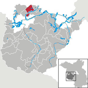
| Location of the municipality of Beetzseeheide in the Potsdam-Mittelmark district | ||
  |
||

Beetzseeheide [ beːʦeːˈhaɪ̯də ] is a municipality with around 650 inhabitants in the Potsdam-Mittelmark district in Brandenburg . It was created in 2002 through the voluntary amalgamation of the municipalities of Butzow, Gortz and Ketzür in the run-up to the planned Brandenburg municipal reform in 2003 and belongs to the Beetzsee Office .
Settlement of the area around the Beetzsee is documented as early as the Stone Age. The first mention of a place belonging to the municipality comes from the year 1161, when Mötzow was assigned to the Brandenburg Cathedral Chapter . The namesake for the community came from the Rinnensee Beetzsee belonging to the city of Brandenburg an der Havel , on whose banks it lies, and the wooded heathland in the north. The Beetzseeheide landscapes such as the Beetzseerinne , wetlands and plateaus are predominantly shaped by the Ice Age . Large areas are protected as nature parks, landscape or nature reserves, and several historical buildings are listed as monuments. The community does not yet have its own coat of arms.
geography

Geographical location
Beetzseeheide has an area of over 37 square kilometers and consists of two separate municipal areas. The eponymous Beetzsee, belonging to the independent city of Brandenburg an der Havel, divides it into a larger northern and a smaller southern area. The municipality is located in the north of the Potsdam-Mittelmark district on the border with the Havelland district, about five to ten kilometers northeast of the central town of Brandenburg an der Havel, the regional center of the region.
Beetzseeheide is also located about 35 kilometers west of the city limits of the federal capital Berlin and in the western area of the Berlin / Brandenburg metropolitan region . The shore of the Beetzsee has an average height of 28 to 29 meters above sea level, depending on the water level . The highest point of Beetzseeheide is the 77.2 meter high Butzower Berg in the northwest. The elevation is part of a chain of hills formed during the Ice Age, which extends to the southwest to the neighboring municipality of Beetzsee and Havelsee . This chain of hills represents a southwestern branch of the Nauener Platte . Dry valleys lie between the hills. To the north-west of this is the glacier tongue basin or the meltwater channel of the Marzahner Fenn , through the bottom of which the municipal boundary to the Havelsee runs.
Community structure and neighboring cities and communities

Beetzseeheide is divided into three districts and one municipality. The three villages Butzow , Gortz and Ketzür are located in the north of the two municipal areas northwest of the lake and are administrative districts. The village Mötzow , which belonged to the municipality of Butzow before the merger, represents a part of the municipality. Its boundary is located in a municipal exclave south or east of the Beetzsee. Beetzseeheide belongs to the Beetzsee office, to which the city of Havelsee and the communities of Beetzsee, Päwesin and Roskow also belong.
The following localities border the municipality of Beetzseeheide in a clockwise direction: in the south the independent city of Brandenburg an der Havel, in the west and north of the southern part of the municipality and in the south of the northern part of the municipality the Beetzsee, which also completely belongs to the city of Brandenburg, in the west of the northern part of the municipality the municipality of Beetzsee with the district Radewege and the city of Havelsee with Marzahne . The city of Havelsee and the municipality of Beetzsee belong to the Potsdam-Mittelmark district. In the north is the municipality of Märkisch Luch, belonging to the Havelland district, with the districts of Garlitz and Barnewitz . To the east, north of the Beetzsee, which divides the community, lie Päwesin with Bollmannsruh and south of the lake Roskow with Lünow and Grabow . Päwesin and Roskow belong to the district of Potsdam-Mittelmark.
geology

The central part of the municipality lies in a subglacial channel in which the Beetzsee formed as a typical channel lake. This channel was created during the Vistula glaciation and initially runs from the northeast to the southwest. Just below Butzow, it bends south.
In addition, foothills of the hilly plateaus of the Nauener Platte, also formed during the Ice Age, dominate the picture in the north. The Nauener Platte includes three parallel chains of hills running from northeast to southwest. These were formed by advancing glaciers in the backward marginal areas of ice edge layer 2 in the Brandenburg phase of the Vistula glaciation. The north-western of the three ridges with the Broseckenberg (66.8 m) and the moraines dome Butzower mountain can be in the southwest to the formed at the ice stage 2 Black Mountain track. It forms the southeastern wall-like edge of the Marzahn Glacier Tongue Basin.

A second chain of hills extends from the Mühlberg (61.9 meters) north of Ketzür over the Mosesberg (62.9 meters) to the Hasselberg (58.8 meters) between Butzow and Radewege, which is also formed on Ice Edge 2 . This second and the first chain of hills flank the Gortzer glacier tongue basin. Both chains are assigned to ice edge layer 2b. In the glacier tongue basin northwest of Gortz, meltwater first flowed in a channel in a southeastern direction towards the Beetzseerinne. The deepened Gortzer Laake formed in this area . South of Gortz or east of the Mühlberg, the meltwater channel swung sharply in a south-westerly direction.
To the southeast of the Mühlberg – Hasselberg range of hills lies the Todtlaake, which is also marshland in the flat valley . The valley was part of the meltwater channel from the Gortzer glacier tongue basin to the Beetzseerinne. It is flanked by the second northwest and a third chain of Ice Age elevations with an elevation also known as Hasselberg (52.7 meters), the Flachsberg (64.6 meters) and the Hüselberg (66.3 meters) to the southeast. The latter chain of hills continues to the northeast towards Päwesin as far as the Riewendsee . It is assigned to ice edge layer 3.
On the east side of the Beetzsee south of the village of Mötzow is the Wasenberg with a height of 48.5 meters, which, like the Schwarze Berg and the Radeweger Hasselberg, belongs to Eisrandlage 2. This edge of the ice can be traced in a line to the southeast over the vineyard near Klein Kreutz and the Götzer Berg . Another former meltwater channel extends around the Wasenberg.
Floors
In the municipality of Beetzseeheides there are different types of soil in a small space. In the northern municipal area, Pseudogley dominates over a wide area between the two north-western chain of hills . The hills are mostly determined by brown earth . In the Marzahner Fenn and in the shores of the Beetzsee east of Ketzür there are mostly low-lying bogs, and between Butzower Berg and Broseckenberg a narrow strip of Podsol runs right through the northern municipality. The Broseckenberg consists of Podsol brown earth and north of this elevation up to the district and municipal border the soil type Gley brown earth is predominant.
In the south or east of Beetzsees commune in the area around Mötzow clearly outweigh Gleye . Only two plateaus consist of brown earth and a narrow strip in the extreme south has humus gley and gley brown earth.
The areas in which the soil types pseudogley and gley dominate are described as soils with a very high yield potential. The areas of terrestrial fens and limestone glacier have high yields. In the vast majority of the areas of the municipality, due to the quality of the soil, have high to very high yield potentials.
Land use
| Land use 2012 | Area in ha |
|---|---|
| Buildings and open spaces | 102 |
| including living space | 27 |
| including commercial and industrial areas | 11 |
| Traffic areas | 109 |
| of which streets, paths, squares | 108 |
| Bodies of water | 103 |
| Agricultural land | 2443 |
| Forest areas | 922 |
| Operating areas | 7th |
| of which mining areas | 5 |
| Recreational areas | 13 |
| including green spaces | 10 |
| Areas of other use | 25th |
| including cemeteries | 1 |
| of it land | 24 |
| total area | 3723 |
More than 93 percent of the municipality is made up of forest, water and arable land. Due to the quality of the soil, the agricultural land has by far the largest share at 65.6 percent. The share in the municipality is thus well above the national average of around 49 percent. At 24.8 percent, the proportion of forest areas, which makes up 35.6 percent throughout Brandenburg, is below the national average. The largest forest areas are in the Gortzer and Ketzürer Heide, which occupy the entire north, and in the area of the hilltops. There are also other forests around smaller lakes. At 2.8 percent, water areas make up a smaller proportion of the total area than the national average of the state with many bodies of water. Throughout Brandenburg, water areas make up 3.4 percent. The small proportion of Beetzseeheide is mainly due to the fact that the Beetzsee belongs to the city of Brandenburg an der Havel and not to the neighboring communities over its entire length. Only a very small area of Beetzseeheide is built on. The type of land use actually made is itemized in the 2012 table of land use .

Waters

Even if statistically only 2.8 percent of the municipality is water, the Beetzseeheide landscape is shaped by a large number of bodies of water. Dominating is the Beetzsee, which divides the municipality in two, but which itself does not belong to the municipality, but rather to the independent city of Brandenburg an der Havel. The municipal boundaries are directly on the shores of the lake. The almost 22 kilometer long chain of lakes with three Beetzsee basins and the Riewendsee was created within an Ice Age channel formed by advancing inland ice. It is designated as a federal waterway . Until the 20th century, the Beetzsee played an important role as a transport route, especially for adjacent brickworks. Since the second half of the 20th century and the end of clay brick production, cargo shipping has only traveled a short distance in the extreme south. Since the end of cargo shipping on the waterway, the lake has been of increasing importance primarily for tourism and water sports. For example, the international Beetzsee regatta course is located opposite the Mötzow part of the municipality.
In addition to the Beetzsee there are a large number of smaller lakes, but all of them are of anthropogenic origin. They are mostly former clay pits in which the material for the local brickworks was extracted. Some lakes, called Erdelöcher, are to the west and south of Mötzow. The lakes south of Mötzow are in the Katharinenbruch and in the Fuchsbruch, which extends into the urban area of Brandenburg. Other small lakes lie east and west of Ketzür.

There are no rivers in Beetzseeheide. The only flowing waters are ditches created to drain wetlands, some of which are controlled by weirs and all of which flow into the Beetzsee. For example, the Katharinengraben south of Mötzow drains the Fuchsbruch and the Katharinenbruch to the lake. The Katharinengraben was historically built as part of the Landwehr of Brandenburg Neustadt between Beetzsee and Havel and was later expanded. The main ditch Ketzür begins directly at Gortz, flows north of Ketzür among other things through the Todtlaake wetland, drains it and flows into the west of the village. The ditch L 0392 begins between the Butzower Berg and the Broseckenberg and flows east into the municipality of Päwesin. Among other things, it drains the Gortzer Laake. Its mouth is at Bollmannsruh. The discharge is controlled by two weirs near Gortz. The main trench Ketzür and trench L 0392 are connected to each other via smaller ditches west of Gortz, so that part of the water in the main trench can drain away. Finally, the Marzahner Fenn is drained through the Russengraben . This flows into the Beetzsee at Radewege. In addition to these four larger systems, there are also a large number of other smaller trenches.
In the municipality there are some inland salt points where salty water comes to the surface. There are several such salt points in the Todtlaake, for example. In addition to the Todtlaake, there is another salt point in the area of the Beetzsee shore south-east of the Ketzür district.
climate
In the municipality of Beetzseeheide there is a Central European temperate climate, influenced by the continental climate in the east and the Atlantic maritime climate in the west. The precipitation is distributed relatively evenly over the year with a maximum in summer. There are no dry months. The average annual rainfall in Beetzseeheide is 544 mm. The driest month is February with a rainfall of 32 mm. Most of the precipitation falls on average in June with 64 mm. The annual average temperature is 9.1 ° C. The warmest month is July with an average temperature of 18.3 ° C. In January, the coldest month, the average temperature is −0.3 ° C.
|
Monthly average temperatures and precipitation for Beetzsee
Source:
|
|||||||||||||||||||||||||||||||||||||||||||||||||||||||||||||||||||||||||||||||||||||||||||||||||||||||||||||||||||||||||||||||||||||||||||||||||||||||||||||||||||||
history
Prehistory and early history

The area around Beetzseeheide was already inhabited by people in prehistoric times. Archaeological finds prove that the area between the Havel and the Beetzsee was settled at least since the Middle Stone Age . Numerous bone and antler artifacts have been excavated in the area , which could be dated to the Upper Paleolithic or Mesolithic times. There are also finds from the early Stone Age . At Hasselberg on the border with the Beetzsee municipality, for example, graves of the Havelland culture were secured. Several hanging vessels were found, some of which are exhibited in the Museum of Prehistory and Early History in Berlin . Further finds come from the Stone Age spherical amphora culture .

Finds in the area also come from the Bronze Age, for example . On the Mosesberg north of Ketzürs and east of Butzow, an urn burial field with around 60 graves, which can be ascribed to the early Iron Age and the early Roman Empire , was discovered during excavation work. Grave goods were fibulas , knives and belt buckles. In 1899 an Iron Age urn grave field was excavated north of Mötzow near the shore of the Beetzsee. In addition to stone-age graves, one of the largest urn grave cemeteries in the Elbe-Havel area was discovered on the Hasselberg from the later Roman imperial period up to the beginning of the migration period . During excavations, mostly bowl-shaped urns without additions were found. The finds were dated between the 3rd and 5th centuries. Many of the archaeological finds from the Butzow district are exhibited in the Jerichower Land district museum in Genthin .
In his work Germania , Tacitus described the area east of the Elbe up to the Oder as a settlement area of the Suebian tribe of the Semnones . Apart from a few remaining groups, the Semnones left their old settlement area on the Havel in the direction of the Rhine before or at the latest during the time of the migration of peoples from the 3rd or 4th century . From the 5th or 6th century, Germanic settlement activity largely came to a standstill. From this time until the 8th century there are only a few archaeological finds. At the beginning of the 8th century, Slavs immigrated to the area largely devoid of settlements after the Germans had emigrated . Remnants of the Germanic population went into the Slavic majority population. Finds along the Beetzsee date from the early Slavic period. Surface finds come from the shore of the Beetzsee lake east of the current location of Butzow. A settlement from the early to the late Slav period is said to have existed at this point. Other Slavic settlements were located in the Ketzür district directly on the lake, about 200 meters southwest of today's village center, and in the Gortz district on the bank below the Flachsberg.
middle Ages

After the Slavic castle of Brandenburg had been conquered by Heinrich I 20 years earlier , King Otto I established the Diocese of Brandenburg in 948 . Since there was an uprising of the Slavs in 983 , in which Brandenburg and its surrounding areas fell back into the hands of pagan Slavs, the bishops lived formally in continuous occupation from this time on, but in exile in Magdeburg as titular bishops , and had no rule over them Areas in the east on the Havel. This condition existed for almost 200 years until 1157 Albrecht the Bear was able to recapture Brandenburg.
The oldest written mention of Mötzow comes from the year 1161, four years after the reconquest. The village, written in the document "Mukzowe", was assigned as a Slavic settlement on the Beetzsee shore southwest of its current location by Bishop Wilmar of Brandenburg to the newly founded cathedral chapter of Brandenburg . In 1204, a document to the Brandenburg Margrave Otto II , in which the possession of the cathedral chapter was confirmed, mentioned two nearby villages of Mötzow. Three years later, in 1207, Butzow was first mentioned as "Buzow". In 1242, in a document in which Mötzow was again mentioned, there was talk of a "villa Mocszow slavicali" at the Allod Mötzow. In 1267 this village was again referred to as Wendish . Soon after, the Slavic place is said to have fallen into desolation , while the allod was described in 1335 as a curia , as a farm .
Gortz was first mentioned in 1313 when a document mentioned a "Borgardo plebano in Gardyz". A second mention comes from the year 1334 as "villam Garditz". The families of book and Kerkow were with the place invested , previously owned by the family von Bredow was. In a document from Margrave Ludwig I from 1335, several Beetzsee communities were obliged to carry out maintenance work on dams. Among other things, this affected Butzow and Kützkow, which was first mentioned. In 1371 a Tile Selchow had left the income of several farms in the village to the Altar Sankt Antonii in the Sankt Gotthardt Church in the old town of Brandenburg in “the village of Garze” . Four years later, "Gartz" was ascribed to Claus Hennicke in the land book of Charles IV . As a margravial fiefdom, he held the jurisdiction of the higher courts and the car service . The village is said to have had 34 hooves , 2 of which were owned by the pastor ( Wedemhof ) and 5 by Claus Hennicke ( Ritterhof ). The rest were leased like the fishery. There were 14 cottages and one Kruger in town. The vineyard was paid £ 1 a year .
In Butzow the Landbuch listed 24 hooves, 22 of which were free and only 2 were leased. There was no real farming community in the village. Of the free hooves, 15 were owned by the margrave's vassals. In addition, 7 kossas and one Kruger were described. Rent had to be paid for fishing on the lake. The local high court was held by the vassals Heinrich Bröseke and Claus Butzow. The owner of Ketzür was Thile Brösigke, also from the Brösigke family , who kept the village in their possession for several centuries. The family was mentioned in different spellings over the centuries. Thile was also a vassal of the margrave. He held the higher jurisdiction and the church patronage. "Kotzure" or "Kotzüre" had 26 hooves, 6 of which were owned by Brösigke and 2 by the pastor. The rest of the hooves were leased. In addition there were 6 farms and a windmill . The rent of the mill was 3 rye wispel , the fishing brought 5 schillings and the Schulze had to maintain the feudal horse.
In the 15th century, in 1413, Butzow and Ketzür and other villages were plundered by robber barons from Magdeburg . In 1413 or 1414 a Klaus or Claus Ruck, who was a citizen of Brandenburg, is said to have been lord of Gortz and sold the place to the von Trebbow family. In 1428 the Brandenburger Domstift received from the margrave in Butzow a previously fallen courtyard and a vineyard right next to the rectory as a fief. Two years later the Brösikes became co-owners of Gortz. In 1440, the old town of Brandenburg owned the fishing rights on the Beetzsee near Butzow. Residents of the village were only allowed to fish with small nets on the shore. According to the lap register, the von Brösigke family enlarged their farm in Ketzür to 8 Hufen by 1450 . Claus von Brösike owned a farm with 5 hooves in Gortz, which was enlarged by another 3 until 1480, so that the manor was also 8 hooves in size. Lord of Butzow in 1450 was a citizen Jasper Lantyn from Brandenburg, who had owned an estate since 1431 and also owned properties in Hohenferchesar and Fohrde in what is now the Havelsee. From 1477 a Margarethe Retzow received an annual pension from Achim Brösicke from the village of Ketzür. The first major fire described was in Gortz in 1480. During this several farms with a total of twelve hooves were destroyed. From 1499 to 1542 the Premonstratensian Monastery of Our Lady on the Mountain on the Marienberg in front of the old town had the right of patronage over Butzow.
Early and modern modern times

In 1518 the elector Joachim I gave a failed fiefdom in Butzow to the Premonstratensian monastery on Marienberg, which already held the church patronage, and in 1520 he sold Butzow with all rights and income for 992 guilders and 30 groschen to the cathedral chapter of Brandenburg. The feudal succession also passed from the Brösegke and Klest families to the cathedral chapter. The previous free hooves were then leased to farmers. Later, in the course of the Reformation , the church patronage came from the Premonstratensian monastery to the cathedral chapter, and from 1541 at the latest until the 17th century, the Butzow church service was provided by the Ketzür priest. The Gortzer Church was a branch church of Ketzür. Also from 1541 at the latest, the Brösegkesche Gut in Ketzür was divided within the family.
Mötzow was 1,567 as Vorwerk expelled or sheep in the register of the cathedral. The high court of justice of the cathedral was located on the Wasenberg south of the village and not far from the road to Nauen . The gallows and straightening wheel stood on it and executions were carried out there at least into the 18th century. The exercise of rights reached back to the Merseburg tithe contract of 1237, which ended the Brandenburg tithe dispute . His agreements included the transfer of high or blood jurisdiction in the localities of the cathedral chapter property to the provost or his deputy. As clerics were allowed blood jurisdiction not exercise itself, but had appointed a judge to another jurisdiction belonged. During the plague in 1577 and 1598, for example, the wealthy citizens left the old town and new town and partially withdrew to their lands in the vineyards. The old town was near Radewege, the new town near Klein Kreutz . The common Brandenburg Schöppenstuhl met during these times on the Pählbrücke near Butzow.
In lap cadastre of 1624 a village blacksmith was first mentioned in writing for Butzow. In the same year there were twelve peasant, twelve manorial and two parish hooves, a shepherd and a blacksmith in Ketzür. As a result of the Thirty Years' War (1618 to 1648), Butzow fell largely desolate. Gortz was also destroyed. After the war and the resettlement, Butzow had its own pastor again by 1656 at the latest. Gortz was rebuilt a little off the Beetzsee north of the Flachsberg. In 1669 a fire destroyed four Butzow homesteads, a barn and the Küsterhof. Ketzür remained fully owned by the von Brösegke family until the late 17th century. As a result of an inheritance comparison in 1674, part of the property in Ketzür went to a Joachim von der Hagen at the end of the 17th century . The Gortz manor, which also included possessions and rights outside the village, was also divided. The smaller part stayed with the von Brösegke family, the larger part went to von der Hagen. In 1691 Joachim von der Hagen received the feudal letter from Elector Friedrich III. , later King Friedrich I.
From 1717 the cathedral monastery leased its Mötzow estate. The first tenant was August von Schönborn until 1729. The goods of the von Hagens in Ketzür and Gortz in 1718 comprised a knight's seat, shepherd justice, fishing, piping, hunting, higher and lower jurisdiction, part of the church, gardens, meadows, meat tithe, wood, farms, leases and more. For the year 1772 163 residents were counted for Butzow and 68 residents in the Vorwerk Mötzow around 1800.
In 1815, provinces were formed in the Kingdom of Prussia after the Wars of Liberation against Napoleonic France and the associated political and geographical changes. The areas around the city of Brandenburg were incorporated into the new Prussian province of Brandenburg . A year later, the Westhavelland district was founded, to which the towns of Butzow, Gortz, Mötzow and Ketzür belonged. In 1824 the estate in Ketzür with twelve hooves passed from the Brösegke family to the von Rochow family and in 1836 the estate in Gortz also changed. The Hagens manor in Gortz had gone to the citizen Beyl in 1828. From 1859 the Mötzow cathedral monastery and the lands belonging to the estate leased to Friedrich Sander. In 1894 he had a castle-like manor house built on the estate.

In the entire area along the Havel and the lakes connected to it, there was an economic boom at the beginning and in the course of the 19th century and with the beginning and advancing industrialization in Prussia. Due to the rich clay deposits in the area and near the lake, several brickworks were built around the villages of Mötzow, Butzow, Ketzür and Gortz. The Havel enabled transport to industrial centers. The fired clinker was loaded onto barges on site and transported by ship to the cities of Brandenburg, Potsdam and Berlin. A shipload usually consisted of around 40,000 to 50,000 bricks. Clinker production was partially maintained until the middle of the 20th century. Then the clay deposits were exhausted and more modern materials were used. In 1840 there were 29 residential buildings and 80 farm buildings in Butzow, including a mill and a brick factory. Mötzow was a Vorwerk in 1860 with 12 residential and 41 farm buildings, two of which were brickworks.
20th and 21st centuries

Around 1900 there were more than 500 people in Ketzür and the place consisted of 53 residential buildings. Butzow had 360 residents and 70 houses. Two of the residents of Butzow were innkeepers, a butcher, a bakery, a fishery and a dairy owner. There were also several newly established farms in the village. In 1904 today's Beetzseeheide was connected to the German rail network. In that year, a branch line of the West Havelland District Railways, which had existed since 1901 and connected Brandenburg with Nauen in the northeast, was opened via Butzow and Ketzür . To the southeast of Ketzür, the connection was made via a bridge over the Beetzsee. The railway connection played an important role primarily in freight traffic for the Beetzsee communities. Mainly agricultural products and brickworks were transported. After the decline of rail traffic, the connection via Butzow and Ketzür was discontinued in 1969 and subsequently dismantled. The track from the direction of Brandenburg has ended in the Beetzsee community since it was dismantled.
During the First World War , 14 people fell from Gortz and 18 people from Butzow. In the course of the dissolution of the estate districts , Mötzow became a free rural community in 1928. In 1933 the place had 134 inhabitants. This number fell to 122 by 1939. At the same time there were 303 and 297 residents in Butzow, 370 and 383 in Ketzür and 306 and 314 in Gortz. In 1939 there were a total of 26 agricultural and forestry holdings in Ketzür.

During the Second World War, on July 12 and 27, 1942, five Soviet prisoners of war who had fled from a camp in the city of Brandenburg were shot near Butzow . They were buried in the cemetery. A memorial stone was erected after the end of the war. Also in the cemetery are 13 German soldiers who perished near the village in early May 1945. At least twelve residents of Butzow fell as soldiers in World War II or were reported missing. Twenty-three German soldiers who fell in late April and early May 1945 were buried in the Gortz cemetery.
In the course of the land reform in the Soviet occupation zone from 1945 onwards, 375 hectares of agricultural area of the former manor were redistributed among 54 residents around Ketzür. At Gortz a manor with 312 and a manor with 128 hectares and at Butzow an estate with 117 hectares were redistributed among the landless and poor population. The Domstiftsgut Mötzow remained in ecclesiastical ownership, however it had to be managed by the Domstift itself and could no longer be leased. In 1952 an administrative reform took place in the GDR, which was founded in 1949 . The states were dissolved and districts were formed for them. In this context, it was also necessary to restructure the existing circles. So the district of Westhavelland, to which the places belonged until then, was dissolved, and the communities were incorporated into the new district of Brandenburg (Land) in the district of Potsdam . From 1953, as everywhere in the GDR, in today's districts of Beetzseeheide, the collectivization of agricultural businesses took place, some of which were too small due to the land reform to be run profitably or effectively. Agricultural production cooperatives (LPG) were formed. The Domstiftsgut was not affected by this collectivization. In the course of the expansion of agriculture, large stables for pig and cattle fattening and as a dairy cattle facility were built in Butzow in 1955. The village Mötzow, which has been independent since the estate districts were dissolved, was incorporated into Butzow in 1957. In 1960 the LPG Butzows, Ketzürs and Gortz joined forces to form the LPG "Friendship". Agriculture experienced a further concentration with the establishment of a Cooperative Plant Production Department (KAP) north of the city of Brandenburg, whose headquarters were in Brielow and to which the plant productions of the LPG in the area were affiliated. After the closure of the Westhavelländische Kreisbahnen, a large campsite was set up on the former railway site near Butzow to the Beetzsee and in 1979 a weather station was opened.
With the political upheavals of 1989 and 1990 there were again changes. The individual LPGs were dissolved, which led to changes in agricultural production. The former members of the cooperative leased their property, managed it themselves or, for example, brought it to the newly founded Brielower Agrar GmbH. The stables in the area were shut down. The Domstiftsgut at Mötzow also reduced production. Initially, up to 50 percent of the cultivation area on their lands alone was set aside, and ultimately the former estate was leased from 2001. In 1990 the Potsdam district was dissolved and merged into the re-established state of Brandenburg. After reunification, the new district of Potsdam-Mittelmark was founded in 1993, into which the district of Brandenburg was merged. In the run-up to the Brandenburg municipal area reform planned for 2003, the previously independent municipalities of Butzow, Gortz and Ketzür voluntarily merged to form the municipality of Beetzseeheide on February 1, 2002.
Municipality and place names
When the previously independent towns of Butzow, Gortz and Ketzür merged in 2002, it was decided to give the community a new name. This should make it clear that it was an equal merger and not an incorporation. The Beetzseeheide was chosen because the Beetzsee and the wooded heathland (Gortzer, Ketzürer and Butzower Heide) dominate the landscape.
The origin of the name Beetzsee has not been conclusively clarified. For example, a possible connection to other possible names of lakes such as Bützsee, Bötzsee, Bützowsee is established. A borrowing from the Ur-Slavonic is discussed. For example, a reference to bъčъ for “large vessel” or “field well” or bučatri for “swell with moisture” or “rotten” is suspected.
The place names Beetzseeheides are of Slavic origin. Butzow is derived from the Polish name Budz or Buč . It would thus be described as a dwelling of this person. The name and the spelling of the place hardly changed over the centuries. When it was first mentioned in writing, the village was called "Buzow". Gortz is also of Polish origin. It should be derived from gardec or gard , which means something like "castle" or "fenced, fortified place". In a first document in 1313 there was talk of "Gardyz" and in 1334 of "Garditz". In records from 1371 the place was called "Garze" and in the land register 1375 "Garz".
Heresy is declared a hangover location. It is said to be derived from the Polish kocur , which means "hangover". However, it is believed that hangover in this case does not refer to a male cat, but rather metaphorically to a plant, as in other Slavic languages. Thus, Ketzür would be an area where a plant known as a hangover was found. In its first documentary mention in 1335, the village "Cùczoer" was written and in the land register 1375 was called "Kotzure" or "Kotzüre". In the Schmettauschen map series of the late 18th century it was already called "heresy".
Mötzow is also a name of Slavic or Polish origin. Mokoš is said to exist in various Slavic languages and to be related to pagan deities. In 1161 Mötzow was assigned to the cathedral chapter as "Mukzowe". 35 years later it had become “Muczowe”. The explicitly Slavic settlement in ecclesiastical ownership was mentioned in documents in 1242 as "Mucszowe" and in 1267 as "Mocszowe" and the farm in 1335 as "Motzowe".
population
At the 2011 census , Beetzseeheide had 643 inhabitants. In the district of Potsdam-Mittelmark only the communities Päwesin, Wenzlow , Gräben and Buckautal had a smaller population. The proportion of foreigners was 0.9 percent. 22.7 percent of the population or 146 inhabitants belonged to Protestant Christianity , 3.7 percent or 24 absolutely to Catholic Christianity. When asked about religious affiliation, the remaining population was summarized under “other, none, no information”, so that it is not possible to make a statement about other religious communities on the basis of these data.
Population development
The population in the area of today's municipality of Beetzseeheide had reached its first maximum at the end of the 19th century with 1346 inhabitants in 1890. In the following decades the villages increasingly lost their population. This trend was only briefly interrupted shortly after the end of World War II, when emigrants from former German areas were housed and resettled in the villages. In 1946, the all-time high was 1447 inhabitants. As a result, there was another drop in the population, which lasted continuously until 1996. In this year 637 inhabitants were recorded for the places and thus less than half of the years 1890 and 1946. After 1996 the numbers initially stagnated. Then there was a slight increase for the first time since the post-war period up to 2004. From 2004 to 2013, the number of inhabitants fell continuously again, but much more easily than decades before. From 2014 the number of inhabitants will grow again, if only to a small extent. The exact population figures are shown in the table Population development in the territorial status of the respective year .
|
Dialects
Up until the 19th and 20th centuries, the regional dialect was a typical Brandenburg dialect that was spoken by the majority of the population in everyday life. In the time of Theodor Fontane, for example, this Low German dialect was still used in the area . In many words, p instead of f, t instead of s-sounds and k instead of ch. For example, they talked grot instead of big and Dörp held village. There were also differences in vowels such as ie and u instead of the diphthongs ei and au. So the house was a huus at that time . Starting in the second half of the 19th century, the language in the cities changed more and more from Low German to the Berlin dialect , so that today Low German around the city of Brandenburg is almost extinct. Exemplary for the language of the 20th and 21st centuries, au is spoken for o ( lofen instead of running) and z for voiceless s ( ssitrone instead of lemon). The frequent rewriting of the genitive like Gregor's car is also typical .
politics
mayor
Mayor of the municipality of Beetzseeheide is the non-party Eberhard Pinkpank, who was elected for five years with 82.5 percent of the valid votes in the 2014 municipal elections . It is his second term in office. In the 2008 election, he prevailed with 71.8 percent against the incumbent Horst Kemmeries (28.2 percent). Kemmeries was elected as the first mayor of Beetzseeheide in 2003 as a single applicant.
Community representation
| Election 2014 | number | % | +/- | Seats | +/- | ♀ |
|---|---|---|---|---|---|---|
| Eligible voters | 595 | |||||
| Voters | 347 | 58.3 | −2.3 | |||
| invalid ballot papers | 11 | 3.2 | +0.5 | |||
| valid votes (up to three per voter) | 992 | 95.3 | −1.5 | |||
| List heretic | 526 | 53.0 | +5.1 | 5 | +1 | 1 |
| List Butzow | 212 | 21.4 | −5.8 | 2 * | 0 | 0 |
| Free citizens and farmers | 104 | 10.5 | +10.5 | 1 | +1 | 0 |
| Individual applicant Uwe Sernow-Rose | 66 | 6.7 | +6.7 | / | / | / |
| Individual applicant Bruno Schnorbach | 39 | 3.9 | +3.9 | / | / | / |
| Alliance 90 / The Greens | 25th | 2.5 | +2.5 | / | / | / |
| Individual applicant Oliver Richter | 20th | 2.0 | +2.0 | / | / | / |
* Two seats chosen for the list with only one candidate. A seat remains vacant.
The community council includes seven community representatives with eight seats to be filled. The last local election took place on May 25, 2014. The elections were combined person and list elections. Each voter could cast up to three votes. The turnout was 58.3 percent. This was 2.3 percent less than in the 2008 election, but over twelve percent more than the national average. The turnout was 46.2 percent across Brandenburg. The first-placed list Ketzür achieved an absolute majority with 53 percent, whereby it improved its result from 2008 by 5.1 percent. She won five seats. The Butzow list came in second with 21.4 percent. This was a minus of 5.8 percent. With the election result, she theoretically won two seats in the municipal council. However, since there was only one candidate on the list, the second seat remains vacant until the end of the election period, in accordance with the Brandenburg Municipal Electoral Act, and the number of municipal representatives has been reduced to a total of seven. The last vacant seat was won by free citizens and farmers with 10.5 percent. This electoral list came up for the first time with a candidate for local elections in the municipality. Three individual applicants and Bündnis 90 / Die Grünen , who had also not run in the previous elections, were not elected. The only woman in the community council is Britta Fraas, who was voted fourth on the Ketzür list. The farmers' association and the Beetzseeheide electoral community, which each won a seat in 2008, did not run again.
Sights and culture
Buildings

Registered architectural monuments in Beetzseeheide are, for example, the village churches in Butzow, Gortz and Ketzür, manor houses and residential buildings. The village church of Ketzür combines elements from different epochs. The gothic polygonal (heptagonal) central building made of brick, which adjoins the tower asymmetrically, is striking . It is said to come from the 13th or 14th century. The lower part of the tower is also Gothic, the structure is baroque . In relation to the nave, the choir is oriented further from the east-west axis that is usual for churches to the northeast. As a result, with a strictly aligned west tower, the church has a slightly curved longitudinal axis that deviates to the northeast. The connection of the choir to the nave forms due to the polygonal shape, which makes the nave narrower in this area, protruding corners in the north and south-west. The choir dates from 1599 and has a striking tail gable in the east , which can be assigned to the Renaissance . Inside the church, the patronage box of the von Broesigke family and an epitaph by the sculptor Christoph Dehne donated for Heyno and Heino von Broesigke are outstanding.

The Ketzür post mill is to the east not far from the village. It is restored and working. The Ketzür master carpenter Friedrich Henkel bought the wooden structure in 1861 and moved it to Ketzür. Before that, the mill was in Bornim near Potsdam. It remained in commercial operation for almost a hundred years before it was shut down in 1955. After it fell into disrepair in the following years, the first renovation work began on today's monument in 1988. Further renovations followed. The mill is owned by the municipality. It is made available to the public and operated by the Association for the Preservation of the Post Mill on various occasions.

In Ketzür, opposite the church, stands the old manor house of the von Brösegke family . It is a two-storey plastered building whose origins are said to be in the 16th century. A Renaissance gable as the oldest decorative element has been preserved on the southern canyon . In later centuries, for example in 1752, the building was extensively rebuilt and expanded. The central rectangular building is simple. The paint has a shade of yellow, rectangular windows and a five-part basket - arched skylight above the portal are framed by white bottles . The roof is hipped . In the north there is an annex that differs from the main building in two ways. The windows of this part of the building are ogival . It also has a mansard roof . The local council and the community council meet in the manor house. In addition to the church and manor house, there are four historically valuable residential buildings and farmsteads in Ketzür ( Dorfstrasse 29 , Dorfstrasse 30 , Dorfstrasse 31 and Unter den Linden 11 ) as well as a brick-paved street north of the town in the state's list of monuments.

The Gortz village church is in two parts structurally. The Gothic nave made of field stones was built between 1450 and 1500. The rectangular hall building originally had a pointed arched step portal to the south. Later a square tower with a west portal in the Baroque style was added. In 1906 the church was extensively rebuilt inside. The windows were also structurally changed for the last time. The stalls and the west gallery originate from the time of the renovation . Next to the church is in Gortz the house Dorfstraße 12 under monument protection . The light gray paintwork of the farmhouse has a central projection , pilaster strips in ashlar plaster , a cornice with consoles and pointed, neoclassical window canopies .

The church in Butzow the youngest of the village churches built to 1879th It is a relatively simple neo-Romanesque plastered building with a pointed spire and a semicircular apse, made of bricks . External decorative elements are unplastered pilaster strips , a simple eaves cornice and window windows . Inside there is an organ by the Potsdam organ builder Carl Eduard Gesell . The outwardly inconspicuous house at Dorfstrasse 8 in Butzow is the oldest building in the village and also a protected monument. It is a Lehmfachwerkhaus . The half-timbering is not visible because the building was subsequently plastered gray. A decorative element is a simple, white-painted, profiled threshold between the floors. On the northern outskirts there is a Soviet memorial for those who fell in World War II. The bilingual inscription reads "Eternal glory to our heroes in the common fight against fascism".

The Mötzower manor house of the cathedral monastery can be assigned to late historicism . It looks like a castle and is an example of mansions from the late 19th century in the area around the city of Brandenburg. It was built with red bricks, most of which remained unplastered. The many niches created by risalites with half-hipped roofs and tower-like extensions of various sizes and shapes are striking . It also has several tower-like roof turrets and various windows. The year of construction of the manor is said to have been 1894. In addition to the manor house, there are some residential and farm buildings, some of which are significantly older, in the estate. In a survey by ARD in 2012, the Domstiftsgut was voted the second most beautiful farm in Germany.
Museums

The only museum in the community, the N'Ostalgiemuseum , moved from Mötzow to Leipzig in 2016.
Regional artists regularly exhibit in the premises of the Mötzow estate's art mill. In 2013, photographs by Lars Friebel and Ronald Geisler and pictures by the painter Gisela Neuenhahn were on view.
Events
Since 2001, the Ketzür Rockt open-air concert has been held every year in August in a gravel pit near Ketzür . Mainly local and regional bands perform at this concert. Regularly changing cultural events also take place at Gut Mötzow. The Beetzsee regatta course across from Mötzow is an international competition venue where canoe racing and rowing regattas such as world and European championships are regularly held.
Protected areas
In Beetzseeheide there are a large number of protected areas and protection assignments, some of which overlap. For example, the entire area of the municipality is located in the Westhavelland Nature Park . In addition, has Beetzseeheide share in the conservation area Marzahner Fenn and dune heath , the conservation area Westhavelland, the SPA area (European bird sanctuary) Average Havelniederung, the FFH sites Beetzsee channel and lowlands, Middle Havel supplement and Bagower break and the protected landscape components Feldmark Mötzow-Lünow and Marzahner Fenn. Completely within Beetzseeheide are nine other protected landscape elements, a natural monument and a pedunculate oak designated as a natural monument . Other areas are designated as protected biotopes and some streets as protected avenues.


| Protection expulsion | Surname | Size in ha |
Number in card |
|---|---|---|---|
| Nature reserves | Marzahner Fenn and Dünenheide | 725 | 1 |
| Landscape protection areas | West Havelland | 136.071 | / |
| Nature parks | West Havelland | 131,500 | / |
| FFH areas | Bagower Bruch | 154 | 2 |
| Beetzsee gully and lowlands | 916 | 3 | |
| Middle Havel addition | 2,524 | 4th | |
| SPA areas | Middle Havel lowlands | 25,024 | 5 |
| Protected landscape components | Marzahner Fenn | 6th | |
| Feldmark Mötzow-Lünow | 7th | ||
| Katharinenbruch | 8th | ||
| Gortzer Strictly | 9 | ||
| Todtlaake Ketzür | 10 | ||
| Todtlaake Gortz | 11 | ||
| Hüselberg | 12 | ||
| Kerkfenn | 13 | ||
| Pork corners | 14th | ||
| Orchards | 15th | ||
| Gortzer Laake | 16 | ||
| Area natural monuments | Erdeloch near Mötzow | 17th | |
| Natural monuments | English oak (Gortz) | 18th |
See also the list of natural monuments in the Beetzsee office .
Westhavelland Nature Park
The entire area of the Beetzseeheide municipality is part of the Westhavelland Nature Park, which extends along the Lower Havel. At 1,315 square kilometers, this is the largest protected area in Brandenburg. It comprises one of the largest contiguous wetlands in inland and Central Europe. It is also the largest resting and breeding area for waders and water birds inland. The wetlands are also some of the largest inland resting places for Nordic migratory birds. In spring, thousands of gudgeons and diving ducks rest on the lakes and flat flooded meadows along the Havel . Large flocks of waders look for food before moving on to their northern and eastern homes. Sometimes the birds also find suitable breeding areas there. The lowlands of the nature park are home to the largest proportion of the highly endangered and threatened meadow breeders in Brandenburg. The curlew , lapwing , black-tailed godwit , redshank , snipe and corncrake nest in the reserve . Endangered species of ducks such as the shoveler , teal and gadfly breed there . Also Pintail there are still at home. As for birds of prey, there are sea and ospreys , kites and Montagu's harriers . The ruff is the heraldic animal of the Westhavelland Nature Park. In the autumn months gray geese and cranes roam the nature park. In addition to the large number of birds, beavers and otters also live on the Beetzsee .
Marzahner Fenn and Dünenheide nature reserve

The Marzahner Fenn in the northwest of Beetzseeheide is part of the nature reserve Marzahner Fenn and Dünenheide. This 725 hectare nature reserve is characterized by a close spatial relationship between different habitats. There are near-natural alder and pine forest communities on nutrient-poor locations, bodies of water, slight mountain ranges with only extensively used dry valleys, so-called dwarf shrub and dune heaths, small fens, wet and wet meadows. Due to the different habitats, a large number of partly endangered plant, bird, reptile and amphibian species live in the protected area. According to the German Nature Conservation Union , 78 of the 156 vertebrate species found in the Marzahner Fenn and Dünenheide are considered endangered. The area is an ecological link between the Beetzsee and the Riewendsee in the east, the Havelniederung in the west and the Havelländischer Luch in the north. Some of the animal and plant species living in the nature reserve are osprey, spotted eagle , tree falcon , snipe, quail , crane and great shrike , Sand lizard , grass snake , common garlic toad , moor frog , crested newt , purple loosestrife and milfoil . The nature reserve Marzahner Fenn and Dünenheide is in its entirety part of the European bird sanctuary (SPA area) Middle Havelniederungen and in the northern area part of the FFH area Weißes Fenn and Dünenheide. It is part of the European Natura 2000 network of protected areas .
economy
In Beetzseeheide there are only small businesses and craft businesses. Industrial companies have not resettled since the end of the brickworks. The main economic sectors of the municipality are tourism and agriculture.
tourism

The main tourist attraction is the Beetzsee, on the banks of which the municipality is located. In addition to the lake and the surrounding nature with forest areas and meadows, Beetzseeheide benefits from its relative proximity to the cities of Berlin, Potsdam and Brandenburg. As in the other neighboring communities of the Beetzsee, nature , water and water sports tourism in particular is developing more and more. The lake is a sailing and motorboat area on its entire surface. In addition to the Beetzsee, there are other swimming opportunities in the many clay pit lakes. Water hikes from the direction of the Lower Havel along the Beetzsee-Riewendsee chain are also popular with tourists. For several years now, trips and vacations in rented houseboats without a license on the river and its adjacent lakes have been increasingly offered and in demand. The Beetzsee and Beetzseeheide can be reached all year round with private boats via the Havel and the waterways connected to it.
There are several campsites, holiday homes, guest houses, guesthouses and excursion restaurants right on the Beetzsee in the towns. Hotel facilities on the lake are located in the districts of Radewege and Brielow in the neighboring municipality of Beetzsee and in the Päwesin district of Bollmannsruh about 500 meters northwest of the municipality border with Beetzseeheide. There are other hotels in the city of Brandenburg, for example. Many Brandenburgers have their weekend and holiday homes in the community. The Beetzsee-Havel-Radweg and Storchenwanderweg have been touching the community for several years. Both lead as circular routes around the Beetzsee. The Beetzsee holiday region is one of the holiday regions in Brandenburg with the highest growth rates.
Agriculture

In addition to tourism, agriculture is an important economic factor in the municipality. 2,443 hectares and thus almost two thirds of the Beetzseeheide area are used for agriculture. At the time of the GDR, the farms Butzows, Ketzürs and Gortz were organized in agricultural production cooperatives (LPG). After the end of the GDR, the cooperatives were dissolved. The stables were incorporated into Brielower Agrar GmbH, but were shut down relatively soon. Most of the agricultural land was leased by the owners. The main crops are wheat , rapeseed and animal feed. Since there are several inland salt points in the Todtlaake where salty water comes to light, there are mainly salt marshes that are extensively grazed or mowed. Mötzow's agricultural land, which was never part of an LPG, was leased in 2001. Since then, the Domstiftsgut has been operated as a so-called multi-fruit and adventure farm with partial direct marketing. The main crops are blueberries and asparagus . There are some orchards around the villages, for example north of the Mühlenberg near Gortz. The fruit is juiced and marketed in a Ketzürer cider factory.
forestry
The areas in the north of the municipality are primarily used for forestry. The largest forest area of Beetzseeheide is the Gortzer Heide, which merges to the west into the Ketzürer and Butzower Heide. In addition, the hilltops and some of the bank areas are forested. The vast majority of the forests are made up of monoculture pine forests . At the transition from the Gortzer to the Bagower Heide to the northwest, there is a semi-natural mixed deciduous forest, a small portion of which lies in the Beetzseeheides municipal area. Around the clay pit lakes, especially near Mötzow, swamp forests have partially formed again . There are only a small proportion of hardwood forests. In recent years, clear-cutting and monoculture reforestation have been abandoned and the development of more natural mixed forests has been promoted instead.
Infrastructure
traffic

The main axis of road traffic is the state road 911, which leads from Brandenburg an der Havel to Barnewitz . Coming from the south it crosses Mötzow from Brandenburg, is led with the Pählbrücke over the Beetzsee and on a short stretch through the municipality of Beetzsee, crosses Butzow, leads north past Ketzür and through the village of Gortz. North of Gortz, the state road leaves the community to Märkisch Luch. To the north of Mötzow, shortly before the Pählbrücke, the district road 6941 branches off from the state road 911. It leads to the places Grabow and Lünow in the municipality of Roskow. Another main road that branches off is Landesstraße 912. From the 911 in Gortz it leads to the municipality of Päwesin in Bollmannsruh. There are also municipal and private roads.
Beetzseeheide is located with some port facilities on the Beetzsee-Riewendsee-Wasserstraße , a federal waterway. It is classified as class IV up to the Pählbrücke . This means that so-called European ships with the dimensions 85 meters in length, 9.50 meters in width and 2.50 to 3.00 meters in draft are permitted. The Beetzsee is only used by such ships in the extreme south on a short distance between the suburban lock Brandenburg and the silo canal . Above the Pählbrücke, the waterway is a so-called unclassified inland waterway. While the lake in the area of the municipality used to be an important traffic route for commercial shipping, this picture has now completely changed. In fact, commercial shipping in the form of cargo shipping no longer takes place. Only watercraft for repair and improvement work in the area of the waterway and passenger ships, in addition to recreational and sport shipping, use the lake at the level of the municipality. In the latter, in contrast to commercial shipping, there has been a very strong increase in recent decades, so that the lake is particularly busy in the spring and summer months. The port facilities include several jetties for motor and sailing boats.
With the cessation of traffic on the Westhavelländische Kreisbahnen route through Butzow and Ketzür in the 1960s and the extensive dismantling of the track, today's Beetzseeheide was completely decoupled from the German rail network. Since the closure, bus transport has been the only public transport provider in the municipality. There are two regional bus connections operated by Verkehrsgesellschaft Belzig mbH (VGB) through Beetzseeheide. The most important line is the 569, which leads from Brandenburg to Päwesin or Riewend via Butzow, Ketzür and Gortz. It is operated at least eight times in each direction of travel on weekdays and more frequently on school days. The line runs three times on Saturdays and twice in each direction on Sundays. Mötzow is connected with line 552. This runs primarily in school traffic between Brandenburg, Mötzow, Lünow and Radewege. Beetzseeheide is part of the Berlin-Brandenburg transport association and is integrated into its tariff system. This makes it possible to use various modes of transport to travel from the cities of Berlin, Potsdam or Brandenburg to the municipality using a single ticket.
Education and Public Institutions

There are no schools in Beetzseeheide. The primary school responsible is the “Am Beetzsee” primary school in Radewege, which is located near the municipal boundary on Hasselberg. Primarily the students of Beetzseeheide and Beetzsee are taught here up to the end of the sixth grade. The Radeweg school was inaugurated as a new building on June 1, 1962 and was a ten-class general education polytechnic high school until 1991 . From 1976 to 1991 she was called " Vladimir Ilyich Lenin ". It was then converted into a primary school. The closest secondary schools are in the city of Brandenburg. Nearby universities are the Brandenburg Medical School , the Brandenburg University of Technology and the University of Potsdam . There are kindergartens in the municipality of Beetzsee in Radewege and in Brielow and in Brandenburg an der Havel.
The Beetzseeheide volunteer fire department consists of the Butzow, Gortz and Ketzür volunteer fire departments. There are fire stations with fire engines and emergency vehicles in all three districts. The community council holds its meetings primarily in the manor house in Ketzür. The responsible authorities are located in the headquarters of the Beetzsee Office at Chausseestrasse 33 b in Brielow Expansion . There you will find the registry office, the building office, the office for order and social affairs and the office for central services and finances.
Medical institutions
There are no resident doctors, dentists or physiotherapists in Beetzseeheide. Outpatient medical care takes place in the neighboring towns. In Brielow there is a general practitioner, a dentist, a pediatrician and a physiotherapeutic practice, in Marzahne there is physiotherapy, in Päwesin two general practitioners, in Roskow one general practitioner and one dentist. Other medical, dental and physiotherapeutic practices are located in Brandenburg an der Havel. The closest hospitals are also in the city of Brandenburg. The municipal clinic there serves as a hospital for specialized care. The Sankt-Marien-Krankenhaus is a geriatric, the Asklepiosklinik a neurological and psychiatric special hospital and the Heliosklinik Hohenstücke a neurological rehabilitation facility. For the emergency services are rescue stations in Brandenburg and Bollmannsruh responsible. The nearest rescue helicopter location is also in the city of Brandenburg. There is an art therapy studio in Ketzür .
media
The daily newspaper with the best-selling circulation in Beetzseeheide is the Märkische Allgemeine based in Potsdam. The local editorial office responsible for the Brandenburg country courier and thus the news of the community is based in neighboring Brandenburg an der Havel. There are also the two free newspapers, Brandenburger Wochenblatt (BRAWO) and PreussenSpiegel , which are financed by advertisements and publish regional and local news.
Personalities
- Heino von Broesigke (1525–1609), manorial estate owner , civil servant and art patron
- Willy Isensee (1898 – after 1946), politician of the KPD and SED , member of the state parliament of Saxony-Anhalt , born in Gortz
- Jean Wiersch (* 1963) police officer and writer, lives in Ketzür
literature
- Sebastian children, Haik Thomas Porada on behalf of the Leibniz Institute for Regional Geography and Saxon Academy of Sciences in Leipzig (ed.): Brandenburg an der Havel and surroundings . A geographical inventory in the area of Brandenburg an der Havel, Pritzerbe, Reckahn and Wusterwitz (= Landscapes in Germany. Values of the German homeland . Volume 69 ). Böhlau Verlag, Cologne 2006, ISBN 3-412-09103-0 .
- Sebastian children, Haik Thomas Porada on behalf of the Leibniz Institute for Regional Geography and Saxon Academy of Sciences in Leipzig (ed.): The Havelland around Rathenow and Premnitz . A geographical inventory in the area of Brandenburg an der Havel, Pritzerbe, Reckahn and Wusterwitz (= Landscapes in Germany. Values of the German homeland . Volume 74 ). Böhlau Verlag, Cologne 2017, ISBN 3-412-22297-6 .
- Günther Mangelsdorf: The devastation of the Havelland. de Gruyter, Berlin 1994, ISBN 978-3-11-014086-6 .
- Uwe Czubatynski (Hrsg.): History of the Chur and capital Brandenburg on the Havel. Becker, Potsdam 2012, ISBN 978-3-88372-044-9 .
- Ernst Fidicin: The territories of the Mark Brandenburg. Volume III, J. Guttentag, Berlin 1860.
Web links
- Beetzseeheide municipality. Welcome. Butzower Dorfkern e. V., accessed on July 17, 2014 .
- Office Beetzsee. At a glance. Beetzsee Office, accessed on July 17, 2014 .
Individual evidence
- ↑ Population in the State of Brandenburg according to municipalities, offices and municipalities not subject to official registration on December 31, 2019 (XLSX file; 223 KB) (updated official population figures) ( help on this ).
- ^ A b c S. Children, HT Porada (Ed.): Brandenburg an der Havel and surroundings. 2006, p. 243.
- ^ Roland Weisse : Contributions to the Weichselkaltzeitlichen morphogens of the Elbhavelwinkel. Series of publications by the Mathematics and Natural Sciences Faculty of the University of Potsdam, Potsdam April 2003, ISBN 3-935024-73-8 , p. 74, Fig. 4.4.1.
- ↑ S. Children, HT Porada (ed.): Brandenburg an der Havel and surroundings. 2006, p. 298, fig. 72. (draft by J. Marcinek and L. Zaumseil)
- ↑ Part sheet Northwest Floors. (PDF) (No longer available online.) In: Landkreis Potsdam-Mittelmark Landschaftsrahmenplan. Office for Environmental and Landscape Planning, archived from the original on August 7, 2011 ; Retrieved October 16, 2013 .
- ↑ Part sheet Northwest Special Soils. (PDF) (No longer available online.) In: Landkreis Potsdam-Mittelmark Landschaftsrahmenplan. Office for Environmental and Landscape Planning, archived from the original on August 7, 2011 ; Retrieved May 4, 2013 .
- ↑ a b c Partial sheet Northwest Biotope, Flora. (PDF) Landkreis Potsdam-Mittelmark landscape framework plan. (No longer available online.) Office for Environmental and Landscape Planning, archived from the original on August 7, 2011 ; accessed on June 23, 2014 .
- ↑ Survey of area according to type of actual use in the State of Brandenburg 2012 . Statistical report. Office for Statistics Berlin-Brandenburg, Potsdam, June 2013. pp. 24 and 25.
- ↑ a b Part sheet Northwest Surface Waters. (PDF) (No longer available online.) In: Landkreis Potsdam-Mittelmark Landschaftsrahmenplan. Office for Environmental and Landscape Planning, archived from the original on August 7, 2011 ; Retrieved October 16, 2013 .
- ↑ a b Climate: Beetzseeheide. AmbiWeb GmbH, accessed on June 27, 2014 .
- ↑ S. Children, HT Porada (ed.): Brandenburg an der Havel and surroundings. 2006, p. 90 ff.
- ↑ a b c d e f g h i j k l m n S. Children, HT Porada (ed.): Brandenburg an der Havel and surroundings. 2006, p. 140.
- ↑ a b c d e f g h S. Children, HT Porada (ed.): Brandenburg an der Havel and surroundings. 2006, p. 141.
- ↑ a b c d S. Children, HT Porada (ed.): Brandenburg an der Havel and surroundings. 2006, p. 146.
- ↑ Felix Biermann, Stefan Dalitz, Karl-Uwe Heussner: The fountain of painke, city of Brandenburg ad Havel, and the absolute chronology of the early Slavic settlement in north-east Germany. In: Praehistorische Zeitschrift, Volume 74 (1999), Issue 2, ISSN 0079-4848 , pp. 219-244 passim .; Following them expressly Thomas Kersting: Slavs in Brandenburg: an archaeological snapshot. In: Joachim Müller, Klaus Neitmann, Franz Schopper (eds.): How the Mark came about. 850 years of the Mark Brandenburg. BLDAM, Wünsdorf 2009, ISBN 978-3-910011-56-4 , pp. 15–31, here p. 23.
- ^ Günther Mangelsdorf: The local devastation of the Havelland. Walter de Gruyter. Berlin 1994, p. 43.
- ^ A b Günther Mangelsdorf: The local devastation of the Havelland. Walter de Gruyter. Berlin 1994, p. 105.
- ↑ a b Theo Engeser and Konstanze Stehr: Gortz (Ev. Village church). 2003, accessed September 2, 2014 .
- ↑ a b c d e f g h S. Children, HT Porada (ed.): Brandenburg an der Havel and surroundings. 2006, p. 142.
- ↑ Johannes Schultze (Hrsg.): Das Landbuch der Mark Brandenburg von 1375 (= Brandenburg Land Books . Volume 2; Publications of the Historical Commission for the Province of Brandenburg and the Imperial Capital Berlin . Volume VIII, 2). Commission publisher von Gsellius, Berlin 1940, (Obule et Merice). Gartz, pp. 172–173 ( digitized version in Potsdam University Library ).
- ↑ a b c Ernst Fidicin: The territories of the Mark Brandenburg. Volume III, J. Guttentag, Berlin 1860, pp. 11-12.
- ↑ a b c d Ernst Fidicin: The territories of the Mark Brandenburg. Volume III, J. Guttentag, Berlin 1860, p. 26.
- ↑ Otto Tschirch: History of the Chur and capital Brandenburg an der Havel, Festschrift for the millennium of the city in two volumes. Wiesike, Brandenburg an der Havel 1928, p. 96.
- ↑ a b c S. Children, HT Porada (ed.): The Havelland around Rathenow and Premnitz. 2017, p. 362.
- ↑ a b c d Ernst Fidicin: The territories of the Mark Brandenburg. Volume III, J. Guttentag, Berlin 1860, pp. 20-21.
- ↑ a b c d e S. Children, HT Porada (ed.): Brandenburg an der Havel and surroundings. 2006, p. 147.
- ^ Christiane Schuchard: No charter. Symeon plebanus de Colonia as a witness - The first documentary mention of Cölln on the Spree in 1237/38 . In: Hans J. Reichhardt (Hrsg.): Berlin in Geschichte und Gegenwart (= yearbook of the Landesarchiv Berlin . Year 1987). Wolf Jobst Siedler Verlag, Berlin 1987, ISBN 3-88680-283-3 , p. 7–36 , here pp. 20–21 .
- ^ Christian Gahlbeck, Wolfgang Schößler: Brandenburg monastery book. Volume I . In: Heinz-Dieter Heimann , Klaus Neitmann , Winfried Schich and others (eds.): Brandenburgisches Klosterbuch. Handbook of the monasteries, monasteries and those coming up to the middle of the 16th century (= Klaus Neitmann on behalf of the Brandenburg Historical Commission and in connection with the Brandenburg State Main Archive [Hrsg.]: Brandenburg Historical Studies . Volume 14). 2 volumes. Be.Bra Wissenschaft Verlag, Berlin 2007, ISBN 978-3-937233-26-0 , Brandenburg / Havel. Premonstratensian Cathedral Chapter of St. Peter and Paul. 3. Constitutional order. 3.5 Immunity and bailiff rights, p. 238 .
- ↑ Otto Tschirch: History of the Chur and capital Brandenburg an der Havel, Festschrift for the millennium of the city in two volumes. 1928, Volume 2, p. 48.
- ^ Courtyards in Gortz. Butzower Dorfkern e. V., accessed on September 2, 2014 .
- ↑ Adolf Friedrich August von Rochow (ed.): News on the history of the family von Rochow and their possessions. 1861, Berlin, p. 200.
- ↑ a b c Our story. The Domstiftsgut used to be. (No longer available online.) Vielfruchthof Domstiftsgut Mötzow GmbH & CO. KG, archived from the original on May 29, 2014 ; Retrieved June 7, 2014 .
- ↑ Ernst Fidicin: The territories of the Mark Brandenburg. Volume III, J. Guttentag, Berlin 1860, p. 21.
- ↑ The brickyard Krahnepuhl in Briest. (No longer available online.) Harumi Michelle Waßerroth, archived from the original on October 23, 2013 ; Retrieved October 22, 2013 .
- ^ Michael Rademacher: German administrative history from the unification of the empire in 1871 to the reunification in 1990. Westhavelland district. (Online material for the dissertation, Osnabrück 2006).
- ^ R. Krukenberg: Butzow, Beetzseeheide community, Potsdam-Mittelmark district, Brandenburg. Online project Fallen Memorials, August 1, 2012, accessed on May 2, 2014 .
- ^ R. Krukenberg: Gortz, Beetzseeheide community, Potsdam-Mittelmark district, Brandenburg. Online project Fallen Memorials, August 1, 2012, accessed on May 2, 2014 .
- ^ Black Book of Land Reform - Contained Communities and Places ( Memento from January 28, 2011 in the Internet Archive )
- ↑ a b A foray through the Beetzsee office. Butzow, GT Mötzow. Stadtmagazin BS GmbH, 2007, accessed on June 27, 2014 .
- ↑ S. Children, HT Porada (ed.): Brandenburg an der Havel and surroundings. 2006, p. 62. Fig. 16. (Design by S. Kinder)
- ↑ S. Children, HT Porada (ed.): Brandenburg an der Havel and surroundings. 2006, p. 60. Fig. 15. (Design by S. Kinder)
- ↑ S. Children, HT Porada (ed.): Brandenburg an der Havel and surroundings. 2006, p. 148.
- ↑ Area changes from 01.01. until 31.12. 2002. Federal Statistical Office, 2014, accessed on September 4, 2014 .
- ↑ Ernst Fidicin: The territories of the Mark Brandenburg. Volume III, J. Guttentag, Berlin 1860, p. 38.
- ↑ http://www.destatis.de/GPStatistik/servlets/MCRFileNodeServlet/BBHeft_derivate_00003031/120695902019_Beetzseeheide_Bev.pdf (link not available)
- ↑ Historical municipality directory of the state of Brandenburg 1875 to 2005. (PDF) Potsdam-Mittelmark district. In: Contribution to statistics. State Office for Data Processing and Statistics Information Management Department, December 2006, pp. 14-17 , accessed on May 28, 2016 .
- ^ Population in the state of Brandenburg from 1991 to 2014 according to independent cities, districts and communities. (PDF) (No longer available online.) Berlin-Brandenburg Statistics Office, 2015, archived from the original on March 3, 2016 ; accessed on May 28, 2016 .
- ↑ Joachim Wiese: Dialects and colloquial language . Published in S. Kinder, HT Porada (Hrsg.): Brandenburg an der Havel und Umgebung. 2006, p. 73 f.
- ^ Result of the mayoral election in Beetzseeheide. The State Returning Officer / State Voting Officer, 2014, accessed on June 27, 2014 .
- ^ Law on local elections in the state of Brandenburg (Brandenburg Local Election Act - BbgKWahlG). Section 73 Term of office of honorary mayors. January 11, 2016, accessed May 27, 2016 .
- ↑ Announcement of the final election results for the election of the honorary mayor of the Beetzseeheide community on September 28, 2008. (PDF) Mühlberg Wahlleiterin, October 2, 2008, accessed on June 27, 2014 .
- ↑ a b Announcement of the final election results for the election of the honorary mayor of the Beetzseeheide community on May 25, 2014. (PDF) Mühlberg election supervisor, June 3, 2014, accessed on June 27, 2014 .
- ^ Statistical report. (PDF) Local elections in the state of Brandenburg on September 28, 2008 Elections to the local councils. Office for Statistics Berlin-Brandenburg, p. 107 , accessed on September 2, 2014 .
- ↑ Elections of the district assemblies of the districts and city councils of the independent cities on May 25, 2014 in the state of Brandenburg. Country results table. (No longer available online.) The State Returning Officer for Brandenburg, 2014, archived from the original on July 14, 2014 ; accessed on June 27, 2014 .
- ↑ a b Ketzür Church. Beetzsee Office, accessed on June 27, 2014 .
- ↑ File: Kircheketzür schild.JPG , accessed on January 15, 2014
- ↑ History of the mill in Ketzür. (No longer available online.) Association for the Preservation of the Bockwindmühle Ketzür e. V., archived from the original on January 16, 2014 ; accessed on January 15, 2014 .
- ↑ community council. Archive. Butzower Dorfkern e. V., 2014, accessed June 28, 2014 .
- ↑ List of monuments of the state of Brandenburg, Potsdam-Mittelmark district. (PDF) (No longer available online.) Brandenburg State Office for Monument Preservation and State Archaeological Museum, December 31, 2012, archived from the original on January 6, 2016 ; accessed on January 15, 2014 .
- ↑ Data on the village church of Gortz. Friends of Gortz e. V., accessed on January 16, 2014 .
- ^ The village church of Butzow (Potsdam-Mittelmark district). Old Churches Berlin-Brandenburg Association V., accessed on June 27, 2014 .
- ^ Soviet memorial Butzow. Butzower Dorfkern e. V., accessed on June 28, 2014 .
- ↑ S. Children, HT Porada (ed.): Brandenburg an der Havel and surroundings. 2006, p. 150.
- ↑ Steffen: Brandenburg has the two most beautiful farms. TMB Tourismus-Marketing Brandenburg GmbH, October 22, 2012, accessed on June 28, 2014 .
- ↑ “N'Ostalgie Museum” Leipzig, everyday life in the GDR on 300 square meters . Published on July 13, 2016 in Mitteldeutsche Zeitung . Accessed November 27, 2016.
- ^ Art mill. Rural ambience - not only for lovers of art “10 years of the art mill”. Vielfruchthof Domstiftsgut Mötzow GmbH & CO. KG, accessed on June 28, 2014 .
- ↑ Ketzür Rockt. (No longer available online.) Ketzür-Rockt e. V., archived from the original on July 14, 2014 ; accessed on June 28, 2014 .
- ↑ Part sheet Northwest Protected Areas. (PDF) (No longer available online.) In: Landkreis Potsdam-Mittelmark Landschaftsrahmenplan. Office for Environmental and Landscape Planning, archived from the original on August 7, 2011 ; Retrieved October 16, 2013 .
- ↑ Appendix 1, Natural Monuments. (PDF) (No longer available online.) In: Official Journal for the Potsdam-Mittelmark district. District Office Potsdam-Mittelmark, 2001, archived from the original on August 7, 2011 ; Retrieved April 29, 2013 .
- ↑ a b Marzahner Fenn and Dünenheide. Westhavelland Nature Park. (PDF) NABU Foundation for National Natural Heritage, November 1, 2013, accessed on July 20, 2014 .
- ^ Ordinance on the "Westhavelland" nature reserve. State government of Brandenburg, January 29, 2014, accessed on June 28, 2014 .
- ↑ a b Westhavelland Nature Park. (No longer available online.) State Office for Environment, Health and Consumer Protection, July 3, 2014, archived from the original on July 30, 2014 ; Retrieved July 28, 2014 .
- ↑ 3442-303 Bagower Bruch. (FFH area) Profiles of the Natura 2000 areas. Published by the Federal Agency for Nature Conservation . Retrieved November 25, 2017.
- ↑ 3442-304 Beetzsee channel and lowlands. (FFH area) Profiles of the Natura 2000 areas. Published by the Federal Agency for Nature Conservation . Retrieved November 25, 2017.
- ↑ 3542-305 Middle Havel Supplement. (FFH area) Profiles of the Natura 2000 areas. Published by the Federal Agency for Nature Conservation . Retrieved November 25, 2017.
- ↑ 3542-421 Middle Havelniederung. (EU bird sanctuary) Profiles of the Natura 2000 areas. Published by the Federal Agency for Nature Conservation . Retrieved November 25, 2017.
- ↑ Westhavelland Nature Park. Introducing the natural landscape ... TMB Tourismus-Marketing Brandenburg GmbH, accessed on October 16, 2013 .
- ^ Economy in Butzow. Butzower Dorfkern e. V., accessed on June 28, 2014 .
- ^ Economy in Gortz. Butzower Dorfkern e. V., accessed on June 28, 2014 .
- ^ Economy in Ketzür. Butzower Dorfkern e. V., accessed on June 28, 2014 .
- ↑ Fascination Havel - water sports area Potsdam-Brandenburg Havel lakes. Destination IT Consult, accessed on July 16, 2014 .
- ↑ Charter for everyone. WIR - Water Tourism Initiative Region Potsdamer & Brandenburger Havelseen, accessed on May 3, 2014 .
- ↑ House on Lake Mötzow. (No longer available online.) CVJM-Ostwerk e. V., archived from the original on July 25, 2014 ; Retrieved July 20, 2014 .
- ↑ Christels Pension u. Coffee shop. Butzower Dorfkern e. V., accessed on July 20, 2014 .
- ↑ Seehotel Brandenburg on the Havel. STG Stadtmarketing- und Tourismusgesellschaft Brandenburg an der Havel mbH, accessed on July 28, 2014 .
- ↑ Hotel Bollmannsruh on the Beetzsee. STG Stadtmarketing- und Tourismusgesellschaft Brandenburg an der Havel mbH, accessed on July 20, 2014 .
- ↑ “Beetzsee-Havel-Radweg” cycle route. STG Stadtmarketing- und Tourismusgesellschaft Brandenburg an der Havel mbH, accessed on July 20, 2014 .
- ↑ Stork hiking trail around the Beetzsee. Beetzsee Office, accessed on July 20, 2014 .
- ↑ Thorkit Treichel: Berlin leaves New York and London behind. In: Berliner Zeitung. Berliner Verlag GmbH, February 21, 2013, accessed on July 20, 2014 .
- ↑ EU-Life project "Inland salt stations in Brandenburg". Havelland project area. Ministry of the Environment, Health and Consumer Protection, July 8, 2013, accessed July 22, 2014 .
- ↑ Gastronomy in and around Ketzür. Cider factory and juice sales. (No longer available online.) Association for the Preservation of the Bockwindmühle Ketzür e. V., 2011, archived from the original on July 14, 2014 ; Retrieved July 20, 2014 .
- ↑ Federal waterways. Classification of Federal Inland Waterways. (No longer available online.) Special office for surveying at the Regensburg Waterways and Shipping Office, archived from the original on July 28, 2014 ; Retrieved July 20, 2014 .
- ↑ Water tourism development concept of the city of Brandenburg an der Havel. (PDF) Reppel and Lorenz Tourismusberatung, Tourismus-Kontor Heike Helmers, City Administration Brandenburg, accessed on July 20, 2014 .
- ↑ 569. (PDF) Brandenburg> Brielow> Radewege> Riewend> Päwesin and Päwesin> Riewend> Radewege> Brielow> Brandenburg. Verkehrsgesellschaft Belzig mbH, accessed on January 8, 2015 .
- ↑ 552. Brandenburg> Mötzow> Lünow> Radewege and Radewege> Lünow> Mötzow> Brandenburg. (PDF) Verkehrsgesellschaft Belzig mbH, accessed on January 8, 2015 .
- ↑ Frank Bürstenbinder: Festival week on the Hasselberg The Radewege elementary school turns 50 . Published on May 25, 2012 in the Märkische Allgemeine Zeitung.
- ↑ Employees. Beetzsee Office, accessed on July 20, 2014 .
- ↑ Yellow Pages. Deutsche Telekom Medien GmbH and partner specialist publishers, accessed on July 20, 2014 .
- ^ Art therapy. Anna Luise Beck, accessed July 20, 2014 .
- ^ The media landscape in the city of Brandenburg an der Havel. City of Brandenburg an der Havel, accessed on July 20, 2014 .
Cities: Bad Belzig | Beelitz | Bridge | Havelsee | Niemegk | Teltow | Treuenbrietzen | Werder (Havel) | Ziesar
Municipalities: Beetzsee | Beetzseeheide | Bensdorf | Borkheide | Borkwalde | Buckautal | Golzow | Görzke | Trenches | Gross Kreutz (Havel) | Kleinmachnow | Lehnin Monastery | Linthe | Michendorf | Mill flow | Nuthetal | Päwesin | Broken plan | Planetal | Rabenstein / Fläming | Rosenau | Roskov | Schwielowsee | Seddiner See | Stahnsdorf | Wenzlow | Wiesenburg / Mark | Wollin | Wusterwitz