Vineyard (Klein Kreutz)
| Vineyard | ||
|---|---|---|
|
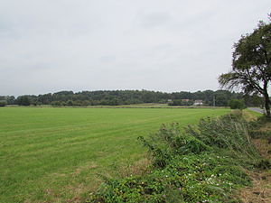
Vineyard from the east |
||
| height | 62.8 m | |
| location | Klein Kreutz , Brandenburg an der Havel , Brandenburg , Germany | |
| Coordinates | 52 ° 26 '28 " N , 12 ° 38' 11" E | |
|
|
||
| Type | Terminal moraine | |
The vineyard is a 62.8 meter high, Ice Age shaped elevation , also called Hohe Warte , near the village of Klein Kreutz , a district in the east of the city of Brandenburg an der Havel in Brandenburg .
morphology
The vineyard originated during the last, the Vistula cold period . Ice masses advancing from northern to central Europe formed a range of terminal moraine hills between the Havel near Klein Kreutz and the Beetzsee near Mötzow . The vineyard is to be counted as its highest elevation in this ridge. The Wasenberg is also part of this. The ridge was formed on ice edge layer 2 of the Brandenburg phase . On closer inspection, the ridge continues over the valleys of the Beetzsee to the west and the Havel to the southeast. For example, the Black Mountain was formed west of the Beetzsee . Peripheral location 2 is traceable with the line Schwarzer Berg - Hasselberg - Wasenberg - Weinberg - Götzer Berg .
Usage history
In 1324, Margrave Ludwig I gave the village of Klein Kreutz to the new town of Brandenburg, including the Hohe Warte, which was named "Hogenwarde" in the deed of donation. As a result, the Hohe Warte between two important traffic routes, the Heerstraße from Brandenburg to Spandau and the Havel , was expanded as part of the Neustadt Landwehr .
From the early 16th century, viticulture was practiced on the Hohe Warte for more than three centuries . So, initially from 1515 onwards, only a few vineyards were planted. In 1525 the Klein Kreutzer Weinberge settlement was established and the Neustadt council allowed 42 citizens of the city to use the slopes intensively for growing wine. However, since the areas at the Hohe Warte were limited, the wine-growing was later extended to further hills to the north, so that there were at times up to 25 vineyards around Klein Kreutz. In 1802 there were supposed to have been 46 vineyards. Most of the facilities were privately owned by wealthy citizens of Neustadt and were managed by local wine masters. During the plague outbreaks in the 16th century, which also struck the cities of old town Brandenburg and Neustadt Brandenburg, the vineyards and the lands were the owners' retreats . In the 19th century, wine growing finally continued to decline. In 1868, vines were still grown on around 9 hectares. In the following years, however, cultivation was also discontinued on these areas. They were sold to farmers' hands and production was mainly switched to fruit. As a result, cherries and walnuts in particular were the main crops, but also cereals. The old wine masters' houses were dismantled. On the north-west slope, a mining area that is now disused was created, on which gravel and sand were extracted in an open-cast mine . The agricultural areas on the mountain lie fallow in the 21st century.
Protected areas
The vineyard is located in the Brandenburg Osthavelniederung landscape protection area and the Mittlere Havelniederung SPA area . The nature reserve Mittlere Havel and the FFH area Mittlere Havel supplement extend below the southern slope of the Havel .
Individual evidence
- ↑ Sebastian children and Haik Thomas Porada (ed.): Brandenburg an der Havel and surroundings. 2006, p. 225.
- ↑ Sebastian children and Haik Thomas Porada (ed.): Brandenburg an der Havel and surroundings. 2006, p. 298, fig. 72.
- ↑ Sebastian children and Haik Thomas Porada (ed.): Brandenburg an der Havel and surroundings. 2006, pp. 226 and 227.
- ^ Brandenburg an der Havel; Bird sanctuaries (SPA) . Accessed June 5, 2014.
- ^ Brandenburg an der Havel; Nature reserves on the territory of the city . Accessed June 5, 2014.
- ^ Brandenburg an der Havel; Flora Fauna Habitat (FFH) areas . Accessed June 5, 2014.


