
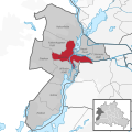
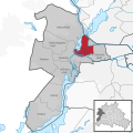
Spandau district
 5th district of Berlin |
|||||||||||||||||||
|---|---|---|---|---|---|---|---|---|---|---|---|---|---|---|---|---|---|---|---|
 .svg) |
|||||||||||||||||||
| Coordinates | 52 ° 32 '0 " N , 13 ° 10' 0" E | ||||||||||||||||||
| surface | 91.878 km² | ||||||||||||||||||
| Residents | 245,197 (Dec. 31, 2019) | ||||||||||||||||||
| Population density | 2669 inhabitants / km² | ||||||||||||||||||
| Proportion of foreigners | 18.0% (Dec. 31, 2016) | ||||||||||||||||||
| Unemployment rate | 8.3% (Nov. 30, 2019) | ||||||||||||||||||
| Post Code | 13581, 13583, 13585, 13587, 13589, 13591, 13593, 13595, 13597, 13599, 13629, 14052, 14089 | ||||||||||||||||||
Administration address |
Spandau Town Hall Carl-Schurz-Strasse 2/6 13597 Berlin |
||||||||||||||||||
| Website | www.spandau.de | ||||||||||||||||||
| Average age | 43.7 years (Dec. 31, 2016) | ||||||||||||||||||
| structure | |||||||||||||||||||
| District key | 05 | ||||||||||||||||||
| Structure of the district | |||||||||||||||||||
| politics | |||||||||||||||||||
| District Mayor | Helmut Kleebank ( SPD ) | ||||||||||||||||||
| Deputy District Mayor | Gerhard Hanke ( CDU ) | ||||||||||||||||||
| Allocation of seats ( district assembly ) | |||||||||||||||||||
|
|||||||||||||||||||
.svg)
Spandau is the fifth administrative district of Berlin and had 245,197 inhabitants as of December 31, 2019. Large parts of the district lie along the Havel . Spandau is known for its forest and water areas.
Today's Berlin district was formed in 1920 in the course of the formation of Greater Berlin from the area of the city of Spandau, which was already mentioned in a document in 1232, and several surrounding communities and manor districts.
In Spandau there are some Berlin industrial production sites, such as B. the BMW plant in Berlin , which produces motorcycles for the world market. The electronics group Siemens is one of the largest employers here.
The Spandau Citadel , which was built in the 16th century, is one of the main buildings in the district . The former fortress is now mainly used for concerts and entertainment events.
geography
location
Today's Spandau district is largely located on the western bank of the Havel (see also Zehdenick-Spandauer Havelniederung ). In terms of area, it is the fourth largest of the current twelve Berlin districts. The city of Spandau was founded before the 13th century at the confluence of the Spree and Havel rivers. Spandau borders the Brandenburg districts of Oberhavel and Havelland and the regional capital Potsdam .
Landscapes
- Spandau Forest
- Landscape protection area Grimnitzsee with the listed Birkenwäldchen settlement
- Landscape protection area Tiefwerder Wiesen
- Stößensee and Pichelswerder
- Bullengraben green corridor
- The Eiskeller landscape protection area is located in the Hakenfelde district on the westernmost edge of the Spandau Forest. Eiskeller is considered the coldest place in Berlin in winter. On clear, windless nights, the temperatures are often up to ten degrees Celsius below those in the center of the city .
Districts

.jpg)


The Spandau district is divided into nine districts:
| District and locations |
Area (km²) |
Residents December 30, 2019 |
Inhabitants per square kilometer |
location |
|---|---|---|---|---|
0501 Spandau
|
8.03 | 39,560 | 4,927 |
  |
0502 Haselhorst
|
4.73 | 15,663 | 3,311 |
  |
0503 Siemensstadt
|
5.66 | 12,831 | 2,267 |
  |
0504 Staaken
|
10.90 | 46,607 | 4,276 |
  |
0505 Gatow
|
10.10 | 3,733 | 370 |
  |
0506 Kladow
|
14.80 | 16,212 | 1,095 |
  |
0507 Hakenfelde
|
20.40 | 31,296 | 1,534 |
  |
| 0508 Falkenhagener Feld | 6.88 | 38,759 | 5,634 |
  |
0509 Wilhelmstadt
|
10.40 | 40,536 | 3,898 |
  |
Planning rooms
The small-scale structure for Berlin is the lifeworld-oriented rooms (LOR) with delimitation according to professional criteria. These are used for socio-spatial planning purposes and have replaced the spatial reference system of the “statistical areas / traffic cells”. Data on the population structures in these planning areas are available online in the Kiezatlas der Sozialraumdaten.
| Planning rooms | Key number | District region | Foreign nationals | Germans (with MHG ) | Germans (without MHG) | Total number | Share (without MHG) | Share (with MHG) |
|---|---|---|---|---|---|---|---|---|
| Hakenfelde North | 05010101 | Hook field | 1904 | 1360 | 7619 | 10883 | 70% | 30% |
| Goltzstrasse | 05010102 | Hook field | 714 | 533 | 4638 | 5885 | 79% | 21% |
| Amorbacher way | 05010103 | Hook field | 559 | 667 | 6397 | 7623 | 84% | 16% |
| Griesingerstrasse | 05010204 | Falkenhagener Feld | 593 | 664 | 2040 | 3297 | 62% | 38% |
| At the potion | 05010205 | Falkenhagener Feld | 183 | 335 | 1392 | 1910 | 73% | 27% |
| Gütersloh way | 05010206 | Falkenhagener Feld | 1626 | 1892 | 6728 | 10246 | 66% | 34% |
| Darby Street | 05010207 | Falkenhagener Feld | 2384 | 3232 | 5876 | 11492 | 51% | 49% |
| Germersheimer Platz | 05010208 | Falkenhagener Feld | 1362 | 1005 | 5260 | 7627 | 69% | 31% |
| On the cap | 05010209 | Falkenhagener Feld | 753 | 984 | 4361 | 6098 | 72% | 28% |
| Corner hill | 05010310 | Spandau center | 738 | 530 | 2612 | 3880 | 67% | 33% |
| Eiswerder | 05010311 | Spandau center | 1544 | 1361 | 2765 | 5670 | 49% | 51% |
| Kurstrasse | 05010312 | Spandau center | 2485 | 1146 | 3486 | 7117 | 49% | 51% |
| Ackerstrasse | 05010313 | Spandau center | 1519 | 1031 | 4154 | 6704 | 62% | 38% |
| Carl-Schurz-Strasse | 05010314 | Spandau center | 2338 | 1958 | 7672 | 11968 | 64% | 36% |
| freedom | 05010339 | Spandau center | 579 | 62 | 333 | 974 | 34% | 66% |
| Isenburg way | 05020415 | Brunsbütteler Dam | 187 | 521 | 3177 | 3885 | 82% | 18% |
| On the Heideberg | 05020416 | Brunsbütteler Dam | 28 | 67 | 1614 | 1709 | 94% | 6% |
| Staakener Strasse | 05020417 | Brunsbütteler Dam | 763 | 837 | 4247 | 5847 | 73% | 27% |
| Spandauer Strasse | 05020418 | Brunsbütteler Dam | 343 | 395 | 3272 | 4010 | 82% | 18% |
| Magistratsweg | 05020419 | Brunsbütteler Dam | 814 | 859 | 5359 | 7032 | 76% | 24% |
| Werkstrasse | 05020420 | Brunsbütteler Dam | 58 | 96 | 775 | 929 | 83% | 17% |
| Döberitzer Weg | 05020521 | Heerstrasse North | 281 | 534 | 2280 | 3095 | 74% | 26% |
| Pillnitzer way | 05020522 | Heerstrasse North | 1957 | 1209 | 4198 | 7364 | 57% | 43% |
| Mulberry Avenue | 05020523 | Heerstrasse North | 3206 | 3494 | 5713 | 12413 | 46% | 54% |
| Weinmeisterhornweg | 05020524 | Heerstrasse North | 425 | 572 | 5137 | 6134 | 84% | 16% |
| Borkumer Strasse | 05020625 | Wilhelmstadt | 1310 | 1072 | 5100 | 7482 | 68% | 32% |
| Adamstrasse | 05020626 | Wilhelmstadt | 4636 | 2325 | 12398 | 19359 | 64% | 36% |
| Tiefwerder | 05020627 | Wilhelmstadt | 812 | 702 | 2545 | 4059 | 63% | 37% |
| Graetschelsteig | 05020628 | Wilhelmstadt | 194 | 231 | 1559 | 1984 | 79% | 21% |
| Börnicker Strasse | 05020629 | Wilhelmstadt | 305 | 306 | 3802 | 4413 | 86% | 14% |
| Citadel Path | 05030730 | Haselhorst | 663 | 1420 | 1855 | 3938 | 47% | 53% |
| Gartenfelder Strasse | 05030731 | Haselhorst | 2173 | 2520 | 6929 | 11622 | 60% | 40% |
| Dam | 05030832 | Siemensstadt | 2731 | 2195 | 6766 | 11692 | 58% | 42% |
| Motardstrasse | 05030833 | Siemensstadt | 1138 | 111 | 296 | 1545 | 19% | 81% |
| Old Gatow | 05040934 | Gatow / Kladow | 909 | 318 | 2738 | 3965 | 69% | 31% |
| Groß-Glienicker Weg | 05040935 | Gatow / Kladow | 73 | 24 | 318 | 415 | 77% | 23% |
| Jägerallee | 05040936 | Gatow / Kladow | 541 | 1041 | 8273 | 9855 | 84% | 16% |
| Kladower Dam | 05040937 | Gatow / Kladow | 118 | 176 | 1857 | 2151 | 86% | 14% |
| Kafkastrasse | 05040938 | Gatow / Kladow | 198 | 282 | 3190 | 3670 | 87% | 13% |
history

The Spandau district emerged from the settlement of Spandau . The settlement of the area can be traced back to the 6th century, when the Havelland was settled by the Sprewanen and Hevellern ( Slavic tribes ). Albrecht the Bear to have a castle built from which the eponymous castle Spandow arose, which was documented in 1197 for the first time. To this castle, the city Spandow, which became the center of the area and probably already around 1200 developed city charter possessed.
1232 were the city rights by the Margrave Johann I and Otto III. documented expanded. Due to the formal certification in which Spandau is mentioned as a city for the first time, it has since been regarded as a city. In 1539, Elector Joachim II converted to the Protestant faith in the St. Nikolai Church in Spandau , which made the Mark Brandenburg also Protestant. From 1239 to the 16th century there was an important Benedictine monastery in Spandau , which held the church patronage over the St. Nikolai Church and ten other churches in the area. It went under as a result of the Reformation .
1600-1945

The state of the city and the surrounding area around 1728 is documented in a cadastre for the fortified city of Spandau, which is the first time that a complete real estate cadastre was created with the two large-scale maps Spandau Intra moenia (1: 1000) and Spandau extra moenia, as well as corresponding lists of owners. This is still in the Spandau city archive today. The work was prepared by the surveyor Gustav Haestskau .
From the 1830s to 1874, the Spandau procession took place annually for the Corpus Christi festival in Spandau , in which Catholics from Berlin and Charlottenburg took part. Since its completion in 1848, the center of the celebrations has been the church of St. Marien am Behnitz . The procession was no longer approved as part of the Prussian Kulturkampf from 1875.

In 1887 the city left the Osthavelland district and became an urban district . The spelling of the city name was changed from Spandow to Spandau in the following year, 1878 .
With the construction of the Berlin-Hamburg railway , Spandau received a railway connection at the location of today 's Stresow S-Bahn station in 1846, followed by the Berlin-Lehrter railway in 1871 . The steadily increasing commuter traffic with the industrialization of Spandau led to the construction of the Spandau suburban railway between 1909 and 1911 , which was electrified as the S-Bahn in 1928 .

During the First World War , the arms industry in particular grew, so that by the end of the war Spandau had become an important armaments center of the German Empire . The MG 08/15 machine gun manufactured here became synonymous with the phrase of the same name . From 1897, the electrical company Siemens & Halske relocated production and administration to the east of Spandau on the Nonnenwiesen. A novelty was the construction of a housing estate by Siemens when this industrial area was built. This also included their infrastructure: the Fürstenbrunn train station, the tram on Nonnendammallee and, in 1929, the Siemensbahn, used by the S-Bahn, to the newly created Siemensstadt district .
As part of the formation of Greater Berlin on October 1, 1920, the Spandau district - then the eighth district of Berlin - was formed from the following territorial units: Spandau district, Staaken community, Tiefwerder community, Pichelsdorf community, Gatow community, Kladow community , Spandau estate district - Citadel , Pichelswerder estate and Heerstraße estate (northern part).
1945–1990
After the Second World War , the Spandau district in the " four-sector city " of Berlin belonged to the British sector and lost West Staaken to the Soviet zone of occupation . Until 1987, the Spandau war crimes prison was located on Wilhelmstrasse , where the Allies only guarded Rudolf Hess , who was sentenced to life imprisonment . After his death, the prison was demolished.
All S-Bahn traffic in the district came to a standstill in 1980 on the three routes from Jungfernheide to Gartenfeld ( Siemensbahn ) as well as via Fürstenbrunn to Spandau and from Friedrichstrasse via Westkreuz - Spandau to Staaken. In the same year, the West Berlin district received its first connection to the Berlin underground network with the extension of the then underground line 7 (today: U7) to Rohrdamm underground station . In 1984 the U7 was completed to the terminus at Rathaus Spandau .
The cultural center of the district is the old town of Spandau , although little of the original structure has been preserved due to the events of the Second World War . Nevertheless, with the renovation in the 1970s and the removal of the single-storey makeshift buildings for shops that were built in vacant lots after 1945, a reconstructed new old town was achieved. At the same time, it was largely freed from through traffic and converted into a pedestrian zone and has since provided space for weekly markets and the annual Spandau Christmas market that takes place during Advent .
After the fall of the Berlin Wall in 1989, Spandau got back West Staaken, which had been separated at the time. The Air Force Museum was established in 1995 on the former Gatow airfield , which was used by the Royal Air Force during the division . Since 1998 the S-Bahn has been running again on the tracks of the Spandau suburban railway to the then newly built Berlin-Spandau station with a connection to regional and long-distance traffic.
Since 1990
The urban development measure “ Wasserstadt Berlin-Oberhavel ” was largely completed in 2008. The area extends on both sides of the Eiswerder island and to the north of it on former fallow land on the Havel. The urban redevelopment carried out here is ecologically oriented. The development measure demanded high investments from the State of Berlin, which could not be refinanced from increases in the value of the developed properties. Some of the new residential areas were also only accepted very hesitantly by the property market, so that in 2009 large areas (in the approach path of Tegel Airport ) were still fallow.
population

As of December 31, 2019, the Spandau district had 245,197 inhabitants. Spandau has the lowest population of all Berlin districts , followed by the Treptow-Köpenick district . Due to the relatively high proportion of water and forest areas in the total area of almost 92 square kilometers, the average population density on the reference date was 2,669 inhabitants per square kilometer.
The unemployment rate was 8.3% in November 2019. As of December 31, 2016, the median age of the population was 43.7 years.
The population forecast for 2016 assumes that the population in Spandau will grow to 248,000 by 2030.
| year | Residents |
|---|---|
| 1925 | 111,629 |
| 1933 | 146.472 |
| 1939 | 170.384 |
| 1946 | 159,599 |
| 1950 | 166.161 |
| 1961 | 172,663 |
| 1970 | 197,687 |
| 1987 | 201.915 |
| 2000 | 223,898 |
| 2009 | 223.724 |
| 2016 | 238.278 |
Population groups
On December 31, 2017 , the proportion of foreigners in the district was 19.0% and the proportion of the population with a migration background was 35.2%.
| Share of the population with a migration background (2017) | |
|---|---|
| Germans without a migration background | 74.8% (156,952) |
| Germans with a migration background | 16.2% (39,285) |
| Foreigners | 19.0% (45,906) |
| Migration background from Islamic countries (including Turkey , Syria , Iran ) | 13.9% (33,545) |
| Migration background from EU countries (including Poland, Bulgaria, Romania) | 10.8% (26,161) |
| Migration background from the former Soviet Union (Russia, Ukraine, Kazakhstan) | 4.9% (11,883) |
| Migration background from former Yugoslavia (Serbia, Croatia, Bosnia) | 3.0% (7,268) |
economy


With its supply and disposal facilities such as the Reuter power plant , the biogas plant and the Ruhleben sewage treatment plant, as well as numerous production facilities ( Siemens , Osram , BMW motorcycles ) , the Spandau district is an important industrial location for Berlin.
More than 30 companies are based in the Thelen Technopark, u. a. Boschen & Oetting Automatisierungs-Bau GmbH and BSH Laundry Care Technology Center .
The district also has large areas of forest and water that are used as a popular excursion area for tourists.
In 2007 the manufacturing sector (companies with more than 20 employees) in the district had 64 companies with 16,691 employees. In 2012, 12,461 traders from Spandau belonged to the IHK Berlin .
The Johannesstift Diakonie is a health and social company based Spandau. It is the largest denominational clinic operator in Berlin and employs more than 8,800 people at various locations in northeast Germany.
Rent
In the Berlin district of Spandau, the asking rents for apartments to be rented out averaged 8.59 euros in 2018 (Berlin average: 10.32 euros). In a district comparison, rents in Spandau were among the lowest.
Infrastructure
The city of Spandau owned its first horse-drawn tram line from June 1892 ( Hauptbahnhof to Fehrbelliner Tor). In 1894 the depot was created and the second line (Hauptbahnhof to Pichelsdorf ) and the third line (Hauptbahnhof to Schützenhaus) were added in 1896. In 1896 all lines were electrified, and in 1909 the Spandau tram came into the hands of the city. In the 1930s there was trolleybus traffic in Spandau. In 1967 the last West Berlin tram (line 55) ran from Hakenfelde to the Zoo station . A railway line from the Spandau West train station via Johannesstift to Bötzow ( Bötzowbahn ) has been out of service since the end of the Second World War or only partially serves as a freight line.
Private transport
The two federal highways B 2 and B 5 run through Spandau .
Spandau is connected to numerous national, international and regional cycle routes: including the European EuroVelo route EV 7 (runs from Norway to Malta ), the Berlin – Copenhagen cycle path (including via Oranienburg , Zehdenick , Fürstenberg , Rostock ) and the Havel cycle path (including via Potsdam and Brandenburg an der Havel ).
Public transport

In Spandau there are connections with the following public transport :
- Regional rail transport on lines RE2, RE4, RE6, RB10, RB13 and RB14
- Metro - U7
- S-Bahn lines S3 and S9
- City and regional bus routes 130, 131, 133, 134, 234, 334, 135, 136, 236, 137, 237, 337, 139, 638, 639, 671 and 697
- MetroBus lines M32, M37, M45 and M49
- Express bus lines X33, X34, X36 and X49
- Night bus routes N7, N30, N33, N34, N35 and N39
Long-distance rail passenger transport
The following long-distance passenger rail lines have a stop at Berlin-Spandau train station :
Shipping

The federal waterways Untere Havel-Wasserstraße , Havel-Oder-Wasserstraße and Spree-Oder-Wasserstraße run through Spandau . The Spandauer Südhafen on the Havel is the second largest freight port in Berlin.
The following ferries operate in the Spandau district:
- F10 passenger ferry between Kladow and Wannsee
- private car ferry between Hakenfelde and Konradshöhe
- private passenger ferry between Hakenfelde and Konradshöhe mt round trip to the islands of Valentinswerder and Maienwerder (both in the Reinickendorf district ). In the summer of 2011, the former operator stopped operating the ferry. A private ferry is operated by residents of the island of Valentienswerder as required.
The Spandau lock bridges the different water level heights of the Lower Havel Waterway and the Upper Havel Waterway. It is located between the old town and the Spandau Citadel.
power supply
The largest solar park in the Berlin-Brandenburg metropolitan region is located on the former Staaken airfield . The plant went into operation in 2011 and has a maximum output of 21 megawatts.
politics
District Mayor


- 1919–1921 Kurt Woelck ( DDP ), last Lord Mayor of the city of Spandau
- 1921–1933 Martin Stritte
- 1933–1944 Max Harrer ( NSDAP )
- 1944–1945 Ernst Neumann (NSDAP)
- 1945 Fritz Warsow
- 1945–1946 Richard Münch
- 1946 Bruno Lehmann ( LDP )
- 1946–1949 Gottlob Münsinger ( SPD )
- 1949–1954 Karl Schilling (SPD)
- 1954–1958 Georg Ramin (SPD)
- 1958–1965 Ernst Liesegang (SPD)
- 1965–1967 Klaus Bodin (SPD)
- 1967–1979 Herbert Kleusberg (SPD)
- 1979–1992 Werner Salomon (SPD)
- 1992–1995 Sigurd Hauff (SPD)
- 1995–2011 Konrad Birkholz ( CDU )
- since 2011 Helmut Kleebank (SPD)
The district of Spandau is represented by the district mayor at state level in the council of mayors and in the resource management group .
District Assembly
The election for the District Assembly (BVV) Spandau took place on September 18, 2016.
coat of arms
In its current form, the coat of arms was awarded on February 4, 1957 by the Berlin Senate .
Blazon : In a silver shield above blue waves an outwardly rising red city wall; in front of the open, wide central gate, which is closed at the top with a crenellated wreath, there is a silver triangular shield with the Brandenburg golden-armored red eagle , the wings of which are covered with golden clover angels . The gate is flanked by two golden-buttoned red, pointed-roofed, windowed towers emerging from behind the wall, between which a natural-colored pot helmet - the Brandenburg heraldic helmet - sits on the crenellated wreath of the gate . As a crest he wears a black flight covered with golden linden leaves. A red three-tower wall crown rests on the shield , the central tower of which is covered with a small Berlin coat of arms .
Description of coat of arms: The coat of arms of the district of Spandau is derived from the coat of arms of the city of Spandau , whose heraldic elements are documented as early as the 13th century - the helmet and the walls refer to the fortress city, the blue wavy band to the river Havel, and the red march Eagle on the founding lords. The crown of the wall was added to the coat of arms on January 1, 2001 as part of the district reform as a connecting element of all Berlin districts .
Town twinning
![]() Siegen and the Siegen-Wittgenstein district in North Rhine-Westphalia since 1952 Luton in the United Kingdom since 1959 Asnières-sur-Seine in France since 1959 Aschdod in Israel , since 1968 İznik in Turkey since 1987 Nauen in Brandenburg since 1988
Siegen and the Siegen-Wittgenstein district in North Rhine-Westphalia since 1952 Luton in the United Kingdom since 1959 Asnières-sur-Seine in France since 1959 Aschdod in Israel , since 1968 İznik in Turkey since 1987 Nauen in Brandenburg since 1988
![]()
![]()
![]()
![]()
![]()
police
Directorate 2 of the Berlin police is responsible for the Spandau and Charlottenburg-Wilmersdorf districts.
education

- Hans Carossa High School
- Freiherr-vom-Stein-Gymnasium
- Kant high school
- Lily-Braun-Gymnasium
- Wilhelmstadt schools
- Carl-Friedrich-von-Siemens-Gymnasium
- Swiss International School
- The world's only "wet" depth noise simulation facility is located on the Scharfen Lanke on the southeastern edge of Wilhelmstadt. The DLRG Berlin can with its diving tower system of Research and Education site (BLFS) depths up to 150 meters of water to simulate. Operational, professional and sport divers can experience the dangers of deep intoxication here under - in comparison to open water - safe conditions . Diving accidents can also be treated here.
Buildings
buildings

- Spandau Citadel
- Old town Spandau and Kolk
- Staaken garden city
- New Jerusalem settlement
- Monuments in Spandau
- Open-air stage at the citadel
- As a complete ensemble of colonists settlement, the listed village of Tiefwerder , to which the former Spandau fishermen were resettled in 1816.
- Fort Hahneberg
- Bruno H. Bürgel Observatory
Sacred building
Churches and chapels

The Protestant churches of Spandau belong to the Spandau parish in the Evangelical Church of Berlin-Brandenburg-Silesian Upper Lusatia , the Roman Catholic parishes to the Spandau deanery in the Archdiocese of Berlin .
- Christophoruskirche , also called "Siemensstadt Church" - Siemensstadt, Schuckertdamm, 1929–1931, monument (Protestant)
- Village church Gatow - Gatow, Alt-Gatow, 1301–1315, monument (Protestant)
- Village church Kladow - Kladow, Alt-Kladow, first building 14th or 15th century, new building 1818–1819, monument (Protestant)
- Staaken village church - Staaken, Nennhauser Damm / Hauptstrasse, around 1310, monument (Protestant)
- Community Center St. Lambertus - Hakenfelde, Cautiusstraße, 1975 (Catholic)
- Gnadenkirche - Wilhelmstadt, Jaczostraße, 1946–1957 (Protestant)
- Church in Johannesstift - Hakenfelde, Schönwalder Allee, 1907–1910, monument (Protestant)
- Church of St. Marien am Behnitz - Spandau, Behnitz, 1845–1848, architectural monument (Catholic)
- Church in the community center Heerstraße Nord (Berlin-Staaken) - Staaken, Obstallee 22e, 1976–1978 (Protestant)
- Luther Church - Spandau, Lutherplatz, 1895–1896, architectural monument (Protestant)
- Melanchthon Church - Wilhelmstadt, Melanchthonplatz / Wilhelmstrasse, 1893, architectural monument (Protestant)
- Community center Radeland - Hakenfelde, Schwanter Weg, community center from 1992 (Protestant)
- St.-Franziskus-von-Assisi-Kirche - Staaken, Hackbuschstraße, 1955 as "St.-Johannes.-B.-M.-Vianney Chapel", since 1970 with a new name (Catholic)
- St. Joseph Church - Siemensstadt, Quellweg / Goebelstraße / Natalissteig, 1934–1935, architectural monument (Catholic)
- St. Mark's Church - Falkenhagener Feld, Am Kiesteich, 1976–1977 (Catholic)
- St. Nikolai Church - Spandau, Reformationsplatz, first building around 1240, new building before 1369, architectural monument (originally a Catholic parish church, Protestant since 1539)

- St. Maximilian Kolbe Church - Staaken, Maulbeerallee, 1975–1976 (Catholic)
- Thatch roof chapel for the Good Shepherd - Kladow, Gottfried-Arnold-Weg, 1951–1953, monument (Protestant)
- Christmas Church - Haselhorst, Haselhorster Damm, 1934–1935 and 1960–1964, monument (Protestant)
- Wichernkirche - Hakenfelde, Wichernstraße, as an interim chapel, initially from 1897 in Charlottenburg and from 1908 in Siemensstadt, new building in 1932 (Protestant)
- Refuge Church - Falkenhagener Feld, Westerwaldstrasse, 1965–1967 (Protestant)
- Confidence Church - Staaken, Brunsbütteler Damm, 1962–1966 (Protestant)
Mosques
The mosques in the Spandau district are Sunni . They belong to different umbrella organizations:
- Spandau Yeni Camii - Lynarstrasse 17, Islamic Federation Berlin
- Büyük Camii - Seeburger Straße 90, Association of Islamic Cultural Centers
- Kocatepe Camii - Grammestrasse 17, Turkish-Islamic Union of the Institute for Religion
- Hoca Ahmet Yesevi Camii - Neuendorfer Strasse 101, Federation of Turkish Democratic Idealist Associations in Germany
- Teiba Mosque - Brunsbütteler Damm 108, Islamic Federation Berlin
Buddhist temples
- Pagoda Linh Thuu - Heidereuterstraße 30, Buddhist Vietnamese Congregation in Berlin V.
- Wat Pah Bodhi-Dhamm - Breitehornweg 1a, Wat Pah Bodhi-Dhamm Buddhist Association e. V.
Culture
In Spandau there is the Spandauer Künstler Berlin e. V. the Kulturhaus Spandau, the Theater Zitadelle, the Freilichtbühne Zitadelle, the Kunstlandschaft Spandau, the Bastion Jugendkunstschule Berlin-Spandau as well as other private and public initiatives and institutions.
Sports

The water Spandau 04 are one of the most successful sports clubs. To date, the track record shows around 100 German championships, ten European championships and one world championship as well as titles in swimming, jumping and water polo. Hagen Stamm , long-time captain of the water polo team, was German champion fourteen times in a row from 1979 to 1992, German cup winner twelve times and won the European championship cup in 1982, 1985, 1986 and 1989. He is currently the president of the association (as of 2020). The home games of the water polo players do not take place in the district, but in the Schöneberg sports center .
The LSV Spandau won the title of the first German basketball champion in 1939 , which was achieved with a clear 47:16 victory over Bad Kreuznach . After 1945 the association was dissolved.
The SG ASC / VfV Spandau played in the 2nd handball Bundesliga .
The Blue Ribbon of the Spree is one of the largest German dance sport events and takes place every year over Easter in the Siemensstadt Sports Center.
The SC Siemensstadt and Spandau TSV 1860 each have more than 5,000 registered members (as of 2014) and are among the large membership, sports clubs in the city.
Museums and exhibitions

- Art in public space in Berlin's Spandau district
- Air Force Museum of the German Armed Forces ( Gatow Airfield )
- Gothic house, city history museum
Events

- Spandau Citadel as an established venue for concerts and other entertainment programs (e.g. the medieval castle festival)
- Spandau Christmas Market
Cinemas
- Cineplex-Spandau in the Havelstrasse
- Cinema in the Kulturhaus Spandau
- Open-air cinema (only in the summer months)
Spandau in the arts
The British music group Spandau Ballet chose their name after a trip to Berlin, during which they a. a. visited the Gatow airfield , which was located near the then still existing Berlin Wall . In the opinion of the band members, the name should not embody any direct political concerns, but allude to the romantic and gloomy of the borderline situation.
Sons and daughters of the district
.jpg)
- (sorted chronologically)
- Ernst Heinrich (1899–1984), architect, building researcher and university professor
- Ernst Benda (1925–2009), politician and President of the Federal Constitutional Court
- Ivan Rebroff (1931–2008), real name Hans-Rolf Rippert , singer
- Grit Boettcher (born 1938), actress
- Matthias Roeingh (* 1960), artist name Dr. Motte , co-founder of the Love Parade
- Bela B (* 1962), real name Dirk Felsenheimer , member of the rock group Die Ärzte
- Carsten Rentzing (* 1967), regional bishop of the Evangelical Lutheran regional church of Saxony
- Sascha Grammel (* 1974), comedian, puppeteer and ventriloquist
- Nadine Wrietz (* 1975), actress
- Oli.P (* 1978), real name Oliver Petszokat , actor and singer
- Adel Tawil (* 1978), singer
- Jessica Ginkel (* 1980), actress
- Ronald Rauhe (* 1981), canoeist and multiple Olympic champion
- Vincent Stein (* 1983), singer and music producer
- Sıla Şahin (* 1985), German-Turkish actress
- Patrick Baehr (* 1992), actor and voice actor
literature
- Rainer Fliegner: Spandau - history and stories. Sutton Verlag, Erfurt 2007, ISBN 978-3-86680-122-6 .
- Wolfgang Ribbe (ed.): Slavic castle - state fortress - industrial center. Studies on the history of the city and district of Spandau. Colloquium, Berlin 1983, ISBN 3-7678-0593-6 .
- Wolfgang Ribbe: Spandau. Colloquium Verlag, Berlin 1991, ISBN 3-7678-0716-5 .
- Hans-Rainer Sandvoss: Resistance in Spandau. Issue 3 of the series of publications on the resistance in Berlin from 1933 to 1945, German Resistance Memorial Center, Berlin 1988, ISSN 0175-3592 .
- Ralf Schmiedecke: Spandau near Berlin. Sutton Verlag, Erfurt 2002, ISBN 978-3-89702-463-2 .
- Vermessungsamt Spandau (Ed.): 777 years of Spandau in the map of the centuries. DVD, 2009.
- Otto Kuntzemüller : Documented history of the city and fortress Spandau. Arani Verlag, Berlin 1978, ISBN 3-7605-8534-5 .
- The buildings and art monuments of Berlin city and district Spandau. Gebr. Mann Verlag, Berlin 1971, ISBN 3-7861-4076-6 .
Web links
- Official website of the Spandau district of Berlin
- Out and about in Spandau . Sights, news, event information and reports from Spandau
- The digital library: Digitized Spandauer Zeitung 1925, 1930, 1931
Individual evidence
- ↑ a b c Statistical report - residents in the state of Berlin on December 31, 2016 (PDF; 3.1 MB). Office for Statistics Berlin-Brandenburg . Retrieved June 26, 2017.
- ↑ a b November: Unemployment in Berlin at an all time low . In: Berliner Zeitung , accessed on January 11, 2020.
- ↑ Numbering according to the district key
- ↑ heat island, cold hole: A visit to icehouse . In: Der Tagesspiegel , March 4, 2003, accessed on November 9, 2016.
- ↑ Residents in the State of Berlin on December 31, 2019, data from the Berlin-Brandenburg Statistics Office , accessed on August 27, 2020 ( PDF file ) ( help on this ).
- ↑ [1] Significance of the LOR and address directories of the lifeworld oriented spaces.
- ↑ Access to the data of the individual neighborhoods is provided by adding the key numbers to the web address . The data from 2008 and 2009 are available as a PDF, the later as an HTML list.
- ↑ Updated population figures from December 31, 2019 by the Berlin-Brandenburg Statistics Office , accessed on June 10, 2020 ( [2] ) ( help on this ).
- ↑ Senate Department for Urban Development and the Environment: Population forecast for Berlin and the districts 2015–2030 . (PDF) Retrieved July 26, 2016.
- ^ Statistical yearbooks of Berlin
- ↑ a b Residents in the State of Berlin on December 31, 2017 (PDF; 2.3 MB). Statistics Berlin-Brandenburg. Retrieved March 5, 2020.
- ↑ Facts and figures on the economy in Spandau . Ed. by IHK Berlin , accessed on June 29, 2017.
- ↑ Housing Market Report 2018 , (PDF page 93), IBB, accessed on January 26, 2020.
- ↑ 2Wohnmarktreport Berlin 2019 , Berliner Zeitung, accessed on January 26, 2020.
- ↑ translator2: EuroVelo 7 - EuroVelo. Retrieved May 3, 2017 .
- ↑ Berlin-Oranienburg | Berlin - Copenhagen. Retrieved May 3, 2017 .
- ↑ The Havel cycle path from Ankershagen to Gnevsdorf. Retrieved May 3, 2017 .
- ↑ SOLAR PARK ON FORMER AIRFIELD STAAKEN , Berlin saves energy, accessed on January 17, 2020.
- ^ Council of Mayors - accessed on May 18, 2019
- ↑ Small request from the FDP - accessed on May 18, 2019
- ↑ a b The State Returning Officer for Berlin , accessed on September 20, 2016
- ^ National emblem of Berlin - district coat of arms , accessed on January 21, 2020.
- ^ Website of the association , accessed on January 17, 2020.
- ↑ Website of the working group Spandauer Künstler Berlin e. V. , accessed on January 17, 2020.
- ^ Website of the Kulturhaus Spandau , accessed on January 17, 2020.
- ^ Website of the Citadel Theater , accessed on January 17, 2020.
- ^ Website of the Citadel Open Air Theater , accessed on January 17, 2020.
- ^ Website of the artist community Kunstlandschaft Spandau , accessed on January 17, 2020.
- ↑ Website of Bastion Jugendkunstschule Berlin-Spandau , accessed on January 17, 2020.
- ↑ Blaues Band der Spree , accessed on January 17, 2020.
- ↑ Berlin's sports clubs have more members than ever before. In: Berliner Morgenpost , accessed on June 23, 2017.
- ^ Castle festival at the citadel - Spandau knight games. In: Der Tagesspiegel , September 8, 2016, accessed June 5, 2017.

|
|
|
|
|
|
|
|
|
|
|
|
|
|
|
Falkenhagener Feld | Gatow | Hook field | Haselhorst | Kladow | Staaken | Siemensstadt | Spandau | Wilhelmstadt
Middle (1) | Tiergarten (2) | Wedding (3) | Prenzlauer Berg (4) | Friedrichshain (5) | Kreuzberg (6) | Charlottenburg (7) | Spandau (8) | Wilmersdorf (9) | Zehlendorf (10) | Schöneberg (11) | Steglitz (12) | Tempelhof (13) | Neukölln (14) | Treptow (15) | Köpenick (16) | Lichtenberg (17) | Weissensee (18) | Pankow (19) | Reinickendorf (20) | Marzahn (21) | Hohenschönhausen (22) | Hellersdorf (23)