Pankow district
|
Pankow 3rd district of Berlin |
|||||||||||||||||||||||
|---|---|---|---|---|---|---|---|---|---|---|---|---|---|---|---|---|---|---|---|---|---|---|---|
| Coordinates | 52 ° 34 '8 " N , 13 ° 24' 8" E | ||||||||||||||||||||||
| surface | 103.07 km² | ||||||||||||||||||||||
| Residents | 409,335 (Dec. 31, 2019) | ||||||||||||||||||||||
| Population density | 3971 inhabitants / km² | ||||||||||||||||||||||
| Proportion of foreigners | 12.0% (Dec. 31, 2016) | ||||||||||||||||||||||
| Unemployment rate | 6.1% (Nov. 30, 2019) | ||||||||||||||||||||||
| Post Code | 10119, 10247, 10249, 10369, 10405, 10407, 10409, 10435, 10437, 10439, 13051, 13086, 13088, 13089, 13125, 13127, 13129, 13156, 13158, 13159, 13187, 13189 | ||||||||||||||||||||||
Administration address |
Breite Strasse 24a-26 13187 Berlin |
||||||||||||||||||||||
| Website | www.berlin.de/ba-pankow | ||||||||||||||||||||||
| Average age | 40.7 years (Dec. 31, 2016) | ||||||||||||||||||||||
| structure | |||||||||||||||||||||||
| District key | 03 | ||||||||||||||||||||||
| Structure of the district |
13 districts |
||||||||||||||||||||||
| politics | |||||||||||||||||||||||
| District Mayor | Sören Benn ( Die Linke ) | ||||||||||||||||||||||
| Deputy District Mayor | Vollrad Kuhn ( Green ) | ||||||||||||||||||||||
| Allocation of seats ( district assembly ) | |||||||||||||||||||||||
|
|||||||||||||||||||||||
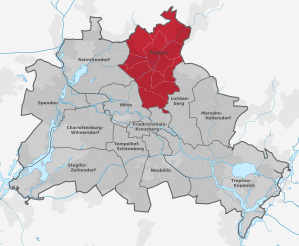
Pankow [ ˈpaŋkoː ] is the third administrative district of Berlin and had 409,335 inhabitants as of December 31, 2019.
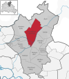
The districts of Pankow , Prenzlauer Berg and Weißensee , which were independent until 2001 , were combined with the administrative reform to form today's most populous Berlin district. In terms of area, it is the second largest district in the metropolis.
Pankow is the district with the highest number of births in Berlin and has a rather advantageous social structure . The district is characterized by many new Berliners who moved here after 1995.
A large number of self-employed people and founders live in Pankow. The largest private employers with headquarters in the district include a. Eckert & Ziegler and GetYourGuide .
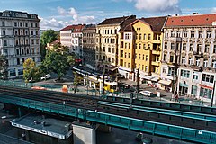
The district of Prenzlauer Berg in the south of Pankow has become famous for its German-European bohemian style .
geography
Location and description
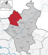
Pankow is located in the north-east of Berlin and borders the districts of Lichtenberg (in the east), Friedrichshain-Kreuzberg (in the south), Mitte (south-west) and Reinickendorf (west) and in the north on the districts of Oberhavel and Barnim in the state of Brandenburg .
The northernmost point of the district is in the district of Buch , which is also the northernmost district of Berlin.
The district is almost completely on the glacial formed plateau of the Barnim , which is planar here to wavy flat. For the most part, the landscape consists of ground moraine areas . A sander runs along the Panke from north to south to the Berlin glacial valley .
Waters
In the district of Weißensee there is the park at the Weißen See with the almost circular Weißensee , the largest natural body of water in the district.
The Karower ponds are a nature reserve in Pankow. It acts as a habitat for amphibians , dragonflies and water birds .
There are other bodies of water in the district which are sorted by districts on the waterway map and listed with a description of the location. Some of the flowing waters were created in the system of runoff from the sewage fields or streams were used for this purpose during this period.
The waters in the following lists sometimes belong to several districts. Thus there are 129 trenches and through-flowing basins and ponds as flowing waters in the district. The number of standing water bodies (named as lake or pond) is 17. The numbers in brackets are the new water body numbers that allow connections after the number, the old water body numbers can be found in the factual data at FIS-Broker.
- Blankenburg
- Ziegelteich (582944723) - Location: Ziegelstraße 60/62
- Blankenfelde
- Arkenberger See (5819692215) - Location: West of the railway from S-Bahn station. Schönfließ to S-Bhf. Berlin-Blankenburg, south of KGA "Arkenberger Grund"
- Köpchensee (5819625) to Tegeler Fließ - Location: northwest of Schildower Weg (Niedermoorwiesen)
- Schwarzwassersee (5819692442321) - Location: West of Hauptstrasse, east of Schildower Strasse
- Pond in the Botanical Volkspark (5819692485) - Location: In the Botanical Volkspark, school garden driving bridge area
- book
- Teich Heim Hospital (5829426211) - Location: On the site of the former Dr. Heim Hospital in Buch, southeast of Hobrechtsfelder Chaussee 154 B
- Lindenhof pond (582943225) - Location: northwest of Schönerlinder Strasse, on the railway line
- Torfstich II (582942622211) - Location: northwest of Hörstenweg / Mewesstraße
- French Buchholz
- Elfenteich (5829439443) - Location: Parkstrasse / Elfenallee
- Krugpfuhl (58196922411) - Location: In the KGA "Krugpfuhl", (north of Liebermann- / Rubensweg)
- Viktoriateich (582943962) to the rainwater pipe - Location: Parkstrasse 24, 26, 28
- Heinersdorf
- Hamburger Teich (5829443211721) - Location: South of Eigerstrasse 80–96
- Rohrpfuhl Heinersdorf (58294432117235) - Location: Tino-Schwierzina-Straße 26, in the KGA "Heinersdorf"
- Teich Str. Am Steinberg (58294432117233) - Location: Northwest Am Steinberg / Preunelstraße, in the KGA "Free Land"
- Karow
- Heimfriedteich (582943631) - Location: Heimfriedstrasse 31
- Rübländer Strasse pond (58294365) - Location: Böttnerstrasse 22
- Streckfußstrasse ponds (58294367) - Location: Streckfußstrasse 51 and 49 B.
- Niederschönhausen
- Pond Wackenbergstr. (582947211) - Location: Wackenbergstrasse 79
- Weissensee
- Goldfischteich (5829443211725) - Location: Amalienstraße 23
- Kreuzpfuhl (58294432117) - Location: Woelckpromenade, west No. 5–7
- Weißer See (58294432115) - Location: West of Berliner Allee / Seeweg, in the Weißenseer Park
- Wilhelmsruh
- Wilhelmsruher See (58294863) - Location: Heegermühler Weg 49, 53
- Blankenburg
- Laake (5829438) - Location: Berlin Karow city limits - Am Luchgraben / Bernau district to Panke, name in Brandenburg: Fließgraben
- Rübländergraben (5829436) - Location: Northern border Busonistraße 63 A to the confluence with the Panke
- Schmöckpfuhlgraben (582946) - Location: Malchower Straße 71 to Panke
- Alter Schmöckpfuhlgraben (58294688) - Location: In the KGA "Feuchter Winkel West to Heimdallgraben
- Heinersdorfer Strasse basin (5829465) - Location: East of Heinersdorfer Strasse / Kiebitzweg
- Binnengraben (5829449282) - Location: In the KGA "Blankenburg", between Purpurkardinalweg and Papstfinkweg to Wachtelgraben
- Eifelgraben (58294482) - Location: Eifelstrasse / Ilsenburgstrasse to Ilsenburggraben (near the Blankenburg sports field)
- Heinersdorfer Graben (5829464) - Location: KGA "Märchenland" west of Drosselbartweg to Schmöckpfuhlgraben, height of Langer Hals
- Ilsenburggraben (5829448) - Location: Gartenstrasse / Jungbornstrasse to Fließgraben
- Pond area nursing home (58294483) - Location: Bahnhofstrasse 31, in the course of Ilsenburggraben
- Upstallgraben Karow (58294384) - Location: Frundsbergstraße 24 A / Straße 84 and Beuthener Straße 16 to Laake Blankenburg
- Wachtelgraben (582944928) - Location: Purpurkardinalweg, Papstfinkweg to Wildentengraben
- Wildentengraben (58294492) - Location: Schmöckpfuhlgraben / Purpurkardinalweg to Fließgraben
- Zingergraben Nord (58196924) - Location: East of Buchholzer Straße 28 to Nordgraben
- Blankenfelde
- Blankenfelder Graben (58196922) - Location: Berlin city limits at the feeder A 114 towards Prenzlau to Nordgraben, from the Schönerlinde sewage treatment plant to the Berlin city limits water management system of the BWB (4316 m)
- Schildow-Waldeck drainage ditch (5819624) - Location: West of Schildower Straße, between Weißdorn- and Bachstelzensteg (KGA Schildow-Waldeck) to Tegeler Fließ
- Graben 1 Blankenfelde (581969248) - Location: From Blankenfelder Graben (Blankenfelder Chaussee 9) to Zingergraben Nord
- Graben 1 Mühlenbeck (5819623832) - Location: From Mönchmühler Teich over the wetland in Tegeler Fließ
- Graben 16 Blankenfelde (5819692476) - Location: North of KGA Einigkeit to Zingergraben North
- Graben 17 Blankenfelde (5819692474) - Location: Southwest Blankenfelder Chaussee / Berliner Straße to Zingergraben Nord
- Graben 20 Blankenfelde (5819692472) - Location: Between the Reinickendorf district border (Lübars OT) and the railway line (NEB) to Zingergraben Nord
- Graben 25 Blankenfelde (581969246) - Location: south of Bahnhofstrasse / west of the railway line to Zingergraben north
- Graben 26 Blankenfelde (5819692462) - Location: south of Bahnhofstrasse / west of the railway line to Graben 25 Blankenfelde
- Graben 27 Blankenfelde (581969244) - Location: Southwest Schildower Straße 15 to Zingergraben North
- Graben 29 Blankenfelde (5819692442) - Location: West of Schildower Straße to R-Kanal north of Bahnhofstraße / west of the industrial railway, along KGA "Schildow-Waldeck interrupted (water feature canceled)
- Graben 33 Blankenfelde (581969242) - Location: North of the main road / Möllersfelder Weg to Zingergraben North
- Graben 46 Buchholz (5819692224) - Location: Parallel path northeast of Ideallee
- Graben 5 Blankenfelde (581969224) - Location: Buchholzer Straße to Blankenfelder Graben, east of Blankenfelder Chaussee 9
- Graben 52 Buchholz (5819692222) - Location: Behind Ideallee 2 to 54
- Graben Mönchmühler Teich (58196238) - Location: From the state border (main road-road to Blankenfelde) over the wetland in Tegeler Fließ
- Großer Reppfuhl (58196924423) - Location: To the east of the industrial railway / to the west of Schildower Strasse in the course of the 29 Blankenfelde trench
- Großer Zingerteich (5819692487) - Location: North of Heilkräuterweg / Huflattichweg, Botanischer Volkspark
- Main ditch Mühlenbeck (58196234) - Location: State border to Tegeler Fließ, partly Brandenburg
- Kleiner Zingerteich (5819692483) - Location: West of the Botanical Volkspark, north of the Großer Zingerteich
- Koppelgraben (581969222) - Location: Ideallee 54/56 to Blankenfelder Graben (north of Buchholzer Straße)
- Mönchmühler Teich (581962383) - Location: West of main road 162 (road to Blankenfelde), east of Tegeler Fließ
- Eastern edge ditch Blankenfelde (58196244) - Location: northeast of Sichelsteig 24 to the Schildow-Waldeck drainage ditch
- Sonnenblumengraben (58196242) - Location: South-east of the Kürbissteig to the Schildow-Waldeck drainage ditch
- book
- Alter Lietzengraben (5829424) - Location: In the Bucher Forest, south of Schönerlinder Chaussee from Lietzengraben to Lietzengraben
- Blankenfelder Graben (58196922) - Location: Berlin city limits at the feeder A 114 towards Prenzlau to Nordgraben, from the Schönerlinde sewage treatment plant to the Berlin city limits water management system of the BWB (4316 m)
- Brendegraben (58294322) - Location: City limits Schönerlinder Straße to Buchholzer Graben
- Buchholzer Graben (5829432) - Location: Blankenfelder Graben (west of A 114) to Panke (south-west of Krontaler Steg)
- Graben 126 Lindenhof (58294244) - Location: West of Schönerlinder Strasse / Am Vorwerk, along the A 10 motorway to Alter Lietzengraben
- Graben 132 Lindenhof (58294242) - Location: To the east of Schönerlinder Strasse / A 10 motorway over the railway line to Alter Lietzengraben
- Kappgraben (5829418) - Location: (Panketal pond, south Rotdornweg) city limits Bln-Buch / Panketal district to Panke
- Lietzengraben (582942) - Location: Berlin-Buch city limits - north of Bucher Forst / Bernau district to Panke
- 1. Carp pond (582942653) - Location: Bucher Forst west of Hobrechtsfelder Chaussee / Schäfersteig
- 2. Karpfenteich (582942655) - Location: Bucher Forst west of Hobrechtsfelder Chaussee / SchäfersteigL, 2 ponds connected via Graben 18 Buch
- Baumschulengraben Buch (58294184) - Location: East of Karower Chaussee 217 to Kappgraben
- Bogensee (582942651) - Location: Bucher Forst south of Schönerlinder / west of Hobrechtsfelder Chaussee
- Graben 1 book (5829428) - Location: south of Am Sandhaus 31 to Lietzengraben
- Graben 1 Hobrechtsfelde (58294232) - Location: Northern border, east of Hobrechtsfelder Chaussee to Lietzengraben
- Graben 12 Buch (58294272) - Location: From the railway line to Lietzengraben, south of the second carp pond
- Graben 133 Lindenhof (582942422) - Location: East of Schönerlinder Straße to Graben 132 Lindenhof
- Graben 134 Lindenhof (5829424224) - Location: East of Schönerlinder Straße to Graben 133 Lindenhof
- Graben 18 Buch (5829426) - Location: From Bogensee via carp ponds to Lietzengraben
- Graben 2 Hobrechtsfelde (582942322) - Location: Northern state border, northwest Buch to Graben 1 Hobrechtsfelde
- Graben 22 Buch (58294266) - Location: West of Hobrechtsfelder Chaussee, north of the railway line to Graben 18 Buch
- Graben 25 Schönerlinde (58294236) - Location: North of Schönerlinder Chaussee to Lietzengraben
- Graben 26 Schönerlinde (58294234) - Location: North of Schönerlinder Chaussee to Lietzengraben, near the state border
- Graben 3 Hobrechtsfelde (5829423228) - Location: Northern state border, west of Dorfstrasse (Hobrechtsfelde) to Graben 2 Hobrechtsfelde
- Graben 30 Hobrechtsfelde (5829422) - Location: From the mouth of Graben 31 Hobrechtsfelde, east of Hobrechtsfelder Weg to Lietzengraben
- Graben 31 Hobrechtsfelde (58294222) - Location: West, partly parallel to Kugelbaumweg to Graben 30 Hobrechtsfelde
- Graben 32 Hobrechtsfelde (582942222) - Location: From the confluence of Graben 33 and 34 Hobrechtsfelde to Graben 31 Hobrechtsfelde
- Graben 33 Hobrechtsfelde (5829422222) - Location: From the confluence of Graben 41 and 43 Hobrechtsfelde to Graben 32 Hobrechtsfelde
- Graben 34 Hobrechtsfelde (5829422224) - Location: northwest of Hobrechtsfelder Weg to Graben 32 Hobrechtsfelde
- Graben 38 Hobrechtsfelde (582942222242) - Location: From Lietzengraben to Graben 41 Hobrechtsfelde
- Graben 41 Hobrechtsfelde (58294222224) - Location: From the confluence of Graben 38 Hobrechtsfelde to Graben 33 Hobrechtsfelde
- Graben 43 Hobrechtsfelde (58294222222) - Location: East of Prenzlauer Chaussee (Schönerlinde) / Hauptstrasse (Schönwalde) to Graben 33 Hobrechtsfelde
- Institutsgraben Buch (58294182) - Location: Southwest Lindenberger Weg (Helios Klinikum site) to Kappgraben (in Brandenburg)
- Moorlinse (582942823) - Location: South of Am Sandhaus 13/15
- Röntgengentaler Graben (5829426222) - Location: From the Waldgraben, at the state border to Pölnitzweg
- Schloßparkgraben (5829416) - Location: From Panke, north of Pölnitzweg to Panke, near the Wiltbergstrasse bridge, in the Buch Castle Park
- Schloßparkiche Buch (58294163) - Location: In the Schloßpark Buch
- Seegraben (58294264) - Location: Lietzengraben to Bogensee
- Ponds on Pölnitzweg (58294262225) - Location: northeast of Pölnitzweg 114 - 122, 2 ponds (1185.398 m² + 156.034 m²)
- Torfstich I (58294262223) - Location: In the course of the Röntgen valley trench, northwest of Eupener Straße / Dranweg, 2 ponds (17167.004 m² + 3568.398 m²)
- Waldgraben (58294262) - Location: From Brandenburg, city limits north of Eupener Straße to Bogensee
- Werkgraben Buch (58294162) - Location: East of Pölnitzweg 5 to Schloßparkgraben
- Zig-zag ditch (58294282) - Location: south of Am Sandhaus 15, through moorland to ditch 1 book
- French Buchholz
- Alter Lietzengraben (5829424) - Location: In the Bucher Forest, south of Schönerlinder Chaussee from Lietzengraben to Lietzengraben
- Basin Bucher Straße (58294342) - Location: North of Bucher Straße, at the motorway entrance to the A 114 (retention basin)
- Brendegraben (58294322) - Location: City limits Schönerlinder Straße to Buchholzer Graben
- Brendegraben (Unterlauf) (5829434) - Location: Between the railway site and the Schönerlinder Straße junction (A 114) to Panke
- Buchholzer Graben (5829432) - Location: Blankenfelder Graben (west of A 114) to Panke (south-west of Krontaler Steg)
- Dorfgraben Buchholz (582943944) - Location: Bucher Straße 42 to R-Kanal Gravensteinstraße
- Ententeich (5829431221) - Location: west of Panke, height KGA "Bullenwiese", east of Bucher Strasse
- Graben 111 Buchholz (58294316) - Location: From Weidenteich, east of Bucher Strasse, to Panke
- Graben 113 Buchholz (58294314) - Location: From Graben 111 to Pnke, south of the reed pond
- Graben 116 Buchholz (58294312) - Location: East of the Ententeich to Panke
- Graben 117 Buchholz (582943122) - Location: From Ententeich to Graben 116
- Graben 121 Buchholz (5829431432) - Location: East of Bucher Strasse, west of Lietzengraben
- Graben 126 Lindenhof (58294244) - Location: West of Schönerlinder Strasse / Am Vorwerk, along the A 10 motorway to Alter Lietzengraben
- Graben 132 Lindenhof (58294242) - Location: To the east of Schönerlinder Strasse / A 10 motorway over the railway line to Alter Lietzengraben
- Graben 60 Buchholz (58294392) - Location: KGA "Pankegrund" to Panke, at Ferdinand-Buisson-Straße 48
- Graben 73 Buchholz (582943226) - Location: southwest of the bridge over the Lietzengraben / A 10 to Brendegraben, east of Schönerlinder Strasse
- Graben 99 Buchholz (5829439444) - Location: From Dorfgraben Buchholz, west of Tomato Path 18 to R-Canal Gravensteinstraße, corner of Straße 73
- Inselteich (5828431611) - Location: east of Bucher Straße, north of willow pond
- Laake (5829438) - Location: Berlin Karow city limits - Am Luchgraben / Bernau district to Panke, name in Brandenburg: Fließgraben
- Lietzengraben (582942) - Location: Berlin-Buch city limits - north of Bucher Forst / Bernau district to Panke
- Side arm from Parkgraben (582943964) - Location: Elfenallee 16/20 to Parkgraben
- Pankebecken (58294398) - Location: South of Bahnhofstrasse / Blankenburger Weg
- Parkgraben (58294396) - Location: Straße 166 No. 12 to Panke
- Rübländergraben (5829436) - Location: Northern border Busonistraße 63 A to the confluence with the Panke
- Schilfteich (582943143) - Location: to the east of Bucher Strasse, to the east of the willow pond
- Schmöckpfuhlgraben (582946) - Location: Malchower Straße 71 to Panke
- Willow pond (582943161) - Location: east of Bucher Strasse, west of the reed pond
- Heinersdorf
- Heimdallgraben (5829468) - Location: Heimdallstrasse / KGA "Feuchter Winkel Ost" to Schmöckpfuhlgraben, partially piped
- Schmöckpfuhlgraben (582946) - Location: Malchower Straße 71 to Panke
- Alter Schmöckpfuhlgraben (58294688) - Location: In the KGA "Feuchter Winkel West to Heimdallgraben
- Axengraben (5829462) - Location: Kandertaler Weg 88 to Schmöckpfuhlgraben
- Karow
- Karower drainage ditch (582944664) - Location: Siverstorpstraße 44/44 A to Karower Feldgraben
- Laake (5829438) - Location: Berlin Karow city limits - Am Luchgraben / Bernau district to Panke, name in Brandenburg: Fließgraben
- Rübländergraben (5829436) - Location: Northern border Busonistraße 63 A to the confluence with the Panke
- Upstallgraben Karow (58294384) - Location: Frundsbergstraße 24 A / Straße 84 and Beuthener Straße 16 to Laake Blankenburg
- Kappgraben (5829418) - Location: (Panketal pond, south Rotdornweg) city limits Bln-Buch / Panketal district to Panke
- Karower Basin (5829446647) - Location: South-east of Straße 64, in the course of the Karower drainage ditch (rain retention basin)
- Nördlicher Upstallgraben (58294362) - Location: East of Lanker Straße 14 A to Rübländer Graben, at Schönerlinder Weg 58
- Waldgraben Malchow (5829446648) - Location: Am Luchgraben, in the Neue Wiesen park on the outskirts
- Malchow
- Bitburger Teiche (582944325) - Location: West of Bitburger Strasse 8 and 8 D, 2 ponds (3066.437 m² + 534.469 m²)
- Heinersdorfer Graben (5829464) - Location: KGA "Märchenland" west of Drosselbartweg to Schmöckpfuhlgraben, height of Langer Hals
- Niederschönhausen
- Kreuzgraben (5829472) - Location: Waldemarstraße 35 to Panke
- Tempelgraben (5829486) - Location: Garibalditeich to Zingergraben, partially piped
- Graben 58 Wilhelmsruh (58294872) - Location: Nordendstraße 35 C (north. An den Zingerwiesen) to Zingergraben
- Iderfenngraben (5829488) - Location: R-Kanal connection Sachsenstraße 20 to R-Kanal Kuckhoffstraße 122 and KGA "Zingertal" (Grenzweg / Kirschenallee) to Zingergraben, mostly piped
- Kreuzbecken I (58294727) - Location: In the course of the Kreuzgraben, at the level of the Kreuzgraben 13 street
- Cross basin II (58294725) - Location: In the course of the cross moat, level Rousseauweg 36-44
- Cross basin III (58294723) - Location: In the course of the cross ditch, level with Fritz-Reuter-Straße 31/32
- Zingergraben with diversion Zingergraben (582948) - Location: Zingergraben Nord / Straße 141 to Panke
- Pankow
- Schmöckpfuhlgraben (582946) - Location: Malchower Straße 71 to Panke
- Basin Am Bürgerpark (5829491) - Location: south-west of the street Am Bürgerpark, Wilhelm-Kuhr-Straße 30-38
- Heimdallgraben (5829468) - Location: Heimdallstrasse / KGA "Feuchter Winkel Ost" to Schmöckpfuhlgraben, partially piped
- Kreuzgraben (5829472) - Location: Waldemarstraße 35 to Panke
- Prenzlauer Berg
- Eschengraben (5829492) - Location: West of Stavanger Straße to Esplanade / R-Kanal, partly piped
- Rosenthal
- Tempelgraben (5829486) - Location: Garibalditeich to Zingergraben, partially piped
- Zingergraben with diversion Zingergraben (582948) - Location: Zingergraben Nord / Straße 141 to Panke
- Angergraben (5829484) - Location: Between Kastanienallee 92 and 98, through KGA Rosenthal II to Zingergraben (partly piped)
- Gabrielengraben (5819692478) - Location: KGA "Einigkeit" (Am Zingergraben / Grenzweg) to Zingergraben North
- Graben 1 Blankenfelde (581969248) - Location: From Blankenfelder Graben (Blankenfelder Chaussee 9) to Zingergraben Nord
- Schönwaldgraben (58294834) - Location: KGA "Windige Ecke" parallel to Tulpenweg
- Wiesenweggraben (5829482) - Location: Wiesenkräuterweg / Lampertssteinweg to Zingergraben
- Zingergraben Nord (58196924) - Location: East of Buchholzer Straße 28 to Nordgraben
- Malchow suburb
- Drainage ditch Fauler See (58294432) - Location: Fauler See to the river ditch north of Ortnitstraße, partially piped
- Laake (5829438) - Location: Berlin Karow city limits - Am Luchgraben / Bernau district to Panke, name in Brandenburg: Fließgraben
- Waldgraben Malchow (5829446648) - Location: Am Luchgraben, in the Neue Wiesen park on the outskirts
- Karower drainage ditch (582944664) - Location: Siverstorpstraße 44/44 A to Karower Feldgraben
- Lerchengraben (582944326) - Location: East of Malchower Chaussee to Malchower Basin, drainage ditch Fauler See
- Lindwurmgraben (582944328) - Location: In Lindwurmweg
- Malchower Basin (582944327) - Location: Malchower Chaussee estuary area of the drainage ditch Fauler See / Lerchengraben, retention basin
- Märchenlandgraben (58294434) - Location: Schwarzelfenweg / Am Graben to Fließgraben
- Suderoder Graben (58294472) - Location: South of Brockenweg 50 to Fließgraben
- Weissensee
- Bitburger Teiche (582944325) - Location: West of Bitburger Strasse 8 and 8 D, 2 ponds (3066.437 m² + 534.469 m²)
- Lerchengraben (582944326) - Location: East of Malchower Chaussee to Malchower Basin, drainage ditch Fauler See
- Drainage ditch Fauler See (58294432) - Location: Fauler See to the river ditch north of Ortnitstraße, partially piped
- Fauler See (582944321) - Location: North of Sürmondtstrasse
- Hansastrasse pond (582944323) - Location: Between Perler Strasse and Liebermannstrasse, west of Hansastrasse 185
- Wilhelmsruh
- Garibalditeich (58294861) - Location: To the east of Fontanestrasse 52–60 Wilhelmsruh
- Tempelgraben (5829486) - Location: Garibalditeich to Zingergraben, partially piped
Surveys
The Arkenberg Mountains in the Blankenfelde district of the Pankow district have been created since 1984 by building rubble. In 2015 it was found that its summit was 120.7 m above sea level. Reached NHN . Since then it has been considered the highest elevation in the area of the State of Berlin.
Settlement structure
The district is populated relatively differently. Two thirds of the district's population live in the three largest districts: Prenzlauer Berg, Pankow and Weißensee. Prenzlauer Berg is the fifth most densely populated district of Berlin, while Blankenfelde and the outskirts of Malchow are the two most sparsely populated districts of the city. These two districts together represent almost a fifth of the area of the district, but have less than one percent of the district's population. After Neukölln , Prenzlauer Berg is the second most populous district in Berlin.
Pankow is considered a green district, as there are parks such as the Bürgerpark , the park at Schönhausen Palace and the Schönholzer Heide park .
Districts
The following 13 districts exist in the Pankow district:


| District and locations | Area (km²) | Residents December 31, 2019 |
Inhabitants per square kilometer |
location |
|---|---|---|---|---|
| 0301 Prenzlauer Berg | 11.00 | 165.003 | 15,000 | |
| 0302 Weissensee | 7.93 | 54.032 | 6,814 | |
| 0303 Blankenburg | 6.03 | 6,875 | 1,140 | |
| 0304 Heinersdorf | 3.95 | 7,869 | 1,992 | |
| 0305 Karow | 6.65 | 19,679 | 2,959 | |
| 0306 Malchow suburb | 5.68 | 1,120 | 197 | |
| 0307 Pankow | 5.66 | 64,945 | 11,474 | |
| 0308 Blankenfelde | 13.40 | 2,064 | 154 | |
| 0309 book | 18.20 | 16,868 | 927 | |
| 0310 French Buchholz | 12.00 | 21,281 | 1,773 | |
| 0311 Niederschönhausen | 6.49 | 31,996 | 4,930 | |
| 0312 Rosenthal | 4.90 | 9,596 | 1,958 | |
| 0313 Wilhelmsruh | 1.37 | 8.007 | 5,845 |
Kieze (LOR)
The small-scale structure for Berlin is the lifeworld-oriented rooms (LOR) with delimitation according to professional criteria. These are used for socio-spatial planning purposes and have replaced the spatial reference system of the “statistical areas / traffic cells”. Data on the population structures in these planning areas are available online in the Kiezatlas der Sozialraumdaten. The key numbers of the LOR consist of the two digits of the district (Pankow = 03), the forecast area, the district region (roughly aligned with the districts) and the actual planning areas.
| LOR | Key number | Name (planning room) | District region (district) |
Number of inhabitants | German | Citizens with MGH | Foreigners | Share of Germans |
|---|---|---|---|---|---|---|---|---|
| 01 | 03010101 | Bucher forest | book | 3928 | 3459 | 161 | 308 | 88% |
| 02 | 03010102 | book | book | 11685 | 10155 | 427 | 1103 | 87% |
| 04 | 03010104 | Lietzengraben | book | 0 | 0 | 0 | 0 | // |
| 03 | 03020203 | Blankenfelde | Blankenfelde / Niederschönhausen | 2116 | 2014 | 69 | 33 | 95% |
| 09 | 03020209 | Niederschönhausen | North. Pankow | 14726 | 12634 | 823 | 1269 | 86% |
| 10 | 03020210 | Herthaplatz | North. Pankow | 11132 | 9760 | 571 | 801 | 88% |
| 07 | 03020307 | Buchholz | Buchholz | 17930 | 15958 | 1236 | 736 | 89% |
| 05 | 03030405 | Karow North | Karow | 10986 | 9739 | 620 | 627 | 89% |
| 06 | 03030406 | Alt-Karow | Karow | 8245 | 7643 | 327 | 275 | 93% |
| 11 | 03030711 | Blankenburg | Blankenburg / Heinersdorf / fairy tale land | 6810 | 6454 | 197 | 159 | 95% |
| 15th | 03030715 | Heinersdorf | Blankenburg / Heinersdorf / fairy tale land | 7388 | 6200 | 336 | 852 | 84% |
| 16 | 03030716 | Fairyland | Blankenburg / Heinersdorf / fairy tale land | 1138 | 1102 | 16 | 20th | 97% |
| 08 | 03040508 | Rosenthal | Schönholz / Wilhelmsruh / Rosenthal | 4530 | 3686 | 601 | 243 | 81% |
| 12 | 03040512 | Wilhelmsruh | Schönholz / Wilhelmsruh / Rosenthal | 9783 | 8550 | 674 | 559 | 87% |
| 13 | 03040513 | Schönholz | Schönholz / Wilhelmsruh / Rosenthal | 3412 | 2960 | 238 | 214 | 87% |
| 14th | 03040614 | Pankow center | Pankow center | 35308 | 30982 | 1877 | 2449 | 88% |
| 18th | 03040818 | Pankow South | Pankow South | 34314 | 29483 | 1645 | 3186 | 86% |
| 19th | 03050919 | Gustav-Adolf-Strasse | Weissensee | 5564 | 4532 | 162 | 870 | 81% |
| 20th | 03050920 | White lake | Weissensee | 7397 | 6442 | 382 | 573 | 87% |
| 23 | 03050923 | Weißenseer tip | Weissensee | 9098 | 7516 | 518 | 1064 | 83% |
| 24 | 03050924 | Behaimstrasse | Weissensee | 5883 | 4660 | 324 | 899 | 79% |
| 25th | 03050925 | Composers Quarter | Weissensee | 9468 | 8004 | 541 | 923 | 85% |
| 17th | 03051017 | Racetrack Street | Weissensee East | 4247 | 3508 | 201 | 538 | 83% |
| 21st | 03051021 | Buschallee | Weissensee East | 6503 | 5854 | 173 | 476 | 90% |
| 22nd | 03051022 | Hansastrasse | Weissensee East | 4527 | 4253 | 130 | 144 | 94% |
| 26th | 03061126 | Arnimplatz | Prenzlauer Berg northwest | 15187 | 11306 | 1180 | 2701 | 74% |
| 31 | 03061131 | Falkplatz | Prenzlauer Berg northwest | 10521 | 7240 | 942 | 2339 | 69% |
| 27 | 03061227 | Humannplatz | Prenzlauer Berg North | 14520 | 11108 | 1128 | 2284 | 77% |
| 28 | 03061228 | Erich-Weinert-Strasse | Prenzlauer Berg North | 12619 | 10122 | 774 | 1723 | 80% |
| 32 | 03061332 | Helmholtzplatz | Helmholtzplatz | 22519 | 16055 | 2132 | 4332 | 71% |
| 29 | 03061429 | Greifswalder Strasse | Prenzlauer Berg East | 10082 | 8787 | 478 | 817 | 87% |
| 30th | 03061430 | Volkspark Prenzlauer Berg | Prenzlauer Berg East | 3921 | 2486 | 189 | 1246 | 63% |
| 34 | 03061434 | Anton Saefkow Park | Prenzlauer Berg East | 6238 | 4842 | 446 | 950 | 78% |
| 35 | 03061435 | Conrad-Blenkle-Strasse | Prenzlauer Berg East | 3875 | 2910 | 299 | 666 | 75% |
| 41 | 03061441 | Eldenaer Strasse | Prenzlauer Berg East | 2560 | 1912 | 305 | 343 | 75% |
| 36 | 03071536 | Teutoburger Platz | Prenzlauer Berg southwest | 10747 | 7119 | 1152 | 2476 | 66% |
| 37 | 03071537 | Kollwitzplatz | Prenzlauer Berg southwest | 15635 | 10521 | 1473 | 3641 | 67% |
| 33 | 03071633 | Thalmann Park | Prenzlauer Berg South | 3010 | 2316 | 267 | 427 | 77% |
| 38 | 03071638 | Winsstrasse | Prenzlauer Berg South | 17260 | 12177 | 1654 | 3429 | 71% |
| 39 | 03071639 | Bötzowstrasse | Prenzlauer Berg South | 12367 | 9338 | 1071 | 1958 | 76% |
history
1920 to 2001
When Greater Berlin was formed in 1920, the 19th administrative district of Berlin was formed from the following areas, which until then belonged to the Niederbarnim district , the list also states the area (in hectares (ha)) and the number of inhabitants at that time:
|
|
|
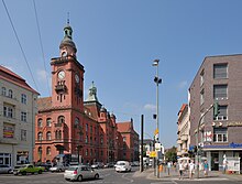
The western part of the rural community Rosenthal including Wilhelmsruh came to the Reinickendorf district . The district was named Pankow after its most populous district . The Pankow town hall also became the seat of the district mayor and the district council . In 1930, the Pankow district was reached by the Berlin subway with the opening of the Schönhauser Allee - Vinetastraße section .
The Berlin regional reform with effect from April 1, 1938 resulted in numerous straightening of the district boundaries as well as some major changes to the area. The area west of the Berlin Northern Railway on Wollankstrasse was reclassified from the Pankow district to the Wedding district . The Reinickendorf district surrendered its area east of the Northern Railway, consisting of Wilhelmsruh and the Waldsteg settlement to the south, to the Pankow district. Due to the border changes, the population of the district increased by 1,629 and the area of the district increased by 81 hectares .
At the end of the Second World War , the Red Army captured the Pankow district in the Battle of Berlin on April 22, 1945. According to the zone protocols , it was assigned to the Soviet sector in the four- sector city of Berlin and after the division of Berlin belonged to East Berlin , from 1952 as "Pankow district".
After the founding of the GDR, the residences of the top management personnel of the SED and the GDR government were located in the restricted area on Mayakowskiring until the 1960s . The nearby Schönhausen Palace was the seat of the President of the GDR , Wilhelm Pieck , from 1949 to 1960 , and then to 1964 of the State Council Chairman Walter Ulbricht . That is why “Pankow” was considered a synonym for the GDR leadership, especially among the western public.
After the construction of the Berlin Wall in August 1961, the exact course of the district border along the northern runway became important. Despite their name, the Wilhelmsruh and Schönholz S-Bahn stations were located in West Berlin and were no longer accessible from the Pankow district. The Wollankstraße S-Bahn station was in the Pankow district, but its eastern access was also blocked. The station remained accessible from West Berlin.
In 1985 the districts of Karow, Heinersdorf and Blankenburg were reclassified into the district of Weißensee , which in turn gave up a large part of its area to the new district of Hohenschönhausen .
Schönhausen Palace served as a guest house for state visitors to the GDR from 1964 to October 1989 . During the peaceful revolution , the Central Round Table of the GDR met in the Schönhausen Palace complex from the end of December 1989 to March 1990 .
With German reunification on October 3, 1990, the Pankow district became part of the federal state of Berlin. On September 16, 2000, the U2 underground line was extended from Vinetastraße to Berlin-Pankow station.
Pankow district since 2001
On January 1, 2001, the Pankow district was merged with the Weissensee and Prenzlauer Berg districts as part of the Berlin district reform . After lengthy disputes about the name, the areas involved were able to agree on the short name of Pankow by resolution of its district council meeting .
population
overview
| year | Residents | year | Residents |
|---|---|---|---|
| 1920 | 94,656 | 1961 | 134,826 |
| 1925 | 100,825 | 1970 | 141,466 |
| 1933 | 141,333 | 1987 | 115,538 |
| 1939 | 154,725 | 2000 | 125,345 |
| 1946 | 143,962 | 2012 | 381,602 |
| 1950 | 149,662 | 2015 | 389.976 |
| 2016 | 394.816 |
As of December 31, 2019, the Pankow district had 409,335 inhabitants on an area of 103.07 square kilometers. Thus, on the reporting date, the population density was 3,971 inhabitants per square kilometer. See also: List of districts and districts of Berlin .
On December 31, 2016, the proportion of foreigners was 12.0%, which varies greatly depending on the district. The proportion of the population with a migration background was 18.5% on the reporting date. The unemployment rate was 10.0% on April 30, 2013 and was thus the lowest value of all Berlin districts (for comparison: the Neukölln district had the highest unemployment rate at 17.1%). The average age of the population on December 31, 2016 was 40.7 years. The proportion of women in the district was 51.2% compared to 48.8% of men.
With around 4,500 newborns in 2013, Pankow was the district with the highest birth rates in Berlin.
Population groups
| category | 2001 | 2011 | 2017 |
|---|---|---|---|
| German and foreign residents | 334.086 | 365.021 | 402.289 |
| Average age | 39.7 | 40.7 | 40.7 |
| German citizens (total) | 315.241 | 339.311 | 350,578 |
| German citizens without a migration background | 319.018 | 322,455 | |
| German citizens with a migration background | 20,293 | 28,123 | |
| Foreign nationals | 25,710 | 51,711 | |
| Foreigners and residents with a migration background | 46.003 | 79,834 | |
| Germans (nationals) in total | 339.311 | 350,578 | |
| Proportion of Germans without a migration background (%) | 87.4% | 80.2% | |
| Proportion of Germans with a migration background (%) | 5.6% | 7.0% | |
| Proportion of residents with foreign citizenship (%) | 7.0% | 12.9% | |
| Total number of Germans with a migration background (in the district) | 20,293 | 28,123 | |
| - * from the EU | 7,547 | 10,612 | |
| - * from the former Yugoslavia | 657 | 903 | |
| - * from the former Soviet Union | 3,982 | 5,168 | |
| - * from Islamic countries | 3,356 | 5,002 | |
| - * from Vietnam | 501 | 719 | |
| - from the USA | 603 | 1,072 | |
| Foreign residents (in the district) | 25,710 | 51,711 | |
| - from the EU | 14,028 | 23,220 | |
| - from the former Yugoslavia | 915 | 1,954 | |
| - from the former Soviet Union | 2.234 | 4,783 | |
| - from Islamic countries | 2,047 | 10.154 | |
| - from Vietnam | 1,133 | 1,383 | |
| -- from the USA | 1,348 | 2,698 |
income
In a district comparison, Pankow has had an above-average positive economic development since 2000. In 2018 it was the Berlin district with the highest average net per capita income for the population. Statistically, the net income was 1475 euros per inhabitant (not per employee) and thus above the Berlin average of 1225 euros, but only about 10% above the average income in Germany.
economy
overview
IT , creative and media industries , rail vehicle construction , biotechnology , healthcare and mechanical engineering are concentrated in Pankow .
Companies
In 2014, more than 42,000 companies operated in Pankow. A large number of these are small businesses in the service, construction and retail sectors. 74% of the companies have up to five employees. A high proportion of self-employed and start-ups work in the district.
On Campus Berlin-Buch , one of the largest hospital sites located in Germany. A large number of companies in the healthcare sector operate there.
In 2015, the Swiss company Stadler Rail employed around 1200 people in Berlin-Pankow. GetYourGuide , operator of a global online booking platform, employs more than 600 people at its headquarters in Prenzlauer Berg.
biotechnology
With over 30,000 square meters of usable space, the BiotechPark Berlin-Buch in Pankow is one of the largest German technology parks in the field of biomedicine and biotechnology. The Berlin-Buch Campus Innovation Center is also located on the site. Industry-specific laboratory and office space is made available to founders. The BiotechPark is operated by the “BBB Management GmbH Campus Berlin-Buch” and has an annual turnover of around 140 million euros.
The innovation center focuses on the development of molecular diagnostics and therapies, the development of new drugs, innovations in medical technology and services for research institutions and the pharmaceutical industry, clinical developments, genetic engineering, nanobiotechnology and bioinformatics. The SDAX- listed company Eckert & Ziegler is one of the main companies at the Buch location.
media
- Pankower General
- Barefoot Films
- Xinhua , the German headquarters of the Chinese news agency
Infrastructure
Private transport

Road traffic in the district is characterized by the three federal highways B 96a ( Schönhauser Allee / Berliner Straße) and B 109 ( Prenzlauer Allee / Prenzlauer Promenade), which run radially from the city center to the north and northeast , which connect to the federal motorway at the Pankow-Heinersdorf S-Bahn station 114 opens, and the B 2 ( Greifswalder Strasse / Berliner Allee ). Pankow is the only district that is accessible from the Berliner Ring, the A 10 motorway . The two ring roads are also of great importance for road traffic: Danziger Straße (inside the S-Bahn ring ) and Ostseestraße - Wisbyer Straße - Bornholmer Straße (outside the S-Bahn ring).
Pankow is integrated into the network of long-distance cycle routes. The long-distance cycle route Berlin – Usedom runs from Museum Island along Schönhauser Allee, then turns into Schwedter Straße and leads through Mauerpark and Schlosspark Pankow and on to Karow and Buch. The Berlin Wall Trail runs along the border between Pankow and the Reinickendorf district and the Wedding part of the Mitte district, which corresponds to the former GDR border .
Transportation
Pankow is connected by the S-Bahn lines S1, S2, S25, S26, S41, S42, S8 and S85. Almost the entire northern part of the eastern ring of the Ringbahn with the S-Bahn stations Storkower Straße , Landsberger Allee , Greifswalder Straße , Prenzlauer Allee and Schönhauser Allee is located in the district . Where on the border with the district of Gesundbrunnen the district center located Bornholmer Bahnhofstrasse share coming from the south lines in the stretch direction Oranienburg / Hennigsdorf ( Berlin Northern Railway ) and Bernau ( Stettin train on). The train stations Wollankstraße , Schönholz and Wilhelmsruh ( Reinickendorf ) are on the border with the Reinickendorf district . The stations of Pankow , Pankow-Heinersdorf , Blankenburg , Karow and Buch are located on the Stettiner Bahn, which runs to the northeast . At Karower Kreuz, the Karower Kreuz train station is in the construction and planning phase (as of 2020).
The regional train line RB27 ( Heidekrautbahn ) of the Niederbarnimer Eisenbahn to Groß Schönebeck or Wensickendorf begins at Berlin-Karow station .
In the district of Pankow there are five subway stations of line U2 : In the district of Prenzlauer Berg the stations Senefelderplatz , Eberswalder Straße and Schönhauser Allee and in the district of Pankow the stations Vinetastraße and Pankow . The stations Schönhauser Allee and Pankow are transfer stations to the S-Bahn.
The tram network in the district essentially follows the main roads described in the individual traffic section. There is also a supplementary line running from southwest to northeast. The tram line running north from Schönhauser Allee branches into three branches in the Pankow district. The route in Berliner Allee leaves the Pankow district eastwards in the direction of the Lichtenberg district . The line in Berliner Allee was equipped in 2005 with noise-absorbing grass track and new stops.
power supply

The first two wind turbines in Berlin are located in a field in the north of Pankow, district of Buch , (with the geo-coordinates : 52 ° 38 ′ 54 ″ N , 13 ° 26 ′ 40 ″ E ) and at the Malchow suburb. Both plants, which were put into operation in 2008 and 2014 respectively, are of the Enercon E-82 type with a rotor diameter of 82 m, a hub height of 138 m and a total height of 179 m.
The nominal output of the first system is two megawatts (MW), the second system has an output of 2.3 MW. The standard energy capacity of the wind turbines is 4 or 5 million kWh per year. The total investment was around 3.4 million euros each.
By 2020, three more, much smaller wind turbines were built in the north of Pankow at Schönerlinder Strasse (two each) and Am Vorwerk.
The Berlin-Buch thermal power station has an electrical output of five megawatts and a thermal output of 130 MW.
politics
District Assembly
The election to the District Assembly (BVV) of Pankow on September 18, 2016 resulted in the following distribution of seats:
| Political party | Seats |
|---|---|
| The left | 13 |
| Alliance 90 / The Greens | 12 |
| SPD | 12 |
| AfD | 8th |
| CDU | 8th |
| FDP | 2 |
| All in all | 55 |
District Mayor
The district mayors of the greater district after the administrative reform in 2001:
- 2001–2002: Alex Lubawinski (SPD)
- 2002–2006: Burkhard Kleinert (PDS / Left Party)
- 2006–2016: Matthias Köhne (SPD)
- 2016-: Sören Benn (Die Linke)
The Pankow district is represented at the state level in the council of mayors .
District Office
Members of the district office are (as of 2020):
- Sören Benn (Die Linke), district mayor
- Vollrad Kuhn (Bündnis 90 / Die Grünen), District Councilor, Deputy District Mayor
- Rona Tietje (SPD), District Councilor
- Daniel Krüger (for AfD), district councilor
- Torsten Kühne (CDU), District Councilor
coat of arms
Blazon : In silver above a continuous red wall adjoining above without joints, with three open gates without gate wings, the middle of the arches wider and higher than the outer ones; below an eight-spoke red wheel, which above its center is accompanied on both sides by a green hop umbel with a leaf. A red three-tower wall crown rests on the shield, the central tower of which is covered with the Berlin coat of arms.
The search for a coat of arms for the Pankow district came to an end on July 28, 2009. In the district, the decision was made by the district administration on the recommendation of the coat of arms commission. After the administrative reform in 2001, the former smaller Pankow district merged into the Pankow district. At the end of 2006, the dispute over the district name was ended and on October 1, 2007, a call was made to find a coat of arms . On April 30, 2008, the district assembly decided to commission the heraldist Jörg Mantzsch with the design, who submitted several drafts according to given content for decision. After some discussions between the district office and the executing heraldist, the Pankow district office announced the approved draft on February 24, 2009. The official award of the coat of arms by the Senate of the State of Berlin took place on July 28, 2009.
The coat of arms of the old Pankow district was awarded as part of the 750th anniversary of Berlin in 1987. It takes up elements of the former rural community of Pankow and shows “in a silver shield two crossed golden grain sheaves on green ground, held together by a silver ribbon. A golden rake is stuck into the sheaves upright, a golden flail to the right and a scythe with a blue leaf to the left. All three devices have a red handle. The sheaves are covered with two overturned and diagonally crossed blue spades with red stems ”. The eight-spoke wheel was adopted in a simplified form from the Weissensee coat of arms . As part of the district reform, the coat of arms was initially supplemented by a three-tower wall crown , the middle tower of which is covered with the Berlin coat of arms . The crown of the wall is the connecting element of all Berlin districts .
Partner and sponsorships
-
 Kołobrzeg (since May 1994) - an actively operated partnership established by the old Pankow district .
 -
 Ashkelon (since July 1994) - partnership brought in by the old district of Weißensee. After the partnership had been inactive for a long time, the contacts have been reactivated since 2009.
 -
 Sponsorship with the 1st company of the guard battalion at the Federal Ministry of Defense (since July 2006), which followed the sponsorship with the Bundeswehr Command Support Regiment 38, which had existed since 1998 (after its relocation to Storkow ).
police
Directorate 1 of the Berlin police is responsible for the Pankow and Reinickendorf districts.
education
Elementary and high schools

- (Selection)
- Glass laboratory
- Carl von Ossietzky High School
- Rosa-Luxemburg-Gymnasium
- Heinrich Schliemann High School
- Käthe-Kollwitz-Gymnasium
Colleges
- The Kunsthochschule Berlin-Weißensee is located in the Weißensee district of the same name and is a university for the training of artists from various fields. It was founded in 1946. A special feature is the basic artistic course , which ties in with the Bauhaus tradition.
- The Bard College Berlin is an independent university in Berlin offers, interdisciplinary study programs in the humanities and social sciences.
- The State Ballet School is located in the Prenzlauer Berg district in the Karree south of Ostseestrasse .
research
- Academy of Health Berlin / Brandenburg
- Deutscher Wetterdienst (DWD) - branch of the hydrometeorology department
- Experimental Clinical and Research Center (ECRC)
- Leibniz Institute for Molecular Pharmacology (FMP)
- Max Delbrück Center for Molecular Medicine in the Helmholtz Association (MDC)
Culture

Events and institutions
- Kulturbrauerei in Prenzlauer Berg
- Comedy Club Kookaburra , club for local comedians and improv theater
- Ballhaus Ost in Prenzlauer Berg
- Prater in Prenzlauer Berg
- Bread factory in Weißensee
- Pfefferberg
- Zeiss large planetarium
- DOCK 11 , free venue for dance
- Organic market at Kollwitzplatz
Sports

The Rugby Klub 03 Berlin is a rugby union club from Weißensee with 250 members. The club currently plays in the first Bundesliga (as of the 2016/17 season).
Founded in 1893 as BFCC Rapide Niederschönhausen 1893 , SG Empor Pankow can look back on a long tradition.
In total there were at least 19 yoga studios in Pankow in 2017 ; most of them in the Prenzlauer Berg district.
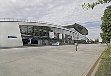
The Max-Schmeling-Halle was the occasion of the Olympic built -Bewerbung Berlin in 2000 in the district of Prenzlauer Berg and 1996 by Max Schmeling inaugurated. The multi-purpose hall is the home ground of the Füchse Berlin handball club (as of the end of 2018). It is also used for other sporting events, events and concerts.
The velodrome is at the Landsberger Allee S-Bahn station . With 12,000 spectator seats, the cycling sports hall is the second largest event hall in Berlin after the Mercedes-Benz Arena (17,000 spectators).
The swimming and diving hall in the Europa Sportpark is located right next to the Velodrome . In the swimming pool several found German Swimming Championships and European Swimming Championships instead. Both buildings were also built in the course of the Berlin Olympic bid.
Buildings
In Prenzlauer Berg , in the older area between Prenzlauer and Schönhauser Allee, wide sidewalks with cafes and pubs are worth seeing despite the dense development. The large housing estates from the 1920s are remarkable, which, in contrast to the tenements, document the new building of their time. This is particularly true for Carl Legien Housing Estate , by Bruno Taut was configured and along with five other settlements Berlin World Heritage Site of UNESCO is.
The Catholic Herz-Jesu-Kirche is one of the most important church buildings in the district . It was built in 1897 in the Lower Saxon-Romanesque and early Christian-Byzantine style.
Cinemas
The district in art

- Pankow is the name of a Berlin rock band.
- The singer Udo Lindenberg brought out a song in 1983 entitled Sonderzug nach Pankow .
- Pankow and its surrounding areas were a popular destination at the end of the 19th century. Pankow appears in various songs, so “Come Karlineken come […] we want to go to Pankow […] Pankow, kille, kille, Pankow […]” or in “ Bolle recently traveled to Whitsun , to Pankow was his goal [...] On the Schönholzer Heide there was a fight [...] "
- The film Berlin - Ecke Schönhauser… (1957) portrays the members of a group of young people on their way to growing up in Berlin in the mid-1950s. The strip shows in particular the area around the Eberswalder Straße underground station in the Prenzlauer Berg district with the intersection of Danziger Straße , Schönhauser - and Kastanienallee .
- Everything on sugar! (2004) caricatures Jewish life and customs in Berlin in a humorous way. A family separated by the division of Berlin and by religious and political beliefs has tofind each other againafter German reunification in order to inherit. One can see the Rykestrasse synagogue .
- Summer in front of the balcony (2005) tells the story of two neighbors in Berlin. The film was shot in the vicinity of Helmholtzplatz in Prenzlauer Berg.
District personalities
- (Selection sorted alphabetically)
- Joachim-Ernst Berendt (1922–2000), music journalist / producer
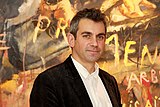
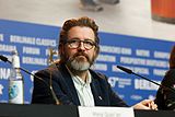
- Olafur Eliasson (* 1967), artist
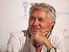
- Henry Hübchen (born 1947), actor
- Wladimir Kaminer (* 1967), writer
- Jürgen Kuczynski (1904–1997), historian and economist
- Christian Lorenz (* 1966), musician in the Rammstein band
- Christoph Schneider (* 1966), musician in the Rammstein band
- Nora Tschirner (* 1981), actress
- Ulrich Wutzke (* 1946), geologist, publisher and editor
See also
- List of fountains in the Berlin district of Pankow
- List of street fountains in the Berlin district of Pankow
Web links
Individual evidence
- ↑ a b c d Statistical report - residents in the state of Berlin on December 31, 2016 (PDF; 3.1 MB). Office for Statistics Berlin-Brandenburg . Retrieved June 25, 2016.
- ↑ a b November: Unemployment in Berlin at an all time low . In: Berliner Zeitung , accessed on January 11, 2020.
- ↑ numbering according to the district key; from 1920 to 2001 number 19.
- ↑ a b c Residents in the State of Berlin on December 31, 2019, data from the Berlin-Brandenburg Statistics Office , accessed on August 27, 2020 ( PDF file ) ( help ).
- ↑ Action-oriented social structure atlas Berlin 2013. (PDF; 17 MB) Health reporting Berlin - special report. Senate Department for Health and Social Affairs, p. 15 , accessed on July 29, 2015 .
- ↑ Founders Index 2010 - The start-up activity in the Berlin districts , Bürgschaftsbank Berlin, accessed on June 29, 2017.
- ↑ Berlin Neighborhood Is a Mecca for Young Families , Der Spiegel, accessed on February 9, 2020.
- ^ Klaus-Detlef Kühnel, Roland Lehmann: Karower Teiche nature reserve. In: Of course Berlin! 2nd Edition. Verlag Natur und Text, Rangsdorf 2009, ISBN 978-3-9810058-9-9 , pp. 52–57.
- ↑ Water map - northeast section , accessed on January 17, 2020.
- ↑ Berlin Waters Directory on FIS-Broker , accessed on January 17, 2020.
- ↑ statistik-berlin-brandenburg.de Significance of the LOR and address directories of the lifeworld oriented spaces.
- ↑ Access to the data of the individual neighborhoods is provided by adding the key numbers to the web address. The data from 2008 and 2009 are available as a PDF, the later as an HTML list.
- ↑ Number in the LOR: On the lower level of detail, the urban area of Berlin is subdivided into 447 planning areas that do not intersect any blocks. The two-digit numbers of the planning areas are characteristic within the districts.
- ↑ The numbers are linked to the web addresses for the social room data of the neighborhood (planning rooms in the LOR system). This also includes the map sections of the neighborhoods based on "OpenStreetMap.org maps CC-BY-SA".
- ↑ Further information on the age structure is included in the linked social room data.
- ↑ Germans without a migration background.
- ↑ Germans with a migration background are here: (1) Germans with a foreign country of birth or naturalization mark or option mark (children born in Germany to foreign parents have been given German citizenship since January 1, 2000 under the conditions set out in Section 4 (3) Citizenship Act (StAG) (Option regulation)). (2) Germans under the age of 18 without their own migration characteristics with a foreign country of birth or naturalization number of at least one parent, if the person is registered at the address of the parents / parent.
- ↑ Foreign citizenship. In the linked social room data, the nationality is further broken down by area of origin.
- ↑ Germans without a migration background. The Berlin average for the proportion of Germans without a migration background is 67.7%, for those with a co-migration background it is 12.4% and foreign nationals across Berlin are given as 17.9% as of December 31, 2016.
- ↑ Berlin in numbers
- ↑ Berlin in Numbers, 1949.
- ^ Statistical yearbooks of Berlin
- ^ Berlin life in numbers. In: Berliner Zeitung . August 18, 2015. Retrieved June 1, 2017.
- ↑ Statistical report AI 5 - hj 2/11 - residents in the state of Berlin on December 31, 2011.
- ↑ Statistical report AI 5 - hj 1/17 - residents in the state of Berlin on December 31, 2017 (PDF)
- ↑ Armes Mitte, reiches Pankow , Der Tagesspiegel, accessed on January 28, 2020.
- ↑ People Pankow , Der Tagesspiegel, accessed on January 18, 2020.
- ↑ Karower Kreuz S-Bahn in the northeast will be interrupted in summer In: Berliner Zeitung Online , April 16, 2018.
- ↑ Second wind power plant inaugurated in Pankow . In: Pankower Allgemeine Zeitung. December 5, 2015, accessed October 9, 2015.
- ↑ Pankower pioneer: New wind power plant is being built on Bundesstrasse 2 in the Malchow suburb. Retrieved May 13, 2020 .
- ↑ a b The State Returning Officer for Berlin , accessed on September 19, 2016.
- ↑ Elections for the District Assembly 2016
- ^ Council of Mayors - accessed on May 18, 2019.
- ↑ District Office College
- ↑ National emblem of Berlin - district coat of arms
- ^ Draft of the new coat of arms ( Memento from August 6, 2009 in the Internet Archive ) (PDF; 175 kB)
- ↑ Press release of the Senate of July 28, 2009: "Pankow district with new coat of arms"
- ↑ Cooperation with Kolberg 2011 ( Memento from April 7, 2014 in the Internet Archive ) (PDF; 2.9 MB)
- ^ Twin town Ashkelon
- ↑ District Office Pankow, partnerships and sponsorships ( Memento from June 12, 2012 in the Internet Archive )
- ^ Artistic basics on the khb Weißensee website, accessed on April 6, 2013.
- ↑ The world is back. In: Der Tagesspiegel , accessed on May 26, 2017.
- ↑ Own representation ( Memento from May 30, 2014 in the Internet Archive ) About us - Own representation of the RK 03 Berlin; Retrieved April 26, 2010.
- ↑ Welcome to yoga @ inberlin - the directory for yoga studios in Berlin ( Memento from August 8, 2017 in the Internet Archive ), accessed on July 3, 2017.

