
Green city
_01.JPG)
.JPG)
The Green City is a residential ensemble in the same location in the Berlin district of Pankow , Prenzlauer Berg .
Inspired by the garden city movement, more urban green space was planned between and around the apartment blocks when building the residential blocks, in contrast to the densely built-up inner city district, which had previously been poorly greened .
location
The Green City came into being with plans in the 1920s to settle the area north of the dense inner-city development of Prenzlauer Berg, which was built in the early days since 1870 with tenements without any noteworthy greenery. In a broader sense, the urban area between Danziger , Greifswalder Strasse , Ringbahn and Kniprodestrasse is summarized. The central street in north-south direction is the northern section of Bötzowstraße . With the project “Urban Redevelopment East”, this quarter with buildings from the 1930s came back into the focus of urban planners . In the system of "Lebensweltlichorientierte Raum (LOR) - Planning Areas", the described location is noted as "Anton-Saefkow-Park". The adjoining planning rooms are the “rooms” (i.e., the district), Thälmann-Park, Erich-Weinert-Straße, Greifswalder-Straße (internally also Mühlenviertel), Volkspark Prenzlauer Berg, Conrad-Blenkle-Straße, Barnimkiez, Bötzowstraße, Winsstraße, starting clockwise from the west .
The location of the Green City is limited by the following border lines.
- The Anton-Saefkow-Park forms the end to the north. It was created in 1955 from the pile of rubble of the "Dead City" that was piled up between 1948 and 1950 . In addition to the residents' recreational area, there is the noise-reducing green zone to the railway line of the Ringbahn and the commercial area on the former freight station.
- To the south borders the Danziger Straße, with the adjoining Bötzowviertel and the Arnswalder Platz .
- The B 2 arterial road in the west separates it from the Ernst-Thälmann-Park opposite , on the area of which the gasworks, with a corresponding odor pollution, was located until the 1960s.
- In the east borders the Kniprodestrasse, originally planned through Weißensee as an arterial road to Bernau according to the Hobrecht plan of 1862. To the east of this is the residential development from the 1950s around Conrad-Blenkle-Strasse with the Velodrom towards Landsberger Allee .
.JPG)
The Inner Parkring (number 18), which connects Friedrichshain and Pankow here, and the Hönower Weg (number 7), which leads from Volkspark Friedrichshain to Volkspark Prenzlauer Berg , cross each other as part of Berlin's main green path .
.JPG)
Streets and squares
The street names according to areas with Prussian reference in the Polish areas since 1945 were replaced (preferably in 1974) by the East Berlin magistrate with names after anti-fascist resistance fighters .
- bounding east and west
- Greifswalder Straße: Plots 48–80L (continuous) on the east side belong to the street. The numbers 80A-80L are commercial properties north of Anton-Saefkow-Straße up to the railway line on the former freight yard.
- Kniprodestrasse (1974 to 1995 as Artur-Becker-Strasse ): The location includes properties 111A – 97 on the west side, with residential buildings. The 190 m at the Volkspark are not in the number system.
- bounding south
- Danziger Strasse (1950 to 1995 as Dimitroffstrasse ): The plots 179–119 (odd) belong to the location on the north side.
- East-west continuously
- John-Schehr-Strasse (until 1974 Kurische Strasse ). The lots on the street are numbered 1–73 (odd, north side) and 2–70 (even, south side).
- Anton-Saefkow-Straße (until 1955 Gumbinner Straße ): The street is on the south side with residential buildings built on the plots are 2–70 (straight). The nursery on 27 and 33 is in the park.
- Southwest to Northeast (partly coming from Friedrichshain)
- Bötzowstraße: (until 1936 the street section belonging to the quarter was called Trakehner Straße ). It is located (starting at Friedrichshain) between Danziger Straße and Volkspark / Anton-Saefkow-Straße in Viettel. The plots in the local area are numbered 55–89 (odd, west side) and 54–88 (even, east side).
- Hans-Otto-Straße (until 1974 Braunsberger Straße ): The section from Danziger to John-Schehr-Straße is numbered 49–53 (odd, west side) and 50–60 (even, east side). The start is on Friedrichshain / Käthe-Niederkirchner Straße.
- Werner-Kube-Strasse (until 1974 Pregelstrasse ). It is located 60 m east of the street on Hans-Otto-Straße in the middle of the residential block (block 609/608 west, 644/641 east) from John-Schehr-Straße to the Volkspark with house numbers 5-19 (odd, west side) and 2 –20 (straight, east side) numbered.
- Residential blocks west of Bötzowstrasse
- Bernhard-Lichtenberg-Straße (until 1974 Rastenburger Straße ): Numbered 1–11 (consecutively from Greifswalder Straße, south side) and 12–23 (downward, north side).
- Eugen-Schönhaar-Straße (until 1974 Wehlauer Straße ): It leads to the east diagonally in the district continuously to the Volkspark with the lots 1–27 (odd, west side) and 2–30 (even, east side) numbered.
- Olga-Benario-Prestes-Straße (until 1974 Neukuhrer Straße ) It is located between Greifswalder and Egon-Schönhaar-Straße in the center of the square with the apartment blocks 1–13 (odd, from Greifswalder Straße, north side) and 2–12 (even, south side, 14 undeveloped) numbered.
- Margarete-Walter-Straße (until 1974 Bartensteiner Straße ): It is in the corner between Anton-Saefkow- and Bötzowstraße. From Bötzowstraße the southern plots 1 and 3 are undeveloped green areas and to the north to Anton-Saefkow-Straße on the west side are the houses 5-13 (odd). On the north side of Bötzowstrasse is the block 2-10 (straight) and around the corner 12 and 14 with a connection to the block of Anton-Saefkow-Strasse 34/36.
- Residential block between Bötzowstrasse and Kniprodestrasse east of Bötzowstrasse
- Heinz-Kapelle-Strasse (until 1974 Goldaper Strasse ): It is located south of John-Schehr-Strasse in the center with houses 5–11 (odd, north) and 2–12 (even, south).
- Rudolf-Schwarz-Strasse (until 1974 Ermländische Strasse ): It complements the residential block north of John-Schehr-Strasse. In the center with the apartment blocks 1–15 (odd, north) and 2–16 (even, south) on Walter-Kube-Strasse and further on 17–35 and 18–32 to the houses on Kniprodestrasse 102 and 103 respectively / 25A and 27 / 27A on the north side and 24 / 24A with 26 / 26A passages across the courtyard to symmetrical apartment house gates on Anton-Saefkow- (62A to 64A) and John-Schehr-Straße (63A to 65A).
.JPG)
Classification for city statistics
In addition to the RBS geoportal (regional reference system) in Berlin and thus for the Pankow district, different types of classification are used for the various planning tasks.
- For statistical evaluations, which are based on the streets and the quarters and neighborhoods, the location belongs to area 118. This is subdivided into blocks according to locations, which are sometimes further subdivided. In this block system, Kniprode-, Danziger and Greifswalder Straße are designed as main streets and also the sections of the tram turning loop in Hans-Otto- and John-Schehr-Straße. All other traffic routes in public space are categorized as side streets.
- Block 34: Eugen-Schönhaar-Strasse 18–30 (even), John-Schehr-Strasse 23–35 (odd), Margarete-Walter-Strasse 1–13 (odd), the east side of which is Bötzowstrasse without a property number (at the daycare center ). The residential development is divided into sub-block 1 and the school and daycare center as (statistical) sub-block 34/2.
.JPG)
- Block 35: located in the northeast corner of 34: Anton-Saefkow-Straße 34, 36, Bötzowstraße 83-89 (odd), Margarete-Walter-Straße 2-14.
- Block 36: Bernhard-Lichtenberg-Strasse 20-23 (continuous), Eugen-Schönhaar-Strasse 5-9 (odd), Greifswalder Strasse 50, 51, John-Schehr-Strasse 2-18 (even).
- Block 37: Bernhard-Lichtenberg-Straße 12-19 (continuous), Bötzowstraße 63, Eugen-Schönhaar-Straße 6, 6A, 8, John-Schehr-Straße 20-36.
- Block 38: Bernhard-Lichtenberg-Straße 1, 2, 3, Danziger Straße 119–127 (odd), Eugen-Schönhaar-Straße 1, 3, Greifswalder Straße 48, 49.
- Block 39: Bernhard-Lichtenberg-Strasse 4, 4A, 5B, 5C, 6A-6D, 7-11, Danziger Strasse 129-147 (odd), Eugen-Schönhaar-Strasse 2, 4.
- Block 41: Anton-Saefkow-Straße 54–70, Kniprodestraße 97-102 (continuous), Rudolf-Schwarz-Straße 17–35, Werner-Kube-Straße 1-20.
- Block 42: Bötzowstrasse 54, 56, Danziger Strasse 153–159A, Hans-Otto-Strasse 49, 51, 53, John-Schehr-Strasse 38 (at the width of the school).
- Block 44: John-Schehr-Strasse 55-73 (odd), Kniprodestrasse 103-108 (consecutive), Rudolf-Schwarz-Strasse 18-32, Werner-Kube-Strasse 2-10.
- Block 45: Anton-Saefkow-Straße 2-26, Eugen-Schönhaar-Straße 19-27, Greifswalder Straße 57-62 (continuous), Olga-Benario-Prestes-Straße 1–13.
- Block 46: Eugen-Schönhaar-Strasse 11-17 (odd), Greifswalder Strasse 52-56 (continuous), John-Schehr-Strasse 1–21, Olga-Benario-Prestes-Strasse 2-14.
- Block 606: Danziger Strasse 161–179, Hans-Otto-Strasse 50, 52, 54, Heinz-Kapelle-Strasse 2–12, Kniprodestrasse 110A-111A.
- Block 607: Hans-Otto-Strasse 56, 58, 60, Heinz-Kapelle-Strasse 5–11, John-Schehr-Strasse 50–70, Kniprodestrasse 109–110.
- Block 608: Anton-Saefkow-Strasse 38–52, Bötzowstrasse 78-88, Rudolf-Schwarz-Strasse 1–15, Werner-Kube-Strasse 13-19
- Block 609: Bötzowstrasse 68–76 (straight), John-Schehr-Strasse 37–53, Rudolf-Schwarz-Strasse 2–16, Werner-Kube-Strasse 5 and 7.
- Block 610: This includes the commercial buildings Anton-Saefkow-Strasse 27 and 33 (road and green space office: support point), as well as Greifswalder Strasse 80A and 60B (construction of the former VVB coal and energy, now various offices), 80C, 80E (Centro Italia and other trade and commerce), 80L (cement mixer and construction company HoBa). These plots 80 are summarized as sub-block 610/002, while sub-block 001 is the Volkspark with the gardeners' base.
- At the edge of the location is the statistical block 108-901 of the railway area with the sub-blocks of the southern edge area of the railway's own area as 001, the track area 003, the S-Bahn station as 004. The sub-block 108-901 / 2 is already on the other side of the Kniprodestrasse bridge Landsberger Allee train station.
- The LOR system (living environment-oriented spaces) was intended to achieve homogeneity while at the same time maintaining comparability of the planning space units. In this system, the location belongs to the forecast area (level 3) 06 Northern Prenzlauer Berg, the district region (level 2) 14 Prenzlauer Berg Ost and the planning area (level 1) 34 Anton-Saefkow-Park.
history
.jpg)


.jpg)
The area covered by the Green City (to Berlin NO 55) and further to the Weichbild boundary to Weißensee was used for agricultural purposes until 1900. This, including the surrounding area, had been in the possession of the Bötzow family since around 1700. The Berlin city center was settled along the arterial roads. In 1910, Elbinger Strasse (→ Danziger Strasse) was reached. The address book from 1910 names storage, coal and storage areas on the plots 36–70 for the north side (consecutive). Development began in 1911, initially the plots along Elbinger Strasse - renumbered 35–58 - were built with multi-party rental houses; the inner courtyards were 10 m × 20 m in size with transverse buildings. The tenement houses have 14 to 20 tenants. The Braunsberger road is north of the number between 42 and 43 Elbing road applied and crosses Goldap ( 7a ) and Couronian road ( road 7b ). The Trakehner street with new buildings and construction sites begins between 46/47, 55/56 between the start Wehlauer road (8b the abbot. XIII previously 8a) with new buildings on the Rastenburger the Curonian road noted in the address 1912th The Rastenburger Straße is not built on and the Kurische Straße is built on in 1911/1912 (new buildings and construction sites). The builders were the Bauges. Berlin Nordost GmbH (Charlottenburg), the Bau- u. Terrain current total Phönix (Charlottenburg) and individual architects. Greifswalder Strasse is built on the east side from Elbinger to Rastenburger Strasse in 1912 and a new building is indicated on Kurische Strasse, the land belonging to the Ringbahn continues to belong to the Gilka-Bötzow heirs with storage spaces and sites for construction companies. Kniprodestrasse is located between Am Friedrichshain / Virchowstrasse via the ring railway to Weißenseer Feldmark. On the west side from the Ringbahn to Kurische Strasse with the site and coal square, to Goldaper Strasse with a new building and tenement and from there two tenement houses to Elbinger Strasse .
First World War and the effects of inflation delayed further development. The 1915 address book shows the location of the Bartensteiner, Braunsberger, Gumbinner, Labtauer, Lycker and Pregelstraße and the Kurischen Platz (previously Platz B I ) to the north of Kurische Straße . Ermländische Strasse is missing in 1915 and 1921, as Pregelstrasse was planned to be continuous between Greifswalder and Kniprodestrasse as the northern end of Wehlauer, Trakehner and Labtauer Strasse. In the Prenzlauer Berg administrative district of Greater Berlin, which was formed in 1920, the apartment buildings are built up to Kurische Strasse (→ John-Schehr-Strasse). To the north of Kurische Strasse, the 230th and 248th elementary school and the 7th auxiliary school were built at the (then) end of Wehlauer Strasse (→ Eugen-Schönhaar-Strasse) to provide schooling for the children . The planned streets are named in the address book in 1921 with a picture of the situation, but recorded as undeveloped.
At the end of the 1930s, residential buildings were added up to Gumbinner Strasse (→ Anton-Saefkow-Strasse). Between 1919 and 1938, these planning areas were primarily used in allotment garden colonies. These apartment blocks, built before the beginning of the war, are committed to the social concept of the garden city movement and Bauhaus architecture . 1800 apartments were built for small and medium-sized civil servants according to designs by architect Werner Harting 1938–1939. The client was the Gemeinnützige Siedlungs- und Wohnungsbaugesellschaft Berlin mbH. The courtyards between the roadside buildings were larger with a generous street grid with house distances of 50 m to 120 m. From Greifswalder Strasse and also from Bötzowstrasse, gatehouses (between Greifswalder Strasse 56/57 and Bötzowstrasse 76/78) to the east are designed as access roads to Mittelstrasse. Instead of the projected Kurischer Platz to the east, a central square on the Bötzowstraße behind the (now) 33rd and 34th elementary school remained free. The crèche (→ Kita John-Schehr-Straße 35) was established in the 1960s. A tree-lined green area was thus preserved. New buildings are listed in the 1940 address book. In the new residential area, the Gumbinner in the north and the Kurische Strasse in the south bordered from Greifswalder to Kniprodestrasse. The north side (left side) of Kurische Straße was already registered in 1940 with the houses 1–21 of the non-profit settlement and housing association Berlin. The ones following to the east of Wehlauer Strasse are new buildings. For Gumbinner Straße, the north (east) side (left side) is also intended for development and is noted as “construction sites”. The right side is between Greifswalder and Wehlauer Straße from the non-profit settlement u. Housing association built on and inhabited by eight tenants. The Goldaper, Kurische, Ermländische, Gumbinner Strasse end at Kniprodestrasse, which borders on the east, between Elbinger Strasse and Ringbahn.
.jpg)
Residential buildings in this location were badly damaged by bomb attacks and the effects of war . The south-east of the residential area with the residential block around Heinz-Kapelle-Strasse (then Goldaper Strasse ), known around 1950 as the “Dead City”, was particularly hard hit . The eastern part of the 1939 buildings on Eugen-Schönhaar-Straße (at that time Wehlauer Straße) and the residential development opposite Arnswalder Platz on the area Bötzowstraße 58-64, John-Schehr-Straße 38-44 and Hans-Otto-Straße 49-61, see Danziger Straße 159. After removing the rubble from the ruins, the rebuilding of completely destroyed houses was carried out in the 1950s. The residential buildings in the Karree Kniprode-, Danziger-, Hans-Otto-, John-Schehr-Straße were rebuilt in the style of the settlement from 1938/1939 (the Green City) with extended green areas around the Heinz-Kapelle-Straße. Residential complexes and new buildings were built in the 1950s, old buildings were newly plastered. The house passage, such as from Greifswalder to Olga-Benario-Prestes-Strasse, was taken up for Heinz-Kapelle-Strasse (Hans-Otto-Strasse 54/56, Kniprodestrasse 110). On the open space Bötzowstraße 58-64 / John-Schehr-Straße 38/44, created by the removal of the war ruins, an intermediate development was initially set up. In 1975 the school (EOS) was built as a type of school building on John-Schehr-Straße 38 with the gym on Bötzowstraße.
On the other side of Gumbinner Straße, a commercial area - in the late 1930s an area owned by the railway with a connection to the freight station on the other side of Greifswalder Straße - remained in the 1940s as a building reserve up to the Ringbahn. During the removal of debris from bomb ruins in the city center from 1948 to 1950, open areas were filled with debris. This mountain of rubble was redeveloped into a park area by 1955 . With the need to replace the houses destroyed in the war, the renovation and building maintenance of the Green City, as in the entire inner city district, took a back seat. The demand was resumed with the political change after 1989 . The plan for urban redevelopment in the east brought the necessary funding. During the renovation and redesign, an expensive full modernization of the apartments that had existed in the 2000s for 60 to 80 years was ruled out for the Green City. The plan was to renew the supply lines, add balconies, new bathrooms and replace the stove heating.
Special development
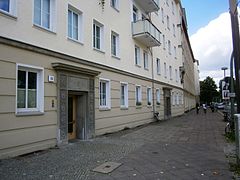
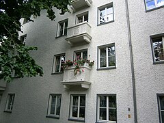
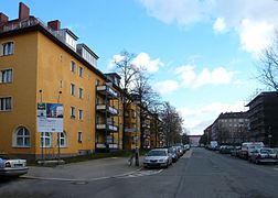
The apartment blocks are in a square, four-storey, horseshoe-shaped housing developments around green inner courtyards. Here and there are laundry bars in the courtyards, meadows lined with trees, play areas, and sometimes front gardens.
- Felix-Mendelsohn-Bartholdy-School: Egon-Schönhaar-Straße 18 → Felix-Mendelssohn-Bartholdy-Gymnasium. The school building was built in the 1920s as the 230th and 248th community school at 8 Wehlauer Straße. With the GSW development from 1938, the back of the 33rd and 34th elementary school was included in the development of Kurische Straße 31 and 31a to Bartensteiner Straße 5 as the eastern boundary of the central square (Kurischer Platz west of Bötzowstraße) as a facade closure. As a result of the war there was slight damage to this house front. In the 1950s there was a change of address to Eugen-Schönhaar-Straße 18 with the school name 33rd and 34th elementary school, then with the GDR school reform 33th and 34th secondary school. By naming: 33rd high school "Werner Kube" and 34th high school "Adolf Diesterweg".
- Turnvater-Jahn-Grundschule: John-Schehr-Straße 38 → Bötzow-Grundschule The cleared open space between Bötzow-, Hans-Otto-, John-Schehr-Straße was after an intermediate development in the 1960s at the end of the 1970s with a type of school for the extended secondary school "Käthe Kollwitz" (John-Schehr-Straße 38, Turnvater-Jahn-Grundschule → Bötzow-Grundschule) and its sports hall (Bötzowstraße 58) were built.
- Day care center and playgrounds

New building in the 1950s on John-Schehr- / Kniprodestrasse
Architectural element from the 1950s on John-Schehr-Strasse
Architectural element from the 1950s on Eugen-Schönhaar-Strasse

Green inner courtyard as a characteristic of the development

Access to the inner courtyard with Rudolf-Schwarz-Straße
.jpg)
.jpg)
.jpg)
.jpg)
.jpg)

Unrenovated yard at John-Scheer-Strasse (2007)
Refurbishment in John-Schehr- / Bötzowstraße (2011)

Children's playground with the transverse buildings of the old building on Danziger Strasse (2016)

Remaining development on John-Schehr- / Eugen-Schönhaar-Straße (2016)

Remaining development on Bernhard-Lichtenberg- / Eugen-Schönhaar-Straße (2016)


.jpg)
.jpg)
.jpg)
Individual evidence
- ↑ The Prenzlauer Berg funding area
- ^ FIS-Broker (Geoportal Berlin): Lebensweltlichorientierte spaces (LOR) - planning spaces
- ^ FIS Broker (map of Berlin 1: 5000 (K5 color edition)) of the Senate Department for Urban Development and Environment Berlin
- ↑ Block map 1: 5000 (ISU5)
- ↑ Basic data on urban development: LOR index
- ↑ Examples for the use of the LOR rooms
- ↑ Text from the Federal Archives: “Berlin, construction site, ruins Illus Martin 9/12/51 Berlin is building! The Dead City in the Greifswalder, Kurischen, and Kniproderstrasse in Berlin is now being rebuilt. Shown here: view of a construction site. "
- ↑ Zentralbild Zühlsdorf 7.2.1956: “Successes of the first five-year plan New apartments in the Prenzlauer Berg district of Berlin In Braunsberger-Strasse and Kniprode-Strasse in the Prenzlauer Berg district, where just a few years ago huge mountains of rubble testify to the fascist destruction of our capital Today, after the completion of the first five-year plan, there are new, beautiful houses. Under the leadership of the party of the working class - the Socialist Unity Party of Germany - the Berliners began in 1952 to free their capital from the traces of war and made space for new residential buildings. It was hard and hard work, but it was worth it and the successes are now visible to all the world. Shown here: In the first five-year plan, this new block of flats was built in Kniprode-Strasse with 113 comfortable apartments. In 1945 this part of the street was completely destroyed by SS bandits with flamethrowers. "
- ^ Elbinger Strasse . In: Berliner Adreßbuch , 1910, part III., P. 187. “← Falkenberger Straße → 36: construction site, 37: coal place, 38: new building - manager innkeeper, 39–41: construction sites, 42: storage place, 43: Stätteplatz, 44 : Storage area, 45: coal area, 46: storage area, 47-52: building sites, 53-56: site area (demolition company), 56.57: building site, 58.59: storage area (demolition company), 60: dairy owner, 61-64 storage area (demolition company), 65 : Building materials Exner, 66—70 construction sites ← Greifswalder Strasse → “(In 1910 all properties are owned by the Gilka-Bötzow heirs. For 1912, the owners are primarily master masons, renters and soil companies.).
- ^ Elbinger Strasse . In: Berliner Adreßbuch , 1912, Part III., P. 103.
- ↑ Braunsberger Strasse . In: Berliner Adreßbuch , 1912, Part III., P. 102. “Elbinger zur Goldaper Strasse three new buildings, on Kurischen Strasse construction sites” (The section south of Elbinger Strasse is built on and inhabited.).
- ^ Goldaper Street . In: Berliner Adreßbuch , 1912, part III., P. 292. "← Kniprodestraße → 1 to Kniprodestraße 110/2, 3: New building by master mason Doß / 4, 5: New building by dairy owner Goltz / 6: New building to master potter Hoier / 7: New building by architect Rings / 8: New building by Renker ← Braunsberger Straße → 9,9a: New building by architect Teutsch / 10–15: Building sites / 16: go. Kniprodestr. 111 ← Kniprodestrasse → “.
- ↑ Trakehner Street . In: Berliner Adreßbuch , 1912, Part III., P. 876. “New buildings on both sides of Elbinger and Kurische Strasse”.
- ^ Wehlauer Strasse . In: Berliner Adreßbuch , 1912, Part III., P. 919. “Elbinger to Rastenburger Strasse six new buildings, construction sites to Kurischen Strasse”.
- ^ Rastenburger Strasse . In: Berliner Adreßbuch , 1912, Part III., P. 700. "Number 1: to Greifswalder Straße 49: inhabited twelve-party house by master mason Hoppe, two new buildings of the Berlin Northeast building company".
- ↑ Curonian Street . In: Berliner Adreßbuch , 1912, Part III., P. 473. "From Greifswalder Strasse on the south side number 1 and on Trakehner Strasse new building, on to Kniprodestrasse construction sites."
- ^ Greifswalder Strasse . In: Berliner Adreßbuch , 1912, III., P. 311. “← Elbinger Strasse → tenement houses 48 and 49 ← Rastenburger Strasse → tenement house 50, new building 51 ← Kurische Strasse → 52–62: do not exist, 63–80: Gilka-Bötzowsche Heirs: 63/65 demolition companies, 66-69 construction sites, 70 innkeepers and master blacksmiths, 71 building materials, 72 ex. not, 73/74 Stätteplatz Bauunternehmen, 75–77 building materials store, 78–80: commercial space (woodworking, coal, fireclay goods, timber store, wheelwright / wagon grease, joinery, joinery) ← Ringbahn → “.
- ↑ Kniprodestrasse . In: Berliner Adreßbuch , 1912, III., P. 419. “← Ringbahn → 104: Kohlenplatz Louise Albers, 108: Stätteplatz Papierabfälle Meyer & Co. ← Kurische Strasse → New building 109, 21-party house 110 ← Goldaper Strasse → 111: tenement by G. Schulz from Rommelsburg, 112: at Elbinger Strasse 35, the tenement of innkeeper W. Neumann ← Elninger Strasse → “.
- ^ Wehlauer Strasse . In: Berliner Adreßbuch , 1921, III., P. 914. “← Elbinger Strasse → 1: Mietshaus Bau- und Terrain Akt.Ges. "Phönix" / 2: also Rastenburger Strasse 4, the apartment building of the roofer Gregor ← Rastenburger Strasse → 3: also Rastenburger Strasse 19, the apartment building by architect Wehnert / 4: construction site ← Kurische Strasse → 5–7: construction sites, 8: city of Berlin, administrator Rector Kirbis: 84th bread commission, 230 and 248th community school, revision inspection 35 of the city. Gas station, residents: secretary assistant, school caretaker, Rector F. Röhl, stoker / construction sites ← Lycker Strasse → construction sites ← Pregelstrasse → construction sites ← Lycker Strasse → construction sites ← Bartensteiner Strasse → construction sites ← Kurische Strasse → 19: construction site / 20 apartment building of the Nordost construction company ← Rastenburger Straße → 21: also Rastenburger Straße 3 apartment building of the property management company "Hansa" Stettin / 22: also Elbinger Straße 57 apartment building of the Bau- und Terrain Akt.Ges. “Phönix” ← Elbinger Straße → “.
- ↑ Interactive aerial photo comparison from 1928 to 2015 . Coordinate compilation of the aerial photos from 1928 and 2015 commissioned by Tagesspiegel 2016 for the whole of Berlin on the basis of Geoportal Berlin.
- ↑ Greifswalder residential complex, John-Schehr-, Eugen-Schönhaar-, Anton-Saefkow- Olga-Benario-Prestes-Straße
- ^ Greifswalder Straße (Kurische Straße to Ringbahn) . In: Berliner Adreßbuch , 1940, IV., P. 312. "East side: ← Kurische Straße → 52–62 (ongoing) Owner of Gemeinnützige Siedlgs.- u. Housing company Berlin mbH from SO36, Kottbusser Str. 1: 6- / 8-party residences 52–56 ← Neukuhrer Strasse → 6- / 8-party residences 57–62 ← Gumbinner Strasse → 63–80: construction sites, 80a: Deutsche Reichsbahn (railway maintenance office, train station Weißensee, station canteen, goods handling, innkeeper A. Seiffert) ← Ringbahn → // Bhf. Weißensee, 80b: construction site “.
- ^ Bötzowstrasse north of Elbinger Strasse . In: Berliner Adreßbuch , 1940, IV., P. 93. “(right side) ← Elbinger Strasse → 54/56 with Elbinger Strasse 46: tenement house, 58: new building, 60: tenement house Deutscher Herold with 50 tenants, 62/64 with Kurische Strasse 38: 40-party tenement house ← Kurische Strasse → ← Kurischer Platz → ← Bartensteiner Strasse → 66–88: new buildings / (left side) ← Elbinger Strasse → 55 / Elbinger Strasse 47: tenement house, 57 with Rastenburger Strasse 11: tenement house ← Rastenburger Strasse → 57/61 with Rastenburger Strasse 12: tenement house, 63 with Kurische Strasse 36: owner Alte Leipziger Versicherungsges. in Schöneberg ← Kurische Strasse → New buildings (without number) ← Ermländische Strasse → Construction sites ← Gumbinner Strasse → “.
- ↑ Have you ever been to the “Green City”?
- ↑ Bartensteiner Strasse . In: Berliner Adreßbuch , 1940, IV., P. 48. “← Gumbinner Straße → Left side: 1–3 new buildings / Right side: 2–14 new buildings ← Bötzowstraße →”.
- ↑ Warmian Road . In: Berliner Adreßbuch , 1940, IV., P. 204. “← Bötzowstraße → Left side: 1–15 new buildings ← Pregelstraße → 17–35 new buildings / Right side: 2–16 new buildings ← Pregelstraße → 18–32 new buildings ← Kniprodestraße → ".
- ^ Pregelstrasse . In: Berliner Adreßbuch , 1940, IV., P. 686. “← Kurische Straße → Left side: 1-11 new buildings ← Ermländische Straße → 13–19 new buildings / Right side: 2–10 new buildings ← Ermländische Straße → 12–20 new buildings ← Gumbinner Strasse → “.
- ↑ Curonian Street . In: Berliner Adreßbuch , 1940, IV., P. 483. “left side ← Greifswalder Strasse → 1–21: inhabited ← Wehlauer Strasse → 23–53 new buildings ← Strasse 65 → 55–73 new buildings”.
- ^ Gumbinner Street . In: Berliner Adreßbuch , 1940, IV., P. 337. “← Greifswalder Straße → Left side: Construction sites / Right side: 2–26: fully rented houses of the non-profit settlement and Housing company mbH ← Wehlauer Strasse → 28–32 new buildings ← Bartensteiner Strasse → 24–36 new buildings ← Bützowstrasse → 38–52 new buildings ← Pregelstrasse → 54–70 new buildings ← Kniprodestrasse → “.
- ↑ Kniprodestraße: from Elbinger Straße to Ringbahn . In: Berliner Adreßbuch , 1940, IV., P. 428. “On the west side in declining numbering from the Weißenseer Feldmark. ← Ringbahn → 92.93: Hamb. Holzkontor H. Hahne, 94–96: Construction sites ← Gumbinner Strasse → 97–102: New buildings ← Ermländische Strasse → 103–108: New buildings ← Kurische Strasse → 109 with Kurische Strasse 68: 17-party apartment building, 110 with Goldaper Strasse 1: Tenement under compulsory administration ← Goldaper Strasse → 111 with Goldaper Strasse 1: tenement of Tillmann and comrades, 112 with Elbinger Strasse 35: tenement with Goldaper Strasse 1: tenement ← Elbinger Strasse → “(In the address book, Pregelstrasse is (probably) wrongly in the picture of the situation recorded between Gumbinner Straße and Ringbahn, in contrast to the text).
- ↑ Damage to buildings 1945. Verlag B.Aust i. A. of the Senator for Urban Development and Environmental Protection ( page no longer available , search in web archives ) Info: The link was automatically marked as defective. Please check the link according to the instructions and then remove this notice.
- ↑ compare the aerial photos from 1943, 1953, 2014 on Google Earth - coordinates 52 ° 32'04 "(N) / 13 ° 26'14" (E)
- ↑ GSW settlement "Green City"
- ↑ Redesign of a school yard at the Felix-Mendelssohn-Bartholdy-Gymnasium
- ↑ Securing and energetic renovation of the sports hall of the Turnvater-Jahn elementary school (today Bötzow elementary school)
- ↑ Refurbishment of the school building of the Turnvater-Jahn-Schule (today Bötzow-Grundschule)
- ↑ Upgrading of the two playgrounds in Anton-Saefkow-Park
Remarks
- ↑ Due to the division of the city and independent authorities for street naming, there has also been a Bernhard-Lichtenberg-Straße under No. 522 in the Charlottenburg-Wilmersdorf district, Charlottenburg-Nord district, since 1962.
- ↑ The planned Braunsberger Straße was to be continued further north via streets 9a, 7d, 9 of section XIII and a ring railway bridge as street 11 . Beyond the ring road, which had existed since 1871, via road 12, this guide to the Weichbild boundary (Weissensee) was planned. This tour was canceled in 1938 with the development of the Green City and ultimately from 1948 to 1950 with the rubble mountain, since 1955 as a public park.
- ↑ Charlottenburg was an independent city west of Berlin in 1912.
- ↑ The properties Trakehner Straße 2 (Bötzowstraße 58) and Kurische Straße 40, 42 (John-Schehr-Straße) were still undeveloped around 1945.
- ↑ For example, the Oderbruchkippe (→ Volkspark Prenzlauer Berg ) was heaped up over the rubble railway on Oderberger Straße beyond the Ringbahn .
- The years of the address books naturally relate to the construction situation of the previous year. For the properties designated as “construction site” in the address book, there is no need for construction activity to exist, it is a category.
literature
- Angela M. Arnold, Gabriele von Griesheim: rubble, railways and districts. Berlin 1945–1955. Self-published, Berlin 2002, ISBN 3-00-009839-9 .
Coordinates: 52 ° 32 ' N , 13 ° 26' E