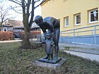
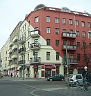
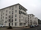
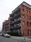
List of streets and squares in Berlin-Prenzlauer Berg
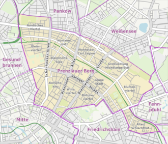

01 Kastanienallee / Teutoburger Platz
02 Kollwitzplatz (Kollwitzkiez)
03 Winsstraße
04 Bötzowviertel
05 Falkplatz (Gleimviertel)
06 Helmholtzplatz / Pappelallee
07 Thälmannpark
08 Saefkowstraße (Green City)
09 Conrad-Blenkle-Straße area at the Velodrom
10 Alter Schlachthof
11 Arnimplatz (Nordisches Viertel)
12 Humannplatz / Stahlheimer Straße
13 Grellstraße / Ostseeplatz (residential area Carl-Legien)
14 Greifswalder / Michelangelostraße
15 Blumenviertel (the 'Blümchenviertel' has become a common distinction)
The list of streets and squares in Berlin-Prenzlauer Berg describes the street system in the Berlin district of Prenzlauer Berg with the corresponding historical references. At the same time, this compilation is part of the lists of all Berlin streets and places .
overview
The district is subdivided into individual areas such as the Bötzowviertel or the residential area of Carl Legien - a large housing estate built between 1928 and 1930 according to plans by Bruno Taut and Franz Hillinger , which is a listed building. In July 2008, the residential city was added to the UNESCO list of world cultural heritage as one of six Berlin Modernist housing developments .
The system of streets and squares also includes the new building complex around Ernst-Thälmann-Park (built between 1970 and 1980 with living space for around 10,000 people), residential areas between Grellstrasse and Ostseestrasse , most of which date from the 1920s, and the Alter Schlachthof development area , which arose from the closure of the central cattle yard in the 1990s (see map series, no. 10). In the area around Greifswalder Straße , around Prenzlauer Allee and Schönhauser Allee there are numerous tenement blocks from the construction period around 1900, which were needed as inexpensive accommodation for the families of the factory workers due to the increasing settlement of industrial companies.
The first planned streets were named after French locations between 1874 and 1890 or from 1881 to around 1910 after locations in the German provinces of Pomerania , East Prussia and West Prussia . Street names were later assigned to countries or cities in Scandinavia and Belgium . Many street names honor famous people, politicians or people from regional history. The traffic routes in the residential area around Snowdrop and Lily of the Valley Street were named after flowers. In the mid to late 1970s, the large Michelangelostraße estate was built on the former allotment garden , as this offered a contiguous building area in the Prenzlauer Berg district with its inner city location in East Berlin, increasingly referred to as the Mühlenviertel after its location on the former Windmühlenberg.
The name "Prenzlauer Berg" was first mentioned in a decree of the Royal Police Headquarters from 1826 for the area of the windmills and vineyards. Prenzlauer Berg has 165,003 inhabitants (as of December 30, 2019) and comprises the postal code areas 10405, 10407, 10409, 10435, 10437, 10439, 10119, 10247 and 10249. There are 208 streets dedicated to this area and twelve named city squares. 14 of the streets also belong to the neighboring districts. The total length of all federal and city roads in Prenzlauer Berg is 110.8 kilometers. The streets Otto-Braun - / Greifswalder Strasse with the B 2 , Petersburger / Danziger Strasse / Schönhauser Allee with the B 96a and Prenzlauer Allee with the B 109 have the status of a federal highway .
The renaming of some streets named after communists or politicians from 1992 onwards, in accordance with a resolution of the Senate , was accompanied by a lot of resistance from the district office and affected residents. It was not until 1995, when the then building senator Herwig Haase intervened, that the name of the large streets Dimitroffstrasse and Artur-Becker-Strasse in particular was changed into Danziger Strasse and Kniprodestrasse .
Overview of streets and squares
The following table gives an overview of the streets and squares in the district as well as some related information.
- Name / location : current name of the street or square. Via the link Location , the street or the square can be displayed on various map services. The geoposition indicates the approximate center of the street length.
- Traffic routes not listed in the official street directory are marked with * .
- Former or no longer valid street names are in italics . A separate list may be available for important former streets or historical street names.
-
Length / dimensions in meters:
The length information contained in the overview are rounded overview values that were determined in Google Earth using the local scale. They are used for comparison purposes and, if official values are known, are exchanged and marked separately.
For squares, the dimensions are given in the form a × b for rectangular systems and for (approximately) triangular systems as a × b × c with a as the longest side.
If the street continues into neighboring districts, the addition ' in the district ' indicates how long the street section within the district of this article is. - Name origin : origin or reference of the name.
- Notes : further information on adjacent monuments or institutions, the history of the street and historical names.
- Image : Photo of the street or an adjacent object.
-
SV (= city district): Assignment according to the plan shown above
(Note: G = street between two residential areas that cannot be fully assigned to either of the two)
| Name / location | Length/
Dimensions |
Origin of name | Date of designation | Remarks | image |
SV |
|---|---|---|---|---|---|---|
|
Aalesunder Strasse
( Location ) |
120 | Ålesund , city and municipality in the Møre og Romsdal province in Norway | July 18, 1907 | The first name was Straße 9f, Section XI of the development plan. It's a short north-south street between Ibsenstraße and Bornholmer Straße. A quiet, yet centrally located, cobblestone street. The houses mainly consist of buildings from the 1920s. |

|
11 |
| Agnes-Wabnitz-Strasse
( Location ) |
100 | Agnes Wabnitz (1841-1894), women's rights activist | Oct 23, 2000 | The road was opened to public traffic on November 7, 2002. It is U-shaped and encloses a narrow green area. |

|
10 |
| Ahlbecker Strasse
( Location ) |
290 | Ahlbeck , seaside spa on the island of Usedom , Mecklenburg-Western Pomerania | Nov 9, 1911 | The first name was Street 16b, Section XII of the development plan. The inner-city residential street runs between Dunckerstraße and Prenzlauer Allee. The street consists of a mixture of old buildings, post-war buildings and new buildings and some commercial space. A section of the inner parking ring runs along the street | 06 | |
| Altenescher Weg
( Location ) |
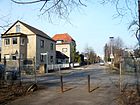
350 | Altenesch , municipality in Lower Saxony | Feb. 27, 1936 | The first name was Street 37 of the zoning plan. The path leads from Kniprodestrasse in a south-easterly direction in a straight line through a residential area to Süderbrokweg on the edge of the Prenzlauer Berg park . |
|
15th |
| At Falkplatz
( Location ) |
140 | Adalbert Falk (1827–1900), Prussian lawyer and minister of education | Sep 15 1906 | The first name was Street 16a, Section XI of the development plan. It is the southern continuation of Ystader Straße and runs between Gleimstraße and Gaudystraße in a north-south route east along the town square that gives it its name . |

|
05 |
| At Friedrichshain
( Location ) |
930 + 230 | Volkspark Friedrichshain located here | Oct 28, 1880 | According to the development plan, the first street sections in 1845 were called Straße 25, Straße 2 and Straße 32, Section XIII . With the increasing construction activity, the traffic routes were merged and named after the adjacent Volkspark Friedrichshain . Between 1993 and 1997 there was a wagon castle for some alternative living on the property at Am Friedrichshain 16-18 at the corner of Bötzowstraße , which was cleared after a decision of the BVV to make space for new buildings.
The former Saalbau Friedrichshain restaurant (demolished in 1993) and the Friedrichshain film theater are or were worth mentioning here . West-Ost-Straße runs between Otto-Braun-Straße and the confluence with Virchowstraße, after which it continues as Kniprodestraße . A section of the Hönower Weg, number 7 of the 20 green main routes , connects the Volkspark Friedrichshain with the outskirts of Hönow as a hiking and cycling route. |
 |
04 |
| At the fairytale fountain
( Location ) |
124 | nearby fairytale fountain | Nov 16, 2016 | The private access route between the lots at Am Friedrichshain 32 and 34 was named with the two developed lots 5 and 7. This access road for the site, which was built in 2017, complements the parallel Am Schweizergarten to the west . The "Bötzowviertel Projektentwicklungsgesellschaft GmbH & Co. KG" had acquired the property at Greifswalder Strasse 6–7 as well as the outgoing private access road. In the first half of the 20th century, the Schweizergarten amusement park was located here, which developed from the beer garden in 1900. This designation was carried out in accordance with Section 5, Paragraph 1, Clause 2 of the Berlin Roads Act (BerlStrG), and a query from the other road and green space authorities in Berlin and the Berlin-Brandenburg Statistics Office had shown that there were no identical designation intentions or identical street names in Berlin. The street number is, Am Märchenbrunnen is part of the Bötzowviertel planning area (03 07 16 39).
10644 Am Meisenwinkel 002 002 G 03 02 02 09 Roset 13158 |

|
04 |
| At the Swiss garden
( Location ) |
290 | formerly the Swiss Garden , an amusement park in the Bötzowviertel | Nov 8, 2005 | The name is intended to recall a beer and coffee garden that was created on the site of the historic Schneider Weißbier brewery in 1867 and which developed into an amusement park from 1900 onwards. The name Schweizer Garten was intended to give it the flair of the well-known holiday destination. The private road opens up the new residential park Prenzlauer Gärten (between Greifswalder Strasse and Am Friedrichshain), which has been created on this area , in which Berlin's first townhouse district was built based on the English model. Quiet residential street that ends as a dead end for cars. At night, the access to the residential area is blocked with a roller shutter. On foot, there is a passage at the northern end of the newly laid out street, both in the direction of Greifswalder Straße and Straße am Friedrichshain. |

|
04 |
| At the cattle yard
( Location ) |
100 | Central cattle yard or cattle yard existing on the site from 1881 to 1991 | Nov 8, 2005 | On January 22, 2008, the road was opened to traffic, but only to a limited extent for pedestrians and cyclists. It connects the street Viehtrift with the Eldenaer street in a north-east-south direction. |

|
10 |
| At the vineyard
( Location ) |
500 | Weingarten, an adjoining show garden | Aug 20, 2015 | The newly named street is located in the section from the allotment garden "Neu Berlin" to the lily of the valley street. The triangular green space behind the school is called Syringenplatz , the street running north and northwest from the corner of Syringenweg and Maiglöckchenstraße was also called Syringenplatz. The street in the north-west of the Kaufland area on the green area was ignored and was named Am Weingarten in 2014, including the previously unnamed public path to the KGA Neu-Berlin. Thus, the streets in the flower district, behind the commercial area Storkower road are named and for the nationwide introduction of ALKIS are geo-referential addresses introduced. The Förderverein Weingarten Berlin e. V., because visitors to the vineyard who are unfamiliar with the location often missed their destination, as the Syringenplatz road encircled the Syringen “park” on both sides in a V shape, especially since the public road Syringenweg also turns at right angles. According to the legal requirements of the Senate, double designations are to be gradually eliminated. The straight route to the KGA 'Neu-Berlin' was the starting point of the street name Am Weingarten and gives the direct route to the Weinschaugarten. The areas owned by the State of Berlin intended for naming and renaming are recorded in the real estate cadastre: corridor 115, parcels 186 and 188 (partial area), parcel 193 (partial area); Corridor 215, parcel 194 and 197. The parcels mentioned are in place. The same or identical street names are not available in Berlin and the key number in the Berlin street register was 10852. For the district budget, 960.00 euros were due for street name signs including posts. Plots 7 (northwest, previously Syringenplatz 27/29) and 8–16 (straight, previously Sigridstrasse 3-5a, plus 16 of Weingarten) were assigned to the newly named street. |

|
15th |
| At the Eldenaer Höfe
( Location ) |
520 | Eldenaer Höfe, borders with the gables of the old cattle yards on Eldenaer Straße | March 30, 2011 | The private street on August-Lindemann-Strasse , Zum Langen Jammer and Eldenaer Strasse was named at the request and at the expense of the owner of the construction site, cds Wohnbau Berlin GmbH. In the Berlin street directory, the street with the number 10645 and 520 m length is marked as a semi-public private street ( RBS class : "STRA", OKSTRA : "P"). The "cds Wohnbau Berlin GmbH" built 28 row houses on the area of the former cattle stables in the southeast of the old slaughterhouse (Zentralviehhof) , which were accessed through four planned streets. The main route of the construction site Planstrasse 1 lies between August-Lindemann-Strasse and Eldenauer Strasse (with the border to Lichtenberg) and the branching planstrasse 2-4 became three side branches, the east of the corner with Eldenaer Strasse is built on one side and borders on the opposite side of the Eldenaer Strasse industrial estate. When construction began, the old cattle yards were still standing and were dismantled except for the historic gables. On the southern street (formerly Planstrasse 1) these gables form the front of the houses 1, 3, 2, 31, 33, 57. In contrast, the 4-family house at An den Eldenaer Höfen 30 is executed in the surrounding style. Three access sections lead to the north-east of the Langen Jammer with the terraced houses 5–29 (odd, west) and 2–28, followed by 31–55 (odd, west) and 32–56, the western lead is only built on one side with 57–83 . A row of houses to the west is addressed as August-Lindemann-Straße 4a – 4p and does not belong to the quarter. In the designation application, the building concept reads: "The street name 'An den Eldenaer Höfen' is intended to refer to both the historical (the old cattle yards) and the existing (Eldenaer Straße) and to represent a connection between the two." |

|
10 |
| Andersenstrasse
( Location ) |
120 | Hans Christian Andersen (1805–1875), Danish writer | July 18, 1907 | The first name was Street 9c, Section XI of the development plan. It's a short north-south street between Ibsenstraße and Bornholmer Straße. To the north it turns into an access path to an allotment garden. It is a quiet, yet centrally located, cobblestone street. The houses consist of old and new buildings. The road ends at the Bornholm II allotment garden.
You will find green spaces for outdoor activity on the former strip of the wall. |

|
11 |
| Angermünder Strasse
( Location ) |
130 | Angermünde , city in Brandenburg | Nov 9, 1863 | The first names were Straße 21, Section XI of the development plan and Eselsgang (around 1827–1863). The landowner Wilhelm Griebenow bought donkeys to ride as a leisure opportunity for young people. He had this road officially laid out and paved in 1863. |

|
01 |
| Anton-Saefkow-Strasse
( Location ) |
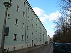
770 | Anton Saefkow (1903–1944), communist and resistance fighter against the Nazi regime | 29 Sep 1955 | The first name in the 19th century was Straße 7 d , from November 9, 1911 it was called Gumbinner Straße after the East Prussian town of Gumbinnen , since 1945 Gussew in Russia . As a result of the redevelopment of the area, the (old) Gumbinner Straße was closed in 1939. A newly routed street, which was first called Straße 61 , was named Gumbinner Straße in March 1939. On the southern edge of Anton-Saefkow-Park, it is a one-way street from Greifswalder to Kniprodestrasse. After several years of discussion on opening up to cyclists in oncoming traffic, the Pankow road traffic authority ordered parallel parking in July 2016. Because the residents remained unasked, the BVV reintroduced the old situation with diagonal parking for cyclists in March 2017 . A separate cycle path on the existing strip along the north side of the road will enable cyclists to ride in the opposite direction. |
|
08 |
|
Arnimplatz
( Location ) |
160 × 160 | Achim von Arnim (actually Carl Joachim Friedrich Ludwig von Arnim; 1781–1831), writer | Sep 15 1903 | The first name was Street H / 1, Section XI of the development plan. During the last Ice Age a subsidence formed there, creating a small lake, the Pankpfuhl. It was only after the turn of the 20th century that construction began around the square. Green spaces are rare in the densely populated residential area around Paul-Robeson-Straße, which is why the square is always well attended. A large playground, benches and sunbathing lawns allow residents to relax. On the square, a bronze sculpture created by Michael Klein in 1996 commemorates Achim von Arnim and his wife Bettina von Arnim. A fountain, also designed by Michael Klein, unfortunately does not donate water even when it is very hot. This may be due to a lack of funds to cover the operating costs or to the technology that is no longer working. The fountain sculpture is called Bettinas Bank and was erected in 1997 on the east side of the park. |

|
11 |
|
Arnswalder Platz
( Location ) |
180 × 120 | Arnswalde, town in Neumark , since 1945 Choszczno in Poland |
1902 (with interruptions) |
After Hobrecht plan he was first as a place A designated. From 1900 to 1904 it was designed as a jewelery space according to plans by Hermann Mächtig . Between 1937 and 1947 it was called Hellmannplatz after Fritz Hellmann, a National Socialist who was killed in a political conflict in 1932. After 1945 it was renamed Arnswalder Platz. It was nameless between 1974 and 1995, when the park was given its original name back. |

|
04 |
| August-Lindemann-Strasse
( Location ) |
350 | August Lindemann (1842–1921), architect and construction officer (central cattle and slaughterhouse) | Oct 23, 2000 | The first part from Hermann-Blankenstein-Strasse was opened to public transport on October 1, 2003, the second, smaller part from Eldenaer Strasse was added on March 21, 2007. The road can only be used continuously by cyclists and pedestrians. The former gate entrance from Eldeaner Straße to the slaughterhouse area has not been usable for motor vehicles since the shopping center was opened.
In the north area is the listed rest of the pedestrian bridge called " Langer Jammer ", which crosses the railway site. Before the massive redevelopment of the site, it established a connection between Storkower Strasse and Eldenaer Strasse. |
 |
10 |
|
Behmstrasse
( Location ) |
460 (in the district) |
Heinrich Wilhelm Behm (1708 to after 1780), pharmacist, builder of the Luisenbad |
March 8, 1894 (with interruptions) |
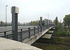
The first name was Straße 8, Section XI of the development plan. In Prenzlauer Berg, Behmstrasse was called Helmut-Just-Strasse from 1960 to 1993 after Helmut Just , a people's police officer who was shot at the Berlin sector border. The name Behmstrasse was retained in Wedding. It runs between the Gesundbrunnen district (starting at the Behmstrasse bridge ; lower picture) to Malmöer Strasse. A small part of the street is in the Prenzlauer Berg district of Pankow, the houses consist mainly of old buildings and some offer a good view over the railway area to the city center. The Behmstrasse bridge over the railway site separates the two districts of Mitte and Pankow. There is a BSR recycling center on the south side of the street. |
|
11 |
| Belforter Strasse
( Location ) |
360 | Belfort , industrial and garrison town in France | June 25, 1875 | The first name was Straße 5, Section XII of the development plan. Several streets in this quarter are named after places that were important during the Franco-Prussian War . |

|
02 |
| Bergener Strasse
( Location ) |
120 | Bergen , Norway's second largest city and municipality | Jul 18, 1907 | The first name was Straße 9d, Section XI of the development plan. It's a short north-south street between Ibsenstraße and Bornholmer Straße. To the north it turns into an access path to an allotment garden. It is a quiet, still centrally located, cobblestone street, the houses consist mainly of old and new buildings. |

|
11 |
|
Berlin street
( Location ) |
420 (in the district) |
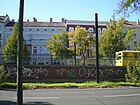
Old Berlin , the direction of the street at that time | around 1895 | The previous names were Berliner Weg (after 1691 to around 1895), Berliner Chaussee (1824 to around 1895), all of which referred to the traffic routes to and from Old Berlin . Berliner Straße forms the border to the Pankow district between Esplanade, Bornholmer Straße and Wisbyer Straße . |
|
11 |
| Bernhard-Lichtenberg-Strasse
( Location ) |
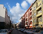
370 | Bernhard Lichtenberg (1875–1943), theologian and resistance fighter against the Nazi regime, Righteous Among the Nations | 4th Sep 1974 | Bernhard-Lichtenberg-Straße was first called Straße 7e, Section XIII / 1 of the development plan. It was in 1911 after the East Prussian city of Rastenburg in Rastenburger street renamed. |
|
08 |
|
Björnsonstrasse
( Location ) |
120 | Bjørnstjerne Bjørnson (1832–1910), Norwegian poet and politician, Nobel Prize winner 1903 | Oct 16, 1911 | The first name was Straße 9, Section XII of the development plan. It's a short north-south street between Ibsenstraße and Bornholmer Straße. The original road grid up to the Eschengraben (Prenzlauer Berg / Pankow border) was not implemented, so the street-width route only runs as a parallel poplar and Björson path through the allotment garden. At the end of the street at the corner of Ibsenstraße there is a turning loop for the tram . This was set up with the separation of the route through the construction of the wall on the grounds of the KGA 'Bornholm II'. To the south, the route bends slightly to the east as Malmöer Straße. This quiet, still centrally located, cobblestone street, only on the east side are old buildings and have a clear view of the allotment gardens Bornholm I on the west side of the street. There is the reversing loop for trams. |
|
11 |
|
Bötzowstrasse
( Location ) |
1140 | Bötzow , Berlin's large landowner and brewer family, after whom the Bötzowviertel was named | Jan. 9, 1901 | The first names were Straße 1 and Straße 5, Section XIII / 1 of the development plan. It (s) originally ran from Am Friedrichshain to Elbinger Straße . On October 10, 1936, Trakehner Strasse was incorporated into Bötzowstrasse. On March 29, 1939, the street 66 was also named Bötzowstrasse. At the confluence with Am Friedrichshain is the Filmtheater am Friedrichshain . |
|
04 |
|
Bornholmer Strasse
( Location ) |
1000 (in the district) |
Bornholm , Danish island in the Baltic Sea | 22 Aug 1903 | The first name was Straße 1, Section XI of the development plan from 1862 ( Hobrecht plan ). Bornholmer Straße connects the districts of Prenzlauer Berg and Gesundbrunnen . It is part of the planned outer ring road with Seestrasse , Osloer Strasse , Bornholmer Strasse, Wisbyer Strasse and Ostseestrasse . It is a noisy, centrally located main road in the districts of Mitte (Wedding) and Pankow (Prenzlauer Berg). In the Prenzlauer Berg district there are predominantly old buildings. The tram runs on the wide central island. To the east of Bornholmer Straße S-Bahn station, the Bornholm I allotment garden is located directly on the street. The Bösebrücke separates the Weddinger part of Bornholmer Strasse from the larger part of the street in the Pankow district. On the Pankow side, right next to the bridge, is Platz des 9 November, which commemorates the day the Berlin Wall fell. Sections of the Wall Trail, Inner Parkring and Lübarser Weg are on the street . |

|
11 |
| Buchholzer Strasse
( Location ) |
220 | Buchholz | Apr 24, 1873 | The first name was Straße 17, Section XII of the development plan. In 1870/1871 the property area Buchholzer Straße, Greifenhagener Straße, Pappelallee and Schönhauser Allee was built with residential houses by the non-profit building company. |

|
06 |
|
Cantian Street
( Location ) |
550 | Christian Gottlieb Cantian (1794–1866), stonemason and master builder; Manufacturer of the large granite bowl in the pleasure garden | Sep 15 1903 | The first name in the Hobrecht plan was Straße 24, Abt. XI . A street laid out in Mitte in 1839 was named Cantianstraße after the owner of a house who was also a stonemason . After this street was abandoned due to new buildings, street 24 in Prenzlauer Berg was given its name in 1903 . In 1912 the city of Berlin had acquired part of the parade ground and the Cantianstrasse, which originally only ran from Gleimstrasse to Gaudystrasse, could be extended to Schönhauser Allee . The Cantianstrasse stadium was created from the former parade ground, and later the Friedrich-Ludwig-Jahn-Sportpark . It is a cobblestone street with mostly residential buildings on the eastern side. |

|
05 |
| Chodowieckistraße
( Location ) |
640 | Daniel Chodowiecki (1726–1801), engraver, graphic artist and illustrator | Sep 15 1906 | The first name was Street 29a, Section XII of the development plan. The street connects Prenzlauer Allee and Greifswalder Straße . It is located in a neighborhood that bears the names of artists and writers. |

|
03 |
| Choriner Strasse
( Location ) |
940 | Chorin , municipality in Brandenburg with the monastery of the same name | Oct 10, 1863 | The previous names were Hinter dem Weinberg (around 1770 to the end of the 18th century) and Hohlweg vor dem Schönhauser Thor (end of the 18th century to 1863). The Choriner Straße forms the border to the Mitte district between Zehdenicker Straße and Schwedter Straße . In the basement area of the old buildings from the beginning of the 20th century, remnants of viticulture (furrows, vine roots) have been preserved. Houses 2–6, 12–14, 42/43, 80–83 and 85 are listed architectural monuments from the Wilhelminian era . |

|
01 |
| Christburger Strasse
( Location ) |
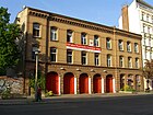
590 | Christburg, town in the province of West Prussia , since 1945 Dzierzgoń in Poland | Sep 1 1892 | The first name was Street 29, Section XII of the development plan. In this street there are two listed school complexes, built according to plans by Ludwig Hoffmann : House number 7 is the former 239th and 296th community school with attached teachers' dormitory and the walling, which was built between 1906-1908 (see picture), is located under number 14 the former community dual school with a teacher's house, gym and surrounding wall. |
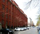
|
03 |
| Christinenstrasse
( Location ) |
490 | Christine, female name | 25 Aug 1860 | The previous name was Mühlenweg (around 1748-1860). The land on which the road was laid belonged to Minister of State Count von Wylich and Lottum . Some chroniclers suspected that the street was named after his wife, but this cannot be confirmed because none of her first names was Christine, but Friederike Sophie Luise. |

|
01 |
| Chrysanthemum Street
( Location ) |
90 | Chrysanthemums , genus of plants from the sunflower family | March 23, 1925 | The name in the zoning plan was street E of the zoning plan. It is a short access road between Schneeglöckchenstraße (northwest) and Oderbruchstraße (southwest), not continuous for motor vehicles. The street is located in the Blümchenviertel, this name has become naturalized by residents due to the proximity to the Volkspark opposite the name Blumenviertel (Rudow, Weißensee). |

|
15th |
| Cohnstrasse
( Location ) |
190 | Lothar Cohn (1908–1944), resistance fighter against the Nazi regime | Jan. 31, 1952 | The first name in the development plan was Straße 42 , in 1938 the traffic route was named Zillebekeweg after a place in Flanders (Belgium), since 1976 part of Ypres . It is a small, quiet residential street with early GDR buildings, the houses have been renovated. There is hardly any car traffic in the dead end. |
|
13 |
| Conrad-Blenkle-Strasse
( Location ) |
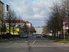
830 | Conrad Blenkle (1901–1943) politician and resistance fighter against the Nazi regime | 4th Sep 1974 | First there were street 30 and street 48, Dept. XIII . In March 1891 it was renamed Thorner Straße after the West Prussian town of Thorn (since 1945 Toruń in Poland). The Heinrich-Schliemann-Gymnasium is located here and in the southern area the Catholic Church “Corpus Christi” including the parish and parish hall in the row of houses. |
|
09 |
| Cotheniusstrasse
( Location ) |
320 | Christian Andreas Cothenius (1708–1789), doctor and medical specialist in the hospital system | Apr 24, 1890 | The first name was Street 26, Section XIII / 1 of the development plan. In 1723 it was a branch of the Landsbergische Landweg , which led to Landsberg / Hohenschönhausen. |

|
09 |
| Cyan Street
( Location ) |
260 | Cornflower (Centaurea cyanus), species of the sunflower family | March 23, 1925 | The name of the development plan was street C . It runs from north to south between Sigridstrasse and Lily of the Valley Road . |

|
15th |
| Czarnikauer Strasse
( Location ) |
390 | Czarnikau, district town in the province of Poznan , since 1945 Czarnków in Poland | Sep 15 1906 | The first name was Straße 11a, Section XI of the development plan. It connects the Malmöer with the Schönfließer Straße in a west-east direction. Its western continuation is the Finnish Road. |

|
11 |
|
Dänenstrasse
( Location ) |
630 | Danish , Scandinavian people, the predominant population of Denmark is | 4th July 1904 | The first name was Straße 12, Section XI of the development plan. The Catholic St. Augustius Church dominates the streets here. The central cobblestone residential street is bordered on the south side by the Berlin Ringbahn . From the front buildings with mostly good old building fabric, you have a relatively clear view of the train, which runs in an incision and can hardly be heard. At the level of Schönfließer Strasse, a footbridge leads over the Ringbahn to Sonnenburger Strasse. A section of the inner parking ring is located on the street . | 11 | |
|
Danziger Strasse
( Location ) |
3000 | Danzig, port and former Hanseatic city in the province of West Prussia , since 1945 Gdańsk in Poland |
Feb. 23, 1874 (with interruption) |
The first names were Communicationsweg (1822–1874), Elbinger Strasse for the section between Greifswalder Strasse and Landsberger Allee and Dimitroffstrasse (1950–1995). Danziger Strasse is part of the B 96a and leads from Schönhauser Allee south-east to Landsberger Allee , where it turns into Petersburger Strasse. It borders on the residential district 03. The wide, busy main road in the Prenzlauer Berg district has the tram route in the middle of the street. There are mostly old buildings in the centrally located street. |

|
G |
| Diedenhofer Strasse
( Location ) |
220 | Diedenhofen, German name of the city of Thionville in France | 28 Sep 1885 | The first name was Straße 34, Section XII of the development plan. It runs between Knaackstrasse and Belforter Strasse in a north-east-south-west direction and forms a boundary for the green area around the water tower. | 02 | |
| Diesterwegstrasse
( Location ) |
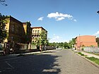
650 | Adolf Diesterweg (1790–1866), educator | March 17, 1891 | The first name was Street 25, Section XII of the development plan. The previously unnamed part of the street between the Prenzlauer Berg district office and the Zeiss large planetarium was incorporated into Diesterwegstraße on February 1, 1993. It makes a 90-degree bend with it. Within the Ernst-Thälmann-Park there is a public playground with ceramic mosaic play elements, which probably represent a relationship with the namesake. This includes a snake, a boat, flowers and other things. |
|
07 |
| Dietrich-Bonhoeffer-Strasse
( Location ) |
360 | Dietrich Bonhoeffer (1906–1945), theologian and resistance fighter against the Nazi regime | 4th Sep 1974 | The first name was Straße 4a, Section XII / 1 of the development plan. In 1902 it was named in Woldenberger Straße after the German town of Woldenberg in Pomerania, since 1945 Dobiegniew in Poland. |

|
04 |
| Driesener Strasse
( Location ) |
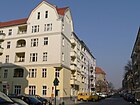
460 | Driesen, town in the province of Brandenburg , Drezdenko in Poland since 1945 | Sep 15 1903 | The first name was Straße 13, Section XI of the development plan. It runs in a north-south direction between Bornholmer Strasse and Dänenstrasse and is the southern continuation of the North Cape Road. |
|
11 |
| Dunckerstrasse
( Location ) |
2000 | Hermann Duncker (1817–1893), member of the Prussian National Assembly, second mayor of Berlin | Jan. 18, 1892 | Around 1865 it was laid out as Straße 14, Section XI of the development plan. The street was named after him during Duncker's lifetime. The road 14 , west of the circle line located bridge, was included in the Dunckerstraße on 23 January 1913th It now leads from Wisbyer Straße via the S-Bahn to Danziger Straße. |
 |
12 |
|
Eberswalder Strasse
( Location ) |
520 | Eberswalde , district town in Brandenburg | April 12, 1889 | The first name was Straße 53, Section XI of the development plan. As an extension of Bernauer Strasse, Eberswalder Strasse leads to Schönhauser Allee , where it becomes Danziger Strasse . The centrally located and busy street is in the middle of the trendy neighborhood of Prenzlauer Berg, some residential buildings offer an unobstructed view of the Mauerpark and the Friedrich-Ludwig-Jahn-Sportpark. There is a large police station directly opposite the Mauerpark. |

|
01 |
| Edith-Stein-Strasse
( Location ) |
140 | Edith Stein , Catholic philosopher and women's rights activist of Jewish origin, resistance fighter, she converted with the religious name Teresia Benedicta of the Cross and was canonized | June 29, 2011 | Edith-Stein-Straße is a new road on the site of the former central cattle yard (area of the old slaughterhouse) and is located between Erich-Nehlhans-Straße and Zur Marktflagge . The intention to name the private street in "Edith-Stein-Straße" was given to the district assembly for information and on May 11, 2011 it was noted and resolved without discussion. The designation was made at the request of the owner of the construction site of AVILA Management & Consulting AG. the private road. They planned the Avila Carre residential complex, whose properties are accessed via the private road. For the AVILA Group, a Christian order of values with a bond with the Carmelites is characteristic, as the applicant named herself after Saint Teresa of Avila. Edith Stein, a Jew, converted to the Roman Catholic Church and from then on lived her life as a Carmelite. With the naming of this street, the memory of Edith Stein, who was murdered by the National Socialists, was preserved and honored. In addition, with this designation, the Pankow district office meets the requirements for greater consideration of women’s personalities. Inquiries from the other civil engineering offices in Berlin and the Berlin-Brandenburg Statistics Office revealed the uniqueness of the street name. On the street are the owner-occupied single-family houses 1–12 (continuous, west side) with parking space and house gardens. The buildings on the east side belong to the guild , the buildings on the bordering streets belong to them. The street (RBS class: STRA) is recorded as a municipal street ( OKSTRA class : G) in the Berlin street directory as 10718. |

|
09 |
| Einsteinstrasse
( Location ) |
490 + 90 | Albert Einstein (1879–1955), physicist and Nobel Prize winner | Feb 14, 1964 | The street runs from Storkower Straße to Hanns-Eisler-Straße and opens up the residential area between Storkower and Michelangelostraße that was built in the late 1950s . It borders the Einsteinpark in the northwest . |

|
14th |
| Eldenaer Strasse
( Location ) |
1200 | Eldena , part of the city of Greifswald in Mecklenburg-Western Pomerania | 29 Aug 1881 | The middle of Eldenaer Straße forms the border to the Friedrichshain district along its entire length . It runs from Proskauer Strasse to Eldenaer Strasse Bridge . |

|
10 |
| Ella Kay Street
( Location ) |
450 | Ella Kay (1895–1988), local politician, resistance fighter against the Nazi regime | Feb. 1, 1993 | At first, the street was a section of Winsstraße, inaugurated in 1891 . In 1984, in connection with the construction of a new residential area on the site of the blown gas works , part of Winsstrasse was spun off and named after the politician Franz Dahlem . After the fall of the Wall , the street was given its new name by resolution of the Senate . It is part of the Ernst-Thälmann-Park and consists mainly of apartment blocks in GDR panel construction. The Vivantes Klinikum im Friedrichshain - Prenzlauer Berg location borders on the west side of the street. The green main path Innerer Parkring runs over this street. |

|
07 |
| Erich-Boltze-Strasse
( Location ) |
220 | Erich Boltze (1905–1944), resistance fighter against the Nazi regime | 4th Sep 1974 | The first names were Street 21, Section XIII / 1 of the development plan and from 1904 Gnesener Straße to the city of Gnesen in the province of Posen , and since 1945 again Gniezno in Poland. It stretches from Danziger Strasse to Conrad-Blenkle-Strasse and beyond that as a residential street for the development of the apartment blocks in the south-west-north-east route. |
 
|
09 |
| Erich-Nehlhans-Strasse
( Location ) |
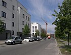
240 | Erich Nehlhans (1899–1950), first chairman of the Jewish community in Berlin after 1945 | Oct 18, 2005 | The road was new as Planstraße TS 13 in age development area slaughterhouse created. It lies between Thaerstrasse and Richard-Ermisch-Strasse and is only built on one side. The street is a section of the Grüner Hauptweg 18 ( Innerer Parkring ) which runs between Forckenbeckplatz and the sports park through the grounds of the old slaughterhouse. |
|
10 |
| Erich-Weinert-Strasse
( Location ) |
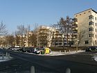
2070 | Erich Weinert (1890–1953), writer, President of the National Committee for Free Germany | 4th June 1954 | The first name was Street 20, Section XII of the development plan. In 1904 it was named Carmen-Sylva-Straße after the pseudonym of the writer Elisabeth zu Wied and later Queen of Romania. The street runs from Schönhauser Allee over Prenzlauer Allee to Greifswalder Straße . The inner-city, tree-lined residential street has a large number of old buildings and residential buildings from the 1920s. |
|
12 |
| Ernst-Fürstenberg-Strasse
( Location ) |
310 | Ernst Fürstenberg (1899–1944), resistance fighter against the Nazi regime | 4th Sep 1974 | The first name was Street 31a, Section XIII / 1 of the development plan. In 1905 it was named Schönlanker Straße after Schönlanke , a town in the former province of Posen, since 1945 Trzcianka in Poland. It leads from Erich-Boltze-Strasse to Paul-Heyse-Strasse. It originally began on Kniprodestrasse, but was shortened by building land. |

|
09 |
| Esmarchstrasse
( Location ) |
340 | Friedrich von Esmarch (1823–1908), doctor and founder of the civil Samaritan system in Germany | Apr 13, 1904 | The first name was Street 1a, Section XIII / 1 of the development plan. It connects Pasteurstrasse with Käthe-Niederkirchner-Strasse in a north-east-south-west route.
House number 3 on this street is a specialty: the former residential building, destroyed in World War II and cleared of rubble after the war , left a vacant lot for decades. The architects Tom Klingbeil and Marek Czyborra acquired the fallow land in the 1990s and built a hybrid house here for 2.3 million euros : apart from two reinforced concrete shafts , the seven-storey house is made of wood , which was traditionally plastered on the outside for fire protection and weather protection reasons. |

|
04 |
| Esplanade
( Location ) |
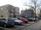
1000 | Esplanade | after 1877 | The street connects the Dolomitenstraße with the Berliner Straße. It was laid out in 1874 by the Charlottenburg manor owner Stuttmeister, who owned the area. The route does not yet have a name on a map from 1877. A free space at the end of the esplanade was planned as Wilhelmplatz in 1892 . The road forms the border to the Pankow district . At the western end, a pedestrian tunnel under the tracks connects the esplanade with Grüntaler Straße in the Gesundbrunnen district . Until the fall of the Wall , several foreign diplomatic missions in the GDR had their headquarters in the street. |
 |
11 |
| Eugen-Schönhaar-Strasse
( Location ) |
380 | Eugen Schönhaar (1898–1934), resistance fighter against the Nazi regime | 4th Sep 1974 | The street connects the Danziger with the Anton-Saefkow-Straße. Their first name was Straße 8a and Straße 8b, Section XIII of the development plan. From October 6, 1911 it was called Wehlauer Strasse after the town of Wehlau in East Prussia , and since 1945 Znamensk in Russia. |

|
08 |
|
Falkplatz
( Location ) |
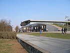
280 × 160 | Adalbert Falk (1827–1900), Prussian Minister of Education | June 16, 1906 | The first name was place 1, section XI of the development plan. The square is bordered by Gleimstrasse and Am Falkplatz. It is only at number 1, the Max-Schmeling-Halle on the south side of the square. The residential buildings have a clear view over Falkplatz, Mauerpark and the Gesundbrunnen district. There is a large playground and lawns on the Falkplatz. |
|
05 |
| Fehrbelliner Strasse
( Location ) |
370 (in the district) |
Fehrbellin , municipality in Brandenburg | Apr 23, 1863 | The first name was Straße 67, Section XI of the development plan. The street leads from Anklamer Straße in Mitte to Schönhauser Allee, with only the part between Choriner Straße and Schönhauser Allee in Prenzlauer Berg. The Sacred Heart Church is located on the south side of the building . | 01 | |
| Finnish road
( Location ) |
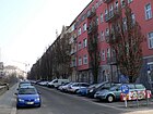
250 | Finland , state in Scandinavia | June 28, 1907 | The first name was Street 2c, Section XI of the development plan. It connects Norwegerstrasse with Malmöer Strasse in a west-east route. The street continues to the east as Czarnikauer Straße. |
|
11 |
| Fritz-Riedel-Strasse
( Location ) |
670 | Fritz Riedel (1908–1944), resistance fighter against the Nazi regime | July 26, 1951 | The street runs from Paul-Heyse-Straße to Landsberger Allee . The first name was Street 28a, Section XIII / 1 of the development plan. From 1906 it was named Deutsch-Kroner-Straße after the town of Deutsch-Krone in West Prussia, and since 1945 Wałcz in Poland. This is where the Werner-Seelenbinder-Halle stood until it was demolished in 1995. Since 1997, the Velodrom with the complex swimming and jumping hall in the European Sports Park (SSE) has been in its place . |

|
09 |
|
Froebelplatz
( Location ) |
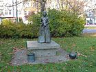
170 × 60 | Friedrich Froebel (1782–1852), educator | Apr 22, 1982 | The square east of Prenzlauer Allee was laid out in 1935 and was named Nordmarkplatz (until 1982) after the Nordmark , a historic stretch of land between the Elbe and Oder. In 1985 the bronze sculpture Girls with Play Elements - dedicated to Froebel by the sculptor Michael Klein was installed on the west side of Prenzlauer Allee. |
|
07 |
|
Froebelstrasse
( Location ) |
350 | Friedrich Froebel (1782–1852), educator | Apr 22, 1982 | From April 2, 1891 to February 13, 1937, Fröbelstrasse. In 1937 it was named Nordmarkstraße after the Nordmark , a historic stretch of land between the Elbe and Oder. In 1985 it was renamed Froebelstrasse again. Fröbelstraße leads from Prenzlauer Allee to Ella-Kay-Straße. The Froebelplatz extends on its south side. |

|
07 |
|
Gaudystrasse
( Location ) |
490 | Franz von Gaudy (1800–1840), poet and novelist | 22 Aug 1903 | The first name was Straße 23, Section XI of the development plan. The quiet cobblestone residential street runs from Falkplatz to Schönhauser Allee in a west-east route. The Friedrich-Ludwig-Jahn-Sportpark is on its south side . |

|
05 |
| Georg-Blank-Strasse
( Location ) |
340 | Georg Blank (1888–1944), resistance fighter against the Nazi regime | Jan. 31, 1952 | The name of the first installation in the 1920s was Street 39 . In 1931 it was named Dißmannweg after the union functionary Robert Dißmann (until 1933), then until 1952 Hollebekeweg after a place in Belgium that was the scene of the battles of Flanders in the First World War . It begins about 100 meters northwest of Sältstrasse and ends at Gubitzstrasse. |

|
13 |
| Gethsemanestrasse
( Location ) |
160 | Gethsemane Church on the street | March 8, 1894 | The first name was Street 16a, Section XI of the development plan. On April 15, 1896, the square-like extension created in the northeast of Gethsemanestrasse was also named Gethsemanestrasse. It connects the Greifenhagener with the Stargarder Straße at right angles. During the 1980s, the Gethsemane community, like other Berlin communities, was a gathering point for opposition members and the GDR peace movement . | 06 | |
| Glaßbrennerstrasse
( Location ) |
160 | Adolf Glaßbrenner (1810–1876), satirist | Jan. 23, 1913 | The first name was Street 18b, Section XII of the development plan. The inner-city residential street with cobblestones and residential buildings from the 1920s runs from Wisbyer Straße in a south-west direction to Kuglerstraße. |

|
12 |
| Gleimstrasse
( Location ) |
870 | Johann Wilhelm Ludwig Gleim (1719–1803), poet | Jan. 18, 1892 | The traffic route previously designated as Straße 19, Section XI of the development plan initially only ran in the Gesundbrunnen district from Swinemünder Straße to the railway line of the Berlin Northern Railway to the former freight station Eberswalder Straße . On October 4, 1902, the extension in Prenzlauer Berg to Schönhauser Allee was named that way. In the course of Gleimstrasse on the outskirts of the city is the Gleimtunnel , which was completed in 1911 and whose eastern entrance was bricked up after the wall was built in 1961. The Berlin Wall separated Gleimstrasse into a western and an eastern part until 1990. The living environment is shaped differently. Gleimstraße is a rather quiet residential street with many renovated old buildings. The area around Schönhauser Allee, on the other hand, is very urban with many pubs and a large cinema . |

|
05 |
|
Gneiststrasse
( Location ) |
180 | Rudolf von Gneist (1816–1895), Prussian lawyer and politician | July 15, 1896 | The first name was Street 13a, Section XII of the development plan. It runs between Schönhauser Allee and Pappelallee. Here, the 'Berliner Gemeinnützige Baugesellschaft' (BGB) initially built simple, inexpensive residential buildings that were not designed as tenements . Due to the insolvency of the BGB, the development was stopped, and it was only from 1870 that five-storey residential buildings without backyard buildings were built here. Large parts of the buildings are now owned by an owners' cooperative. |

|
06 |
|
Goehrener Strasse
( Location ) |
170 | Göhren , municipality in Mecklenburg-Western Pomerania | June 1, 1910 | The first name was Street 13e, Section XII of the development plan. The street runs in an L-shape from Raumerstraße to Senefelderstraße and in a bulge forms a square that belongs to Göhrener Straße and is known as the Göhrener Ei . |

|
06 |
| Goethestrasse
( Location ) |
120 (in the district) |
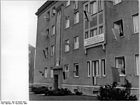
Johann Wolfgang von Goethe (1749–1832), poet | 1874 | The Goethestrasse, originally only located in the Weissensee district, was named Woeltges Strasse from 1872 to 1874 after its owner, the Weissensee district chief Ludwig Woeltge . On December 28, 1956, its extension in Prenzlauer Berg to Ostseestrasse, Strasse 22b , was also given the name Goethestrasse. |
|
13 |
| Gormannstrasse
( Location ) |
100 | Cornelius Gormann (1796–1861) master potter and stove manufacturer | May 13, 1867 | It was built around 1699 as a connecting route between Rosenthaler Straße and Linienstraße and was first called Laufgasse . On August 4, 1897, the extension between Linienstrasse and Zehdenicker Strasse was also named Gormannstrasse. Only plots 17, 17A and 17B on the east side between Torstrasse and Zehdenicker Strasse belong to Prenzlauer Berg. This area has been designated as a bicycle street since around 2009 (see picture). |

|
01 |
| Gotland road
( Location ) |
260 | Gotland , Swedish island in the Baltic Sea | July 18, 1907 | The first name was Straße 9i, Section XI of the development plan. It runs between Bornholmer Strasse and Stavangerstrasse. On March 27, 1974, the City of East Berlin decided that Gotlandstrasse was extended beyond Ibsenstrasse. There are several embassy buildings from the GDR era, some of which are still in use (picture: Moldovan embassy). |

|
11 |
| Greifenhagener Strasse
( Location ) |
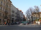
1050 | Greifenhagen, town in Pomerania , since 1945 Gryfino in Poland | Apr 4, 1895 | The first names were Straße 18 and Straße 18a, Section XII of the development plan. The street begins at Wisbyer Straße, crosses the Berlin Ringbahn on the Greifenhagener Bridge built in 1911 , passes the Gethsemane Church and ends at Gneiststraße. The road is open to car traffic at the Ringbahn. Pedestrians and cyclists can pass them over the Greifenhagener bridge. From the bridge there is direct access to the Schönhauser Allee S-Bahn station . At the northern end is the entrance to the parking garage for the Schönhauser Allee Arcaden shopping center . Greifenhagener Straße is an inner-city residential street with cobblestone pavement in the trendy district of Prenzlauer Berg and partly with restored old buildings. |
|
12 |
|
Greifswalder Strasse
( Location ) |
2660 | Greifswald , Hanseatic city , independent city in Mecklenburg-Western Pomerania | Oct 12, 1868 | The previous names were Bernauische Landstrasse (16th century to around 1803), Chaussee to Weißensee (around 1803–1859) and Vor dem Königs-Thore (around 1859–1868). Greifswalder Strasse is part of the B 2 and, as an extension of Otto-Braun-Strasse, runs from Am Friedrichshain via Danziger Strasse to Gürtelstrasse, where it turns into Berliner Allee . |

|
G |
| Grellstrasse
( Location ) |
880 | August Eduard Grell (1800–1886), composer and organist, director of the Sing-Akademie zu Berlin | Nov 9, 1911 | The first name was Street 19, Section XII of the development plan. The section of Wichertstrasse, which lay between Prenzlauer Allee and Greifswalder Strasse, was renamed Grellstrasse. |

|
13 |
| Gubitzstrasse
( Location ) |
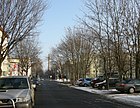
590 | Friedrich Wilhelm Gubitz (1786–1870), graphic artist (wood engraver), writer and publisher, theater critic | June 1, 1910 | The first name was Street 22a, Section XII of the development plan. The street is the eastern limit of the residential area Carl Legien . At the corner of Erich-Weinert-Straße is the State Ballet School and School of Artistry , which will be extensively renovated in 2011/2012 . Gubitzstraße also forms a cross branch here, which opens up house numbers 18 to 20a. |
|
13 |
| Gudvanger Street
( Location ) |
550 | Gudvangen , town in the municipality of Aurland on the Nærøyfjord, Norway | Aug 1, 1938 | The part of Lychener Strasse that ran from Wichertstrasse to Wisbyer Strasse was renamed Gudvanger Strasse.
At the request of a citizens' initiative, the district office of Pankow decided in February 2015 to close this street to car traffic once a week, making it a temporary play street . This inner-city residential street mainly consists of post-war buildings. The tree-lined Humannplatz at the south end of the street has a large children's playground. |

|
12 |
|
Belt Street
( Location ) |
600 (in the district) |
The Hobrecht Plan for Berlin of 1862 envisaged a ring road as a belt around the whole of Berlin. Belt in the sense of the surrounding road around old Berlin | around 1871 | The street is between Greifswalder Straße / Berliner Allee and the southwest corner of the Jewish cemetery . In the 1870s it was also listed as a ring road in architectural drawings . Its entire length is identical to the Berlin soft image border. It forms the border between the districts of Prenzlauer Berg and Weißensee . There are streets or sections of the same name in different districts. House numbers 2-14 belong to the Weißensee Weißensee (consecutive). On the opposite south-west side in Prenzlauer Berg there are several retirement homes (Gürtelstraße 32, 32a, 33). The Weißenseer section ends at Puccinistraße, the suburb of Prenzlauer Berg closes the area of the Free Waldorf School on Prenzlauer Berg at the address Gürtelstraße 16 (until 2014/2015 school for people with learning disabilities). On the opposite side, the further course of the road to the south-east is offset by 40 meters to the south and follows the block of flats 27–30 (consecutive, Q3A-Typbau ), a daycare center (number 25), the workshop of the nbw - Nordberliner Werkgemeinschaft gGmbH (Number 26). The Weißensee addresses belong to zip code 13088, those in Prenzlauer Berg to 10409. On the Weißensee side at the corner of Meyerbeerstraße, the new buildings 6–9 for condominiums were built. Due to the location near the former Schlei-Pfuhl (on the opposite side), there was a workshop with storage space until the renovation of the composer's quarter. From Greifswalder Strasse (Prenzlauer Berg) there is the residential block 36–39 (consecutive, QP 64 ), numbers 35 and 36 is a commercial building for the energy supply of Vattenfall , followed by the senior citizens' homes of the "Prenzlauer Berg Foundation" (33, 32, 32a ) and across from the corner of Puccinistraße the disused department store on lot 31 (Kaufhallen-Typbau). The buildings on the Prenzlauer Berg side were built as a construction area at Michelangelostraße-Nord in the 1960s on former allotment grounds. Their side paths, Kuckucks-Weg and Mauerweg, became the access road to apartment block 27/30, the further guide leads as a footpath ten meters away from the cemetery wall to the north end of Kniprodestrasse. The three blocks of flats Q3A across the path are addressed to Michelangelostraße. |

|
14th |
|
Hagenauer Strasse
( Location ) |
210 | Hagenau (French Haguenau ), city in Alsace, France | Apr 20, 1890 | In the Berlin address book of 1891, it is mentioned for the first time with 17 consecutive house numbers, of which numerous construction sites are identified. Several streets in this quarter are named after places that were important during the Franco-Prussian War . |

|
02 |
| Hanns-Eisler-Strasse
( Location ) |
950 + 280 + 600 | Hanns Eisler (1898–1962), composer | Jan. 24, 1976 | The Hanns-Eisler-Straße opens up in several sections the residential area between Storkower and Michelangelostraße, which was built in the 1970s . The course of the street is folded several times in accordance with the settlement of the apartment blocks within the new development area, which was usual at this time. The Hönower Weg, number 7 of the 20 green main routes , runs between Storkower and Michelangelostraße through the Einsteinpark over an eastern section of the Hanns-Eisler-Straße. |

|
14th |
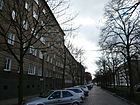
| Hans-Otto-Strasse
( Location ) |
710 | Hans Otto (1900–1933), actor; murdered by the Nazis as one of the first leftist artists | 4th Sep 1974 | In the development plan it was Straße 3 and Straße 3a, Dept. XIII . In 1903 they were jointly named Braunsberger Straße after the East Prussian town of Braunsberg , since 1945 Braniewo in Poland. |
|
04 |
| Heinrich-Roller-Strasse
( Location ) |
420 | Heinrich Roller (1839–1916), founder of a German stenography system | Nov 25, 1925 | The first name was Straße 27, Section XII of the development plan. In May 1866 it was named after its direction to Heinersdorf : Heinersdorfer Straße , a former village northeast of Old Berlin, since 2001 part of the Berlin district of Pankow . The quiet, sloping, cobblestone street has a few commercial units and a school. The development consists mainly of old buildings. Some houses offer an unobstructed view of the cemetery area on the west side of the street ( Kirchhof I of the Protestant Georgen Parish and New Churchyard of St. Marien and St. Nikolai ). A section of the Tiergartenring runs along the street . |

|
04 |
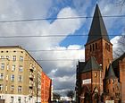
| Heinz-Bartsch-Strasse
( Location ) |
210 | Heinz Bartsch (1906–1944), roller worker and resistance fighter against the Nazi regime | 4th Sep 1974 | The first name in the development plan was Straße 21a, Section XIII . In August 1905 it was named Schneidemühler Straße after the town of Schneidemühl in the province of Poznan , since 1945 Piła in Poland. - On the corner with Danziger Strasse is the Evangelical Advent Zacchaeus Church. (see image) |
|
09 |
| Heinz-Kapelle-Strasse
( Location ) |
230 | Heinz Kapelle (1913–1941), head of the KJVD in Berlin during the 1930s and resistance fighter against the Nazi regime | 4th Sep 1974 | The first name was Straße 7 e, Section XIII / 1 in the development plan. In November 1911 it was named Goldaper Street after the town of Goldap in East Prussia , and since 1945 Gołdap in Poland. The street is built over with residential houses at both ends; H. it can only be reached via narrow passages. |

|
08 |
|
Helmholtzplatz
( Location ) |
240 × 70 | Hermann Ludwig von Helmholtz (1821-1894), natural scientist (physiologist and physicist) | Aug 4, 1897 | The first name was place D, section XII of the development plan. The elongated town square in the northwest-southeast axis is surrounded by Lettestrasse, Dunckerstrasse, Raumerstrasse and Lychener Strasse. |

|
06 |
| Hermann-Blankenstein-Strasse
( Location ) |
1500 | Hermann Blankenstein (1829–1910), local politician, architect | Oct 23, 2000 | The new road was opened to public transport on May 6, 2002. It runs in a semicircle from Hausburgstrasse to Scheffelstrasse, parallel to the route of the Berlin Ringbahn . At the same time, it forms the northern end of the former slaughterhouse site . |
 |
10 |
| Hiddenseer Strasse
( Location ) |
180 | Hiddensee , island in the Baltic Sea, Mecklenburg-Western Pomerania | June 1, 1910 | The first name was Street 13b, Section XII of the development plan. It connects Senefelder Straße with Prenzlauer Allee in a west-south-east direction. |

|
06 |
|
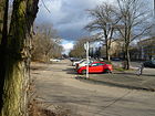
Hohenschönhauser Strasse
( Location ) |
50 (in the district) |
Hohenschönhausen , former village east of Berlin, since 2001 part of Lichtenberg | around 1895 | Only property number 80 belongs to Prenzlauer Berg, which is a larger car park and the entrance to the Volkspark Prenzlauer Berg , where there are no buildings. |
|
15th |
| Hosemannstrasse
( Location ) |
800 | Theodor Hosemann (1807–1875), painter, illustrator and caricaturist | June 1, 1910 | The first name was Street 23, Section XII of the development plan. In 1910 the street was only laid out as far as Carmen-Sylva-Straße (since 1954 Erich-Weinert-Straße), it was not until the 1930s that it was extended and carried out to Roelckestraße (Weissensee) . |

|
13 |
|
Hufelandstrasse
( Location ) |
650 | Christoph Wilhelm Hufeland (1762–1836), physician, first dean of the medical faculty of the new Berlin university | June 4, 1904 | The first name was Straße 2, Abt. XIII / 1 . The sidewalks on this street are wider than in the neighboring streets and are planted with a row of linden trees; probably to compensate for the otherwise narrow development with several backyards. |

|
04 |
|
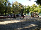
Humannplatz
( Location ) |
170 × 150 | Carl Humann (1839-1896), engineer, architect and archaeologist ( Pergamon Altar ) | 22 Aug 1903 | The first name was place E, section XII of the development plan. The square Erich-Weinert-Strasse, Gudvanger Strasse, Wichertstrasse and Stahlheimer Strasse form the boundaries of the square. The Catholic parish church of the Holy Family is located on its south side . |
|
12 |
|
Husemannstrasse
( Location ) |
360 | Walter Husemann (1903–1943), communist and resistance fighter against the Nazi regime | Jan. 31, 1952 | It was initially planned as Strasse 36, Section XII ; When it was actually built in 1877, it was named Hochmeisterstraße after the Hochmeister , the highest office in the Teutonic Order.
A hairdressing museum has been located in house number 8 since 1987. It belongs to the Stadtmuseum Berlin Foundation and moved to Alt-Marzahn in the spring of 1995 . The Museum Berliner Arbeiterleben around 1900 was housed in house number 12 between 1987 and 1995 and was cleared in 1995. |

|
02 |
|
Ibsenstrasse
( Location ) |
580 | Henrik Ibsen (1828–1906), Norwegian writer and playwright | June 28, 1907 | The first name was Street 1a, Section XI of the development plan. The traffic route runs in a west-east direction north parallel to Bornholmer Strasse . On the south side there are four-story houses, while on the north side between the school building and Andersenstrasse there are allotment gardens (systems Bornholm I and Bornholm II) . The embassy buildings of Cuba and Bosnia and Herzegovina , which use buildings from the GDR era, are located between Stavanger and Gotland streets .
The car traffic is interrupted at one point, so that the traffic volume is relatively low. At the western end ( Björnsonstraße ) there is a turning loop for the tram . This was set up with the separation of the route through the construction of the wall on the grounds of the KGA 'Bornholm II'. |
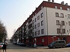
|
11 |
| Immanuelkirchstrasse
( Location ) |
490 | Immanuelkirche standing here | Sep 1 1897 | The first name was Street 30, Section XII of the development plan. It runs between Prenzlauer Allee and Greifswalder Straße in a west-south-east direction. It continues to the northwest as Knaackstrasse. |
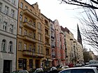
|
03 |
| Icelandic road
( Location ) |
240 | Iceland , island nation in the North Atlantic | June 28, 1907 | The first name was Street 2b, Section XI of the development plan. In 1907 it was given a new name, which was written Islandstrasse up to and including 1929 . |

|
11 |
|
Jablonskistraße
( Location ) |
630 | Daniel Ernst Jablonski (1660–1741), court preacher in Berlin and senior (bishop) of the Polish branch of the Brotherhood | Sep 15 1906 | The first name was Street 29b, Section XII of the development plan. It runs between Prenzlauer Allee and Greifswalder Straße in a west-south-east direction. |

|
03 |
| James-Hobrecht-Strasse
( Location ) |
280 | James Hobrecht (1825–1902), Berlin urban planner in the 19th century | Oct 23, 2000 | This road on the site of the former central cattle yard was opened to public traffic on May 28, 2002. It lies between Hermann-Blankensteinstrasse and Eldenaer Strasse and continues on Samariterstrasse in the Friedrichshain district . |

|
10 |
| John-Schehr-Strasse
( Location ) |
730 | John Schehr (1896–1934), chairman of the KPD, murdered by the National Socialists | 4th Sep 1974 | The first name was Straße 7, Section XIII / 1 in the development plan. In November 1911 it was named the Curonian Road after the Curonian Lagoon , a sea bay off the Lithuanian-Russian Baltic coast. |

|
08 |
|
Käthe-Niederkirchner-Strasse
( Location ) |
480 | Käthe Niederkirchner , (1909–1944) resistance fighter against the Nazi regime | 4th Sep 1974 | The street in the Bötzowviertel lies east of Greifswalder Straße to the unnamed place of Hans-Otto-Straße with Am Friedrichshain . The name in the development plan was Street 2a, Section XII / 1 . On April 23, 1902, it was named Lippehner Strasse after the city of Lippehne in the province of Brandenburg , which has been a Polish city of Lipiany since 1945 , so it was renamed East Berlin in 1974, along with other streets to now Polish places with "anti-fascists" as Namesake. Along the street on both sides there are Wilhelminian-style houses, partly renovated and partly in need of renovation. The paved quiet residential street is lined with street trees and there are small shops that define the character of the neighborhood. |
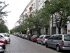
|
04 |
| Kanzowstrasse
( Location ) |
270 | Thomas Kantzow (around 1505–1542), chronicler and historian | Nov 9, 1911 | The name in the development plan was Street 19b, Section XII . It runs between Dunckerstraße and Prenzlauer Allee to the northeast, parallel to the circular railway line . |

|
12 |
|
Kastanienallee
( Location ) |
1000 | Chestnuts (Castanea), a genus in the beech family | 1826 | Kastanienallee is one of the oldest named streets in the Prenzlauer Berg district. It was laid out in 1826 by the landowner Wilhelm Griebenow as a continuation of the already existing Weinbergweg and named after the first planting.
Here is the Prater , a well-known beer garden. On October 1st, 1858, the 15th Berlin Community School opened at Kastanienallee 6 as the first school in the district. On October 13, 1864, the school moved from the rooms it had initially rented to the school building at Kastanienallee 26. The street is open until late at night. Cars, trams, countless cyclists and pubs jostle. The apartments are in great demand because of their central location. The Volkspark am Weinberg and the nearby Mauerpark offer opportunities for exercise in the fresh air. The street is part of the Tiergartenring , a system of 'green hiking trails' across Berlin. |
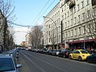
|
01 |
| Knaackstrasse
( Location ) |
990 | Ernst Knaack (1914–1944), resistance fighter against the Nazi regime | Jan. 31, 1952 | The first names were Straße 6 and Straße 8, Section XII of the development plan. In 1875 they were combined and named in Tresckowstraße after the Prussian officer Hermann von Tresckow .
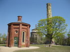
Knaackstrasse leads from Danziger Strasse, past Kollwitzplatz , to Prenzlauer Allee . The most famous building is the Kulturbrauerei with its main entrance on Knaackstrasse. |
|
02 |
| Kniprodestrasse
( Location ) |
1920 | Winrich von Kniprode (around 1310–1382), 22nd Grand Master of the Teutonic Order |
Feb. 13, 1901 (with interruptions) |
It was first called Straße 25, Section XII / 1 in the development plan, according to the address book and Kaupert's (since 1770) Verlorener Weg . The name Kniprodestrasse was "proposed" in 1900 and officially received in 1901. In 1974 the East Berlin magistrate named the section in Prenzlauer Berg Artur-Becker-Straße after the Spanish fighter Artur Becker .
On November 1, 1995, Artur-Becker-Strasse was renamed Kniprodestrasse. The original Kniprodestrasse ran north-east at the same level over the tracks of the Berlin Ringbahn and further over the Prenzlauer Berg area, straight over the northern section of the Jewish cemetery in Weißensee. Then it crossed what was then Lichtenberger Strasse (since 1985 Indira-Gandhi-Strasse ) and connected to Falkenberger Strasse and Hohenschönhauser Strasse . When the cemetery was enlarged at the beginning of the 1950s, the western section of Kniprodestrasse was raised and led over the tracks by means of a bridge ; it has since ended at Michelangelostrasse, which runs north-west . A section of the Hönower Weg, number 7 of the 20 green main routes , connects the Volkspark Friedrichshain with the outskirts of Hönow as a hiking and cycling route . |

|
15th |
|
Kollwitzplatz
( Location ) |
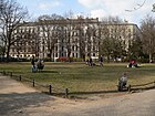
160 × 160 × 140 (triangular shape) | adjacent Kollwitzstrasse | Oct 7, 1947 | In the development plan it was initially called Platz H, Dept. XII , in 1875 it was named Wörther Platz after Wœrth , a battle site in the Franco-German War in Alsace. |
|
02 |
| Kollwitzstrasse
( Location ) |
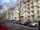
1100 | Käthe Kollwitz (1867–1945), socially committed artist | Oct 7, 1947 | The name in the development plan was Straße 4, Abt. XII . In 1874 it was named Weißenburger Strasse after Weißenburg , a temporary German city in the realm of Alsace-Lorraine . Kollwitzstraße leads from Schönhauser Allee via Kollwitzplatz to Danziger Straße. In the White Straße 25 , a corner in the Wörther place (since 1947 Kollwitz Platz ), had from 1891 to 1943 Käthe and Karl Kollwitz apartment, doctor's office (until 1940) and studio. Until 1991, the "Meta Lorei" haulage company with 18 horses was located in Kollwitzstrasse 74. The cowshed was on Kollwitzstrasse. After the Second World War, expelled farmers from Kolberg lived here , who continued to lead the country life in the big city. There were also chickens and hay and straw in front of the door. The stables that still exist are used for other purposes. |
|
02 |
| Kolmarer Strasse
( Location ) |
210 | Colmar (1871–1918 and also Kolmar during the Nazi era ), city in Alsace | 28 Sep 1885 | The name in the development plan was Straße 33, Abt. XII . Several streets in this quarter are named after places that were important during the Franco-Prussian War . |

|
02 |
|
Copenhagen Street
( Location ) |
870 | Copenhagen , capital of Denmark | Apr 30, 1899 | The name in the development plan was Straße 18, Abt. XI . In 1979 the well-known DEFA film “ Solo Sunny ” was shot in house no .
There is a listed substation in this street . The southern side of the inner-city residential street is bordered by the Berlin Ringbahn . The western end of the street is a dead end for cars from Schwedter Straße, pedestrians and cyclists can get to Mauerpark from here. Old buildings are predominant. At the level of Sonnenburger Strasse there is a pedestrian walkway over the Ringbahn to Dänenstrasse and Arnimplatz. The street belongs to the Wall Trail and the Inner Parkring . |

|
05 |
|
Korsörer Strasse
( Location ) |
270 | Korsør , port town on the island of Zealand, Denmark | 17 Sep 1905 | The name in the development plan was Straße 19a, Section XI . It connects the Schwedter Strasse with the Ystader Strasse in a west-east route. |

|
11 |
|
Kruger Street
( Location ) |
420 | Franz Krüger (1797–1857), known as "Horse Krüger", painter and lithographer | Jan. 23, 1913 | The name in the development plan was Straße 15a, Section XII . It leads from Erich-Weinert-Straße to Prenzlauer Allee, contrary to the other right-angled street network but as a diagonal in a west-north-east route. Until 1966, tram line 70 ran from Humannplatz to Prenzlauer Allee / Ostseestrasse with a stop on Gudvanger Strasse through Krügerstrasse. There are mostly old buildings on the inner-city residential street. |

|
12 |
|
Küselstrasse
( Location ) |
370 | Erich Küsel (1903–1942), politician and resistance fighter against the Nazi regime | Jan. 31, 1952 | The name in the development plan was Straße 37 . It was named Silberschmidtweg in 1931 after the union official Hermann Silberschmidt . In 1933, during the National Socialist era , the street was divided into Dixmuidenweg (after the Belgian town of Diksmuide ) and Langemarckstraße (after the Belgian municipality of Langemarck near Ypres ), both battlefields in the First World War . |

|
13 |
| Kuglerstrasse
( Location ) |
1080 | Franz Kugler (also Franz Theodor Kugler); (1808–1858), art historian and poet | Sep 15 1903 | The name in the development plan was Straße 20a, Abt. XII . The traffic route extended from Schönhauser Allee to Stahlheimer Strasse. Its eastern part, street 20b , was named on February 9, 1913. Until the end of the 1920s, the route from Kuglerstrasse led to Greifswalder Strasse. On January 27, 1931, the part of Kuglerstrasse that lay between Hosemannstrasse and Greifswalder Strasse was renamed Döblinweg , and in line with the Flanders settlement , it was named Zeebruggestrasse during the Nazi era . In 1945, Döblinweg was again proposed for this , but the name was changed to Schieritzstraße . The inner-city residential street has partly cobblestones, the development consists mainly of old buildings. |

|
12 |
| Kurt-Exner-Strasse
( Location ) |
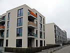
100 | Kurt Exner (1901–1996), local politician ( SPD ) | Dec 17, 2001 | The road laid out in 2001 as planned road HS 26 in the " Alter Schlachthof development area " was opened to public transport on November 7, 2002. It is located on the site west of Thaerstraße between Walter-Friedländer- and Otto-Ostrowski-Straße . The street is a section of the Grüner Hauptweg 18 ( Innerer Parkring ) which runs between Forckenbeckplatz and the sports park through the grounds of the old slaughterhouse. |
|
10 |
|
Landsberger Allee
( Location ) |
960 (in the district) |
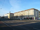
Altlandsberg , city in Brandenburg | Jan. 31, 1992 | The street or individual sections have had several different names since it was built, most recently Leninallee (1950–1992). At eleven kilometers, Landsberger Allee is one of the longest streets in Berlin, along with Adlergestell and Heerstraße . The section between Danziger Straße and Oderbruchstraße belongs to Prenzlauer Berg . |
|
G |
| Lettestrasse
( Location ) |
260 | Wilhelm Adolf Lette (1799–1868), social politician and lawyer | March 8, 1892 | The name in the development plan was Straße 12, Abt. XII . It connects Lychener Strasse with Dunckerstrasse in a light west-east route. At the same time, it forms the north-eastern boundary of the Helmholtzplatz. |

|
06 |
| Lewaldstrasse
( Location ) |
120 | Fanny Lewald (1811–1889), writer | Jan. 23, 1913 | The name in the development plan was Street 18c, Section XII . It leads from Wisbyer Straße to Kuglerstraße. It is an inner-city residential street with old buildings on the western side. On the eastern side there is a small green area with a playground. |

|
12 |
| Lilli-Henoch-Strasse
( Location ) |
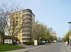
280 | Lilli Henoch (1899–1942), track and field athlete and gym teacher, victim of the Nazi regime | Feb. 1, 1993 | The street is part of the residential district built around Thälmannpark, made up of apartment blocks in GDR prefabricated construction and was first named Wilhelm-Florin-Straße in 1984 after Wilhelm Florin , KPD politician and resistance fighter against National Socialism . By resolution of the Senate , it was given the new name after reunification . The Ernst-Thälmann-Park swimming pool is on the street and the Inner Parkring is on the same route . |
|
07 |
| Lindenhoekweg
( Location ) |
150 | Lindenhoek, place in West Flanders , Belgium | May 11, 1938 | The name in the development plan was Straße 44 . Lindenhoek was in World War I, during the First Battle of Ypres theater of war. |

|
13 |
| Liselotte-Herrmann-Strasse
( Location ) |
450 | Liselotte Herrmann (1909–1938), resistance fighter against the Nazi regime | 4th Sep 1974 | The name in the development plan was Straße 2b, Section XIII / 1 . In September 1905 it was named Allensteiner Straße after the East Prussian town of Allenstein , since 1945 Olsztyn in Poland. |

|
04 |
|
Lottumstrasse
( Location ) |
310 | Carl Friedrich Heinrich von Wylich and Lottum (1767–1841), Prussian minister and privy councilor | 25 Aug 1860 | As early as 1770, a dirt road led westwards along the Lottumstrasse to the Vorwerk in front of the Schönhauser Thor . Around 1860 this street was still unpaved and only three single-storey houses were built on. The terrain through which the Lottumstrasse and Christinenstrasse led, which were named on the same day, belonged to Count von Wylich and Lottum. |

|
01 |
| Lychener Strasse
( Location ) |
830 | Lychen , city in Brandenburg | April 20, 1894 | The name in the development plan was Straße 15, Abt. XII . The part of the road south of the Ringbahn was named first. Originally it ran as far as Wisbyer Straße. On August 1, 1938, its northeastern part (behind the Ringbahn) was named Gudvanger Straße. The street forms the extension of Knaackstrasse from Danziger Strasse to the S-Bahn site. It is an inner-city residential street in the trendy district of Prenzlauer Berg. The development consists of partly superbly restored old buildings. The road ends at the S-Bahn route as a dead end. |

|
06 |
|
Lily of the Valley Street
( Location ) |
330 | Lily of the valley ( Convallaria majalis ), a species of plant in the asparagus family | March 23, 1925 | In the development plan (around 1863) it was called Straße 26a . The street forms the outermost eastern border of the district and lies at the foot of the Prenzlauer Berg public park . The street is located in the Blümchenviertel, this name has become naturalized by residents due to the proximity to the Volkspark opposite the name Blumenviertel (Rudow, Weißensee). |

|
15th |
|
Malmöer Strasse
( Location ) |
520 | Malmo , Swedish city | 4th July 1904 | The name in the development plan was Straße 9, Abt. XI . The name of the southern part of Malmöer Straße was canceled on August 16, 1906 and officially named Ystader Straße . |

|
11 |
| Almond Street
( Location ) |
370 | Eduard Mandel (1810–1882), engraver | Jan. 23, 1913 | The name in the development plan was Straße 23b, Section XII . The street is on both sides of Ostseestrasse. Here is the monument of the former 306./307. Community school with teacher's house, built 1915–1923 according to plans by Ludwig Hoffmann (center). The building has been a senior high school center since the late 1990s. |

|
13 |
| Margarete-Sommer-Strasse
( Location ) |
350 | Margarete (Grete) Sommer (1893–1965), Catholic social worker and resistance fighter against the Nazi regime | Nov 5, 1993 | In the development plan of the 19th century it was called Straße 16a, Section XII . In 1896 it was named Werneuchener Strasse after Werneuchen , a town in what was then the Mark Brandenburg . |

|
04 |
| Margarete-Walter-Strasse
( Location ) |
150 | Margarete (“Grete”) Walter (1913–1935), saleswoman and resistance fighter against the Nazi regime | 4th Sep 1974 | In the development plan of the 19th century it was called Straße 64, Dept. XIII . In November 1911 it was named Bartensteiner Straße after the East Prussian town of Bartenstein , since 1945 Bartoszyce in Poland. Another name given in the meantime was Neukuhrer Straße (after Neukuhren in East Prussia, since 1945 Pionerskij in Russia) because the Bartensteiner Straße was rerouted. |

|
08 |
| Marienburger Strasse
( Location ) |
550 | Marienburg, district town in the province of West Prussia , since 1945 Malbork in Poland | 25 Sep 1884 | The name in the development plan was Straße 26, Abt. XII . Around 1874 it was named Taraschwitzweg after E. Taraschwitz, a property owner and entrepreneur (gold strips, stone cardboard and metal letter factory) in the 19th century. It connects Prenzlauer Allee with Greifswalder Straße. |
|
03 |
|
Marthashof
( Location ) |
140 × 60 | Martha Hebrew "mistress", female first name | since 2008 | The private road , which was laid out in 2008, branches off from Schwedter Strasse. A completed new residential complex was built here by 2011. The Kaiserswerther Diakonie founded the Marthashof in 1854 , a Protestant hostel and educational facility for young maids at Schwedter Strasse 37-40. The street name is reminiscent of the historical name of the property. |

|
01 |
| Mendelssohnstrasse
( Location ) |
290 | Felix Mendelssohn Bartholdy (1809–1847), composer |
December 3, 1887 (with interruptions) |
The name in the development plan in the course of Mendelssohnstraße was street A and street B of the development plan NO. At the time when Mendelssohnstrasse and Meyerbeerstrasse were named (from Street B), these were already built on. Originally, the Berlin customs wall was located in the route of the later street (cemeteries were outside the urban area ). Already in 1887 it got its name in the south-north run, at the same time the west-east branch got the name Meyerbeerstraße . From its creation as Street A until the new Mollstrasse was built in 1969, the street continued south. Mendelssohnstraße was located between Linienstraße (which continued to the east) and Meyerbeerstraße at the corner of the “ burial place of the Marienkloster and Nicolai parish ” and crossed Jostystraße . In 1938 it was renamed Rombergstrasse along with the eastward Meyerbeerstrasse during the "Aryanization of street names" , named after Moritz Heinrich Romberg , a doctor and university professor practicing in Berlin. In 1946 the old name was proposed for the entire street and in 1950 it was renamed in honor of the Jewish composer. As a result of the Second World War, there was considerable damage to buildings around Mendelssohnstrasse and especially in the Mitte district since 1945, including total losses and war ruins. In 1961 Mendelsohnstraße was still between Linienstraße in the arch to Neue Königsstraße. With the establishment of the new building district north of Alexanderplatz across Mollstrasse, the southern section of Mendelssohnstrasse was omitted in favor of Mollstrasse , which at that time had been widened to 70 meters and which lies with the road in the Mitte district . Mollstrasse was extended in 1969 in the section over Otto-Braun-Strasse (then Hans-Beimler-Strasse , previously Neue Königsstrasse). On the west side of Mendelssohnstraße there is a WBS 70 apartment block with the house numbers 1–7 (odd), limited to the district . The houses surrounding the square belong to the Moll- and Otto-Braun-Straße district. On the right (south and east) side of the street at an angle to the residential blocks Mollstrasse 33-36 (continuous) and Otto-Braun-Strasse 77 and 79 is the Helene-Häusler-Schule (house number 10) and the sports hall (plot 4). On the north side (east-west course) facing Otto-Braun-Straße there is a five-storey residential building with a penthouse top from the 2010s, in a densely built-up area, located on City East . With house number 27, this takes up the historical property numbering (especially Rombergstrasse ). To the west on (in the detailed network) unnumbered property is a parking lot (3300 m²). |

|
03 |
| Metz Street
( Location ) |
480 | Metz , city in France | March 1874 | The name in the development plan was Straße 3, Abt. XII . The naming of the street was published in April 1874 without a specific date. It got its name due to the annexation of Metz in 1871. In 1748 King Friedrich II of Prussia had five windmills built in the square of Saarbrücker / Metzer / Straßburger Strasse, in 1770 there were eight. The name "Windmühlenberg" goes back to this. |

|
01 |
| Meyerheimstrasse
( Location ) |
270 | Friedrich Eduard Meyerheim (1808–1879), painter | May 12, 1910 | The name in the development plan was Straße 14b, Section XII . It runs between Kuglerstrasse and Zelterstrasse in a north-southwest direction. |

|
12 |
|
Michelangelostrasse
( Location ) |
860 | Michelangelo Buonarroti (1475–1564), Italian painter, sculptor, architect and poet | Feb 14, 1964 | The street was laid out in connection with the relocation of Kniprodestrasse and was given its name on the occasion of the 400th anniversary of Michelangelo's death. It connects Kniprodestrasse with Greifswalder Strasse. A section of the Hönower Weg, number 7 of the 20 green main routes , connects the Volkspark Friedrichshain with the outskirts of Hönow as a hiking and cycling route. |

|
15th |
| Milastrasse
( Location ) |
120 | Guillaume (Wilhelm) Mila (1764–1833), historian | 17 Sep 1905 | The name in the development plan was Straße 23a, Section XII . Milastraße connects Cantianstraße with Schönhauser Allee in a west-east route, it is a quiet residential street with continuous old buildings. |

|
05 |
| Minna Flake Square
( Location ) |
80 × 70 diagonals of a dragon square |
Minna Flake (1886–1958), doctor and socialist | Nov 27, 2015 | The withdrawn residential building at Erich-Weinert-Strasse 65 and the also set-back corner buildings at Gudvanger Strasse 24 and Krügerstrasse 1 create an unnamed open space of 3000 m² diagonally across from the northeast corner of Humannplatz . The redesigned square in the form of a dragon square lies in the Krügerstrasse and the historic street course with two traffic islands was retained. There is a waste material kiosk in front of the Krüger / Gudvangerstraße residential building, and the waste disposal facility is surrounded by bushes in front of Erich-Weinert-Straße 65. The naming of the public town square after Minna Flake was requested by the Women's Council Pankow as an honorable souvenir in recognition of her achievement and the extraordinary personality of her time. The namesake was from 1927 to 1929 city school doctor at the health department in Prenzlauer Berg. According to the concern of the Pankow district office in 2010, the proportion of streets, squares and places named after women is to be increased. The named town square is in the former sphere of activity of the school doctor and creates a topographical reference. | 12 | |
|
Mollstrasse
( Location ) |
810 (in the district) |
Joseph Maximilian Moll (1813–1849), watchmaker and politician | Aug 9, 1963 | Parts of the street run in the neighboring districts of Friedrichshain and Mitte . Only the northern development between Prenzlauer Allee and Otto-Braun-Straße belongs to Prenzlauer Berg. |

|
03 |
|
Mülhauser Strasse
( Location ) |
110 | Mulhouse (French: Mulhouse), city in Alsace, France | 28 Sep 1885 | The first name was Street 33a, Section XII of the development plan. First it was written on Mühlhausener Straße , the correction of the spelling was published on April 18, 1886. It connects Kolmarer Strasse with Prenzlauer Allee. |

|
02 |
|
Naugarder Strasse
( Location ) |
420 | Naugard, town in the Pomerania province , has been Nowogard in Poland since 1945 | May 12, 1910 | The first name was Street 32a, Section XII of the development plan. It was originally intended to extend to Gubitzstrasse, but was only laid out to Hosemannstrasse. |
|
13 |
| New world
( Location ) |
270 | Neue Welt , a former beer bar in front of the Frankfurter Tor | Oct 23, 2000 | The road was opened to public traffic on October 1, 2003. It runs between James-Hobrecht- and August-Lindemann-Straße. Several four-family terraced houses were built here in a striking orange, with a narrow green area on the south side. |

|
10 |
| North Cape Road
( Location ) |
130 | North Cape , Slate Plateau (Cape) on the Norwegian island of Magerøya | July 18, 1907 | The first name was Straße 9e, Section XI of the development plan. It's a short north-south street between Ibsenstraße and Bornholmer Straße. To the north it turns into an access path to an allotment garden. Many of the residential buildings on the quiet, yet centrally located, cobblestone street date from the 1920s. |

|
11 |
| Norwegerstrasse
( Location ) |
330 | Norwegians , the largest ethnic group in Norway . The street name takes the street names assigned in the same neighborhood according to places in Norway. | July 18, 1907 | The first names were Street 3a and Street 12b, Section XI of the development plan. At the southern end, a pedestrian path leads to the Behmstrasse bridge . The eastern side of the residential street consists mainly of old buildings, while the western side is bordered by the S-Bahn. Norwegerstraße is a bicycle street and only residents are allowed to drive on motor vehicles. Some remains of the wall can still be seen at the underpass under Behmstrasse. The Wall Trail, the Lübarser Weg and the Inner Parkring also run here . |

|
11 |
|
Ochtumweg
( Location ) |
220 | Ochtum , river near Bremen and tributary of the Weser | Feb. 27, 1936 | The first name was Street 39 of the zoning plan. The path leads from Steengravenweg in a south-easterly direction in a straight line through a residential area to Süderbrokweg on the edge of the Prenzlauer Berg park . |

|
15th |
|
Oderberger Strasse
( Location ) |
550 | Oderberg , city in Brandenburg | 17 Sep 1873 | The first name was Straße 55, Section XI of the development plan.
A well-known building is the Stadtbad Oderberger Straße on property 57/59, which ceased its bathing operations in 1986 due to structural damage. The bathroom has been completely renovated since 2012 and reopened in 2016. A hotel was also set up in the building complex. On the inner part of the property of the municipal swimming pool, the community double school with the official apartments for the rectors on the upper floors of the street front was inaugurated in 1900. A separate water tower on the property enabled the swimming pool to be operated and supplied the residents with fresh water. The Tiergartenring hiking trail runs along Oderberger Straße. |

|
01 |
| Oderbruchstrasse
( Location ) |
320 | Oderbruch , landscape in Brandenburg | Nov 9, 1911 | The first name was Straße 17, Section XIII / 1 of the Hobrecht Plan . When it was named in 1911, it formed the northern extension of Thaerstrasse. Oderbruchstrasse ran in a straight line to Lichtenberger Strasse; it was only shortened in the late 1940s, when the Prenzlauer Berg park was heaped up from the rubble of the war. It is located on the border between the districts of Prenzlauer Berg and Fennpfuhl am Blümchenviertel, this name has become natural for residents due to the proximity to the Volkspark opposite the name of the Blumenviertel (Rudow, Weißensee). |

|
15th |
| Oleanderstrasse
( Location ) |
240 | Oleander , evergreen plant, belongs to the dog poison family (Apocynaceae) | March 23, 1925 | The name of the development plan was road D . The residential buildings from the 1960s range from Syringenstrasse to Oderbruchstrasse and consist of individual blocks. The street is located in the Blümchenviertel, this name has become naturalized by residents due to the proximity to the Volkspark opposite the name Blumenviertel (Rudow, Weißensee). | 15th | |
| Olga Benario Prestes Street
( Location ) |
180 | Olga Benario (1908–1942), German-Brazilian communist and resistance fighter against the Nazi regime | 4th Sep 1974 | The first name at the beginning of the 20th century was Bartensteiner Straße , which was given the name Straße 62 at the end of 1939 after it was re-routed in connection with intensive construction work . In 1940 it was named Neukuhrer Straße after Neukuhren, a place in East Prussia, since 1945 Pionerskij in Russia. |

|
08 |
|
Ostseeplatz
( Location ) |
200 × 50 | Baltic Sea , Sea in Northeast Europe | Jan. 23, 1913 | The first name was place F 2, Section XII of the development plan. The square is more of a small park around which the directional lanes of Ostseestrasse run. The bronze sculpture Kneeling Lady with a Bowl by Anna Franziska Schwarzbach has stood in the middle of the park since 1987 . |

|
13 |
|
Ostseestrasse
( Location ) |
1060 | Baltic Sea , Sea in Northeast Europe | Jan. 23, 1913 | The first name was Street 31a, Section XII of the development plan. The three former city districts of Prenzlauer Berg, Weißensee and Pankow meet at the traffic junction Ostseestraße / Prenzlauer Allee / Wisbyer Straße . Because of its location, it is popularly known as 'Spitze' or Weißenseer Spitze . |

|
13 |
|
Otto-Braun-Strasse
( Location ) |
400 (in the district) |
Otto Braun (1872–1955), politician (SPD) in the Weimar Republic | Nov 1, 1995 | The earlier names were Rennweg , also Rönnweg (16th to 17th century), Bernauer Straße (17th century to 1810), Neue Königstraße (1810–1966) and Hans-Beimler-Straße (1966–1995). The street runs in the district in a south-north direction between Mollstrasse and Prenzlauer Berg. |

|
03 |
| Otto-Ostrowski-Strasse
( Location ) |
550 | Otto Ostrowski (1883–1963), politician, mayor of Prenzlauer Berg, Wilmersdorf and mayor of Berlin | Oct 23, 2000 | The street was opened to public traffic on November 7, 2002 between Agnes-Wabnitz-Strasse and Thaerstrasse and on January 22, 2008 beyond Hermann-Blankenstein-Strasse. The north side of this street in the Alter Schlachthof development area is a dead end ; it ends on foot at the Landsberger Bridge . Here a symbolic gate with two bears on pedestals marks the entrance to the area. The street is a section of the Grüner Hauptweg 18 ( Innerer Parkring ) which runs between Forckenbeckplatz and the sports park through the grounds of the old slaughterhouse. The path is on the southeast side of the road to Hausburgpark . |
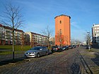
|
10 |
|
Poplar Avenue
( Location ) |
900 | Poplars , a genus of plants in the willow family | around 1826 | The poplar avenue, initially a dirt road to the lands of the Niederschönhausen manor, was laid out as a road by Wilhelm Griebenow around 1826 . Although there should not have been any poplars there, the name was popularly developed . In 1860, one of the residents asked for the name Heinrichstrasse , but the magistrate refused. On August 16, 1906, the name of the northern part of the Pappelallee was canceled and renamed Stahlheimer Straße . The street runs as an extension of Kastanienallee from Schönhauser Allee to the S-Bahn site. Since January 4, 2010 the Suhrkamp Verlag has been based at No. 78–79 . It is an inner-city residential street with many cafes and restaurants and some shops. The development consists of partially restored old buildings. The cemetery park of the former free religious community is located in the street. The St. Josefsheim (No. 60/61) serves as a domicile for the Carmelites of the divine Heart of Jesus. Tram line 12 runs through the street on its way from Kastanienallee to Stahlheimer Straße. |

|
06 |
| Paracelsusplatz
( Location ) |
100 × 70 m² | Paracelsus (1494–1541), Swiss-Austrian doctor and alchemist | November 16, 2016 | The previously unnamed green space on Paracelsus-, Achtermann-, Prießnitzstraße was named “Paracelsusplatz” in 2016. The residents of the surrounding streets jointly submitted the application for designation. The hospital residential area followed the Pankow hospital built around 1900. The choice of name was based on the adjacent streets with the names of famous doctors. After Theophrastus Bombastus von Hohenheim, called Paracelsus, the square in the middle of Paracelsusstrasse between Prießnitzstrasse and Achtermannstrasse was unofficially named that way. The statistical key number is: 10989. The place has no direct residents. |
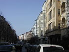
|
04 |
| Pasteur Street
( Location ) |
680 | Louis Pasteur (1822–1895), French naturalist and physician | 4th July 1904 | The first name was Straße 4, Section XIII / 1 of the development plan. There is a listed school building at Pasteurstraße 7-11, which was extensively renovated and modernized in 2012-2014. |

|
04 |
| Paul-Grasse-Strasse
( Location ) |
400 | Paul Grasse (1883–1946 Berlin), lathe operator and resistance fighter against the Nazi regime | Oct 5, 1953 | Before that there was a colony of arbors . The street was built in the early 1950s as a connecting street between street 22b of the development plan (later Goethestrasse) and Gubitzstrasse. It now runs across Gubitzstrasse to Hosemannstrasse. |

|
13 |
| Paul-Heyse-Strasse
( Location ) |
430 | Paul Heyse (1830–1914), writer | 13 Sep 1905 | The first name was Straße 16, Section XIII / 1 of the development plan. The street forms the entrance to the underground car park of the Velodrom . On the corner with Conrad-Blenkle-Straße is the ice rink Paul-Heyse-Straße . |

|
09 |
| Paul-Robeson-Strasse
( Location ) |
740 | Paul Robeson (1898–1976), American actor, singer, athlete, author and civil rights activist | March 29, 1978 | The first name was Straße 11, Section XI of the development plan. In 1902, when the development began, it was named Stolpische Strasse after the town of Stolp in the Pomerania Province, since 1945 Slupsk in Poland. The central residential street has mostly good old buildings and a few bars. |

|
11 |
| Pieskower Weg
( Location ) |
550 | Pieskow, part of the municipality of Bad Saarow in Brandenburg | July 13, 1934 | The first name was Straße 57, Section XIII / 1 of the development plan. With the construction of the new buildings around Greifswalder Straße, the former course of the route changed, it now has several side arms and surrounds a green inner courtyard. At the corner of Storkower Strasse there is a building as part of a monument. House number 49/50 is a day care center from the 1960s with a mosaic above the main entrance and a bronze sculpture "Mother with a toddler" in front of it. The mother-and-child representation was produced in Lore Plietzsch's workshop in 1964 . The east end of the Pieskower Weg lies at the Einsteinpark and is touched by the Hönower Weg (Grüner Hauptweg 07). The street runs from Storkower Straße to the northeast between commercial areas and apartment blocks from the 1950s, then turns to the southeast at the area built with residential buildings from the 1960s. At the level of the kindergarten, the road bends again to the northeast with a connection to a side branch of Thomas-Mann-Straße. Here the zigzag run again goes south-east, with the Paul-Lincke-Grundschule on the north side of the street and the Einsteinpark on the south side, and ends with a lockable driveway to the 21-storey twin high-rise, Pieskower Weg 52/54. |

|
14th |
| November 9th 1989 square
( Location ) |
150 × 20 | November 9, 1989, the day the Berlin Wall fell after 28 years | November 9, 2010 | The square is about 150 meters long, which is bordered by the former hinterland security wall and previously had no name. A permanent exhibition on the square is reminiscent of the former Bornholmer Strasse border crossing , which was located here and where the Berlin Wall was first opened on November 9, 1989. |
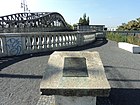
|
11 |
|
Prenzlauer Allee
( Location ) |
2850 | Prenzlau , district town in Brandenburg | Dec 30, 1879 | The earlier names were Heinersdorfer Weg (before 1723 to after 1824) and Prenzlauer Chaussee (after 1824–1878). Prenzlauer Allee runs from Prenzlauer Tor to the intersection of Ostsee- and Wisbyer Straße and then merges into Prenzlauer Promenade.
A particularly striking building is the Zeiss large planetarium on the western edge of the Ernst-Thälmann-Park , which belongs to the Archenhold observatory . |
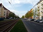
|
G |
| Prenzlauer Berg
( Location ) |
430 | Existing elevation of the Prenzlauer Berg, southern branch of the Barnim plateau | Jan. 23, 1913 | It is a connecting road between Greifswalder Straße and Prenzlauer Allee . Part of the Friedenstraße, as the communication along the Berlin customs wall between Prenzlauer and Frankfurter Tor has been called since 1872, was renamed in 1913 according to the location of the site. The name Prenzlauer Berg was transferred to the entire 4th Berlin administrative district in 1921. The Georgenkirchhof (numbers 1/2 and Greifswalder Strasse 229-234) and the churchyard of the Nikolai and Mariengemeinde (numbers 13/14 and Prenzlauer Strasse 62) are located on this street . |

|
03 |
|
Prenzlauer Tor
( Location ) |
the Prenzlauer Tor , which was demolished between 1866 and 1869, stood here | around 1750 | Here Prenzlauer Allee joins Karl-Liebknecht-Strasse and crosses Torstrasse and Mollstrasse . The “BerlinClub” stands next to the bakery as a striking building, converted from the historic Jonaß department store . |

|
01 | |
| Preussstrasse
( Location ) |
60 | Heinrich Preuß (1886–1944), politician (KPD), trade unionist and resistance fighter against the Nazi regime | Jan. 31, 1952 | When the Carmen-Silva-Siedlung between Grellstrasse and Ostseestrasse was built, this street was named Segitzstrasse in 1931 after the tin caster and union official Martin Segitz , who died in 1927 . With the expansion of the settlement during the Nazi era and its renaming to “Flanders Quarter”, the traffic train was named Bixschootestrasse in 1933 to Bikschote , a theater of the First Battle of Flanders . This designation was replaced in 1952 by the name chosen after the trade union official and baker Heinrich Preuss. A memorial plaque for him is attached to his house at nearby Stargarder Straße 13. The street goes from the Grellstraße as a dead end to the north parallel between Gubitzstraße and Hosemannstraße and ends as a street on the kindergarten area of Preussstraße 5 and 6. This daycare center was built in 1958 as a kindergarten and maternity home and is on the list of monuments. As a footpath, a connection leads through allotment gardens of the resident tenants to Erich-Weinert-Straße. The original open space to the north between Hosemannstrasse and Gubitzstrasse was not built on until the 1960s with residential houses and the ballet school . |

|
13 |
|
Raabestrasse
( Location ) |
210 | Wilhelm Raabe (1831–1910), writer | 23 Aug 1902 | The first name was Street 30a, Section XII of the development plan. It is worth mentioning a closed and well-equipped playground with climbing and romping opportunities. Some houses on this street have been converted to make them barrier-free . |
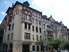
|
03 |
| Raumerstrasse
( Location ) |
730 | Karl Otto von Raumer (1805-1859), Prussian District President and Minister of Education | March 8, 1892 | The first name was Street 13, Section XII of the development plan. Raumerstraße is an extension of Gneiststraße to Prenzlauer Allee . |
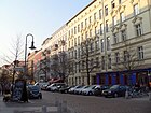
|
06 |
| Rhinower Strasse
( Location ) |
180 | Rhinow , city in Brandenburg | Sep 15 1903 | The first name was Straße 17, Section XI of the development plan. At the corner of Kopenhagener Strasse near Schönhauser Allee , a citizens' initiative has created a small, fenced-in playground with colorful bridges, tunnels, seesaws and houses. The relatively quiet residential street lined with old buildings is located in the Gleimviertel, which is characterized by bars and restaurants . |

|
05 |
| Richard-Ermisch-Strasse
( Location ) |
460 | Richard Ermisch (1885–1960), architect and construction clerk | Oct 28, 2005 | The newly created traffic route in the Alter Schlachthof development area leads from Hermann-Blankenstein-Strasse in a straight line to the southwest to Eldenaer Strasse . From there, Liebigstrasse continues in the Friedrichshain district . The street is a section of the Grüner Hauptweg 18 ( Innerer Parkring ) which runs between Forckenbeckplatz and the sports park through the grounds of the old slaughterhouse. |
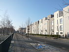
|
10 |
| Rietzestrasse
( Location ) |
240 | Wilhelm Rietze (1903–1944), lathe operator and resistance fighter against the Nazi regime | Jan. 30, 1952 | In the development plan it was initially a section of Zellestrasse. It was spun off and named on January 27, 1931 after the trade union official Adam Drunsel in Drunselweg . After the National Socialists came to power , the traffic route was named Pilckemstraße to Pilkem on July 10, 1933 , a theater of war in the First World War near Ypres . |

|
13 |
| Rodenbergstrasse
( Location ) |
530 | Julius Rodenberg (1831–1914), journalist and writer |
23 Aug 1902 (with interruptions) |
The first name was Straße 19a, Section XII of the development plan, in 1902 it was officially named Rodenbergstraße. In 1938 it was renamed Langbehnstrasse after the writer Julius Langbehn . After the end of World War II, it got its previous name back. It is an inner-city, tree-lined residential street with a mixture of old buildings, post-war buildings and new buildings and some commercial space. At the eastern end is the Humannplatz with a large playground. |
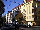
|
12 |
| Rudi-Arndt-Strasse
( Location ) |
320 | Rudi Arndt (1909–1940), typesetter and resistance fighter against the Nazi regime | 4th Sep 1974 | According to the development plan, it was first called Straße 26, Section XII / 1 . In 1891 it was named Olivaer Straße nach Oliva in West Prussia, since 1926 a district of Gdańsk in Poland. |

|
09 |
| Rudolf-Schwarz-Strasse
( Location ) |
350 | Rudolf Schwarz (1904–1934), locksmith and resistance fighter against the Nazi regime | 4th Sep 1974 | The first name was Street 63 ; in March 1939 it was given the name Ermländische Straße nach Ermland , a landscape in West Prussia. |
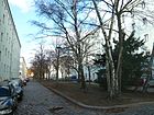
|
08 |
|
Rykestrasse
( Location ) |
600 | Bernd Ryke (also Reiche , around 1390 – around 1449), patrician, mayor of Berlin | Apr 2, 1891 | The first name was Street 35, Section XII of the development plan. The synagogue and the water tower on Knaackstrasse are remarkable . It's a cobblestone street that is busy until late at night. |
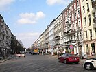
|
02 |
|
Saarbrücker Strasse
( Location ) |
440 | Saarbrücken , capital of the Saarland | Apr 11, 1874 | Saarbrücker Strasse is the northwest continuation of Prenzlauer Berg street. At the corner of Prenzlauer Allee there is a renovated bakery that is used as a cultural site (picture). At the corner of Saarbrücker Straßburger Straße, a new children's playground was designed on a 743 square meter area acquired by the district. Its official inauguration took place on May 28, 2012. In 1748 King Friedrich II of Prussia had five windmills built in the square of Saarbrücker / Metzer / Straßburger Strasse , and in 1770 eight are shown on maps. |
 
|
02 |
| Scherenbergstrasse
( Location ) |
430 | Christian Friedrich Scherenberg (1798–1881), poet | June 11, 1902 | The first name was Street 18b, Section XII of the development plan. It leads from Wisbyer Straße to Wichertstraße in a north-south-west direction. There is a mixture of old buildings, post-war buildings and new buildings and some commercial space on the inner-city residential street with cobblestones. There is a large playground on the Humannplatz. |

|
12 |
| Schieritzstrasse
( Location ) |
560 | Otto Schieritz (1889–1945), employee and resistance fighter against the Nazi regime | March 31, 1952 | The previous names were Döblinweg (1931-1933) and Zeebrüggestraße (1933-1952). Here there is the Prenzlauer Berg volunteer fire brigade, which has given itself the honorary name "Otto Schieritz". A kind of soot drawing can be seen on a neighboring free-standing gable showing a historical rescue scene. |

|
13 |
| Schivelbeiner Strasse
( Location ) |
690 | Schivelbein, town in Pomerania , since 1945 Świdwin in Poland |
22 Aug 1903 (with interruptions) |
At first it was Street 12, Section XI of the development plan. Between 1971 and 1993 the traffic route was called Willi-Bredel-Straße after Willi Bredel , writer and president of the GDR Academy of the Arts . By resolution of the Senate , the street was given its historic name back in 1992. It is a centrally located residential street with mostly good old buildings, a few street cafes and commercial units. The Inner Parkring runs along the street |

|
11 |
| Schliemannstrasse
( Location ) |
620 | Heinrich Schliemann (1822–1890), merchant and pioneer of field archeology, excavator of the ruins of Troy | Jan. 18, 1892 | The first name was Street 14, Section XII of the development plan. Schliemannstrasse begins south at Helmholtzplatz and connects Raumerstrasse with Danziger Strasse. Since autumn 2013, the "Werner Franke Doping Archive" has been located at Schliemannstrasse 23 in the Robert Havemann Society building . This includes materials that are related to the doping of German competitive athletes and that could be saved from destruction. This archive is operated by the Doping Victims Aid Association, which has opened the archive to interested parties since October 2013. The collection was named after the scientist and doping expert Werner Franke , who laid the foundation in the 1990s. |
06 | |
|
Snowdrop Road
( Location ) |
550 | Snowdrop , spring flower | March 23, 1925 | The first name was street 17b of the development plan. It leads from the south-western edge of the Volkspark Prenzlauer Berg in a straight line in a north-south-west direction as a continuation of Sigridstraße to Syringenweg. There it makes an offset and leads as a dead end in the direction of the intersection of Storkower Straße / Landsberger Allee. The street is located in the Blümchenviertel, this name has become naturalized by residents due to the proximity to the Volkspark opposite the name Blumenviertel (Rudow, Weißensee). |

|
15th |
|
Schönfließer Strasse
( Location ) |
440 | Bad Schönfließ, town in the province of Brandenburg , since 1945 Trzcińsko-Zdrój in Poland | 22 Aug 1903 | The first name was Straße 14, Section XI of the development plan. The centrally located residential street with mostly good old buildings and a few street cafes runs from Dänenstrasse northwards to Bornholmer Strasse. At the southern end of the street, a pedestrian walkway connects Schönfließer Strasse with Sonnenburger Strasse. The inner parking ring is on the street with a section. |

|
11 |
|
Schönhauser Allee
( Location ) |
2840 | Schönhausen Palace in Niederschönhausen | Dec. 27, 1841 | Earlier names were Pankowscher Landweg (15th to 17th century) and Schönhauser Weg (17th century to around 1825/1826). Schönhauser Allee is an extension of Alte Schönhauser Strasse from Torstrasse to the corner of Bornholmer and Wisbyer Strasse, where it continues as Berliner Strasse. It is one of the most important thoroughfares in the district. There are numerous listed residential buildings (numbers 8, 55, 58–60, 63, 65–68, 88, 146, 147, 184) as well as other facilities such as the Jewish cemetery at Schönhauser Allee on this busy thoroughfare (subway as elevated train and tram) , former Schultheiss brewery (No. 36–39) or the Blessed Church (number 161). |
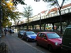
|
G |
|
Schönhauser Gate
( Location ) |
formerly located here Schönhauser Tor | around 1750 | The busy intersection was built on extensively in the years from 1991, with another complex recently being built on the southeast side. The buildings erected on three sides of the intersection are marketed as Schönhauser Tor . On the fourth side is the property to which the Volksbühne Berlin belongs. |

|
01 | |
|
Schwedter Strasse
( Location ) |
2000 | Schwedt , city in Brandenburg | May 29, 1862 | The first name was Lost Way (18th century to 1862). At the northwest end, the Schwedter Steg connects the Schwedter Strasse with the Behmstrasse. The road leads from the railway site to Bernauer Strasse along Mauerpark . South of Bernauer and Eberswalder Strasse to Choriner Strasse, it forms the border between the districts of Mitte and Prenzlauer Berg and ends at Schönhauser Allee at Senefelderplatz . On April 1, 1868, the Post-Expedition 37 opened at Schwedter Straße 7. Schwedter Strasse was divided after the wall was built and has consisted of two parts since then. The northern part consists of old buildings that offer an unobstructed view of the Mauerpark or the railway site. The Mauerpark is located on the former middle section . The part to the north of Gleimstrasse is a pedestrian street between the children's farm and the Copenhagen and Korsörer Strasse (s) that do not go through here. The Mauerweg, Lübarser Weg and Innerer Parkring are located on the street section in the Mauerpark and further over the Schwedter Steg . In the Schwedter Straße 263 there was an earthenware foundry from 1863, from 1882 the iron foundry Czarnikow and later it became a residential and administrative building. |

|
05 |
| Seelower Strasse
( Location ) |
430 | Seelow , district town in Brandenburg | 22 Aug 1903 | The first name was Straße 15, Section XI of the development plan. It runs north-south from Bornholmer Strasse to Dänenstrasse and touches Arnimplatz to the east. A central residential street with mostly good old buildings and a few street cafes and the course of the inner park ring . |

|
11 |
|
Senefelderplatz
( Location ) |
100 × 90 × 50 | Alois Senefelder (1771–1834), Austrian-German actor and theater writer, inventor of lithography | June 7, 1896 | The first name was Platz A, Dept. XII of the Hobrecht Plan , after which it was temporarily referred to as Thusnelda-Platz . The development of the area began around 1895. | 02 | |
| Senefelderstrasse
( Location ) |
500 | Alois Senefelder (1771–1834), Austrian-German actor and theater writer, inventor of lithography | Apr 4, 1895 | The first name was Straße 14a, Section XI of the development plan. In a north-south route, it connects Stargarder Straße across Raumerstraße with Danziger Straße. It continues to the south as Kollwitzstrasse. |

|
06 |
| Sigridstrasse
( Location ) |
400 | Sigrid , a female Nordic given name | March 23, 1925 | Street 21b was specified in the development plan . The street in the "Flower Quarter" lies between the newly named street Am Weingarten and Schneeglöckchnstraße. From the north tangent Volkspark Prenzlauer Berg and it opens the Stedinger way from the south lead the Syringgasse place and Cyanenstraße . Plots 12–18 are (straight) on the south side of the street opposite the Volkspark, in the western continuation towards Syringenplatz the “Primary School at the Flower Quarter” and opposite the residential buildings 4–5a (continuous, east of Stedinger Weg) and 6–11 (continuously) each with its own access path, as the settler properties are from the road to the north. On plot 3 there is a commercial building in extension of the street Am Weingarten. |

|
15th |
|
Sodtkestrasse
( Location ) |
410 | Arthur Sodtke (1901–1944), locksmith and resistance fighter against the Nazi regime | Jan. 31, 1952 | The first name was Street 34 . On January 27, 1931, it was named Jäckelstraße after the trade union official Ernst Hermann Jäckel , in July 1933 the National Socialists renamed the street in Kemmelweg after the Kemmel , a ridge in Belgium that was fought over by German troops in the First World War . The Berlin actor Horst Buchholz lived in House 11 . |
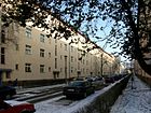
|
13 |
| Sonnenburger Strasse
( Location ) |
350 | Sonnenburg, town in the province of Brandenburg , since 1945 Słońsk in Poland |
22 Aug 1903 (with interruptions) |
The first name was Straße 16, Section XI of the development plan, which was renamed in 1903. On August 16, 1906, Street 16b was also given this name. By resolution of the Berlin city council, part of the parade ground was bought by the military treasury in order to cross Sonnenburger Strasse from Gaudy Strasse to Eberswalder Strasse. From 1920 to 1935 this section was named Rudolf-Mosse-Straße after the publisher Rudolf Mosse . In 1935 it was renamed Sonnenburger Strasse. In 1951, the Friedrich-Ludwig-Jahn-Sportpark was created by depositing the debris of the war , to which the part of Sonnenburger Strasse between Gaudy and Eberswalder Strasse had to give way. Since then it has been a dead end on Gleimstrasse. In 2012, BVV decided to create Sonneburger Platz at the northern end of the street. The space in front of the pedestrian bridge over the S-Bahn was supposed to make the neighborhood more attractive. The district office rejected this request in 2013 due to lack of money. On the centrally located residential street there are mainly old buildings, some commercial units and street cafes. At the northern end of the street, a pedestrian walkway connects Sonnenburger Strasse with Schönfließer Strasse. |

|
05 |
|
Sredzkistraße
( Location ) |
750 | Siegmund Sredzki (1892–1944), lathe operator and resistance fighter against the Nazi regime | Jan. 31, 1952 | The first name was Straße 9, Section XII of the development plan. Between 1875 and 1952 it was called Franseckystraße , named after General Eduard von Fransecky . The Kulturbrauerei is located here . The Sredzkistraße leads in a west-facing route with two slightly bends along between Schönhauser Allee and Prenzlauer Allee. |

|
01 |
| Stahlheimer Strasse
( Location ) |
600 | Stahlheim , place in the municipality of Voss , Norway | Sep 15 1906 | The northern part of Pappelallee from the Ringbahn was renamed Stahlheimer Straße in 1906. The street leads to Wisbyer Straße . It is an inner-city residential street with old buildings, post-war buildings and some commercial buildings. The Humannplatz with a large playground is right on the street. The tram line 12 runs through the street on its way from Pappelallee to Wisbyer Straße. |
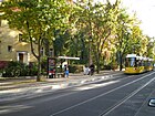
|
12 |
| Stargarder Strasse
( Location ) |
1020 | Stargard, district town in the province of Pomerania , today Stargard in Poland | March 17, 1891 | The first name was Street 16, Section XII of the development plan. Construction on the western part of the street began in the 1890s. Stargarder Straße originally ran over Prenzlauer Allee to Greifswalder Straße. The street was shortened by building extensions to the gas works in the 1920s. Lively residential street with a few small businesses. |
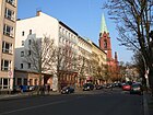
|
06 |
| Stavangerstrasse
( Location ) |
590 | Stavanger , the fourth largest city in Norway in the province of Rogaland | June 28, 1907 | The first name was Straße 9 g, Section XI of the development plan. On March 27, 1974, by resolution of the municipal authorities, Stavanger Strasse was extended beyond Ibsenstrasse. The street now runs from Bornholmer Straße to the Esplanade. Several buildings of diplomatic missions from GDR times are located here, some of which are still used as an embassy or have been converted for residential purposes. Centrally located residential and commercial street with old and new buildings, prefabricated buildings for embassies were built in GDR times. |

|
11 |
| Stedingerweg
( Location ) |
510 | Stedinger Land , region in Lower Saxony | Feb. 27, 1936 | The first name was Street 41 of the zoning plan. In February 1936, some streets in Prenzlauer Berg were named after the landscapes and places of the Stedinger Land in memory of the uprising of the Stedinger farmers . |

|
15th |
| Steengravenweg
( Location ) |
180 | Steengraven (Low German for stone ditch ), small river not far from Bremen in Lower Saxony | Feb. 27, 1936 | The first name was Street 42 of the zoning plan. In February 1936, some streets in Prenzlauer Berg were given names in memory of the uprising of the Stedinger farmers after landscapes or places in the historic Stedinger Land. |

|
15th |
|
Storkower Strasse
( Location ) |
1910 (in the district) |
Storkow (Mark) , small town in Brandenburg | May 12, 1910 | The first name was Street 12, Section XII / 1 of the development plan. It originally ended at Kniprodestrasse, only on August 9, 1929 was it continued to Landsberger Allee . On April 2, 1975, the newly created section running along the S-Bahn from Leninallee (since 1992 Landsberger Allee again) to Möllendorffstraße was also called Storkower Straße. This part is in the Fennpfuhl district . |
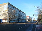
|
15th |
| Strasbourg street
( Location ) |
600 | Strasbourg (French: Strasbourg), capital of the Alsace region , France | Apr 11, 1874 | The street is in the "Quartier Windmühlenberg" from the suburbs border (Mollstrasse in the middle) to Belforter Strasse. The first name was Straße 1, Section XII of the development plan. House number 35 contains the access to the gallery under Berlin , which was set up by the artists Vanessa Huber-Christen and Lorenz Christen in a former cellar of the Königstadt brewery . The 50-meter-long underground tunnel served as an air raid shelter in the Second World War after the brewery was shut down; parts were also used for production that was important for the war effort. Mushrooms were later grown here. In 1748 King Friedrich II. Of Prussia had five windmills built in the square of Saarbrücker / Metzer / Straßburger Strasse; in 1770 there were eight here. On property 6/9 (“Königstadtbrauerei”) was the “Berliner Weissbierbrauerei”, which was founded by Landré in 1856 at Münzstraße 4. When it was relocated in 1870/1871, it became an AG and later the Breithaupt brewery, which was expropriated or rededicated in 1947, but which was still brewed as Breithaupt KG until 1968. The GDR government's vehicle fleet had been on this property since 1952, on which the brewery buildings were demolished and the vehicle fleet expanded in the 1970s. After 1990 it was used by small businesses and artists. In January 2013 the old buildings were demolished to create new residential buildings. From the development of the 1950s in three rows below, the rearmost row of buildings was replaced in 2014 for new residential developments. Another industrial settlement on Straßburger Strasse was Aschinger AG, founded in 1906, which was located in the street until 1947. In 1951 the buildings were taken over by the VEB Aktivist and in 1968 the VEB Backwarenkombinat moved in, which extended to Prenzlauer Allee and ceased operations here after the fall of the Wall. |

|
02 |
| Stubbenkammerstrasse
( Location ) |
170 | Stubbenkammer , landscape around the Königsstuhl | June 1, 1910 | The first name was Street 13c, Section XII of the development plan. It connects Senefelder Straße with Prenzlauer Allee in a west-south-east direction. |
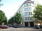
|
06 |
|
Süderbrokweg
( Location ) |
400 | Süderbrook, a historically significant place thanks to the Stedinger farmers' struggle for freedom against the Archbishop of Bremen 1229–1234; District of Lemwerder in Lower Saxony | Feb. 27, 1936 | The first name was street 43 of the zoning plan. In February 1936, some streets in a district between Gürtelstraße and Storkower Straße were given names after the landscapes or places in the Stedinger Land in memory of the Stedinger War. The street runs between Kniprodestrasse and Syringenplatz / Sigridstrasse in a villa colony. |

|
15th |
|
Sülstrasse
( Location ) |
490 | Wilhelm Sält (1888–1921), communist trade unionist; leading the Central German uprising | Jan. 31, 1952 | The first name was Straße 36 in the development plan. In 1931 it was named Massinistrasse after Albert Massini , a German trade union official. During the Nazi era , it was renamed Flandernstrasse in memory of the four battles in Flanders in the First World War . |

|
13 |
| Syringenplatz
( Location ) |
350 | Syringa , another name for lilac | March 23, 1925 | The first name was place H 1 of the development plan. The triangular square was laid out as a green area with the tip on Lily of the Valley Street and the base in the north on Sigrid Street. At this point in time, these two streets had been expanded to the east, their course to the east to Storkower Strasse was only planned and this was not implemented with the later Storkower Strasse industrial estate. The V-shaped sides of the square had been laid out as street 18b in the east and street 24 on the west side since 1925. The street 18b laid out parallel to the Cyanenstraße and projected up to the Landsberger Allee. On January 30, 1933, the streets that bounded the square in a V-shape - street 24 and the expanded part of street 18b - were named Syringenplatz. In the strict sense of the word, the facility is not a square , but a street (between Sigridstrasse and Lily of the Valley Street), which is why the dimensions are not specified in the usual space. The square is located in the Blümchenviertel, this name has become common among residents due to the proximity to the Volkspark opposite the name Blumenviertel (Rudow, Weißensee). Until the 2000s, the square with its two streets was ignored in the area between the settlement at the Volkspark and the industrial area. The construction of the elementary school in the flower district, a type school building from the 1970s and the use of the Syringenweg as an access from the south left the situation unaffected. When driving through the street called Syringenplatz as a direct continuation of the Syringenweg, the fact was ignored. The western boundary of the square was also used as a parking lot by a supermarket after 1990. For example, the naming of the west section of Syringenplatz, which runs without assigned land, was only decided by the district administration as Am Weinberg in preparation for the nationwide introduction of ALKIS . |

|
15th |
| Syringenweg
( Location ) |
330 | Lilac (Greek Syringa ), genus of plants from the olive family (Oleaceae) | Jan. 30, 1933 | The first name was street 18b of the zoning plan. The street leads from Storkower Straße to Syringenplatz. It has two offshoots for developing properties. The street is located in the Blümchenviertel, this name has become naturalized by residents due to the proximity to the Volkspark opposite the name Blumenviertel (Rudow, Weißensee). |
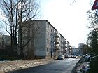
|
15th |
|
Tegnerstrasse
( Location ) |
70 | Esaias Tegnér (1782–1846), Swedish poet | June 28, 1907 | The first name was Straße 9h, Section XI of the development plan. It runs in a north-south direction from a playground on Ibsenstrasse to Bornholmer Strasse. Quiet, still centrally located, cobblestone street. The houses mainly consist of old buildings. The short street ends as a dead end at a daycare center. |

|
11 |
| Templiner Strasse
( Location ) |
260 | Templin , city in Brandenburg | Sep 9 1866 | The first name was Straße 22, Section XI of the development plan. It runs north-south-west between Schwedter Strasse and Fehrbelliner Strasse and touches Teutoburger Platz. |

|
01 |
|
Teutoburger Platz
( Location ) |
120 × 90 | Teutoburg Forest , a low mountain range up to 446 m high in Lower Saxony and North Rhine-Westphalia | Dec 9, 1875 | The first name was place A, Dept. XI in the Hobrecht Plan . The development around the square began in 1860. The square was designed by Hermann Mächtig and has been preserved over the centuries as a “green lung”. After a few additions regarding the use of the space ( transformer house , which has been operated as a "square house" by a civic association since the 1990s) and the planting, in the 1980s the installation of a fountain from Stephan Horota's studio , it is still a popular recreational facility . |
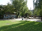
|
01 |
| Thaerstrasse
( Location ) |
600 (in the district) |
Albrecht Daniel Thaer (1752–1828), founder of modern agricultural science | Oct 18, 1881 | The first name was Street 50, Section XIII / 2 of the development plan. At that time it ran from Frankfurter Allee via Baltenplatz and the Ringbahn not far from the Zentral-Viehhof train station to Landsberger Allee / Oderbruchstrasse. The section in the district of Fennpfuhl , between the confluence of the new southern section of Storkower Strasse and the property at Thaerstrasse 28a, was canceled with effect from January 21, 1963. With the reconstruction of the destroyed houses, Thaerstraße was shortened after 1974/1975 and extended from Bersarinplatz to the Ringbahn. Since the new Thaerstraßenbrücke was handed over to traffic in 2002, Thaerstraße extends back to Storkower Straße. |
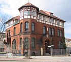
|
10 |
| Thomas-Mann-Strasse
( Location ) |
250 | Thomas Mann (1875–1955), writer | Jan. 24, 1976 | The street was dedicated in 1976 after the shortening of Kniprodestrasse and the diversion of traffic there. As early as the 1920s, streets were drawn in corresponding city maps that were to be laid out between Storkower Straße and the Weissensee district or existing ones to be extended accordingly. In the 1940s, the new road system was implemented in parts, the not yet created were numbered (here: 104 ). |

|
14th |
| Topsstrasse
( Location ) |
350 | Hermann Tops (1897–1944), toolmaker and resistance fighter against the Nazi regime | Jan. 31, 1952 | The street, which was only laid out in the 1930s, was named Ludwigstraße in 1937 after Otto Ludwig, a supporter of the Nazi movement, who died in 1932 during political conflicts. The Topsstraße connects the Eberswalder Straße first leading to the northwest, then bending to the east, with the Schönhauer Allee across the Milastraße. The centrally located street is a rather quiet residential area although it is in the middle of the trendy Prenzlauer Berg neighborhood. The residential buildings offer a clear view over the Friedrich-Ludwig-Jahn-Sportpark. |

|
05 |
|
Torstrasse
( Location ) |
760 (in the district) |
based on Thorstrasse , as a part of the street in the Mitte district was called until 1873 | July 25, 1994 | The section of Torstrasse running in the district between Gormannstrasse and Prenzlauer Allee has had different names in the course of history: Schönhauser Communication (around 1770–1832), Wollankstrasse (1832–1873), Lothringer Strasse (1873–1951). In 1951 it was named Wilhelm-Pieck-Straße after Wilhelm Pieck , the first president of the GDR . In 1994 it was named Torstrasse. Only the north side belongs to the Prenzlauer Berg district. | 02 | |
| Trachtenbrodtstrasse
( Location ) |
310 | Martin Trachtenbrodt (1909–1942), worker and resistance fighter against the Nazi regime | Jan. 31, 1952 | The first name in the development plan was Straße 35 . In 1931 it was named Elmstrasse after the union official Adolph von Elm . During the Nazi era , it was renamed Ypres Street in 1933 after the town of Ypres , where a battle with the use of poison gas took place during the First World War .
The road connects Lindenhoekweg with Küselstraße in a north-east-south-west route. |
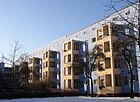
|
13 |
|
Ueckermünder Strasse
( Location ) |
250 | Ueckermünde , port city in Mecklenburg-Western Pomerania | June 28, 1907 | The first name was Straße 2, Section XI of the development plan. It connects Norwegerstrasse with Malmöer Strasse in a west-east route. The street continues to the east as Paul-Robeson-Straße. |

|
11 |
|
Varnhagenstrasse
( Location ) |
340 | Karl August Varnhagen von Ense (1785–1858), chronicler of the Romantic period and the 19th century | December 19, 1912 | The first name was Street 18c, Section XI of the development plan. The inner-city, tree-lined street with residential buildings from the 1920s runs between Wisbyer Straße and Erich-Weinert-Straße in a slight north-south-west route. The street ends at Humannplatz where there is a large children's playground. |
|
12 |
| Cattle drift
( Location ) |
230 | Cattle drift , here: way on which slaughter cattle were driven to the auctions | Nov 8, 2005 | The new road was opened to public traffic on January 22, 2008. It runs between Thaerstraße and Richard-Ermisch-Straße, where it ends at Blankenburg-Park, in a light west-east route. |
|
10 |
| Virchowstrasse
( Location ) |
100 (in the district) |
Rudolf Virchow (1821–1902), physician | March 17, 1891 | The first name was Straße 32, Section XIII / 2 of the development plan. The construction of the SEZ and the surrounding open spaces meant that Virchowstraße was designed as a footpath in its northern section (between Straße Am Friedrichshain and Volkspark Friedrichshain ). At the southern end it can be used by cars and is connected to Langenbeckstraße to the east. There is a driveway for company vehicles from Landsberger Allee to the Friedrichshain Clinic . |
|
04 |
|
Walter-Friedländer-Strasse
( Location ) |
290 | Walter Friedländer (1891–1984), social pedagogue, local politician, persecuted by the Nazi regime | Oct 23, 2000 | It lies between Hermann-Blankensteinstrasse and Thaerstrasse and was opened to public transport on November 7, 2002. | 10 | |
| Werner-Kube-Strasse
( Location ) |
220 | Werner Kube (1923–1945), car mechanic and resistance fighter against the Nazi regime | 4th Sep 1974 | The first name was Straße 9, Section XIII in the development plan. In 1911 it was named Pregelstrasse after the Pregel River in what was then East Prussia, and since 1945 Pregolja in Russia. |

|
08 |
| Wichertstrasse
( Location ) |
1070 | Ernst Wichert (1831–1902), writer and lawyer | June 11, 1902 | The first name was Street 19, Section XII of the development plan. On November 9, 1911, the section between Prenzlauer Allee and Greifswalder Strasse (which was previously also called Wichertstrasse) was renamed Grellstrasse. In this street (house number 22/23) is the main portal of the Catholic Church Holy Family , inserted flush into the neighboring apartment block. It is a busy inner-city residential street with a wide, green central reservation and a bike lane on the roadway. The street consists of a mixture of old buildings, post-war buildings and new buildings and some commercial space. There is a large playground on Humannplatz across from the Church of the Holy Family. |

|
12 |
| Winsstrasse
( Location ) |
860 | Thomas Wins (actually Wyns, 1385 to before February 4, 1465), landowner and Berlin mayor | March 17, 1891 | The first name was Street 25, Section XII of the development plan. In 1984 part of Winsstrasse was renamed Franz-Dahlem-Strasse after Franz Dahlem , a communist politician, and in 1993 it was renamed Ella-Kay-Strasse . Winsstrasse leads from Heinrich-Roller-Strasse to Danziger Strasse . |
|
03 |
|
Wisbyer Street
( Location ) |
1100 | Visby (German also Wisby), city on the west coast of the Swedish Baltic Sea island Gotland | 23 Aug 1905 | The first names were Street 31 and Street 31a, Section XII of the development plan. Wisbyer Straße is part of the outer ring road from the Hobrecht plan from 1862, consisting of Seestraße , Osloer Straße , Bornholmer Straße , Wisbyer Straße and Ostseestraße . It forms the border to the district of Pankow , to which the northern side of the road belongs. |

|
12 |
|
Wörther Strasse
( Location ) |
670 | Wœrth (German Wörth an der Sauer), city in Alsace , France | June 25, 1875 | The first name was Straße 7, Section XII of the development plan. Wörther Straße runs from Schönhauser Allee to Prenzlauer Allee . Several streets in this quarter are named after places that were important during the Franco-Prussian War . | 04 | |
|
Ystader Street
( Location ) |
250 | Ystad , town in the southern Swedish province of Skåne on the Swedish south coast | Sep 15 1906 | The street was previously the southern part of Malmöer Straße. It runs between Kopenhagener Strasse and Gaudystrasse. A northern section is a dead end and ends at the Ringbahn site. |

|
11 |
|
Zehdenicker Strasse
( Location ) |
140 (in the district) |
Zehdenick , small town in Brandenburg | Oct 16, 1863 | The first name was Straße 59, Section XI of the development plan. The street leads from Choriner Straße to Christinenstraße. The western part between Weinbergsweg and Choriner Straße is in the Mitte district . |
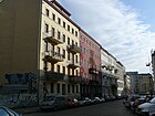
|
01 |
| Zelterstrasse
( Location ) |
200 | Carl Friedrich Zelter (1758–1832), musician, composer and conductor | June 1, 1910 | The first names were Street 20 and Street 20d, Section XII of the development plan. Zelterstrasse originally ran from Lychener to Naugarder Strasse. It was shortened by construction work in 1929/1930. On January 27, 1931, the part that led from Hosemannstrasse to Naugarder Strasse was renamed Drunselweg after the union official Adam Drunsel . Since then, this section has had its own name, since 1952 Rietzestrasse . The New Apostolic Church is on the corner with Dunckerstrasse (see picture). |

|
12 |
| Zionskirchstrasse
( Location ) |
220 (in the district) |
Zionskirche standing here | Dec 13, 1866 | The first name was Straße 61, Section XI of the development plan. The part to the west of Choriner Strasse is in Mitte . |

|
01 |
| Too bad
( Location ) |
260 | Langer Jammer , one of the popular names for the former 400 m long steel footbridge from Storkower to Eldenaer Straße over the S-Bahn and slaughterhouse grounds | Dec 2, 2002 | The eponymous bridge was built in 1937 for hygienic reasons, so that passers-by to the S-Bahn station did not cross the slaughterhouse area. At the end of the 1970s, it was extended by 85 meters to the Fennpfuhl residential area. With the closure of the slaughterhouse it lost its function and was demolished in mid-2002 except for the 85-meter-long section from the S-Bahn station to Storkower Straße. The name of the bridge has now been transferred to a new road that was opened to public traffic on November 20, 2007. |

|
10 |
| To the stock exchange
( Location ) |
230 | Exchange building of the former cattle yard | Nov 8, 2005 | The stock exchange building was the center of the cattle yard, in which around 400 cattle dealers, cattle exporters and cattle commission shops had their headquarters and organized the trade. In the run-up to a market day, u. a. the sales prices are determined and then published in the daily press. - On January 22nd, 2008 the new road was opened to traffic. |
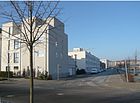
|
10 |
| To the guild
( Location ) |
140 | Guild , form of organization of the craft | Nov 8, 2005 | The name is reminiscent of the butcher's guild trade that existed on the former cattle and slaughterhouse. The traffic was opened on January 22, 2008. |

|
10 |
| To the market flag
( Location ) |
230 | Flag Market, showed the period of permitted livestock trade to | Nov 8, 2005 | The market flag was hoisted at the beginning of a market day and brought down again at the end of the market day. Trading in cattle was only allowed when the market flag was raised. Market days were Wednesday and Saturday.
On January 22nd, 2008 the new street was opened to traffic. |

|
10 |
| To the cattle auction hall
( Location ) |
230 | Cattle auction hall formerly available here | Nov 8, 2005 | It forms the northern boundary of the Hermann Blankenstein Park. A new Kaufland branch was built on its north side . The bicycle dealer Zweirad-Stadler has set up shop in the eponymous hall that has been preserved in the outer components. |
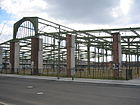
|
10 |
| To the scales
( Location ) |
110 | Cattle scales on the site of the former cattle and slaughterhouse | Nov 8, 2005 | The listed weighing house is located on August-Lindemann-Straße between the former mutton stables. On January 22nd, 2008 the new street was opened to traffic. |

|
10 |
Other locations in Prenzlauer Berg
Parks

- (Alphabetical)
- Ernst-Thälmann-Park In the area of the former gasworks, apartments, the Zeiss large planetarium and extensive parks were built between 1983 and 1986 .
- Einstein Park
- Friedrich-Ludwig-Jahn-Sportpark Here you will find the Jahn Stadium (after the Olympic Stadium the second largest in Berlin), several sports fields for tennis and beach volleyball as well as the Max-Schmeling-Halle
- Hausburgpark
- Hermann Blankenstein Park
- Leise-Park : the park on Heinrich-Roller-Straße was opened on June 1st, 2012. The Leisepark is located on 15,900 m² of former parts of the St. Marien – St. Nicolai, which the Senate of Berlin had acquired from the Evangelical Cemetery Association Berlin Stadtmitte. Parts of the cemetery equipment have been preserved, they have been supplemented with natural play areas and opportunities to relax.
- Mauerpark ( location ), created from 1990 on a section of the former wall . In the 19th century the area belonged to the old exercise place .
- Volkspark Anton Saefkow : west of the railway line between Greifswalderstraße and Kniprodestraße situated park, which by reclaiming of war debris was
- Volkspark Prenzlauer Berg , a park that was created on a mountain of rubble after the Second World War
Other plants
- Jewish cemetery Schönhauser Allee with numerous grave sites of well-known Jewish citizens. There is also a lapidarium in which restored tombstones are kept, which could no longer be assigned to a location after the devastation by the National Socialists and the war.
- Velodrom at Landsberger Allee S-Bahn station, one of the largest event halls in Berlin. The Velodrom was planned and built by Dominique Perrault in place of the Werner-Seelenbinder-Halle as part of the Berlin application for the 2000 Olympic Games .
- Water tower square , listed building ensemble and garden monument
Allotment gardens
In Prenzlauer Berg there are 814 allotment gardens in eight complexes, the existence of which is secured until 2020 according to the allotment garden development plan 2010 with the approval of the Senate Administration . The areas on Bornholmer Strasse (near the S-Bahn station ) and at Volkspark Prenzlauer Berg are, however, part of the strategic area reserves, in the second case for a possible expansion of the road ring, in the former for residential construction, which did not take place here as a result of the First World War . The need for allotment gardens close to home continues to exist. The existing allotment gardens (KGA), formerly mostly called colonies , in the Prenzlauer Berg district are:
| Name of the KGA number in the area plan |
coordinate | when founded | Number of gardens / plots |
Access | Comments, possibly photo |
|---|---|---|---|---|---|
| , Bornholm I ' 03003 |
location | 1896 | 236 | Bjoernsonstrasse | on 77,778 m² of state-owned leased land; three permanent residents. The Step classifies the two Bornholm facilities as "allotment gardens with long-term use prospects". Up until the fall of the Berlin Wall, Bornholm I was part of the border area and could only be entered with a special permit. |
| , Bornholm II ' 03004 |
location | 1896 | 185 | IIbsenstrasse |
on 60,830 m² of state-owned leasehold land and 6,820 m² of private leasehold land of the Protestant Church According to the 'Urban Development Plan 2015', the KGA is only secured until after 2025, after which it is to be built with residential houses, it is therefore considered to be 'at risk'. Both Bornholm plants were built on former garbage dumps . |
| 'Am Volkspark Prenzlauer Berg' (also: Zur Laube ) 03001 |
location | 1905 | 125 | Hohenschönhauser Strasse 80 | + a permanent resident on 45,455 m² of state-owned leased land, which is permanently secured. A further 35 parcels on 12,457 m² of state-owned leased land are only temporarily secured and intended for the construction of a higher-level main road . |
| 'Mountain and Valley' 0300 |
location | 1930 | 14th | Greifswalder Strasse 80 | on 5,026 m² of state-owned leased land (near the railway), which is only secured temporarily. |
| 'Greenland' 03005 |
location | 1904 | 94 | Süderbrokweg 30 | + two permanent residents on 41,088 m² of state-owned leased land are considered secured; a further 18 parcels on 7,930 m² of land are only considered secured until the Seestrasse ring is expanded. |
| 'New Berlin' 03006 |
location | 1901 | 24 | Stedinger way | on 8,088 m² on leased land on the southern edge of the residential estate; is secured in time. In 2000 a club house was inaugurated. |
| 'New home' 03007 |
location | 1908 |
66 12 |
Kniprodestrasse 59 | on 24,241 m² and 4,550 m² of land; The first parcels are considered to be permanently secured according to the allotment garden development plan, the others are in the area of the planned ring road in continuation of the Seestrasse through Lichtenberg. |
| 'Prenzlauer Vorstadt' 03008 |
location | 1912 | 7th | Gubitzstrasse | on 1,500 m² of private land, is considered unsecured according to security level Ia. |
See also
literature
- Daniela Dahn : Prenzlauer Berg Tour , Rowohlt Berlin, 2nd edition. February 2010, ISBN 978-3-87134-430-5 .
Web links
- Map of Berlin 1: 5000 with district boundaries. Senate Department for Urban Development Berlin, 2009, accessed on May 27, 2010 .
- Street directory Prenzlauer-Berg. kaupert media gmbh, accessed on October 30, 2010 .
- prenzlauerberg-kiez.de. Private site, accessed December 12, 2010 .
- Office for Statistics Berlin-Brandenburg: List of streets and places in the Pankow district (as of February 2015); pdf
Individual evidence
- ↑ Hans Prang, Günter Kleinschmidt: With Berlin up to you and you - exquisite and overheard things from 750 years of Berlin life. FA Brockhaus Verlag Leipzig 1980, p. 29 ff.
- ↑ a b c d e Rolf Gänsrich: When Goethe drove over the Schönhauser . Prenzlberg Views, August 2013, p. 7. Quoted from Klaus Grosinski: Prenzlauer Berg - a Chronicle. Dietz-Verlag, Berlin 2008.
- ↑ berliner-stadtplan.com: Aalesunder-Strasse
- ↑ Construction trailer instead of building society savings. Wagenburg Bötzowstraße threatened - Building permit for hotel soon on Scheinschlagonline.de , accessed on September 4, 2012.
- ↑ a b c Senate Department for Urban Development: Weg07
- ↑ Location between Greifswalder Straße and Am Friedrichshain
- ↑ The acquired land on Greifswalder Strasse was built with a hotel. In the rear area with an apartment building. A private access road with an official street name became necessary for a unique address, which the Bötzowviertel Projektentwicklungsgesellschaft GmbH & Co. KG had applied for.
- ^ Kauperts: At the Swiss Garden
- ↑ berliner-stadtplan.com: Am-Schweizer-Garten-Berlin-Prenzlauer-Berg
- ↑ a b Am Weingarten FIS broker (map of Berlin 1: 5000 (K5 color edition)) of the Berlin Senate Department for Urban Development and Environment
- ↑ The length of the renamed street section is 320 meters, plus 180 meters of the included public path (between Sigridstraße and KGA 'Neu-Berlin') along the back wall of the commercial buildings at Storkower Straße 115
- ↑ On an area of the Office for Environment and Nature there are 500 Riesling and 200 old varieties of vines that have been looked after by the 'Weingarten Berlin' association since 2004. From: The wine-growing season begins at Syringenplatz . In: Berlin Week of March 20, 2014 (Bernd Wähner)
- ↑ The Weinschaugarten is a project in collaboration with "Weingarten Berlin" e. V., the Pankow Road and Green Space Office and the “Chance - Education, Youth and Sport BJS” gGmbH. The district office planted 400 Riesling vines at the Volkspark Prenzlauer Berg. Visitors suspected the location of the vineyard within the Volkspark Prenzlauer Berg, as the “corner of Syringenplatz / Sigridstraße” of the public street Syringenplatz ran along the area of Syringenplatz on the eastern and western sides. As a result, there were two junctions with the same name to Sigridstrasse.
- ^ Ceremonial street naming in Prenzlauer Berg on August 30, 2015
- ↑ Printed matter VII-0788: Naming of the unnamed public street in the section from the allotment garden complex Neu Berlin to Sigridstraße and in continuation the renaming of the public street Syringenplatz in the section from Sigridstraße to Maiglöckchenstraße in Am Weingarten . Accessed in 2017 .
- ↑ Grapes for the Berlin Riesling
- ↑ The winemakers from Prenzlauer Berg. In: Prenzlauerberg News, June 6, 2011
- ↑ The costs are financed from Chapter 3800, Title 52101 within the framework of the existing budget.
- ↑ a b Printed matter VI-1291: Designation of a private road in the Prenzlauer Berg district in An den Eldenaer Höfen
- ↑ To the Eldenaer Höfen FIS broker (map of Berlin 1: 5000 (K5 color edition)) of the Berlin Senate Department for Urban Development and Environment
- ↑ Donkey gear on berlingeschichte.de , access on 6 May 2012 found.
- ↑ Gumbinner Straße on berlingeschichte.de
- ↑ Back to the beginning - District councilors revise the district's decision . In: Berliner Woche , March 15, 2017, p. 1
- ↑ berliner-stadtplan.com: Arnimplatz-Berlin-Prenzlauer-Berg-Achim-von-Arnim-Bettina-von-Arnim
- ↑ Hellmannplatz on berlingeschichte.de
- ^ Kauperts: August-Lindemann-Strasse
- ↑ Helmut-Just-Straße on berlingeschichte.de
- ↑ berliner-stadtplan.com: Behmstrasse-Berlin-Prenzlauer-Berg
- ↑ Rastenburger Strasse on berlingeschichte.de
- ↑ a b c Björnson- / Ibsenstraße FIS-Broker (map of Berlin 1: 5000 (K5 color edition)) of the Berlin Senate Department for Urban Development and Environment
- ↑ (official) plan of Berlin ( memento of the original dated November 16, 2016 in the Internet Archive ) Info: The archive link was inserted automatically and has not yet been checked. Please check the original and archive link according to the instructions and then remove this notice. , Sheet 4332 from 1956. Coordinates: X = 24940, Y = 25470
- ^ Kauperts: Bötzowstrasse
- ^ Kauperts: Cantianstrasse
- ↑ BD school complex Christburger Strasse 7
- ↑ BD double school from 1895/1896
- ^ Kauperts: Christinenstrasse
- ↑ a b c d e f g Members' magazine Im Zentrum , issue 2/2015
- ↑ Zillebekeweg on berlingeschichte.de
- ↑ City map of Berlin 1893 ( Memento of the original dated November 28, 2015 in the Internet Archive ) Info: The archive link was inserted automatically and has not yet been checked. Please check the original and archive link according to the instructions and then remove this notice. registered Thorner Straße and Straße 48 XIII
- ↑ Thorner road on berlingeschichte.de
- ↑ Woldenberger road on berlingeschichte.de
- ^ Directorate 1, Section 15 of the Berlin Police
- ↑ Printed matter - VI-1346: Designation of a private street in the Prenzlauer Berg district in "Edith-Stein-Straße"
- ↑ Franz-Dahlem-Strasse on berlingeschichte.de
- ↑ Gniezno road on berlingeschichte.de
- ↑ a b BVV-Drucksache - IV-0167/01: Designation of Planstrasse HS26 in Kurt-Exner-Strasse and TS 13 in Erich-Nehlhans-Strasse in the development area "Alter Schlachthof"
- ↑ Carmen-Sylva-Straße on berlingeschichte.de
- ^ Kauperts: Ernst-Fürstenberg-Strasse
- ↑ Schönlanker Straße on berlingeschichte.de
- ↑ Dirk Engelhardt: Nice warm, nice quiet ; In: Berliner Zeitung , November 24, 2015, p. 12 (Berlin).
- ^ Kauperts: Esplanade
- ↑ Wehlauer Straße on berlingeschichte.de
- ↑ berliner-stadtplan.com: Falkplatz-Berlin-Prenzlauer-Berg
- ^ Deutsch-Kroner-Straße on berlingeschichte.de
- ↑ Nordmarkplatz on berlingeschichte.de
- ↑ Bronze Maiden on Bildhauerei-in-Berlin.de ( Memento of the original from October 22, 2010 in the Internet Archive ) Info: The archive link has been inserted automatically and has not yet been checked. Please check the original and archive link according to the instructions and then remove this notice.
- ↑ Nordmarkstraße on berlingeschichte.de
- ^ Kauperts: Gleimstrasse
- ^ Kauperts: Gneiststrasse
- ^ Kauperts: Goethestrasse
- ↑ The roadway becomes a playground once a week . In: Berliner Morgenpost, weekend extra , February 28th / January 1st. March 2015, p. 1.
- ↑ ... straße FIS Broker (map of Berlin 1: 5000 (K5 color edition)) of the Senate Department for Urban Development and Environment Berlin
- ^ Kauperts: Belt Street
- ↑ Hagenauerstrasse (N) . In: Berliner Adreßbuch , 1891, II.T., p. 184. “Franseckstr. – Danzigerstr., 1–17, five residential buildings, eight new buildings”.
- ↑ Braunsberger Straße on berlingeschichte.de
- ↑ Heinersdorfer Straße in Prenzlauer Berg on berlingeschichte.de
- ↑ Schneidemühler Straße on berlingeschichte.de
- ^ Kauperts: Hosemannstrasse
- ↑ Hans Prang, Günter Kleinschmidt: With Berlin up to you and you - exquisite and overheard things from 750 years of Berlin life. FA Brockhaus Verlag Leipzig 1980, p. 29.
- ↑ Hochmeisterstraße on berlingeschichte.de
- ↑ Mechthild Henneke: Swap scissors for hook plows. Berlin museums start packing: Husemannstrasse 8 opened for the last time. In: Berliner Zeitung of October 29, 1994. Retrieved on December 15, 2010.
- ↑ (official) plan of Berlin ( memento of the original dated November 16, 2016 in the Internet Archive ) Info: The archive link was inserted automatically and has not yet been checked. Please check the original and archive link according to the instructions and then remove this notice. , Sheet 4332 from 1956. Coordinates: X = 24940, Y = 25470
- ↑ Iceland Strait . In: Berliner Adreßbuch , 1926, part IV, p. Page VI. "I = J; Right column: Islandstrasse p. 473 (5385): N113 - Malmöer Str. 1–9 Norweger Str. 10–18 ”.
- ↑ Curonian road on berlingeschichte.de
- ↑ Lippehner Straße on berlingeschichte.de
- ↑ Tresckowstraße on berlingeschichte.de
- ↑ Lemma . In: Address book for Berlin and its suburbs , 1900, Part III, p. 628. “NO Verlorener Weg (Suggested: Knieprodestr.) Street scene: Virchowstr./Am Friedrichshain, Bardeleben-Str. (W), Elbinger Str., Thorner Str. (W), Ringbahn ”.
- ^ Artur-Becker-Straße on berlingeschichte.de
- ↑ Berlin city map from 1926 ( page no longer available , search in web archives ) Info: The link was automatically marked as defective. Please check the link according to the instructions and then remove this notice.
- ^ Pharus plan of Berlin, 1944; Grid squares N / OP 4/5
- ↑ Berlin city map 1932; online ( page no longer available , search in web archives ) Info: The link was automatically marked as defective. Please check the link according to the instructions and then remove this notice.
- ↑ On city maps from the 1930 and 1940s, this is only the newly designated remnant in the area of the Jewish cemetery, which was then completely withdrawn.
- ↑ Wörther Platz on berlingeschichte.de
- ^ Kauperts: Kollwitzstrasse
- ↑ A whole life and dog Fritz (-al-): In. Prenzelberg Views, July 2014, p. 18, Kiezgeschichten.
- ↑ Silberschmidtweg , Dixmuidenweg and Langemarckstraße on berlingeschichte.de
- ↑ Kauperts: Kuglerstraße
- ^ Kauperts: Landsberger Allee
- ↑ location of Lindenhoek on getamap.net
- ^ Kauperts: Lottumstrasse
- ^ Nights with the moon calf . In: Der Tagesspiegel , December 31, 2010.
- ↑ Mandelstrasse 6/8, 306./307. Community school with teachers' house, 1915–1923 by Ludwig Hoffmann
- ↑ Bartensteiner Straße and Neukuhrer Straße on berlingeschichte.de
- ^ Provincial and municipal authorities, institutions, societies and associations> Institutions, societies and associations . In: Berliner Adreßbuch , 1874, IV, p. 124. “Evangelical Maid Education School and Hostel (Martha's Hof)”.
- ↑ Map around 1789 with the location of the excise wall around Spandauer and Königsvorstadt ( page no longer available , search in web archives ) Info: The link was automatically marked as defective. Please check the link according to the instructions and then remove this notice.
- ↑ Mendelssohnstrasse (NO) . In: Berliner Adreßbuch , 1888, II.T., p. 294. “ad Linienstraße - s. Str. A. (This is listed under 1965 on page 425.) Street A is given in the address book of Linienstraße with construction sites (1–7, consecutive) and developed properties on 8–29, including new buildings on 8, 11, 14, 26, 27, to street B (now Meyerbeerstraße) belong 15–20 and 28, 29 “.
- ^ Meyerbeerstraße (NO) . In: Berliner Adreßbuch , 1888, II. T, p. 426. “adNeuen Königsstr. / 1–14 and 21–27 go. Str.A, 15.16, 19.20, 28: construction sites, 17.18: new buildings, 29 ad Neuene Königstr. is a residential building with 14 inhabitants [incl. Family]".
- ↑ Westermanns Plan von Berlin Publisher: Georg Westermann / Berlin W 40 / Braunschweig: Friedrichshain around 1932 ( page no longer available , search in web archives ) Info: The link was automatically marked as defective. Please check the link according to the instructions and then remove this notice.
- ↑ Mendelsohnstrasse . In: Berliner Adreßbuch , 1935, IV. Part, p. 557. “NO 43 Mendelsohnstrasse: Lininestr. (1,2) -3 does not exist, Jostystraße (4–8), Meyerbeerstr. (9–16) Jostystr., (17, 18) Linienstr. ”.
- ↑ 1–4 and Neue Königstr. 13 are commercial buildings, 5–14 (consecutive) multi-department houses (38/26/32/12/6/15/11 tenants, # 12: factory, # 13: six and # 14 seven tenants), to 14: see also new ones Koenigstrasse 14.15
- ↑ PHARUS PLAN BERLIN. PHARUS-PLAN, Berlin N 54, Schwedter Straße 263: Berlin-Mitte around 1943 ( page no longer available , search in web archives ) Info: The link was automatically marked as defective. Please check the link according to the instructions and then remove this notice.
- ↑ a b Rombergstrasse . In: Berliner Adreßbuch , 1943, IV. Part, p. 730. “Left side: Linienstr. (1,3) Jostystraße (5–29) Neue Königstraße / right side: Linienstr. (2,4) Jostystraße (6–28) Neue Königstraße ”.
- ↑ Rombergstraße on berlingeschichte.de
- ↑ City map of Berlin Publisher: Richard Schwarz, Landkartenhandlung u. Geogr. Verlag, Berlin W.35: Friedrichshain around 1946 ( page no longer available , search in web archives ) Info: The link was automatically marked as defective. Please check the link according to the instructions and then remove this notice.
- ↑ Pharus city map Berlin large edition Pharus plan publishing house in Treuhand / Berlin N54 / Schwedter Straße 263: Prenzlauer Berg around 1954 ( page no longer available , search in web archives ) Info: The link was automatically marked as defective. Please check the link according to the instructions and then remove this notice.
- ↑ Scan of the map of building damage 1945 from the publication: Urban development of Berlin since 1650 in maps , Soldin coordinates: R = 25964, H = 22309
- ↑ see Google Earth: picture from December 1953
- ↑ Map Berlin 1961: The book plan Berlin . VEB Landkartenverlag, Berlin C2, Neue Grünstraße 17
- ^ Resolution of the Central Committee of the SED: On the socialist construction of the capital of the GDR
- ↑ mendelssohn27 ( Memento of the original from April 28, 2015 in the Internet Archive ) Info: The archive link was inserted automatically and has not yet been checked. Please check the original and archive link according to the instructions and then remove this notice.
- ↑ FIS Broker map display detailed network Berlin: Soldner coordinates: X = 392803, Y = 5820845
- ^ Kauperts: Metzer Strasse
- ↑ Ralf Gänsrich: King Friedrich II had 5 windmills built . In: Prenzlberg views. 21st year, September 2013, p. 8.
- ^ Minna-Flake-Platz FIS-Broker (map of Berlin 1: 5000 (K5 color edition)) of the Berlin Senate Department for Urban Development and Environment
- ↑ Official Journal for Berlin, publisher: Landesverwaltungsamt Berlin, 65th volume, no. 41, issued in Berlin on October 9, 2015, ISSN 0943-9064 , p. 2169 f.
- ↑ Printed matter VII-1019: Intention to designate a public square in the Prenzlauer Berg district in "Minna-Flake-Platz"
- ↑ Bartensteiner Strasse . In: Berliner Adreßbuch , 1939, Part IV., P. 50. “Bartensteiner Strasse in NO 55: vacant on Greifswalder Strasse”.
- ↑ a b Neukuhrer Straße on stadtgeschichte.de , accessed on May 22, 2012.
- ↑ Neukuhrer Strasse . In: Berliner Adreßbuch , 1940, part = part IV., P. 625. “NO 55 Neukuhrer Strasse: Greifswalder nis Wehlauer Strasse: 1–15 (left), 2–14 (right): built and inhabited”.
- ↑ Sculpture on Bildhauerei-in-Berlin.de ( Memento of the original from October 22, 2010 in the Internet Archive ) Info: The archive link has been inserted automatically and has not yet been checked. Please check the original and archive link according to the instructions and then remove this notice.
- ^ Kauperts: Poplar avenue
- ^ Map of Berlin 1: 5000 (K5 - color edition): Paracelsusplatz
- ↑ https://www.berlin.de/ba-pankow/politik-und-verwaltung/bezirksverordnungenammlung/online/vo020.asp?VOLFDNR=4372 Printed matter - VIII-0028: Name of the public green area in the Pankow district in "Paracelsusplatz"
- ↑ .The search for the other road and parks departments of Berlin and the State Statistical Institute Berlin - Brandenburg has shown that no same naming intentions exist and the same or identical names of streets, squares and parks in Berlin are not available.
- ↑ Press release from the Pankow District Office on the repair of the Pasteurstrasse school building, which was built according to plans by Ludwig Hoffmann , accessed on May 11, 2012.
- ↑ Pieskower Weg 2–14 / Storkower Straße 13, residential complex, 1930 from Schneckenburg
- ↑ Bildhauerei-in-Berlin.de ( Memento of the original from March 27, 2010 in the Internet Archive ) Info: The archive link was inserted automatically and has not yet been checked. Please check the original and archive link according to the instructions and then remove this notice. (the house number 41 given in the catalog is no longer correct); Retrieved March 10, 2012.
- ↑ FIS broker map display map of Berlin 1: 5000 (K5 color edition), produced by the district surveying offices
- ↑ District Office Pankow. Printed matter - VII-0541 of September 25, 2013
- ↑ Homepage of the Zeiss large planetarium
- ↑ Supplement to the Berlin address book 1893. Verlag Julius Straube316: Friedrichshain around 1893 ( page no longer available , search in web archives ) Info: The link was automatically marked as defective. Please check the link according to the instructions and then remove this notice.
- ↑ Ralf Gänsrich: In the shortest street . Prenzlberg Views, December 2013, p. 5.
- ↑ Drunselweg on berlingeschichte.de
- ↑ Pilckemstrasse on berlingeschichte.de
- ↑ Olivaer Straße on berlingeschichte.de
- ↑ Warmia road on berlingeschichte.de
- ↑ berliner-stadtplan.com: Rykestrasse-Berlin-Prenzlauer-Berg
- ↑ New playground on Saarbrücker Straße ready . In: Berliner Morgenpost , May 21, 2012, p. 14.
- ^ Doping archive moves to Berlin . In: Berliner Zeitung , April 23, 2013. Center for Doping Victims Aid opens the Werner Franke Doping Archive named after its initiator in Berlin , press release from the Center for German Sports History, October 23, 2013.
- ↑ Jäckelstraße on berlingeschichte.de
- ↑ Kemmelweg on berlingeschichte.de
- ↑ Kemmelweg 11 . In: Berliner Adreßbuch , 1943, IV., P. 412. “E (owner): Einfa Berliner Gesellschaft zur Förder des Einfamilienhauses gGmbH; eight tenants, including the shoemaker Hugo Buchholz ”(In the house: two representatives, official, commercial employee, machinist, machinist, lady).
- ^ Rudolf-Mosse-Strasse on berlingeschichte.de
- ^ Kauperts: Sonnenburger Strasse
- ↑ Berliner Woche: Cancellation for Sonneburger Platz . April 3, 2013, p. 1.
- ^ Kauperts: Stargarder Strasse
- ^ Kauperts: Steengravenweg
- ^ Kauperts: Storkower Strasse
- ^ Stefan Strauss: Underground Gallery . In: Berliner Zeitung of January 7, 2011, p. 22.
- ^ Kauperts: Süderbrokweg
- ↑ Massinistraße on berlingeschichte.de
- ↑ Flandernstrasse on berlingeschichte.de
- ↑ a b On sheet 4228 of the official city plan of Berlin from 1929, Syringenplatz has already been developed, but Syringenweg as street 18b is only planned and not named.
- ↑ City map Berlin 1926 ( page no longer available , search in web archives ) Info: The link was automatically marked as defective. Please check the link according to the instructions and then remove this notice.
- ↑ City map Berlin 1943 ( page no longer available , search in web archives ) Info: The link was automatically marked as defective. Please check the link according to the instructions and then remove this notice.
- ↑ Ludwig road to berlingeschichte.de
- ↑ Thorstrasse . In: Berliner Adreßbuch , 1874, II.T., p. 362. “1 adBrunnenstrasse, between 9 and 10 Ackerstr., Between 12 and 13 Bergstrasse, between 17 and 42 Gartenstrasse, between 44 and 45 Borsigstrasse, 59 ad Chausseestr. ”.
- ↑ Elmstrasse on berlingeschichte.de
- ↑ Ypernstrasse on berlingeschichte.de
- ^ Kauperts: Viehtrift
- ↑ Drunselweg on berlingeschichte.de
- ↑ Kauperts: To the great pity
- ^ Kauperts: To the stock exchange
- ^ Kauperts: To the market flag
- ↑ Kauperts: To the scales
- ↑ District Office: Leise-Park in Prenzlauer Berg finished
- ↑ Berlin Week: Secure allotment gardens permanently. District association chief Egid Riedl on the start of the gardening season. April 24, 2013, p. 13, Local.
- ↑ a b c Kristina Auer: West cars on the garden fence . In: Berliner Zeitung , July 26, 2091, p. 12.
- ↑ a b c d e f Level III a: Fictitious permanent allotment gardens which, according to the representations of the land use plan, are to be used for another purpose.
- ^ The property , Journal of the VDGN, 11 / 12-2016, p. 07: Endangered allotment gardens in Berlin .
- ↑ a b c Level V b: Fictitious permanent allotment gardens according to Sections 16 and 20a of the Federal Allotment Garden Act . The fictitious permanent allotment gardens are additionally protected by the representation in the FNP as "green areas - allotments".
- ^ Homepage KGA Neu-Berlin
- ↑ Homepage KGA New Home
- ↑ Level I a: Allotment gardens on private areas that are intended for another use according to the representations of the land use plan. A termination is possible at any time in compliance with the allotment garden regulations.


