List of streets in Berlin-Plänterwald

The list of streets in Berlin-Plänterwald describes the street system in the Berlin district of Plänterwald with the corresponding historical references. At the same time, this compilation is part of the lists of all Berlin streets and places .
overview
Plänterwald has 11,365 inhabitants (as of December 30, 2019) and includes the postcode areas 12435 and 12437.
Overview of the streets
The following table gives an overview of the existing streets in the district and some related information.
- Name / location : current name of the street. The street can be displayed on various map services via the Location link . The geoposition indicates the approximate center of the street length.
- Traffic routes not listed in the official street directory are marked with * .
- Former or no longer valid street names are in italics . A separate list may be available for important former streets or historical street names.
-
Length / dimensions in meters:
The length information contained in the overview are rounded overview values that were determined in Google Earth using the local scale. They are used for comparison purposes and, if official values are known, are exchanged and marked separately.
If the street continues into neighboring districts, the addition ' in the district ' indicates how long the street section within the district of this article is. - Name origin : origin or reference of the name.
- Notes : further information on adjacent monuments or institutions, the history of the street and historical names.
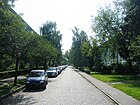
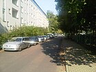
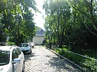
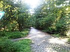
- Image : Photo of the street or an adjacent object.
| Name / location | Length / dimensions (in meters) |
Origin of name | Date of designation | Remarks | image |
|---|---|---|---|---|---|
|
At the Plänterwald
( Location ) |
500 | Plenter forest , managed high forest, where trees of all dimensions (not age groups!) Are mixed up in a colorful mix. | June 24, 1960 | The street runs from Köpenicker Landstraße to Neue Krugallee. Before it was given its current name, it was referred to as Straße 150 according to the development plan . |

|
| At Treptower Park
( Location ) |
1400 (in the district) |
Treptower Park , a park laid out on the Spree between 1876 and 1887 | Sep 7 1901 | The street leads from Puschkinallee to Bulgarische Straße and continues as Köpenicker Landstraße. The street is part of the federal highway 96a one-way street in the southeast direction. The house number sequence follows the principle of horseshoe numbering. Before 1909 it was part of the Köpenicker Landstrasse. Part of the road land and the north-eastern side of the road are in Alt-Treptow . The tenement ensemble with the house numbers 16–21, 24–25, 27–39 and 43–50 is a listed building. |

|
|
Bergaustrasse
( Location ) |
500 | Fritz Bergau (1894–1941), printer and resistance fighter | 17th July 1966 | Bergaustrasse runs from Dammweg to Eichbuschallee. It was created in connection with the housing in a residential area Plänterwald and first as Neubaustraße A designated. The widow of the namesake lived in this street at the time it was named. |

|
| Bulgarian street
( Location ) |
780 (in the district) | Bulgaria , country in Eastern Europe | Sep 30 1935 | The traffic route runs from Am Treptower Park / Köpenicker Landstraße via Alt-Treptow / Neue Krugallee to the Spree . The previous names were Park-Allee (1842 to around 1888) and Parkstrasse (around 1888 to 1935). The northwest side of the street is in Alt-Treptow . |

|
|
Causeway
( Location ) |
1870 (in the district) |
Knüppeldamm , a path paved by wooden planks | Jan. 29, 1842 | The Dammweg connects the Kiehnwerderallee with the Sonnenallee and Grenzallee streets . The house number sequence follows the principle of orientation numbering. In the city map of 1877 the Dammweg was drawn from Kaiserstraße (today: Neukölln Allee) to Kiefholzweg. In the past, the path was unofficially called Knüppeldamm . The southwest section of the road is in Neukölln . During the division of Germany , the Dammweg was interrupted by the Berlin Wall . |

|
| Defreggerstrasse
( Location ) |
310 | Franz von Defregger (1835–1921), painter | Oct 12, 1909 | Defreggerstraße runs from Puderstraße to Karpfenteichstraße. It was initially called Straße 9 and was built with representative town houses towards the end of the 19th century. |

|
|
Eichbuschallee
( Location ) |
750 (in the district) | after the Eichbusch, a small oak grove that used to be here | Jan. 29, 1842 | Eichbuschallee runs from Kiefholzstraße to Neue Krugallee and forms a footpath to Kiehnwerderallee. Part of the southeast side of the street with the odd house numbers 1 to 15 is in Baumschulenweg . |

|
| Erich-Lodemann-Strasse
( Location ) |
500 | Erich Lodemann (1909–1944), employee and resistance fighter | Aug 24, 1962 | The house number range 1 to 39 extends from Dammweg to Plänterwald S-Bahn station and ends there as a dead end . With house numbers 41 to 135, it continues from Dammweg to Eichbuschallee. At first it was called 400 Street . There is a field path between the S-Bahn station and the apartment block with house numbers 1 to 9, which has also been part of Erich-Lodemann-Straße since May 2, 1998. The street was laid out and built on in connection with the residential construction on Köpenicker Landstrasse at the beginning of the 1960s. |

|
| Erwin-Bennewitz-Weg
( Location ) |
200 | Erwin Bennewitz (1902–1980), from October 1946 to July 1948 District Mayor of Treptow | Feb. 24, 2011 | The Erwin-Bennewitz-Weg runs from the Bulgarische Straße to the Am Plänterwald street and ends there as a dead end. Until it was renamed on February 24, 2011, the street was called Pappelallee. It originally ran from Parkstrasse, which is now called Bulgarische Strasse, to Eichebuschallee. The area between Straße 150, today's Straße Am Plänterwald, was closed in 1960 due to the construction of housing. |

|
|
Galileistraße
( Location ) |
350 | Galileo Galilei (1564–1642), Italian physicist and astronomer | Aug 8, 1960 | The Galileistraße leads from the street Am Plänterwald to Dammweg. The house number sequence follows the principle of orientation numbering. |

|
|
Hans-Thoma-Strasse
( Location ) |
170 | Hans Thoma (1839–1924), painter | Dec 18, 1956 | The Hans-Thoma-Straße starts from the Treptower Park . At first it was 13 . |

|
| Herkomerstrasse
( Location ) |
170 | Hubert von Herkomer (1849–1914), painter | Nov 30, 1911 | The street runs from Am Treptower Park to Stuckstraße. Before it was given its current name, it was called Straße 14 . The tenement houses with the house numbers 6 and 12 as well as 7–9 are under monument protection. |

|
|
Karpfenteichstrasse
( Location ) |
390 | after a carp pond in Treptower Park | June 9, 1905 | The road leads from Am Treptower Park to Kiefholzstraße. From 1901 to 1905 it was officially called Sackführerdamm , as can be seen from an address book from 1901. Named for the first time, but not yet treated as an official street, the path was recorded on July 20, 1826 in a file from the Berlin City Council. The renaming to Karpfenteichstraße took place amid controversial disputes after a new bourgeoisie had settled through the development of the residential area at Treptower Park. The path, which was already marked without a name on a map by Carl Oesfeld from 1786, was then part of a road to Rixdorf and served as a connection from the Teltow to the Spree . It was supposedly laid out as an escape route through the quarry forest to the castle wall on the Kreuzbaum. In the Middle Ages and the Thirty Years War it was used by fleeing farmers. Later it served millers as a transport route to the Spree. |

|
| Kiefholzstrasse
( Location ) |
2170 (in the district) |
Pine , old name for pine trees | Nov 25, 1895 | The street leads from Lohmühlenstraße to Südostallee and Rixdorfer Straße. Parts of the street run through Alt-Treptow , Neukölln and Baumschulenweg . From 1842 to 1895 the street was called Kiefholzweg. The Kiefholzstraße leads with 428 house numbers through four Berlin districts and three postcode areas and follows the principle of horseshoe numbering. House numbers 327 to 392 are in Plänterwald. The street was the starting point for several tunnel refugees during the German division . The section between Puderstrasse and Karpfenteichstrasse was expanded in 1903. |

|
| Kiehnwerderallee
( Location ) |
1420 | Kiehnwerder, old name for the swampy part of the Spree lowlands through which the road ran. | Jan. 29, 1842 | The Kiehnwerderallee runs from Dammweg to Baumschulenstrasse. On September 24, 1997, Kiehnwerderallee was de-designated as an official street. The egg house with house number 1, built between 1890 and 1891 and 1914, is a listed building. |

|
| Klingerstrasse
( Location ) |
80 | Max Klinger (1857–1920), sculptor, painter and graphic artist | July 7, 1910 | Klingerstrasse runs from Am Treptower Park to Leiblstrasse. At first she was as road B , respectively. |

|
| Köpenicker Landstrasse
( Location ) |
1300 (in the district) |
Köpenick , an independent city until 1920 and today part of Berlin | around 1896 | The street leads from Am Treptower Park and Bulgarische Straße to Schnellerstraße. The house number sequence follows the principle of orientation numbering. The southeastern section of the road belongs to Baumschulenweg and Niederschöneweide . The street was initially called Köpenicker Weg. This was attached in 1889 . In 1896 its repair and expansion began. Until the trade fair in 1896 , the road to the Chaussee was expanded. The section between Bouchéstrasse and Bulgarische Strasse was renamed Am Treptower Park in 1909. |

|
|
Leiblstrasse
( Location ) |
280 | Wilhelm Leibl (1844–1900), painter | 1910 | The street leads from Karpfenteichstraße over Ludwig-Richter-Straße. |

|
| Ludwig-Richter-Strasse
( Location ) |
80 | Ludwig Richter (1803-1884), painter | Oct 8, 1909 | The street runs from Am Treptower Park to Leiblstraße. Before it was officially named, it consisted of streets 56 and 54 . |

|
|
Moosdorfstrasse
( Location ) |
150 | Otto Moosdorf (1864–1932), entrepreneur and local politician in Treptow | Nov 15, 1907 | Moosdorfstraße goes off from Am Treptower Park. At first it was called Straße 12 . The tenement houses with house numbers 3–14, built between 1907 and 1909, are listed as a whole along with house number 24 on Am Treptower Park. |

|
|
New Krugallee
( Location ) |
1100 (in the district) |
Neuer Krug, a former inn in Niederschöneweide , towards which the road ran | Jan. 29, 1842 | The Neue Krugallee connects the Bulgarische Straße and Alt-Treptow with the Rodelbergweg. The house number sequence follows the principle of orientation numbering. The southeast section of the road runs in Baumschulenweg . The buildings erected between 1908 and 1910 with the house numbers 2 to 6 and the official building with the number 8 built in 1876 as well as the row houses 24 to 30 from the years 1919 to 1921 are listed. The entire complex, built between 1927 and 1928, with the even house numbers of street sections 32 to 52, is also protected as a monument. |

|
|
Orion Street
( Location ) |
340 | Orion , constellation | Aug 8, 1960 | The road leads from Am Plänterwald to Dammweg. The previous name was Street 252 (Stichstrasse II). |

|
| Plane path
( Location ) |
370 | Sycamore , tree species and the only genus in the plane tree family | July 14, 1961 | The plane tree path leads from Eichbuschallee to Willi-Sänger-Straße and ends there as a dead end. The house number sequence follows the principle of horseshoe numbering. |

|
| Poetensteig
( Location ) |
340 | Poet , synonymous for ' poet ', more rarely also for ' writer ' or ' author ' | Jan. 29, 1842 | The Poetensteig starts as a footpath from Bulgarian Street. On September 24, 1997, the Poetensteig was rededicated as an official road. |

|
| Puderstrasse
( Location ) |
410 | after the dusty texture of the former powder frame, an old field name | before 1901 | The road leads from Am Treptower Park to Kiefholzstraße. It developed from a rack path through the Köllnische Heide and was referred to as a powder rack as early as 1793 in a plan by the Cöllnische Cammerei Heide . The apartment buildings with the house numbers 1 and 24 as well as 4 to 6 are under monument protection. |

|
|
Rethelstrasse
( Location ) |
160 | Alfred Rethel (1816–1859), painter | Oct 12, 1909 | Rethelstraße runs from Am Treptower Park to Stuckstraße. It was first referred to as 11 Street . The tenement houses with house numbers 1 and 10 are under monument protection. |

|
|
Schwindstrasse
( Location ) |
40 | Moritz von Schwind (1804–1871), | Oct 8, 1909 | The street leads from Karpfenteichstraße to Ludwig-Richter-Straße. At first it was called Street C . |

|
| Stuckstrasse
( Location ) |
260 | Franz von Stuck (1863–1928), painter | Nov 30, 1911 | The street runs from Rethelstraße to Herkomerstraße. It was previously referred to as 10 Street . The tenement houses with the house numbers 13-16 built between 1927 and 1929 are listed as historical monuments. |

|
|
Waterway
( Location ) |
720 | the path runs in the direction of the Spree | around 1850 | The waterway runs from the Bulgarian road to the dam path. On September 24, 1997, it was de-designated as an official road. |

|
| Willi-Singer-Strasse
( Location ) |
280 | Willi Sänger (1894–1944), employee and resistance fighter | July 14, 1961 | The street starts from the Neue Krugallee; it was re-created in 1960. During the planning phase it was called Straße 162 . |

|
Further locations of Plänterwald
Allotment gardens (KGA, formerly also colonies )
|
|
Parks and other facilities
See also
Web links
- Map of Berlin 1: 5000 with district boundaries. Senate Department for Urban Development Berlin, 2009, accessed on January 11, 2011 .
- Street directory Plänterwald. kaupert media GmbH, accessed on February 25, 2011 .
- Berlin-Brandenburg Statistics Office: Directory of streets and squares in the Treptow-Köpenick district (as of February 2015); pdf
