
List of streets and squares in Berlin-Spandau

The list of streets and squares in Berlin-Spandau describes the street system in the Berlin district of Spandau with the corresponding historical references. At the same time, this compilation is part of the lists of all Berlin streets and places .
overview
The district of Spandau has 39,560 inhabitants (as of December 30, 2019) and includes the postcode areas 13581, 13583, 13585 13587, 13597 and 14052.
Overview of streets and squares
The following table gives an overview of the streets and squares in the district as well as some related information.
- Name / location : current name of the street or square. Via the link Location , the street or the square can be displayed on various map services. The geoposition indicates the approximate center of the street length.
- Traffic routes not listed in the official street directory are marked with * .
- Former or no longer valid street names are in italics . A separate list may be available for important former streets or historical street names.
-
Length / dimensions in meters:
The length information contained in the overview are rounded overview values that were determined in Google Earth using the local scale. They are used for comparison purposes and, if official values are known, are exchanged and marked separately.
For squares, the dimensions are given in the form a × b for rectangular systems and for (approximately) triangular systems as a × b × c with a as the longest side.
If the street continues into neighboring districts, the addition ' in the district ' indicates how long the street section within the district of this article is. - Name origin : origin or reference of the name.
- Notes : further information on adjacent monuments or institutions, the history of the street and historical names.
- Image : Photo of the street or an adjacent object.
| Name / location |
Length / dimensions (in meters) |
Origin of name | Date of designation | Remarks | image |
|---|---|---|---|---|---|
|
Achenbachstrasse
( Location ) |
110 | Heinrich von Achenbach (1829–1899), lawyer and politician, Upper President of the Province of Brandenburg | 1898 | The street that was newly laid out in 1890 was called Kreuzstraße because it led to the intersection of Moltke and Bismarckstraße . The name was given out of gratitude, because Achenbach approved the beautification association to hold lotteries, the proceeds of which were used to finance the maintenance of the public facilities created by the association. At the end of the 1950s, the southern section of the street was included in the redesign of Falkenseer Platz. |

|
| Ackerstrasse
( Location ) |
470 | the fields in the area | 1861 | The newly created street was built between Bergstrasse and Birkenstrasse from 1867/1869, after 1872 between Falkenhagenerstrasse and Blumenstrasse. The listed Catholic-Apostolic Church from 1896 is located at Ackerstraße 15 . |

|
| Altonaer Strasse
( Location ) |
1230 | Altona / Elbe , until 1937 independent city in Schleswig-Holstein, today Hamburg district | Oct 19, 1910 | As early as 1894 there were plans to build on the meadow and farmland between Hamburger Strasse , now Brunsbütteler Damm, and Seeburger Strasse. According to a resolution of 1910, the streets in this area were to be named after the Hanseatic League and other northern German cities. This is how the road projected along a field path got its name in 1910. |

|
| Old town ring
( Location ) |
650 | semi-circular bypass around the old town of Spandau | Apr 1, 1962 | This bypass around today's pedestrian zone was rebuilt between 1960 and 1962. The name in Old Town Square took place after completion of the 1st construction phase on April 1, 1962 and the 2nd construction phase on March 1, 1963. It leads from Falkenseer Platz to Seegefelder Straße. Here is the Spandau town hall and opposite the Münsingerpark with the Florida ice cream parlor . |

|
| At the Spandau train station
( Location ) |
180 | Spandau train station | Nov 1, 2001 | The street connects the Brunsbütteler Damm with the Seegefelder Straße. |

|
| At the grove
( Location ) |
200 | Grove , derived from the term "Totenhain" (in relation to the Ruhleben cemetery ) | Jan. 28, 1966 | The road forms the entrance to the Ruhleben cemetery. Only the driveway belongs to the district, the parking lot to Westend . |

|
| At the Juliusturm
( Location ) |
380 (in the district) |
Juliusturm , one of the landmarks of the Spandaus district | March 29, 1939 | The previous name was from before 1900 Berliner Chaussee . The course of the road was changed several times. Until 1891 it ran on today's Citadel Trail. The construction of the Juliusturmbrücke in 1938/1939 gave it its present-day course. The area south of the citadel between the street and the Spree was formerly called Alter Kietz . Today there are industrial buildings here. The eastern section of the road runs in Haselhorst . |

|
| At the Koeltzepark
( Location ) |
240 | Friedrich Wilhelm Georg Koeltze (1852–1939), Spandau Mayor and City Elder of Berlin | Oct 19, 1910 | The street is located on the park of the same name, which was created in 1933 after it had become the property of Berlin on the site of the former cemetery of the Nikolaikirchengemeinde. The cemetery was created in 1772 and closed in 1886. The initial name was Street 29 . |
.JPG)
|
| At the Oberhafen
( Location ) |
370 | Location at the former Oberhafen | Feb. 27, 1920 | The Oberhafen, a part of the old Havel bed that was retained when the southern port was built (1906–1911), was filled in in 1933. |

|
| At the snake ditch
( Location ) |
550 | The snake ditch that flowed around the Stresow | July 15, 1981 | During the expansion of the Stresower fortifications belonging to the fortress Spandau , it was channeled and became part of these systems. The ditch was then filled in in the years 1914–1916 except for the former confluence with the Havel. The road opens up the industrial area at the mouth of the Spree. |

|
| At the Spandau water tower
( Location ) |
110 | Water tower of the former Spandau slaughterhouse | March 15, 2004 | The water tower of the Spandau abattoir, which was located here, is listed as a monument. |

|
| On the wall
( Location ) |
100 | Ramparts | May 30, 1913 | In connection with the construction of the town hall, the fortifications located here were removed from 1903 in accordance with the “Entfestigungsgesetz”. |

|
| At the freedom meadows
( Location ) |
250 | here located freedom meadows | Oct 15, 2003 | "Freedom meadows" means something like "tax-free land". The street is located in an industrial area north of Ruhlebener Straße. |

|
| On the cap
( Location ) |
490 (in the district) |
old hallway name | 1878 | The "cap" is an old field name for the area west of the Hasenmark and south of the Spektewiesen. The field name is probably derived from the nature of the area, a hilltop or "cap". The road that bears his name since 1878, was previously on a part between the old fortifications and the Scharfrichterei (knacker) and the Schinderweg , later the name was poor Sünderweg for the eastern part of the way in popularly in use because it on toward led the former gallows mountain. The western section of the road runs in the Falkenhagener Feld district . |

|
| Askanierring
( Location ) |
2170 | Ascanians , East Saxon (East Westphalian) dynasty | April 16, 1909 | As part of the demolition from 1903, the fortifications were demolished and roads were built in the area. The Askanierring runs along the Inner Ringstrasse, which was built in the former fortifications . In 1909 it was named Askanier Ring (later written Askanierring ). In 1937 the Askanierring was divided into two sections by building barracks. The north-eastern part was therefore later detached and named Havelschanze on January 29, 1958. On March 1, 1963, part of the southern section also became an independent street named Münsingerstraße. On November 30, 2007 the street was extended from Fehrbelliner Tor to Streitstrasse. |

|
| Augusta shore
( Location ) |
210 | Augusta von Sachsen-Weimar-Eisenach (1811–1890), German Empress and Queen of Prussia, wife of Kaiser Wilhelm I. | 1897 | The development plan from 1880 already provided for a riverside road on Mühlengraben, which was intended to act as a bypass road to relieve traffic in the old town. At the suggestion of the military administration, the street was not expanded, but laid out as a promenade by the Beautification Association in 1897/1898. The naming can also refer to the 4th Guards Grenadier Regiment "Queen Augusta", which was garrisoned in Spandau from 1893 to 1896 . |
.JPG)
|
|
Barnewitzer way
( Location ) |
230 | Barnewitz , part of the community of Märkisch Luch in Brandenburg | Nov 5, 1942 | When it was first installed, it was called Straße 553 . The street is located in a settlement area in the Spandauer Vorstadt, construction of which began in 1939. |

|
| Behnitz
( Location ) |
120 | probably Behnitz , village annexed in 1240 | around 1450 | The old town of Spandau and the Kolk were separated by an arm of water until 1912, the so-called "German Rhine". It was filled in and the street Am Juliusturm was laid. The street itself is located on the former island of Behnitz, one of the oldest settlement areas in the Spandau district and is one of the oldest street names. The small cobblestone street lies close to the banks of the Havel and is separated from the southern old town by the wide street Am Juliusturm. The Spandau lock and some neat old buildings can be found here. There are several listed buildings such as the church of St. Marien am Behnitz . and the Heinemannsche House from 1770 |

|
| Bismarckplatz
( Location ) |
170 × 160 × 70 | Otto von Bismarck (1815–1898), first German Chancellor | 1901 | Since 1866, the “Spectacular meadows” near the city have been built on more and more. From 1880 on, green spaces were laid out and weekly markets were held on the square then known as the Bürgerbauplatz (building material was stored here). On May 10, 1901 (the 30th anniversary of the Peace of Frankfurt ), a Bismarck monument with a statue by the sculptor Georg Meyer-Steglitz was erected here. The square got its current name. In 1941 the bronze statue (like many other statues at the time) was melted down and the remains of the monument were torn down. |

|
| Bismarckstrasse
( Location ) |
460 | Otto von Bismarck (1815–1898), first German Chancellor | 1901 | The Spektestrasse, which was laid out in 1890, was a very spacious street for the time and was therefore renamed Bismarckstraße in 1891. The Kant grammar school is located here |

|
| Flower Street
( Location ) |
300 | to the flower gardens in the neighborhood | 1891 | The old Feldstrasse, located in the Spandauer Neustadt, forked into two arms in its western part, both of which were also referred to as Feldstrasse. In 1891 the north-western part was named Blumenstrasse. |
.JPG)
|
| Borchertweg
( Location ) |
150 | Wolfgang Borchert (1921–1947), writer | July 1, 1962 | The road was newly laid out at the time it was named. It runs between Askanierring and Hohenzollernring. The Wolfgang Borchert Oberschule is located here. |

|
| Borkumer Strasse
( Location ) |
290 | Borkum , westernmost and largest of the East Frisian Islands | Nov 18, 1910 | The street in Klosterfelde was called Straße 23a at the first installation . |

|
| Borkzeile
( Location ) |
360 | Wilhelm Bork (1842–1906), railway pioneer, trailblazer for the electrification of the railway | Jan. 21, 1961 | The street was created in the Klosterfelde area north of the Hamburg Railway from a newly laid northern part of the street and a southern part, which was called Grüner Weg from 1889 to 1961 . |

|
| wide street
( Location ) |
480 | originally the widest street in Spandau's old town | before 1701 | This street in the old town of Spandau is one of the oldest streets. It originally formed a unit with Klosterstrasse in Klosterfelde; this street was probably interrupted by the construction of the city wall in the 14th century. It is one of the few Spandau streets that has kept its name to this day. It was mentioned as early as 1701 in traditional documents. The Gothic House , which has been renovated in the meantime, is located at 32 Breiten Strasse and is considered the oldest surviving residential building in Berlin. It was built around 1500 and now houses the local history museum. There are also Breite Straße No. 12, 21, 29 and 35 Feldsteinbrunnen from 1300/1400. The street in the old town of Spandau is characterized by residential and commercial buildings. At the northern end it is a pure pedestrian zone, which can only be delivered in the morning. |

|
| Brunsbütteler Dam
( Location ) |
2360 (in the district) |
Brunsbüttel , industrial and port city in the south of the Dithmarschen district in Schleswig-Holstein | March 11, 1937 | As part of renaming in the 1930s, Hamburger Straße (today: Brunsbütteler Damm) in the Klosterfelde area of the Spandau district and Berliner Straße in the Staaken district , which together formed a street, were combined to form Brunsbütteler Damm in 1937. The former Kaiser's coffee roastery is located at Brunsbütteler Damm 132–142 (straight). |

|
|
Carl-Schurz-Strasse
( Location ) |
530 | Carl Schurz (1829–1906), German- American politician and revolutionary in the states of the German Confederation and during the Baden Revolution of 1848/1849; American general and historian. US Secretary of the Interior from 1877 to 1881. | March 15, 1939 | The previous names were Klosterstrasse (before 1728–1754) and Potsdamer Strasse (1754–1939). The name in 1939 was intended to commemorate the liberation of the poet Gottfried Kinkel by Carl Schurz from the Spandau prison (between today's Carl-Schurz-Strasse and Jüdenstrasse). The street in the old town of Spandau is characterized by residential and commercial buildings and is located in the middle of the pedestrian zone. The street is one of the oldest in Spandau. At its southern end is the listed Spandau Town Hall from 1913. |

|
| Charlottenburger Chaussee
( Location ) |
1620 (in the district) |
Charlottenburg , former Berlin district, today a district | 1882 | The Charlottenburger Chaussee forms the district boundary to Westend over a short area , with plots 3–17 up to the Ruhleben underground station belonging to Westend. In 1822 the Chaussee between Charlottenburg and Spandau was completed. Initially not officially designated as Berliner Chaussee , it was named Charlottenburger Chaussee in 1882. The western parts of the street were later removed and named Grunewaldstrasse in 1892 and Ruhlebener Strasse in 1909 . The part up to the railway bridge runs in the Ruhleben area of the Spandau district, after which it forms the border with the Wilhelmstadt district . |

|
| Charlottenstrasse
( Location ) |
330 | Sophie Charlotte (1668–1705) Duchess of Braunschweig-Lüneburg , first queen in Prussia, named after Charlottenburg | 1754 | The narrow residential and commercial street in the heart of Spandau's old town runs from Jüdenstraße to Charlottenbrücke. Already in the plan of the city of Spandau Intra Moenia from 1728 it was shown that this several centuries old street in the old town of Spandau had three different names, the western part between Jüden- and Carl-Schurz-Straße was called Stadthofgasse , the middle part up to the width Great silk bag street and the eastern part up to the Charlottenburger Tor Stresower Gasse, which was demolished in 1880 . At Charlottenstraße 10 there is a listed residential building from 1686/1715. |

|
|
Dallgower Strasse
( Location ) |
120 | Dallgow-Döberitz , an unofficial municipality in Brandenburg | 1912 | The road was rebuilt in 1912. |
.JPG)
|
| Diedenhofener Strasse
( Location ) |
70 | Diedenhofen (French Thionville), town in the Moselle department in north-eastern France | Jan. 13, 1913 | The name in the initial investment was road M . Several streets in this quarter are named after locations of the Franco-Prussian War of 1870/1871. |
 |
| Village street
( Location ) |
690 + 120 | Main street of the former fishing village Tiefwerder | before 1903 | The road that ran through the village of Tiefwerder, originally laid out in 1816-23, with its originally 29 fishing properties, had the character of a village road for a long time. The street has a detour to the banks of the Havel. The colonist settlement of Tiefwerder from 1815 is a listed building. |

|
|
Corner hill
( Location ) |
190 | Eckschanze , part of the fortifications of the Spandau Fortress | May 1, 1965 | The original name was Waldstrasse (1889-1965). Since there were 16 forest roads in the urban area after the formation of Greater Berlin in 1920, some were gradually renamed. This is why the corner hill was given its name in 1965. |

|
| Egelpfuhlstrasse
( Location ) |
290 (in the district) |
Egelpfuhl , old hallway name | around 1900 | From before 1700 to before 1900 it was called Egelpfuhlweg . The Egelpfuhlwiesen were given this name as early as 1647. Peat was cut here in the 1890s. The unpaved northern section of the old Egelpfuhlweg was renamed Egelpfuhlstraße around 1900. The road was not expanded until after 1970. The southern section of the street is in the Wilhelmstadt district . The western side of the street is largely undeveloped. There is the Ernst Ludwig Heim allotment garden and other green spaces. On the eastern side there is some business at the northern end, followed by single-family houses. |

|
| Eiswerderufer
( Location ) |
90 | Eiswerder , island in the Havel | May 9, 1919 | The street is on the west bank of the Havel with a view of the island after which it got its name. |

|
| Elisabethstrasse
( Location ) |
120 | Elisabeth (1485–1555), Electress of Brandenburg | 1893 | The northeast section was named Lasiuszeile on February 1, 1962. |
.JPG)
|
| Elsflether way
( Location ) |
580 | Elsfleth , city in Lower Saxony | Oct 17, 1959 | The street was named Kieler Straße when it was planned in 1910 . After the plant in the 1950s, it was renamed in 1959. |

|
| Elstaler Strasse
( Location ) |
90 | Elstal , formerly an independent municipality in the Havelland district, today part of Wustermark | Oct 11, 1928 | The street was built from 1927 and was previously called Straße 10 . |

|
| Emdenzeile
( Location ) |
190 | Louis Emden (1813–1880), businessman, parliamentarian, member of the Reichstag, member of the Prussian House of Representatives | Dec. 1, 1963 | Since there were two mountain roads and one new mountain road in Spandau, the mountain road in Spandau Neustadt was renamed Emdenzeile in 1963. |

|
|
Falkenhagener Strasse
( Location ) |
920 | Falkenhagen , part of the town of Falkensee in Brandenburg | before 1800 | This road is the old way to Falkenhagen, on which there were farms as early as the 18th century, which mostly belonged to arable citizens. Since that time it has also been called Falkenhagener Straße. In 1908, after the fortifications had been removed, the road was laid straight from Askanierring to Pionierstrasse. |

|
| Falkenhagener Tor
( Location ) |
180 | Falkenhagen , part of the town of Falkensee in Brandenburg | 1908 | In 1908, after the fortifications had been removed, Falkenhagener Strasse was laid to Pionierstrasse. The part that led over the former fortress was named Falkenhagener Tor in memory of the gate built in 1878 . |
.JPG)
|
| Falkenseer Chaussee
( Location ) |
180 (in the district) |
Falkensee , city in Brandenburg | Feb 14, 1958 | The Falkenhagener Chaussee (1895-1958) was renamed in 1958 in Falkenseer road to future confusion with the Falkenhagener street in Spandau avoid Neustadt. Only the part between Falkenseer Damm and Hohenzollernring belongs to the Spandau district. The majority is in the Falkenhagener Feld district . |
.JPG)
|
| Falkenseer dam
( Location ) |
790 | Falkensee , city in Brandenburg | March 2, 1959 | As part of the extensive construction work in the 1950s, this street was rebuilt from 1959 to 1961 in continuation of the street Am Juliusturm . Numbers 17 and 19 are the living quarters and tool shed of the army letter pigeon station from 1904. |
.JPG)
|
| Falkenseer Platz
( Location ) |
120 (diameter) |
Falkensee , city in Brandenburg | Nov 5, 1960 | In 1960, during extensive construction work, a new circular square was created between the streets of Falkenseer Damm and Am Juliusturm , which was named Falkenseer Platz. The tram operated here until 1967 . On the center island of the roundabout there is an approximately three meter high sculpture by Ursula Hanke-Förster depicting a fisherman with nets. |
_3.jpg)
|
| Fehrbelliner Strasse
( Location ) |
680 | Fehrbellin , municipality in Brandenburg | 1888 | The street leading from the former Fehrbelliner Tor via Schönwalde to Fehrbellin was given this name in 1888. |
.jpg)
|
| Fehrbelliner Tor
( Location ) |
110 | Fehrbellin , municipality in Brandenburg | 1888 | The road to Fehrbellin led through the gate built when the fortifications were built in 1878, which is why it was given this name. In 1903 the gate, which severely obstructed traffic, was demolished. The part on the former fortifications was therefore given its name in 1888. |
.JPG)
|
| Feldstrasse
( Location ) |
440 + 220 | fields here | before 1828 | According to traditional documents, the name of this very old path in the Spandauer Neustadt has existed since at least 1828. The “misery gardens” were located here. In 1891 the northern section of the street was converted into an independent street called Blumenstrasse. To the west of the Flankenschanze there is a separate second part that can be reached via Blumenstrasse. |

|
| Fischerstrasse
( Location ) |
270 | fishermen who lived there in the Middle Ages | before 1728 | The street in the old town of Spandau consisted of three sections in the earlier years, as indicated by the plan of the city of Spandau Intra Moenia from 1728. The middle part was already called Fischerstraße at that time. The part to the south of Charlottenstrasse was called Bollenwinkel (renamed in 1853), while the northern section was called Petersilienwinkel (renamed in 1865). In the Fischerstrasse there are several listed residential buildings, z. B. the house No. 26 from 1751 |

|
| Flank jump
( Location ) |
780 | Flankenschanze, one of the entrenchments of the fortress around Spandau | May 19, 1959 | The newly created street, in the course of which the old Gartenstraße was included, was named Flankenschanze. St. Mary's Church from 1910 at numbers 43 and 45 is a listed building. |

|
| freedom
( Location ) |
2280 | "Freedom Meadows" | around 1870 | "Freedom meadows" means something like "tax-free land". The street is located in an industrial area between the Spree and the railway area. The Ruhleben sewage treatment plant and the Ruhleben waste incineration plant are located here. The Ruhleben trotting track existed in the area until 1955. Previous names were An der Artilleriewerkstatt (around 1865–1868) and Lindenallee (1868 to around 1870) |
 |
| Friedrichstrasse
( Location ) |
100 | Friedrich III. (1831–1888), German Emperor and King of Prussia | 1890 | In the course of Friedrichstrasse, the Glacisweg ran along longer stretches . In the separation recession (land consolidation) of 1860 as a border path between the Hasenmark and the fortifications , d. H. of the old city fortifications, which existed until 1860. |

|
| Frobenstrasse
( Location ) |
220 | Emanuel Froben (1640–1675), stable master of the Great Elector | 1890 | The street was built in 1890 and was named after the stable master Froben, who died in the battle of Fehrbellin in 1675 . The name is therefore related to the neighboring Fehrbelliner Straße. |
.jpg)
|
|
Galenstrasse
( Location ) |
500 | Clemens August Graf von Galen (1878–1946), Bishop of Münster and Cardinal, opponent of National Socialism | March 1, 1962 | The Falkenseer Damm, which was newly laid out around 1960, divided the previously continuous Moltkestrasse (1891–1962) into two sections that were given new street names. The southern part was renamed Galenstrasse in 1962. It leads past the Roman Catholic parish church Maria, Hilfe der Christians . |

|
| Commercial yard
( Location ) |
350 | Gewerbehof , a settlement of small and medium-sized businesses, craftsmen and traders | 3rd June 1966 | The site belonged to the artillery workshop until 1919 and then to the German industrial works until the 1960s . The first IKEA store built in Berlin is located here . |

|
| Glacisweg
( Location ) |
80 | Glacis , in modern fortress construction, an earthfill in front of the ditch that rises slightly from the field side | Nov 8, 1955 | The original name was road E . The name is reminiscent of the glacis of the earlier fortifications, near which the road was laid. It is located in the 'Georg-Ramin-Siedlung'. |

|
| Glöwener Strasse
( Location ) |
200 | Glöwen is now part of the municipality of Plattenburg in Brandenburg | Nov 5, 1942 | At the plant it was called Straße 554 . |

|
| Golmer Street
( Location ) |
290 | Golm , district of Potsdam | Nov 5, 1942 | At the plant it was called Straße 21 . |

|
| Grenadierstrasse
( Location ) |
210 | Grenadiers , infantrymen in the 17th and 18th centuries, originally armed with hand grenades, later term for infantry units | April 16, 1909 | The road created when the railway facilities in Spandau were redesigned was intended to create a connection to the new district on Ruhlebener Straße. It runs over the former parade ground of the Guard Grenadier Regiment No. 5 and was therefore given the name. The listed Stresow-Kaserne I (barracks on the Schlangengraben) is located at Grenadierstrasse 13-16. |

|
| Groenerstrasse
( Location ) |
310 | Wilhelm Groener (1867–1939), military and politician | March 1, 1962 | The Falkenseer Damm, which was newly laid out in 1960, divided Moltkestrasse (1891–1962) into two sections, which were given new street names. The northern section was named Groenerstrasse. |

|
|
Grünhofer way
( Location ) |
570 | Grünhof , district of Szczecin | Dec 16, 1956 | The Stettiner Straße , which was planned in 1910 in the Klosterfelde area, but not built on , was given the name Grünhofer Weg in 1956 in connection with the construction of an industrial area in order to reduce the multiple naming of streets. |

|
| Grunewaldstrasse
( Location ) |
320 | Grunewald , forest in Berlin | 1892 | The road was part of the Charlottenburg Chaussee and was from 1855 to 1882 between Stresowplatz and snake grave bridge Chausseestraße , then Charlottenburger Chaussee and because they led in the direction of the then up to the Spandau Hill ranging from 1892 Grunewald Grunewald street. |

|
|
Rabbit marrow
( Location ) |
170 | old hallway name | 1910 | old area name of the neighboring area |

|
| Havelstrasse
( Location ) |
130 | Havel , tributary of the Elbe, on which Spandau lies | before 1728 | The Havelstraße, which was also called Havelgasse in the 18th century , is located in the old town of Spandau and is one of the oldest streets in the district. Between it and Mönchstrasse, the old town developed from a merchants' settlement in the 12th century. From the map of the city of Spandau Intra Moenia it can be seen that it was named Havelgasse as early as 1728. Here are several listed buildings, z. B. the group of houses No. 18-21. |

|
| Hedwigstrasse
( Location ) |
130 | Hedwig Jagiellonica (1513–1573), Electress of Brandenburg | 1893 | The previous name was Melanchthonstrasse (1890-1893). With the construction of the Melanchthon Church, a path that passed there was named Melanchthonstrasse, which is why Hedwigstrasse was named after it in 1893. |

|
| Heidereuterstrasse
( Location ) |
490 | Heidereuter (forester to look after the ' Spandauer Heide ') | Oct 14, 1910 | When you built it, it was called Straße 4a . The Heidereuter , who had to look after the 'Spandauer Heide' ( Grunewald ), lived from 1696 to 1813 on the Eichelsberg, an elevation on Ruhlebener Strasse and Tiefwerder Weg. Part of the southern side of the street is in Wilhelmstadt . The Chùa Linh Thứu Pagoda is located on plot 30 . The pagoda is the temple of the Buddhist-Vietnamese community in Berlin. She won particular attention by establishing the world's largest jade - Buddhas in 2011th |

|
| Hempelsteig
( Location ) |
230 (in the district) |
Carl Hempel (1833–1903), city councilor in Charlottenburg | Feb 13, 1937 | The first name was Street 1 . On September 30, 1966, it was extended to Rominter Allee. Only the north side of the western part is in Spandau, the rest is in Westend . |

|
| Hermann Oxfort Promenade
( Location ) |
Hermann Oxfort , German politician | Oct 21, 2014 | The street name was given to a new footpath and bike path along the banks of the Havel between Dischingerbrücke and Schulenburgbrücke . The promenade houses, among other things, the landing stage for river cruises and pleasure boats. |
.jpg)
|
|
| Hertefeldstrasse
( Location ) |
80 | Friedrich Leopold Samuel Baron von und zu Hertefeld (1667–1730), forest clerk | Dec 13, 1961 | Hertefeldstrasse is the northernmost street in Spandau's old town. |

|
| Hohenzollernring
( Location ) |
3360 | Hohenzollern , dynasty that provided the Prussian kings and German emperors until 1918 | April 16, 1909 | The outer Ringchaussee or Ringstrasse , also called Glacisstrasse , ran from Seegefelder Strasse to Haveltor in front of the ramparts that were built in 1876–1880 . After the fortifications were demolished, one of these streets was expanded and straightened. It was assumed that this street would develop into a representative street and therefore named it Hohenzollernring. Large parts of the western and northern side of the street are in the districts of Falkenhagener Feld and Hakenfelde . |

|
| High stone path
( Location ) |
110 | ancient name for a cobbled street | 1754 | In the 18th century the street was called Mühlengasse after the cutting mill located there . There is still a remnant of the old Spandau city wall here. |

|
| Hoppenrader Weg
( Location ) |
100 | Hoppenrade , formerly an independent municipality in Havelland, now part of the municipality of Wustermark | Nov 23, 1931 | At the plant it was called Straße 11b . It runs directly on the railway line. |
 |
| Hospitalstrasse
( Location ) |
70 | Holy Spirit Hospital | around 1890 | In 1889 the Heilig-Geist-Hospital moved from Berliner Strasse to the Spittelberg property here. A new senior citizens' home has been located here since 1975. |

|
| Hilltop
( Location ) |
340 | Hügelschanze, one of the nine entrenchments in the fortifications around Spandau | March 1, 1962 | From 1861 to 1962 it was called Birkenstrasse . The renaming took place to reduce the multiple naming of Berlin streets. There are other birch streets in Berlin-Moabit , Bohnsdorf, Kaulsdorf, Köpenick and Rahnsdorf. |

|
|
Jadeweg
( Location ) |
250 | Jade Bay , bay between the mouth of the Weser and the East Frisian Peninsula | June 19, 1956 | According to a resolution of 1910, the streets in this area were to be named after Hanseatic and other northern German cities. |

|
| Jagowstrasse
( Location ) |
340 | Matthias von Jagow (1480–1544), reformer and bishop of Brandenburg | 1890 |

|
|
| Jenneweg
( Location ) |
100 | Rudolf Jenne (1846-1909), publishing bookseller , local politicians | Oct 22, 1956 | As a liberal city councilor, Jenne played a key role in municipal work in Spandau. He promoted u. a. the Beautification Association and the People's Education Association, which opened a people's library in 1907. |

|
|
Jüdenstrasse
( Location ) |
420 | according to the historical Jewish settlement of this area | before 1400 | In Spandau this street was named after the Jews living there at that time . A first document about the presence of Jews in Spandau comes from the year 1307. But according to the inscriptions on tombstones, there must have been a Jewish cemetery ( Judenkiewer in Spandau ) as early as 1244 . It was leveled during the persecution of the Jews in 1510, and the tombstones were later used in the fortress construction. In 1488, a document mentions a synagogue , the Jewish school with courtyard and stable, at the southern end of the street. The synagogue was later located at the confluence of Kammerstrasse and Lindenufer; it was cremated by the National Socialists on November 9, 1938 . The former location is marked with a relief plaque.
This street in the old town of Spandau, which is included in the plan of the city of Spandau Intra Moenia from 1728 under the name Jüdenstraße , was laid out centuries ago. The Nazis then renamed Kinkelstrasse in 1938 , when all streets whose names could be traced back to Jews were renamed. The name Kinkelstrasse should refer to the poet Gottfried Kinkel , who was imprisoned in Spandau prison in 1850. On September 1st, 2002 the street got its original name Jüdenstraße back. In Jüdenstrasse and on the adjacent Viktoriaufer there are remains of the old Spandau city wall and other listed houses. |

|
|
Kammerstrasse
( Location ) |
90 | Royal Salt Chambers located here | 1863 | The road, known as the Kammersteig until 1863 , led in the direction of the Royal Salt House, also known as the “Salzkammer”, near the Havel. |
 |
| Kemmannweg
( Location ) |
430 | Gustav Kemmann (1858–1931), transport scientist | Nov 8, 1955 | The street was named Street F when it was newly built . It runs from Borkzeile to Galenstrasse and continues as a footpath through Münsingerpark. |

|
| Kirchgasse
( Location ) |
60 | St. Nikolai Church | around 1850 | From before 1728 to 1850 it was called Schulgasse . Because of its narrow width, it was never called “street”, although this was common. The narrow street in the old town of Spandau is in the pedestrian zone and cannot be used by cars. |
.jpg) |
| Kirchhofstrasse
( Location ) |
290 | former churchyard of the Nikolaigemeinde | before 1864 | The cemetery was laid out in 1772 and used until the second half of the 19th century - the Koeltzepark has been located there since 1933. The name has been traceable since 1864, but presumably it existed much earlier |

|
|
Klärwerkstrasse
( Location ) |
190 | here located sewage treatment plant Ruhleben | Dec. 1, 1965 | At the level of the sewage treatment plant, the street connects Charlottenburger Chaussee and Straße Freiheit. |

|
| Small middle street
( Location ) |
100 | Connection between Mittelstrasse and Schönwalder Strasse | around 1873 | Originally it was a path that went between the farms of the arable citizens and was called Kuhgasse. The current name did not appear until 1873. |

|
| Klosterstrasse
( Location ) |
680 | Benedictine monastery , founded in 1239 and demolished in 1639 | 1878 | The exact location of the monastery is unknown. It is believed that it was between the Havel and Klosterstrasse, which is where the name of the Klosterfelde location comes from. The part, renamed in 1878, belonged to the Potsdam Provincial Chaussee .
In this street is the Alte Post , a building that has been converted for several years (Urban Art Hall) and is to be demolished from 2020. The Berlin street art scene was concentrated here and transformed the gable of the unsightly concrete structure into an art project. In the run-up to the demolition, the Secret Spot 2 exhibition was organized inside in July 2019 . Works by Moe , Muecke , Sr Papa chango and Caro Pep (open daily from 2 p.m.) can be seen here until July 21, 2019 . |

|
|
Körnerstrasse
( Location ) |
190 | Grains, cutting mill owners | 1890 | The area used as a wood yard was developed and divided up in 1889/1890. The name reminds of the previous owner of the site. |

|
|
Kolk
( Location ) |
120 | Kolk , deepening in a flowing water | after 1400 | The street has had this name for centuries. There are several listed buildings here, e.g. B. the "Alte Kolkschenke". |

|
| Kurstrasse
( Location ) |
330 | Kur , election of the king by the electors | 1890 | The name of the street that emerged in the former cemetery of the Nikolaikirchengemeinde is intended to recall the electoral dignity of the Brandenburg electors or the Kurmark . |
.JPG)
|
| Short street
( Location ) |
130 | Length of the traffic route | 1866 | The street was called Neue Feldstrasse from 1860 to 1866 , but this led to confusion, which is why it was renamed in 1866. |
.JPG)
|
|
Lasius line
( Location ) |
90 | Christoph Lasius (1504–1572), Protestant theologian | Feb. 1, 1962 | In Spandauer Neustadt, Elisabethstrasse was divided into two sections by Schönwalder Strasse. On February 1, 1962, the north-eastern section therefore became an independent street and was named Lasiuszeile. |
.JPG)
|
| Lindenufer
( Location ) |
570 | Linden trees | 1882 | The street, previously called Communication on the Wall , was separated from the Havel foreland by the city wall. Towards the end of the 1870s, the city acquired the site from the military treasury. In 1880 most of the old city wall was torn down, the part south of the Charlottenbrücke in 1890. The area exposed in 1880 was planted with linden trees and given the name. The streets Eckgasse , Lange Mauergasse and Garten Gässchen were also combined to form the street Lindenufer. Quiet residential street in the old town of Spandau with green areas on the banks of the Havel on the east side. |

|
|
Lutherplatz
( Location ) |
100 × 70 | Martin Luther (1483–1546), theologian and reformer of the Church | 1890 | From 1889 the Nikolaigemeinde sold large parts of their church land as building land. The space left out for the construction of the church was named Lutherplatz. Since the streets were laid out on former church premises, they were mostly given names of personalities from the Reformation era. The Luther Church was consecrated in 1896. |

|
| Lutherstrasse
( Location ) |
250 | Martin Luther (1483–1546), theologian and reformer of the Church | 1890 | From 1889 the Nikolaigemeinde sold large parts of their "Kirchenack" as building site. Since the streets were laid out on former church premises, they were mostly given names of personalities from the Reformation era. |

|
| Lynarstrasse
( Location ) |
640 | Rochus zu Lynar (1525–1596), Florentine fortress builder and military | 1889 | The street, which was also laid out on the former Kirchenacker, was named after Count Lynar, who played a decisive role in the construction of the Spandau Citadel . He also directed the construction of the Berlin City Palace . The listed Spandau Municipal Hospital is located on Lynarstrasse . |

|
|
market
( Location ) |
110 × 110 × 40 (triangular shape) |
Market , place where goods are regularly traded or exchanged | after 1232 | The market was laid out as a central square when Spandau was built. In 1728, the square was designated as “Marckt” in the “Plan of the City of Spandau Intra Moenia”. On the south side, the old scraper buildings, massive sales stalls, stood until 1893. The oldest town hall in Spandau was not yet on the market, but the later town halls have been built here since the 15th century. The town hall, built in 1731 using the existing structure, was demolished in 1816 due to its dilapidation. The old town hall, built in its place in 1817 and extended in 1877, was demolished in 1929 to make way for the Spandauer Bank office building. Today this is a listed building monument. Further architectural monuments can be found at Markt 2 and 3 as well as 5–7. |

|
| Market street
( Location ) |
80 | Location on the market | 1858 | From before 1728 to 1858 it was called Nagelgasse . It was renamed Marktstrasse because it leads from Charlottenstrasse to the market. The houses 1, 2, 4, 7 and 11 are architectural monuments. |

|
| Marschallstrasse
( Location ) |
160 | the namesake is not clearly clarified, two possibilities:
or
|
1913 | The west-east street is the continuation of the Perwenitzer Weg and leads to Schönwalder Straße . |

|
| Martin-Albertz-Weg
( Location ) |
80 | Martin Albertz (1883–1956), Protestant theologian, 1931 to 1953 pastor at St. Nikolai in Spandau and superintendent, resistance fighter against the Nazi regime | Sep 18 1962 | It is a small street to the west of the Old Town Ring, which is connected to Münsingerstraße to the north. To the south, Galenstrasse and Seegefelder Strasse are within walking distance. The Rathaus Spandau underground station and the district court are nearby . |

|
| Mauerstrasse
( Location ) |
100 | former city wall located here | around 1800 | The previous name was irrational from before 1728 to around 1800 . The proper interrogation in court was referred to as "reason", the torture by executioners as "unreason". From there the name was transferred to execution and from this to the street. Mauerstraße 6 is the Spandau rectifier works monument. |
.JPG)
|
| Mittelstrasse
( Location ) |
260 | Location between Schönwalder Strasse and Ackerstrasse | 1861 | "Of the streets that have been newly built in Orianienburger Vorstadt, the partly newly built street between Falkenhagener and Birkenstrasse on the one hand and between Schönwalder and Ackerstrasse on the other is named Mittelstrasse", announced the municipal authorities in 1861 . The name was derived from its location in the road network. |
_b.jpg)
|
|
Möllentordamm
( Location ) |
120 | Möllen- or Mühlentor, demolished in 1639 | Nov 3, 1938 | From around 1232 to 1938 the street was called Damm , after the village of Damm on the north side of the street, which consisted of seven fishing properties and was incorporated into Spandau in 1875. Since the street name caused confusion, it was renamed after the Möllen- or Mühlentor gate, which was demolished in 1639 and located at the eastern end of the street. The south side of the street, which has always been in the Spandau area, was called Oranienburger Straße until 1882 . The houses 1 to 4, 7, 9 and 10 are architectural monuments. |
.jpg)
|
|
Mönchstrasse
( Location ) |
60 | dates of the Dominican Order previously located here | before 1800 | The former Münchsgasse in the old town of Spandau was renamed Mönchstraße in the 18th century. This short street is one of the oldest streets in the district. During the redesign of the old town, it was given a different tour, but kept its name, which was confirmed by a resolution of September 24, 1954. On January 1, 2000, the part between Breite Strasse and Carl-Schurz-Strasse was renamed Philipp-Gerlach-Gasse after the architect Philipp Gerlach . By a resolution of September 27, 2000, this renaming was reversed on June 1, 2001. |
 |
| Moritzstrasse
( Location ) |
420 | Moritz church located nearby | 1863 | It was named after the Moritzkirche, which is located near Jüdenstrasse and where it passed. The time when the church was founded cannot be determined exactly, but it was already there in 1461. In 1545 the church was turned into a granary. Almost 100 years later it was decided to return the church to its original purpose. After completion of the expansion, it was inaugurated again on September 22, 1657. In 1836 the military treasury acquired the church and had it converted into a barracks. In 1920 it was demolished.
In 1863 Moritzgasse became Moritzstrasse. The part between Jüdenstrasse and the city wall was called Pfortstrasse (formerly also Pfortgasse ) until 1896 , probably because a gate in the city wall provided access to the mill ditch. In 1896 the newly laid road section up to the Flankenschanze was included in Moritzstraße. At Moritzstraße 10 there is a riding arena and stable building of the former "Kaserne Moritzstraße". |
 |
| Müllerstrasse
( Location ) |
110 | Friedrich August Oswald Müller (1824–1899), master bricklayer, local politician | 1878 | Müller began to subdivide his land in the 1870s and laid the road to develop the site. |
 |
| Münsingerstrasse
( Location ) |
150 | Gottlob Münsinger (1873–1949), toolmaker, mayor of Spandau | March 1, 1963 | Because in 1962 the Münsingerplatz in front of the town hall (from 1953) was withdrawn due to road construction work, the southern section of the Askanierring was given the name Münsingerstraße in 1963. Münsingerstraße 2 is the listed Lily-Braun-Schule. |

|
|
Nauener Strasse
( Location ) |
610 | Nauen , city in Brandenburg | 1878 | A private dirt road that went off Hamburger Chaussee (today: Brunsbütteler Damm), crossed the tracks of the Lehrter and Hamburger Eisenbahn and ended in Seegefelder Strasse, was the forerunner of today's road. The part between Hamburger Chaussee and Staakener Strasse existed as early as 1846 and was called Nauener Weg , the continuation to Seegefelder Strasse was popularly known as Müllerscher Weg because it passed the mill master Müller's windmill. The mill stood until 1892. The street was given its current location and design when the Spandau railway system was redesigned in 1912. Nauen has been a twin town of the Spandau district since 1988 . The western side of the road partly belongs to the Falkenhagener Feld district . |

|
| New mountain road
( Location ) |
630 | Path that led to the student mountains | 1878 | The road was an old way that led into the student mountains and on which there were some farmsteads of arable citizens.
The street has consisted of two separate sections since 1975 because the former middle part of the street came to the property of the Spandau Municipal Hospital . |

|
| Neuendorfer Strasse
( Location ) |
1620 | Nieder Neuendorf , part of the city of Hennigsdorf in Brandenburg | before 1800 | The road to Nieder Neuendorf was known as the Neudorffischer Weg as early as the 17th century . Until 1882 it had a different location in its southern part. From the Hafenplatz it went more east than today over the area of the old city fortifications towards the Oranienburger Tor, from where the traffic went over the Kolk or Behnitz into the Breite Straße. When the fortifications were closed, this path was drawn in and replaced by a new street that led from the Hafenplatz to Carl-Schurz-Straße. In the southern section, the current course was finally determined around 1960, with the port square in Neuendorfer Straße also opening up in 1961. At Neuendorfer Straße 1, 2 and 3 are the facilities of the former garrison washing facility, the army provisions office and the garrison bakery. A large part of the road land and the eastern side of the road is in Hakenfelde . |

|
| Neuhausweg
( Location ) |
120 | Friedrich Neuhaus (1797–1876), CEO of the Berlin-Hamburg Railway Company | Nov 8, 1955 | The street, which was called Straße D before it was named , is located in the Georg-Ramin-Siedlung, which was built in the 1950s as one of the first new residential areas after the Second World War. |

|
| Neumeisterstrasse
( Location ) |
160 | Neumeister, name of three Spandau mayors: George Neumeister sen. (1607–1676), George Neumeister jun. (1639–1703) and George Adam Neumeister (1672–1727) | 1889 | George Neumeister jun. put on a Meierhof on Schönwalder Strasse , which in 1710 became the property of the Nikolaikirche, which leased the Kirchmeierei . At the time of the building boom since 1889, the Nikolaigemeinde parceled out and sold its church field , on which u. a. the Neumeisterstraße was laid out. |

|
| Nordenhamer Strasse
( Location ) |
130 | Nordenham , city in Lower Saxony | July 1, 1963 | It is a newly constructed spur road in the Klosterfelde area in the early 1960s. |

|
|
Obermeierweg
( Location ) |
210 | Otto Obermeier (1843–1873), doctor and bacteriologist | Oct. 20, 1932 | The street was created by merging the former Artilleriestraße (1857-1932) and Kanonierstraße (1908-1932). |

|
| Oranienburger Tor
( Location ) |
40 × 40 × 40 (triangular shape) |
The city gate to Oranienburg that was formerly here | May 26, 1910 | The eponymous Oranienburger Tor was located here until 1881. From here the road to the new town led across the glacis of the old town fortifications to the harbor square. |

|
|
Päwesiner way
( Location ) |
360 (in the district) |
Päwesin , municipality in Brandenburg | May 16, 1938 | From 1878 to 1938 the street was called Lazarusstrasse after the Jewish landowner and judicial officer Julius Lazarus (1834-1897), who owned the Amalienhof estate and had the housing estate built on Gärtnerallee. In 1938 the street was renamed Päwesiner Weg by the National Socialists. The part between Lazarusstrasse and Seeburger Strasse is in the Wilhelmstadt district . |

|
| Perwenitzer Weg
( Location ) |
230 | Perwenitz, part of the community Schönwalde-Glien in Brandenburg | Nov 5, 1942 | The previous name was 555 Street . |

|
| Petersenweg
( Location ) |
90 | Richard Petersen (1865–1946), engineer and builder of the Wuppertal suspension railway | Oct 22, 1956 | The short cul-de-sac is in an area where several streets were named after railway pioneers. |
.JPG)
|
| Petzoldtweg
( Location ) |
180 | Joseph Petzoldt (1862–1929), philosopher, educator | Dec 13, 1934 | When the new system was built, it was called Straße 506 . Petzoldt worked at the Spandau Kant-Gymnasium from 1891 to 1928 . This grammar school came into being through the expansion of a Progymnasium from 1862, for which the Minister of the Interior had given approval. The first director was Albert Pausch, who took office at Easter 1863. Petzoldt held an extraordinary professorship at the TH Charlottenburg and published on philosophical and educational problems in numerous specialist journals. He lived in Spandau in 1928 (Wröhmännerstrasse 6). |

|
| Pichelswerderstrasse
( Location ) |
500 | Pichelswerder , Havel peninsula in Wilhelmstadt | Oct 14, 1910 | The old path to Pichelsdorf, which was only a poorly paved sand path until 1875, was called the Pichelsdorfer Weg until the 1870s . Only then was it paved between Wilhelmstrasse and Weverstrasse. In the first half of the 19th century there were three windmills here. Today the first IKEA store built in Berlin and the company Schleicher Electronic are located here . |

|
| Pinneberger way
( Location ) |
130 (in the district) |
Pinneberg , district town in the south of Schleswig-Holstein | Feb. 18, 1955 | The Road 373 and Road 501 were merged in 1955 and named in Pinneberger way. In this residential area north of Brunsbütteler Damm - the former Hamburger Strasse - several streets bear the names of Hamburg suburbs and communities in the Hamburg area. The western section of the road runs in the Falkenhagener Feld district . |
.JPG)
|
| Plantation
( Location ) |
90 × 50 | Plantation , forestry or large-scale agricultural operation | 1855 | In 1751, Prince August Wilhelm had a parade ground laid out on the Stresow and planted with trees by the magistrate . The name "Plantage", which the square was officially given in 1855, is said to come from this plantation. The group of houses 8 to 17 is a listed building. |
 |
| Preacher's garden
( Location ) |
50 | possibly after the gardens that the preachers of the Nikolaikirche used to use | 1906 | The street serves to develop the so-called “Preacher's Gardens”, which the city has parceled out since 1904, and which the council may have left to the clergy of the Nikolaikirche to relax in earlier centuries. In the last decades before they were built, the preacher's gardens were used as storage areas. The street is the shortest in Spandau. |

|
| Prisdorfer Strasse
( Location ) |
340 | Prisdorf , municipality in the southwest of Schleswig-Holstein | May 11, 1938 | The Road 495 and Road 502 were merged in 1938 and named in Prisdorfer road. In this residential area between what was then Hamburger Strasse (today: Brunsbütteler Damm) and the Berlin-Hamburg railway line, the streets were named after Hamburg suburbs and communities in the vicinity of Hamburg. The street is mostly built with single-family houses. |
.JPG)
|
|
Reformation Square
( Location ) |
80 × 80 | Reformation , church renewal movement between 1517 and 1648, which led to the division of Western Christianity into different denominations (Catholic, Lutheran, Reformed) | March 15, 1939 | Where the square is today, there was evidence of a churchyard from around 1200. In the plan of the city of Spandau Intra Moenia from 1728, the square therefore still bears the name “Kirch Hoff”. The churchyard was leveled around 1750 and a parade ground was built in its place, which was divided into two squares in 1855, Heinrichplatz (1855–1939), named after Prince Heinrich's brother and Joachimplatz (1855–1939), named after Joachim II. (1505-1571). In 1939 both squares were merged and were given the new name Reformationsplatz, referring to the history and tradition of the square. The most important building here is the Nikolaikirche from 1370, with the monument to Elector Joachim II (Hector), after whom Hektorstraße in Halensee is named. |
 |
| Ritterstrasse
( Location ) |
150 | Knight , term for the well-armed, heavily armored, mounted warriors of the European Middle Ages | before 1800 | In the 'Plan Der Stadt Spandau Intra Moenia' from 1728 the street is already shown as Rittergasse . The name suggests that knights once lived here when they were in Spandau. From 1728 until 1800 the name was Rittergasse . Houses 1a, 4, 12 and 14 in Ritterstraße are listed as historical monuments. |
 |
| Roonstrasse
( Location ) |
220 | Albrecht von Roon (1803–1879), Prussian general and minister | around 1899 | In the separation of 1860, a public path was designated to the Spektewiesen, which was popularly known as the Schwarzer Peter-Weg and in the course of which the Roonstraße was laid out. The "Black Peter" was a powder magazine north of the street Hasenmark , which owes its name in the 1850s to a black cat who visited the guard there devotedly. |

|
| Ruhlebener Strasse
( Location ) |
740 (in the district) |
Ruhleben , part of the Berlin district of Charlottenburg-Wilmersdorf | April 16, 1909 | A section of the Charlottenburger Chaussee, between Teltower and Heidereuter Straße and the then Charlottenburger Tor, was named in Ruhlebener Straße in 1909 after the neighboring estate district. Another part of Ruhlebener Strasse, between Teltower Strasse and the district border with Charlottenburg - the former Strasse 1 - was renamed Ruhlebener Strasse after the Second World War. The western part of Ruhlebener Straße, between Heidereuter and Klosterstraße, was built after the Dischingerbrücke was built and renamed Ruhlebener Straße in 1956. The part between Klosterstrasse and Heidereuterstrasse belongs to the district of Spandau; the remaining part of the street belongs to the district Wilhelmstadt. |
.JPG)
|
|
Shipping bank
( Location ) |
170 | Berths for inland shipping | Oct 10, 1962 | The property owner Schultze set up a ship unloading point here as early as 1878. When tugboat shipping came up after 1890, several shipowners and steamboat owners settled here. |
.JPG)
|
| Schiffbauerdamm
( Location ) |
140 | formerly resident shipbuilder | 1855 | Got its name because it led past the large shipbuilding site of the Stresow master shipbuilder Schultze. |

|
|
Schönwalder Strasse
( Location ) |
1370 | Schönwalde, part of the community Schönwalde-Glien in Brandenburg | before 1800 | The old way to Schönwalde has had this name for centuries. It was the main street of the Oranienburger suburb, on which farms and dairies were already in the 18th century. The first Spandau tram ran through Schönwalder Strasse since 1892, where the first tram station was also located from 1892 to 1894. |

|
|
Schülerbergstrasse
( Location ) |
100 | School mountains, sand hills removed in this area around 1875 | 1878 | A previously existing path was named in 1878 after its location. These "student mountains" were sand hills overgrown with sparse trees, which were removed around 1875 when the artillery car houses (later: Zeugamt) were built. |
.JPG)
|
|
Schürstrasse
( Location ) |
220 | Schür, military person | around 1892 | On September 3, 1846, a cabinet order was issued by Friedrich Wilhelm IV (1795–1861) that the gun foundry was to be built on the left bank of the Spree in the Spandau suburb of Stresow . It was also determined that steam engines should be used for operation. In 1853, Captain Schür from Berlin was commissioned to design the building for the Royal Gun Foundry in Spandau. The first casting took place on July 1, 1855. Schür was promoted to major in 1859 and was the first manager of this factory until 1866. In 1866 he became a lieutenant colonel. |

|
| Schulenburgstrasse
( Location ) |
290 (in the district) |
Rudolf von der Schulenburg (1860–1930), lawyer, royal Prussian chief president and politician | 1911 | The section between Tiefwerderweg and Ruhlebener Straße is located in the Wilhelmstadt district . |

|
| Sedanstrasse
( Location ) |
140 | Battle of Sedan during the Franco-Prussian War | 1906 | Several street names in this area are named after locations from the Franco-Prussian War. |

|
| Seeburger Strasse
( Location ) |
210 (in the district) |
Seeburg , part of the municipality of Dallgow-Döberitz in Brandenburg | 1857 | Only the part between Klosterstrasse and Elsflether Weg belongs to Spandau, the majority is in the Wilhelmstadt district . The road leads to the neighboring village of Seeburg. The old name of the eastern part was Crooked Gardens , on which some farmsteads were located. At the end of Seeburger Straße there were sand pits that were filled in in 1883 and planted with a birch grove in 1896. |
.JPG)
|
| Seegefelder Strasse
( Location ) |
1220 (in the district) |
Seegefeld , district of Falkensee | around 1878 | The old path to the village of Seegefeld was named around 1878. The largest housing estate in Spandau after the Second World War with more than 1,300 apartments was built here between 1955 and 1957. Around 1850 there were two windmills near the road. It has been built on since around 1872. The new Berlin-Spandau train station was built here between 1996 and 1998 . The western section of the road runs in the Falkenhagener Feld district . |

|
| Sophienwerderweg
( Location ) |
1150 (in the district) |
Sophienwerder , peninsula just above the confluence of the Spree in the Havel in the district Haselhorst | 5th July 1960 | The road leads from Freiheit to the bank of the Spree and to the end of Sophienwerder. The western section is in Haselhorst . |
.jpg)
|
| Spandau castle wall
( Location ) |
220 (in the district) |
Castle complex from the 8th century | Sep 9 1931 | Burgwall was the name of the former island and the path that ran through it has always been. In 1560, the Kietz fishermen settled here, who had to give up their previous residences when the Spandau Citadel was built. In 1813 the village on the castle wall was destroyed and the fishermen were settled on the Tiefwerder after the war of liberation . The first block to Straßburger Straße is in the Wilhelmstadt district . From 1909 to 1931 the street was called Burgwall . Many properties are located on the ground monument of the former castle complex, of which many of the still-preserved foundation walls testify. |

|
|
Spandauer dam
( Location ) |
190 (in the district) |
Spandau , district of Berlin | March 30, 1950 | Only the part between Rominter Alle and Wiesendamm belongs to Spandau, the rest to Westend . |
.JPG)
|
| Spekteweg
( Location ) |
730 (in the district) |
Spectrum field or spectral field (formerly also Spechtefeld) through which the path runs | 1895 | The name Spekteweg was first mentioned in 1895. On March 10, 1986, a section that came to the Beerwinkel street was cut off. On January 1, 1990, the section to the west of the Großer Spektesees was converted into the independent street An der Felgenlake . Most of the street belongs to the Falkenhagener Feld district . |
.JPG)
|
| Staakener Strasse
( Location ) |
1890 (in the district) |
Staaken , part of the Berlin district of Spandau | around 1878 | It is the old way to the neighboring town of Staaken and on to Hamburg . The slaughterhouse opened in 1889 was on the corner of Nauener Strasse. The Hudson Textile Works were located next to the slaughterhouse. In 1913, Fritz Seyfarth from Sonneberg emigrated to the USA and founded a stocking company on the Hudson River in the 1920s . In 1949, his siblings Louis and Louise founded the "Deutsche Hudson" in Stuttgart, which in 1962 took over the "Berolina stocking factory" in Spandau. Stockings with seams have been replaced by the production of seamless stockings. Ultimately, ousted by the sheer tights , the Spandau plant had to close in 1994. |

|
| Stave garden
( Location ) |
290 | Stabholzgarten, an urban square that was used to store salt barrel wood (called stave wood) until 1749 | 1913 | In the combing cash register for the year 1722 it is noted: “Zinß because of the space in front of the Kloster-Thor, on the hospital site, to the Saltz barrel-wood magazine, to be demanded by the Holzschreiber-Heerwag in Martio and comes here pro 1721 a receipt according to the Cammer promise. 10 rtl. “As a storage area for salt barrel logs (wood sticks), the municipal site was leased to the state salt administration until 1749. Then the tax authorities relocated the salt wood storage facility to the Salzhof on the Oberhavel. The stave wood garden, “where the Königl. Saltz Coctur Holtz “, has been leased to private parties by the magistrate since 1750. The term "gardens" for storage areas was common at that time. On the banks of the Havel there are still remains of the fortifications from 1817 to 1847. |

|
| Stadtheidestrasse
( Location ) |
100 | nearby city forest or the city heath | Dec. 1, 1963 | Originally the street was called Radelandweg 1869 , but was renamed Heidestrasse in the same year due to double naming . In 1963, this small street was renamed Stadtheidestrasse to eliminate multiple names of Berlin streets. |

|
| Stendelweg
( Location ) |
40 | Karl Stendel (1851–1938), Charlottenburg local politician | Aug 16, 1928 | The previous name was Straße 53 in the Ruhleben settlement. Spandau only owns property no. 2, on which a post office was located. The rest is in Westend . |
.JPG)
|
| Sternberg promenade
( Location ) |
Sternberg family, residents of Spandau until 1939 | Nov 1, 2014 | This path on the banks of the Havel between the Juliusturmbrücke and the Dischingerbrücke was removed from the Lindenufer and received its name in autumn 2014. An important building is the memorial for the Jews of Spandau who were expelled or died during the Nazi era . It was designed in 1988 based on designs by the artist Ruth Golan-Zareh and inaugurated in 1989. |

|
|
| Strasbourg street
( Location ) |
550 (in the district) |
Strasbourg ( French: Strasbourg), capital of the Alsace region in France | around 1903 | The name was given in memory of the siege of Strasbourg during the Franco-German War . Several streets in this quarter are named after locations of the Franco-Prussian War of 1870/1871. Street on the banks of the Havel with large blocks of flats. At the northern end there is a pedestrian passage to Ruhlebener Straße. Hiking trail no. 12 (Havelseenweg), one of 20 hiking trails through Berlin, runs along the street and the shipping bank in front of it and leads over the linden bank to the old town. The southern section forms the border to the Wilhelmstadt district on the western edge of the street . |
.JPG)
|
| Streitstrasse
( Location ) |
190 (in the district) |
Guido Alexander Franz Friedrich von Streit (1813–1904), military person | 1878 | As an extension of Neuendorfer Straße, it is part of the old route to Nieder Neuendorf . The sandy path, which was formerly lined with birch trees, was named in 1878; with the name one honored Major General Guido von Streit, who was commandant of Spandau from 1865–1878. When the hook field was developed, it was laid out in 1903 as a wide promenade street. Only the part between Havelschanze and Hohenzollernring belongs to Spandau, the rest belongs to the Hakenfelde district . |
.JPG)
|
| Stresowplatz
( Location ) |
210 | Stresow , Slavic name for a guarded river crossing | 1855 | The square in the Stresow area has been known since the beginning of the 19th century as the end and departure point for gate wagons and Kremser cars coming from Berlin and Charlottenburg . The street splits at Stresowstrasse and forms a small square. |

|
| Stresowstrasse
( Location ) |
300 + 110 + 100 | Stresow , Slavic name for a guarded river crossing | July 31, 1947 | The quiet residential street with an unobstructed view of the Havel consists of three parts: the main part leading to the Charlottenbrücke , which was called Brückenstraße from 1855 to 1937 , and the part next to it, which can only be reached from Stresowplatz. The third part is the access to the Stresow train station (formerly Berlin-Spandau ), which was laid out in 1846 by the Berlin-Hamburg railway company. Between 1937 and 1947 the street was called Schlemmingerstraße . |

|
|
Tiefwerderweg
( Location ) |
570 | Tiefwerder , former fishing village and Werder on the Havel | around 1816 | Between 1816 and 1823 the 29 fishermen who had previously lived on the castle wall were settled on the Tiefwerder. The access road, the Tiefwerder Weg, also dates from the time the new village was established. The road area and the east side of the road are in the Wilhelmstadt district . |

|
| Triftstrasse
( Location ) |
170 | Trift , way to drive the cattle to pasture | 1891 | Before that, the Trift zur Havel was located here , on the south side of which was the Bernhardt shipbuilding site, which was originally part of the Wröhmännerwiesen. This part was previously called the combing area . The northern side of the street is in Hakenfelde . |

|
|
Victoria Bank
( Location ) |
400 | Empress Victoria (1840–1901), wife of Emperor Friedrich | 1899 | This bank is the counterpart to the Augustaufer on the opposite side of the Mühlengraben. It was called Wall-Gasse from 1728 to 1754 and An der Mauer from 1754 to 1890 after the city wall, which was demolished in the late 1890s. The town shepherd's house, which was demolished in 1886, was also located on the street. On Viktoriaufer and in the adjacent Jüdenstraße there are remains of the old Spandau city wall and other architectural monuments. |

|
|
Waterway
( Location ) |
90 | leads to the water of the Havel | 1863 | From before 1728 to 1754 it was called Pfortgasse , from 1754 to 1863 Wassergasse . In the 19th century, the name alley was often replaced by street . |
.jpg)
|
| Werkring
( Location ) |
520 | Ringstrasse in the Ruhleben industrial park | Dec 5, 1967 | The road planned as a ring road runs from Straße Freiheit between the sewage treatment plant and the Ruhleben waste incineration plant and ends at Sophienwerderweg. Another part is located on the site of the sewage treatment plant. The street on the Sophienwerder peninsula has only the two Berlin waste disposal companies as residents, but the access roads are in Straße Freiheit. However, it opens up the Sophienwerderweg with other industrial companies. The young trees on the side of the road hide the view of the farms, but let some smell through. In the evening it is lonely in the area and seduces some citizens to dump their rubbish here. |
.jpg)
|
| Wiesendamm
( Location ) |
790 | Damm (wall) , artificially built wall made of a pile of earth or rock | 1911 | When the power plant was built by the Hochbahngesellschaft in 1911 on the meadow area of the former Ruhleben domain, a road embankment leading through the meadows was created as the access to the power plant. It leads from Spandauer Damm to Sophieenwerderweg and then turns into Straße Freiheit and forms the border with the Westend district. |

|
| Wilhelmshavener Strasse
( Location ) |
180 | Wilhelmshaven , independent city in Lower Saxony on the Jade Bay | Oct 19, 1910 | It was named Straße 23 when it was newly built . |

|
| Windmühlenberg
( Location ) |
50 | Small hill on which a windmill stood | April 16, 1909 | It was previously called 13a Street . From 1826 to 1904 the Paschker post mill stood on the increase . |
.jpg)
|
| Wröhmännerstrasse
( Location ) |
260 | Wröhmänner, farmers who have come together to form a Wröhe to regulate field cultivation and land disputes | 1889 | Between the glacis of the city fortifications at the Oranienburger Tor, the Havel , the way to Niederneuendorf and the "Bleichplatz" or the "Viehtrift", there were meadows on which Spandau farmers grazed horses that they used to pursue deserters from Prince Heinrich's regiment had to provide. The horse owners were mostly also "Wröhmänner", members of the agricultural community, which settled field cultivation and border disputes in voluntary jurisdiction. Even when horse keeping ceased, the Wröhmänner continued to use the meadows; In 1824, however, the city council no longer wanted to give the meadows to the agricultural community free of charge. The Wröhmännerwiesen , as they were called after their previous users, were therefore leased in 1829 and with the highest bidder. In 1875 they were raised with the sand from the removed school mountains and used as storage and storage areas. The Wröhmännerpark was created here in 1913/1914 . This new road was laid out in 1889 as part of an old towpath on the edge of the meadows. |

|
| Wustermarker Strasse
( Location ) |
470 + 300 | Wustermark , municipality in Brandenburg | Oct 3, 1928 | At facility street 28 . On September 9, 1931, the section west of Nauener Strasse was added and on March 1, 1955, the previous Strasse 7 was incorporated as the eastern section . It is interrupted by Nauener Strasse. |

|
|
Zeppelinstrasse
( Location ) |
350 (in the district) |
Ferdinand von Zeppelin (1838–1917), inventor and namesake of the corresponding airships | April 16, 1909 | Since 1879 the residents of Klosterfeld wanted a direct connection with the Neustadt. A terrestrial company, which had already acquired extensive land in Spekte- and Falkenhagener Feld in the first years of the 20th century, expanded the road designated as Road A in the development plan in 1907/1908 in order to develop its land. It was named Zeppelinstraße in 1909 - under the impression of the airship disaster in Echterdingen and the enthusiasm for Count Zeppelin at the time. On July 1, 1975, the southern extension was incorporated into Zeppelinstrasse. Most of the street belongs to the Falkenhagener Feld district . |

|
| Brick yard
( Location ) |
230 | Brickworks formerly present here | April 16, 1909 | In 1909 the road projected between Klosterstrasse and Havel was named after the neighboring property of the former municipal brick yard, on which the Spandau council had built a "brick barn with house, shower and kiln" in 1672. This brick factory was in operation until the 1830s. Before it was named, it was called Straße 26 . House numbers 2, 4 and 6 are in the Wilhelmstadt district . |

|

.jpg)

.jpg)


Other locations of Spandau
Allotment gardens (colonies)
The increasing number of immigrants around 1900 caused tightness and lack of space in Berlin, so after the demolition of the Spandau ramparts, the first allotment gardens were laid out on Spandau's fallow farmland. The allotment gardeners formed associations, for example to combat arbitrary rents. In 1912 they formed the "City Association of Allotment Gardeners and Settlers of Spandau and the Surrounding Area". and the “Provincial Association of Allotment Gardeners and Settlers” based in Berlin was created as an umbrella organization. The new structures encouraged the establishment of allotment garden associations, especially when the German Reichstag passed the "Allotment Garden and Small Lease Land Regulations" (KGO) in July 1919. Which was only replaced by the Federal Allotment Garden Act in April 1983 . After the end of the war in 1914–1918 there was a lack of new living space and the disused armaments industry in Spandau brought unemployment. The Spandau city council provided the allotment gardeners' association with the city's own land. In the years of the Second World War and afterwards, areas were leased as 'Grabeland' in allotment garden leases. Gazebos became residential gazebos. However, these had hygienic problems, which is why in 1958 the use of residential gazebos in the Spandau district was prohibited on allotment grounds. Up until 1945 there were around 130 clubs in Spandau, but when the war ended, the allotment gardening organizations broke up. During the Berlin blockade , seeds were given out and the need for 'Grabeland' increased. With normalization in the 1950s and 1960s, the number of members decreased and allotment gardens were required for social housing. Since 1990 three new colonies with a total of 104 parcels have emerged, 200 new parcels have been created in existing colonies and colonies have been saved from demolition through gas rehabilitation. In the Spandau district, facilities (mostly at the request of the allotment gardeners) with the status of weekend settlement (WES) were rededicated to the restrictions of the allotment garden law. In the district, 34 colonies are included in the street directory and 37 in the allotment garden development plan, which includes eight railway farms. The three weekend settlements (WES) are not listed in the allotment garden development plan, and some permanent facilities are represented by the allotment garden association.
There are in the district allotment gardens on Bullengrabengrünzug , in the east on Ruhlebener Straße / Charlottenburger Chaussee and the allotment gardens near the railway system.
- KGA 'Alpenveilchen' (street number (RBS): 6110, allotment garden map: 05001, location ): The allotment garden in Egelpfuhlstrasse 32–36 has 22 parcels on 11,362 m² of state-owned leased land. With a permanent resident, the facility is located to the north at Bullengraben at the corner of Egelpfuhlstrasse and borders the commercial area to the north. With level Va it is one of the permanently secured investments.
- KGA Altonaer Straße (street number: 6116, Altonaer Straße 69, location ): The colony is located north of the Bullengrabengrünzug between the KGA 'Grünhofer Weg' and the commercial area in the Klosterfelde area. The facility 'Altonaer Straße I' (05002) with 20 plots on 8689 m² of state-owned leased land is a permanently visible area, on the other hand there are 18 plots on the remaining 13,616 m² (Altonaer Straße II, 05003) between the commercial areas of Brunsbütteler Damm with level IIIa only secured for a limited time.
- KGA 'Am Grünhofer Weg' (zip code: 13581, RBS: 6899, KGA plan: 05007, location ): The colony on the Grünhofer Weg 46 property (at the southern end) is located between Bullengraben and the industrial area to the north in the Klosterfelde area. With 33 parcels on 11,197 m² of land, it is entered in the development plan as permanently secured.
- KGA 'An der Lazarusstraße' (zip code: 13581, RBS: 6027, KGA plan: 05011, location ): With the address Päwesiner Weg 31, the 21 parcels on 6927 m² of leased land are permanently attached to the south of Bullengraben on the border to the district Wilhelmstadt , which lies along Lazarusstrasse, is secured.
- BLW 'Unterviertel Spandau Gruppe Bötzowbahn' is a railway farm (road number 16108) included in the allotment garden plan (5206), which is located with 20 parcels on the 6,465 m² railway land in the southeast ( location ) at the junction of the Bötzow railway from the Hamburg railway .
- KGA 'Brunsbütteler Damm' (RBS: 6229, KGA plan: 05013, location ): a permanently secured allotment garden colony ( Grünhofer Weg 54) on 11,327 with 23 plots is located between Bullengraben and the industrial area in the Spandau district of Klosterfelde .
- KGA 'Burgwallschanze': The facility is located on the east bank of the Havel, south of Ruhlebener Strasse ( Lage ) and takes its name from the former fortifications of the Spandau Fortress. It is listed with the address Ruhlebener Straße 205 in the RBS with the street number 6234 and in the allotment garden map as 5014 with level Va. The 123 parcels are located on a land area of 53,481 m².
- KGA 'Eichtal' (KGA plan: 5016, location ) with the address Spandauer Damm 274-280, it is located to the west of the colonies in Westend on the northern edge of the Teltower Platte and is across the Charlottenburg district border on Wiesendamm in the angle between and the Spandauer Damm and the railway line. It is a fictitious permanent complex with 42 parcels (including one permanent resident) on 23,279 m² of state-owned leased land (street code: 6264).
- KGA 'Ernst Ludwig Heim' is located in 13581 on the Spandau property Egelpfuhlstrasse 47 (RBS: 9059, KGA plan: 5017, location ) on the corner of Brunsbütteler Damm and Egelpfuhlstrasse near the district boundaries to Staaken and Wilhelmstadt . The facility with 61 parcels on 26,194 m² is a permanent facility on Brunsbütteler Damm 189–199.
- KGA 'Freie Scholle' is located with 15 parcels on 5990 m² of land. In the street register under 6328 and in the allotment garden development plan under 5019 ( location ) it has the postal address Egelpfuhlstraße 32-36 and is located north at Bullengraben, east of the 'cyclamen' colony in the north, bounded by industrial areas.
- FOAG 'Sub-district Spandau Gruppe Freiheit' is located at the postal address Freiheit 49 east of Pichelswerderstraße between the railway line and Freiheit . The small facility ( location ) has three parcels on 780 m² of railway area. The FOAG system is listed in the RBS directory under 6558 and as a KGA under 5203.
- BLW 'Unterviertel Spandau Gruppe Güterbahnhof Ruhleben' (KGA: 5202, RBS: 16115, Lage ) is located with 30 parcels near the 'Gruppe Freiheit' at the Güterbahnhof Ruhleben north of the railway facilities to Freiheit on 9558 m².
- BLW 'sub-district Staaken Gruppe Haarmannweg' is listed in the RBS with 6016 in the KGA plan with 5209 as Haarmanweg 1 ( location ) with 36 parcels on an area of 10,602 m². To the east of Staaken, the railway industry is located in the triangle of the railway systems.
- KGA 'Ludwig-Heim' is located on the Neustaakener Graben (the Staakener district boundary) and to the east is the KGA 'Ernst-Ludwig-Heim'. This KGA on the property Brunsbütteler Damm 217 with an area of 30,833 m² owns 83 parcels as a permanent colony. RBS: 9203, KGA: 5041, location .
- Weekend settlement (WES) 'Morellental' ( location ) is a colony with 2778 m² rededicated at the request of the settlers on the peninsula between Jürgen- and Hauptgraben east of Tiefwerder , Dorfstraße 56c, the street code of the WES is 6555.
- KGA 'Neuer Wiesengrund' (Spekteweg 119): The colony (RBS: 6569, KGA 5044) south of the Spekteweg near Hohenzollernring is on the border with the Falkenhagener Feld between the Spekteweg and the Spektegraben ( location ). With 24 plots on 11,075 m², it is a fictitious permanent facility led on land.
- KGA 'Paulsfelde' (Colony 'Paulsfelde') is a small fictitious permanent complex with five plots, in the plan (5049, location ) on 1616 m² of the property Spekteweg 1 it is located to the east of the KGA 'Neuer Wiesengrund' on Hohenzollernring across from the Falkenhagener Feld district .
- KGA 'Ruhleben' (zip code: 13597, RBS: 6656, KGA plan: 5055, location ) is located north of Charlottenburger Chaussee on the S-Bahn line towards Heerstraße ( Charlottenburger Chaussee 4-32). With the 22 parcels on 8878 m², it is only temporarily secured as a complex because there is a development plan for another use.
- BLW 'Sub-district Spandau Group Charlottenburger Chaussee' is a small facility with four plots south of the railway line to Charlottenburger Chaussee ( location ) on the premises of the freight station. With only 1261 m², the parcels are located within the rail triangle and are listed as a street property under 16109 and in the KGA development plan as 5201.
- KGA 'Ruhlebener Straße' (RBS: 9142, KGA: 5056, location ) is located on the property at Ruhlebener Straße 201 south of Ruhlebener Straße and borders on the north of KGA 'Tiefwerderweg'. The ten parcels on 3120 m² of private leased land are designated as highly secured allotment gardens.
- KGA 'Schlangengraben' (zip code: 13597, street number: 6681) on the property at Pichelswerder Straße 15 ( location ) is located south of the railway facilities at the S-Bahn station Stresow between Ernst-Ludwig-Heim-Schule and Pichelswerderstraße. In the allotment garden development plan, the entire state-owned area is divided into three parts. 5059c with nine parcels on 3789 are intended for another use, 5059a with 97 parcels on 40,237 m² are included as permanent facilities, as well as under 5059b 34 parcels on 9511 m².
- KGA 'Sonnenschein' (RBS: 6709, KGA: 5063, Lage ) is located between Charlottenburger Chaussee and the district border with Charlottenburg, west of the Ruhleben underground station with 64 lots and eight permanent residents on the 28,346 m² private leasehold land on the Charlottenburger Chaussee 27-43 property and is included as a highly secured facility.
- BLW 'Sub-district Spandau Gruppe Spandau-West' is a railway farm that is managed in the regional reference system (RBS) with 16111 and in the KGA plan with 5205, this small plant with three parcels ( location ) on the property Staakener Straße 85/86 (1.570 m²) is located west of the Spandau long-distance, regional and S-Bahn station on Staakener Straße.
- BLW 'Unterviertel Spandau Gruppe Staakener Straße' is located on the property at Staakener Straße 119-124 ( location ) with nine parcels on the outskirts of Staaken north of the railway facilities on 3230 Bahnland (RBS: 9535, KGA: 5208)
- Weekend settlement 'Steingrund' (RBS: 9411, Lage ) is another allotment garden development 12,064 m² on Askanierring 155, which is not subject to the Federal Allotment Garden Act. It is located southeast of the Falkenhagener Tor between Hohenzollern and Askanierring in the north, bounded by the playground and the Askanierring 156 commercial building in the south.
- KGA 'Tiefwerderweg' with 23 parcels on 7,634 m² of private land, property at Tiefwerder Weg 2-4, is listed as 5069 in the allotment garden development plan and as 9143 in the Berlin street plan. The highly secured facility is located south of Ruhlebener Strasse on the southern edge of KGA Ruhlebener Strasse ( location ).
- KGA 'Tsingtau' at Hohenzollernring 161f (ZIP: 13585, Lage , RBS: 6755). The colony (Hohenzollernring) is located on the spect meadows along the 'Bernhard Lichtenberg' Catholic school and is included in the development plan as a fictitious permanent facility under 5070 with 18 plots on 6204 m².
- KGA 'Unterhavel-Wilhelmstadt': The facility at the Unterhavel power plant is enclosed by Ruhlebener Strasse and the district boundary to Wilhelmstadt. On the property at Am Oberhafen 10 (Unterhavel power plant, RBS: 6779, KGA: 5071 location ), a fictitious permanent allotment garden with 17 plots on 6700 m².
- KGA 'Wiesengrund' (zip code 13581, RBS: 6319 KGA: 5074, location ) on the property at Altonaer Str. 100/102 is a temporary property with nine plots on 3885 m² located at the west end of Altonaer Strasse / corner of Nauener Strasse and is surrounded by commercial space on Brunsbütteler Damm.
- KGA 'Wilhelmsgarten' on the property Elsflether Weg 30 is located between Bullengraben and the residential area Grünhofer Weg in the local area of Klosterfelde ( Lage ) and is restricted by a daycare center and the Konkordia school. The 33 parcels on the 12,699 m² land area are located in a permanent facility. In addition to the KGA located to the east (in plan 5076) listed under street number 9065, there is also the KGA 'Wilhelmsgarten I' under 6845 ( location ).
- KGA 'Wilhelmsgarten-West' is located north of the Bullengrabengrünzug to the residential area Grünhofer Weg, to the west the KGA 'Brunsbüttler Damm' is on the east edge of the WES (weekend settlement) 'Zum Blanken Spaten'. With the plot of land at Grünhofer Weg 52 (RBS: 6888), the permanent allotment garden is located under 5079 ( location ) with 32 plots on 8682 m² of state-owned leased land.
- The weekend settlement 'Zum Blanken Spaten' occupies a strip of 5000 m² between the KGA 'Wilhelmsgarten-West' and 'Altonaer Straße' (6015, Lage ). The weekend colony is north of Bullengrabengrünzug in the Klosterfelde area and is not subject to the Federal Allotment Garden Act.
Parks and other facilities

Wröhmännerpark
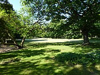
Münsingerpark


- Bull ditch green train
- Koeltzepark
- Münsingerpark and Ramingrünzug
- Spandau lock
- Spectacular
- Stave garden
- Stresowpark
- Wröhmännerpark
- Brick yard
See also
literature
- Gesellschaft Wirtschaftshof Spandau eV (Hrsg.): Street chronicle with signposts through the Spandau economy . H. Born & Co Spandau, Berlin 1957.
Web links
- Street directory Spandau. kaupert media GmbH, accessed on January 11, 2011 .
- Prussian military center Spandau at the confluence of the Spree and Havel rivers. (PDF; 3.2 MB) Exhibition on the museum ship “Kurier” in the historic port of Berlin, 2007, archived from the original on February 14, 2010 ; Retrieved January 30, 2011 (autumn 2007).
- cards
- Map of Berlin 1: 5000 with district boundaries. Senate Department for Urban Development Berlin, 2009, accessed on January 11, 2011 .
- Surveying map from 1938 - Spandau, Reinickendorf, Osthavelland district - 1: 10000. Surveying Office Berlin-Spandau, 1938, accessed on November 1, 2011 .
- Surveying map from 1938 - Spandau, Charlottenburg, Wilmersdorf, Osthavelland district - 1: 10000. Surveying Office Berlin-Spandau, 1938, accessed on November 1, 2011 .
- Surveying map from 1936 - Part IV - 1: 4000. (Spandau old town to Ruhleben and Haselhorst). Berlin-Spandau surveying office, 1936, accessed on November 1, 2011 .
Individual evidence
- ↑ Catholic Apostolic Church
- ↑ Water tower of the former Spandau slaughterhouse
- ^ Rainer Fliegner: Spandau - history and stories. Erfurt 2007, Sutton Verlag, ISBN 978-3-86680-122-6 - Askanierring p. 39.
- ↑ Kath. St. Marienkirche with parish and residential house
- ↑ Heinemann's house
- ↑ Gothic house on Breite Strasse
- ↑ Breite Straße 35 Feldsteinbrunnen from 1300/1400
- ↑ Breite Straße, Berlin-Spandau (Spandau old town)
- ↑ Kaiser's coffee roastery
- ^ Rainer Fliegner: Spandau - history and stories. Erfurt 2007, Sutton Verlag, ISBN 978-3-86680-122-6 - Potsdamer Straße p. 23 ff.
- ↑ Spandau town hall with police building
- ^ Kauperts: Charlottenburger Chaussee
- ^ Rainer Fliegner: Spandau - history and stories. Erfurt 2007, Sutton Verlag, ISBN 978-3-86680-122-6 - Charlottenbrücke p. 30.
- ↑ Residential building from 1668/1715 at Charlottenstrasse 10
- ↑ Colonist settlement Tiefwerder
- ↑ berliner-stadtplan.com: Egelpfuhlstrasse
- ↑ Living room and tool house of the army letter pigeon station
- ↑ For a picture of Falkenseer Platz with tram, see Tram Forum , 5th picture from above
- ↑ Fischerstrasse 26
- ↑ Catholic St. Mary's Church
- ↑ Freedom were meadows in the east of the Stresow between Spree and Charlottenburger Chaussee that belonged to the Spandau nuns.
- ↑ Stresow-Kaserne I & Kaserne am Schlangengraben
- ^ Rainer Fliegner: Spandau - history and stories. Erfurt 2007, Sutton Verlag, ISBN 978-3-86680-122-6 - Haveltsraße p. 33.
- ↑ Residential building group Havelstrasse 18–21
- ↑ Ralf Salecker: The largest jade Buddha in the world in Spandau : The peace symbol in the Linh Thuu Pagoda, July 9, 2011, accessed on February 6, 2019
- ↑ Continuation of the development of the moat! Press release of the District Office Spandau from 2014 , accessed on August 21, 2016.
- ↑ City wall and tower of the fortifications
- ^ Rainer Fliegner: Spandau - history and stories. Erfurt 2007, Sutton Verlag, ISBN 978-3-86680-122-6 - pp. 32, 35.
- ^ Kauperts: Jüdenstrasse
- ↑ a b Viktoria-Ufer and Jüdenstrasse Old City Wall
- ↑ Residential house at Jüdenstrasse 51 around 1700
- ↑ Betonschandfleck as an art project . In: Berliner Zeitung , July 18, 2019, p. 10 (Berllin page).
- ↑ Old kolk tavern
- ^ Rainer Fliegner: Spandau - history and stories. Erfurt 2007, Sutton Verlag, ISBN 978-3-86680-122-6 - Lindenufer p. 31.
- ↑ Lynarstrasse 12 Municipal Hospital
- ↑ Georg Ermisch's office and commercial building, 1929
- ↑ Residential and craftsman's house from 1701/1750
- ↑ Rectifier plant in Spandau
- ↑ Tenement group Möllentordamm 2, 3, 4, 4a
- ^ Rainer Fliegner: Spandau - history and stories. Erfurt 2007, Sutton Verlag, ISBN 978-3-86680-122-6 - p. 44.
- ↑ Riding arena and stable building of the former "Moritzstraße barracks"
- ↑ Lily-Braun-Schule Münsingerstraße 2
- ^ Rainer Fliegner: Spandau - history and stories. Erfurt 2007, Sutton Verlag, ISBN 978-3-86680-122-6 - Haveltsraße p. 55.
- ↑ Garrison laundromat, army provisions office, garrison bakery
- ↑ Residential building group 8 to 17
- ↑ so at least: Gesellschaft Wirtschaftshof Spandau eV (Hrsg.): Street chronicle with signposts through the Spandau economy. H. Born & Co Spandau, Berlin 1957.
- ↑ Ev. St. Nikolai Church
- ↑ Monument to Elector Joachim II
- ↑ House from 1751/1800
- ^ Rainer Fliegner: Spandau - history and stories. Erfurt 2007, Sutton Verlag, ISBN 978-3-86680-122-6 - Haveltsraße p. 36.
- ↑ Hans-Jürgen Kämpf: The tram in Spandau and around Spandau . Ed .: Heimatkundliche Vereinigung Spandau 1954. Berlin 2008, ISBN 978-3-938648-05-6 , pp. 245 .
- ↑ Castle, castle town, suburb, artisan settlement and eastern suburbium as well as western suburbium and cemetery
- ^ Rainer Fliegner: Spandau - history and stories. Erfurt 2007, Sutton Verlag, ISBN 978-3-86680-122-6 - p. 46.
- ↑ Batardeau & fortification & plastic
- ↑ Unveiling of an information board “Sternbergpromenade” ; Press release from April 6, 2016 at www.berlin.de, accessed on August 21, 2016.
- ↑ Information on the memorial complex according to the extensive information board set up by the district office on Lindenufer; As of August 2016.
- ↑ PHARUS-PLAN from 1943 square K6, the name can not be recognized precisely ( page can no longer be accessed , search in web archives ) Info: The link was automatically marked as defective. Please check the link according to the instructions and then remove this notice.
- ↑ Schlemmingerstrasse . In: Berliner Adreßbuch , 1938, p. 1246.
- ↑ House Viktoria-Ufer 17
- ^ Werkring-Berlin-Spandau
- ^ Rainer Fliegner: Spandau - history and stories. Erfurt 2007, Sutton Verlag, ISBN 978-3-86680-122-6 - p. 51.
- ^ History of the Spandau allotment gardeners
- ↑ Allotment gardens in Spandau ( Memento of the original from September 29, 2013 in the Internet Archive ) Info: The archive link was automatically inserted and not yet checked. Please check the original and archive link according to the instructions and then remove this notice.
- ^ Associations in the Spandau allotment garden association
- ↑ a b c d e f g h i j k Level V a: Allotment garden areas that are defined as permanent allotment gardens by the B-Plan.
- ↑ a b c d Fictional permanent allotment gardens * which, according to the FNP, are to be used for another purpose. In some cases, for small areas under three hectares, development plans derived from the land use plan can follow in stage Va.
- ↑ a b c Level I b: Allotment gardens on areas owned by Deutsche Bahn AG that are leased to "Railway Agriculture". These are smaller groups of gardens that are close to railway tracks.
- ↑ The Federal Allotment Garden Act differentiates between permanent and other allotment gardens. Permanent allotments are only allotments on an area that is specified in the development plan for permanent allotment gardens. The fiction is that existing leases are to be treated like permanent allotments. Source: Allotment garden development plan Berlin: Basics of allotment garden law. P. 9 ( Memento of the original from September 24, 2015 in the Internet Archive ) Info: The archive link was automatically inserted and not yet checked. Please check the original and archive link according to the instructions and then remove this notice.
- ↑ a b c Level V b contains fictitious permanent allotments in accordance with §§ 16 and 20a BKleingG. These are additionally protected by the representation in the FNP as green areas - allotments.
- ↑ a b c Level IV: Allotment garden areas which, according to the presentation of the land use plan, are to be retained. State-owned areas at this level are allotment gardens that were established after the BKleingG came into force and are therefore not fictitious permanent allotment gardens. For allotment gardens on private areas, procedures for binding planning law security are required or are already being processed.

Adlershof | Altglienicke | Alt-Hohenschönhausen | Alt-Treptow | Baumschulenweg | Biesdorf | Blankenburg | Blankenfelde | Bohnsdorf | Borsigwalde | Britz | Book | Buckow | Charlottenburg | Charlottenburg-North | Dahlem | Falkenberg | Falkenhagener Feld | Fennpfuhl | French Buchholz | Friedenau | Friedrichsfelde | Friedrichshagen | Friedrichshain | Frohnau | Gatow | Gesundbrunnen | Gropiusstadt | Grünau | Grunewald | Hook field | Halensee | Hansaviertel | Haselhorst | Heiligensee | Heinersdorf | Hellersdorf | Hermsdorf | Johannisthal | Karlshorst | Karow | Kaulsdorf | Kladow | Konradshöhe | Köpenick | Kreuzberg | Lankwitz | Lichtenberg | Lichtenrade | Lichterfelde | Lübars | Mahlsdorf | Malchow | Mariendorf | Marienfelde | Märkisches Viertel | Marzahn | Middle | Moabit | Müggelheim | Neu-Hohenschönhausen | Neukölln | Niederschöneweide | Niederschönhausen | Nikolassee | Oberschöneweide | Pankow | Plänterwald | Prenzlauer Berg | Rahnsdorf | Reinickendorf | Rosenthal | Rudow | Rummelsburg | Schmargendorf | Schmöckwitz | Schöneberg | Siemensstadt | Spandau | Staaken | Malchow suburban settlement | Steglitz | Tegel | Tempelhof | Zoo | Adventure | Wannsee | Wartenberg | Wedding | Weissensee | Westend | Wilhelmsruh | Wilhelmstadt | Wilmersdorf | Wittenau | Zehlendorf