List of streets in Berlin-Borsigwalde

The list of streets in Berlin-Borsigwalde shows the streets in the Berlin district of Borsigwalde with their historical references. At the same time, this compilation is part of the lists of all Berlin streets and places .
overview
Borsigwalde has 6,777 inhabitants (as of December 30, 2019) and is in the postal code area 13509. There are 32 dedicated streets in the district with a total length of 16.6 kilometers. Nine of these streets lead to the neighboring districts under the same name: Reinickendorf , Wittenau or Tegel .
On April 24, 2012 the district office decided to officially declare Borsigwalde to be the 11th part of the Reinickendorf district . The borders of Borsigwalde are as follows:
- Northern boundary: At the north ditch from Borsigwalder Weg to Eichborndamm
- Eastern limit: Eichborndamm from Am Nordgraben - Eichborndamm S-Bahn station
- southern limit: S-Bahn station Eichborndamm - Trettachzeile
- western boundary: Trettachzeile - Altenhofer Weg - Borsigwalder Weg - Am Nordgraben
Borsigwalde as a locality of Wittenau is already listed in the 1919 address book. Accordingly, the "colony Borsigwalde" following roads with the addition, post Borsigwalde 'in the suburb called Wittenau: Conrad- , Ernst , Innungs- , Mirau , CHART Sound , Schubart- , summer fields , Tietzstraße and road 18 ( Seidelstraße ) Street 21 and Street 22 ( Wittestrasse ). In the 1910 address book, the Borsigwalde colony and its streets are included as a sub-point of Wittenau. In addition to the eight streets and the undeveloped church square, several numbered plan streets are only listed as projected cross streets in 1910, but not as a keyword. In 1909, Dalldorf was mentioned in the address book, but not in the street directory of the suburbs.
Overview of the streets
The following table gives an overview of the existing streets in the district and some related information.
- Name / location : current name of the street. The street can be displayed on various map services via the Location link . The geoposition indicates the approximate center of the street length.
- Traffic routes not listed in the official street directory are marked with * .
- Former or no longer valid street names are in italics . A separate list may be available for important former streets or historical street names.
-
Length / dimensions in meters:
The length information contained in the overview are rounded overview values that were determined in Google Earth using the local scale. They are used for comparison purposes and, if official values are known, are exchanged and marked separately.
If the street continues into neighboring districts, the addition ' in the district ' indicates how long the street section within the district of this article is. - Name origin : origin or reference of the name.
- Notes : further information on adjacent monuments or institutions, the history of the street and historical names.
- Image : Photo of the street or an adjacent object.
| Name / location | Length / dimensions (in meters) |
Origin of name | Date of designation | Remarks | image |
|---|---|---|---|---|---|
|
Altenhofer way
( Location ) |
240 | Altenhof , part of the community Schorfheide in Brandenburg | Apr 10, 1961 | It was created as street 169 of the development plan and runs from Conradstrasse to Nassenheider Weg. Between Ziekowstraße and Nassenheider Weg, it forms the border to the Tegel district . |

|
| At the north ditch
( Location ) |
1330 (in the district) |
Nordgraben , drainage ditch that connects the Panke with the Tegeler See | Nov 1, 1968 | It was created as street 374 of the development plan. On July 1, 1976, roads 473 and 374 were also named that way. The extension between Triftstraße and Gorkistraße was also given this name on November 1, 1978. The majority is in the Wittenau district . The Vivantes Humboldt Clinic is located here , Am Nordgraben . |

|
|
Borsigwalder Weg
( Location ) |
1220 | Borsigwalde , former location in Wittenau , today a district of Reinickendorf | before 1922 | The route already existed in 1905 without a name. It was created as street 10 of the development plan and connects Ernststraße with street Am Nordgraben. The naming took place between 1918 and 1922. |

|
| Breitenbachstrasse
( Location ) |
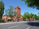
880 | Paul von Breitenbach (1850–1930), from 1906 to 1918 Minister of Public Works in the Kingdom of Prussia | before 1908 | The street leads from Holzhauser Straße to Miraustraße through industrial sites. The administration building of EDEKA Berlin, the former main post workshop for postal vehicles and the substation in Wittenau are listed monuments. Until 1945, the main factory of Altmärkische Kettenwerke , a manufacturer of armored vehicles, was located on property 33-36 . |

|
|
Conradstrasse
( Location ) |
850 | Conrad von Borsig (1873–1945), industrialist | before 1903 | It is one of the oldest streets in Borsigwalde, which was created when the factory settlement was built. The residential complex Conradstrasse 51-78 is a listed building monument. As an extension of Ziekowstrasse, the street connects the Tegel district with Holzhauser Strasse. |

|
|
Drenziger line
( Location ) |
190 | Drenzig , place in the former province of Brandenburg , today Drzeńsko in the Polish Lubusz voivodeship | Apr 10, 1961 | The road from Trepliner Weg to Vietzerzeile was laid out as road 167 . |

|
| Drostestrasse
( Location ) |
120 + 110 | Droste, around 1844 a gendarme in the municipality of Tegel | Oct. 20, 1932 | The road connects Borsigwalder Weg with Ernststraße and then runs offset as a footpath to Jacobsenweg. Before road 1a and open space J . |

|
|
Eichborndamm
( Location ) |
1240 (in the district) |
Ludwig (Louis) Eichborn (1819–1903), landowner, banker, lottery taker. | May 20, 1937 | Previous names were Rosenthaler Strasse (before 1902-1937), Charlottenburger Strasse (before 1910-1937) and Eichbornstrasse (1875-1937). The calibration fount road ran from the Scharnweberstraße to this station Eichborndamm . Its extension was the Charlottenburger Strasse, which ran to the main street in Wittenau (today: Alt-Wittenau). Both streets were renamed Eichborndamm in 1937 (the S-Bahn station only received this name on May 28, 1995 when the S-Bahn line between Schönholz and Tegel was reopened). On January 22, 1958, the part of Holzhauser Strasse from the confluence with Eichborndamm to Oranienburger Strasse was given the same name; it used to be part of Rosenthaler Strasse. The street forms the eastern border to the Wittenau district . In the building of the former DWM (Deutsche Waffen- und Munitionsfabriken) at No. 179 the German Service Center (WASt) for the notification of the next of kin of the dead of the former German armed forces (former armed forces information center) is housed. The Berlin State Archive is also located there . |

|
| Eichstädter Weg
( Location ) |
300 | Eichstädt , part of the municipality of Oberkrämer in Brandenburg | Apr 10, 1961 | It was created as road 171 and connects the Borsigwalder Weg with the Altenhofer Weg. |

|
| Ernststrasse
( Location ) |
920 | Ernst Borsig from Borsig from 1909; (1869–1933), industrialist | 1903 | Previous names were Gaswerkstrasse (around 1900-1939), Extended Gaswerkstrasse (before 1903 to before 1905), Hempelstrasse (before 1905 to around 1913) and Neue Ernststrasse (around 1913–1939). Ernststraße originally only ran from Conradstraße to Miraustraße. On March 29, 1939, Neue Ernststrasse (Conradstrasse to S-Bahn-Trasse, today roughly the city motorway ) and Gaswerkstrasse (Berliner Strasse to S-Bahn-Trasse) were incorporated into Ernststrasse. It runs from Berliner Straße in Tegel to Miraustraße. Only the part east of the Kremmener Bahn belongs to Borsigwalde, the western part to Tegel . Since the 1920s, the two parts were initially connected to one another by a wooden pedestrian bridge, which was later replaced in favor of a concrete structure. |

|
|
Holzhauser Strasse
( Location ) |
1540 (in the district) |
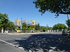
Holzhausen , district of Kyritz in Brandenburg | May 20, 1937 | Previous names were Spandauer Strasse (before 1898-1937) and Charlottenburger Strasse (before 1907-1937). In 1937, Spandauer Strasse, the remainder of Charlottenburger Strasse to the northeast and the adjoining part of Rosenthaler Strasse up to Oranienburger Strasse were renamed Holzhauser Strasse. On January 22, 1958, part of Holzhauser Strasse from the confluence with Eichborndamm to Oranienburger Strasse was given the name Eichborndamm. The part of Holzhauser Straße between Eichborndamm and Am Nordgraben was renamed Am Rathauspark on July 1, 1976. On the same day, its extension, Strasse 374 , was given the name Holzhauser Strasse. The part south of the S-Bahn line is in Tegel. |
|
|
Guild Street
( Location ) |
370 | Guild , professional form of organization of the handicraft at local or regional level | before 1908 | A sheep farm of the Charlottenburg slaughter guild was located here. It was laid out as Straße 19 and named between 1905 and 1908. It once ran from Seidelstraße in Tegel to Miraustraße. The part of the street in the Tegel district was renamed Otisstraße on July 19, 1956. The Berlin North Employment Agency is located at Innungsstrasse 40. |

|
|
Jacobsenweg
( Location ) |
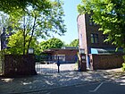
550 | Emil Jacobsen (1836–1911), chemist and poet | March 29, 1939 | The street runs from Holzhauser Straße to Ernststraße. The oxygen works Borsigwalde - Gesellschaft für Linde Eismaschinen AG, Bohemian Brewery is a listed building monument. |
|
|
Klinnerweg
( Location ) |
650 | Georg Klinner (1864–1958), from 1906 to 1912 the first municipal master builder in Wittenau | June 25, 1936 | It was laid out as street 5 . It runs between Holzhauser Straße and Borsigwalder Weg as an extension of the Nassenheider Weg. |

|
| Klosterfelder Weg
( Location ) |
290 | Klosterfelde , part of the community Wandlitz in Brandenburg | Apr 10, 1961 | It was created as road 172 and connects the Borsigwalder Weg with the Nassenheider Weg. |

|
|
Ladeburg way
( Location ) |
220 | Ladeburg , part of the city of Bernau near Berlin | Apr 10, 1961 | It was created as road 173 and connects the Borsigwalder Weg with the Nassenheider Weg. |

|
| Letschiner way
( Location ) |
300 | Letschin , municipality in the district of Märkisch-Oderland in Brandenburg | Apr 10, 1961 | It was created as Straße 170 and connects the Borsigwalder Weg with the Altenhofer Weg. |

|
| Leuenberger line
( Location ) |
250 | Leuenberg , part of the municipality of Höhenland in the Märkisch-Oderland district in Brandenburg | Apr 10, 1961 | It was created as Straße 165 and runs from Ernststraße to Trepliner Weg. |

|
|
Miraustraße
( Location ) |
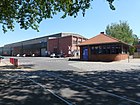
1610 | Clemens Mirau (19th century – after 1906), government master builder, district building officer in the Niederbarnim district | before 1910 | It runs from Gorkistraße in Tegel to Eichborndamm. It borders the Borsigwald residential area to the northwest of Holzhauser Strasse. The Toulouse Lautrec School and the Borsigwalder Elementary School are located here. It leads through the industrial area between Holzhauser Straße and Eichborndamm. There are numerous listed buildings here. |

|
|
Nassenheider way
( Location ) |
360 | Nassenheide , part of the municipality of Löwenberger Land in Brandenburg | Apr 10, 1961 | The road was created as road 174 and runs from Altenhofer Weg to Borsigwalder Weg. |

|
|
Noise street
( Location ) |
580 | Johannes Räus (19th century – 1920), director of the Borsig central administration | before 1903 | It was laid out as Straße 2 by the Tegel Terraingesellschaft, of which Räus was a member of the supervisory board. The entire street from the early days of the Borsigwalde colony is a listed building . It runs from Holzhauser Straße to Borsigwalder Weg. The Catholic Church of All Saints is located at Rauscherstraße 20. |

|
| Reppener line
( Location ) |
190 | Reppen , city in the former province of Brandenburg , today Rzepin in the Polish Lebus voivodeship | Apr 10, 1961 | The access road starting from Vietzerzeile was created as Straße 166 . |

|
| Rüdnitzer line
( Location ) |
330 | Rüdnitz , municipality in Brandenburg | Apr 10, 1961 | The residential street was created as street 174 and runs between Miraustraße and Klinnerweg. |

|
|
Schubartstrasse
( Location ) |
620 | Paul Schubarth (19th century – after 1928), lawyer, director of the Borsigwerk | before 1903 | It was laid out as Straße 3 by the Tegel Terraingesellschaft , whose supervisory board chairman was Schubart. The entire street from the early days of the Borsigwalde colony is a listed building. It is located between Holzhauser Straße and Borsigwalder Weg. |

|
| Soltauer Strasse
( Location ) |
600 | Soltau , town in the Lüneburg Heath in Lower Saxony | Feb. 1, 1965 | It is one of the oldest streets in Borsigwald and was called Mühlenstraße until 1965 after the former Dallgower Mühle located here. It leads from Holzhauser Strasse to Innungsstrasse. |

|
| Sommerfelder Strasse
( Location ) |
120 | Sommerfeld , district of Kremmen in Brandenburg | around 1914 | The short street between Jacobsenweg and Conradstraße was created as Straße 52 . The Benjamin Franklin High School is located here. |

|
|
Tietzstrasse
( Location ) |
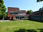
640 | Carl Tietz (1831–1874), architect | before 1903 | It was created as street 4 . On the city map, which was created around 1903, Tietzstraße is already marked by name. It leads from Holzhauser Straße to Borsigwalder Weg. Here is the Stötzner school for the learning disabled, a youth home and the Gnade-Christi-Kirche. |

|
| Trepliner way
( Location ) |
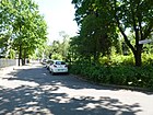
290 | Treplin , municipality in the Märkisch-Oderland district in Brandenburg | May 1, 1978 | The street running from Ziekowstraße to Leuenbergerzeile was laid out as Straße 389 . |
|
| Pedal line
( Location ) |
230 | Trettach , the right source river of the Iller in the Allgäu Alps in Bavaria | July 26, 1955 | The street going from Ziekowstraße was laid out as street D. It forms the border to Tegel , where other roads named after Bavarian rivers are located. |

|
| Triftstrasse
( Location ) |
180 (in the district) |
Trift , the path used by cattle between the pasture and the stable | before 1902 | The street is already listed in the Berlin address book from 1902. It continues in Wittenau and runs from Holzhauser Straße to Alt-Wittenau. Only the part between Holzhauser Straße and Nordgraben belongs to Borsigwalde. |

|
| Vietzer line
( Location ) |
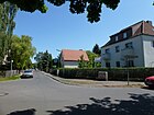
210 | Vietz , city in the former province of Brandenburg , today Witnica in the Polish Lubusz voivodeship | Apr 10, 1961 | The street running from the Drenziger line to the Leuenberger line was laid out as street 168 . |
|
|
Ziekowstrasse
( Location ) |
50 (in the district) |
Carl Friedrich August Ziekow (1832–1887), feudal and court mayor , owner of the feudal mayor in Tegel | around 1913 | It was laid out as street 2 . In 1945/1946 the street was briefly named Paul-Gehrt-Straße , which was reversed. On July 1, 1976, part of the Titusweg was renamed Ziekowstraße. It continues to Tegel. |

|
Allotment colonies
See also
Web links
- Street directory Borsigwalde. Retrieved October 24, 2012 .
- Map of Berlin 1: 5000 with district boundaries. Senate Department for Urban Development Berlin, 2009, accessed on January 11, 2011 .
- Office for Statistics Berlin-Brandenburg: Directory of streets and places in the Reinickendorf district (as of February 2015); pdf
- Pictures of Borsigwalde - then and now
- Borsigwalde then and now - local historical information collection
- Hermann Jansen: rows of terraced houses, Berlin-Borsigwalde 1922
Individual evidence
- ^ Borsigwalde: 11th district of Reinickendorf. ( Page no longer available , search in web archives ) Info: The link was automatically marked as defective. Please check the link according to the instructions and then remove this notice. Printed matter No. 0020 / XIX of BVV Reinickendorf (including map of the district boundaries), April 25, 2012.
- ^ Wittenau with the Borsigwalde colony . In: Berliner Adreßbuch , 1919, Part V., p. 539.
- ↑ Borsigwalde Colony . In: Berliner Adreßbuch , 1910, Part V., p. 697.
- ↑ a b c Hermann Jansen (1869-1945) Development plan for the small settlement Borsig, Berlin-Tegel. Partial development plan Borsigwalde (1922)
- ↑ EDEKA Berlin GmbH
- ↑ Main postal workshop for postal vehicles
- ↑ Substation and substation Wittenau
- ↑ Conradstrasse residential complex
- ^ Kauperts: Eichborndamm
- ↑ German arms and ammunition factories (DWM)
- ^ Kauperts: Holzhauser Strasse
- ↑ Employment Agency Berlin North
- ↑ Oxygen plant Borsigwalde - Gesellschaft für Linde Eismaschinen AG, Bohemian Brewery
- ↑ German arms and ammunition factories (DWM)
- ↑ a b Borsigwalde Colony
- ↑ Support center Stötzner Schule [1]
- ^ Kauperts: Ziekowstrasse
