List of streets in Berlin-Malchow

The list of streets in Berlin-Malchow describes the streets of the Berlin district of Malchow in the Lichtenberg district . At the same time, this compilation is part of the lists of all Berlin streets and places .
overview
With 635 inhabitants (as of December 30, 2019) on around 150 hectares , Malchow is one of the smallest districts in Berlin and the least populous. It only includes the Malchow village center as a populated area. The village street is the main axis of the village, part of the federal highway 2 , also the longest street of Malchow with 1.1 kilometers as well as the only street that runs exclusively in the district. Together with the Wartenberger Strasse, the Hohenschönhauser Weg, the Chaussee to Lindenberg and the Gutsweg, it formed the small road network until the 1930s. There are now seven public roads in the Malchower area. The Malchow suburban settlement has not belonged to Malchow since the 2001 district reform, but forms a separate district in the Pankow district .
Malchow is assigned to the postal code area 13051.
Overview of the streets
The following table gives an overview of the existing streets in the district and some related information.
- Name / location : current name of the street. The street can be displayed on various map services via the Location link . The geoposition indicates the approximate center of the street length.
- Traffic routes not listed in the official street directory are marked with * .
- Former or no longer valid street names are in italics . A separate list may be available for important former streets or historical street names.
-
Length / dimensions in meters:
The length information contained in the overview are rounded overview values that were determined in Google Earth using the local scale. They are used for comparison purposes and, if official values are known, are exchanged and marked separately.
If the street continues into neighboring districts, the addition ' in the district ' indicates how long the street section within the district of this article is. - Name origin : origin or reference of the name.
- Notes : further information on adjacent monuments or institutions, the history of the street and historical names.
- Image : Photo of the street or an adjacent object.
| Name / location | Length / dimensions (in meters) |
Origin of name | Designation date |
Remarks | image |
|---|---|---|---|---|---|
| Blankenburg paved path
( Location ) |
200 (in the district) |
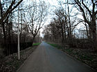
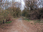
Blankenburg , part of the Pankow district of Berlin | after 1882 | The former Blankenburger Weg is the historical connection between Malchow and Blankenburg. After the city of Berlin acquired the Malchow and Blankenburg manors in 1882, it initiated the paving of the path to develop their sewage fields, which explains the name. The larger section of the street runs through Blankenburg and the suburb of Malchow . |

|
|
Bundesstrasse 2
( Location ) |
110 (in the district) |
a German federal highway | after 1990 | Bundesstraße 2 runs through the district and is called Dorfstraße in the built-up (village) area . To the north of the Blankenburger Pflasterweg the official and georeferenceable street name is "Bundesstraße 2". Correspondingly, lots 4 (KGA Neu-Malchow), 8 (art workshop) and 10 (Hundeplatz) have the address Bundesstraße 2. From the level of plot line 4–6, the street area belongs to the neighboring suburb of Malchow and thus to the Pankow district . The road continues to the north and leaves (also with the eastern properties) the district of the pest ditch a little north of the underpass of the Berlin outer ring with change to Wartenberg . Road land and the west side remain in the suburb of Malchow to Am Luchgraben . Here the B 2 continues in Lindenberg (Karl-Marx-Straße). The arterial road from Berlin was called Chaussee nach Lindenberg and later Lindenberger Chaussee .
In November 2014, after several months of construction, Berlin's second wind turbine went into operation on this road , which is expected to deliver an average of 5 million kilowatt hours per year. This can supply around 1500 four-person households with electricity. The first system was built in 2008 in the Berlin-Buch district. Both wind turbines are operated by the company "Neue Energie Berlin". |

|
|
Village street
( Location ) |
1160 | according to their location in the Malchow village center | after 1400 | The Dorfstraße, which runs in north-south direction, is the oldest traffic route in the district. It emerges from the Malchower Chaussee on the southern edge of the village and leads to the Blankenburger Pflasterweg, where it turns into the street known as Bundesstraße 2 . The entire length of the street is part of Bundesstraße 2 . The Malchow village church with the cemetery next to it, the Malchow nature conservation station and, since 2013, the Synanon Foundation in the listed buildings of the former estate are located here . |

|
| Hohenschönhauser Weg
( Location ) |
575 (in the district) |
Alt-Hohenschönhausen , district in the Lichtenberg district of Berlin | after 1600 | The Hohenschönhauser Weg was part of the historical connection between Alt-Hohenschönhausen and Malchow and is now a footpath. It begins south of the village center in the area of the Malchow suburb on Malchower Chaussee, then runs through Malchow and Neu-Hohenschönhausen and ends at Darßer Strasse, which partly follows the path. |

|
| Fairy tale trail
( Location ) |
225 (in the district) |
'Märchenland' colony with fairytale garden paths | after 1939 | The fairy tale trail goes from Dorfstraße to the west and forms the northern end of the KGA 'Märchenland' in the neighboring Malchow suburb . The path to the border with the Malchow suburb is marked as a public road, behind it it is a (semi-public) private road to the 'Märchenland' colony. |

|
| Wartenberger way
( Location ) |
965 (in the district) |
Wartenberg , part of the Lichtenberg district of Berlin | after 1600 | The Wartenberger Weg is the historical connection to Wartenberg. It leads from Dorfstrasse in the direction of Neu-Hohenschönhausen and turns into Ernst-Barlach-Strasse at the Egon-Erwin-Kisch-Strasse intersection. |

|
| To the Hechtgraben
( Location ) |
525 (in the district) |
Hechtgraben , flowing water in the Lichtenberg district of Berlin | March 28, 1984 | The street Zum Hechtgraben goes east of the Malchower See from the Wartenberger Weg. The road was laid out in the 1930s as an access road to the newly built Niles settlement . The road is interrupted for motor vehicle traffic at the level of the district boundary to Neu-Hohenschönhausen. It was previously referred to as Strasse 14 .
In this street, the Lichtenberg district maintains a neighborhood meeting place in a prefabricated building that is to be expanded as the Hechtgraben community center. Some clubs such as are family run eV - FAN , club Kietz for Kids - recreational sports or woman Technikzentrum resident want to start their own club for the community center. The district administration wanted to organize a location conference on the problem in summer 2018 , at which the renovation of the premises (estimated cost 800,000 euros) and the maintenance of the community center were to be clarified. |

|
Allotment garden
- KGA, Volkspark Malchow '(also Neu-Malchow; An der B2, No. 4)
See also
literature
- Anke Huschner: Hohenschönhausen . In: Wolfgang Ribbe (Ed.): History of the Berlin administrative districts . tape 15 . Stapp Verlag, 1995, ISBN 3-86134-532-3 .
- Hans-Jürgen Mende (Ed.): Lexicon of all Berlin streets and squares. From the foundation to the present . tape 2 . New Life / Edition Luisenstadt, Berlin 1998, ISBN 3-355-01491-5 .
- Walter Püschel : Walks in Hohenschönhausen . Haude & Spener, Berlin 1995, ISBN 3-7759-0398-4 .
Web links
- Office for Statistics Berlin-Brandenburg: List of streets and squares in the Lichtenberg district (February 2015) (PDF; 325 kB)
- Streets in Malchow. kaupert media gmbh, accessed on April 9, 2010 .
Individual evidence
- ↑ Malchow> Chaussee to Lindenberg, cross street of Dorfstraße . In: Berliner Adreßbuch , 1922, Part IV, p. 1763.
- ^ Malchow> Lindenberger Chaussee . In: Berliner Adreßbuch , 1943, Part IV, p. 2346.
- ↑ The second wind turbine is turning on the outskirts of Berlin . In: Berliner Zeitung of Nov. 20, 2014.
- ↑ Homepage nature conservation station , Dorfstrasse 35
- ↑ Steffi Bey: A community center in the plate. In: Hohenschönhausen-Lichtenberg district journal , spring 2018, p. 6. ( also in www.lichtenbergmarzahnplus.de )

