List of streets and squares in Berlin-Kreuzberg

The list of streets and squares in Berlin-Kreuzberg describes the street system in the Berlin district of Kreuzberg with the corresponding historical references. At the same time, this compilation is part of the lists of all Berlin streets and places .
overview
Today's district of Kreuzberg with its northern part belonged to old Berlin in earlier centuries and was opened up with streets such as Friedrichstrasse, Lindenstrasse, Stallschreiberstrasse or Jacobs Gasse. The southern part lay outside the city of Berlin until the end of the 18th century and the traffic routes from the city gates were named after the direction such as Buckow, Köpenick, Rixdorf. The street system there did not develop until the 19th century on the basis of the Hobrecht plan . The names given for the new streets were based on nearby points, such as the Sebastian Church, the path to the cemetery (Todtengasse) , the vineyard. It was not until later that some streets were named after people with reference to the district such as Cuvrystraße or Baerwaldstraße. Usually, towards the end of the 19th century, rulers' names were also given here for the traffic routes (Elisabeth, Maria Anna Amalie [= Marianne], Prince, Kaiser Friedrich). The regional allocation was initially carried out via the corresponding police stations, which were numbers 10, 11 and 12. With the progressive expansion of the road network, the police stations were split up around 1850, now the numbers 10 (partially) to 14 belonged to them. Soon it was necessary to go over to defining the first “city districts”. These were based on the corresponding streets and were called (for today's Kreuzberg), for example, Jerusalemsstrasse district, Anhaltischer Thor district, Gymnasium-Belle-Alliance-Platz district; with one digit between 44 and 70b but not consistently. The next step was a further division of the police stations around 1863, the Kreuzberger Streets are now assigned the numbers 27-36. The system only became clearer with the creation of the new larger districts and their naming from 1920.
The list shows 312 streets and squares, but does not claim to be exhaustive; For this, reference is to be made to the street directory (according to the Berlin Road Act) kept by the district's land surveying office, which can be viewed free of charge and in which the extent of the dedicated street area is proven.
The division of the urban area associated with the development of the greater Berlin community was initially carried out according to its direction from the center, which corresponded to the delivery post offices. The current district of Kreuzberg thus comprised the designations SW (= south-west) or SO (= south-east) and the numbers 11, 16, 26, 27, 36, 47, 61, 68. After the postcodes valid until 1993 were still the two localities " Kreuzberg 61 " and " SO 36 " remain.
Kreuzberg has 154,351 inhabitants (as of December 30, 2019) and includes the five-digit postcode areas 10785, 10961, 10963, 10965, 10967, 10969, 10997 and 10999.
According to a resolution of the district council meeting (BVV) of the Friedrichshain-Kreuzberg district on February 23, 2005, streets and squares should initially only be named or renamed after women in order to equalize the number of streets dedicated to men and women. However, exceptions are possible in the event of greater public interest. (According to a press release from the district office in April 2013, the district has 375 streets and squares, of which only twelve are currently named after women.)
On August 12, 2014, the Senate issued the Twelfth Ordinance to Change the District Boundaries , which stipulates that the district boundary in the Columbiadamm / Züllichauer Straße / Lilienthalstraße area will be changed so that these streets and the enclosed area are now part of the Friedrichshain- Kreuzberg belong.
Overview of streets and squares
The following table gives an overview of the streets and squares in the district as well as some related information.
- Name / location : current name of the street or square. Via the link Location , the street or the square can be displayed on various map services. The geoposition indicates the approximate center of the street length.
- Traffic routes not listed in the official street directory are marked with * .
- Former or no longer valid street names are in italics . A separate list may be available for important former streets or historical street names.
-
Length / dimensions in meters:
The length information contained in the overview are rounded overview values that were determined in Google Earth using the local scale. They are used for comparison purposes and, if official values are known, are exchanged and marked separately.
For squares, the dimensions are given in the form a × b for rectangular systems and for (approximately) triangular systems as a × b × c with a as the longest side.
If the street continues into neighboring districts, the addition ' in the district ' indicates how long the street section within the district of this article is. - Name origin : origin or reference of the name.
- Notes : further information on adjacent monuments or institutions, the history of the street and historical names.
- Image : Photo of the street or an adjacent object.
| Name / location | Length / dimensions (in meters) |
Origin of name | Date of designation | Remarks | image |
|---|---|---|---|---|---|
|
Adalbertstrasse
( Location ) |
700 (in the district) |
Adalbert von Prussia (1811–1873), Prussian prince and admiral | Jan. 21, 1847 | The division of the Köpenicker field between 1841 and 1846 led to the construction of this road. On October 1, 1975, part of Dresdener Strasse was added. A street section runs in the district of Mitte . |

|
| Admiralstrasse
( Location ) |
400 | Adalbert von Prussia (1811–1873), Prussian prince and admiral | June 28, 1866 | The street was laid out in 1866 as an extension of Adalbertstraße. |

|
| Alexandrinenstrasse
( Location ) |
1340 | Alexandrine von Mecklenburg-Schwerin (1879–1952), Crown Princess and from 1912 to 1947, Queen of Denmark and Iceland | June 29, 1843 | The previous names were Die Demmerung , then Feldstrasse . |

|
| Alfred-Döblin-Platz
( Location ) |
40 × 25 | Alfred Döblin (1878–1957), doctor and socially critical writer | Sep 11 1978 | After the 100th birthday of Döblin, the triangle formed by the Luckauer, Dresdener and Sebastianstraße got its current name. |

|
| Old brewery
( Location ) |
80 | former Schultheiss brewery | Apr 1, 2001 | The street belongs to the Viktoria district . |

|
|
Old Jakobstrasse
( Location ) |
1240 (in the district) |
Possibly a landowner with the last name Jacob. Or the apostle James the Younger , either as the patron saint of the Jakobus Hospital located here | around 1778 | Part of the street runs in the Mitte district . The previous names were Cöpnicksche Vor-Strasse (eastern section; around 1680 – around 1778), Am Kirchhofe (around 1699 – before 1723), Gegen der Kirche (around 1699 – before 1723) and Jacobs Strasse (western section; before 1716 – around 1778). The Berlinische Galerie and Kreuzberg's largest industrial company, Bundesdruckerei, are located on Alte Jakobstrasse . | |
|
At the Berlin Museum
( Location ) |
150 | Berlin Museum in the former Collegienhaus, now part of the Jewish Museum Berlin | May 3, 1985 | The street serves as a new connection between Lindenstrasse and Alter Jakobstrasse. Here is the work of art Messages - The Berlin Embassy by Silvia Klara Breitwieser . It is part of a public sculpture garden of the Berlinische Galerie entitled Art - City - Space . |

|
| At the Midsummer table
( Location ) |
120 | Dining table for the field workers on the adjoining Gut Tempelhof belonging to the Order of St. John | Nov 16, 1850 | The street served as a royal lumber yard at the beginning of the 19th century and was only built in its current form after the Landwehr Canal was rebuilt around 1850. The street was also called just Johannist . |

|
| At Tempelhofer Berg
( Location ) |
290 | Tempelhofer Berg, former name of the Kreuzberg | Apr 24, 1873 | The road was laid out in 1870. It leads north from the Berlin Bock brewery to Bergmannstrasse. |

|
| On the vineyard
( Location ) |
50 × 30 | Viticulture on the mountain until the 18th century; today only on a small scale on Methfesselstrasse | Apr 1, 2001 | As a private street, the square belongs to the Viktoria-Quartier . |

|
| Anhalter Strasse
( Location ) |
260 | Anhalt , a region in central Germany | 16 Aug 1840 | The road was laid out in 1840 to connect the newly built Berlin-Anhalt Railway closer to the city. It was initially called Anhaltische Communication and then Anhaltstrasse . |

|
| Arndtstrasse
( Location ) |
480 | Ernst Moritz Arndt (1769–1860), poet, historian and politician | Feb. 19, 1879 | The first name of the street laid out in 1878 was Straße 23a, Section II of the development plan. The street 27a, Div. II of the development plan also received this name as an extension of Arndtstraße on March 12, 1889. |

|
|
Askanian place
( Location ) |
170 × 90 (triangle shape) |
Ascanians , East Saxon princely family | Feb. 7, 1844 | The square previously served as a cattle market. It was named because of its new location in front of the Anhalter Bahnhof . At the same time, the naming was a tribute to the dynasty ruling in Anhalt . |

|
|
Axel-Springer-Strasse
( Location ) |
300 (in the district) |
Axel Springer (1912–1985), publisher | Apr 10, 1996 | A short part of the street runs in the district of Mitte . It was part of Lindenstrasse until 1996 . The Berlin branch of the Axel Springer publishing house is located on the street . In June 2012 it was extended to Leipziger Strasse . | |
|
Baerwaldstrasse
( Location ) |
880 | Peter Friedrich Carl Baerwald (1797–1871), pharmacist, city councilor and city elder of Berlin and first administrative director of the municipal gas companies | Jan. 18, 1874 | Baerwaldstraße, formerly Straße 15 of the development plan, has been a public road since 1866. It was paved in 1873 . The listed Baerwaldbad is located here . |

|
| Baruther Strasse
( Location ) |
400 | Baruth / Mark , city in Brandenburg | Feb 12, 1864 | The previous name was Straße 31, Section II of the development plan. |

|
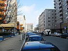
| Bergfriedstrasse
( Location ) |
180 | Keep , main tower of a medieval castle | Aug 31, 1949 | The first name from 1861 was Fürstenstrasse . |
|
|
Bergmannstrasse
( Location ) |
1260 | Marie Louise Bergmann (1774-1854), landowner (not secured) | Apr 20, 1837 | The first name was Weinbergsweg , i.e. access to vineyards that were laid out on the chain of hills between Rixdorf and Schöneberg. Numerous catering establishments have settled in this street. Along the street of houses there are two listed school building complexes. The northern area of the middle section of the street, which borders on Marheinekeplatz , is used as a flea market on weekends . So-called parklets have been set up in the street for an 18-month test phase since autumn 2018 . They should serve as quiet zones in the street and reduce or displace car traffic. |

|
| Bernburger Strasse
( Location ) |
300 | Bernburg , district town in Saxony-Anhalt | Jan. 24, 1844 | After the opening of the Anhalter Bahnhof , it was laid out as an access road. It was named after the city of Bernburg with reference to the nearby Anhalter Bahnhof, from which the trains to Anhalt departed. |

|
| Besselstrasse
( Location ) |
200 | Friedrich Wilhelm Bessel (1784–1846), astronomer, mathematician and geodesist | March 13, 1844 | This street was laid out as a connection between Friedrichstrasse and Charlottenstrasse. Because of the nearby observatory, it was named after the astronomer Bessel. |

|
| Bethaniendamm
( Location ) |
500 | Bethanien Hospital , an artist house since the 1990s | July 31, 1947 | The previous names were Bethanienufer , Mariannenufer and Felsendamm . Part of the street runs in the Mitte district . The tree house is adjacent to the wall . |

|
| Bevernstrasse
( Location ) |
80 | August Wilhelm von Braunschweig-Wolfenbüttel-Bevern (1715–1781), Duke of Braunschweig-Wolfenbüttel-Bevern and Prussian general | Feb. 20, 1895 | After Hobrecht plan they called street 5a, Abt. I . It connects the intersection of Oberbaumstrasse / Schlesische Strasse / Köpenicker Strasse with the May-Ayim-Ufer on the Spree. Here are some privately owned rental houses built before the war. House number 2 was the target of squatters in spring 2012. |

|
| Blücherplatz
( Location ) |
250 | Gebhard Leberecht von Blücher (1742–1819), Prussian Field Marshal General | Apr 7, 1884 | The square is a hook-shaped cul-de-sac going north from Blücherstrasse. From the eastern end, footpaths lead through a green area to the Waterloo embankment and Zossener Straße. The America Memorial Library , built from 1952 to 1954 at Blücherplatz 1, is a listed building. In 2019, the parliamentary group of Bündnis 90 / Die Grünen introduced a motion to the “demilitarization of public space” in the Friedrichshain-Kreuzberg district assembly to encourage a public discourse and participation process about a possible renaming of Blücherplatz and the other streets in the district named after generals and battles and initiate places. |

|
| Blücherstrasse
( Location ) |
900 | Gebhard Leberecht von Blücher (1742–1819), Prussian Field Marshal General | Oct. 31, 1864 | When it was built in 1813, the street was named Pionierweg and then Pionierstraße . It forms a section of a busy road between Obentrautstrasse and Urbanstrasse, then bends in a south-easterly direction approximately at the level of Tempelherrenstrasse and leads to Südstern . It is limited to the west by Mehringdamm and to the east by Südstern.
Houses 22 and 23 are listed architectural monuments. The Holy Cross Church (1855–1888) based on a design by Johannes Otzen is also worth mentioning . The Blücherstrasse, like the Blücherplatz, is under discussion for a possible renaming after a motion by the BVV parliamentary group of Bündnis 90 / Die Grünen. (see above) |

|
|
Böckhstrasse
( Location ) |
450 | August Boeckh (1785–1867), classical philologist and archaeologist | Nov 1, 1874 | The street was laid out around 1860 as street 5, section II , according to the development plan. It runs in a straight line between Planufer / Grimmstrasse (west) and Schönleinstrasse / Kottbusser Damm (east-south-east).
The houses 13 and 14 from the years 1886/1887 are architectural monuments. |

|
|
Böcklerstrasse
( Location ) |
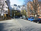
260 | Hans Böckler (1875–1951), trade unionist and politician | March 1, 1978 | Böcklerstraße runs in a curved shape between Gitschiner Straße (north) and Erkelenzdamm (east). Before it was named, it only existed as an access road on the site of the former Second Municipal Gas Works , which was demolished in 1922 and built over with a park. The modern residential buildings, up to ten stories high, along the street date from the late 1970s. |
|
| Boppstrasse
( Location ) |
180 | Franz Bopp (1791–1867), linguist | Dec. 1, 1857 | According to the development plan, the plan street was given the name Straße 8, Section II . It forms the southern boundary of Hohenstaufenplatz , to the west is Schönleinstrasse and to the east it ends at Kottbusser Damm. |

|
| Curlew Route
( Location ) |
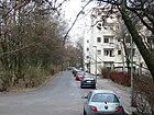
350 | Albert Emil Brachvogel (1824–1878), writer | Apr 14, 1910 | At the beginning of the 20th century, tram traffic and the first cars increased rapidly, so that from 1906 a new traffic connection was built between Alexandrinenstrasse and Mittenwalder Strasse for the heavily frequented Blücherplatz and the Belle Alliance Bridge. This got its name after Brachvogel, who lived nearby (Körnerstraße 24). On August 16, 1956, Alexandrinenstrasse between Waterloobrücke and Johanniterstrasse and the Waterloo Ufer between Waterloobrücke and Zossener Strasse were renamed and thus included in Brachvogelstrasse. |
|
| Brandesstrasse
( Location ) |
140 | Alwin Brandes (1866–1949), trade unionist, politician and resistance fighter | Dec. 1, 1971 | The traffic route connects Lindenstrasse with Mehringplatz in an east-west direction. At the same time it forms a northern branch of a dead end. Brandesstraße was only built after the residential buildings around the former Belle-Alliance-Platz that had been destroyed in the Second World War had been replaced by new buildings and Lindenstraße and Alte Jakobstraße had been pivoted slightly in this area. |

|
| Brommystrasse
( Location ) |
95 | Carl Rudolph Bromme , called "Brommy" (1804–1860), rear admiral | June 15, 1906 | It was created and named at the same time as the Brommy Bridge was built . The Brommystraße goes northeast from the Köpenicker Straße. It originally led over the Spree bridge to Friedrichshain on Stralauer Allee. The Wehrmacht had blown up the bridge in early 1945. It has not (yet) been rebuilt, which is why the Kreuzberg section of this street ends at the Brommy balcony on the banks of the Spree. |

|
|
Carl-Herz-Ufer
( Location ) |
460 | Carl Herz (1877–1951), politician and lawyer | Nov 25, 1965 | This riverside road runs parallel to the Landwehr Canal to the south . It is part of the Planufer , which reached from Blücherplatz / Alte Jakobstraße to Kottbusser Damm. The western section was outsourced and renamed after the former urban harbor was filled in. The Carl-Herz-Ufer now leads in a west-east direction from Brachvogelstrasse to Geibelstrasse. The listed depot of the city cleaning service is located at Carl-Herz-Ufer 30, built according to plans by Ludwig Hoffmann in 1901. |

|
|
Chamissoplatz
( Location ) |
110 × 100 | Adelbert von Chamisso (1781–1838), naturalist and poet | Apr 24, 1890 | The square was built around 1880. Arndtstrasse borders it to the north, and Willibald-Alexis-Strasse to the south. The western and eastern borders of the square are also called Chamissostraße, which has 8 house numbers. In the year it was named, a distinction was made between the square and the west / east streets, which were called Am Chamissoplatz and were already built on by 1893. A spacious green area forms the main area of the square. An organic market takes place there regularly . The square is often used for filming old Berlin because of its Wilhelminian- era development . |

|
| Charlottenstrasse
( Location ) |
360 (in the district) |
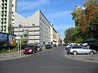
Sophie Charlotte of Hanover (1668–1705), Prussian queen | around 1706 | Charlottenstrasse initially stretched from Behrenstrasse to Kochstrasse . The section between Kochstrasse and Enckeplatz was laid out in 1844. In 1879 the magistrate decided to extend Charlottenstrasse to Georgenstrasse. The house numbers 1–15 and 81–98 belong to Kreuzberg, the rest to the district of Mitte . The Berlin theater was located in building number 90 until 1936 . |
|
|
Columbiadamm
( Location ) |
400 (in the district) |
Miss Columbia , the name of the plane with which Clarence Chamberlin and Charles Levine made the first flight from New York to Berlin in 1927 | Aug 14, 1950 | Today's east-west street was not built until the early 1930s. Individual sections of the street had the following names one after the other or at the same time: Strasse 37 (Dept. I) (around 1870), Kirchhofstrasse (before 1901 – around 1919), Friedhofstrasse (around 1919–1929), Prinz-August-von-Württemberg-Strasse and Columbiastrasse (1929-1950). Only the Prinz-August-von Württembergstraße is exactly the section of this street between Friesenstraße and Lilienthalstraße, which today belongs to Kreuzberg. The existing buildings, including the residential buildings, will be summarized as "Quartier Friesenstrasse" and will be structurally renovated. Since August 12, 2014, the district border to Tempelhof-Schöneberg has been running between Friesenstrasse and Lilienthalstrasse on the north side of the street. Therefore, the assigned properties belong to the district, the road to Tempelhof , from Lilienthalstraße to Neukölln . |

|
| Cuvrystrasse
( Location ) |
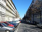
550 | Heinrich Andreas de Cuvry (1785–1869), city councilor and city elder | Aug 8, 1858 | The street was laid out in 1852 over the property of de Cuvry (address 1850: Schlesische Straße 15-16) and led to the Landwehr Canal (today: Paul-Lincke-Ufer ). At first it is said to have been called the Green Way by the residents . After 1858 it was listed in the address book as de Cuvrystraße and de Cuvry-Ufer . led, numbering has not yet taken place. With the completion of the Görlitz train station, the street was interrupted, so the southern area was renamed Ratiborstraße in 1893 . At Cuvrystraße 16 there is a tenement house from 1857 with a later added building for the Markgraf & Tau chair factory (“special leather furniture, cane chairs for hotels, restaurants and home furnishings”). preserved and listed.
In mid-2013, Berlin's first slum was built on the Cuvrybrache between Schlesischer Strasse and the banks of the Spree . The hut village was evacuated in September 2014 after a fire. The Cuvry graffiti , two large-scale facade paintings by the Italian street art artist Blu from 2007/2008 on the wasteland, were among the most famous graffiti in Berlin and were published in 2014 as a protest against urban development policy and Berlin’s dealings with art in agreement painted over with black paint by the artist Blu. |
|
|
Dessauer Strasse
( Location ) |
390 | Dessau , district of Dessau-Roßlau in Saxony-Anhalt | Jan. 24, 1844 | This street was built at the same time as the Berlin Anhalter Bahnhof was being built. It was named after the destination of the new railway line.
Two residential buildings from the mid-19th century and the Gildehaus des Berliner Druckgewerbes (inaugurated in 1906) have been preserved and are under monument protection. |

|
|
Dieffenbachstrasse
( Location ) |
820 | Johann Friedrich Dieffenbach (1792–1847), physician and surgeon | December 22, 1875 | The traffic route was laid out as Straße 6, Section II of the development plan 1873/1874. In July 1966, a section on the grounds of the Am Urban hospital in Dieffenbachstrasse was included. It now runs between two green spaces, to the east (unnamed) between Geibelstrasse and the southern bank of the Spree and Hohenstaufenplatz (to the west).
19 residential buildings, a school, the Christ Church with the Bethesda deaconess house and the hospital in the area of this street are listed monuments (numbers 3–7, 11–13, 16, 17, 20, 27–37, 39/40, 58 ). Due to extensive traffic calming measures, numerous street cafes and smaller shops have settled. |

|
| Dresdener Strasse
( Location ) |
180 + 110 (in the district; interruption by Oranienplatz) |
Dresden , state capital of Saxony; then direction of the road | 1772 | The northern section of the street runs in the district of Mitte (house numbers 31–114). The first names of the street were Rixdorfer Damm and Rixdorfer Straße .
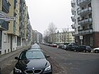
Numerous buildings in this street (numbers 20–24, 27, 115, 118–120) are part of the monument complex between Oranienplatz and Heinrichplatz. It is worth mentioning the Babylon Kreuzberg cinema in house number 126, which was opened as Helo in 1955 . In the 1970s, the facility was called Kent and, in keeping with the Turks and their families in the neighborhood, specialized in showing exclusively Turkish films. Taken over by the Yorck Kinogruppe in 1986 , there were mainly night-filling special programs. Ultimately, the owners divided the cinema into two auditoriums, in which films have been shown successfully in their original versions ever since. In 2012, Babylon Kreuzberg was the venue for Berlinale films as part of the "Berlinale goes Kiez" initiative . |
|
| Dudenstrasse
( Location ) |
1000 (in the district) |
Konrad Duden (1829–1911), philologist and lexicographer | Jan. 3, 1949 | The previous names were consecutively Kolonnenweg , Dreibundstraße and Immelmannstraße . The south side of the street belongs to Tempelhof . As a continuation of Kolonnenstraße, the street runs straight eastwards with a connection to Columbiadamm. Numerous individual buildings and wings (Dudenstrasse 12–20, 26–30 and 34–38) are listed monuments. Another monument is the book printer association house (Dudenstrasse 10) (lower picture). There are stumbling blocks in front of this house and at Dudenstrasse 32a . The Willy Kressmann Stadium (until 2010: Katzbachstadion ) is adjacent to Dudenstrasse. |
 |
|
Eberhard-Roters-Platz
( Location ) |
60 × 60 | Eberhard Roters (1929–1994), initiator and founding director of the Berlinische Galerie | Apr 1, 2001 | The square and the adjacent streets of the Alte Brauerei and Sixtusgarten were created on the site of the former Schultheiss brewery . This was sold to private investors in the 1990s and then rebuilt. It forms the Viktoria quarter around the Kreuzberg. A factory outlet of a small fashion label (Fashionart Ltd. Co.) has set up at this place . |

|
| Eisenbahnstrasse
( Location ) |
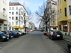
480 | From 1852 to 1871 a railway line, the Berlin Connection Railway, ran through the street . | May 22, 1852 | The first name from 1849 was Lübbener Strasse , today's Manteuffelstrasse, which runs parallel, was initially called Eisenbahnstrasse. With the relocation of the railway line in 1852, both streets were renamed. The street runs as a continuation of Brommystraße from Köpenicker Straße from northeast to Lausitzer Platz (southwest). Originally it reached as far as the Landwehrgraben (today: Landwehr Canal ). When the Anhalter station was completed, the southern section (previously part of Lausitzer Communication ) was named Lausitzer Straße . This gave houses a new horseshoe-shaped numbering that began at Lausitzer Platz and extended to Köpenicker Straße. A well-known building here is the market hall IX , also called the railway hall , which is a listed building.
The protagonist of the novel Herr Lehmann by Sven Regener lives on Eisenbahnstrasse. |
|
|
Enckestrasse
( Location ) |
60 | Johann Franz Encke (1791–1865), astronomer | Feb. 18, 1927 | The street was laid out as an extended Charlottenstraße with the inclusion of Enckeplatz up to Lindenstraße . It was shortened again later.
This is where the Berlin observatory was located from 1835 to 1912 , where Encke did research. |

|
| Erkelenzdamm
( Location ) |
760 | Anton Erkelenz (1878–1945), trade unionist and politician | July 31, 1947 | The previous names were Elisabethufer and Hoffmanndamm . This dam runs from Oranienplatz to Fraenkelufer, the house numbers are given in orientation numbering . |

|
| ETA Hoffmann Promenade
( Location ) |
200 | ETA Hoffmann (1776-1822), writer | Sep 1 1991 | The street got its name when block 606 was built between Friedrichstrasse and Lindenstrasse . It only serves as an entrance for residents, it is a walkway throughout. On the north side is the site of the former flower wholesale market , which has now been converted and opened as the Academy of the Jewish Museum . There are some sports fields on the south side. |

|
| Eylauer Strasse
( Location ) |
300 | Preussisch Eylau , 1807 site of a battle in the Franco-Prussian War in East Prussia | Jan. 9, 1901 | The first name was Street 6b, Section III of the development plan. Eylauer Strasse connects Monumentenstrasse (north) with Dudenstrasse (south). The "Mendelssohn Chamber Choir Berlin" founded in 2005 has an office at Eylauer Straße 12. In 2019, the parliamentary group of Bündnis 90 / Die Grünen submitted a motion for the “demilitarization of public space” to the district assembly in Friedrichshain-Kreuzberg in order to initiate a public discourse and participation process about a possible renaming of Eylauer Strasse and the others in the district after generals and battles To initiate streets and squares. |

|
|
Falckensteinstrasse
( Location ) |
520 | Eduard Vogel von Falckenstein (1797–1885), Prussian general and politician | Nov 9, 1887 | It was created as Straße 5, Section I of the development plan. The traffic route is the straight south-south-west continuation of the Oberbaumbrücke to Görlitzer Straße. Until 1945 a line of the Berlin tram ran through this street between Warschauer Straße and Hermannplatz . It was not put back into operation after the Second World War.
Today, a meeting place located here is worth mentioning (house number 6). This cultural institution, financed by the district office, has extensive leisure activities for all generations and different cultural groups. |

|
| Fanny-Hensel-Weg
( Location ) |
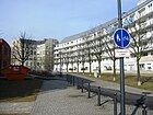
130 | Fanny Hensel (1805–1847), composer | Oct 1, 1991 | The path is a slightly curved connection between Dessauer Straße and Schöneberger Straße. It was laid out for the International Building Exhibition in 1989 and houses from the city's social housing program were built on. That is why families with a migrant background in particular have rented rooms here in recent years. Because the Berlin House of Representatives canceled the follow-up financing for the entire residential complex in 2010, drastic rent increases have been recorded and conflicts arise. |
|
| Feilnerstrasse
( Location ) |
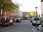
140 | Tobias Feilner (1773–1839), master potter and manufacturer | Feb 10, 1848 | The first name was Hasenhegergasse , then Hasenhegerstrasse . With the new name, the administration honored Feilner's national work, who had his factory and apartment here; see also Feilner's house . |
|
| Fichtestrasse
( Location ) |
380 | Johann Gottlieb Fichte (1762–1814), philosopher | Nov 1, 1874 | The Kolonnenweg ran here first . With the public dedication in 1866, according to the development plan, the street 10, Section II . Between 1874 and 1884 the address book only shows the municipal gas station here, there was no parcel numbering yet. The development of residential houses began in 1885 and was largely completed by 1890 with 34 parcels. W. Aberson and J. Krengel worked as architects. Fichtestrasse connects the Urbanstrasse – Grimmstrasse (north) with the Hasenheide (south). The remains of the municipal gas works, completed in 1884, and five apartment buildings from the years 1886 to 1891 are listed monuments. |

|
| Fidicin Street
( Location ) |
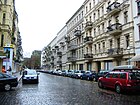
550 | Ernst Fidicin (1802–1883), archivist and historian | Apr 24, 1890 | The first name was Straße 23, Section II of the development plan. It connects Mehringdamm (west) with Friesenstrasse (east). In addition, the traffic route continues as Jüterboger Straße to Golßener Straße.
About thirty Wilhelminian-style houses on this street in Chamissokiez are listed architectural monuments. |
|
|
Fontane promenade
( Location ) |
360 | Theodor Fontane (1819–1898), writer | Apr 30, 1899 | According to the development plan, the Fontanepromenade was initially called Straße 13, Abt. II and connected Blücherstraße / Kaiser-Friedrich-Platz with Urbanstraße. A military laundromat stood between plot 15 and Blücherstrasse.
On January 10, 1972, the north-facing part of the street Am Urban was included in the Fontanepromenade. Since then it has been a dead end for motor vehicles. In line with its name as a promenade, it has a wide, green median. Fontanepromenade 15 is a listed building that was built in 1905/1906 for administrative purposes (probably the military laundrette). From 1938 to 1945 it served as the headquarters of the “Central Office for Jews” created by the National Socialists, including a separate employment office. After the war it was used as a house of worship for the “reorganized Church of Jesus Christ of the Holy Last Days” (today: “Community of Christ”). It is a listed building together with a neighboring rental apartment building (number 16/17). |

|
| Forster Street
( Location ) |
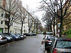
430 | Forst , district town in Brandenburg, original direction of the road | Jan. 8, 1874 | It was laid out in 1870 as Straße 2, Section I of the development plan. Forster Strasse goes south-west from Wiener Strasse and leads to Paul-Lincke-Ufer. |
|
| Fraenkelufer
( Location ) |
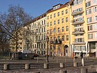
550 | Albert Fraenkel (1848–1916), physician | July 31, 1947 | The embankment was called, one after the other, Kohlenufer and Thielschufer . Here are the remains of a synagogue that was badly damaged in the night of the pogrom . |
|
| Franz-Klühs-Strasse
( Location ) |
370 | Franz Klühs (1877–1938), social democrat, editor and resistance fighter | Dec. 1, 1971 | It connects Wilhelmstrasse (west) across Friedrichstrasse with Lindenstrasse (east) and thus forms the diversion for motor vehicle traffic. Layout of the line take over the former Hofdurchgänge the Comedy Theater on (West) and Handelshof (East). |

|
| Franz-Künstler-Strasse
( Location ) |
290 | Franz Künstler (1888–1942), trade unionist, politician and resistance fighter | Dec 8, 1960 | It connects Lindenstrasse (west) via Alte Jakobstrasse with Alexandrinenstrasse (east). Its curved course is based a little on the former Husarenstrasse . However, after the total destruction in World War II, the road network in this area was rearranged in the course of rebuilding. It is worth mentioning several hostels and a children's farm (numbers 4–10) on this street , run by the regional association of the German Schreberjugend , which has been closed since 2012. |

|
| Freiligrathstrasse
( Location ) |
170 | Ferdinand Freiligrath (1810–1876), poet, poet and translator | Jan. 9, 1901 | The traffic route was built in 1899 as Straße 13a, Section II of the development plan. The street runs in a west-east direction and connects the Fontanepromenade with the Körtestrasse. A house on Freiligrathstrasse at the corner of Körtestrasse, where a roof structure burned out in November 2012, became ingloriously well known. 120 firefighters were on duty. The German-Italian children's shop “EKT Girotondo e. V. “, adapted to the origin of the tenants in this neighborhood. |

|
| Friedrich-Stampfer-Strasse
( Location ) |
100 | Friedrich Stampfer (1874–1957), journalist and politician | July 1, 1971 | The short street was created in connection with the redevelopment of the areas around Mehringplatz. The southernmost tip of Wilhelmstrasse was also relocated in such a way that it has since flowed into Hallesche Ufer. Friedrich-Stampfer-Straße is a dead end , the route of which traces the course of Wilhelmstraße in this section. The “AOK Service Center Northeast” is located here (house number 1). |

|
|
Friedrichstrasse
( Location ) |
800 (in the district) |
Friedrich I (1657–1713), Prussian king | around 1706 | The street was laid out and named in connection with the settlement of the Huguenots in the Berlin suburbs. The longer northern section runs in the district of Mitte . During the Cold War , the road ended at the Checkpoint Charlie border crossing on both the East and West Berlin sides . In the south the road forms a dead end for motorized traffic. The Mehringplatz can be reached by pedestrians and cyclists . Plots 1-45 (consecutive, with some numbers missing) and on the opposite side 206-246 (consecutive) belong to the district, the other properties belong to the Mitte district in the Mitte district . Friedrichstrasse in the district of Kreuzberg-Friedrichshain and Mitte has road number 16228 in Berlin's directory, and there are with 1402 Friedrichstrasse in the district of Spandau of Spandau and in 1403 those in the Steglitz-Zehlendorf district Lichterfelde . |

|
|
Friesenstrasse
( Location ) |
560 | Friedrich Friesen (1784–1814), co-founder of the German gymnastics movement and teacher | 25 Sep 1884 | The traffic route was created in 1864 on the basis of the development plan and was given the designation Straße 21c, d, f, Section II (SW) . A chemical factory is said to have been located here before. In 1878 Friesenstrasse was dedicated to the public. Another section was added on August 4, 1897. It now led southwards from Marheinekeplatz to Tempelhofer Feld to Kolonnenweg and on to the unofficial Green Way at the railway settlement. On the east side barracks were built around 1890 for the Queen Augusta Guard Grenadier Regiment No. 4 and the Guard Cuirassier Regiment , most of which buildings and enclosures are preserved and listed. Since the conversion of the former parade field to Tempelhof Airport , Friesenstrasse has ended at Columbiadamm. Numerous residential buildings from the 19th century are listed monuments. |

|
| Fromet-und-Moses-Mendelssohn-Platz
( Location ) |
60 × 50 m | Moses Mendelssohn (1729–1786), philosopher and his wife Fromet | Apr 26, 2013 | The name of the place on Lindenstrasse , between the Jewish Academy and the Jewish Museum , decided by the BVV in April 2013 , is based on an application from the museum administration. The town square that was created through the renovation of the wholesale flower market was originally only to be named after the philosopher Mendelsohn. The woman / man solution resulted from BVV's request to improve the quota of street names by women in the city district. |

|
| Fürbringerstrasse
( Location ) |
360 | Moritz Fürbringer (1802–1874), theologian and local politician (City School Council) | Dec. 26, 1874 | The construction company "Belle Alliance" had laid out streets 30 and 30a, Section II of the development plan, and arranged for them to be developed. After Fürbringer died, the city honored his work in the same year by assigning a street name. He himself had lived very close by ( Anhaltstrasse 11 ). It runs between Solmsstrasse (west) and Schleiermacherstrasse (east). At Fürbringerstraße 27 there is the parent initiative children's shop “EKT - Guten Tag Kinder e. V. ". |

|
|
Geibelstrasse
( Location ) |
160 | Emanuel Geibel (1815–1884), poet | Feb 12, 1898 | According to the development plan, it was first called Straße 14a, Section II . It goes north from Urbanstraße and then swings west to Carl-Herz-Ufer (formerly: Intersection Plan-Ufer / Wilmsstraße). |

|
| Gitschiner Strasse
( Location ) |
1380 | Gitschin , municipality in the Czech Republic, scene of a battle in the German War in Bohemia, today Jičín in the Czech Republic | Oct. 24, 1868 | The west-east road connects Hallesche Ufer with Skalitzer Strasse and runs parallel to the Landwehr Canal to the north . Gitschiner Straße was formed before 1870 from Halleschen Communication and Hellweg .
At Hellweg 8/9, the “Städtische Gaserleuchtungs-Kompagnie” built the II. Municipal gasworks from 1845–1847 to supply the southern areas of Berlin. From January 1, 1847, together with the I. Städtische Gasanstalt (south of the Schillingbrücke between Stralauer Platz and the Spree) and in competition with the neighboring “Englische Gasanstalt” operated by the “ Imperial Continental Gas Association ” (ICGA) ( today's area of the Kreuzberg summer pool , Gitschiner Straße 18–31), which supply public gas lights . Parcels 1 and 4-11 were initially used as “Stätteplatz” (which was used to designate a municipal building yard and storage area). Along the Gitschiner, a number of smaller craftsmen and larger companies such as the Berlin worsted spinning mill “Schwendy & Co” (Gitschiner Straße 12/13) or the metal foundry “Ende & Devos” had settled between the houses around 1875 ; (Number 74) production facilities set up. The numbers 19-21 belonged to the "ICGA", the numbers 23-40 were the address of the (later closed) English gas company. The barracks of the Guard Cuirassier Regiment stood on lots 97-102 on the corner of Friedrichstrasse. Around 1880 the house number sequence was apparently changed, because after that the municipal gas station appears as numbers 39-49. The magistrate had the pumping station II (around 1890) built at Gitschiner Straße 7-11 for the municipal sewerage establishment, and other craftsmen and factories were always added (wood factories, linen factories, a steam fittings factory, a piano factory and many others) . |

|
| Glogauer Strasse
( Location ) |
390 | Glogau , a city in Silesia, today Głogów in Poland | Feb 25, 1891 | The Glogauer Straße, laid out according to the development plan as Straße 1, Section I (SO) , runs south from Wiener Straße over Reichenberger Straße and Paul-Lincke-Ufer (formerly Kottbusser Ufer) to the Landwehr Canal and comprises 34 house numbers. The traffic route then leads over the Thielenbrücke and continues in the Neukölln district as Pannierstraße. |

|
|
Gneisenaustrasse
( Location ) |
1180 | August Neidhardt von Gneisenau (1760–1831), Prussian Field Marshal General | Oct. 31, 1864 | According to the development plan, it should first have been named Straße 7, Section II . When it was named, its course was indicated "between Hasenhaide and Bellealliancestrasse" with six house numbers and nine houses named after people. In today's street scene, it connects Südstern / Hasenheide with Yorckstraße, Mehringdamm intersection. The street is part of the general train and is laid out with a green median strip throughout. |

|
|
Görlitzer Strasse
( Location ) |
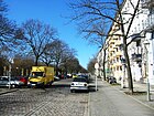
925 | Görlitz , city in Saxony | Feb. 2, 1869 | The 54, Abt. I of the development plan was created in 1868 at the instigation of the Berlin-Görlitz railway company. The name refers to the Berlin Görlitzer Bahnhof, which opened in 1867 . It runs from Skalitzer Straße (northwest) to Görlitzer Ufer - formerly parallel to the railway area, today as the northeast boundary of Görlitzer Park . Five tenement houses, a school building and the “Directorial residential building” of the Berlin-Görlitzer Eisenbahn in this street are listed monuments. |
|
|
Görlitzer Ufer
( Location ) |
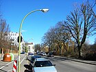
320 | Görlitz , city in Saxony | Nov 12, 1866 | The Uferstraße is a section of the northwestern bank of the Landwehr Canal . It connects the Heckmannufer from Ernst-Heilmann-Steg with Wiener Straße. Then the Görlitzer Ufer continues as a footpath to Ratiborstrasse. The architectural ensemble of two schools completed in 1901 is located on Görlitzer Ufer 2. |
|
| Golßener Strasse
( Location ) |
300 | Golßen , city in Brandenburg | Feb 12, 1898 | The traffic route was laid out as road 20a, section II , according to the development plan . It initially goes south from Jüterboger Straße, after the confluence with Züllichauer Straße it makes a swivel to the southwest and ends at Columbiadamm . The northeast section of the road borders the Luisenstadt cemetery. Police Directorate 5 is located in this street with the “Central Tasks Traffic Service” area. |

|
|
Graefestrasse
( Location ) |
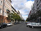
900 | Albrecht von Graefe (1828–1870), physician | Dec. 1, 1875 | After this street, the area is also called "Graefekiez". There is an ice cream factory at Graefestrasse 7, and the parent-child shop “Sonnenblümchen” can be found at number 43. Graefestraße 85–88 is a historic school building (176th and 184th community school, built 1888–1890 based on a design by Hermann Blankenstein ), which now houses the 9th integrated secondary school. Some houses and the school are historical buildings. |
|
| Grimmstrasse
( Location ) |
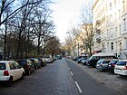
370 | Jacob and Wilhelm Grimm (1785–1863 and 1786–1859), linguists and fairy tale collectors | Nov 1, 1874 | The street consists of two lanes separated by a wide green lane, which were laid out as double street B, Section II , in accordance with the development plan . In 1874 the street was officially registered in the address book as Zwillingstraße . It runs from Boeckhstraße (east-north-east) to over Urbanstraße (west-south-west). Some residential buildings and the Am Urban hospital adjoining here are listed architectural monuments. |
|
| Großbeerenstrasse
( Location ) |
1240 | Großbeeren , place of a battle in the Wars of Liberation in Brandenburg | Aug 2, 1864 | The first development with residential buildings was carried out without house number assignment, but seven houses were identified by name. The Großbeerenstraße was laid out as Straße 8, Section III , in accordance with the development plan . It runs from Stresemannstrasse / Ida-Wolff-Platz by means of the Großbeerenbrücke over the Landwehr Canal to Kreuzbergstrasse in a north-south route. Numerous apartment buildings from the second half of the 19th century have been preserved and are listed.
In 2019, the parliamentary group of Bündnis 90 / Die Grünen submitted a motion for the “demilitarization of public space” to the Friedrichshain-Kreuzberg district assembly to encourage a public discourse and participation process about a possible renaming of Großbeerenstrasse and the other streets named after generals and battles in the district and initiate places. |

|
|
Harbor square
( Location ) |
140 × 90 (shape of a chordal quadrilateral ) |
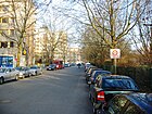
a filled in former port of the Landwehr Canal | Nov 6, 1849 | Since the basin that gave it its name was filled in, the traffic area is actually no longer a “square”, but a street that borders Mendelssohn-Bartholdy-Park to the northeast. On the occasion of the naming, the address book shows him as “Bassin an der Schöneberger Straße”. The contemporary residents of the buildings at the port include a council of commerce, a judicial council, a consul, master craftsmen, government officials, even a landowner and many similarly well-off people. That is why the area was popularly known as the "Secret Council Quarter". The Hafenplatz comprises seven parcels and connects Köthener Strasse with Schöneberger Strasse. In the area of the intersecting Dessauer Straße it is closed to through traffic. |
|
| Hagelberger Strasse
( Location ) |
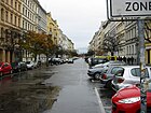
540 | Hagelberg , site of a battle in the Wars of Liberation in Brandenburg | Dec 18, 1863 | According to the development plan, it was Street 2, Section III . The first spelling was Hagelsbergerstrasse . At first it had no numbering, but seven houses named after the owners are listed. Hagelberger Strasse runs in a west-east direction between Yorckstrasse and Mehringdamm. In the 21st century, hotels, factories (for example a “mustard parlor”), restaurants and smaller shops have settled here.
In 2019, the parliamentary group of Bündnis 90 / Die Grünen submitted a motion for the “demilitarization of public space” to the Friedrichshain-Kreuzberg district assembly to promote a public discourse and participation process about a possible renaming of Hagelberger Strasse and the others in the district after generals and battles To initiate streets and squares. |
|
| Hallesche Strasse
( Location ) |
330 | Halle (Saale) , city in Saxony-Anhalt | Oct 3, 1861 | The road was laid out in 1861. The street name was based on the terminus of the railway that left the nearby Anhalter Bahnhof. The address book describes it as "near Hirschelstrasse ". Hallesche Straße comprises 15 parcels. It connects Möckernstrasse (west) with Stresemannstrasse (east). The office and commercial building for the Association of German Travel Companies (VDR), which was completed in 2004 on behalf of the Senate Administration, is located at Ida-Wolff-Platz / Hallesche Strasse 1. |

|
|
Hallesches Tor (*)
( Location ) |
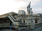
90 × 50 | Location of an earlier city gate of the Berlin customs wall on the road towards Halle (Saale) | 1843 | The square was created from the Halleschen Communication ("between Halleschen and Wasser-Thor") and (1850) Am Halleschen Thore, which existed in the 18th century . At some point the “Am” disappeared from the address books.
The space is currently not officially dedicated . |
|
| Hallesches Ufer
( Location ) |
1500 | Halle (Saale) , city in Saxony-Anhalt | Nov 6, 1849 | The coastal road was built simultaneously with the expansion of the Landwehr ditch the Landwehr Canal and accompanied it on the north side. The naming was based on the end point of the railway line beginning at Anhalter Bahnhof.
The district administration assigned the last three houses on Königgrätzer Strasse to Hallescher Ufer on December 19, 1936. The Hallesche Ufer is a connection between the Reichpietschufer (west) and Gitschiner Straße (east). The Hebbel am Ufer Theater (HAU; formerly: Hebbel Theater ) is worth mentioning here . |

|
|
Hasenheide
( Location ) |
1000 | when naming the adjacent rabbit enclosure and heathland | 1678 | The south side of the street is in the Neukölln district and includes house numbers 61–119. House numbers 5–58 on the north side belong to Kreuzberg (1–4 not assigned). The spelling until 1907 was Hasenhaide . The street runs from Südstern (west) to Hermannplatz (east). A well-known address for electronics amateurs is the Conrad-Electronic company . |

|
| Heckmannufer
( Location ) |
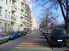
240 | Carl Justus Heckmann (1786–1878), blacksmith and industrialist; Founder of the company C. Heckmann “Abth. for copper forging, brass and iron products " | Apr 30, 1899 | The road begins at the Landwehr Canal , where it branches off from the Spree (east) and runs north parallel to the canal bank past the Schlesische Brücke to Taborstrasse (west). At this point, a footpath connects the Heckmannufer with the Görlitzer Ufer. Originally (1900) the bank only extended from Schlesische Strasse / Schlesische Brücke to Görlitzer Ufer. For many years it had no residential development, but the Heckmann factory buildings dominated the silhouette along the water. The world-famous picture Adolph Menzel's iron rolling mill is said to have been created for the 50th anniversary of the Heckmann factories. There are now residential buildings with the numbering 1–10 that are advertised as “located in a quiet side street”. The Heckmannufer is a section of the inner-city cycle path. |
|
| Hedemannstrasse
( Location ) |
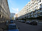
360 | Heinrich Philipp Hedemann (1800–1872), local politician | July 28, 1872 | The Kommerzienrat and manufacturer G. Stobwasser from Wilhelmstrasse (center) had this new road built in 1872, which connected Königgrätzer with Wilhelmstrasse. The street name was given at the suggestion of the magistrate , which honored Hedemann "the recently deceased mayor". An extended Hedemannstrasse built around 1920 was added to Hedemannstrasse in 1927. Today it runs between Stresemannstrasse and Friedrichstrasse in a west-east route. |
|
| Heimstrasse
( Location ) |
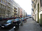
270 | Ernst Ludwig Heim (1747–1834), doctor and honorary citizen of Berlin | Nov 19, 1887 | According to the development plan, it was laid out as Street 27a, Section II and was already extensively occupied with residential buildings by the time it was named. The street was named after Heim doctor for the poor and hobby botanist, who lived in Berlin-Mitte and had his practice, honoring his work for a broad section of the population. The street runs between Bergmannstraße and Jüterboger Straße in a north-south direction. There are three parent-child stores on this street (Krötenpfuhl, Wildblume, Zippel and Zappel) . |
|
|
Heinrichplatz
( Location ) |
90 × 90 | Heinrich of Prussia (1781–1846), prince, military and Grand Master of the Order of St. John | Apr 7, 1849 | The first spelling was Heinrichs-Platz , around 1859 Heinrichsplatz . As a postal address, it was only of short-term importance when a house was mentioned here ("Kunstsches Haus").
In the 20th century restaurants and cafes settled on the square. The actual square, consisting of four triangles, is dominated by deciduous trees. It is distributed over the sloping surfaces at the intersection of Oranienstrasse and Mariannenstrasse. The houses preserved here have addresses of the intersecting streets. They date from the second half of the 19th century and are listed architectural monuments. |

|
|
Hermannplatz
( Location ) |
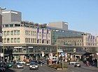
140 × 70 | Mythical and symbolic figure Hermann the Cheruscan | 28 Sep 1885 | After the development plan he was first called Place I . Except for the west side of the elongated rectangular square with the Karstadt department store in Kreuzberg, the square is in the Neukölln district . |
|
|
Hohenstaufenplatz
( Location ) |
200 × 80 | Hohenstaufer , Swabian noble family | Feb. 27, 1889 | According to the development plan, it was called Platz A, Section II and was included in the expansion of the road network from 1875 onwards. The area served the first inhabitants of the area as pasture for their goats , which is why it is said to have been called Zickenplatz . The large green area is bounded by Lachmannstrasse (north), Schönleinstrasse (northwest, southwest), Boppstrasse (south) and Kottbusser Damm (east). Numerous dining establishments have established themselves in the houses in the surrounding streets. An organic market takes place regularly on the west side of the square . |

|
|
Hornstrasse
( Location ) |
250 | Heinrich Wilhelm von Horn (1762–1829), Prussian lieutenant general | Aug 24, 1873 | It was laid out as Street A, Section III , according to the development plan . Hornstrasse has two lanes separated by a wide, green central reservation, which go back to the initial plans for a general train . The Hornstrasse is accessible from the Möckernstrasse (west), its connection to Yorckstrasse (east) is only possible as a footpath. It comprises 14 house numbers, including the Christ Church , which was consecrated here in 1963 , Hornstrasse 7/8. |

|
|
Ida-Wolff-Platz
( Location ) |
60 × 50 | Ida Wolff (1893–1966), local politician and resistance fighter | Jan. 1, 1999 | The rectangular square is east of Stresemannstrasse and was created by slightly pivoting the Halleschen and Großbeerenstrasse. |

|
|
Jahnstrasse
( Location ) |
240 | Friedrich Ludwig Jahn (1778–1852), initiator of the German gymnastics movement | Sep 18 1885 | According to the development plan, it was initially called Straße 3, Section III . It connects Urbanstrasse (north) with Hasenheide (south).
The “Child and Youth Welfare Association” with an extensive family aid package is located at Jahnstrasse 26. |

|
| Jakobikirchstrasse
( Location ) |
120 | St. Jacobi Church | Apr 7, 1849 | The street was laid out in the year it was named and originally extended to Mathieustraße . Jakobikirchstrasse has been a dead end ever since it was moved in and rededicated as building land. It goes north from the Ritterstraße and ends on the square in front of the eponymous church. |

|
| Johanniterstrasse
( Location ) |
390 | Order of St. John | May 30, 1864 | According to the development plan, it was built as Straße 34, Section II . The traffic route connects Zossener Strasse (west) with Tempelherrenstrasse (east). In 1956, part of the flat bank between Blücherstrasse and Brachvogelstrasse was incorporated into Johanniterstrasse. In 1978, the area between Blücherplatz and Zossener Straße fell away. Kauperts.de explains the name given by the fact that this name is related to the Johannist, a former city mission center.
The parent-child shop “Kindervilla Waldemar” is located at Johanniterstraße 17. |

|
| Jueterboger Strasse
( Location ) |
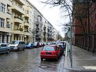
460 | Jueterbog , town in Brandenburg | Aug 4, 1897 | According to the development plan, the traffic route was laid out as Straße 20, Section III . Jüterboger Strasse runs between Golßener Strasse (east) and Friesenstrasse (west), after which the route continues as Fidicinstrasse.
There is again a parent-child shop here, the “EKT - Fino und Fleur e. V. “One of the two Berlin vehicle registration offices is located in building number 3. |
|
|
Kastanienplatz (*)
( Location ) |
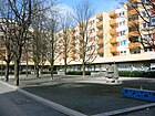
60 × 30 | 16 chestnuts that were planted here | April 16, 2013 | The square is not officially dedicated because it is owned by Gewobag. He was mentioned by name as early as 2007. However, in April 2013 an official name tag was unveiled.
Kastanienplatz is on the northwest side of the intersection of Wassertorstrasse and Bergfriedstrasse. Although the area is not very large, it has already been used several times for street festivals (open-air chess, festival of lights, concerts). According to the will of the non-profit housing association Gewobag, which also owns the adjacent houses, it was further upgraded together with the residents. A low-rise building that houses the “Café Wassertor” opens out onto the square. |
|
| Katzbachstrasse
( Location ) |
710 | Katzbach , tributary of the Oder in Silesia and eponymous for a battle in the Wars of Liberation | Oct. 31, 1864 | According to the development plan, it was initially Street 14, Section III . Katzbachstrasse runs in a north-south direction between Yorckstrasse and Dudenstrasse. The southward continuation is called Boelckestrasse. Viktoriapark touches the street in the middle east area .
The cycle paths were marked in green over a total length of around 1300 meters on behalf of the Senate Department for the Environment, Transport and Climate Protection and by the state-owned company Infravelo as the builder and project manager between September and November 2018. In 2019, the parliamentary group of Bündnis 90 / Die Grünen submitted a motion for the "demilitarization of public space" to the Friedrichshain-Kreuzberg district assembly to encourage a public discourse and participation process about a possible renaming of Katzbachstrasse and the other streets named after generals and battles in the district and initiate places. |

|
| Kleinbeerenstrasse
( Location ) |
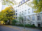
80 | Kleinbeeren , district of Großbeeren in Brandenburg | Dec 2, 1870 | At the request of the councilor carpenter A. Caspar, who owned building plots here, Kleinbeerenstraße was to be named Sadowastraße after the Prussian victory in the battle of Sadowa in 1866 . The city fathers were not that patriotic, however, but gave it its current name because it originally led to Großbeerenstraße. In June 1963 and November 1966, two sections were cut, leaving a dead end east of Möckernstrasse. In this street, the Augusta School was opened in 1886, along with a teacher’s seminar based on designs by the architect Friedrich Schulze. Between 1991 and 1995, the Berlin Senate had a new building complex built here for the Berlin Family Court and the district court, which was built between 1915 and 1921, had it converted to make it a listed building. |
|
| Small park road
( Location ) |
100 | nearby Viktoriapark | Apr 20, 1837 | It is an access road for the villas south of Kreuzbergstrasse. Their location was given as “on Lichterfelder Straße ” and initially comprised ten parcels directly on Viktoriapark and a further nine parcels reaching as far as Kreuzbergstrasse. The numbers 1–10 were later removed from the address lists. Kleine Parkstrasse 14-19 was owned by the city of Berlin around 1920. At the time, the parcels included the “Victoria Terraces” with the “Fritz Lang & Co.” café and a maternity and baby home run by the Patriotic Women's Association, southern district . |

|
| Kloedenstrasse
( Location ) |
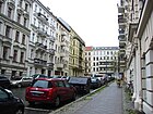
80 | Karl Friedrich von Klöden (1786–1856), educator, historian and geographer | March 17, 1891 | The traffic route was built according to the development plan 1888/1898 as Straße 21 e, Section II . Kloedenstrasse connects Willibald-Alexis-Strasse (north) with Fidicinstrasse (south). It is located in Chamissokiez and has numerous architectural monuments. |
|
|
Kochstrasse
( Location ) |
280 | Johann Jacob Koch († before May 1751), master baker and local politician | 1734 | At first it was called Kirchstrasse . It was evidently renamed during Koch's lifetime, it was initially written as Koch-Strasse . The street is also the namesake for the Kochstraße underground station . The Federal Association of Building Materials - Stones and Earths is located in this street . The OSZ “Clothing and Fashion” is housed in house number 9 . After the re-routing and redevelopment of the former "newspaper district", which was largely destroyed at the end of the Second World War , Kochstrasse was extended by one section to Lindenstrasse. This section was spun off on April 30, 2008 and renamed Rudi-Dutschke-Straße . |

|
| Kohlfurter Strasse
( Location ) |
450 | Kohlfurt, city in Silesia, today Węgliniec in Poland | Aug 31, 1949 | The traffic route laid out in 1861 was first called Britzer Straße . The road runs from west-north-west from Wassertorplatz to Fraenkelufer. At Kohlfurter Straße 10 there is a support association for people with disabilities, called "Mosaik". Kohlfurter Straße 20 is the address of the "Jens-Nydahl-Schule". |

|
|
Kommandantenstrasse
( Location ) |
300 (in the district) |
a city commandant of Berlin who owned a house on this street | 1846 | The traffic route is part of today's Friedrichstadt and from around 1658 was first called Scheunengasse , then Jouanengasse and from 1763 Neue Kommandantenstraße in the spelling Commendanten-Straße (new) . The Alte Kommandantenstrasse was added around 1800 . It was not until 1846 that the two were combined to form Kommandantenstrasse. An abandoned municipal cemetery (at that time the address at Kommandantenstrasse 5a) was included in the development of the street.
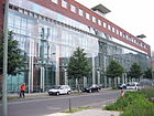
The house number range 15–62 belongs to Kreuzberg, the numbers 70–80 belong to the district center . Kommandantenstrasse runs with a slight bend between Lindenstrasse and Alexandrinenstrasse. Kreuzberg's largest industrial company, Bundesdruckerei, is located at Kommandantenstrasse 15 . |
|
| Kopischstrasse
( Location ) |
90 | August Kopisch (1799–1853), history painter and writer | Apr 24, 1890 | According to the development plan, the traffic route was laid out as Straße 21 f, Section II . It is a short north-south connection between Willibald-Alexis- and Fidicinstraße and is located in Chamissokiez . The buildings at Kopischstrasse 1–10 are part of the Berlin list of monuments, including the Tempelhofer Berg water tower from 1887/1888 by Hugo Hartung and Richard Schultze. |

|
|
Köpenicker Strasse
( Location ) |
1100 (in the district) |
Köpenick , a town in Brandenburg until 1920, towards the street | after 1600 | Earlier names (from around 1590) were descriptions of individual sections of the trail: The long dam , Weidendamm , Die neue Trift and Der neue Damm . When it was merged at the beginning of the 17th century, the traffic route was widened and bordered with trees. The street name was written Copnickerstraße , also Cöpnicksche Straße or Cöpnickerstraße . The spelling with "K" was only introduced in the 1930s according to the changed spelling of the eponymous district.
Part of the street runs in the Mitte district . |

|
|
Körtestrasse
( Location ) |
380 | Werner Körte (1853–1937), surgeon | Oct 21, 1933 | According to the development plan, it was first called Straße 11, Section II . In 1893 it was named Camphausenstrasse . In the 21st century, a number of restaurants and small commercial establishments have established themselves along this street. |

|
|
Koethener Strasse
( Location ) |
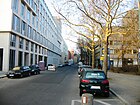
580 | Koethen , city in Saxony-Anhalt | Jan. 24, 1844 | The name was given immediately after the road was built with reference to the end point of the railways departing from Anhalter Bahnhof. The west side of the street (house numbers 1-6) is in the Tiergarten district .
The Berlin Professional Association of Visual Artists has its administrative headquarters at Köthener Strasse 44 . |
|
| Kottbusser Dam
( Location ) |
980 | Cottbus , city in Brandenburg | before 1867 | The traffic route was built as Rixdorfer Straße in the 16th century, later it was also called Rixdorfer Damm . A first section was spun off in 1839 and renamed Kottbusser Straße (see below). The longer section was named Kottbusser Damm around 1866, in 1867 only number 1 is listed. The buildings were built until around 1874, although no further house numbers were counted at first, the houses were named after their owners (Winkler, Bluth, Monkorps, Wappler).
The dam leads from the Landwehr Canal ( Kottbusser Bridge ) to Hermannplatz . The east side of the street (house numbers 62-104) is in the Neukölln district . On Kottbusser Damm, there are three residential building complexes built at the beginning of the 20th century that are listed as historical monuments. |

|
| Kottbusser Strasse
( Location ) |
245 | Cottbus , city in Brandenburg | Apr 7, 1839 | Kottbusser Strasse is a continuation of Dresdener Strasse to the south. Like the Kottbusser Damm, it is a section of the Rixdorfer Damm , which was documented as early as the 16th century, and thus part of the old military road to Dresden. First it was written on Kottbuserstrasse . It began around 1870 at Kottbusser Tor / Skalitzer Strasse, led to the (then) extended Ritterstrasse (later included in Ritterstrasse ) and comprised 22 parcels. It runs in a straight line southeast to the Landwehr Canal, its continuation is the Kottbusser Damm. |

|
|
Kottbusser Tor (*)
( Location ) |
120 (diameter) |
Location of a former city gate of the Berlin customs wall on the road towards Cottbus | before 1789 | The place is not officially dedicated . However, it appeared early in the address books as Vor dem Kottbuser Thore . Adalbertstrasse (north), Skalitzer Strasse with two lanes separated by the U-Bahn-Hochtrasse (east-west), Reichenberger Strasse (southeast-northwest) and Kottbusser Strasse (south) flow into the roundabout. The locals call the place with its immediate surroundings "the Kotti". |

|
| Kreuzbergstrasse
( Location ) |
950 | Kreuzberg , eponymous mountain | July 31, 1862 | The previous name of a section was Weinmeisterweg . When the mountain got its name, the trail was renamed accordingly. A new street section laid out as street 6a, section III according to the development plan was included in Kreuzbergstraße on April 4, 1895. When in 1938 a new delimitation of the administrative districts was made, a part (house numbers 39-42) came to Schöneberg . Only the roads remained in Kreuzberg.
The parent-child store "EKT - Macht nix e." Is located at Kreuzbergstrasse 43. V. " |

|
|
Lachmannstrasse
( Location ) |
130 | Karl Lachmann (1793–1851), medievalist and classical philologist | Nov 1, 1874 | The first name was Straße 9, Section II of the development plan. Lachmannstrasse forms the northern boundary of Hohenstaufenplatz and runs between Schönleinstrasse and Kottbusser Damm. Only the north side of the street is built on with a contiguous residential wing, which is more recent and is not a listed building. In front of house number 4 there is a stumbling block for Recha Feibel, who was deported during the Nazi era and killed in the Majdanek concentration camp . |

|
|
Lausitzer Platz
( Location ) |
120 × 100 | Lausitz , region in Germany and Poland | Apr 7, 1849 | The square is part of the former Köpenicker field within the Berlin city wall. In 1847 the “Köpenicker Tor” was built here and from 1890 to 1893 the Emmaus Church . | |
| Lausitzer Strasse
( Location ) |
580 | Lausitzer Platz | Oct 13, 1866 | During the development of the former Köpenick field in front of the Berlin city gates, streets were redesigned and laid out in accordance with the development plan. The traffic route leading from the already existing Lausitzer Platz ( Street 3, Section I of the development plan) was therefore named after the square. Around 1873 it was extended from Wiener Straße to Reichenberger Straße and called the new section Extended Lübbenerstraße , which was included in the Lausitz in 1875. At the corner of Lausitzer Strasse and Paul-Lincke-Ufer stands the smallest church building in Berlin, the Ölberg Chapel . |

|
| Legiendamm
( Location ) |
170 (in the district) |
Carl Legien (1861–1920), trade unionist | July 31, 1947 | The first names were Luisenufer and after the filling of the Luisenstadt Canal, including part of the coal bank, Kösterdamm . The Legiendamm marks the west side of the former canal and is a mirror image of the Leuschnerdamm.
The northern section of the street (house numbers 30-42) runs in the Mitte district . The Berlin headquarters of the ARAG Group is located at Legiendamm 8-10 . Three buildings on Legiendamm are listed monuments. |

|
| Leuschnerdamm
( Location ) |
400 (in the district) |
Wilhelm Leuschner (1890–1944), trade unionist, politician and resistance fighter | July 31, 1947 | The previous names were Elisabethufer and Schröderdamm . Part of the street (house numbers 1–25) runs in the Mitte district . In Kreuzberg is the section between Oranienplatz and Waldemarstraße. The St. Michael Church is on this corner , address Waldemarstrasse. The “Engelbeckenhof” (Leuschnerdamm 13) is a listed building monument.
The old Berlin inn "Die Henne", opened in 1911, is also worth mentioning at Leuschnerdamm 25 on the corner of Waldemarstrasse . The owner and operator of the premises was the architect Paul Litfin , whose design was used to create the interior furnishings: among other things, a counter covered with sheet silver (front wall decorated with green and brown tiles), a dark-stained wooden bottle rack, rustic tables, deer antlers on the walls and wrought iron Lamps. Litfin had called it "Zur Hirschecke". Special: since 1968 only one dish, a specially prepared fried chicken, has been served here. The name of the restaurant comes from Bernd Henne, the tapper who ran it between 1980 and 1991. The houses at Leuschnerdamm 9 and Leuschnerdamm 7 were occupied in the late 1970s to early 1980s. |

|
| Liegnitzer Strasse
( Location ) |
430 | Liegnitz , city in Silesia, today Legnica in Poland | May 10, 1873 | The traffic route was laid out as Straße 6 according to the development plan, Section I and was given the name to the public in 1873. Liegnitzer Strasse connects Wiener Strasse (northeast) with Paul-Lincke-Ufer (southwest). In houses number 14 and 17 the association “EKT - TÄKS e. V. / BABB Kreuzberg “two daycare centers. |

|
| Lilienthalstrasse
( Location ) |
330 (in the district) |
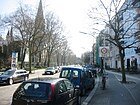
Otto Lilienthal (1848–1896), aviation pioneer | Jan. 7, 1928 | When the name was given, a path that had previously passed the Hasenheide shooting ranges, the military training area and the military cemetery received its first official name.
In May 1929, the Siboldstraße - Lehniner Straße to the north in Lilienthalstraße was included. |
|
|
Lindenstrasse
( Location ) |
980 | First planting with linden trees | around 1706 | In the address books around 1800 the route from the Rondell (today's Mehringplatz) via Hasenhegergasse , Jerusalemer Strasse to Neue Commendanten-Strasse is given .
The Jewish Museum (pictured), the listed building of the former Victoria Insurance and the headquarters of the health insurance company BKK VBU have been located in the street since the 1990s . There are also various sculptures from a public sculpture garden of the Berlinische Galerie entitled “ Art - City - Space ”, for example “ Black Sun Press ”, “ Nobody ” and “ Water Carrier ”. |

|
| Lobeckstrasse
( Location ) |
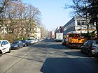
730 | Heinrich Ludwig Lobeck (1787–1855), founder of the first life insurance company in Berlin | Nov 1, 1962 | From 1849 the traffic route was called Brandenburgstrasse . Lobeckstrasse runs from Oranienstrasse to Gitschiner Strasse in a north-east-south-west direction.
The life insurance institute financed the redesign of the Waldeckpark in 1936 , which was then renamed "Lobeckpark". In the 1950s the park was restored to its original state; it was used during and after the war for the purpose of logging. On this occasion, the district administration decided in 1962 to rename Brandenburgstrasse to Lobeckstrasse. |
|
|
Luebbener Strasse
( Location ) |
210 | Lübben , district town in Brandenburg | Aug 11, 1872 | As early as the beginning of the 19th century there was a street of the same name ("between Lausitzer Platz and Köpnickerstraße"), which was renamed via Eisenbahnstraße to Manteuffelstraße . The traffic route laid out around 1860 as Straße 2, Section I , was named Lübbener Straße. It leads from Görlitzer to Skalitzer Straße. In this street (Lübbener Straße 6/7) there are two daycare centers EKT - Kinder einer Erde e. V. and the municipal facility Kindergartens City |

|
| Luckauer Strasse
( Location ) |
220 | Luckau , city in Brandenburg | Nov 17, 1856 | Luckauer Strasse runs in a south-north direction from Oranienstrasse to Dresdener Strasse – Waldemarstrasse. Until about 1980 the larger section (numbers 1-16) still belonged to the district of Mitte , after the last administrative reform only numbers 7-9 are on the west side of the street in Mitte. The Berlin Wall ran through this street for a while. |

|
| Luckenwalder Strasse
( Location ) |
220 | Luckenwalde , district town in Brandenburg | March 4, 1863 | According to the development plan, it was built as Straße 17, Section III . Luckenwalder Strasse connects Schöneberger Strasse with Tempelhofer Ufer. |

|
|
Manteuffelstrasse
( Location ) |
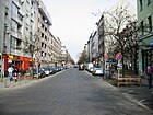
1260 | Otto Theodor von Manteuffel (1805–1882), Prussian politician | May 22, 1852 | From 1849 the street was called Eisenbahnstraße . |
|
|
Marheinekeplatz
( Location ) |
230 × 90 | Philipp Konrad Marheineke (1780–1846), philosopher and theologian | December 22, 1875 | The first names were street 27a for the northern boundary and place F, section II of the development plan. Market hall XI (to the west) and a green area with a playground (to the east) are located directly on the square . |

|
|
Mariannenplatz
( Location ) |
300 × 100 | Princess Marianne of Prussia (1785–1846), wife of Wilhelm of Prussia | March 24, 1849 | The square was created in connection with the development plan on the area of the former Köpenick field. It forms an elongated oval between Bethaniendamm and Mariannenstrasse, which goes south in the middle. Its garden-like design is based on designs by Peter Joseph Lenné . In the second half of the 20th century, Mariannenplatz became known beyond the district for house occupations and not always peaceful May events. The site includes the Diakonissenhaus Bethanien (now the Künstlerhaus; see picture) and the St. Thomas Church on its northern edge. |

|
| Mariannenstrasse
( Location ) |
690 | Princess Marianne of Prussia (1785–1846), wife of Wilhelm of Prussia | March 24, 1849 | The traffic route initially led "from Mariannenplatz, crossing Oranienstrasse to Kottbusser Communikation " (today: Skalitzer Strasse). The sequel to the Kottbusser Damm / Fraenkelufer the Landwehr canal was called after the Zoning Department. I initially Straße 8 . It was incorporated into Mariannenstrasse on September 18, 1871. |

|
| Markgrafenstrasse
( Location ) |
500 (in the district) |
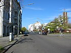
Margrave Philipp Wilhelm von Brandenburg-Schwedt (1669–1711), who owned a palace here | around 1706 | The street name was assigned while the margrave was still alive.
The house numbers 5-20 and 62-87 are located in Kreuzberg and were only added in 1733 as a southward extension of Markgrafenstraße (between Lindenstraße); so the name of the street section dealt with here had to be changed to this year. The numbers 22-61 belong to the district of Mitte (this East Berlin section was named Wilhelm-Külz-Straße between 1968 and 1991 ). |
|
|
May Ayim shore
( Location ) |
275 | May Ayim (1960–1996), poet, educator and activist of the Afro-German movement | Feb 20, 2010 | The first name from 1896 was Groeben-Ufer . The Uferstraße along the Spree runs from Pfuelstraße to Oberbaumstraße / Falckensteinstraße ( Oberbaumbrücke ). To the latter, however, stairs lead up. It was laid out after 1891 and received an elaborately designed ship landing stage. In the 21st century, this no longer serves so much for excursion traffic on the Spree, but as a berth for a hotel ship . |

|
|
Mehringdamm
( Location ) |
1340 | Franz Mehring (1846–1919), publicist and politician | July 31, 1947 | The dam was created from a historical land connection from Berlin to the outside. In 1837 it was given its first official name: Tempelhofer Straße . Several renaming have taken place up to the present name. The long street runs from Tempelhofer Ufer to Columbiadamm. There are 22 listed architectural monuments on it. |

|
|
Mehringplatz
( Location ) |
100 (diameter) |
Franz Mehring (1846–1919), publicist and politician | July 31, 1947 | The first name was Rondell . After the Wars of Liberation , it was renamed Belle-Alliance-Platz . On the occasion mentioned, he received a "Peace Column" (in the center of the photo), which was made in 1843 and is based on designs by City Councilor Christian Gottlieb Cantian . It is decorated with sculptures by Christian Daniel Rauch . The 19 meter high slender column stands in a fountain basin in the center of the square and survived the Second World War. |

|
| Methfesselstrasse
( Location ) |
610 | Albert Methfessel (1785–1869), composer and conductor | Sep 30 1935 | At first it was Street H, Section III of the development plan. From 1876 it was called Lichterfelder Straße . The street was named after Methfessel's 150th birthday. It runs from Kreuzbergstrasse (north) to Dudenstrasse (south). |

|
| Mittenwalder Strasse
( Location ) |
590 | Mittenwalde , city in Brandenburg | Dec 7, 1874 | The housing association "Belle Alliance" had the traffic route laid out as street 29a according to the development plan Section II at the beginning of the 1870s.
The street connects Blücherstraße (north) with Marheinekeplatz and comprises 24 house numbers. A grammar school opened in 1907 (Mittenwalder Strasse 7 / Schleiermacherstrasse) is a listed building monument. |

|
|
Möckernstrasse
( Location ) |
1580 |
Möckern (now part of Leipzig), site of a victorious battle of the Prussian-Russian army in the wars of liberation against Napoléon or Möckern , also a battleground in the wars of liberation ( battle near Möckern ) |
Oct. 31, 1864 | The traffic route connects Stresemannstrasse (north) with Kreuzbergstrasse and crosses Yorckstrasse. After its layout, it was initially referred to as a military road . Several buildings in the street are listed as architectural monuments. Möckernstraße forms the eastern border of the park at Gleisdreieck , which opened in 2011 . |

|
| Monument Street
( Location ) |
200 (in the district) |
National Monument on the Kreuzberg | Jan. 9, 1901 | The street runs on a former brickworks path . After the national monument on Tempelhofer Berg (today's Kreuzberg) was inaugurated in 1831, the residents called the route Monumentenstrasse, in the address book it is called Weg zum Kriegdenkmal . City maps from 1875 and 1893 already contain the street name Monumentenstrasse. The western section of the street belongs to the Schöneberg district . |

|
|
Moritzplatz
( Location ) |
120 × 120 | Moritz von Oranien (1567–1625), Dutch prince and general | Apr 7, 1849 | Although Moritzplatz and Moritzstraße got their names at the same time, they do not refer to the same person. Square and street do not touch either. The first spelling was Moritz Platz and it was described "where Oranienstrasse and Prinzenstrasse cross".
Moritzplatz is not a postal address, but the intersection between Oranienstraße (west-east street) and Heinrich-Heine-Straße / Prinzenstraße (north-south street). The round roundabout served as the namesake for the Moritzplatz underground station, which was built between 1926 and 1928 and is a listed building . |

|
| Moritzstrasse
( Location ) |
210 | Karl Philipp Moritz (1756–1793), educator and writer | July 5, 1866 | Although Moritzplatz and Moritzstraße got their names at the same time, they do not refer to the same person. Square and street do not touch either.
Moritzstrasse connects Lobeckstrasse with Prinzenstrasse in a west-east direction. |

|
|
Müllenhoffstrasse
( Location ) |
210 | Karl Müllenhoff (1818–1884), Medievalist and scientist | June 7, 1896 | According to the development plan Section II , it was built as street 2a . It is located in a traffic-calmed residential area and connects Grimmstrasse (west) with Graefestrasse (east). |

|
| Muskauer Strasse
( Location ) |
630 | Bad Muskau , city in Saxony | Oct 10, 1871 | The traffic route runs from Mariannenstrasse (west) to Zeughofstrasse. When it was named, it did not yet have house numbers assigned; six named houses were finished or still under construction. In the meantime 55 parcels belong to this street, in which, among other things, a sports hall and a parent-child shop are located. In addition, nine apartment buildings and a school building are listed monuments. |

|
|
Naunynstrasse
( Location ) |
795 | Franz Christian Naunyn (1799–1860), lawyer and Lord Mayor of Berlin | Oct. 31, 1864 | After the traffic route was laid out around 1862, it was initially given the name Dennewitzstrasse . The barracks of the 5th Squadron of the 1st Guards Dragoons Regiment were built on parcels 14-16 between 1863 and 1870 . The Train barracks were also located between Waldemarstrasse and Naunynstrasse . |

|
| Neuenburger Strasse
( Location ) |
330 | Neuchâtel , Swiss canton | Apr 29, 1853 | Count Wilhelm von Pourtales, who lives at Leipziger Platz 19, had acquired a building site with his brother Albert (both born in Neuchâtel) and had this street built there (designated as the owner of lots 4 and 5). In 1855, Neuenburger Strasse owned five building plots and went off from Alexandrinenstrasse.
It currently begins in the interior between Lindenstrasse and Alte Jakobstrasse and leads to Alexandrinenstrasse. The footpath to Lindenstrasse is a section of the road that was disengaged on September 1, 1971. The tenement group Neuenburger Strasse 9-11 is a monument. |

|
| Niederkirchnerstrasse
( Location ) |
420 (in the district) |
Käthe Niederkirchner (1909–1944), resistance fighter | May 10, 1951 | The first name of the traffic route was Prinz-Albrecht-Straße . Because of the reference to the Gestapo torture cellar in this street, the Berlin Senate and the District Office gave a new street name in 1951.
The north side of the street and the road area are in the Mitte district . On the (Kreuzberg) south side (house numbers 7 and 8) there is a section of the Berlin Wall and the Topography of Terror memorial . |

|
|
Nostitzstrasse
( Location ) |
620 | August Ludwig von Nostitz (1777–1866), Prussian general | 4th July 1865 | According to the development plan, Section II , the traffic route was laid out as street 25 . On the occasion of the 50th anniversary of the Battle of Ligny , it was given the name of Blücher's rescuer during his lifetime. The road 21b was included in the Nostitzstraße on February 19 1879th Nostitzstrasse runs from Baruther Strasse (north) to Arndtstrasse (south) and includes 60 house numbers. |
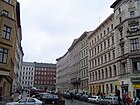
|
|
Obentrautstrasse
( Location ) |
580 | Hans Michael Elias von Obentraut (1574–1625), general in the Thirty Years War | Aug 24, 1936 | Since around the 17th century, the Mühlenweg ran along this route in front of the Hallesches Tor . In 1862 the name was changed to Teltower Straße . Finally, the responsible administration gave the current name.
Obentrautstraße runs in an east-west-east direction between Mehringdamm and Möckernstraße. Its eastern continuation is Blücherstrasse. The houses number 32 and the coach house on the farm number 53 are architectural monuments and date from the end of the 19th century. In 2019, the parliamentary group of Bündnis 90 / Die Grünen introduced a motion for the “demilitarization of public space” to the Friedrichshain-Kreuzberg district assembly to encourage a public discourse and participation process about a possible renaming of Obentrautstrasse and the other streets named after generals and battles in the district and initiate places. |

|
| Oberbaumstrasse
( Location ) |
170 | Oberbaum , a river barrier in this area of the former Berlin customs wall in the Spree | June 7, 1896 | According to the development plan, Section I, the street was built as street 60 on the former communication that led to the Oberbaumbrücke . The eastern section on the Spree was previously called Am Oberbaum (1845) and referred to the location of two royal control buildings and a military guard building, in which the "bridge winder" was also domiciled. The street leads in a slight curve from the bridge in two separate lanes west-south-west to the Schlesisches Tor with the underground station of the same name. |

|
| Ohlauer Strasse
( Location ) |
460 | Oława , a town in Lower Silesia , today Oława in Poland | Aug 31, 1949 | The street 7 , laid out according to the development plan Section II , was named Grünauer Straße in 1880 . It connects Wiener Straße with Paul-Lincke-Ufer in a north-east-south-west route and comprises 46 house numbers. There are two architectural monuments here - the disinfection facility inaugurated in 1886 (Ohlauer Straße 39-41) and an electrical substation (Ohlauer Straße 43 / Paul-Lincke-Ufer). |
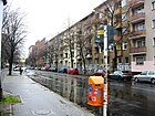
|
| Oppelner Strasse
( Location ) |
420 | Opole, city in Silesia, today Opole in Poland | July 29, 1873 | The merchant and building contractor Paul Haberkern from Naunynstrasse had the street laid out as street 6 “on Kottbusser Damm” from 1872 according to the development plan, Section II . It connects Skalitzer Straße at the Schlesisches Tor (north) in a straight line with Görlitzer Straße (south). The residential buildings Oppelner Strasse 12, 13 and 14 from the years 1873 to 1882 are architectural monuments.
|

|
|
Oranienplatz
( Location ) |
160 × 140 | Orange , royal family of the Netherlands | March 24, 1849 | From 1841 to 1852, the square was built according to plans by Peter Joseph Lenné when the Luisenstadt Canal was built . In 1906 Erwin Barth redesigned it. The square is crossed by Oranienstrasse and Dresdener Strasse. The square is a protected garden monument. |

|
|
Oranienstrasse
( Location ) |
1860 | Orange , royal family of the Netherlands | March 24, 1849 | Oranienstrasse runs from the Görlitzer Bahnhof underground station (Skalitzer Strasse / Manteuffelstrasse) (east) to Lindenstrasse (northwest). Kreuzberg's largest industrial company, Bundesdruckerei, is located at Oranienstrasse 91 . Oranienstrasse 134 houses the St. Jacobi Church and a Diakoniestation in the building complex. Numerous restaurants and smaller shops have settled along the street and contribute to the street's popularity. |

|
|
Paul-Lincke-Ufer
( Location ) |
1260 | Paul Lincke (1866–1946), composer and honorary citizen of Berlin | Nov 7, 1966 | The quayside was built in sections in the middle of the 19th century. Initially it was Kottbusser Kommunication , from around 1856 another area Kottbusser Ufer was added with four parcels. Until around 1880 it got its current length, which extends from Kottbusser Straße to Ratiborstraße and includes 45 house numbers. Between Forster Strasse and Liegnitzer Strasse, the bank is interrupted by a green corridor, so it is not a continuous road.
Between 1956 and 1966 the street was named Lincke-Ufer. |

|
| Pfuelstrasse
( Location ) |
110 | Ernst von Pfuel (1779–1866), Prussian general and politician | Apr 4, 1895 | The traffic route was built according to the development plan Section II around 1860 as road 5b . Pfuel had made a particular contribution to the spread of swimming in the army and in 1817 opened a river bathing establishment named after him (on Köpenicker Strasse, probably in the area of the guard rifle and guard pioneer barracks, plots 11-15). This is considered one of the oldest in Berlin. |

|
| Flat bank
( Location ) |
660 | Plan, historical field name | Nov 6, 1849 | The quayside was the expansion of the trench to Landwehr Landwehr channel created along the south shore area. When it was first recorded in the Berlin address book in 1855, the course was given as "between the Kottbusser and Halleschen Thore" and only one residential building is entered. In the following years there were further developments on the south side of the street, in 1861 there were already six apartment houses and private buildings. Street 6b and Street 6c , which were later built according to the development plan Section II , were included in the plan embankment on March 8, 1894; at that time there were already 97 house numbers. The street 14a, Abt. II completed the Planufer in 1896, which now reached from Steinplatz on the Waterloobrücke to Kottbusser Damm. The entire western part was later separated and renamed Carl-Herz-Ufer. The constant additions and outsourcing are related to the changes to the canal, for example the filling in of the Urbanhafen basin.
As of May 2013, the Planufer leads from Dieffenbachstrasse (west) to Kottbusser Damm (east). A number of residential buildings (Planufer 88–94) are architectural monuments that were built towards the end of the 19th century. |

|
| Prinzenstrasse
( Location ) |
800 | Wilhelm (1797–1888), from 1840 to 1861 Prince of Prussia and later as Wilhelm I of the German Emperor | Apr 7, 1849 | The road was longer when it was built on the former Köpenicker Feld. On July 22, 1960, the Berlin magistrate spun off the northern section in the Mitte district as Heinrich-Heine-Strasse. From there, Prinzenstrasse now leads south over Moritzplatz to the Baerwaldbrücke on the Landwehr Canal . From here the route becomes Baerwaldstrasse.
The Prinzenstraße underground station, which was inaugurated in 1901 and named after the street, is a listed building. |

|
| Prinzessinnenstrasse
( Location ) |
245 | Princesses from the House of Hohenzollern | Jan. 3, 1855 | Initially this street was the southeastern section of Stallschreiberstraße . With the re-routing of the street system around Oranienplatz and further development, an area was separated that was given its own name. The renaming to Prinzessinnenstrasse is based on the nearby Prinzenstrasse.
It leads from Oranienstrasse (northwest) in a straight line to Segitzdamm (southeast). A building complex directly on Oranienplatz (house numbers 1–3), built as a department store according to plans by Max Taut and Ludwig Hoffmann , is a monument. |

|
|
Pücklerstrasse
( Location ) |
550 | Hermann von Pückler-Muskau (1785–1871), writer and world traveler | 1874 | The road laid out around 1840 leads from Köpenicker Straße (north-northeast) to Waldemarstraße (south-southwest). Market hall IX , also known as the "Railway Market Hall", is a monument between this street and Eisenbahnstraße . The current house number count ranges from 12–51, the numbers 1–11 are not available. Originally, some house numbers were missing at the intersection of Waldemarstrasse (13–31) and Wrangelstrasse (34–46), which suggests that there are planned structural extensions. |
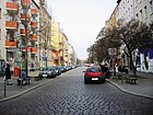
|
| Puttkamerstrasse
( Location ) |
200 | Eugen von Puttkamer (1800–1874), Prussian politician | Aug 15, 1845 | The name was already given during Puttkamer's lifetime.
In the first few years it was listed in the address book as Puttkammerstrasse (double “m”). It runs between Wilhelmstrasse and Friedrichstrasse , house numbers 1–23 have been assigned in the shape of a horseshoe. After many buildings were destroyed in this quarter in the Second World War, new buildings were erected in their place, which is why there are no architectural monuments on this street. However, a police service building (Puttkamer Strasse 16-19), today's Kurt Schumacher primary school and the birthplace of the physician Emil Du Bois-Reymond (Puttkamer Strasse 19), have not survived. |

|
|
Rahel Varnhagen Promenade
( Location ) |
180 | Rahel Varnhagen von Ense (1771–1833), writer | July 1, 1998 | It runs between Wilhelmstrasse and Friedrichstrasse and forms the northern boundary of the Theodor Wolff Park . In terms of traffic, the promenade is an access road for residents and delivery traffic. |

|
| Ratiborstrasse
( Location ) |
380 | Ratibor , city in Silesia , today Racibórz in Poland | Apr 12, 1893 | Before the Görlitz train station was built, the street was the southern part of Cuvrystraße. In 1895, the route between Wiener Strasse and Kottbusser Ufer (today Paul-Lincke-Ufer ) is shown in the address book . There was a bathing establishment directly at the southern end. In house number 13 there is the parent-child meeting "Wilde 13" in the 21st century. Next to it, at Ratiborstraße 14a, the house of the “Königliche Wasserbauinspektion Berlin I” (initially simply called “Official House” in the address book) has been preserved as a monument. |

|
| Reichenberger Strasse
( Location ) |
1980 | Reichenberg, city in Bohemia , today Liberec in the Czech Republic | Sep 14 1873 | The traffic route laid out as Straße 52 in accordance with Section I of the development plan and the extended Ritterstraße were combined in 1873 with the name Reichenberger Straße. It reached from the Elisabethufer (today Erkelenzdamm ) over the Kottbusser Tor to the Görlitzer Ufer and comprised 185 lots, mostly built with multi-family houses. The street name is said to have been chosen because of the battle near Reichenberg under the Duke of Braunschweig-Bevern during the Seven Years War (1756–1763).
Reichenberger Straße 131/132 housed the building complex of the 145th / 151st, built at the end of the 19th century. Community school. Noteworthy are some of the rails with symbolic horse hooves that have been preserved on the northern footpath, which mark the course of the horse-drawn tram that used to run along this street. In 2009 a Kiezfest was established in this street ("Reiche Street Festival"), which has taken place once a year since then. |

|
|
Reichpietschufer
( Location ) |
170 (in the district) |
Max Reichpietsch (1894–1917), organizer of the anti-war movement in the Imperial Navy | July 31, 1947 | Most of the street is in the Tiergarten district . According to the list of the Office for Statistics, there are no parcels / house numbers in this section of the bank in Kreuzberg. The district boundary runs on the street, however, so that an area between the Gabriele-Tergit-Promenade (opposite bank of Flottwellstraße; west) and the Mendelssohn-Bartholdy-Park / Köthener Straße (east) counts up to the Landwehr Canal to Kreuzberg. |
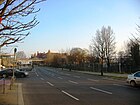
|
| Riemannstrasse
( Location ) |
250 | Heinrich Arminius Riemann (1793–1872), theologian and fraternity member | Dec. 1, 1936 | The traffic route, at its facility at Straße 26b, Section II , of the development plan, was named Mariendorfer Straße in 1874 . The street runs in an east-west direction between Zossener Straße and Nostizstraße. For some years now, an area west of Solmsstrasse has only been accessible as a walkway.
The EKT "Panzerknacker" has set up in Riemannstrasse 17. |

|
|
Ritterstrasse
( Location ) |
1400 | Knights of the Middle Ages | Feb. 20, 1845 | The traffic route was named Neue Junkerstraße in 1843 because it was the continuation of Junkerstraße . The New Junkersstraße went on the Old Jakobstraße. After a breakthrough to Lindenstrasse, the street was renamed Ritterstrasse. The district administration decided on August 14, 1981 to spin off a section that was named Jakobikirchstrasse . Adolph Menzel lived at Ritterstraße 43 from 1847–1860 , as is remembered by a memorial plaque. Ritterstraße has 127 house numbers. |

|
|
Rudi-Dutschke-Strasse
( Location ) |
490 | Rudi Dutschke (1940–1979), sociologist and spokesman for the German student movement in the 1960s | Apr 30, 2008 | Until 2008 it was part of Kochstrasse . The renaming took place at the instigation of the taz and was controversial for years. Rudi-Dutschke-Strasse connects the Lindenstrasse / Axel-Springer-Strasse with Friedrichstrasse . The “ Fathers of Unity ” monument is located here . In addition, the outlines of the Jerusalem Church can be seen in the pavement in front of the Axel Springer high-rise , which stood here until 1961. |

|
| Ruhlsdorfer Strasse
( Location ) |
150 | Ruhlsdorf , part of Teltow in Brandenburg | Aug 31, 1949 | At first the traffic route was called Lankwitzstrasse . It is located between Tempelhofer Ufer (north; with which it is not connected to traffic) and Obentrautstrasse (south). |

|
|
Schenkendorfstrasse
( Location ) |
80 | Max von Schenkendorf (1783–1817), writer | Feb. 19, 1879 | According to the development plan Section II , the traffic route was initially called Straße 21a . It was created at the instigation of Friedrich Spielhagen (“General Agent for Mortgage Banks”, residing at Gitschiner Strasse 111). The street ran between Bergmannstraße and Straße 23a . |

|
| Schleiermacherstrasse
( Location ) |
590 | Friedrich Schleiermacher (1768–1834), theologian, classical philologist and educator | December 22, 1875 | According to the development plan Section II , it was laid out as Straße 29 . It leads from Blücherstraße (northeast; at that time Pionierstraße ) over Fürbringerstraße (where it makes a slight swivel south) and via Gneisenaustrasse to Bergmannstraße (south).
A school building in Schleiermacherstraße has been preserved as a monument. |

|
| Schlesische Strasse
( Location ) |
560 | Schlesisches Tor , former city gate of Berlin nearby | Apr 7, 1839 | This street is the extension of Köpenicker Straße and leads from Skalitzer Straße to the Schlesische Brücke . On the north side, numerous factories and commercial enterprises have settled in the backyards, in the south there are mainly residential buildings. There are several trendy bars and clubs in the street, and new companies from the music and media industry have set up shop in the “ Industriepalast ” complex (also known as “Höfe am Osthafen”). The once legendary "Tritonus" sound studio is located in the building at number 31. At the southern end, the street turns into the short stretch of street in front of the Schlesisches Tor . | |
|
Silesian Gate
( Location ) |
100 × 150 (intersection area of streets) |
Location of an earlier city gate of the Berlin customs wall towards Silesia | after 1760 | The place is not officially dedicated . It was created when the customs wall was erected. In the Berlin address book the place is mentioned among other things in 1831 with “a. Schl. Th. ”(In connection with the Pfuelschen bathing and swimming establishment). In 1836 the Silesian Gate is entered on a city map, whereas it is still called the Wendish Gate on a map from 1760 . The square is named for the station on the first Berlin underground line: Schlesisches Tor underground station . |

|
| Lock bank
( Location ) |
210 | here the upper lock of the Landwehr Canal | around 1849 | The road goes northeast from Vor dem Schlesisches Tor and forms the south bank of the Landwehr Canal. It ends on the banks of the Spree. It includes house numbers 3–6. |

|
| Smithy
( Location ) |
60 | former forge for the horses and wagons of the Schultheiss brewery | Apr 1, 2001 | As a private street, the street belongs to the Viktoria-Quartier . |

|
|
Schöneberger Strasse
( Location ) |
580 | Schöneberg , formerly an independent city; Direction of the road | Apr 25, 1843 | The road was created by paving and expanding an earlier dirt road to Schöneberg. When it was built, it comprised 20 horseshoe- numbered parcels and began / ended at Askanischer Platz. In 1860 it was already extensively built on, the address book names 34 house numbers. Nothing was added in the later years.
The Reichsbahndirektion Berlin was in the building Schöneberger Straße 13 & 14 / Schöneberger Ufer 1 & 3; Along the street, a few factories were built alongside numerous residential buildings. A factory and the railway building are registered monuments. Schöneberger Strasse connects Stresemannstrasse (northeast) across the Landwehr Canal with Luckenwalder Strasse. |

|
|
Schöneberger Ufer
( Location ) |
300 (in the district) |
Schöneberg , formerly an independent city; Direction of Schöneberger Straße |
November 6, 1849 with interruption between 1935 and 1947 |
Part of the street is in the Tiergarten district . The embankment was created when the Landwehr trench was expanded into a canal. The naming refers to the crossing Schöneberger Straße. The royal court actor F. von Lavallade (residing at Leipziger Strasse) had applied for the name to be changed to Princess-Augusta-Promenade in 1860 , but this was rejected.
During the Nazi era , in June 1935, the bank was named Großadmiral-von-Koester-Ufer . After the Second World War , on July 31, 1947, the Berlin magistrate and the district administration decided to rename it Schöneberger Ufer. |

|
|
Schönleinstrasse
( Location ) |
350 | Johann Lukas Schönlein (1793–1864), doctor at the Berlin Charité since 1840 | December 22, 1875 | The street was laid out as street 4 according to the development plan Section II . It connects the Kottbusser Damm (northeast) with the Urbanstraße (south) and first runs westwards to Böckhstraße, then it turns southwards. It forms the western boundary of Hohenstaufenplatz . The street is also the namesake for the subway station of the same name . |
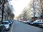
|
| Schwiebusser Strasse
( Location ) |
540 | Schwiebus, town in Neumark, today Świebodzin in Poland | Feb 12, 1898 | The street was laid out as street 22 according to the development plan Section II . It runs in a straight line from west to east between Mehringdamm and Friesenstrasse. It forms the northern border of the Tempelhofer Feld . In the year in which the name was given, no parcel numbers had yet been set, but there were seven private houses as well as the “Berliner Bock-Brauerei” and a “ Steuerhaus ”.
The house of a mill built around 1843 has been preserved as a monument. The main customs office in Berlin is very close by (Mehringdamm 129c) . Extensive construction has been going on along Schwiebusser Strasse since 2011 - mainly multi-storey residential buildings. |

|
|
Sebastianstrasse
( Location ) |
500 (in the district) |
former Sebastian Church , which was later called Luisenstadt Church . The Sebastiankirche was named after the Cölln councilor Sebastian Nethe. | Feb. 27, 1839 | Part of the street runs in the Mitte district . Before it was named today, it was called Riecksdorfische Strasse according to its direction to Rixdorf (today Berlin-Neukölln ).
In 1962, an escape tunnel was dug in house number 82 with which people from East Berlin were supposed to get to West Berlin . The plan was betrayed, however, the escape helper Siegfried Noffke was shot by Stasi employees. The second escape helper, Dieter Hötger , was imprisoned for “ illegally crossing the border ”. An information board reminds of what is happening. |

|
| Segitz dam
( Location ) |
630 | Martin Segitz (1853–1927), union leader and politician | July 31, 1947 | When the street was laid out in the mid-19th century, it was given the name Louisen-Ufer . It was a promenade along the Luisenstadt Canal. After the canal was filled in, the road became a "dam". It leads from Böcklerstraße (south) west along the former canal. At Oranienplatz, the route continues as Legiendamm to Heinrich-Heine-Platz / Michaelkirchplatz. The areas Luisenstadt / Bethaniendamm and Luisenstadt / Segitzdamm are parts of the Köpenick suburb and are designated as “milieu protection” by the Berlin Senate. |

|
| Sixtusgarten
( Location ) |
90 | Sixtus Villa, landmark of the former Schultheiss-Tivoli-Patzenhofer brewery | Apr 1, 2001 | The street belongs to the Viktoria district . Its alignment is new, but it takes up parts of the former Kleine Parkstraße and Lichterfelder Straße (today Methfesselstraße). It runs from Tivoliplatz (west) to Methfesselstrasse (east). The villa is a brick building with a round tower and battlements, which was built in 1900/1901. A few years later it was set up as a restaurant "Zum Schultheiss am Kreuzberg", where the beer brewed there was served. In the 1930s, the bar had to be closed, which then served as a residence for the directors of the brewery. From 1945 the trained authorized signatory Hans Sixtus became director and from 1956 first general director of the brewery and lodged in the building that has now been named after him. All the historical buildings that have been preserved have been renovated in recent years and are listed as historical monuments. |

|
|
Skalitzer Strasse
( Location ) |
2000 | Skalitz, site of a battle in the German War in Bohemia, today Česká Skalice in the Czech Republic | Oct. 24, 1868 | The street was merged from the previous streets in front of the Berlin city gates, Kottbusser Communication and Lausitzer Communication , and renamed. A section of Dresdner Straße was integrated into the course of the road in 1975. It leads in a west-east direction in two separate lanes from Wassertorplatz via Kottbusser Tor , Lausitzer Platz to Schlesisches Tor . The elevated railway of underground line 1 runs along the median . Almost a dozen buildings on this street are listed, including a schoolhouse that was inaugurated in 1887 and built according to plans by Hermann Blankenstein and Karl Frobenius . |

|
| Solmsstrasse
( Location ) |
560 | Solms-Baruth , former civil authority in the Mark Brandenburg | Dec 7, 1874 | The traffic route was built according to the development plan Section II as street 26a on behalf of the construction company "Belle Alliance". It runs between Baruther Straße (north) and Bergmannstraße (south), the house numbers are counted in a horseshoe shape from 1 to 52. Solmsstraße 1 houses a daycare center (“Sonnenschein II”), Solmsstraße 37 is the address of a conservatory for Turkish music. |
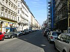
|
| Sorauer Strasse
( Location ) |
260 | Sorau, town in eastern Lower Lusatia , today Żary in Poland | 5th Sep 1874 | The merchant and building contractor Paul Haberkern from Naunynstrasse had the street laid out as street 2a from 1872 according to the development plan Section I. Sorauer Strasse runs in a straight line between Wrangelstrasse (north-northeast) and Görlitzer Strasse (south-southwest). The residential buildings house numbers 1–31 were built between 1880 and 1886 and are architectural monuments. |

|
| Spreewaldplatz
( Location ) |
130 × 100 | Spreewald , lowland area and cultural landscape in Brandenburg | March 8, 1894 | The square was created in 1866 as the forecourt of the Görlitz train station . Coals were sold on the north side. A horse-drawn tram line ended here as early as 1893, later trams went here (top picture, 1928). The Wendenstraße running on the west side of the square , to which all the houses currently available on the square belonged, was also renamed Spreewaldplatz in 1949. On the east side of the square, the bath at Spreewaldplatz was built in 1987 , the old station forecourt was planted with trees and integrated into the footpath (lower picture). |

|
| Stallschreiberstrasse
( Location ) |
600 | Clerk in the electoral stables , who lived in the first built-up property in the 18th century (number 15) | Sep 11 1846 | Part of the northeast side of the street (house numbers 17–32) is in the Mitte district . The traffic route existed as Stallschreiber Gasse as early as the middle of the 18th century and ran between Alte Jakobstrasse and Köpenicker Feld (the area in front of the city gate of the same name).
The alley was later extended to the southeast. In 1855, the king decreed that the section between Oranienstraße and Luisenufer , which was named Prinzessinnenstraße , was hived off . The given date refers to the renaming to street. No architectural monuments have been preserved in the street, although there were numerous houses on both sides in the first half of the 19th century, in which mostly small families of craftsmen lived. A small section of this street was part of the Berlin Wall . A number of retirement homes are now here and, since 2012, there have also been asylum seekers and refugee homes. On September 13, 1964, American civil rights activist Martin Luther King visited the street. In the early morning hours of that day, a 21-year-old man was seriously injured by gunfire while trying to cross the border fortifications. King toured an apartment in Kreuzberg that had been hit by bullets and the 28 bullet holes in house number 42. |

|
|
Stresemannstrasse
( Location ) |
1220 (in the district) |
Gustav Stresemann (1878–1929), politician | Feb. 6, 1930 (with an interruption between 1935 and 1947) | The merging of the communications (Brandenburger, Potsdamer, Anhaltische) with the streets in front of the Wall in 1867 led to Königgrätzer Straße . This was divided again in the 20th century, a remainder (numbers 1–70 and 76–129) was named Stresemannstrasse. The other part of the street - around 300 meters - is in the Mitte district and is called Ebertstrasse . Between 1935 and 1947 the traffic route was called Saarlandstrasse . |

|
|
South star
( Location ) |
250 × 150 (oval shape) |
star-shaped distribution of the outgoing roads | July 31, 1947 | The previous names were successively Kaiser-Friedrich-Platz and Gardepionierplatz .
This square forms a large central island of the star-shaped confluence of the streets Hasenheide (east), Lilienthalstrasse (southeast), Bergmannstrasse (southwest), Gneisenaustrasse (west), Blücherstrasse (northwest) and Fontanepromenade (northeast). The church on the south star dominates the south star. |

|
|
Taborstrasse
( Location ) |
300 | Tabor Church | December 19, 1912 | When the church building was erected, the northern section of the Görlitzer Ufer was spun off in 1912 and named after the Tabor Church, which was inaugurated in 1903. The street leads from the Schlesische Straße (northeast) in a slight curve southwards to the street Görlitzer Ufer / Heckmannufer and comprises 24 house numbers. When the name was assigned, all houses were already completed. |

|
| Tempelherrenstrasse
( Location ) |
250 | Members of the Knights Templar | Dec 21, 1868 | The street was laid out as street 33 according to the Abbot II development plan . Tempelherrenstrasse runs in a northeast-southwest direction between Carl-Herz-Ufer (formerly Plan-Ufer) and Urbanstraße (formerly Pionierstraße ). The development began only around 1880; Four of these residential buildings are listed (house numbers 2-5). |

|
| Tempelhofer Ufer
( Location ) |
1300 | Tempelhof , part of Berlin and until 1920 a rural community in Brandenburg | Nov 6, 1849 | This riverside road opens up the southern bank area of the Landwehr Canal. It connects Schöneberger Strasse (west) with Waterloo-Ufer in the area of Blücher-Platz (east). The houses 10-14 and 21 are under monument protection, as well as the former post office Tempelhofer Ufer 1 and two former factory buildings, among others for the company Orenstein and Koppel (see also Tempelhofer Ufer 23-24 ). |

|
| Tivoli Square
( Location ) |
40 × 30 | "Tivoli" amusement bar, which existed here from 1829 to 1856 | Apr 1, 2001 | The square belongs to the Viktoria-Quartier and did not have its own address before the new development of the quarter. |

|
| Trebbiner Strasse
( Location ) |
190 | Trebbin , city in Brandenburg | March 4, 1863 | The traffic route was laid out as street 15 according to the development plan Section III .
This is where the German Museum of Technology , known far beyond Berlin, is located , which opened in 1983 as the "Museum for Transport and Technology". |

|
|
Urbanstrasse
( Location ) |
1780 | Urban, traditional name for a swamp area | Nov 1, 1874 | Urbanstraße runs from Blücherstraße to Sonnenallee in a west-east direction. It was created by fortifying and straightening an earlier cattle path. Numerous architectural monuments have been preserved along the street, including the Wrangel Fountain , which was moved here from the former Kemperplatz . |

|
|
In front of the Silesian Gate
( Location ) |
120 | Schlesisches Tor , former city gate of the Berlin customs wall on the road towards Silesia | before 1864 | The road, which is currently limited to the area of the Lohmühleninsel, formerly led through the Silesian Bush on the Treptower area to today's Puschkinallee .
When they were entered in the address book, no house numbers were shown, only the "Sachse'sche Badeanstalt" (from the manufacturer Sachse) and a lumber mill . A control building was added by 1868 , and by 1870 three owners had their houses built on this street. |

|
|
Waldemarstrasse
( Location ) |
1100 | Waldemar von Prussia (1817–1849), Prussian major general | Apr 7, 1849 | The road was laid out between 1841 and 1846. In 1850 the following description of the course can be found: “Crossing Adalbertstrasse, from Lausitzer Platz to Dresdner Strasse”, as it is still relevant. The entire Kleine Waldemarstrasse, which is also contained in the address book, is in the center of Berlin (“between Gipsstrasse, Auguststrasse and Linienstraße”).
On August 31, 1949, Buckower Strasse was incorporated into Waldemarstrasse. Part of the north side of the street (odd house numbers 1–17, between Luckauer Straße and Leuschnerdamm) is in the Mitte district . |

|
| Wartenburgstrasse
( Location ) |
290 | Wartenburg , site of a battle in the Wars of Liberation in Saxony-Anhalt | March 3, 1868 | The road was laid out in 1867 on behalf of the manufacturer Johann Stöcker . |
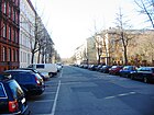
|
|
Wassertorplatz
( Location ) |
200 × 140 | a former city gate of the Berlin customs wall at the passage of the Luisenstadt Canal | March 24, 1849 | The water gate was an iron grille and blocked the passage if necessary. After the toll wall was dismantled, the square was redesigned into a green area in 1885. The canal was filled in from 1926 to 1929. Efforts have been made to reopen it since the 21st century. |

|
| Wassertorstrasse
( Location ) |
540 | no longer preserved city gate of the Berlin customs wall at the passage of the Luisenstadt Canal | Apr 7, 1849 | The road was laid out between 1841 and 1846. The part between Alexandrinenstrasse and Brandenburgstrasse became a building site and was moved in on July 1, 1959. |
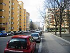
|
| Waterloo banks
( Location ) |
200 | Waterloo , site of a battle in the Wars of Liberation in Belgium | Apr 13, 1866 | The Uferstraße was laid out in 1866. It originally led from Blücherplatz to Alexandrinenstrasse. The part between Zossener Brücke and Waterloobrücke was renamed Brachvogelstrasse on August 16, 1956 . |

|
| Werner-Düttmann-Platz
( Location ) |
40 × 40 | Werner Düttmann (1921–1983), architect, urban planner and painter | 1984 | The square is part of the Viktoria-Quartier . |

|
|
Wiener Straße
( Location ) |
1140 | Vienna , capital of Austria | Oct 9, 1873 | The first name from around 1866 was Extended Oranienstraße and was renamed Wiener Straße in 1873 after the final destination of the first trains from the adjacent Görlitz station . It connects the Görlitzer Bahnhof underground station in a straight south-east route with the Görlitzer Ufer. In the northwest it forms with the Orange Street one block, in the southeast she was until its demolition in 1945 on the Vienna bridge with the Karl-Kunger road connected. |

|
| Wilhelmshöhe
( Location ) |
330 | Wilhelm I (1797–1888), German Emperor and King of Prussia, and his “ Wilhelmshöhe ” palace in Kassel | 1871 | Originally there was a sand pit here, from which the Berliners were supplied with white sand. The street was created on the initiative of a community of owners who had a villa colony built here. It ran south-eastwards from what was then Belle-Alliance-Straße (today: Mehringdamm ) and comprised 30 parcels (some “numbers are not available, but numbers 20 to 30 partly belong to Belle-Alliance-Straße”). |

|
|
Wilhelmstrasse
( Location ) |
1025 (in the district) |
Friedrich Wilhelm I (1688–1740), Prussian King | 1735 | Part of the street is in the Mitte district . This part was previously named Neue Wilhelmstrasse and 1964–1993 Otto-Grotewohl-Strasse after the politician Otto Grotewohl . The Kreuzberg section (house numbers 1–42, 108–150) leads north from Hallescher Ufer near Hallescher Tor to over Kochstrasse. The traffic route that used to start at the Rondell / Friedrichstrasse was swiveled away from the square around 1970 and merged with the Mehringdamm to form a new route.
Here you will find the Tommy-Weisbecker-Haus (number 9), the Willy-Brandt-Haus (number 140; Federal Center of the SPD) and the Topography of Terror memorial . |

|
| Willibald-Alexis-Strasse
( Location ) |
460 | Willibald Alexis (1798–1871), writer | March 12, 1889 | The first names according to the Zoning Plan Section II were Street 23b and Street 27b .
Willibald-Alexis-Straße runs from Kopischstraße (west) to Heimstraße and forms the southern boundary of Chamissoplatz. It belongs to the Chamisso-Kiez , in which numerous Wilhelminian-style houses have been preserved and form a monument ensemble. |
|
| Wilmsstrasse
( Location ) |
330 | Robert Wilms (1824–1880), physician and surgeon | Jan. 18, 1892 | The first name was Straße 6a, Section II of the development plan. The street connects Tempelherrenstraße with the Planufer and forms the northern boundary to the Am Urban hospital . Wilmsstraße 19 is the address of the Kreuzberg volunteer fire brigade , house number 10 houses the neighborhood house and the “mayor's heart primary school”. With the numbers 8–12 the street borders on the complex Baerwaldbad , Schule, Kirche. |

|
| Wrangelstrasse
( Location ) |
620 | Friedrich von Wrangel (1784–1877), Prussian field marshal | Apr 7, 1849 | The road was laid out and named in 1849. Wrangelstrasse connected Zeughofstrasse with Mariannenufer and between 1850 and 1860 had only one residential building. By 1870 extensive building work had started and the plots were numbered (1–92). On January 20, 1875, the street between Zeughofstrasse and Skalitzer Strasse as well as Strasse 51, Section I of the development plan were included in Wrangelstrasse, the house numbers had to be rearranged and now ranged from 1 to 149 (then again slightly reduced to 136 / 137). They were given in a horseshoe shape.
Wrangelstrasse currently begins at Mariannenplatz and then runs in a straight line south-east to Taborstrasse. It is worth mentioning some architectural monuments in this street (houses numbers 41-46), a community dual school (Wrangelstrasse 128) and the "Wrangelstrasse sports field". |

|
|
Yorckstrasse
( Location ) |
860 (in the district) |
Ludwig Yorck von Wartenburg (1759–1830), Prussian field marshal | Oct. 31, 1864 | The street was called Gürtelstraße between 1862 and 1864 and is a section of the planned “ general train ”. Part of the street is in the Schöneberg district . The St. Bonifatius Church (Yorckstraße 88c) , consecrated in 1907 , is remarkable. In addition, the historical multiple bridge construction is known far beyond Kreuzberg: Yorckbrücken . The Berlin monument list contains numerous architectural monuments along this street. |

|
|
Zeughofstrasse
( Location ) |
410 | a former military magazine called "Zeughof" , which was located here | Apr 7, 1849 | In 1733 the first warehouse for weapons and wagons of the military was built here. When it was added to the address book in 1850, its location was described as follows: "From Köpnickerstraße next to the Royal Traindepot (in the direction of Lausitzer Communication ) leading to Wrangelstraße". At Zeughofstraße 20, an industrial park from 1902 has been preserved and is a listed building. |
|
| Zimmerstrasse
( Location ) |
880 | Former storage area for carpentry materials | 1734 | The street was laid out when Friedrichstadt was built . The north side of the street and the street land are in the middle . Residential buildings were built here at an early stage and the “Gentzsche Badeanstalt” is mentioned as early as 1831 under number 78. |
|
|
Zossener Strasse
( Location ) |
920 | Zossen , city in Brandenburg | Dec. 26, 1874 | The former Straße 26 and Straße 32, Section II of the development plan were laid out in 1874. On December 19, 1912, the extension of Zossener Strasse between Plan- and Waterloo-Ufer was also given this name. The street connects the Waterloo bank on the Landwehr Canal with Bergmannstraße on Marheinekeplatz . |

|
| Züllichauer Strasse
( Location ) |
710 | Züllichau, town in the Neumark, today Sulechów in Poland | Feb 12, 1898 | The street was laid out in 1897 and leads from Golßener Straße (west) to Lilienthalstraße (northeast). The south side with the odd house numbers 1, 3, 5, 7 belonged to the Tempelhof district until August 12, 2014 and forms the access to the allotment garden “Am Flughafen”. Since then, the entire street that borders on the Luisenstadt cemetery has belonged to Kreuzberg . The building located here operates as "BIS Business Integration Service in Kreuzberg". |
|
Former and planned streets and squares
(without length information and geographic coordinates)
Sources : Kauperts.de, historical Berlin city maps (1926, 1943, 1946) and Berlin address books from 1835 to 1943 (random samples)
| Surname; possibly picture | Origin of name | designation | Repeal | Notes, possibly today's name (→) |
|---|---|---|---|---|
| Anhalt communication | Communicationsweg at Anhalter Tor | 16 Sep 1840 | 1875 | Only house numbers 5 to the end belonged to the police station 11. From the 1870s, initially at Königgrätzer Straße , it was renamed Stresemannstraße for the first time in 1930 . From 1935 to 1947 it was called Saarlandstrasse . |
| On the Barthschen Promenade ( location ) |
Erwin Barth (1880–1933), garden designer | Apr 1, 2001 | July 2012 | The 100-meter-long private road belongs to the Viktoria-Quartier and was named at the investor's request. The Friedrichshain-Kreuzberg district office decided in August 2012 to cancel the name at the request of the property owner, because "due to the structural development, the property can no longer be clearly assigned" and no residents are registered at this address. |
| Bahnhofstrasse | Anhalter Bahnhof | May 22, 1847 | Aug 30, 1949 | It was laid out as a connecting road from Schöneberger Strasse to the newly built Anhalter Bahnhof; 1949 renamed Güstener Straße . |
| Belle Alliance Square | Belle-Alliance , name of the French farm near Waterloo, after which Gebhard Leberecht von Blücher described the battle against Napoleon | Oct. 22, 1815 | Feb 16, 1946 | The square was created in 1734 after the Landwehr ditch was laid. At first the area was called a roundel because of its shape . After 1946 the area was briefly renamed Franz-Mehring-Platz . |
| Belle-Alliance-Strasse | Belle Alliance , the name of the French farm near Waterloo, after which Gebhard Leberecht von Blücher described the battle against Napoléon | 1864 | 1947 | The Tempelhoferstraße has been renamed. → Mehringdamm |
| Bethanienufer | Bethany Hospital | March 24, 1849 | May 20, 1937 | The Luisenstadt Canal , to which the bank belonged, was filled in from 1926 to 1929 and designed as a dam along its course . The street was then named Felsendamm together with the Mariannenufer . |
| Brandenburgstrasse | Friedrich Wilhelm Graf von Brandenburg , Prussian politician | Apr 17, 1849 | Oct 31, 1962 |
→ Lobeckstrasse |
| Britzer Strasse | Britz , the neighboring village of Kreuzberg when it was named | 1861 | 1949 | The master carpenter and builder F. Winkler had applied for the street to be given his name, but this was not approved (address 1863: Britzerstraße 34 ). |
| Buckower Street | Buckow , location in today's Berlin-Neukölln district ; Direction of the traffic route | Feb 3, 1864 | Aug 31, 1949 | The Buckower road was the western section of today → Waldemarstraße . |
| Camphausenstrasse | Ludolf Camphausen (1803–1890), first president of the Rheinische Eisenbahngesellschaft, member of the German Reichstag and from March to June 1848 Minister in Prussia | May 12, 1893 | Oct 21, 1933 | → Körtestrasse |
| Communication at Hallesches Thor | Communicationsweg at Halleschen Tor | before 1835 | 1849 | The path is divided into 23 parcels (house numbers). Around 1850 the street name was combined with the already existing Hallesche Communication . |
| Cuvry Bank | Heinrich Andreas de Cuvry | Nov 6, 1849 | after 1920 | The street ran along the upper lock between the Spree and Schlesischer Straße and was built over. |
| Dennewitzstrasse | Dennewitz , site of a battle in the Wars of Liberation | May 29, 1862 | Oct. 30, 1864 | The street was originally within the Berlin customs wall; On the occasion of the division of the Köpenicker Feld as a building area, it was redesignated and named. They have already been divided into 59 plots. → Naunynstrasse |
| The twilight | Dam , "insulated path" | 17th century | 1843 | → Alexandrinenstrasse |
| Dreibundstrasse | Triple Alliance , a defense alliance concluded on May 20, 1882 between the three powers Germany, Austria-Hungary and Italy. | Jan. 1901 | Apr 21, 1936 | Renamed Immelmannstrasse during the Nazi era . |
| Eisenbahnstrasse | Freight railway that brought coal from the Schlesisches Bahnhof to the gas works in Gitschiner Straße | 1849 | 1852 | This street name is not identical to the still existing railway street . → Manteuffelstrasse |
| Elisabethufer | Elisabeth , Queen of Prussia | 1849 | 1937 | First of all, the course is given as "from Bethanienufer to Oranienbrücke". On November 12, 1866, part of the Kottbusser Ufer came to the Elisabethufer. During the Nazi era , the bank was renamed Oranienplatz , Schröderdamm and Hoffmanndamm . |
| Enckeplatz | Johann Franz Encke (1791–1865), director of the observatory in Berlin and astronomer at the Prussian Academy of Sciences | 1844 |
Dedicated in 1927 |
In 1845 it is specified in the address book as "Enke-Platz" (police station 12). From 1860 he wrote himself correctly “Enckeplatz”. In 1927 it was canceled as a place and included in → Enckestrasse . |
| Establishments in front of the Kottbusser Tor, this side of the Landwehrgraben to the gas station exclusive | Etablissement , a French term for apartments | 1839 | 1844 | The name is no longer in the address book in 1845. |
| Feldstrasse | Field , agricultural land | 18th century | 1843 | Only a section of this street was in today's Kreuzberg; the corresponding streets belonged to the police stations 10, 11 or 12. Previously the route was called Die Demmerung . → Alexandrinenstrasse |
| Rock dam | Eduard Felsen (1908–1932), supporter of National Socialism , who died in political disputes in February 1932 | May 20, 1937 | July 31, 1947 | → Bethaniendamm |
| Franz-Mehring-Platz | Franz Mehring , publicist and politician | Feb 16, 1946 | July 31, 1947 | The Berlin magistrate had not approved the renaming of Belle-Alliance-Platz with the full name of Franz Mehring, as this name had been requested for Küstriner Platz in the Friedrichshain district . → Mehringplatz |
| Fürstenstrasse | Prince , ruler title ("The first, the noblest") | Dec 1861 | 1949 | → Bergfriedstrasse |
| Guard pioneer place | Guard Pioneer Battalion , Prussian military unit that existed as a Berlin garrison in the 19th century | 1938 | July 31, 1947 | The picture shows the unveiling of a monument to the guards pioneers in 1929. → Südstern |
| Groebenufer, also written Groebenufer | Karl von der Groeben-Neudörfchen (1788–1876), General of the Cavalry and 1853/58 Commanding General of the Guard Corps | 1891 | 2010 | The new Uferstraße was named after a military person, although the address book is more familiar because it was created shortly after the name was given.
The photo shows a ship landing stage in 2007. |
| Grand Admiral-von-Koester-Ufer | Hans von Koester (1928), Prussian officer | June 5, 1935 | July 31, 1947 | → Schöneberger Ufer |
| Grünauer Strasse | Grünau , direction | 1880 | 1949 | → Ohlauer Strasse |
| Güstener Strasse | Güsten , city in Saxony-Anhalt; Name referred to the Anhalter Bahnhof | Aug 31, 1949 |
Dedicated in 1987 |
The short street was set aside for the construction of a new school building in 1987. |
| Hallesche Communication | Communicationsweg at Halleschen Tor | 1848 | around 1880 | From the 1870s the name was simplified to Am Halleschen Thor , then Platz am Halleschen Tor (1880). A few years later it was shortened to Hallesches Tor . |
| Hasenhegerstrasse | Heger (Hasenheger) in the service of the elector, who was responsible for the wild animal population in the Hasenheide and who lived in this path, known as Hasenhegergasse until 1844 | 17th century | 1848 | → Feilnerstrasse |
| Hellweg | derived from hell , denoted a path on which the dead were driven to hell | 1860 | 1868 | The path led directly inside along the Berlin city wall. It was initially called Vor dem Hallesches Thore . In 1860 it was named Hellweg. → Gitschiner Strasse |
| Hirschelstrasse | Hirschel, landowner, over whose area the road ran | July 23, 1831 | Oct 16, 1867 | Hirschelstrasse was outside the customs and excise wall. After its removal in 1866/1867, this street was merged with some others to form Königgrätzer Straße in 1867 . From this in 1930 the → Stresemannstraße emerged. |
| Hollmannstrasse | Hollmann, August Karl Friedrich (1776–1858), businessman and local politician | 1857 | Sep 15 1993 | The road was rededicated in two parts: on June 30, 1960, the part between Alexandrinenstraße and Alte Jakobstraße was withdrawn and rededicated; on September 15, 1993, the rest of the traffic route reached the grounds of the Jewish Museum and was also rededicated. |
| Hoffmanndamm | Hans Hoffmann, member of the Hitler Youth who was killed in 1931 | May 20, 1937 | July 31, 1947 | → Erkelenzdamm |
| Husarenstrasse | Hussar , horse soldier | 1789 | 1857 | In their layout it led from Lindenstrasse to Alexandrinenstrasse. → Hollmannstrasse |
| Immelmannstrasse | Max Immelmann (1890–1916), pilot of a fighter plane that crashed over France in 1916 | Apr 21, 1936 | Jan. 2, 1949 | → Dudenstrasse |
| Jerusalem Street | Jerusalem Church , which existed on this street from 1484 to 1945 | around 1838 |
1960 part of the Kreuzberg district devoted |
The first spelling was Jerusalem Street . Part of the street is in the Mitte district. Axel Springer had his publishing house built on the stretch of road north of Rudi-Dutschke-Strasse (then: Kochstrasse ) . The picture shows Jerusalemer Straße (left) with the church of the same name in 1906. |
| Jouanengasse | Jouane, a merchant family and landowner on this street who ran a coffee house here around 1750 | around 1740 | 1763 | The name of the street after a French owner is said to have been corrupted by the Berliners at the time in "Schwanengasse". → Kommandantenstrasse |
| Junkerstrasse, Neue Junkerstrasse | Junker, based on the lower ranks of the army ( Fahnenjunker ) | 1839 |
December 15, 1970 deconsecrated |
At first it was unofficially called Bauernstraße . With the development beginning around 1830, the police chief gave the name Junkerstraße. The traffic route connected Markgrafenstrasse with Lindenstrasse. The New Junkersstraße presented the extension of Junkersstraße to Alexandrinenstraße is and was named 1843. 1845 it was in → Ritterstraße renamed. |
| Kaiser-Friedrich-Platz | Kaiser Friedrich , German Emperor and King of Prussia | 1893 | 1938 | The town square was renamed Guard Pioneer Square during the Nazi era . The view shows part of Kaiser-Friedrich-Platz with the New Garrison Church (today: Church on Südstern ). |
| Kirchstrasse | Sebastian Church | around 1730 | 1734 | → Kochstrasse |
| Coal bank | Coal that was needed for the municipal gas station in Gitschiner Strasse was handled here | Nov 6, 1849 | June 7, 1896 | One section came in 1894 to Luisenufer, another section to Kottbusser Ufer. The remaining section was named Sedanufer in 1896 . |
| Convoy path | Column , military unit of the Guard pioneers who in this way to their training ground on the Tempelhof Field arrived |
before 1874 around 1895 |
1874 Jan. 1901 |
A Kolonnenweg was renamed → Fichtestrasse in 1874 . Another column route was named Dreibundstrasse in 1901 . |
| Königgrätzer Strasse | Königgrätz, city in Bohemia, today Hradec Králové in the Czech Republic | Oct 16, 1867 | 1935 | After the Berlin customs wall was removed, the communications (Brandenburger, Potsdamer, Anhaltsche) were merged with the streets in front of the wall to create Königgrätzer Strasse. In 1915 the northern part was spun off as Budapester Straße . In 1930, the rest (numbers 1-70 and 76-129) received the new name Stresemannstrasse, renamed Saarlandstrasse in 1935. Three houses (71–75) still had the address Königgrätzer Straße until December 1936, after which they came to Hallescher Ufer. In 1949 the street was renamed → Stresemannstraße as it ran through Kreuzberg . |
| Kösterdamm | Eduard Köster, SS troop leader, who died in political conflicts in 1932 | 1937 | July 31, 1947 | Divided into → Legiendamm and → Segitzdamm |
| Cuirassiergasse | Cuirassiers , term for military riders from 16. – 19. century | 1836 |
Dedicated in 1959 |
The Todt alley received in 1836 the name Kürassierstraße because the riders used this way. The street ran between Alexandrinenstrasse and Alte Jakobstrasse. It was withdrawn when the Otto Suhr settlement was built. |
| Lankwitzstrasse | Lankwitz , direction of the street | Oct. 29, 1864 | Aug 30, 1949 | The street was built as street 3 according to the development plan Section III . In 1866 sewer pipes were laid and the street was paved . From 1898 , the Salvation Army maintained a home for seven women who had recently given birth at Lankwitzstrasse 4 . The historian Johann Fidicin lived in house number 12 for a while . → Ruhlsdorfer Strasse |
| Lehniner Strasse | Lehnin Monastery , first Cistercian settlement in the Mark Brandenburg | Aug 4, 1897 | May 13, 1929 | Lehniner Strasse began as Strasse 17, Section II of the development plan. It ran from Bergmannstrasse / Hasenhaide (north) over ten parcels to the Catholic Garrison Church (south). There the route made a slight swivel southwest and continued as Siboldstrasse to Jüterboger Strasse. → Inclusion in Lilienthalstrasse |
| Lichterfelder Strasse | Lichterfelde , at the time the name was given, an independent village at the gates of Berlin; direction | 22 Feb 1876 | 29 Sep 1935 | Lichterfelder Straße 11–17 is the address of the Schultheiß brewery (end of the 19th century) → Methfesselstraße |
| Lohmühlenstrasse |
On the road were in the 18th century Bark Mill , where tree bark ( " Tan ") has been processed into flour Borken. | July 1897 |
1978 Kreuzberg section deducted |
First the street led from the Schlesisches Tor to the Harzer Straße. The Kreuzberg section has been preserved as a footpath on Lohmühleninsel. The officially named Lohmühlenstraße (parcel numbers 7-67) is in the Alt-Treptow district and leads from the Upper Freiarchenbrücke to Eichenstraße. |
| Luebbener Strasse | Lübben , city in the Spreewald | 1849 | 1852 | Renamed Eisenbahnstraße after the tracks were laid . After that, things got a little mixed up with the names, because an extended Lübbener Strasse appeared in the address book around 1870, but belonged to Lausitzer Strasse . |
| Luisenufer; first spelling Louisen Ufer | Luise Auguste Wilhelmine Amalie (1776–1810), Queen of Prussia | 1859 | May 20, 1937 | Renamed Kösterdamm during the Nazi era |
| Mariannenufer | Mariannenplatz after Maria Anna Amalie von Hessen-Homburg , Princess of Prussia | March 1849 | 1937 | The Luisenstadt Canal , to which the bank belonged, was filled in from 1926 to 1929 and designed as a dam along its course. The street was later named Felsendamm together with the Bethanienufer . |
| Mariendorfer Strasse | Mariendorf , direction of the street | Dec. 26, 1874 | Nov 30, 1936 | The land belonged to the construction company "Belle Alliance", which had residential buildings built here and then partly sold on. In 1880 a (municipal) bus depot was designated in the Solmsstraße / Nostitzstraße area. → Riemannstrasse |
| Mathieustraße | Charles Louis Mathieu (1800–1885), art gardener, local politician | March 24, 1849 | June 8, 1973 | The members of the Mathieu family had come to Kurbrandenburg as religious refugees and had built a new existence here. The road laid out in 1849 ran across Mathieu's property and was therefore named after him. It led from Brandenburgstrasse to Alexandrinenstrasse. canceled |
| Military road | served as the route of the garrison soldiers to Tempelhofer Feld | Feb 7, 1850 | Oct. 31, 1864 | From 1846 the street received a sewer system and paving . → Möckernstrasse |
| Mühlenweg in front of the Hallesches Tor | a wind powered sawmill that was built on this road in 1684 | 17th century | March 24, 1862 | Until 1860, the Berlin address book only contained Mühlenstrasse, which belongs to the Berlin-Friedrichshain district (today) and was assigned to police station 26 at the time . After the incorporation of the Tempelhofer Vorstadt, which was previously part of Tempelhof, in 1861, the Mühlenweg in front of the Hallesches Tor also belonged to the city of Berlin, which consequently appears in the address book in 1862. It has no house numbers, but its 22 buildings are named after the owners. A windmill no longer exists here at that time. Mühlenweg was renamed Teltower Straße in 1862 |
| Orange Street, New Orange Street | Orange , city in the south of France | 1740 | March 23, 1849 | The street name given is related to the immigration of Huguenots to Berlin. → Oranienstrasse |
| Pioneer Road | Pioneers , special department of the Prussian army | June 30, 1836 | Oct. 30, 1864 | → Blücherstrasse |
| Prinz-Albrecht-Strasse | Albrecht, Prince of Prussia (1837–1906), Field Marshal General | July 28, 1891 | May 9, 1951 | An extension of Zimmerstrasse to the west made around 1887 is said to have been laid over the property of Prince Albrecht. The new street with five parcels was initially called the extended room street . In 1891, while Prince Albrecht was still alive, it was given his name. → Niederkirchnerstrasse |
| Prinz-August-von-Württemberg-Strasse | August von Württemberg (1813–1885), Prussian military, among other things long-time commander of the Gardes du Corps | Feb 12, 1898 | March 20, 1929 | → Columbiadamm |
|
Rixdorfer Damm, Rixdorfer Strasse (Riecksdorfische Strasse) |
Rixdorf (first spelling also Riecksdorf ); Today Neukölln , towards the road from the Friedrichstadt from |
16th century (dam) 1650 (street) |
1772 (street) |
In earlier centuries the traffic route was part of the Heerstraße from Old Berlin via Rixdorf to Mittenwalde . When it was extended to Dresden , it was given the name → Dresdener Straße . After the Second World War , the entire area had to be rebuilt, for which an inner-city street section between Neue Jakobstrasse and Heinrich-Heine-Strasse was canceled. Another section between Adalbertstrasse and Dresdener Strasse 10 disappeared in 1973. Finally, a part of the Kreuzberg district was named → Skalitzer Strasse in 1975 - the street was thus gradually shortened. |
| Roundabout | Roundel , shape of the square | 1734 | 1815 | The square was created in 1734 in front of the Hallesches Tor. After the victory over Napoleon it was named Belle-Alliance-Platz . |
| Saarlandstrasse | Saar area , industrial area on the central Saar | Jan. 26, 1935 | July 31, 1947 | The renaming of Stresemannstrasse took place because the referendum carried out in the Saar area, the Saar vote , led to the return to the German Reich. The Saar area had previously come to France under the Versailles Treaty . In 1947 the street got its previous name back: → Stresemannstraße . |
| Scheunengasse, Scheunenstrasse | Barn , large warehouse | 1658 | around 1740 | The path led outside the Berlin city wall; on a map by Johann Friedrich Walther from 1737 it is entered as Scheunenstrasse. From around 1740 the path was named Jouanengasse . |
| Schröderdamm | Friedrich Schröder (1908–1932), insurance officer, supporter of the Nazi movement, who died in 1932 | May 20, 1937 | July 31, 1947 | → Leuschnerdamm |
| Sedanufer | Sedan , site of a battle in the First World War | June 7, 1896 | 1937 | → Thielschufer |
| Siboldstrasse | Sibold , first abbot of Lehnin Monastery | Aug 4, 1897 | May 13, 1929 | It was laid out according to the development plan as Straße 18, Section II in the 19th century and continued the route of Lehniner Straße to the southwest. → Inclusion in Lilienthalstrasse |
| Simeon Street | Simeon Church | 1870 |
Repealed in 1959 |
The retired teacher F. Siegel had the traffic route laid out as a connection between Alter Jakobstrasse and Alexandrinenstrasse in 1869 and named after the nearby Simeon Church in 1870. |
| Sparwaldshof | C. Sparwald, owner of the Sparwalder Fuhrwerkanstalt with a residence on Neue Kommandantenstrasse and a "shop" at Spittelmarkt 10 | 1840 | 1848 | Most of the street ran in what is now the Mitte district, but house numbers 4–12 are assigned to police station 10. It was the approach to the vehicle depot. It was renamed Spaarwaldsbrücke in 1849 , from 1850 it is no longer in the address book. |
| Teltower Strasse | Teltow , municipality in the outskirts of Berlin, direction of the street | March 25, 1862 | 23 Aug 1936 | The first spelling was Teltowerstrasse . The Bethesda, infirmary with a deaconess and a court preacher was mentioned in addition to the residential buildings, which are only named after the owners . In 1865 a house number was assigned in the shape of a horseshoe, which reached up to number 62. → Obentrautstrasse |
| Tempelhofer Strasse | Tempelhof ; Direction of the road | April 20, 1834 | Oct. 30, 1864 | → Belle-Alliance-Strasse |
| Thielschufer | Hermann Thielsch, car mechanic, member of the SA , who died in 1931 | 1937 | July 31, 1947 | → Fraenkelufer |
| Extended Oranienstrasse | Orange , royal family | 1878 | 1893 | → Wiener Strasse |
| Before the Hallescher Thor to the Landwehrgraben | Hallesches Tor , city gate of the Berlin Fortress | before 1835 | around 1880 | Hallesche Communication and Hellweg (spun off as early as 1860). |
| Weinmeisterweg | Wine master | 16th century | July 31, 1862 | People who cultivated wine on the Round Vineyard until 1740 lived along the way. Because viticulture had been given up, the street was given a new name after the renamed mountain. → Kreuzbergstrasse |
| Wendenstrasse | Wenden , another name of the Slavs | 25 Sep 1880 | Aug 30, 1949 | The traffic route was laid out as road 12 in accordance with the development plan Section I. The street name is derived from the earlier Wendisches Tor , which had been renamed Schlesisches Tor and thus also referred to the tribes (today Sorbs ) settled south of Berlin in the Spreewald . → The street was included in the Spreewaldplatz , which had existed since 1894 .
|
| Ziegeleiweg | Brick , resulting in Schöneberg had been | handed down (approx. 17th century) | Jan. 9, 1901 | The Schönebergers used this route to get clay from the pits at Tempelhofer Berg (today: Kreuzberg). The name was not officially established. → Monumentenstrasse |
Parks, cemeteries and other facilities in Kreuzberg
| Surname |
Length / dimensions (in meters) |
Origin of name | designation | Remarks | image |
|---|---|---|---|---|---|
|
Besselpark
( Location ) |
90 × 80 | Friedrich Wilhelm Bessel (1784–1846), astronomer, mathematician and geodesist | 1995 | The park was created as a compensatory measure for the new building of the SPD party headquarters, the Willy-Brandt-Haus , in Stresemannstrasse. |
|
|
Böcklerpark
( Location ) |
270 × 200 | Hans Böckler (1875–1951), politician and trade union official | 1922 | The park was created according to plans by the German landscape architect Heinrich Wiepking-Jürgensmann in the area of the disused municipal gas works . From 1936 to 1945 it was called Harry-Anderssen-Park , from 1945 to 1951 Urbanpark . |

|
|
Elise Tilse Park
( Location ) |
200 × 100 | Elise Tilse (1910–2005), former head of the Kreuzberg art department | April 24, 2012 | The park was created on the former platform apron of the Anhalter Bahnhof . |

|
|
Cemeteries at Hallescher Tor
( Location ) |
370 × 200 | nearby former Hallesche Tor | 1700 | The cemeteries were laid out at the Berlin Customs Wall at the beginning of the 18th century before the gates of Berlin . These are cemeteries I, II, III of the Jerusalem and New Church Congregation, Cemetery I of the Trinity Congregation , the cemetery of the Bethlehem or Bohemian Congregation and the cemetery of the Brethren ( Herrnhuter Brothers Congregation , 1826). |

|
|
Cemeteries on Bergmannstrasse
( Location ) |
670 × 380 | adjoining Bergmannstrasse | 1825 | There are four separate cemeteries, separated by walls: the 1st Luisenstadt cemetery , the IV. Cemetery of the Jerusalem and New Churches , the II. Friedrichswerderscher Kirchhof and the II. Trinity Churchyard . |

|
|
Goerlitzer Park
( Location ) |
960 × 190 | Location of the Görlitz train station , which was demolished in the 20th century | 1985 | The approximately 14 hectare park is one of the large local recreation areas in Kreuzberg. It includes, among other things, a children's farm, several sports, playgrounds and football fields , two panoramic mountains , and a small lake. In the summer it is the site of numerous spontaneous barbecues and open-air concerts . |

|
| Lohmühleninsel | Lohmühlen , water-powered mills for tannery, which were operated here until the 17th century | 1650 | The approximately 6.5 hectare area between the Landwehr Canal and its flood ditch became an island after it was built. The Lohmühlenstrasse , which runs through the park , was officially de-designated in 1978 and is only a pedestrian and cycle path. There are sports and play facilities on the site. |

|
|
|
Margrave Park
( Location ) |
90 × 90 | Margrave Philipp Wilhelm of Brandenburg-Schwedt (1669–1711) |

|
||
|
Kreuzberg summer pool
( Location ) |
410 × 160 | Swimming pool that is only open in summer | May 15, 1956 | The summer pool has two large swimming pools , a non-swimmer pool with a slide, paddling pool, sunbathing area and a cafeteria . It was renovated from 1984 to 1986. Due to the adjacent Prinzenstrasse, it is often referred to as the “Prinzenbad”. |

|
|
Theodor Wolff Park
( Location ) |
42 × 36 | Theodor Wolff (1868–1943), writer | 23 Sep 1993 | Originally, the area was to be built on as part of the 1984 International Building Exhibition . After a change in the zoning plan , the architect Regina Poly designed the facility, which has had its current name since September 23, 1993. |

|
|
Topography of Terror
( Location ) |
240 × 235 | after a foundation of the same name | 1987 | It is a project to document and come to terms with the terror of the National Socialists in Germany, especially during the period from 1933 to 1945 . Until 2010 there was initially a temporary open-air permanent exhibition on the site of the former Prinz-Albrecht-Straße 8 , today Niederkirchnerstraße 8 . |

|
|
Viktoriapark
( Location ) |
530 × 315 | Location of the national monument by Karl Friedrich Schinkel in memory of the battles of the Wars of Liberation | 1821 | The park is laid out on a branch of the Berlin-Brandenburg plateau of the Teltow south of the Berlin glacial valley . On the top is its landmark, the national monument . There is an artificially created waterfall below the monument . On a slope towards Viktoria-Quartier is wine , the cross-Neroberger grown. | |
|
Waldeck Park
( Location ) |
250 × 220 (triangular shape) |
Benedikt Waldeck (1802–1870), politician | 1604 | The area was laid out as a plague cemetery for the Petri community and later converted into a green area. From 1937 to the 1950s it was called Lobeckpark . |

|
See also
- List of cultural monuments in Berlin-Kreuzberg
- List of stumbling blocks in Berlin-Kreuzberg
- List of cinemas in Berlin-Kreuzberg
literature
- Georg Dehio : Handbook of the German art monuments. Berlin ; Deutscher Kunstverlag 2006, ISBN 3-422-03111-1 , p. 293 ff.
Web links
- Street directory Kreuzberg. kaupert media gmbh, accessed on October 30, 2010 .
- Street overview Friedrichshain-Kreuzberg, Office for Statistics Berlin-Brandenburg (PDF; 280 kB)
- Hermann Jansen: Competition Greater Berlin 1910. Spree between Schilling Bridge and Schlesisches Busch
- Hermann Jansen (1869-1945) Competition Greater Berlin 1910. Sub-area Southern Friedrichstadt (1908)
Individual evidence
- ^ Name more streets, squares and public buildings after women , SPD Friedrichshain-Kreuzberg
- ↑ a b Karin Schmidl: dispute over place names ended ; (printed edition: Mendelssohn in a pack of two ). In: Berliner Zeitung , April 25, 2013; Retrieved April 27, 2013.
- ^ The Governing Mayor, press release from August 12, 2014
- ^ Kreuzberger Chronik, entry on Jakobikirchstrasse, second paragraph
- ↑ a b c Berlin city map 1760 ( page no longer available , search in web archives ) Info: The link was automatically marked as defective. Please check the link according to the instructions and then remove this notice.
- ↑ official announcement from 1841-08-16, Berliner Nachrichten - No. 195, 1841-08-20
- ^ Isabelle Buckow: New Axel-Springer-Strasse released. A new east-west connection is not often created in Berlin. The new Axel-Springer-Strasse was opened on Thursday. This should relieve the traffic, but residents complain about the noise. In: Der Tagesspiegel , June 1, 2012, accessed on July 5, 2012.
- ↑ In the Berlin address book from 1920 there is the following entry regarding the naming: “Allegedly after the owner of a larger piece of land, Ms. master mason Marie Bergmann, b. Neumann, b. 1775, † May 17, 1854 "; Bergmannstrasse> Explanation of the name . In: Berliner Adreßbuch , 1920, Part III, p. 60.
- ↑ 1837 instead of 1834, see Chronik Berlin 1837 on April 20 at luise-berlin.de . Enter "Weinbergsweg" in the search window and scroll down.
- ^ Bergmannstrasse: The big eating. In: Der Tagesspiegel , July 30, 2010.
- ↑ Sebastian Leber: Quiet areas in Kreuzberg: Give the parklets a real chance! In: tagesspiegel.de . March 9, 2019, accessed April 28, 2019 .
- ↑ Bevernstrasse 2 occupied on indymedia.org ; Retrieved April 2, 2013.
- ↑ Blücherplatz 1 monument, America Memorial Library
- ↑ a b c d e f fraction Xhain: DS / 1154 / V - demilitarization of public space. In: Green Xhain. March 7, 2019, accessed on March 29, 2019 (German).
- ^ A b c d e f Antje Lang-Lendorff: Renaming streets in Berlin: What Kreuzberg is up to . In: The daily newspaper: taz . March 19, 2019, ISSN 0931-9085 ( taz.de [accessed on March 29, 2019]).
- ↑ Blücherstraße 22, Gewerbehof, 1910 by August Gietenbruch Blücherstraße 23, tenement house, 1873 by JCA Urban
- ↑ Baudenkmal Böckhstraße 13, tenement house, 1886–1887 by F. A. Hoffmann Baudenkmal Böckhstraße 14, tenement house, 1886 by Linke
- ↑ Bild Böcklerstraße 1979 on bildindex.de , accessed on April 2, 2013.
- ^ Brachvogel, AE, writer . In: Berliner Adreßbuch , 1875, Part II, p. 93.
- ↑ Architectural monument Carl-Herz-Ufer 30, depot of the city cleaning service, 1901 by Ludwig Hoffmann
- ↑ Chamissoplatz and Am Chamissoplatz . In: Berliner Adreßbuch , 1893, Part II, p. 81.
- ↑ Christian Hunziker: Housing construction - the new is growing on the edges. In: Der Tagesspiegel , September 24, 2011.
- ^ Thomas Loy: Exchange of territory with Schöneberg-Tempelhof. Allotment gardeners become Kreuzbergers. Der Tagesspiegel, August 12, 2014, accessed on August 15, 2014 .
- ↑ Alt-Berlin Info ( page no longer available , search in web archives ) Info: The link was automatically marked as defective. Please check the link according to the instructions and then remove this notice. Retrieved March 25, 2013.
- ↑ "de Cuvrystraße" and "de Cuvry-Ufer" (middle column) . In: Allgemeiner Wohnungs-Anzeiger together with address and business manual for Berlin , 1859, part V, p. 306.
- ^ Resident by name> Markgraf and Tau> Cuvrystraße 16 . In: New address book for Berlin and its suburbs , 1896, part II, p. 639.
- ^ The slums of Kreuzberg. In: Berliner Kurier , March 16, 2014
- ↑ Detailed history of Dresdener Straße on kreuzberger-chronik.de
- ↑ Karin Schmidl, Elmar Schütze: When the cinema next door rolls out the red carpet. In: Berliner Zeitung , February 8, 2016, p. 12.
- ↑ Architectural monument at Dudenstrasse 10, Association House of the German Book Printers, 1924–1926 by Max Taut, Franz Hoffmann and Karl Bernhard, reconstruction in 1951 by Max Taut
- ↑ Eisenbahnstraße and (above the railway station) "Streets to Landwehrgraben" . In: General housing indicator for Berlin, Charlottenburg and surroundings , 1850, part II, p. 26.
- ^ Excerpt from the novel , accessed on November 16, 2013
- ^ Website Mendelssohn Chamber Choir
- ↑ Historical tram network maps from 1925 and 1936 at www.berliner-verkehrsseiten.de (PDF)
- ↑ Homepage meeting place Falckensteinstrasse
- ↑ Drastic rent increases force families to move out. In: Berliner Morgenpost , April 26, 2010; Retrieved April 5, 2013.
- ↑ Fichtestrasse> Municipal Gas Authority . In: Berliner Adreßbuch , 1884, Part II, p. 87.
- ↑ Aberson, W .; Architect, Fichtestrasse 20 . In: Berliner Adreßbuch , 1894, Part I, p. 2.
- ^ Krengel, J., architect and master mason; Kreuzbergstrasse 9 . In: Berliner Adreßbuch , 1890, Part I, p. 637.
- ↑ Monument complex Fichtestrasse 4–12, municipal gas station with gas tank II (1883/1884); Residence and Regulatory House, 1874; Bunker installation, 1941/1942 Architectural monuments of tenement houses Fichtestrasse 1, 2, 3, 33, 34 with Urbanstrasse 28–35
- ↑ Website on the community of Christ with reference to history ( memento of the original from February 8, 2015 in the Internet Archive ) Info: The archive link was automatically inserted and not yet checked. Please check the original and archive link according to the instructions and then remove this notice. , accessed April 5, 2013.
- ^ Information on the synagogue on Fraenkelufer, accessed on February 3, 2011
- ^ Website about the children's farm
- ↑ The roof of a residential building in Kreuzberg was on fire. In: Berliner Morgenpost , November 13, 2012; Roof truss fire on youtube.com; 1:34 min.
- ↑ Website of the AOK Servicecenter Kreuzberg ( Memento of the original from February 18, 2013 in the Internet Archive ) Info: The archive link was inserted automatically and not yet checked. Please check the original and archive link according to the instructions and then remove this notice.
- ↑ Monument complex barracks Friesenstrasse 15/16, Columbiadamm 31–69, Golßener Strasse 2–6, Jüterboger Strasse 1–4
- ↑ Map of Berlin 1: 5000: location of the square
- ↑ Fürbringer, Moritz; City School Board . In: Berliner Adreßbuch , 1873, Part I, p. 211.
- ^ Website of Guten Tag Kinder e. V.
- ↑ Municipal Gas Authority on luise-berlin.de
- ^ Gitschiner Straße with details of the route and owners / tenants . In: Berliner Adreßbuch , 1875, Part II, p. 118.
- ↑ Gneisenaustrasse is indicated with the plan number Strasse 7, Dept. II at Luise-Berlin. But according to the address book from before 1864, Street 7, Abth. II “on Wiener Straße”, i.e. at today's Görlitzer Park and therefore somewhere completely different. So that's contradicting itself.
- ^ Website Police Directorate 5
- ^ Zwillingstrasse> from Strasse 6 to the Planufer . In: Berliner Adreßbuch , 1874, Part II, p. 394.
- ↑ Monument Grimmstrasse 10-13b, 14-16n, Städtisches Krankenhaus am Urban
- ↑ Hafenplatz . In: Allgemeiner Wohnungs-Anzeiger together with address and business manual for Berlin , 1867, part II, p. 68.
- ^ Kauperts: History of Hafenplatz
- ^ VDR commercial building, Hallesche Straße 1 on stadtentwicklung.berlin.de , accessed on April 7, 2013.
- ^ Homepage Hebbel-am-Ufer
- ^ Berlin address books from 1907 and 1908.
- ^ Kauperts.de to Heckmannufer
- ↑ Hohenstaufenplatz on kauperts.de
- ↑ Website with location and details on the organic market
- ↑ site KJHV ( Memento of 13 March 2013, Internet Archive )
- ↑ Kreuzberg rider under chestnuts. In: Berliner Zeitung , April 16, 2013.
- ↑ Earliest mention on a website: September 2007 on blubb36.de; accessed on April 17, 2013. ( Memento from April 29, 2013 in the web archive archive.today )
- ^ Website of the chess club Kreuzberg with pictures from the street festival 2012 (?) , Accessed on April 16, 2013.
- ↑ “Market of Opportunities” inaugurates the newly designed Kastanienplatz in Kreuzberger Wassertorkiez , at www.gewobag.de; accessed on January 22, 2016.
- ↑ Green coating - Katzbachstrasse. Retrieved April 25, 2019 .
- ↑ Augusta School and seminar for teachers on deutschefotothek.de
- ↑ New construction of the family court and expansion of the district court on f-iba.de; Retrieved April 17, 2013.
- ↑ In the year of the naming there is a contradiction between Kauperts / Luise (1837) and the Berlin address books, in which the “Kl. Parkstr. ”, Berlin SW, is only included in 1890. Kl. Parkstrasse . In: Berliner Adreßbuch , 1890, Part III, p. 360.
- ↑ Kleine Parkstrasse 14-19 . In: Berliner Adreßbuch , 1920, Part III, p. 643.
- ↑ Renovation of Wilhelminian style houses in accordance with historical monuments in the years after 2003 at www.geplant.de ( Memento of the original from May 3, 2014 in the Internet Archive ) Info: The archive link was automatically inserted and not yet checked. Please check the original and archive link according to the instructions and then remove this notice.
- ↑ Homepage OSZ clothing and fashion
- ↑ Homepage "Mosaik" ( Memento of the original of February 22, 2013 in the Internet Archive ) Info: The archive link was automatically inserted and not yet checked. Please check the original and archive link according to the instructions and then remove this notice.
- ^ Commendantenstrasse (Neue), Commendantenstrasse . In: Karl Neander von Petersheiden: Illustrative Tables , 1799, Part I, p. 13.
- ^ History of Köpenicker Strasse at Kauperts.de
- ^ Homepage of the Professional Association of Visual Artists Berlin
- ↑ Kottbuserdamm (a house with 6 residents registered) . In: Allgemeiner Wohnungs-Anzeiger together with address and business manual for Berlin , 1867, part IV, p. 108.
- ↑ digi-hub digital collections of the Humboldt-Universität zu Berlin At: digi-alt.ub.hu-berlin.de, accessed on November 25, 2014
- ↑ Lübbener Straße, Verl. In: Berliner Adreßbuch , 1874, Part II, p. 227.
- ↑ Annett Heide: Wirtshaus Henne. New Yorkers are keen on Kreuzberg chicken , in: Berliner Zeitung, January 19, 2017. (Print edition: A skin like caramel ), January 19, 2017, p. 16.
- ↑ Homepage of the Catholic Parish Polish Mission in St. John's Basilica ( Memento of the original from January 22, 2016 in the Internet Archive ) Info: The archive link has been inserted automatically and has not yet been checked. Please check the original and archive link according to the instructions and then remove this notice. ; (New) accessed on January 22, 2016.
- ↑ Lindenstrasse> Course . In: Karl Neander von Petersheiden: Illustrative Tables , 1799, Part I, p. 103.
- ↑ Homepage Kindergartens City
- ↑ Victory Column on stadtentwicklung.de
- ↑ Lichterfelderstraße> Querstraße (middle column)> Path to the war memorial . In: Address book for Berlin and its suburbs , 1899, Part III, p. 347.
- ^ Moritz Platz . In: General housing gazette for Berlin, Charlottenburg and surroundings , 1850, part II, p. 108.
- ^ Naunynstrasse> barracks . In: Allgemeine Wohnungs-Anzeiger together with address and business handbook for Berlin , 1872, part II, p. 197.
- ↑ v. Pourtales, W., Graf . In: General housing indicator for Berlin, Charlottenburg and surroundings , 1854, part I, p. 403.
- ↑ Am Oberbaum . In: General housing gazette for Berlin, Charlottenburg and surroundings , 1850, part II, p. 112.
- ↑ Architectural monument Ohlauer Strasse 39–41; Disinfection Institute I, 1885/1886 and 1892/1893 by Hermann Blankenstein and Karl Frobenius Architectural monument Paul-Lincke-Ufer 20/21 and Ohlauer Str .; Abspannwerk, 1926–1928 by Hans Heinrich Müller
- ↑ a b Haberkern, Paul . In: Allgemeiner Wohnungs-Anzeiger together with address and business manual for Berlin , 1872, Part I, p. 257.
- ↑ Strasse 6, Abth. II d. Zoning plan In: Berliner Adreßbuch , 1874, Part II, p. 353.
- ↑ Diakoniestation website ( Memento of the original from March 18, 2013 in the Internet Archive ) Info: The archive link was inserted automatically and has not yet been checked. Please check the original and archive link according to the instructions and then remove this notice.
- ↑ a b Bathing and swimming establishments> “der Ob. v. Pool hint. d. Pion. Cheese. a. Schles. Th. “ In: General Housing Gazette for Berlin, Charlottenburg and Surroundings , 1831, Part I, p. 18.
- ↑ Plan bank . In: General housing gazette for Berlin, Charlottenburg and surroundings , 1855, part II, p. 134.
- ↑ The date of naming given by Luise-Berlin / Kauperts (April 1849) differs by 25 years from the first mention in the Berlin address book. Here Pücklerstrasse appears for the first time in 1875 Pücklerstrasse . In: Berliner Adreßbuch , 1875, part III, p. 319., which makes a more meaningful connection with the prince's life data. It is unbelievable that the inclusion of the street in the official document-based address book was forgotten for such a long period.
- ^ Emil Galli: Görlitzer Bahnhof / Görlitzer Park , p. 54.
- ↑ Architectural monument at Ratiborstraße 14a, house for the supervisor of the Royal Hydraulic Engineering Inspectorate Berlin I; Designed and realized by Wilhelm Germelmann in 1890/1891
- ^ Reichenberger Strasse on kauperts.de
- ^ Reichenberg Street Festival
- ↑ Spielhagen, F.> Gitschiner Strasse 111 . In: Berliner Adreßbuch , 1879, Part I, p. 901.
- ↑ Peter Brock (ed.): Berlin streets rediscovered. 33 forays through the capital. Jaron Verlag Berlin, 2003, ISBN 3-89773-114-2 , pp. 159-164.
- ↑ City map Berlin 1760 ( page no longer available , search in web archives ) Info: The link was automatically marked as defective. Please check the link according to the instructions and then remove this notice. : see Wendisches Thor; at the top left. Attention up is south!
- ↑ State monument list Berlin: Royal Railway Directorate
- ^ From Lavallade . In: Allgemeiner Wohnungs-Anzeiger together with address and business manual for Berlin , 1860, Part I, p. 278.
- ↑ Schwiebuser Strasse . In: Address book for Berlin and its suburbs , 1899, Part III, p. 543.
- ↑ Monument Schwiebusser Straße 5, residential building of a mill complex; 1843/1844
- ↑ Schwiebusser Straße on kreuzberger-chronik.de
- ↑ Environment protection. Conservation areas Luisenstadt / Bethaniendamm and Luisenstadt / Segitzdamm on berlin.de/Bezirksamt Friedrichshain-Kreuzberg; accessed on May 7, 2013 ( Memento from January 9, 2014 in the Internet Archive )
- ↑ Monument ensemble of the Berlin Brewery Society Tivoli: Methfesselstrasse 28–48, brewery building and cellar (from 1858 by Christian August Hahnemann, Gustav Junghahn, Karl Teichen), Alte Brauerei 1–18, Am Weinhang 1–12, Eberhard Roters-Platz 1–4 , Schmiedehof 1–23, Sixtusgarten 1–10, Tivoliplatz 1–9
- ^ Website Conservatory for Turkish Music Berlin
- ↑ City map from 1893 ( Memento of the original from December 28, 2015 in the Internet Archive ) Info: The archive link was inserted automatically and has not yet been checked. Please check the original and archive link according to the instructions and then remove this notice. at www.alt-berlin.info
- ↑ Stallschreibergasse . In: Karl Neander von Petersheiden: Illustrative Tables , 1799, Part I, p. 174.
- ↑ Refugee dormitory Stallschreiberstraße - wonderfully integrated on xhain.net; Retrieved May 8, 2013
- ↑ By credit card to the east in Der Tagesspiegel of September 11, 2014, p. 13
- ↑ Pharus-Plan Berlin from 1906 ( page no longer available , search in web archives ) Info: The link was automatically marked as defective. Please check the link according to the instructions and then remove this notice. at alt-berlin.info, accessed on August 29, 2014
- ^ "Tivoli Pleasure Place" ad Kreuzberg; Gebr. Gericke . In: General housing indicator for Berlin, Charlottenburg and surroundings , 1832, part I, p. Without.
- ^ Before the Schlesisches Thore (first recorded in the address book, although the name of the gate was used earlier) . In: Allgemeiner Wohnungs-Anzeiger together with address and business manual for Berlin , 1864, part II, p. 157.
- ↑ Zeughofstraße . In: General housing gazette for Berlin, Charlottenburg and surroundings , 1850, part II, p. 159.
- ↑ Architectural monument Zeughofstraße 20, Laurinat industrial estate; 1902 by Paul Ueberholz and Chr. Neumann
- ↑ Züllichauer Straße 2 on immobilienscout24
- ↑ Berlin with environment and Charlottenburg> A to Z . In: General apartment indicator for Berlin, Charlottenburg and environments ., 1835, Part I, pp without, directory of all the houses Berlin> A to Z . In: Berliner Adreßbuch , 1875, Part I, pp. 1 to 1016. List of all houses in Berlin . In: Berliner Adreßbuch , 1895, Part II, pp. 1 to 608., Directory of the streets of Berlin . In: Berliner Adreßbuch , 1903, Part III, pp. 1 to 771., Directory of the streets of Berlin . In: Berlin Address Book , 1910, Part III, pp 1 to 966., streets and houses of Berlin> A to Z . In: Berliner Adreßbuch , 1920, Part III, pp. 1 to 976., streets and houses of Greater Berlin . In: Berliner Adreßbuch , 1925, part IV, p. 2 to 1109., residents and companies, sorted by streets and house numbers> administrative district>… Kreuzberg . In: Berliner Adreßbuch , 1937, Part IV, pp. 1 to 993. Inhabitants and companies, sorted according to streets and house numbers> Administrative district>… Kreuzberg . In: Berliner Adreßbuch , 1943, Part IV, pp. 1 to 1006.
- ↑ Old Berlin city map from 1926 ( page no longer available , search in web archives ) Info: The link was automatically marked as defective. Please check the link according to the instructions and then remove this notice. with registered tram lines
- ↑ Berlin from A to Z (street name explanations) on Luise-Berlin.de
- ^ Street in Viktoriaquartier loses its name , Berliner Morgenpost , August 7, 2012, p. 13.
- ↑ Bahnhofstrasse Kreuzberg berlingeschichte.de
- ↑ a b Berlin day by day : see February 16, 1946 at www.luise-berlin.de.
- ↑ Brandenburgstraße on berlingeschichte.de
- ↑ Britzerstraße (first included in the address book) . In: Allgemeine Wohnungs-Anzeiger together with address and business manual for Berlin , 1863, part II, p. 21.
- ↑ Enke Square . In: General housing gazette for Berlin, Charlottenburg and its surroundings , 1845, part II, p. 551.
- ↑ Enckeplatz on berlingeschichte.de
- ↑ Felsendamm> Explanation of the name . In: Berliner Adreßbuch , 1940, Part III, p. 215 .; Felsendamm on berlingeschichte.de ; In the life data the information differs from the address book and has therefore been corrected
- ↑ Gröben-Ufer> namesake . In: Address book for Berlin and its suburbs , 1899, Part III, p. 213 .; contradicts Luise-Berlin / Kauperts, according to which the street is said to have been named after Otto Friedrich von der Groeben (1657–1728), frigate captain, major general, explorer.
- ^ Von-Koester-Ufer on luise-berlin.de
- ↑ Hellweg on berlingeschichte.de
- ^ In front of the Hallesches Thore to the Landwehrgraben . In: General housing gazette for Berlin, Charlottenburg and surroundings , 1843, part III, p. 536.
- ^ Address book 1860: Hallesches Thor (Before) see Hellweg
- ↑ Hirschelstrasse on berlingeschichte.de
- ↑ on www.luise-berlin.de
- ↑ Hoffmanndamm on berlingeschichte.de
- ^ Jerusalemer Straße: A street is being dismembered from www.flanieren-in-berlin.de, accessed on August 6, 2012.
- ↑ Jouane . In: Karl Neander von Petersheiden: Illustrative Tables , 1799, Part II (owner), p. 233.
- ↑ Jouanengasse on berlingeschichte.de
- ↑ Junkerstraße, P (olizei) -R (evier) 12 . In: General housing gazette for Berlin, Charlottenburg and surroundings , 1839, part IV, p. 90.
- ↑ Junkerstrasse on berlingeschichte.de
- ↑ Kohlenufer on berlingeschichte.de
- ↑ Königgrätzer Strasse 71-75; Rest "s. Stresemannstrasse ” . In: Berliner Adreßbuch , 1935, Part IVI, p. 416.
- ↑ Köster, Eduard, SS troop leader, Lichterfelde . In: Berliner Adreßbuch , 1937, Part IV, p. 1398.
- ↑ Kürassierstraße on berlingeschichte.de
- ↑ Information according to documents in the Berlin State Archives; P. 261. ( Memento of the original from March 4, 2016 in the Internet Archive ) Info: The archive link was inserted automatically and has not yet been checked. Please check the original and archive link according to the instructions and then remove this notice. (PDF; 1.0 MB)
- ↑ Lohmühlenstraße at www.kreuzberger-chronik.de, accessed on August 6, 2012.
- ^ Mariendorfer Strasse . In: Berliner Adreßbuch , 1880, Part III, p. 298.
- ↑ Mathieustraße on berlin-geschichte.de
- ^ Documents in the Berlin City Archives; (pdf; 1.0 MB) ( Memento of the original from March 4, 2016 in the Internet Archive ) Info: The archive link was inserted automatically and has not yet been checked. Please check the original and archive link according to the instructions and then remove this notice. : P. 267; A Rep. 000-02-01 No. 775
- ^ Mühlenweg in front of the Hallesches Tor . In: Allgemeiner Wohnungs-Anzeiger together with address and business manual for Berlin , 1862, part II, p. 116.
- ↑ according to Luise-Berlin: Mühlenstraße, Mühlengasse (on berlingeschichte.de)
- ↑ Albrechtstrasse on berlingeschichte.de Prince Albrecht is not listed anywhere in the address books of that time, not even as a resident of Berlin.
- ↑ Verl. Zimmerstrasse (included in the address book for the first time) . In: Berliner Adreßbuch , 1888, Part II, p. 482.
- ↑ Scheunengasse on berlingeschichte.de
- ↑ Teltowerstrasse . In: Allgemeiner Wohnungs-Anzeiger together with address and business manual for Berlin , 1863, part II, p. 168.
- ↑ Wendenstrasse in Kreuzberg on berlingeschichte.de
- ^ Website of the children's farm association ; accessed on January 22, 2016.


