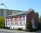
List of streets and squares in Berlin-Marzahn
The list of streets and squares in Berlin-Marzahn describes the street system in the Berlin district of Marzahn with the corresponding historical references. At the same time, this compilation is one of the lists of all Berlin streets and squares .
overview
The current district is divided into three basic areas, these are the old Angerdorf Marzahn from the first half of the 13th century, three colonist settlements from the 19th and beginning of the 20th century and the new building areas that were created from the 1970s mainly on former agricultural land and sewage fields . A small part of these areas was created on land that did not belong to the city of Berlin at the time and was subsequently incorporated.
The district is cut through by Landsberger Allee in a west-east direction, the southern border is the Ostbahn , on whose route the S-Bahn to Strausberg and regional trains run, the eastern border is the Wuhle . To the west are the districts of Alt-Hohenschönhausen , Lichtenberg and Friedrichsfelde . With the redesign of the former districts in 2001, some areas of the former villages of Biesdorf and Kaulsdorf fell to the Marzahn district and vice versa. The northern border is also the border of the urban area of Berlin.
The names of the new streets were largely based on places in the GDR , some magistrals were named after GDR politicians such as Otto Buchwitz , Bruno Leuschner , Karl Maron or Heinrich Rau . The latter street names were replaced by new ones from the 1990s onwards by resolution of the Berlin Senate . After the reunification , further new building areas were built east and south of the first built.
The oldest streets that have survived by name are the Landsberger Allee (formerly Chaussee to Alt-Landsberg ) in a west-east direction and the Marzahner Chaussee ( Chaussee to Friedrichsfelde or Friedrichsfelder Chaussee ), which already existed in the 19th century .
The longest street is the Märkische Allee with around 7.5 kilometers, which crosses the entire district from north to southwest.
The following " lifeworld oriented spaces " (LOR) are distinguished ex officio :
- Marzahn North (with Marzahn-West and Havemannstraße)
- Marzahn-Mitte (with industrial area Bitterfelder Straße, Wuhletalstraße, Marzahn-Ost, Ringkolonnaden, Marzahner Promenade)
- Marzahn-Süd (with Marzahner Chaussee, Springpfuhl, Alt-Marzahn and Landsberger Tor).
The Landsberger Tor residential area , named after a former Berlin customs gate, is a planned quarter “on the drawing board” between Landsberger Allee, Wuhle, Eisenacher Strasse and Blumberger Damm. The building types newly developed for this by several architectural offices have already received several awards.
Marzahn has 111,021 inhabitants (as of December 30, 2019) and includes the postcode areas 12679, 12681, 12685, 12687 and 12689.
Overview of streets and squares
The following table gives an overview of the streets and squares in the district as well as some related information.
- Name / location : current name of the street or square. Via the link Location , the street or the square can be displayed on various map services. The geoposition indicates the approximate center of the street length.
- Traffic routes not listed in the official street directory are marked with * .
- Former or no longer valid street names are in italics . A separate list may be available for important former streets or historical street names.
-
Length / dimensions in meters:
The length information contained in the overview are rounded overview values that were determined in Google Earth using the local scale. They are used for comparison purposes and, if official values are known, are exchanged and marked separately.
For squares, the dimensions are given in the form a × b for rectangular systems and for (approximately) triangular systems as a × b × c with a as the longest side.
If the street continues into neighboring districts, the addition ' in the district ' indicates how long the street section within the district of this article is. - Name origin : origin or reference of the name.
- Notes : further information on adjacent monuments or institutions, the history of the street and historical names.
- Image : Photo of the street or an adjacent object.
| Name / location | Length / dimensions (in meters) |
Origin of name | Date of designation | Remarks | image |
|---|---|---|---|---|---|
|
Liver liver way
( Location ) |
240 | Adersleber Kalvill , winter apple variety, grown in the Adersleben monastery | around 1923 | At first it was called An der Steinhalde (around 1920), in 1930 it was only called Steinhalde (up to then still undeveloped) and another section of street 14 ; from 1932 also Adersleber Weg. Between 1951 and 1973 street 14 can be found again on city maps . With the start of residential development in Marzahn, it is now officially known as Adersleber Weg. It runs from the Allee der Kosmonauten to Heliosstraße and bends to the south. |

|
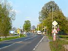
| Ahrensfelder Chaussee
( Location ) |
1650 | Ahrensfelde , municipality in Brandenburg bordering Marzahn to the north | around 1800 | At first it was called the road to Ahrensfelde and connected the Falkenberg area with Ahrensfelde. House number 162 is the historic station facility of the Ahrensfelde station, including the residential and auxiliary buildings, and is on the Berlin list of monuments. |
|
| Ahrensfelder Platz
( Location ) |
100 × 80 × 60 (triangular) |
after the Ahrensfelder Chaussee | Dec 5, 2005 | The station forecourt created during the construction of the S-Bahn line remained nameless for a long time. It is located between the Ahrensfelde train station and Ahrensfelder Chaussee. |

|
|
Alfred-Döblin-Strasse
( Location ) |
560 | Alfred Döblin (1878–1957), writer | July 16, 1980 | It connects the Märkische Allee with the Ludwig-Renn-Straße in a west-east direction. |

|
|
Avenue of the Cosmonauts
( Location ) |
4500 + tributaries (in the district) |
Cosmonaut, Russian term for space travelers | 22 Sep 1978 | The road was completely rebuilt in the 1970s, but integrated parts of earlier roads in its route. It was initially called Springpfuhlstraße in 1975 . It runs from the west (continuation of Herzbergstraße in the OT Lichtenberg) with two bends to Landsberger Allee in the north and continues as Raoul-Wallenberg-Straße . The house numbers 16-25 belong to the district Lichtenberg , the areas 88-144 (the southern extensions) to the district Biesdorf , the larger remainder (up to number 203) to Marzahn. |

|
|
Old Friedrichsfelde
( Location ) |
140 + 40
(in the district) |
Core of the former village of Friedrichsfelde |
1927 * |
In earlier centuries it was called the Chaussee to Frankfurt and in the following it bore numerous other names. (*): House numbers 62–64, which belong to Marzahn, were only laid out at the end of the 1980s as a separate stretch of road going northwards from Alt-Friedrichsfelde; The assigned year of the name assignment is not entirely applicable here. At this address you can find the technical branch of Telekom , a large warehouse of DHL and a large commercial customer. The Alt-Friedrichsfelde street forms the suburbs of Biesdorf , Friedrichsfelde and Marzahn. |

|
|
Alt-Marzahn
( Location ) |
1000
(130 + 510 + 365) |
Alt-Marzahn, core of the medieval village of Marzahn | May 11, 1938 | At first the area was called Dorfaue . In the 1980s, the former continuous village street became a service street, the elongated lens-like course of which marks the medieval village center. Alt-Marzahn also has a branch between Hinter der Mühle and the south-western colonist settlement. The entire ensemble, including the village church and the green areas, has been a listed building since 1977. The artisan and hairdressing museum and the Marzahn village museum are located in house number 22. |

|
| Old Rhinstrasse
( Location ) |
330 | Rhin , tributary of the Havel | Dec 1, 1994 | At first it was called Straße 13 (northern area of Mesenicher Straße up to Berliner Chaussee ), later it had no name and went south from Leninallee as a dead end . After the construction of the Pyramid high-rise complex and the construction of the access roads, this section of the road was given the addition "Old" to make it easier to differentiate. Today it connects Landsberger Allee with the Pyramidenring . |

|
| Althansweg
( Location ) |
330 | Graf Althanns Reneklode , Reneklode variety | 1923 | At first the path was called Kaiser Wilhelm-Straße (until 1922), the short southern section between Vierlanden- and Elisabethstraße was called Warener Straße between 1926 and 1978 , which was then removed and incorporated into Althansweg. In this colonist settlement, several traffic routes have been named after animals or plants. In the northern part, multi-storey prefabricated buildings are loosely grouped. |

|
| Altlandsberger Platz
( Location ) |
180 × 40 | Altlandsberg , city in Brandenburg | Nov 29, 1997 | At the beginning there was a nursery on the site, on the area of which a garden center was built after 1990. A new residential quarter was only built here around 1995. Altlandsberger Platz in the center of this quarter is bordered by Zinndorfer Straße, Hasenholzer Allee and Pritzhagener Weg. It divides the Bollersdorfer Weg into a north and a south area. |

|
| At the Cleantech Business Park
( Location ) |
CleanTech Business Park , commercial and industrial area in the district | 2015 | The road runs in the area of 90 hectares large Clean Tech Business Park , outgoing from the Wolfener road. The groundbreaking ceremony for the park took place in 2012 , and it was officially dedicated in September 2014 . Tillage work began in July 2015, and a road network only gradually came into being in the following years. The first companies settled here in 2016. |

|
|
| Am Schmeding
( Location ) |
1000 | presumably historic corridor designation of forging derived | June 27, 1925 | Before 1923 it was called Straße 1 , from September 1925 it was officially called that way. The street lies in a colonial settlement, the roads of which are often named after animals or plants; but here after the craft. |

|
| Amanlisweg
( Location ) |
520 | Amanlis , variety of pear | 1925 | From 1920 it was initially called Gartenstrasse , but not officially. Nevertheless, this name is still entered on the Berlin city map from 1943. The north-south traffic route connects Pekrunstraße with Allee der Kosmonauten. It also has two loops, each 140 meters in length, which open up the multi-storey residential buildings. In this colonist settlement, several traffic routes have been named after animals or plants. |

|
| Amselhainer Weg
( Location ) |
150 | Amselhain, living space in Werneuchen in Brandenburg | Nov 29, 1997 | On the first maps as the route was listed as Amselhain colony , 1957 as Amselhain residential area . The path is in the housing estate around Altlandsberger Platz and connects it northwards with Spitzmühler Straße. |

|
| At the Kohlbeke
( Location ) |
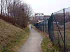
250 | Kohlbeke , from a former sewage farm - settling tanks equipped wetland | around 2010 | The footpath runs to the west in front of a railway embankment, starting from Wuhletalstraße and creates a walking connection to Hellersdorfer Weg. |
|
| Auersbergstrasse
( Location ) |
200 | Auersberg , mountain in the Ore Mountains | December 20, 1978 | The road runs between Pekrun and Blenheimstrasse. |

|
|
Bärensteinstrasse
( Location ) |
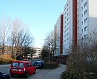
1190 | Bärenstein , municipality in Saxony | December 20, 1978 | The street is angled and ramified between Allee der Kosmonauten and Blumberger Damm . |
|
|
Barnimplatz
( Location ) |
100 × 70 | Barnim , plateau northeast of Berlin | Oct 28, 1996 | After a competition announced by the Marzahn District Office in 1993 to create a new town square , it was laid out between 1995 and 1996 and inaugurated. After initial criticism from the citizens of Marzahn, it is now an accepted element in the neighborhood with markets and cultural events . |

|
| Basdorfer Strasse
( Location ) |
550 | Basdorf , district of Wandlitz in Brandenburg | July 16, 1980 | The street runs in a loop east of Märkische Allee opposite the park cemetery and opens up the residential area. Several traffic routes in the area have been named after former villages or communities in Barnimer Land. |

|
| Beilsteiner Strasse
( Location ) |
1740 | Beilstein , municipality and wine village in Rhineland-Palatinate | March 8, 1935 | At first it was called Street 102 . After the extensive development of Marzahn, the street was lengthened a bit, and commercial facilities were built on the west side and at the north end. To the east, a small settlement area (named after wine towns) borders on Beilsteiner Strasse.
On an area between this street and Marzahner Chaussee, the remains of the lean cattle yard , which was laid out between 1900 and 1907 and are on the list of monuments: stock exchange, loading facilities, walls. Today the street runs from Marzahner Chaussee over the Allee der Kosmonauten to Radebeuler Straße. |

|
| Belziger Ring
( Location ) |
810 | Bad Belzig , district town in Brandenburg | Aug 3, 1983 | The multi-twisted residential street goes off to the west of Kemberger Strasse. It has a northern connection to Havemannstraße and a walking connection to Borkheider Straße. |

|
| Bernburger Strasse
( Location ) |
230 | Bernburg , district town in Saxony-Anhalt | March 12, 1985 | The north-south route connects the Schwarzwurzel- and Dessauer Straße. |

|
| Bitterfelder Strasse
( Location ) |
1100 | Bitterfeld , part of Bitterfeld-Wolfen in Saxony-Anhalt | Apr 2, 1987 | The traffic route initially branches off to the east from Märkische Allee and then runs in a semicircle over a bridge over the avenue and the S-Bahn line westwards. It ends at Gehrenseestrasse and continues to the northwest as Pablo-Picasso-Strasse. The companies located in Bitterfelder Strasse are often grouped under the term “ Gewerbegebiet Südliche Bitterfelder Strasse ” (which was established in the late 1990s with funding from the EU). Under number 13 the gfp Gesellschaft für Pflegeberufe GmbH operates a technical college for care for the elderly. The Falkenberg sewage treatment plant is located on this street. |

|
| Blenheimstrasse
( Location ) |
260 | Golden Renette from Blenheim , apple variety | 1925 | At first it was called Street 19 ; on December 20, 1978 an extension to the Allee der Kosmonauten was completed. In this colonist settlement, several traffic routes have been named after animals or plants.
A fire station from 1985 has been preserved on plots 65–67 . |

|
|
Blumberger Dam
( Location ) |
2350
(in the district) |
Blumberg , district of Ahrensfelde in Brandenburg | Jan. 31, 1992 | The southern part of the street was inaugurated as Globsower Straße in 1937 and only extended as far as Cecilienstraße. The northern part was built as Otto-Buchwitz-Straße when the new large housing estates in Marzahn were built. The old, southern part was also given this name in 1987. The entire street was renamed Blumberger Damm in 1992. A northern section was separated from the course of the road in 1995 and was given its own name Kemberger Straße. On the west side there are three tributaries of the same name: between Wuhletalstraße and Mehrower Allee, between Pöhlbergstraße and Bärensteinstraße and between Kienbergstraße and Geißenweide. There are also branches on the east side: between Glambecker Ring and Landsberger Allee and between Spitzmühler and Eisenacher Straße. |
 
|
| Blumenbachweg
( Location ) |
400 | Johann Friedrich Blumenbach (1752–1840), zoologist and anthropologist | before 1925 | From around 1920, when the small housing estate was built around Marzahner Chaussee, the route was initially led as street 4 . |

|
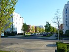
| Bollersdorfer Weg
( Location ) |
220 | Bollersdorf , part of the municipality of Oberbarnim in Brandenburg | Nov 29, 1997 | The new street in the residential area around Altlandsberger Platz goes in a straight line northwards from Eisenacher Straße. |
|
| Borkheider Strasse
( Location ) |
710 | Borkheide , municipality in Brandenburg | Aug 3, 1983 | It is the southern continuation of Schorfheidestrasse and opens up the residential area in a side arm in a curved course. The north-south section runs east parallel to a tram line. |

|
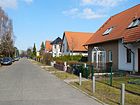
| Boskoopweg
( Location ) |
260 | More beautiful from Boskoop , apple variety | 1927 | At first the path was called Straße 9 ; in the Berlin address book of 1927 it was first listed as Boskoopweg. In this colonist settlement, several traffic routes have been named after animals or plants. |
|
| Boxberger Strasse
( Location ) |
1070 | Boxberg , municipality in Saxony | Nov 8, 1999 | It connects Bitterfelder Straße in a straight line southwards with Wiesenburger Weg. In the middle area it crosses the Hohenschönhauser-Marzahner-Grenzgraben by means of a road bridge. |

|
| Brodowiner Ring
( Location ) |
600 | Brodowin , part of Chorin in Brandenburg | Aug 11, 1982 | The new street in the large housing estate Marzahn I runs in a semicircle with multiple kinks north of Landsberger Allee and Ringenwalder Straße. |

|
| Bruno-Baum-Strasse
( Location ) |
1120 | Bruno Baum (1910–1971), resistance fighter | Oct 17, 1979 | Bruno-Baum-Straße was initially the north-eastern section of Marzahner Chaussee . With the erection of the prefabricated residential buildings in Marzahn, the Chaussee was shortened to its route east of the new S-Bahn line and connected to Radebeuler / Beilsteiner Strasse. Since then, the northern section has been running between Landsberger Allee and Poelchaustraße and was given the name discussed here. |

|
|
Cäcilie-Fröhlich-Strasse
( Location ) |
Cäcilie Fröhlich (1900–1992), mathematician | 2015 | The road to the area of 90 hectares large Clean Tech Business Park run to the plant in 2012, the groundbreaking ceremony took place and officially in September 2014 dedicated been. In July 2015, tillage had just started and a road network was not yet in sight. | Photo not possible in 2015. | |
| Clara-Immerwahr-Strasse
( Location ) |
Clara Immerwahr (1870–1915), chemist | 2015 | The road to the area of 90 hectares large Clean Tech Business Park run to the plant in 2012, the groundbreaking ceremony took place and officially in September 2014 dedicated been. In July 2015, tillage had just started and a road network was not yet in sight. | Photo not possible in 2015. | |
| Coswiger Street
( Location ) |
430 | Coswig , city in Saxony | Oct 1, 1993 | Coswiger Straße was created as a connection between Beilsteiner Straße and Marzahner Chaussee. It has south-facing arms and is located in an industrial park. |

|
|
Dahmeweg
( Location ) |
700 | Wilhelm Dahme (1861–1910), gardening owner in Marzahn | before 1925 | First it was written Dahmesweg . The north-south road runs parallel to the railway embankment to the west and at its southern end has a foot connection to Poelchaustraße and the S-Bahn station of the same name. The Marzahn fire station of the Berlin fire brigade is at the intersection with Märkische Allee, and the Dahmeweg ends there. A fire protection monument made of stainless steel ( shooters what the people's hands create ) by the sculptor Matthias Büttner from 1985 marks this corner. |
 |
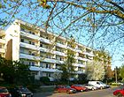
| Dessauer Strasse
( Location ) |
560 | Dessau , district of Dessau-Roßlau in Saxony-Anhalt | March 12, 1985 | The street connects the Ahrensfelder Chaussee (continuation from Hausvaterweg) with the Köthener Straße and is slightly angled. |
|
|
Döllner Strasse
( Location ) |
240 | Groß Dölln , part of Templin in Brandenburg | Dec 6, 1999 | Döllner Straße is included in the regional database, but without land and therefore does not appear in the official street directory of the statistics office. Döllner Strasse connects Hohenwalder Strasse with An der Wuhle / Wuhletalweg ; Barnim Dörferweg begins on Döllner Strasse from the east end . According to the map of the district surveying offices, the road is in the district. Directly on site there is no sign pointing to a street outside Berlin to Ahrensfelde. It is a dead end for motor vehicles. The northern road area borders an Ahrensfeld villa colony (mountain / field road) in the south borders the oak park . The 'Johann-Julius-Hecker-Schule' with spacious outdoor sports facilities is located on an area with Hohenwalder Straße. On Google Maps, Döllner Straße is incorrectly referred to as "Döliner Straße". |

|
| Bullfinch Path
( Location ) |
360 | Bullfinch , songbird | June 27, 1925 | At first it was called Street 29 ; it connected the northern area of what was then Marzahner Chaussee (today: Bruno-Baum-Straße) with the flight of swallows. She has a small western arm. In this colonist settlement, several traffic routes have been named after animals or plants. |

|
|
Eichhorster Strasse
( Location ) |
1000 | Eichhorst , part of the community Schorfheide in Brandenburg | Aug 3, 1983 | The street forms a polygon north of Havemannstraße. Inside the bounded area there are sections of Rosenbecker and Havemannstraße. |

|
| Eisenacher Strasse
( Location ) |
830
(in the district) |
Eisenach , city in Thuringia | March 5th 1985 | The street runs from Blumberger Damm eastwards over the Wuhlebrücke, where it continues with the same name in Hellersdorf and ends at Gothaer Straße. The two parts were first called Marzahner Straße (around 1900–1985) and Hellersdorfer Weg (around 1951–1985). In the Marzahn section there is an entrance to the Gardens of the World . |

|
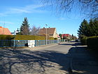
| Eltzbachweg
( Location ) |
550 | Elzbach , tributary of the Moselle | March 8, 1935 | First the way was called Straße 104 . As Eltzbachweg it was initially listed in Friedrichsfelde. |
|
| Eugen-Roth-Weg
( Location ) |
90
(in the district) |
Eugen Roth (1895–1976), poet | Aug 4, 1997 | The short stretch in Marzahn (house numbers 18-24) is designed as a cul-de-sac and runs between Marchwitzastraße and the walkable continuation to Lappiner Straße, which is already in the district of Biesdorf. Several traffic routes in the area have been named after artists or writers. |

|
|
Farmergasse
( Location ) |
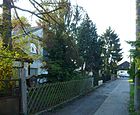
60 | Farmer, English for farmer | Nov 9, 1936 | At first the traffic route was called Straße 5 , in the 1920s it was called Farmer Gasse . It leads northwards from Schwarzwurzelstraße as a cul-de-sac . |
|
| Fastolfsteg
( Location ) |
130 | Red Fastolf, raspberry variety | before 1925 | The short street connects the Hornetweg with the Amanlisweg. In this colonist settlement, several traffic routes have been named after animals or plants. |

|
| Fichtelbergstrasse
( Location ) |
540 | Fichtelberg , highest mountain in the Ore Mountains | December 20, 1978 | It goes from the avenue of the cosmonauts northwest and then swings north to the Pekrunstrasse. In the southwest area of this slightly arched street there is an extensive park with bronze sculptures: seated , mother with child and children playing the flute . They were made by the sculptor Lore Plietzsch in 1982. They were installed in the park in 1992. A system of paths for walking, benches and a rafting area complete the relaxation options. |

|
| Flämingstrasse
( Location ) |
880 | Fläming , mountain range in Brandenburg and Saxony-Anhalt | Aug 3, 1983 | The street is bent in the residential area between Havemannstrasse and Neuer Wuhle. |

|
| Frank-Schweitzer-Strasse
( Location ) |
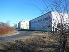
670 | Frank Schweitzer (1963–1993), entrepreneur, son of the founder of Alba AG | Jan. 31, 2000 | The connecting road between the eastern approach to the bridge and the Dahmeweg below, which leads to the municipal cemetery on Wiesenburger Weg , was laid out as a bend when the Marzahner bridges were built around 1985. However, this route remained nameless. In 1992, the disposal company Alba Services established itself here on the site of the former VEB printing plate factory . At the request of the company, the street was given its current name. |
|
| Frank-Zappa-Strasse
( Location ) |
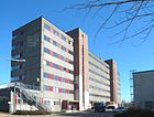
400 | Frank Zappa (1940–1993), American composer and musician | July 28, 2007 | At first it was called Straße 13 and led from Landsberger Allee to the railway tracks. It goes east from the pyramid ring and is a dead end road in terms of traffic . Here is a DDR plate , which after the turn of various art groups into a meeting was and after its former use ORWOhaus is called. |
|
| Franz-Stenzer-Strasse
( Location ) |
1040 | Franz Stenzer (1900–1933), resistance fighter | July 16, 1980 | It connects Märkische Allee in a gently curved course with Raoul-Wallenberg-Strasse. |

|
|
Gehrenseestrasse
( Location ) |
250
(in the district) |
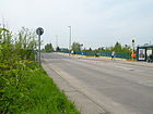
Gehrensee , body of water in the Berlin district of Falkenberg | Nov 1, 1980 | Parts of the street were initially called Falkenberger Weg (before 1906 until after 1954) and Falkenberger Straße (1906–1980). The road connects the Malchower Weg / Wartenberger Strasse intersection in the Alt-Hohenschönhausen district with Hohenschönhauser Strasse at the Bitterfelder Strasse intersection, which belongs to Neu-Hohenschönhausen . The house numbers 42 and 43, which mark half of the bridge over the Berlin outer ring and an eastern section of the road to Pablo-Picasso-Strasse, are still in Marzahn. |
|
| Goat willow
( Location ) |
960 | Geiß, old name for a domestic goat and pasture | June 27, 1925 | At first the traffic route was called Straße 15 , and a traffic route called Robert-Müller-Straße took the same route . The street consists of several branches - a north-south street line connects Kienbergstraße and Cecilienstraße in the district of Biesdorf, it continues northwards - although since the 1970s anonymous and unpaved as a footpath - to Alt-Marzahn. A forked east arm, on the other hand, runs from Heliosstrasse to Blumberger Damm in a west-east direction. Ultimately, this gives the impression of pasture at the collision even today. |

|
| Georg-Knorr-Platz
( Location ) |
60 (diameter) |
after the adjacent street of the same name | June 29, 2007 | At first the round green area was an unnamed roundabout. The name was given at the request of the Knorr-Bremse company , which has its Berlin branch here in a historic factory building. |

|
| Georg-Knorr-Strasse
( Location ) |
660 | Georg Knorr (1859–1911), entrepreneur | Apr 30, 1999 | The first name was Berliner Chaussee . After the straightening of the street and the construction of the Marzahner bridges , the remaining part was the southern section of Boxberger Straße. The listed factory complex (house number 4) was built in 1940–1942 for the world-famous Hasse & Wrede machine tool factory. After the head office of Knorr-Bremse in Neue Bahnhofstrasse in Berlin-Friedrichshain was cleared around 1991, the Berlin branch of the railway supplier moved here. The entire company premises stretch along Georg-Knorr-Strasse. In the company’s canteen, the 'Theater 89' now and again gives performances. |

|
| Straight ring
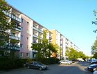
( Location ) |
1000 | Gera , city in Thuringia | March 12, 1985 | The road runs in a spiral north-east from Köthener Strasse. |
|
| Gertrud-Kornfeld-Strasse
( Location ) |
Gertrud Kornfeld (1891–1955), chemist | 2015 | The road to the area of 90 hectares large Clean Tech Business Park run to the plant in 2012, the groundbreaking ceremony took place and officially in September 2014 dedicated been. In July 2015, tillage had just started and a road network was not yet in sight. | Photo not possible in 2015. | |
| Glambeck ring
( Location ) |
970 | Glambeck, living space in Friedrichswalde in Brandenburg | Aug 11, 1982 | It runs in a semicircle east of Blumberger Damm as a continuation of Mehrower Allee, bends twice in order to arrive back at Blumberger Damm. The Ringstrasse continues to the west, but the branch being created here is (also) called Blumberger Damm. In its course, the street, together with the Parsteiner Ring, the Hohensaatener Straße and the Ringenwalder Straße, forms a larger green area. In 2010, with the help of EU funding, this was transformed into an as yet nameless city square , which is dedicated to the topic of preserving biodiversity . Ceramic plates with motifs from flora and fauna are embedded around a roundabout made of three large boulders. |
 |
| Golliner Strasse
( Location ) |
860 | Gollin , part of Templin in Brandenburg | Aug 3, 1983 | The polygon-like street layout north of Havemannstraße surrounds Kölpiner Straße. |

|
| Gottfried-Funeck-Weg
( Location ) |
550 | Gottfried Funeck (1933–2011), City Garden Director of East Berlin 1975–1990 | Jan. 11, 2017 | The foot and bike path connects Blumberger Damm with Siegmarstrasse. It continues as a “green thoroughfare” to Hellersdorfer Strasse in the Hellersdorf district. | |
| Gravensteiner Steg
( Location ) |
160 | Gravensteiner , apple variety | 1923 | On December 20, 1978, the eastern part of the street was renamed Adersleber Weg. In this colonist settlement, several traffic routes have been named after animals or plants. |

|
| Greizer Strasse
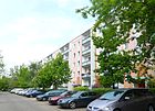
( Location ) |
200 | Greiz , district town in Thuringia | March 12, 1985 | Greizer Straße connects Köthener Straße with Geraer Ring in a west-east direction. |
|
| Grohsteig
( Location ) |
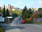
280 | Johann Georg Groh (18th century), colonist from the Electoral Palatinate | June 9, 1933 | At first it was called Street 5 . In the Berlin address book with suburbs, Grohstraße in Marzahn was listed as early as 1923 , the name Grohsteig was officially documented only in 1933. The trail branches off in the middle of Oppermannstrasse to the north and extends to Stangeweg. |
|
| Grumsiner Strasse
( Location ) |
330 | Grumsin, living space in Angermünde in Brandenburg | Aug 11, 1982 | The road runs in a T-shape from Blumberger Damm eastwards to the two arched sections of Glambecker Ring. |

|
| Gülser way
( Location ) |
260 | Güls , district of Koblenz and wine town in Rhineland-Palatinate | March 8, 1935 | At first the path was called Straße 106 . It connects the Ruwersteig with the Kröver Straße in a north-south direction in the industrial area around the Beilsteiner Straße. |

|
|
Rose hip hedge
( Location ) |
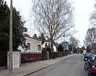
140 | Rose hip , fruit of the rose | June 27, 1925 | At first the traffic route was called Straße 27 . The east-west road connects Bruno-Baum-Straße with Am Schmeding. In this colonist settlement, several traffic routes have been named after animals or plants. |
|
|
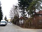
Linnet Walk
( Location ) |
490 | Linnet , songbird | June 27, 1925 | At first it was called Steig Straße 28 . The east-west road connects Bruno-Baum-Straße with Amanlisweg. In this colonist settlement, several traffic routes have been named after animals or plants. |
|
| Harbertssteg
( Location ) |
250 | Harberts Renette , apple variety | around 1925 | The name Harbertssteg is listed in the Berlin address book from 1925 "in the arbor area". It runs in a north-west-south-east direction between Am Schmeding and Hornetweg. In this colonist settlement, several traffic routes have been named after animals or plants. |

|
| Hasenholzer Allee
( Location ) |
410 | Hasenholz, part of the municipality of Buckow in Brandenburg | Nov 29, 1997 | This street is in the residential area around Altlandsberger Platz, it runs as a north-south street between Spitzmühler and Eisenacher Straße with three loops to the Trappenfelder path on the Wuhleniederung. Noteworthy is a humming stone with a suitable explanation in the large inner courtyard . |
 |
| Hatzenporter way
( Location ) |
680 | Hatzenport , municipality and wine village in Rhineland-Palatinate | March 11, 1937 | At first the path was called Straße 115 . It is located in the area of the colonists from the Moselle region and forms a north-south connection between Ruwersteig and Reiler Straße. |

|
| Havemannstrasse
( Location ) |
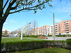
1220 | Robert Havemann (1910–1982), chemist, resistance fighter, later GDR dissident | Jan. 31, 1992 | At first it was called Erich-Glückauf-Straße (1983-1992) after the German politician Erich Glückauf . It runs from Ahrensfelder Platz to Kemberger Straße in the east, from there it continues as the Wuhlewanderweg. In the middle area (see picture) is the metal art installation “Hobby Horse dreams with the rainbow”, which was made by Rüdiger Roehl and Jan Skuin and unveiled on June 1, 2006. |
|
|
Helene-Weigel-Platz
( Location ) |
400 × 260 (out of focus) |
Helene Weigel (1900–1971), actress, wife of Bertolt Brecht | March 1, 1978 | The square is located at the northeast corner of the intersection of Allee der Kosmonauten / Märkische Allee and was planned and laid out early on as an urban center with its own town hall (number 8) in connection with the construction of the Marzahn I residential quarters . The council building was completed in 1988 and is now a listed building. After the reorganization of the Berlin districts, the former town hall has become a town hall after extensive renovation. Other buildings and monuments include a swimming pool and the fountain of the generations . The Springpfuhlpark is immediately adjacent to the north . |
 |
| Heliosstrasse
( Location ) |
260 | Helios , apple variety | December 20, 1978 | It is the former eastern part of Vierlandenstrasse and connects the Allee der Kosmonauten with an arm of the Geißenweide.
Several traffic routes in the area have been named after animals or plants. |

|
| Hellersdorfer Weg
( Location ) |
1020 | Direction to Hellersdorf | around 1957 | From around 1921 the route was called Hellersdorfer Strasse and ran through the Berlin suburbs or estates of Hellersdorf, Mahlsdorf and Kaulsdorf. In today's tour, this traffic route connects Dorfstrasse / Hellersdorfer Strasse in the Falkenberg district with Wolfener Strasse. A small south-eastern section continues as a dead end street, at the end of which a customs post is set up. Before the construction of the large housing estates Marzahn and Hellersdorf, this street continued to over the Wuhle . The continuity was later interrupted, the easternmost section came to Eisenacher Straße. |

|
| Hennickendorfer Weg
( Location ) |
340 | Hennickendorf , part of Rüdersdorf in Brandenburg | Nov 29, 1997 | It connects the Blumberger Damm with the Prötzeler Ring in a two-kinked route. |

|
|
Behind the mill
( Location ) |
160 | Street at the Marzahn post mill, which was rebuilt in 1993/94 | Feb. 1, 1994 | Behind the mill, Landsberger Allee connects with Alt-Marzahn . |

|
| Hirschfelder Weg
( Location ) |
250 | Hirschfelde , district of Werneuchen in Brandenburg | Nov 29, 1997 | The street is in the residential area around Altlandsberger Platz. The course corresponds to an upside down "T", which connects to the Blumberger Damm in the west, to the Prötzeler Ring in the east and continues as an arm of the Prötzeler Ring in the north. The wave park follows in the south . |

|
| Hohensaatener Strasse
( Location ) |
540 | Hohensaaten , part of Bad Freienwalde in Brandenburg | Aug 11, 1982 | The street branches off eastwards from Blumberger Damm in two directions, then bends northwards and flows into Glambecker Ring. At the bend there is a walking connection with the Brodowiner Ring and a north arm of Landsberger Allee. Along its course, the street, together with the Parsteiner Ring, the Glambecker Ring and the Ringenwalder Straße, forms a larger green area. In 2010, with the help of EU funding, this was transformed into an as yet nameless city square , which is dedicated to the topic of preserving biodiversity . Ceramic plates with motifs from flora and fauna are embedded around a roundabout made of three large boulders. Hohensaatener Strasse is a section of route 07 (Hönower Weg) of the 20 green main routes , which connects green and park areas between Volkspark Friedrichshain and the outskirts of Hönow.
The Evangelical Free Church Community Church 43 with the sponsoring association Junge Kirche Marzahn eV is located in this street (house number 18). She is a member of the Mülheim Association . The Bolle youth center (house number 20 / 20a) is also worth mentioning . It was opened in 2010 by the association Straßenkinder eV and is aimed at children and young people between 5 and 18 years of age. According to the will of the founders, many opportunities for meaningful leisure activities (sports, music, homework rooms) were created here, and there is even a cafeteria. Financing is done exclusively through donations from association members, supporters or sponsors. For 2015, Vattenfall provided the amount of 5,000 euros required for maintenance. |
 |
|
Hohenschönhauser Strasse
( Location ) |
1700 (in the district) |
Direction to Hohenschönhausen | around 1900 | At first the traffic route was called Hohenschönhausen (ne) r Weg . This is a remnant of the road connecting Falkenberg and Alt-Hohenschönhausen, which existed in the 19th century . Only the eastern side of the street (house number range 8–60) belongs to Marzahn. |

|
| Hohenwalder Strasse
( Location ) |
530 | Hohenwalde , part of Milmersdorf in Brandenburg | Aug 3, 1983 | Running between Schorfheidestrasse / Klandorfer Strasse and Golliner Strasse, it forms part of the Berlin city limits. On the sports hall of a school building is the gable painting 'Energy and Life'. At its northern end is the "Marzahn Adventure Playground". |

|
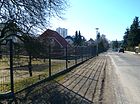
| Hornetweg
( Location ) |
400 | Golden Hornet, apple variety | 1923 | It runs in a northeast-southwest direction between Pekrunstraße and Hänflingsteig. In this colonist settlement, several traffic routes have been named after animals or plants. |
|
| Hornoer ring
( Location ) |
600 | Horno , former district of Jänschwalde in Brandenburg | Nov 15, 1999 | The traffic route was laid out in a U-shape west of Boxberger Strasse. Some companies with large space requirements have already settled here, such as a recycling center and a driving school with its own practice area. |

|
|
Jan-Petersen-Strasse
( Location ) |
400 | Jan Petersen (1906–1969), writer | Oct 14, 1981 | The street opens up the residential area between Lea-Grundig- and Raoul-Wallenberg-Straße with branches and loops and borders on the Marzahn Bürgerpark . Several traffic routes in the area have been named after artists or writers.
It is worth mentioning the elementary school located here at Bürgerpark (Jan-Petersen-Straße 18b), for which a school extension made of prefabricated steel-concrete elements and windows was inaugurated in Berlin in the 21st century (March 4, 2016). The three-storey building has 24 class and group rooms, is equipped with modern sanitary facilities, but special classrooms for natural sciences have not been built in. The building complex is called the Modular School Supplementary Building (MEB) and is one of the first such new buildings in Berlin. The simple and quick setup (only one year from planning instead of up to eight years for the usual school buildings) makes a significant contribution to coping with the increasing number of students in Berlin. |

|
| Jonathanweg
( Location ) |
200 | Jonathan , apple variety | March 15, 1999 | The double access road starts at the north bend of the Allee der Kosmonauten and continues east on Elisabethstrasse. In this colonist settlement, several traffic routes have been named after animals or plants. |

|
|
Kaiserkronenweg
( Location ) |
260 | Imperial crown , garden flower | Feb 8, 2002 | It connects Am Schmeding with the Hornetweg. This path already existed before the name was given, as old city maps show, but it had no name. On plans from the first half of the 1920s, a place C is drawn in the area of today's Kaiserkronenweg. In this colonist settlement, several traffic routes have been named after animals or plants. From 1931 the space ceased to exist and the area became building land. Structurally expanded after the turn of the millennium. |

|
| Karl-Holtz-Platz
( Location ) |
190 × 290 m | Karl Holtz (1899–1978), caricaturist | 2003 | The square was built on an area where two schools and a prefabricated building were demolished due to long vacancies. The district office had commissioned two reports to clarify the land use. With funds from the Urban Redevelopment East project - around 40,000 euros in total - a city garden was created by 2004 . A fountain was placed in the middle . |

|
| Karl-Holtz-Strasse
( Location ) |
460 | Karl Holtz (1899–1978), caricaturist | Oct 14, 1981 | The street runs in a north-south direction between the middle section of Lea-Grundig-Strasse and Rudolf-Leonhard-Strasse. It continues to the south as a footpath to Jan-Petersen-Straße. Several traffic routes in the area have been named after artists. |

|
| Kemberger Strasse
( Location ) |
680 | Kemberg , city in Saxony-Anhalt | May 15, 1995 | At first it was the northernmost part of the Blumberger Damm . Kemberger Straße connects Havemannstraße with the arch Wuhletalstraße / Blumberger Damm and leads over the Neue Wuhle . |

|
| Lapwing bottom
( Location ) |
180 | Lapwing , bird | June 27, 1925 | At first the traffic route was called Straße 22 , running between Landsberger Allee and Sterckmannweg. Several traffic routes in the area have been named after animals or plants. |

|
| Kienbergstrasse
( Location ) |
820 | Kienberg , Berg in the Marzahn district | December 20, 1978 | It curves and branches through the residential area between Allee der Kosmonauten and Blumberger Damm, west of the eponymous elevation. |

|
| Klandorfer Strasse
( Location ) |
520 | Klandorf , part of the community Schorfheide in Brandenburg | Aug 3, 1983 | It runs between Märkische Allee and Schorfheidestrasse and marks part of the northern Berlin border. At its eastern end is the turning loop of the tram, next to it is a large, yet nameless, square. |

|
| Klettwitzer Strasse
( Location ) |
280 | Klettwitz , part of Schipkau in Brandenburg | Nov 15, 1999 | Klettwitzer Straße opens up the industrial area south of Bitterfelder Straße. |

|
|
Klüsserather Weg
( Location ) |
860 | Klüsserath , municipality and wine village in Rhineland-Palatinate | March 11, 1937 | At first it was called Street 123 . It leads in a north-south direction between Ruwersteig and Reiler road, its eastern side lies partially on the railway embankment at two places limits allotments on this path. The northern section is a dead end . Several traffic routes in the area have been named after wine towns in Rhineland-Palatinate. |

|
|
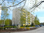
Kölpiner Strasse
( Location ) |
280 | Groß Kölpin , district of Milmersdorf in Brandenburg | Aug 3, 1983 | It runs in a slight curve between two arms of Golliner Strasse. |
|
|
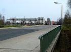
Koethener Strasse
( Location ) |
520 | Köthen , district town in Saxony-Anhalt | March 12, 1985 | It connects Wolfener Straße with Schwarzwurzelstraße and crosses the Wuhle . |
|
|
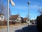
Kröver Street
( Location ) |
390 | Kröv , municipality and wine town in Rhineland-Palatinate, known for the " Kröver Nacktarsch " vineyard | March 8, 1935 | At first it was called Straße 105 , a west-east traffic route between Beilsteiner Straße and Hatzenporter Weg. Several traffic routes in the area have been named after wine towns in Rhineland-Palatinate. |
|
| Krummensee Street
( Location ) |
430 | Krummensee , district of Werneuchen in Brandenburg | Nov 29, 1997 | It is located in the newly developed residential area northwest of Eisenacher Strasse and connects the Blumberger Damm in a straight line in a west-east direction with the Trappenfelder path on the Wuhleniederung. |

|
|
Kürenzer Strasse
( Location ) |
660 | Kürenz , district of Trier and Weinort in Rhineland-Palatinate | March 11, 1937 | At first it was called Strasse 116 . It runs from Ruwersteig to Reiler Straße. Several traffic routes in the area have been named after wine towns in Rhineland-Palatinate. Most of the houses along this street still show the standard construction of the first colonists (picture). |

|
|
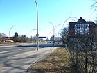
Landsberger Allee
( Location ) |
4920 (in the district) |
Landsberg, original name of the town of Altlandsberg in Brandenburg | Jan. 31, 1992 | The street ran straight through the old village green of Marzahn until the 1970s , after various renaming the western part was called Berliner Chaussee and the eastern part to Alt-Landsberg . Then it was redesigned in the center as a northern bypass of the village green, from 1978 to 1992 it was called Leninallee . Only a few houses from the end of the 19th century have been preserved here, including house number 563, on the gable of which the picture of the April 21st 1945 memorial commemorates the entry of the Soviet armed forces along this street. |
 |
| Langhoffstrasse
( Location ) |
400 | Wolfgang Langhoff (1901–1966), actor and director | March 1, 1978 | It connects Poelchaustraße with Murtzaner Ring in a straight north-south route. |

|
| Lattichweg
( Location ) |
240 | Lettuce , daisy family | Nov 9, 1936 | The road runs in a west-east direction south parallel to Ahrensfelder Chaussee and connects the Radish Path with the Schwarzwurzelstraße. Several traffic routes in the area have been named after animals or plants. The street runs in a west-east direction south parallel to Ahrensfelder Chaussee through a small settlement area. |

|
| Lea-Grundig-Strasse
( Location ) |
980 | Lea Grundig (1906–1977), graphic artist | Oct 14, 1981 | The street connects Mehrower Allee to the southwest with Raoul-Wallenberg-Straße. In the northern section it has a branch into which the Karl-Holtz-Straße flows. |

|
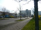
| Leunaer Strasse
( Location ) |
240 | Leuna , city in Saxony-Anhalt | Sep 15 1997 | At first it was an unnamed access road in the industrial area Bitterfelder / Wolfener Straße. It goes westward from Wolfener Straße in the direction of the Mehrower Allee S-Bahn station , in front of which there is a large P + R area. |
|
| Liebensteiner Strasse
( Location ) |
560 | Bad Liebenstein , city in Thuringia | June 9, 1982 | It runs twice angled between Trusetaler Straße and Mehrower Allee. |

|
| Loefer way
( Location ) |
320 | Loef , municipality and wine village in Rhineland-Palatinate | March 11, 1937 | First the way was called Straße 117 . It connects the Thurandter Weg with the Reiler Straße in a north-south direction. Several traffic routes in the area have been named after wine towns in Rhineland-Palatinate. |

|
| Ludwig-Renn-Strasse
( Location ) |
800 | Ludwig Renn (1889–1979), writer | July 16, 1980 | The traffic route runs like a hook between Sella-Hasse- and Raoul-Wallenberg-Straße. Several traffic routes in the area have been named after artists or writers. |

|
| Luise-Zietz-Strasse
( Location ) |
220
(in the district) |
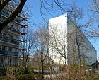
Luise Zietz (1865–1922), politician ( SPD , USPD ) | May 24, 1951 | Laid out from around 1906, it was first called Fürstenstrasse . Most of the street is in Biesdorf . Only the house number range 87–129 (odd; west side between Marchwitzastraße and Allee der Kosmonauten) belongs to Marzahn. Other traffic routes in the area have been named after artists or writers. |
|
|
Lützalweg
( Location ) |
320 | Lützbach valley , tributary of the Moselle | March 11, 1937 | At first the way was called Straße 19 . Several traffic routes in the area have been named after wine towns in Rhineland-Palatinate. |

|
|
Manksweg
( Location ) |
380 | Manks , apple variety | before 1925 | First it was Street 7 and Street 9 ; until 1930 but not yet built on. Several traffic routes in the area have been named after animals or plants. This path forms the eastern border of the former colonist settlement and runs between Blenheimstrasse and Pekrunstrasse. |

|
|
Märkische Allee
( Location ) |
7360 | Mark Brandenburg , historical landscape | Jan. 31, 1992 | When it was rebuilt in 1978, the avenue was called Heinrich-Rau-Strasse after the GDR politician Heinrich Rau . The north-south main road was completely re-routed in the 1970s and designed for extensive traffic. It runs in a slight curve east parallel to the Wriezener Bahn and, as part of the B 158, connects Ahrensfelder Chaussee / Dorfstraße with Alt-Friedrichsfelde / Alt-Biesdorf B 1 / B 5 . It touches two squares and has several identically named arms in the middle area that lead into the residential areas. |

|
|
Märkische tip
( Location ) |
660 | Mark Brandenburg , historical landscape | Sep 15 1997 | The Märkische Spitze west of Märkische Allee was initially nameless for a few years after its layout. It serves as a traffic-related development for some shopping facilities in the furniture and technology area. |

|
| Marchwitzastrasse
( Location ) |
680
(480 + 195) |
Hans Marchwitza (1890–1965), writer | March 1, 1978 | The ramified residential area access road runs between Allee der Kosmonauten and Öseler Straße in Biesdorf . Several traffic routes in the area have been named after artists or writers. | |
| Marga-Faulstich-Strasse
( Location ) |
Marga Faulstich (1915–1998), glass chemist | 2015 | The road to the area of 90 hectares large Clean Tech Business Park run to the plant in 2012, the groundbreaking ceremony took place and officially in September 2014 dedicated been. In July 2015, tillage had just started and a road network was not yet in sight. | Photo not possible in 2015. | |
| Marie-Wreschner-Strasse
( Location ) |
Marie Wreschner (1887–1941), physicist | 2015 | The road runs in the area of 90 hectares large Clean Tech Business Park to the system in 2012, the groundbreaking ceremony took place and officially in September 2014 dedicated been. In July 2015, tillage had just started and a road network was not yet in sight. | Photo not possible in 2015. | |
| Martha-Arendsee-Strasse
( Location ) |
480 | Martha Arendsee (1885–1953), politician ( KPD ) and resistance fighter | December 20, 1978 | It goes in an arch from Bruno-Baum-Straße westwards and then runs southwards to Poelchaustraße. |

|
|
Marzahner Chaussee
( Location ) |
2100
(in the district) |
Traffic route to Marzahn , part of the Marzahn-Hellersdorf district |
before 1900 (with interruption) |
First it was called Straße nach Friedrichsfelde , then Marzahner Chaussee, between 1905 and 1935 Victoriastraße . The traffic route led from the former Berliner Straße (today: Alt-Friedrichsfelde ) to Alt-Marzahn . When the Wriezener Bahn was built , the road ran over the site of the later Magerviehhof station . Around 1980 the northern section was relocated a little westwards and connected to a new industrial area, which in part belongs to the Lichtenberg district. The northern remnant was integrated into the street system of the new Marzahn district and was named Bruno-Baum-Straße. |

|
|
Marzahn promenade
( Location ) |
1340 | Marzahn , part of the Marzahn-Hellersdorf district | Dec. 28, 1983 | The pedestrian area between Eastgate and the Freizeitforum Marzahn was created from 1970 as a “social center” with numerous shops and restaurants. After being vacant for a long time after 1990, the promenade has been revitalized since around 2005 after the renovation of the surrounding prefabricated residential buildings was completed . In addition, the shop windows and entrance areas of the house entrances are to be renewed. Some of the rooms were and are rented to artists; there is also the municipal “Galerie M” here. Every year there is a special art project on and in the promenade. |
 
|
| Max-Herrmann-Strasse
( Location ) |
600 | Max Herrmann (1865–1942), theater scholar | Nov 7, 1984 | The road goes south from a branch of Mehrower Allee and runs in bends and bends. There is no direct connection with the main branch of Mehrower Allee. The full length of the street is bounded by a tram route along which a pedestrian and cycle path runs. |

|
| Meeraner Strasse
( Location ) |
800 | Meerane , city in Saxony | Oct 27, 1997 | The road goes eastward from Rhinstrasse and opens up the industrial area in several branches, then to the south it ends at the Allee der Kosmonauten. |

|
| Mehrower Allee
( Location ) |
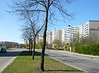
1420 | Mehrow , district of Ahrensfelde in Brandenburg | Jan. 31, 1992 | From 1978 it was first called Otto-Winzer-Straße after the GDR politician Otto Winzer . This busy west-east road between Märkische Allee and Blumberger Damm is accompanied on both sides parallel to the roadways by residential area development roads of the same name, which are interrupted twice (between Felsenstein- and Sella-Hasse-Strasse and between Max-Hermann- / Trusetaler Strasse and Lea -Grundig-Strasse). To the east, the traffic route continues as Glambeck Ring. In its middle area, the road route forms a widening similar to a square. |
|
| Merler way
( Location ) |
320 | Merl, district of Zell and Weinort in Rhineland-Palatinate | March 8, 1935 | The route was previously called Straße 108 . The west-east road connects Beilsteiner Strasse with Marzahner Chaussee, to the west it has a worm-like appendage on which a children's play hall has been established. Several traffic routes in the area have been named after wine towns in Rhineland-Palatinate. |

|
| Merseburger Strasse
( Location ) |
260 | Merseburg , district town in Saxony-Anhalt | March 12, 1985 | It connects the Schwarzwurzel- and Dessauer Straße in a gentle curve. |

|
|
Mühlenbeck way
( Location ) |
490 | Mühlenbeck , part of the community Mühlenbecker Land in Brandenburg | Dec 1, 1994 | The footpath runs southwest from Raoul-Wallenberg-Strasse and is connected to Franz-Stenzer-Strasse. - In the area, several traffic routes have been named after former villages in the area around Berlin. |

|
| Murtzaner ring
( Location ) |
1100 | Murtzan, the first recorded name of Marzahn | March 1, 1978 | It goes in a semicircle southwards from Poelchaustraße and then touches Langhoffstraße in the middle. |

|
|
Neufahrwasserweg
( Location ) |
280 | Neufahrwasser , district of Danzig , today Gdańsk-Nowy Port in Poland | June 9, 1933 | At first the path was called Straße 11 . It connects the Partridge Path with the Kiebitzgrund in the small housing estate southwest of Alt-Marzahn. Between this street and Landsberger Allee stands the Church of the Transfiguration of the Lord . |

|
| Niemegker Strasse
( Location ) |
360 | Niemegk , city in Brandenburg | Aug 3, 1983 | The road runs in a slight curve between Flämingstrasse and Wittenberger Strasse. |

|
| North ring
( Location ) |
900 | Nordring, name of a car dealership located here | Feb 15, 1997 | A few years after it was built, the Nordring was nameless. In the true sense of the word, it is not a ring road : it connects Hohenschönhauser Strasse in a straight line with Wolfener Strasse and forms the northern boundary of the commercial area. |

|
|
Oberweißbacher Strasse
( Location ) |
410 | Oberweißbach , part of the town of Schwarzatal in Thuringia | June 9, 1982 | The street first runs northwards from Mehrower Allee and after a bend eastwards to Blumberger Damm. On Oberweißbacher Straße there is a youth home, the Hobrecht high school and the Felix Hof (a building complex built by the housing association of the same name). |

|
| Oppermannstrasse
( Location ) |
560 | David Oppermann (18th century), colonist from the Electoral Palatinate | June 9, 1933 | At first the traffic route was called Straße 1 , also Oppermannweg . It runs northwest of Landsberger Allee between Jan-Petersen- and Schönagelstraße. |

|
| Otto-Rosenberg-Platz
( Location ) |
30 (diameter) |
Otto Rosenberg (1927–2001), chairman of the Berlin-Brandenburg Sinti and Roma Union | Dec 16, 2007 | Today's square was part of a former forced camp for Sinti and Roma . In 2006 an information board was put up to remind of the story. A year later - on the anniversary of the "Auschwitz Decree" (1942), the roundabout was given its honorary name. The square is in close proximity to the Raoul-Wallenberg-Straße S-Bahn station . |

|
| Otto-Rosenberg-Strasse
( Location ) |
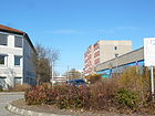
460 | Otto Rosenberg (1927–2001), chairman of the Berlin-Brandenburg Sinti and Roma Union | Dec 16, 2007 | In 1936, during the National Socialist era, a camp for Sinti and Roma was set up on the area along this street in order to keep people denigrated as gypsies out of the city during the Olympic Games . The massacre was only made public late with the naming of one of the few survivors for the street and the square. Otto-Rosenberg-Strasse was previously the southeastern area of Wolfener Strasse. A Don Bosco center has been set up right at the S-Bahn station . |
|
|
Parkerweg
( Location ) |
220 | Parkers Pepping , apple variety | before 1925 | At first the path was called Straße 3 . After its name it was first written Parker Weg . In this colonist settlement, several traffic routes have been named after animals or plants. |

|
| Parsteiner Ring
( Location ) |
620 | Parstein , part of the Parsteinsee municipality in Brandenburg | Aug 11, 1982 | It starts to the east at Glambecker Ring and, together with Brodowiner Ring, forms a closed residential area access road that is intersected by Ringenwalder Straße in a west-east direction. In their course, the two rings , Hohensaatener Straße and Ringenwalder Straße, form the boundaries of a larger green area. In 2010, with the help of EU funding, this was transformed into an as yet nameless city square , which is dedicated to the topic of preserving biodiversity . Ceramic plates with motifs from flora and fauna are embedded around a roundabout made of three large boulders. |

|
| Paul-Dessau-Strasse
( Location ) |
420 | Paul Dessau (1894–1979), composer | July 16, 1980 | It goes north from Raoul-Wallenberg-Straße and describes a quarter circle up to the connection with Ludwig-Renn-Straße. This creates a spacious, green inner courtyard.
Several traffic routes in the area have been named after artists or writers. |

|
| Paul-Schwenk-Strasse
( Location ) |
460 | Paul Schwenk (1880–1960), politician ( KPD ) and resistance fighter | December 20, 1978 | It runs in a quarter circle west of Bruno-Baum-Straße to Martha-Arendsee-Straße. |

|
| Pekrunstrasse
( Location ) |
1160 | Arthur Pekrun (1852-1940), pomologist | 1923 | At first it was called Kaiser-Friedrich-Strasse (from around 1910). Several traffic routes in the area have been named after animals or plants. |

|
| Plant Alley
( Location ) |
60 | another name for a farmer | Nov 9, 1936 | Several traffic routes in the area have been named after animals or plants. |

|
|
Pöhlbergstrasse
( Location ) |
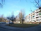
490 | Pöhlberg , mountain in the Ore Mountains | December 20, 1978 | The street runs between Blumberger Damm (as a western continuation of Spitzmühler Straße) and then bends south to Bärensteinstraße. It affects the old Marzahn churchyard. |
|
| Poelchaustraße
( Location ) |
1840
(1060 + 215 + 300 + 270) |
Harald Poelchau (1903–1972), prison pastor and resistance fighter | Jan. 31, 1992 | From 1978 it was called Karl-Maron-Straße after the GDR politician Karl Maron . The street runs as a west-east street between the S-Bahn station of the same name and the Allee der Kosmonauten. It has three southern branches to which the Murtzaner Ring and Langhoffstraße connect. |

|
| Premnitzer Strasse
( Location ) |
430 | Premnitz , city in Brandenburg | Aug 11, 1997 | The traffic route is the eastern continuation of the northern arm of the Schkopauer Ring on the east side of Wolfener Straße in the industrial park and was laid out after 1990. It leads as a dead end to the Wriezener Bahn near the Mehrower Allee S- Bahn station . The environmental office for Berlin-Brandenburg e. V. with the editing of an environmental magazine and the Berlin Nature and Environment Agency as lower authorities of the Federal Environment Agency (number 4) and the health department (numbers 11-13). |

|
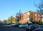
| Pritzhagener way
( Location ) |
420 | Pritzhagen , part of the municipality of Oberbarnim in Brandenburg | Nov 29, 1997 | The street in the new residential area around Altlandsberger Platz connects the Spitzmühler with Eisenacher Straße as a north-south street. It starts at the wave park and touches the Altlandsberger Platz. |
|
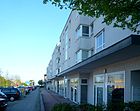
| Prötzeler Ring
( Location ) |
340 | Prötzel , municipality in Brandenburg | Nov 29, 1997 | The street in the new residential area around Altlandsberger Platz takes a triangular course. It connects the south side of Landsberger Allee with the north end of the Trappenfeld path. At the southwest bend, the Hennickendorfer and the Hirschfelder Weg connect to the west. |
|
| Pyramid ring
( Location ) |
1260 | Pyramid , name of an office and commercial building built in 1995 | Aug 4, 1997 | The traffic area south of Landsberger Allee over Beilsteiner Straße existed long before, it was Hohenschönhauser Weg . When the new city district was built, a dead-end street with a name and a name remained, which allowed access to railway facilities. When the corner of Landsberger Allee and the Pyramid commercial building were newly developed, the former cul-de-sac merged into the new pyramid ring. This runs in the arc segment from Landsberger Allee to Rhinstrasse. |

|
|
Rabensteiner Strasse
( Location ) |
680 | Rabenstein , municipality in Brandenburg | Aug 3, 1983 | The traffic connection runs in steps between Havemannstrasse and Borkheider Strasse. |

|
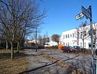
| Radebeuler Strasse
( Location ) |
500 | Radebeul , city in Saxony | Oct 1, 1993 | It connects the junction of Beilsteiner Straße and Marzahner Chaussee at its northernmost point with Coswiger Straße to the south and belongs to the industrial area. |
|
| Radish Path
( Location ) |
100 | Radishes , type of vegetable | Nov 9, 1936 | This north-south route is located in the middle of a colonist settlement south of Ahrensfelder Chaussee. Several traffic routes in the area have been named after plants. |

|
| Raoul-Wallenberg-Strasse
( Location ) |
1350 | Raoul Wallenberg (1912–1947), Swedish diplomat | Jan. 31, 1992 | When it was first built in 1978, it was called Bruno-Leuschner-Strasse after the GDR politician Bruno Leuschner . The traffic route runs from Märkische Allee in a south-east direction to Landsberger Allee. To the south, the Avenue of the Cosmonauts is the continuation. |

|
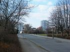
| Partridge Path
( Location ) |
600 | Partridge , hen bird | March 8, 1935 | The street was called Partridge Pasture from 1925 . The eastern part of the street (see map) was added to Blenheimstraße in 1978. Today the street in the small settlement area runs southwest of Alt-Marzahn from Landsberger Allee only to Blenheimstraße. |
|
| Reiler Strasse
( Location ) |
480 | Reil , municipality and wine village in Rhineland-Palatinate | March 8, 1935 | At first it was called Straße 103 . It runs from Marzahner Chaussee to Klüsserather Weg. Several traffic routes in the area have been named after wine towns in Rhineland-Palatinate. |

|
|
Rhinstrasse
( Location ) |
1070
(in the district) |
Rhin , tributary of the Havel | around 1912 | The street in its current form as a main thoroughfare was created primarily in the second half of the 20th century through the expansion and merging of previously existing individual sections. It runs between the district of Hohenschönhausen and the intersection with Alt-Friedrichsfelde , where it continues as the street Am Tierpark. Only the northwest side with the number range 40–140 (even) belongs to Marzahn. Other road sections belong to Alt-Hohenschönhausen, Lichtenberg and Friedrichsfelde. The “ pyramid ” and a branch of Mercedes-Benz are worth mentioning in this area . |

|
| Ringenwalder Strasse
( Location ) |
730
(490 + 240) |
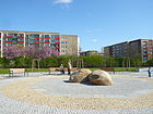
Ringenwalde , part of Temmen-Ringenwalde in Brandenburg | Aug 11, 1982 | The street runs from an eastern arm of Blumberger Damm, then offset and in a slight south bend to Landsberger Allee. She also has a cross arm. In its course, the street, together with the Parsteiner Ring, the Glambecker Ring and the Hohensaatener Straße, forms a larger green area. In 2010, with EU funding, it was transformed into an as yet nameless city square , which is dedicated to the topic of “preserving biodiversity”. Ceramic plates with motifs from flora and fauna are embedded around a roundabout made of three large boulders. |
|
| Rosenbecker Strasse
( Location ) |
860
(560 + 150 + 150) |
Rosenbeck, location in the Eichhorst district of the community of Schorfheide in Brandenburg | Aug 3, 1983 | The street connects the Klandorfer with the Havemannstraße. In the middle area it has two side arms. On June 6, 1990, submerged in the GDR was in the Rose Becker Straße 3 RAF -Aussteigerin Susanne Albrecht arrested. |

|
| Rudolf-Filter-Weg
( Location ) |
100 | Rudolf Filter (1833–1897), teacher and cantor in the village of Marzahn | May 15, 2000 | From about 1930 this street was called filter path , the official at the massive redevelopment of Marzahn 1976 deconsecrated was. However, the footpath still existed and was renamed in 2000 with the full name and better paved. |

|
| Rudolf-Leonhard-Strasse
( Location ) |
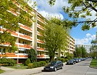
630 | Rudolf Leonhard (1889–1953), writer | Oct 6, 1981 | The traffic route connects Lea-Grundig-Strasse with Blumberger Damm and continues to the east as Hohensaatener Strasse. Several streets in the area have been named after artists or writers. |
|
| Ruwersteig
( Location ) |
850
(500 + 250 + 100) |
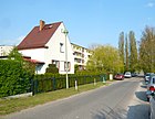
Ruwer , tributary of the Moselle | March 8, 1935 | The path was first built around 1933 as Straße 107 . The east-west road train connects the Beilsteiner road over the Marzahner Chaussee with Kürenzer road and has in the western half in north-south direction to connect to Kröver road through part of the allotment site construction . At the eastern end, a footpath leads to Klüsserather Straße. There are also lots of KGA Aufbau there . Several traffic routes in the area have been named after wine towns in Rhineland-Palatinate. |
|
|
Salanderweg
( Location ) |
300 | Salander, probably derived from Solan , where the Solanka pear variety was bred | 1923 | From 1910 the route was first called Schillerstraße . It is located in the small settlement area southwest of Alt-Marzahn and connects the Pekrun- and Vierlandenstrasse. |

|
| Scheibenbergstrasse
( Location ) |
460 | Scheibenberg , mountain in the Ore Mountains | December 20, 1978 | The street meanders from the intersection of Blenheimstraße / Manksweg to Pekrunstraße. To the south it continues as Fichtelbergstrasse. It is roughly on the former route of Dielsteg , Kuevettsteg and Riversweg , which had to give way to the new residential development. Between Scheibenbergstrasse, Pekrunstrasse and Manksweg there is a large green area on which the ceramic fountain by the artist Wolfgang Weber , entitled Dance of the Young, has been standing since 1984 . (Three ceramic columns of different heights are placed in a fountain bowl (7.10 m in diameter), one dances outside.) |
 
|
| Schkopauer Ring
( Location ) |
700 | Schkopau , municipality in Saxony-Anhalt | June 1, 1997 | It runs in a U-shape west of Wolfener Straße in the industrial park of the same name. |

|
| Schleusinger Strasse
( Location ) |
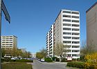
340 | Schleusingen , city in Thuringia | June 9, 1982 | It connects the Trusetaler from the north and west with Mehrower Allee and has two branches designed as branch roads . |
|
|
Schönagelstrasse
( Location ) |
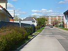
710 | Johann Georg Schönagel († 1785), colonist from the Electoral Palatinate | June 9, 1933 | At first it was called Straße 3 in a small settlement area. In 1993 the west-east traffic route was extended to the north, it now connects Raoul-Wallenberg-Strasse with Rudolf-Leonhard-Strasse and affects outdoor sports facilities here. The southern connection to Landsberger Allee is called “Zur Schönagelstraße”, but it is only a pedestrian and bike path. ( see also: Kiezpark Schönagelstraße .) |
|
| Schorfheidestrasse
( Location ) |
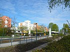
620 | Schorfheide , forest area in Brandenburg | Aug 3, 1983 | The street crosses the northernmost residential area of Marzahn from Ahrensfelder Chaussee or Klandorfer Straße to Havemannstraße. There it continues south as Borkheider Strasse. At the school gym (no. 42) there is a gable painting by Bernd Martin and M. Lewandowski of the meaning of work . In the far north, on the corner of Hohenwalder Strasse, there is a communal adventure playground. At the confluence with Havemannstrasse, a mini- Schorfheide has been recreated with simple landscaping .
In the area, several traffic routes have been named after villages or landscapes in Barnimer Land. |
|
| Schragenfeldstrasse
( Location ) |
400 | Schragenfeld , old hallway name after a wood sawing area | December 20, 1978 | The street opens up a small settlement area south of the Allee der Kosmonauten. |

|
| Swallow flight
( Location ) |
140 | Swallow , migratory bird | June 27, 1925 | At first the traffic route was called Straße 30 . It is a short connection between the Linnet Trail and the Bullfinch Path. In this colonist settlement, several traffic routes have been named after animals or plants. |

|
| Schwarzburger Strasse
( Location ) |
480 | Schwarzburg , municipality in Thuringia | June 9, 1982 | The angled street runs between Wuhletalstrasse and Trusetalstrasse. This street, together with Oberweißbacher and Sitzendorfer Straße, forms a large, yet nameless, green space that was created on the demolition area of a school building. The residents are involved in their design; the provisional name is Kiezpark . A three-part figure ensemble made of oak has stood here since 1988. It was made by Harald Stephan and symbolically represents a human cycle: a young couple, a mother with children and an older couple have been carved out of the tree trunks. |

|
| Black pump way
( Location ) |
160 + 280 | Black pump , district of Spremberg in Brandenburg, industrial and power plant location | Nov 15, 1999 | The two-way street opens up the industrial area Bitterfelder Straße / Wolfener Straße. |

|
| Black salsify route
( Location ) |
1000 | Black salsify, vegetable type | Nov 9, 1936 | It crosses the small settlement area south of Ahrensfelder Chaussee in a west-east direction and in 1985 received a north connection to the Chaussee. One of the children's facilities here has a gable painting by Ursula Wolf: Nest (or Horst ), which was made in 1988. Several traffic routes in the area have been named after animals or plants. |

|
| Sella-Hasse-Strasse
( Location ) |
440 | Sella Hasse (1878–1963), graphic artist | May 6, 1981 | The residential area development road in several segments is connected to Mehrower Allee, Ludwig-Renn-Straße and - within walking distance - to Alfred-Döblin-Straße. Several traffic routes in the area have been named after artists or writers. At the corner with Mehrower Allee, a larger business center was integrated into the street, which was named Marzahn-Plaza . |

|
| Sitzendorfer Strasse
( Location ) |
310 | Sitzendorf , municipality in Thuringia | June 9, 1982 | The west-east road runs between Schwarzburger Strasse and the northwest end of Blumberger Damm . |

|
| Spinach way
( Location ) |
120 | Spinach , vegetable | Nov 9, 1936 | The street in the small settlement area south of Ahrensfelder Chaussee continues north outside the Berlin city limits as Georg-Forster-Allee. Several traffic routes in the area have been named after animals or plants. |

|
|
Spitzmühler Strasse
( Location ) |
420 | Spitzmühle, district of Strausberg in Brandenburg | Nov 29, 1997 | The west-east street in the residential area around Altlandsberger Platz goes westward from Blumberger Damm . The road forms a border to the wave park , which reaches up to the Wuhleniederung. |

|
| Stangeweg
( Location ) |
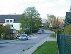
380 | Johann Nicolai Stange († 1776), one of the first colonists from the Electoral Palatinate | 1925 | At first the path was called Straße 4 . The Stangeweg runs north-east of Oppermannstrasse and forms an acute angle back with the Grohsteig, which is also named after a colonist (inverted "V"). |
|
| Sterckmannweg
( Location ) |
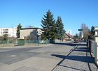
640 | Sterckmann, name of the breeder of a butter pear | 1924 | First the way was called Straße 2 , then Sterkmannweg (without "ck") or Sterckmanns Weg , corrected in today's spelling from 1930. It is located in the small settlement area southwest of Alt-Marzahn. Numerous streets in the area have been named after animals or plants. |
|
| Stolzenhagener Strasse
( Location ) |
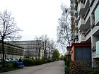
440 | Stolzenhagen , district of Wandlitz in Brandenburg | Aug 3, 1983 | The residential area development road goes south from Raoul-Wallenberg-Strasse, then it bends to the east and ends as a dead end . Several traffic routes in the area have been named after former villages or communities in Barnimer Land. On the gable of a block of flats, the housing association had four life wisdoms applied to the tiles as slogans. |
|
|
Thurandtweg
( Location ) |
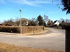
220 | Thurant Castle , castle ruins in Rhineland-Palatinate | March 11, 1937 | At first the path was called Straße 110 . It connects Kröver Straße with Eltzbachweg and forks. In this small settlement area, several streets bear the names of places on the Moselle from which the colonists came to Marzahn in the 18th century. |
|
| Bustard Fields Path
( Location ) |
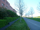
420 | Trappenfelde, district of Ahrensfelde in Brandenburg | Nov 29, 1997 | The foot and bike path east of the residential area around Altlandsberger Platz runs parallel to the Wuhle to the west and extends from Prötzeler Ring to Eisenacher Straße. |
|
| Trusetaler Strasse
( Location ) |
560 | Trusetal , district of Brotterode-Trusetal in Thuringia | June 9, 1982 | The street runs several times angled between an access arm of the Wuhletalstraße and the Märkische Allee; it also has a connection to Mehrower Allee, on which a wide tram route is laid, which is accompanied by a footpath and cycle path. |

|
|
Valwiger Strasse
( Location ) |
280 | Valwig , municipality and wine village in Rhineland-Palatinate | March 11, 1937 | First it was called Straße 118. The street is located in a small housing estate in which numerous traffic routes have been named after the wine villages of the colonists from the Moselle region who settled here. |

|
| Victor-Klemperer-Platz
( Location ) |
180 × 100 | Victor Klemperer (1881–1960), philologist |
Aug 25, 2005
(in the presence of his widow) |
The town square was not given a name when it was built . It is close to the 'Freizeitforum Marzahn', which is surrounded by the Marzahner Promenade , Mühlenbecker, Stolzenhagener and Franz-Stenzer-Straße. The entire pedestrian area has been redesigned since October 2010 according to plans by the landscape architect Ulrike Böhm, the first symbolic groundbreaking ceremony took place directly on Victor-Klemperer-Platz. The square should be more noticeable and it is also intended for cultural events. |

|
| Vierlandenstrasse
( Location ) |
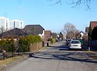
310 | Vierlande , marshland in the Hamburg district of Bergedorf | 1923 | It was first called Goethestrasse around 1920 . With the alignment of the Allee der Kosmonauten, an eastern area was separated in 1978 and was given its own new name, Heliosstraße . |
|
| Walter-Felsenstein-Strasse
( Location ) |
780 | Walter Felsenstein (1901–1975), Austrian theater director, founder of the Komische Oper Berlin | May 6, 1981 | The curved street opens up the residential area between Mehrower and Märkische Allee. Several traffic routes in the area have been named after artists or writers. |

|
|
Wiesenburger way
( Location ) |
980 | Wiesenburg , municipality in Brandenburg | May 11, 1938 | First there were Am Bahnhof (1927, 1943) and Bahnhofstrasse . Around 1970 the eastern area of the Wiesenburger Weg was separated, the rest was given a southward connection to the Georg-Knorr-Straße or continued under the Marzahner bridges as Dahmesweg. Here is the Marzahn Park Cemetery with various memorials. |

|
| Winninger way
( Location ) |
180 | Winningen , municipality and wine village in Rhineland-Palatinate | March 11, 1937 | The dead end goes northwards from the Ruwersteig; it is part of the settlement area of the colonists from the Moselle area. |

|
| Wittenberger Strasse
( Location ) |
860 | Lutherstadt Wittenberg , district town in Saxony-Anhalt | Aug 3, 1983 | This west-east street runs from Märkische Allee over Niemegker Strasse, then it bends several times to finally continue north to Wörlitzer Strasse. |

|
|
Wörlitzer Strasse
( Location ) |
510 | Wörlitz , part of Oranienbaum-Wörlitz in Saxony-Anhalt | Aug 3, 1983 | It goes from Havemannstrasse in a slight south bend and connects to Flämingstrasse. The most striking building is the “atrium”, the inner courtyard of which extends over the first floor and invites you to linger. |

|
| Wolfener Strasse
( Location ) |
1530 | Wolfen , part of Bitterfeld-Wolfen in Saxony-Anhalt | Apr 2, 1987 | The street, which runs in a north-east-south-west direction, opens up an industrial park that was created here from 1987 and was expanded considerably after 1990. The southern section from Bitterfelder Straße was detached in 2007 and given its own name Otto-Rosenberg-Straße . This is a reminder of a forced camp for Sinti and Roma that was set up on this area in 1935. |
|
| Wuhletalstrasse
( Location ) |
1990
(1500 + 490 + 360) |
Wuhletal , valley of the Wuhle river, eastern border of the Marzahn district | Jan. 31, 1992 | Wuhletalstrasse is a west-east main line between Wolfener Strasse, Märkische Allee (which is crossed under) and the Blumberger Damm / Kemberger Strasse street. It has two tributaries running parallel to the south in the residential area (picture). |

|
|
Zinndorfer Strasse
( Location ) |
280 | Zinndorf , district of Rehfelde in Brandenburg | Nov 29, 1997 | The street in the residential area around Altlandsberger Platz runs in a west-east direction. |

|
|
Zühlsdorfer Strasse
( Location ) |
500 | Zühlsdorf , part of the community Mühlenbecker Land in Brandenburg | July 16, 1980 | The access road is west of the Märkische Allee. Several traffic routes in the area have been named after former villages or communities in Barnimer Land. |
|
|
To the old stock exchange
( Location ) |
700 | former cattle exchange of the Friedrichsfelde lean cattle farm | March 25, 2015 | The street extends Kröver Straße across Beilsteiner Straße, then bends in a southerly direction and ends at Marzahner Chaussee. | |
| To Schönagelstrasse
( Location ) |
140 | in the direction ( Schönagelstraße ) | Oct 1, 1993 | The long unnamed footpath, a connection to Landsberger Allee , was given its own name only when Schönagelstrasse was extended to the south. |

|
No longer existing streets and squares
Evaluation and comparison of Berlin address books of different years 1923, 1925, 1927, 1930, 1939, 1940 and 1943 as well as the viewing of maps from 1943 and 1944 led to the following no longer existing streets. In addition, the database of the Luisenstädtischer Bildungsverein was used.
Under 'Designation' and 'Cancellation' are the first and the last recorded year. The information that is still missing cannot be completed with the existing sources and is marked with the note 'no information'.
| Name / location | Origin of name | designation | Repeal | Remarks |
|---|---|---|---|---|
| Baumannstrasse | 'no information' | 1925 | 1939 | |
| Birknersfelder Straße (also Bürknersfelder Straße and Bürknersfelder Weg) | Bürknersfelde , former Vorwerk | 1923 | 1991 | This road was created in place of an earlier connection path through the Rieselfelder in Falkenberg to the south to the Bürknersfelde farm. The connecting route was first recorded on records in 1894. After various unrealized plans, Bürknersfelder Strasse appeared in the city maps from 1951 to 1991. Part of the route has been incorporated into the road network of the industrial area north of Bitterfelder Strasse . |
| Boehmertstrasse | Wilhelm Böhmert (1829–1919), land owner in Marzahn or Karl Gustav Böhmert (* 1878–?), Farmer in Marzahn |
1925 | around 1980 | Although the name was already entered in the Berlin address book from 1925, the documents give the official name assignment as March 8, 1935. With the beginning of the rebuilding of the area in the 1980s, the street disappeared. |
| Carl-Lehmanns-Weg | Carl Lehmann, nursery owner in Marzahn | 1923 | 1925 | |
| Castroper Street | Castrop-Rauxel , city in North Rhine-Westphalia | March 8, 1935 | 1975 | Castroper Strasse was a dead end near Wiesenburger Weg. |
| Celliniweg | Benvenuto Cellini (1500–1871), Italian goldsmith and sculptor or “Cellini”, apple variety |
1923 | 1975 | The surrounding traffic routes are mostly named after fruit types, which is why the apple variety Cellini is more likely to give the name. A section of the Blumberger Damm was later led around this route . |
| Dannenfelzer way | A. Dannenfelzer, former chief of the Marzahn volunteer fire department | 1925 | around 1975 | In contrast to information from the Marzahner Heimatverein, research by the Luisenstädtischer Bildungsverein showed that the street should be named after Johann Wendel Dannenfelzer (1721–1776), an early colonist from the Palatinate. - The street was removed from today's Raoul-Wallenberg-Strasse and incorporated into the new course. It led from the Chaussee to Alt-Landsberg (today Landsberger Allee , corner of the Allee der Kosmonauten ) in a northerly direction into the area of today's Jan-Petersen-Straße. |
| Diels bridge or Diel bridge | "Diels Butterbirne", type of pear | 1923 | 1978 | First street 17 . Included in the Scheibenbergstrasse . |
| Dornburger way | Dornburg , part of the city of Dornburg-Camburg in Thuringia | March 8, 1935 | around 1976 | First street 20 . |
| Elisabethstrasse | Elisabeth , female name | 1939 | later incorporated into Biesdorf | |
| Erhardtstrasse | 'no information' | 1923 | 1925 | |
| Evernweg | "Deutsch-Evern", strawberry variety | 1923 | 1925 | |
| Fridolinweg | Fridolin , male first name | 1934 | 1943 | later assigned to Biesdorf |
| Grievesteg | James Grieve , apple variety | 1925 | ? | |
| Gröpplerstraße, also Gröpplerweg | August Heinrich Gröppler (1811–1885), settler in Marzahn | 1923 | 1943 | |
| Grothestrasse | 'no information' | 1923 | ? | |
| Hedelfinger Weg, also Hedelfinger Straße | Hedelfingen , district of Stuttgart in Baden-Württemberg | 1923 | around 1930 | First street 11 . Abolished after 1930 and shown as undeveloped area in later city maps. |
| Herzogstrasse | Duke , title of nobility | around 1906 | May 24, 1951 | later incorporated into Biesdorf and renamed as Maratstrasse |
| Heinrich-Haase-Platz | Heinrich Haae (1825–1902), landowner in Marzahn | 1923 | 1929 | Repealed in the later development; the exact historical situation could not be reconstructed so far (as of 2017). |
| Kantor-Filter-Platz | Rudolf Filter ( see Rudolf-Filter-Weg ) | 1923 | 1925 | It was probably the unofficial name for the square around the Marzahn village church . |
| Keswicker way | probably after the city of Keswick in England | 1923 | 1925 | |
| Knevettssteg | "Knevett's giant raspberry", raspberry variety | 1923 | 1978 | First street 18 . |
| Lebelssteg or Lebelssteg: | "Jakob Lebel", apple variety | 1923 | 1978 | First street 20 . |
| Lenzstrasse | 'no information' | 1923 | 1925 | |
| Lückestrasse | 'no information' | 1923 | 1925 | |
| Liegels Steg or Liegelssteg | "Liegels Butterbirne", type of pear | 1925 | ? | |
| Ludwig-Dubick-Platz | Ludwig Dubick, farmer and first mayor of Marzahn (19th century) | 1923 | 1930 | In the address books of 1923 and 1929, a Ludwig-Dubick-Platz is recorded in the area of Dorfstrasse / Dorfaue von Marzahn. A war memorial was named as a sight in the Berlin address book from 1923, which is still on the Alt-Marzahn church forecourt today. |
| Mangesdorfstrasse | Mangesdorf: Name of a colonist family from the Electoral Palatinate | 1925 | ? | |
| Miehlegasse | 'no information' | 1923 | 1925 | |
| Nickelstrasse | 'no information' | 1923 | 1925 | |
| Ontariosteg | Ontario , apple variety | 1923 | 1925 | |
| Rieversweg, later also written Riversweg | Thomas Rivers (19th century), pomologist | 1925 | 1978 | First street 13 . The Allee der Kosmonauten has been running here in the section between Pekrunstraße and Blenheimstraße since the 1970s . |
| Roderjanweg | Johannes Roderjan (1746–1808), one of the first settlers in Marzahn | March 8, 1935 | around 1975 | First street 4 , which led from Wiesenburger Weg northwards parallel to the route of the Wriezener Bahn . |
| Seuchenhofstraße, also Seuchenhof (without street) | Seuchenhof, facility of the Friedrichsfelde lean cattle farm , in which suspicious animals were kept | 1925 | 1940 | First street 25 . It was on Falkenberger Weg, north of today's Alt-Marzahn road, and has been repealed. |
| Völklinger Strasse | Völklingen , city in Saarland | March 8, 1935 | First street 25a in the Daheim settlement ; was later incorporated into Biesdorf . | |
| Vorstersweg | 'no information' | 1925 | ? | |
| Wustrowstrasse | 'no information' | 1923 | 1925 |
Other locations in Marzahn
Allotment gardens (colonies)
The few Marzahn allotment gardens (KGA) are subject to the regulations of the Federal Allotment Garden Act ; their existence is described in the allotment garden development plan of the Senate Administration (on submission of the districts). You are a member of the Berlin-Marzahn District Association of Garden Friends
- KGA, An der Wendeschleife '( Lage , Schorfheidestrasse)
is a poorly secured allotment garden, founded in 1989, with 24 plots on 4958 square meters of state-owned leased land. - KGA, Aufbau '( Lage , Thurandtweg)
was founded in 1946 and owns 98 parcels on 56,528 square meters of state-owned leased land. Although the facility is not permanently secured according to the development plan, the reorganization is determined by mutual agreement, as five residents with permanent right of residence live in the KGA. - KGA 'Rosengarten' ( Lage , Marzahner Chaussee)
has existed since 1929. It is not permanently secured with 52 parcels on 15,273 square meters of state-owned leased land. The arbor colony is located east of Marzahner Chaussee directly on the embankment, south of the colonist settlement. - KGA 'Sorgefrei' ( Lage , Klüsserather Weg)
has existed since 1946 and is an unsecured arbor colony of level Ia with 29 parcels on 14,610 square meters of private leased land. It is adjacent to the KGA 'Am Steintal'.
The owner of both KGAn is the Bahn subsidiary DB Immobilien , which offered the entire site (including the KGA Aufbau 39,000 square meters) for sale in March 2017. This endangers the existence of 60 allotment gardeners. The closing date for bids is April 30th. The existing lease agreements, however, include protection of the current status until at least 2020. The areas in the Marzahn district have been designated as building land since 1994 . A discussion between all those involved in the coming weeks should result in a justifiable compromise. - KGA, Steintal '( Lage , Klüsserather Weg)
the little secured complex, founded in 1986, has 27 plots on 8,917 square meters on private leased land.
Parks and miscellaneous
- Gardens of the World ( location ), south of Eisenacher Strasse. There are several gardens from different parts of the world on the 43 hectare park area. The IGA will take place here in 2017 .
- Bürgerpark Marzahn ( Lage ), north of Raoul-Wallenberg-Strasse and east of Paul-Dessau- and Ludwig-Renn-Strasse. In the east it is limited by a tram line parallel to Lea-Grundig-Straße. The Hönower Weg (No. 7 of the 20 main green paths in Berlin) leads through the Bürgerpark and connects it with other green spaces and parks.
- Clara-Zetkin-Park ( Lage ), between Niemegker, Wittenberger, Wörlitzer and Flämingstraße
- "Grove of friendship" ( location ), within this green space between Allee der Kosmonauten and Blumberger Damm (at that time Otto-Buchwitz-Straße ), which was named in 1985 , three schools have been close together since the late 1990s: Kienberg-Oberschule, Marc- Chagall High School and Elementary School at the Mill.
- Heinz-Graffunder-Park ( Lage ), laid out on a demolition area after 2000. It was named in 2004 after the architect Heinz Graffunder . The park is located south of Marchwitzastraße and is bordered to the east by Eugen-Roth-Weg.
- Wedding park ( location ), between Ludwig-Renn- and Alfred-Döblin-Straße
-
Schwarzwurzelpark ( location ), between Schwarzwurzelstraße and Geraer Ring.
The sculpture of a black salsify set up here (see picture) comes from the sculptor Christine Gersch and was set up in 2005. The rather inconspicuous vegetable was formed as a triplet from concrete, is two meters high and is covered by a small ceramic mosaic . - Seelbuschgrabenpark ( location ) on both sides of the Wuhle north of Wuhletalstrasse and Hellersdorfer Weg. It is separated into a western and an eastern part by the Märkische Allee. Path No. 16 of the 20 main green paths - Humboldt-Spur - runs through the park.
- Springpfuhlpark ( location ), north of Helene-Weigel-Platz
- Wellenpark ( location ), belongs to the landscape park Wuhletal and is located between Hirschfelder Weg and Spitzmühler Straße in the residential area Landsberger Tor .
- Wiesenpark ( location ), belongs to the landscape park Wuhletal and lies between the Landsberger Allee in the north, the Wuhle in the east and the Eisenacher Straße in the south in the residential area Landsberger Tor .
- Marzahner mill ( position ), a 1994 replica erected the first Marzahn Windmill at the Landsberger Allee Corner Alley of Cosmonauts
- Eastgate , shopping center between Märkischer Allee and Marzahner Promenade, for the construction of which the former Marzahner Tor department store was demolished.
See also
Web links
- Map of Berlin 1: 5000 with district boundaries. Senate Department for Urban Development Berlin, 2009, accessed on January 3, 2011 .
- Official street directory of the Marzahn-Hellersdorf district; pdf (as of July 2015)
- Street directory Marzahn. kaupert media gmbh, accessed on January 15, 2011 . , some information corrected (year numbers, namesake, OT assignment)
Individual evidence
- ↑ Berlin city map from 1899 with the village of Marzahn, the Rieselfelder north of it, the Landsberger Chaussee and the roads to Biesdorf and Kaulsdorf (south) ( page no longer available , search in web archives ) Info: The link was automatically marked as defective. Please check the link according to the instructions and then remove this notice.
- ↑ a b c Marzahn at the Berlin Statistics Office, as of July 2015 (PDF; 350 kB)
- ↑ Information from the BA Marzahn-Hellersdorf on the Landsberger Tor quarter ( memento from April 21, 2015 in the Internet Archive ), newly accessed on February 1, 2016.
- ↑ a b c d e f g Marzahner streets . In: Berliner Adreßbuch , 1923, Part IV, p. 1832.
- ^ Streets in Marzahn> Steinhalde . In: Berliner Adreßbuch , 1933, Part IV, p. 2139.
- ↑ Ahrensfelder Chaussee station building monument complex from 1900–1910.
- ↑ Berlin address book 1939 with the note "Dorfaue, renamed Alt-Marzahn at the time of printing"
- ↑ Monument areas Alt-Marzahn 16–16c, 18–32, 35, 38–58, 62–64a, 66–70, town center with village green, village church Marzahn and outer green areas (between Allee der Kosmonauten, Blenheimstraße, Landsberger Allee, Parthuhnweg)
- ↑ a b c d e f g h Berlin city map from 1943 with the earlier course of the streets ( page no longer available , search in web archives ) Info: The link was automatically marked as defective. Please check the link according to the instructions and then remove this notice.
- ↑ City map Berlin 1988, VEB Tourist Verlag Berlin, map p. 19, section B2
- ↑ a b Submission of the Marzahn-Hellersdorf District Office No. 1011 / IV
- ↑ CleanTech: These five startups solve energy problems , accessed April 24, 2018.
- ↑ Amselhainer Weg on Kauperts.de
- ↑ passed Barnimplatz on Havemannstrasse . Article in the Berliner Zeitung of October 29, 1996; Retrieved February 13, 2011
- ↑ Stock exchange ,Loading ramp ,Loading tracks ,Enclosure
- ↑ a b c d e f g h i Blumenbachweg . In: Berliner Adreßbuch , 1925, Part IV, p. 1945.
- ↑ a b c streets in Marzahn . In: Berliner Adreßbuch , 1927, Part IV, p. 2023.
- ↑ a b c d Printed matter 1362-VII-1 of the BVV Marzahn-Hellersdorf
- ↑ Street name changed again . In: Berlin Week . Edition Hellersdorf, December 2, 2015, p. 10
- ↑ Address search in RBS
- ↑ FIS-Broker map display map of Berlin 1: 5000 (K5 color edition)
- ^ Berlin, Autofahrer-Atlas, 1: 14.000, Karte 71, StadtInfoVerlag 2007/2008, ISBN 3-8279-3008-1
- ^ Streets in Friedrichsfelde> Eltzbachweg . In: Berliner Adreßbuch , 1940, Part IV, p. 2209.
- ↑ a b c Fruit variety list from BUND (PDF; 105 kB), accessed on February 25, 2011
- ↑ a b Art in the Marzahn-Hellersdorf housing estate (pdf; 2.3 MB) , accessed on March 21, 2011
- ^ Frank-Schweitzer-Strasse in: Kaupert's street guide through Berlin
- ↑ Homepage Alba Services with the address in Marzahn
- ↑ Architectural monument factory
- ↑ Website with the reference Theater 89 in Georg-Knorr-Straße; Retrieved February 19, 2011
- ↑ On the death of Gottfried Funeck. ( Memento of the original from October 29, 2016 in the Internet Archive ) Info: The archive link was inserted automatically and has not yet been checked. Please check the original and archive link according to the instructions and then remove this notice. In: Stadt + Grün, 5/2011, p. 71
- ^ Official name of the Gottfried-Funeck-Weg . Press release from the Marzahn-Hellersdorf district office, January 10, 2017
- ↑ Grohsteig on Kauperts.de
- ↑ a b c d e Art in Marzahn ( Memento of the original from April 5, 2015 in the Internet Archive ) Info: The archive link was inserted automatically and has not yet been checked. Please check the original and archive link according to the instructions and then remove this notice. (PDF; 7 kB)
- ↑ Kauperts.de provides the information that the name Hellersdorfer Weg was assigned after 1938 berlin.kauperts.de , but the route does not appear in the Berlin address books available online (before 1900 to 1943).
- ^ Church website 43 for more information ; Retrieved February 1, 2016.
- ↑ Website Jugendhaus Bolle
- ↑ Katja Ulmer: 5000 euros for young musicians . In: Berliner Zeitung , December 15, 2014, p. 18.
- ↑ Hornet: Explanation. online (Pommier d'ornement 'Golden Hornet' - Malus) ( Memento of the original from November 18, 2009 in the Internet Archive ) Info: The archive link has been inserted automatically and has not yet been checked. Please check the original and archive link according to the instructions and then remove this notice. , French
- ↑ Martin Klesmann: Schoolchildren learn in the prefabricated buildings of the 21st century. Berliner Zeitung , 5./6. March 2016, p. 17.
- ^ Luise-Berlin to Ludwig-Dubick-Platz ; Retrieved March 3, 2011
- ↑ Planning project Rudolf-Leonhard-Straße / Karl-Holtz-Platz at www.stadtentwicklung.berlin, accessed on January 9, 2017.
- ↑ Leninallee . In: Street name lexicon of the Luisenstädtischer Bildungsverein
- ↑ a b city map from 1961 on http://www.blocksignal.de/
- ↑ Architectural monument residential building LA 563
- ↑ a b Birgitt Eltzel: Positive from the plate. Not dreary: Marzahn-Hellersdorf attracts artists and tourists . Article in the Berliner Zeitung of February 14, 2011, p. 21
- ↑ according to city map from 2007; will be checked on site
- ^ Berlin city map from 1988. VEB Tourist-Verlag, Berlin. Page 19, B-2
- ↑ a b c Street names in Marzahn . In: Berliner Adreßbuch , 1930, Part IV, p. 2097.
- ↑ Kauperts : Ruwersteig 2-46
- ↑ Kauperts.de with an explanation of the Salanderweg
- ↑ Homepage with addresses of adventure playgrounds etc. a. in Marzahn, opening times and telephone numbers ( Memento of the original from April 5, 2011 in the Internet Archive ) Info: The archive link was inserted automatically and has not yet been checked. Please check the original and archive link according to the instructions and then remove this notice. ; As of February 14, 2011
- ↑ The Stangeweg is already listed in the Berlin address book from 1925, but the name was not officially assigned until 1933.
- ^ Report of a gardening committee from 1915 , archive online, accessed on February 26, 2011
- ^ Information from the Marzahn-Hellersdorf District Office on the renovation work on the Marzahner Promenade ; (New) accessed on February 1, 2016
- ^ Name of the private street "Zur Alten Börse" in Friedrichsfelde Ost . Press release by BVV Marzahn-Hellersdorf, March 20, 2015.
- ^ Streets in Marzahn . In: Berliner Adreßbuch , 1939, Part IV, p. 2307.
- ^ Streets in Marzahn . In: Berliner Adreßbuch , 1940, Part IV, p. 2317.
- ^ Streets in Marzahn . In: Berliner Adreßbuch , 1943, Part IV, p. 2326.
- ↑ Explanation of the historical Marzahn street names on Luise-Berlin.de - 'Berliner Stadtgeschichte one, two, three ...'
- ^ Chronicle of the Marzahn Heimatverein
- ↑ Berliner Stadtgeschichte one, two three , information from the Luisenstädtischer Bildungsverein zu Herzogstraße , accessed on July 1, 2011
- ^ Heinrich-Haase-Platz on www.luise-berlin.de.
- ↑ Apple variety list (alphabetical)
- ^ Johann-Heinrich Rolff: Fruit types, variety names and synonyms . tape 2 : The pear, 2002, ISBN 3-8311-1812-4 , p. 135 ( limited preview in Google Book search).
- ^ Carl Eduard Geppert: Chronicle of Berlin from the creation of the city to today: Berlin under King Friedrich Wilhelm the First . Chronicle of Berlin from the creation of the city until today: Berlin under King Friedrich Wilhelm the First. tape 2 . Rubach, 1840, p. 285 ( digitized version in the Google book search).
- ^ Kauperts.de on Völklinger Strasse
- ^ Allotment garden inventory_10.pdf ( Memento of the original from September 29, 2013 in the Internet Archive ) Info: The archive link was inserted automatically and has not yet been checked. Please check the original and archive link according to the instructions and then remove this notice.
- ^ Website of the Berlin-Marzahn district association of gardening friends
- ^ Allotment garden association at the Wendeschleife
- ↑ a b c Level III: Fictitious permanent allotment gardens that are to be used for another purpose according to the representations of the land use plan.
- ↑ Construction of allotment garden association
- ↑ Senate Department for the Environment, Transport and Climate Protection , as of 2018
- ↑ Allotment garden association Rosengarten
- ↑ Allotment Garden Association Worry Free
- ↑ a b Level Ia: Allotment gardens on private areas that are intended for another use according to the representations of the land use plan. A termination is possible at any time in compliance with the allotment garden regulations
- ↑ Norbert Koch-Klaucke: Colony 'Worry-Free' is to be sold. In: Berliner Zeitung , April 10, 2017, p. 13.
- ^ Allotment garden association Steintal
- ^ Art in the large housing estate. Works of art in public spaces in Marzahn and Hellersdorf. A documentation ; Commission for Art in Public Space: Thorsten Goldberg, Ellena Olsen, Martin Schönfeld, Andreas Sommerer. Published by the Marzahn-Hellersdorf District Office, 2008. ISBN 978-3-00-026730-7 ; P. 210.


