List of streets and squares in Berlin-Hakenfelde

The list of streets and squares in Berlin-Hakenfelde describes the street system in the Berlin district of Hakenfelde with the corresponding historical references. At the same time, this compilation is part of the lists of all Berlin streets and places .
overview
Hakenfelde has 31,296 inhabitants (as of December 30, 2019) and includes the postal code area 13587.
Development of the road system
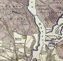
The main roads are Schönwalder Straße and Schönwalder Allee (as L 16) to Schönwalde-Glien from Falkenseer Platz (from Altstädter Ring in Spandau) and the Neuendorfer - Streitstraße - Niederneuendorfer Allee (as L 172) to Hennigsdorf with a connection to the motorway. Of 134 dedicated streets and six named squares, the newly structured paths in the "Hookfelde Housing Estate" are the youngest officially recognized streets ( private streets ). Six streets continue in neighboring districts or are on the border of the district and thus belong to them with the same name and number. The streets of the district are characterized by belonging to the city of Spandau (Oranienburger Vorstadt and Hackenfelde). The fortifications of Spandau outside the Askanierring can be seen in the street location on the 1907 city map and in the area of Hakenfelde near Havel. Around 1900 the area between Streitstrasse and Havel was opened up for industry ( terrain of the Grundrenten Gesellsch. For factories ). Due to the proximity of the Spandau pioneers' water training area , the streets were given the names of Spandau pioneer officers. In 1905/1906, titles of nobility were the basis for naming streets for a residential area west of Schönwalder Allee. The streets of the “ Waldsiedlung ” were built between 1914 and 1916 for residential buildings by the Spandau workers . The residential quarter planned around 1912 with street names according to the member states of the German Empire was not implemented because of the First World War and the inflation that followed. With the "Wasserstadt", which has been continuously expanded since 1996, using cleared commercial and barracks areas, good residential areas on the Havel and near the banks have been developed and new streets have been laid out or changed over time. These residential areas are mainly being built on the west (Hakenfelde) and east ( Haselhorst ) banks of the Havel, but due to insufficient demand, the scope and the pace of construction were subsequently restricted. The most recent development in the road system for the time being are the officially confirmed private roads of the "Hookfelde Housing Estate", which is designed according to building law. The naming of the streets resulted from the nationwide introduction of georeferenceable addresses.
The total length of the city and residential streets in the district is 61.5 kilometers.
Detailed description of the district boundaries
The district borders with the southern edge of Radelander Straße on Falkenhagener Feld , the border leads westwards to the city limits of Falkensee . The city limits run northwards and, as the border of the district, surrounds the local situation Eiskeller , here the district touches the community Schönwalde-Glien . The city limits continue north-eastwards and later eastwards and crosses Schönwalder Allee, north of Laßzinssee Hennigsdorf becomes the neighboring town and further on, the border around the Berlin urban forest Spandau runs south-east and crosses Niederneuendorfer Allee. 780 meters to the east the bank of the Havel is reached and in the middle of the Havel the border turns to the south and touches the neighboring district Konradshöhe ( district Reinickendorf ). Haselhorst extends to the middle of the Havel, the island of Eiswerder belongs to the district. To the north of the Spandau Citadel , which remains outside the district, the west bank of the Havel (northward) is the district boundary to Spandau. On the north side of Triftstrasse (which belongs entirely to Spandau), the district boundary continues on land. Including Neuendorfer and Streitstrasse (the properties on their west side are in Spandau) and on the Hohenzollernring (which belongs to the district, the southern properties belong to Spandau), the border bends westward and includes the district with Radelandstrasse. Radelandstraße is in the district, the southern properties are in turn in the neighboring district of Falkenhagener Feld.
Overview of streets and squares
The following table gives an overview of the streets and squares in the district as well as some related information.
- Name / location : current name of the street or square. Via the link Location , the street or the square can be displayed on various map services. The geoposition indicates the approximate center of the street length.
- Traffic routes not listed in the official street directory are marked with * .
- Former or no longer valid street names are in italics . A separate list may be available for important former streets or historical street names.
-
Length / dimensions in meters:
The length information contained in the overview are rounded overview values that were determined in Google Earth using the local scale. They are used for comparison purposes and, if official values are known, are exchanged and marked separately.
For squares, the dimensions are given in the form a × b for rectangular systems and for (approximately) triangular systems as a × b × c with a as the longest side.
If the street continues into neighboring districts, the addition ' in the district ' indicates how long the street section within the district of this article is. - Name origin : origin or reference of the name.
- Notes : further information on adjacent monuments or institutions, the history of the street and historical names.
- Image : Photo of the street or an adjacent object.
| Name / level / location | Length / dimensions (in meters) |
Origin of name | Date of designation | Remarks | image |
|---|---|---|---|---|---|
|
Aalemannufer
( Location ) |
770 | previous eel fishery | Sep 9 1931 | The street is a dead end east of the Niederneuendorfer Allee to the Havel and lies on the north bank of the 1919–1921 branch canal of the Havel ( Aalemann Canal ). A car ferry takes you across the Havel to Tegelort in the Reinickendorf district . |

|
| Acacia path
( Location ) |
90 | Acacia , tree species | 1916 | The road in the forest settlement lies between Eschenweg and Buchenweg. |

|
| At the boathouse
( Location ) |
160 | Listed boathouse from 1911 | Feb. 1, 2007 | The traffic route is in the Wasserstadt-Oberhavel area, Nordhafen district, between the Havelschanze and the mouth of the northern port of Spandau (corner of the Havel). The boathouse was built in 1911 for the boats of the Royal State Gymnastics Institute. |

|
| At the Forstacker
( Location ) |
480 | Field name Forstacker (18th century) | Nov 1, 1969 | The road laid out in 1969 connects Cautius Strasse and Hakenfelder Strasse. |

|
| At the hazel leek
( Location ) |
240 | Location on the northern edge of the "Haselluch" forest | March 2012 | The settlement road is located in the Hakenfelde housing estate between Marienwerder and Rothenburger Weg north of Werderstrasse and leads around a small wood north of the gardening school. |

|
| At the Maselakepark
( Location ) |
950 | Park on the Maselake peninsula | Feb. 1, 2007 | The street lies between Streitstrasse and Carossastrasse in the Maselake quarter in the center of the water town. |

|
| At the Devil's Break
( Location ) |
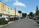
240 | Teufelsbruch , a nature reserve in the forest to the west | Dec. 4, 1996 | The paved road with parking pockets and sidewalks as well as five-story new residential buildings from the 1990s lies between Aalemannufer and Rustweg. |

|
| At the water arch
( Location ) |
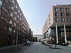
160 | Arched bank from the Maselake Canal into the Havel | Nov 15, 1997 | The road lies on the bank between Boca-Raton- and Asnièresstraße. The narrow street on the Maselake Canal is part of the Wasserstadt Spandau project and was completed in 1999. The designs of the two residential buildings go back to David Chipperfield . |

|
| Amorbacher way
( Location ) |
120 | Amorbach , Bavarian town near Miltenberg | 19 Sep 1931 | The square-like street (roadway and parallel green corridor with trees) between Streitstraße and Wansdorfer Platz was laid out in 1912 as Bayernstraße to form the “federal state district”. Since the expansion was interrupted, local streets were named after places in the Odenwald. |

|
| At the Havelspitze
( Location ) |
650 | Havelspitze protrudes between the Havel and Maselakebucht to the south | June 17, 1997 | The road lies between Parkstrasse and the Havel opposite the Eiswerder island and runs north along the Havel through the industrial area. |

|
| Ashdod Street
( Location ) |
90 | Ashdod , twin town of the Spandau district in Israel | June 9, 1999 | It is located between Rauchstrasse and Asnièresstrasse in the Wasserstadt, Quartier Maselake Nord, without any associated land. |

|
| Asnièresstrasse
( Location ) |
160 | Asnières-sur-Seine , French twin town of the Spandau district north-west of Paris | Sep 20 1999 | The street in the water town lies between Ashdodstrasse and Am Wasserbogen. |

|
| Aspenweg
( Location ) |
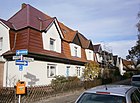
570 | Aspe , species of tree, also known as 'trembling poplar' | Sep 9 1931 | The street in the Waldsiedlung lies between Wichernstrasse and Lichtwarkweg. Named as Ahornweg when it was laid out in 1916 , this name was changed due to the many Ahornweg in Greater Berlin . |
|
|
Bamihlstrasse
( Location ) |
200 | Ernst Bamihl (1848–1932), commander of the pioneer battalion in Spandau | 1900 | It is located between Rauchstrasse and Carossastrasse in the industrial area between Streitstrasse and Havel, which was developed around 1900, where the water training area for the pioneer troops stationed in Spandau was also located. On the 1907 city map, Klinkestrasse is in the area of Grundrenten Gesellsch. For factories . |

|
| Bernkastler way
( Location ) |
190 | Bernkastel , Rhineland-Palatinate city on the Middle Moselle | March 2012 | The path is in the Hakenfelde housing estate between Niederneuendorfer Allee and the gardening school. |

|
| Bertricher way
( Location ) |
170 | Bad Bertrich , Rhineland-Palatinate health resort in the Eifel | March 2012 | The private street is located in the Hakenfelde housing estate between Niederneuendorfer Allee and Marienwerder Weg. |

|
| Birch path
( Location ) |
270 | Birch , deciduous tree | Feb. 4, 1916 | The path in the forest settlement lies between acacia and poplar paths. |
 
|
| Boca Raton Street
( Location ) |
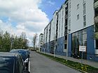
350 | Boca Raton , 1979–2003 twin town of the Spandau district in Florida | Sep 20 1999 | The street in the water town lies between Asnièresstraße and Am Wasserbogen. |
|
| Brewery yard
( Location ) |
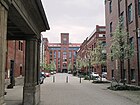
570 | the former local brewery (Patzenhofer) | Sep 15 2001 | The street system is located in Wasserstadt in the Schultheiss district between Eiswerderstrasse and Rosa-Reinglass-Steig. It opens up several building complexes with different access roads and is accessible from Neuendorfer Straße, Eiswerder Straße and Krienickesteig. |
|
| Breubergweg
( Location ) |
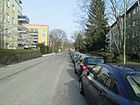
150 | Breuberg , place and castle in the Odenwald, Hesse | Oct 11, 1955 | The path is a dead end from Walldürner Weg to the east. |
|
| Brieselangweg
( Location ) |
210 | Brieselang , former Vorwerk on the Havel Canal | Feb. 1, 1964 | The road, projected as road 43 , lies between Flatower and Hubertusstraße towards the forest. |

|
| Buchenweg
( Location ) |
240 | Beech , deciduous tree | Sep 11 1914 | The Buchenweg lies in the forest settlement between Lichtwarkweg and Fichtenweg. |

|
|
Carossastrasse
( Location ) |
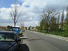
340 | Hans Carossa (1878–1956), medic, poet and storyteller | Feb. 1, 2007 | It is [out of date] still undeveloped in 2012 between Goltzstrasse and Bahmilstrasse in the Maselake Süd quarter of Spandau's Wasserstadt. |
|
| Cautiusstrasse
( Location ) |
760 | Ernst Gottlieb Cautius (1650–1705), Spandau dairy owner and mayor (1703–1705) | May 1, 1965 | The road between Schönwalder Allee and Streitstraße. Previously since 1912 as Reichstrasse , it was renamed in 1965 because the name was identical to other Berlin streets. Cautius had a dairy built in the local area in 1691, which was the starting point for the later settlement. His daughter married a Haake merchant and the company was named "Haakes Meierei"
The St. Lambertus Catholic Community Center is located on Cautiusstraße . |

|
| Chamissostrasse
( Location ) |
430 | Ernst Chamisso de Boncourt (1820–1894), pioneer officer in Spandau | 1900 | The street lies between Streitstrasse and Bamihlstrasse. On the 1907 city map, Klinkestrasse is in the area of Grundrenten Gesellsch. For factories . |

|
|
David-Francke-Strasse
( Location ) |
170 | Johann Gottfried David Francke (1787–1859), owner of a steam powered cutting mill , local politician | June 17, 1997 | The street lies between An der Havelspitze and Hugo-Cassirer-Straße. |

|
| Doehlweg
( Location ) |
60 | Johann Friedrich Doehl (19th century), head of the city council in Spandau from 1843 to 1845 | Apr 21, 1932 | In the forest settlement of Aspenweg to the northwest as a dead end. |

|
|
Oak path
( Location ) |
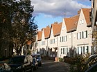
110 | Oak , tree species | Sep 11 1914 | In the forest settlement it connects the ash and acacia path. |
|
| Eiskellerweg
( Location ) |
2440 | Ice cellar , forest and meadow areas, where it is often colder than the surrounding area | Aug 1, 2010 | The street forms the city limits of Berlin and goes off to the west of Schönwalder Allee. It bypasses the Kienhorstsiedlung to the south, runs along the northern edge of the Große Kienheide and then turns south to the city limits. The street is part of the Berlin Wall Trail and the Main Green Trail No. 02. |

|
| Eiswerderstrasse
( Location ) |
1640 | Eiswerder , Havel Island north of the Spandau Citadel | Aug 4, 1960 | This street is between Neuendorfer and Kleine Eiswerderstraße. Noteworthy here is the Seeturm , a high-rise building on the Havel to the west of the Eiswerder Bridge , on the Arnhem Promenade. Up to the bridge it is a quiet residential street, to the old town of Spandau there is a cycle and hiking path along the Havel. A hiking trail leads around the industrial island. |

|
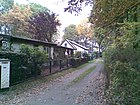
| Elbinger Weg
( Location ) |
140 | Elblag, city in Masuria, since 1945 Elbląg in Poland | March 2012 | The path is in the Hakenfelde housing estate and branches off to the northwest from Stargarder Weg. |
|
| Elkartweg
( Location ) |
700 | Karl Elkart (1880–1959), architect, city planning officer for building construction in the city of Spandau, then city planning director in Berlin and Hanover | Oct 18, 1960 | The path is on the eastern edge of the Hakenfelde housing estate as a dead end and is the access road to the housing estate and the allotment gardens on the Havel, which belong to the sailing clubs and the “Anglerverein Plötze” located here. It continues up to the weekend settlement “Wannseaten 1911”. The small road leads through allotment gardens to the ferry route. At the southern end is the “Glowworm Ground” nature reserve .
The Elkartweg is to be renamed in accordance with the resolution of the Spandau district council from March 2011, as Karl Elkart was involved in the deportation of Polish Jews as Hanover’s city planning officer. The decision has not yet been implemented because the people living along the way have not yet been able to agree on a new name. |

|
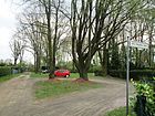
| Ella-Augustin-Platz
( Location ) |
50 × 30 | Ella Augustin († around 1942), a Berlin Jew who was killed in the Sobibor concentration camp during the Nazi era . | March 2012 | The square, marked as a private road, is located in the Hakenfelde housing estate between Johannisburger and Elbinger Weg. It is used as the festival area of the settlement. |
|
| Erlenweg
( Location ) |
140 | Alder , tree species, birch family | 1923 | Located in the forest settlement between Eschenweg and Birkenweg, it was called Weidenweg from 1916 to 1923 . Both tree species grow preferentially in floodplains and on streams. |

|
| Eschenweg
( Location ) |
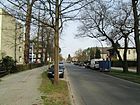
580 | Ash , deciduous tree | Sep 11 1914 | The path in the forest settlement lies between Niederneuendorfer Allee and Pappelweg. |

|
|
Fichtenweg
( Location ) |
320 | Spruce , conifer species | Sep 11 1914 | The path was laid out as one of the first roads in the forest settlement between Eschenweg and Aspenweg.
The chapel of the “St. Elisabeth Seniorenheims “(Fichtenweg / corner Buchenweg) was until the construction of the community center in Cautiusstraße in 1975 the church of the Catholics in Hakenfelde. |

|
| Flatower Street
( Location ) |
910 | Flatow, district of the city of Kremmen (Brandenburg) | Oct 11, 1955 | In 1955 the merging street 10 and street 41 south of the city park were united and named. The road between Brieselangweg and Pausiner Straße continues over the latter to the east as a dead end . |

|
| Franz-Meyer-Strasse
( Location ) |
160 | Franz Meyer, innkeeper and entrepreneur in Spandau | June 17, 1997 | The street in the water town lies between Hugo-Cassirer-Strasse and An der Havelspitze. |

|
| Frieda Arnhem Promenade
( Location ) |
230 | Frieda Arnheim (* 1909; † 1942 in the Riga Ghetto ), clerk and parish assistant, worked in the Confessing Church , resistance fighter against the Nazi regime | Sep 15 2001 | The riverside path on the Havel near the Eiswerder island and Lake Spandau is located in the Schultheiss district of the water town of Oberhavel on the shore between Eiswerderstrasse and Paula-Hirschfeld-Steig. It belongs to the Schultheiss district in the public project “Wasserstadt Spandau”, which was supposed to develop the former industrial wasteland on the Oberhavel. The name Frieda Arnheim was given at the suggestion of the Spandau Jewish History Forum. |
 |
| Fürstenweg
( Location ) |
310 | Prince , high title of nobility | 1906 | The street in the settlement west of Schönwalder Allee is between Radelandstrasse / Hohenzollernring and Kronprinzenstrasse. |

|
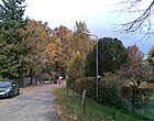
| Fulda way
( Location ) |
320 | Fulda , city in East Hesse | March 2012 | The private road is located in the Hakenfelde housing estate north of Werderstrasse and to the side of “Immenweide”. From Werderstrasse, the path is initially an access road and becomes narrower to the north except for a (signposted) “path” next to the property. |
|
|
Gaismannshofer way
( Location ) |
170 | Gaismannshof , district of Nuremberg , Bavaria | April 16, 1937 | The path goes south from Mögeldorfer Weg. The naming according to Nuremberg districts referred to the "city of the Nazi party rallies of the NSDAP", to which Adolf Hitler had declared Nuremberg in 1933. |

|
| Garmisch way
( Location ) |
510 | Garmisch , Bavarian market town in Werdenfelser Land | March 2012 | The path is south of Werderstrasse along the industrial park. It belongs to the Hakenfelde housing estate and leads close to the Havel. |

|
| Glienstig
( Location ) |
180 | Glien , Brandenburg landscape northeast of Nauen, Brandenburg | Oct 3, 1928 | The road 44 was named in 1928 like other local roads after Havelland places. |

|
| Goltzstrasse
( Location ) |
1050 | Colmar von der Goltz (1843–1916), Prussian field marshal, military historian and writer | 1900 | The street between Streitstrasse and Werderstrasse was named after the chief of the engineer and pioneer corps; the Spandau Pioneer Battalion had its water training area on the Havel. On the 1907 city map, Klinkestrasse is in the area of Grundrenten Gesellsch. For factories . |

|
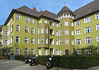
| Grafenwalder Weg
( Location ) |
150 | Grafenwald , part of the Lower Bavarian community of Loiching | Aug 6, 1937 | It lies between Hohenzollernring and Wegscheider Strasse. |
|
| Grünefelder Strasse
( Location ) |
480 | Grünefeld, part of the Havelland municipality Schönwalde-Glien , Brandenburg | Oct 3, 1928 | The road 40 between Radelandstrasse and Hubertusstrasse was named after Havelland towns in this settlement area as well as the surrounding area. |

|
|
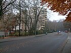
Hakenfelder Strasse
( Location ) |
1400 | Hookfelde area , after which the district is named | Nov 7, 1953 | The street running in an arch from Schönwalder to Niederneuendorfer Allee was formerly the border between arable land and forest and was called Hakenfelde . The name was derived from a dairy built on the outskirts of the city after 1730, which was named "Haackes Meierei" after its owner. The same name with the Spandau district led to the renaming. |
|
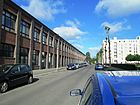
| Hans-Poelzig-Strasse
( Location ) |
140 | Hans Poelzig (1869–1936), architect, painter, set designer and university lecturer | Jan. 29, 1958 | The street in the water town of Oberhavel lies between Hugo-Cassirer- and Sigmund-Bergmann-Straße. |
|
| Havelkaiser Square
( Location ) |
70 × 40 | Havelkaiser , location-specific title of a television film | June 17, 1997 | This town square is located on Hugo-Cassirer-Straße in the water town of Oberhavel. |

|
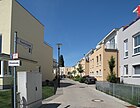
| Havelschanze
( Location ) |
480 | Havelschanze, one of the nine ski jumps in the north of the city and fortress Spandau | Jan. 28, 1958 | The road branches off at Neuendorfer / Streitstrasse eastwards to the Havel. The Askanierring was divided into two sections when the barracks were built in 1937, and in 1958 the northeastern part was given the new name. |
|
| Helen-Keller-Weg
( Location ) |
310 | Helen Keller , American writer | May 26, 2014 | Footpath in the Hakenfelder Wäldchen, which connects Wichernstrasse with Hakenfelder Strasse. It is located on the Spandauer Blindenrundwanderweg. |

|
| Hersfeld Way
( Location ) |
80 | Hersfeld , spa town in northeast Hesse | March 2012 | The private road is located in the Hakenfelde housing estate north of Werderstrasse and goes west from Fuldaer Weg to the gardening school with the goal of Bernkastler Weg. |

|
| Hildesheimer way
( Location ) |
140 | Hildesheim , university town in the south of Lower Saxony | March 2012 | The private road between Marienwerderweg and Masurenweg continues in Stargarder Weg. It is located in the Hakenfelde housing estate north of Werderstrasse. |

|
| Hohenzollernring
( Location ) |
790 (in the district) |
Hohenzollern , German ruling family and former imperial family | April 16, 1909 | The ring-shaped road runs between the district boundary (crossing Radelandstrasse / Fürstenweg) and Streitstrasse. The street is here in the district, the southern properties belong to Spandau . |

|
| Elder path
( Location ) |
250 | Elderberry , honeysuckle as a shrub or subshrub | Nov 26, 1925 | The traffic route laid out as road 77 connects Wichernstrasse and Eschenweg. |

|
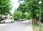
| Hubertusstrasse
( Location ) |
1710 | Hubertus von Liège (around 656–727), Bishop of Maastricht and Liège , saint , patron saint of hunting | 1906 | The north edge of the road between Schönwalder Allee and Krämerweg lies at the Stadtpark-Forst. |
|
| Hugo-Cassirer-Strasse
( Location ) |
520 | Hugo Cassirer (1869–1920), manufacturer (electrical supplier) | June 17, 1997 | The street is located in a densely built-up residential area in the Wasserstadt between An der Havelspitze and Rauchstraße. The idea of building social housing with a view of the water was not realized, but it was built too densely and hardly any shopping opportunities were planned. Subsequent corrections, however, brought generous banks and parks. |

|
|
Ilmenau way
( Location ) |
110 | Goethe and university town of Ilmenau in Thuringia on the northern edge of the Thuringian Forest | March 2012 | The private road is located in the Hakenfelde housing estate north of Werderstrasse and connects Am Haselluch with Fuldaweg. The path leads through the “Immenweidepark” between Stargarder (north) and Rothenburger Weg (south). |

|
| Iznik Street
( Location ) |
90 | İznik , Turkish twin town of the Spandau district | Sep 20 1999 | It is located between Rauchstrasse and Asnièresstrasse in the Spandauer Wasserstadt, Quartier Maselake Nord. The access to Iznikstrasse is via an underpass through Rauchstrasse from Bergmannstrasse. |

|
|
Johannisburger Weg
( Location ) |
120 | Johannisburg in Aschaffenburg, second residence of the Mainz electors and archbishops | March 2012 | The path leads from the Masuria Trail to the northeast. It is located in the Hakenfelde housing estate north of Werderstrasse. |

|
|
Kaiserstrasse
( Location ) |
630 | Emperor , highest secular ruler title | 1906 | The street between Hohenzollernring and Hubertusstraße is located in the 1905/1906 villa district of the city of Spandau with "country house-like buildings". |

|
| Kastanienweg
( Location ) |
60 | Chestnut , tree species, beech family | Feb. 4, 1916 | The road in the Waldsiedlung goes south from Aspenweg and forms a narrow cul-de-sac as access to the two-story houses. |

|
| Ketziner way
( Location ) |
180 | Ketzin , Havelland City, Brandenburg | Feb. 1, 1964 | The former street 42 is located in the residential area south of the city park between Radeland and Flatower Straße, where streets were named after Havelland communities. |

|
| Kleinreuther Weg
( Location ) |
280 | Kleinreuth , district of Nuremberg, Bavaria | April 16, 1937 | The previous street 643 from Mögeldorfer Weg to the north was named in 1937 along with other local streets to Nuremberg districts of the "City of the Nazi Party Rallies ". |

|
| Klingenhofer Steig
( Location ) |
280 | Klingenhof , district of Nuremberg, Bavaria | April 16, 1937 | The street is between Mögeldorfer Weg and Cautiusstraße. The previous street 644 was named in 1937 along with other local streets after Nuremberg districts, in relation to Nuremberg as the "city of the Nazi party rallies ". |

|
| Klinkeplatz
( Location ) |
80 × 80 × 80 triangle |
Karl Klinke (1840–1864), miner, pioneer | March 11, 1937 | The Düppel-Platz with the clinker monument erected since 1908 was renamed in 1937. It is at the intersection of Hohenzollernring and Schönwalder Allee. When storming the Düppeler Schanzen on April 18, 1864, Klinke blew himself up with explosives in the picket fence and thus created a breakthrough. |

|
| Kochemer way
( Location ) |
140 | Cochem , Rhineland-Palatinate city on the Moselle | March 2012 | The private road between Niederneuendorfer Allee and Trabener Weg leads into the Hakenfelde housing estate. |

|
| Koenigstrasse
( Location ) |
510 | King , bearer of monarchical dignity | 1906 | The road between Radelandstrasse and Hubertusstrasse is in the residential area west of Schönwalder Allee. |

|
| Kornburger way
( Location ) |
580 | Kornburg , district of Nuremberg | 23 Sep 1938 | The street is between Wegscheider and Cautiusstraße. The naming of the street 647 in 1937 refers to Nuremberg as the "city of the Nazi party rallies ". |

|
| Krämerweg
( Location ) |
390 | Krämer , forest area south of Kremmen in the Ländchen Glien, Brandenburg | Oct 18, 1937 | It is located between Radelandstrasse and Hubertusstrasse in the settlement south of the city park. At first it was 43 . |

|
| Krienickesteig
( Location ) |
60 | Krienicke, part of the water surface of the Oberhavel north of the citadel | Sep 9 1931 | The previous street 48 was named in this location in the Spandauer Neustadt in 1931. It is north of Triftstraße between the New Apostolic Church building and the old fire station. The extension to the north to the brewery yard is called Rosa-Reinglass-Steig from the fire station . |

|
| Kronprinzenstrasse
( Location ) |
920 | Crown Prince , heir to the throne in kingdoms | 1906 | In the residential area west of Schönwalder Allee from 1905/1906, several streets bear names related to the emperor from the Hohenzollern family. The street lies between Schönwalder Allee and Paarener Straße. |

|
| Kul Movement
( Location ) |
310 | C. Kulbe, fire chief in Spandau | Apr 1, 1962 | The residential street goes off to the west of Goltzstrasse. |

|
|
Lauterbacher way
( Location ) |
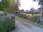
220 | Lauterbach , East Hessian city (Vogelsbergkreis) | March 2012 | The private road is in the Hakenfelde housing estate north of Werderstrasse between Fuldaer Weg and over Schönauer Weg to the Glowworm Ground. |
|
| Lichtwarkweg
( Location ) |
380 | Alfred Lichtwark (1852–1914), art historian, museum director and art educator | Nov 8, 1955 | The road in the forest settlement lies between Aspen- and Eschenweg and is built on the west side, the opposite side is a fenced off forest. To the south there will be a path between fenced-in properties on the east side of which the property of the "open prison hook field" is adjacent. |

|
| Liegnitzer Weg
( Location ) |
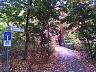
360 | Liegnitz, Lower Silesian city, since 1945 as Legnica to Poland | March 2012 | The path is located in the southeast of the Hakenfelde housing estate to the north, parallel to Werderstraße, going off on both sides of the Elkartweg. |
|
| Lindenweg
( Location ) |
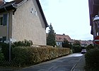
90 | Linden , deciduous tree | Feb. 4, 1916 | The road in the forest settlement lies between Aspen- and Tannenweg. |
|
| Linumer Street
( Location ) |
170 | Linum , part of the municipality of Fehrbellin, Brandenburg | Oct 11, 1955 | The street that branches off from Pausiner Straße was laid out in the 1930s as Straße 13a and, like several streets in this settlement area, was named after Brandenburg municipalities. |

|
|
Marienwerder way
( Location ) |
220 | Marienwerder, town in Pomerania on the Vistula, since 1945 as Kwidzyn to Poland | March 2012 | The path between Kochemer and Masurenweg, to the KGA 'Gesundheitspflege', is in the Hakenfelde housing estate north of Werderstraße |

|
| Marwitzer Strasse
( Location ) |
800 | Marwitz , municipality in Oberhavel, Brandenburg | Oct 3, 1928 | The street, laid out as street 11 according to the development plan , runs between Königstraße and Schwanter Weg. |

|
| Maselakeweg *
( Location ) |
400 | Maselake, bay of the Havel to the west at the level of the Kleiner Wall | March 11, 1937 | It is an unofficial name for the route from Rauchstraße (to Sigmund-Bergmann-Straße) through the Havelwiesen to Maselakebucht parallel to Hugo-Cassirer-Straße. The built-up Klinkestrasse was located in this street . |

|
| Masuria Trail
( Location ) |
230 | Masuria , region in East Prussia, since 1945 part of Poland | March 2012 | The private road is located in the Hakenfelde housing estate between Marienwerder- and Hildesheimer / Elbinger Weg. |

|
| Merianweg
( Location ) |
180 | Matthäus Merian the Elder (1593–1650), engraver and publisher | Nov 8, 1955 | The road between Aspen- and Pappelweg lies on the northern edge of the forest settlement, it was first called Road 634 . A 30-volume Topographia of Europe was published by Merians Verlag from 1642 to 1688 , including the oldest view of the city and fortress of Spandau from around 1645. |

|
| Mertensstrasse
( Location ) |
1020 | Friedrich Wilhelm August Mertens (19th century), military, engineer and honorary citizen of Spandau | 1900 | The road runs between Hakenfelder Strasse and Goltzstrasse and on to the Havel. It was laid out around 1900, when the surrounding area emerged as the Spandau industrial quarter. Since the water training area for the pioneer troops was on the Havel, several streets here bear the names of Spandau pioneers. On the 1907 city map, Mertensstrasse is in the northern section of the Grundrenten Gesellsch site. For factories . |

|
| Michelstadt way
( Location ) |
800 | Michelstadt , Hessian climatic health resort in the Odenwald | Sep 9 1931 | The street is between Wansdorfer Platz and Hakenfelder Straße. It was laid out in 1912 as Oldenburgstrasse in the planned state district. |

|
| Mittenwald way
( Location ) |
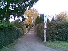
230 | Mittenwald , Upper Bavarian market near Garmisch-Partenkirchen in the upper Isar valley | March 2012 | The private road is located in the Hakenfelde housing estate south of Werderstrasse and north of Garmischer Weg. |
|
| Mögeldorfer Weg
( Location ) |
500 | Mögeldorf , district of Nuremberg, Bavaria | April 16, 1937 | First street 645 it was named in 1937 with reference to the "City of the Reich Party Rallies" Nuremberg. It is located between Schönwalder Allee and Kornburger Weg, partially interrupted by footpaths and cycle paths. |

|
|
Nachtweideweg
( Location ) |
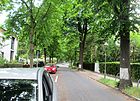
910 | Nachtweide , night pasture for the cattle ( "installation location") | Dec. 1, 1965 | The street in the villa district from 1900 lies between Schönwalder Allee and across Königstraße as a dead end . In 1965, the Markgrafenstraße was renamed because the name appeared several times in Berlin. |
|
| Neuenahrer way
( Location ) |
390 | Neuenahr , health resort and district of Bad Neuenahr-Ahrweiler in Rhineland-Palatinate (Ahrtal) | March 2012 | The private road lies between Marienwerder Weg and Niederneuendorfer Allee in the Hakenfelde housing estate. There is a paved access road to the settlement. |

|
| Neuendorfer Strasse
( Location ) |
1040 (in the district) |
Neuendorf , northern neighbor, since 1923 part of Hennigsdorf | before 1800 | This street lies between Falkenseer Platz and Havelschanze, the Streitstraße leads the street further north. It is the historical route to Oranienburg (originally Neuendorffischer Weg ), the course has been changed due to development (see historical map ). In 1961 the Hafenplatz was included. |

|
| Niederheideweg
( Location ) |
1240 | Niederheide, part of the Spandau city forest | July 30, 1962 | It is located between Radelandstrasse and as a dead end over the Sandwiesenweg. |

|
| Niederneuendorfer Allee
( Location ) |
2950 (in the district) |
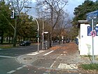
Nieder Neuendorf , northern neighbor, since 1923 part of Hennigsdorf | 1912 | The avenue lies between Mertensstrasse and the city limits to Hennigsdorf, it extends the Streitstrasse to the north and leads for the most part through the Spandau Forest. |
|
|
Oberjägerweg
( Location ) |
1050 (in the district) |
Oberjäger , non-commissioned officer of the hunters, later mountain troops | before 1888 | The officially managed path without associated land is located in the Berlin Forest in the north of the district from Schönwalder Allee to the northeast and continues across the city limits in Hennigsdorf . It is a real forest road. |

|
|
Paarener Street
( Location ) |
390 | Couples , Havelland community, Brandenburg | Oct 3, 1928 | Originated as Straße 6 , it is located between Radelandstraße and Hubertusstraße. |

|
| Papenberger way
( Location ) |
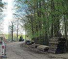
1610 | Papenberge, elevation north of Spandau | Apr 18, 1962 | It is located as a cul-de-sac outside the town to the east of Niederneuendorfer Allee. The access road to the BEWAG Oberhavel power plant, which was newly laid out during the construction in 1962, bears the name of a road that was abandoned by construction. The eponymous "Babenberg" was mentioned in the founding document of 1232 as the northern border of the city of Spandau. |
|
| Poplar Path
( Location ) |
540 | Poplar , deciduous tree | 1923 | When the forest settlement was expanded in 1923, the newly laid streets were also named after tree species. The road between Wichernstrasse and Merianweg forms the north-western edge of the settlement. |

|
| Parkstrasse
( Location ) |
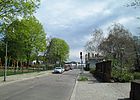
300 | Schützenpark , the local area of the shooting club | 1901 | The street goes from Neuendorfer Straße to the east and ends in an industrial area. Between 1860 and 1901 this street in the "Spandauer Neustadt" was called An der Havel . |
|
| Paula-Hirschfeld-Steig
( Location ) |
170 | Paula Hirschfeld (1871–1943) last lived in Spandau at Markt 11, murdered in Theresienstadt, victim of the Nazi regime | Sep 15 2001 | The street is located on the site of the former Schultheiss brewery in the Wasserstadt between Neuendorfer Straße and Rosa-Reinglass-Steig and was named at the suggestion of the “Forum Jewish History Spandau”. |

|
| Pausiner Strasse
( Location ) |
480 | Pausin , Havelland municipality, today part of Schönwalde-Glien, Brandenburg | Oct 3, 1928 | The street, first street 5 according to the development plan, lies in the settlement south of the city park between and between Radelandstrasse and Hubertusstrasse. |

|
| Pepita promenade
( Location ) |
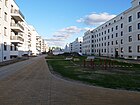
Pepita de Oliva , dancer who lived in a castle in Hakenfelde in the 1850s | 1st May 2018 | The streets lead from Mertensstraße and open up the new Pepitahöfe development area, which will be completed from June 2018 . |
|
|
| Place E
( Location ) |
80 × 30 | Zoning plan with letters for places | after 1950 | The square is between Krämerweg, Flatower Straße and Gliensteig with lots 2–14 (even) and 3–15 (odd). |

|
| Prinz-Adalbert-Weg
( Location ) |
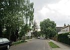
140 | Adalbert von Prussia (1884–1948), prince and officer, son of Kaiser Wilhelm II. | 1906 | In the villa settlement from 1905/1906 it is between Kaiserstrasse and Königstrasse. |
|
| Prince Vain Way
( Location ) |
130 | Eitel Friedrich von Prussia (1883–1942), prince and officer, son of Kaiser Wilhelm II. | 1906 | In the villa settlement from 1905/1906 it is between Kaiserstrasse and Königstrasse. |

|
|
Radelandstrasse
( Location ) |
3320 (in the district) |
Radeland = cleared land | after 1870 | The Radelandstraße runs between Hohenzollernring (east) and Griesingerstraße (west). The entire road area as well as all northern properties and the south side with the cemetery In den Kisseln and the Spandau waterworks (numbers 39–129) as well as the “Evangelical Forest Hospital Spandau” (numbers 207–265) belong to Hakenfelde. The omitted numbers are in the Falkenhagener Feld district .
In the western section, the road is an unpaved road that becomes a pedestrian and cycle path in the forest up to the city limits. |

|
| Rauchstrasse
( Location ) |
880 | Johann Georg Gustav von Rauch (1774–1841), Inspector General for the Prussian fortresses, Minister of War | 1900 | The Rauchstrasse lies between Streitstrasse and the district boundary on the Wasserstadtbrücke, it is extended to the east by Haselhorster Daumstrasse. It has the status of a main thoroughfare. The streets in the area are named after officers of the Spandau Pioneer Battalion von Rauch, and their water training area was nearby. |

|
| Reussstrasse
( Location ) |
210 | Principality of Reuss , two member states of the German Empire | March 20, 1912 | From 1914, a quarter was planned here, the streets of which were to be named after member states of the German Empire. Only the Reussstraße between Streitstraße and Schwendyweg kept its name, the award was made by decision of the Spandau police administration on March 20, 1912. |

|
| Rosa clean glass riser
( Location ) |
80 + 220 | Rosa Reinglass, (1874–) 1944, Protestant, persecuted by the Nazi regime because of her Jewish origins and murdered in 1944 | Sep 15 2001 | The trail lies between Krienickesteig as its extension and the brewery yard in the water town of Oberhavel. |

|
| Rothenburg Way
( Location ) |
210 | Rothenburg adOder, Lower Silesian city, since 1945 Czerwieńsk near Zielona Góra Poland | March 2012 | The private road is in the Hakenfelde housing estate and between Am Haselluch and Schönauer Weg south of the Immenweide. |

|
| Rustweg
( Location ) |
520 | Rustwiesen, field name | Sep 9 1931 | The traffic route, first street 69 , is located east of the Spandau city forest between Niederneuendorfer Allee and as a dead end via Zu den Fichtewiesen to the Havel. |

|
|
Salzunger way
( Location ) |
270 | Salzungen , Thuringian spa town on the middle course of the Werra | March 2012 | The private road is a driveway in the Hakenfelde housing estate, connecting to Werderstrasse south of Schützenhof and the gardening school on both sides. |

|
| Sandwiesenweg
( Location ) |
400 | Sand meadows, field name mentioned as early as 1728 | July 30, 1962 | It is located north of Radelandstrasse and Niederheideweg on the western edge of the KGA 'Sandwiesen'. |

|
| Schäferstrasse
( Location ) |
370 | Way to the municipal sheep farm (combing pre-works sheep farm ) | 1878 | In the Spandauer Neustadt, this old path up to the fortification was called Schäferweg , it lies between Neuendorfer and Schützenstraße. On the Havel there was a wood depot of the municipal forest administration and was called "Ablage Schafstall". |

|
| Schlehenweg
( Location ) |
550 | Sloes , shrubs and trees of the stone fruit family | Jan. 12, 1925 | When the forest settlement was expanded, the road was laid out in 1925 between Wichernstrasse and Eschenweg. |

|
| Schnepfenreuther way
( Location ) |
760 | Schnepfenreuth , district of Nuremberg, Bavaria | 23 Sep 1938 | In this quarter with streets named after districts of Nuremberg, the choice was made with reference to the then addition "City of the Nazi Party Rallies". The Schnepfenreuther Weg lies between Hohenzollernring and Cautiusstraße. The first name in the city park settlement was Street 646 . |

|
| Schönauer way
( Location ) |
260 | Schönau, Lower Silesian village, since 1945 Łąkotka near Legnica , Poland | March 2012 | The path is a private road in the Hakenfelde housing estate between Fuldaer and Elkartweg, with the access road at Rothenburger Weg merging into a driveway between “Immenweide” and “Glühwürmchengrund”. There is also a Schönauer Platz on Schönower Weg, but it does not officially bear his name. |

|
| Schönwalder Allee
( Location ) |
5850 | Schönwalde , Havelland municipality, Brandenburg. | 1907 | It is located between Klinkeplatz on the Hohenzollernring and the city limits. A country road led through the Spandauer Stadtforst to the neighboring town of Schönwalde, which was expanded into a Chaussee in the 19th century and was given the name Schönwalder Allee in 1907. Except for a small section in the Spandau district of Hakenfelde, the road runs as a paved road through the Spandau Forest. There are some parking spaces from which the Spandau Forest can be reached. The game reserve with nature trail and the Johannesstift are particularly worth seeing . A circular route on both sides of the Kuhlake is highly recommended. The path begins and ends at the game reserve. |

|
| Schützenstrasse
( Location ) |
330 | Rifle guild in Spandau | around 1870 | The street is between Schäferstrasse and Neuendorfer Strasse. Around 1864 the street Am Schützengarten was drawn in here. |

|
| Schwanter way
( Location ) |
390 | Schwante , place in the Oberhavel district, Brandenburg | May 19, 1959 | First street 7 , it is between Radelandstraße and Hubertusstraße in the housing estate south of the Stadtforst and the municipal cemetery In den Kisseln . |

|
| Schwendyweg
( Location ) |
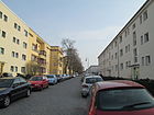
430 | Johann Sigismund Freiherr von Schwendy (1656–1732), Lieutenant General, Governor of Spandau | Sep 9 1931 | The street between Wansdorfer Platz and Cautiusstraße is in the Stadtparkiedlung and was first called Straße 48 . |
|
| Sigmund-Bergmann-Strasse
( Location ) |
380 | Sigmund Bergmann (1851–1927), electrical engineer and entrepreneur | 17 Sep 1997 | The street between Iznikstraße and Hugo-Cassirer-Straße is in the water town of Oberhavel. |

|
| Stargarder way
( Location ) |
230 | Stargard , Prussian Stargard (with reference to Elblag), Pomeranian city near Gdansk, Poland | March 2012 | The private road is a wide driveway in the Hakenfelde housing estate southeast between Elbinger Weg and Elkartweg. |

|
| Streitstrasse
( Location ) |
1260 | Guido Alexander von Streit (1813–1904), Prussian major general, commander and honorary citizen of Spandau | 1878 | The road between Havelschanze and Mertensstraße lies in the course of the historic street to Nieder Neuendorf , Neuendorfer Straße connects to the south and Niederneuendorfer Allee to the north. Before the fortification in 1878, it was a birch-lined sandy path. The 1938-1942 according to plans by Hans Hertlein to Maselakepark out built Luftfahrtgerätewerk of Siemens & Halske (LGW hook field) now houses the after poet Hans Carossa named Carossa-Quartier u. a. numerous shops, a casino, an employment agency and a mosque . |

|
|
Tannenweg
( Location ) |
230 | Fir , conifer | Sep 11 1914 | The road in the forest settlement lies between Eschenweg and Lindenweg. |

|
| Trabener way
( Location ) |
150 | Traben , Rhineland-Palatinate city on the Middle Moselle | March 2012 | The private road is an access route to the Hakenfelde housing estate between Niederneuendorfer Allee and Marienwerderweg. |

|
|
Waldenburger way
( Location ) |
470 | Waldenburg (Wałbrzych) , Lower Silesian city near Wroclaw, Poland | March 2012 | The private road is located in the Hakenfelde housing estate north of Werderstrasse between Schönauer and Elkartweg. The path is signposted, but overgrown and only a path in front of the property north of the open space of the "Immenweide" of 80 meters is recognizable as a path. With the re-marking in the settlement, the route has been upgraded. |

|
| Walldürner way
( Location ) |
440 | Walldürn , town in the Neckar-Odenwald district, Baden-Wuerttemberg | Oct 11, 1955 | The street, first street 637 , lies in the arch between Cautiusstraße and Michelstadter Weg, before it was named it belonged to the settlement south of the Waldviertel. |

|
| Wansdorfer Platz
( Location ) |
110 × 60 | Wansdorf , neighboring municipality of Hakenfelde in the Havelland | Nov 23, 1931 | From the square, Michelstadter Straße and Schwendyweg lead north on both sides of the square, from the center of the square to the south is the Wansdorfer Steig. |

|
| Wansdorfer Steig
( Location ) |
230 | Wansdorf , neighboring municipality in the Havelland, today part of the neighboring town of Schönwalde-Glien | Nov 23, 1931 | The street between Hohenzollernring and Wansdorfer Platz was laid out in 1913 as Strelitzstraße on the route of Straße 55 . In 1931 it was renamed because the completion of the district with streets according to states of the German Empire had been abandoned by the First World War. |

|
| Wegscheider Street
( Location ) |
510 | Wegscheid is a Lower Bavarian market near Passau . | Aug 6, 1937 | The street lies between Streitstraße and across Schnepfenreuther Weg. In the planned residential area (federal state district) the street was named as Württembergstraße in 1912 , this name was canceled in 1937 and the current street was laid out in the course of the project. |

|
| Werderstrasse
( Location ) |
1050 | August von Werder (1808–1887), Prussian general, head of the Guard Fortress Artillery Regiment stationed in Spandau | April 16, 1909 | Laid out as Straße 13 in the industrial district of the Havel, it runs between Niederneuendorfer Allee and Goltzstraße, beyond this as a dead end . In 1943 there was still no development here. It borders the Hakenfelde housing estate to the south and provides access to Garmischer and Mittenwalder Weg. |

|
| Wichernstrasse
( Location ) |
1700 | Johann Hinrich Wichern (1808–1881), theologian and founder of the Spandauer Johannesstift | April 16, 1909 | The street lies between Niederneuendorfer Allee and Pappelweg. The Protestant Wichernkirche is in the street . |

|
| Wilderness way
( Location ) |
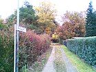
240 | Wildungen , North Hessian spa town near Kassel | March 2012 | The private road is located in the Hakenfelde housing estate north of Werderstrasse and branches off to the east from Fuldaer Weg and opens up properties south of the Glowworm Ground. |
|
| Hookfelde housing estate
( Location ) |
- (distributed plots) |
Housing estate in the district | after 1990 | Plots 37z, south of Werderstrasse and 778z, north of Bertricher Weg, are officially listed separately as the "Hookfelde housing estate", regardless of the other street allocation of the plots. However, they are also address objects in the area of this settlement, which were left over when the street names were assigned in the further area and therefore received this special status. The name of the housing estate was already given when the status was changed. |

|
| Wormditter way
( Location ) |
70 | Wormditt, town in the province of East Prussia, since 1945 Orneta in Poland | March 2012 | The path is in the Hakenfelde housing estate, goes south-east from Marienwerder Weg and opens up properties there. |

|
|
To the spruce meadows
( Location ) |
230 | Spruce meadows , field name and local sports facility of the workers' sports club | Dec. 4, 1996 | The street lies between Aalemannufer and Rustweg. |

|
| To the old lido
( Location ) |
200 | Lido, the seat of Wasserfreunde Spandau 04 since the late 1990s | Feb. 1, 2007 | The traffic route is south of the Havelschanze going off on the Havel. |

|
| To the Alder Ground
( Location ) |
440 | Erlengrund , field name, | Jan. 27, 1997 | The road lies between Rustweg and Aalemannufer. |

|
Planned and former streets
In the district there are several settlement areas with their own names, which have grown historically and were later partially expanded. The most recent changes in the street directory were made in the Hakenfelde housing estate , the names of which were chosen by the residents but incorporated into the official statistics in coordination with the Spandau district. In the 1943 address book, a colony of arbors is recorded for the property at Nieder-Neuendorfer Allee 11a north of Werderstrasse. The Schützenhof of the Schützengilde Spandau, construction sites and then forest area lay as far as the Aalemannufer. The gardening school in the southwest of the site was created according to their own statements on a rubble site. The allotment gardens between Niederneuendorfer Allee and Havel, as well as Rustweg ( Aalemannkanal ) and south of Werderstrasse have different statuses, some as settlement areas that are subject to the Federal Allotment Garden Act. It should be noted that in the plans to implement the Transrapid from the 1990s, there was a variant that would have led over this site.
| Historical names | from | to | renamed | Notes including origin of name |
|---|---|---|---|---|
| Ahornweg | Feb. 4, 1916 | Sep 9 1931 | → Aspenweg | Maple is a type of tree that is used as timber . The path lies in the forest settlement built between 1914 and 1916, in which almost all streets are named after tree species. The name was changed to Aspenweg with the first action to remove the same street names several times by creating Greater Berlin . |
| At the Schützengarten | around 1864 | around 1870 | → Schützenstrasse | The street was on the way from the beer garden of the Schützenhaus to Spandauer Neustadt. |
| On the Havel | around 1860 | 1901 | → Parkstrasse | The street led from the main street to the bank of the Havel . |
| At the port | 1930 | canceled | The road led to the port on the Havel , but was built over. | |
| Bayernstrasse | March 20, 1912 | 19 Sep 1931 | → Amorbacher Weg | Bavaria is a German federal state (at the time it was named kingdom), which gave the street 30 its name. Before the First World War, a “federal state district” with street names according to German states and parts of the country was to be laid out here. Since only a few of the planned streets were actually built, they were later renamed. |
| Elsassstrasse | before 1915 | before 1938 | canceled | Before the First World War, Alsace was part of the German Empire. The street named after it belonged to a projected residential area in the southern part of the current district. The name was changed in favor of Elsaßstrasse in Weißensee |
| Gothastrasse | 1912 | Aug 6, 1937 | → Grafenwalder Weg | Named after the Duchy of Gotha as a federal state in the North German Confederation and the Empire. In the north of Spandau between Streitstrasse and Schönwalder Allee, a new district (federal state district) was planned before the First World War . The streets so named were mostly only named and not laid out were later renamed . Gothastraße was one of the few that was laid out and renamed Grafenwalder Weg on August 6, 1937. |
| Hook field | around 1880 | Nov 7, 1953 | → Hakenfelder Strasse | The street, laid out in the 19th century, was named Hakenfelde around 1880 after the area that gave the district its name. It ran on the border between farmland and forest. To avoid mistakes it was renamed Hookfelder Straße in 1953. |
| Klinkestrasse | 1904 | March 11, 1937 | → Maselakeweg | Carl Klinke (1840–1864), Prussian pioneer, who is said to have blown a hole in the palisade wall and himself into the air with a sack of powder in the Danish bulwark of Schanze II in the Battle of Düppel. The road was lifted by the construction of barracks and after its demolition the Maselakepark is located here. On the 1907 city map, Klinkestrasse is in the area of Grundrenten Gesellsch. For factories . |
| Lothringenstrasse | before 1915 | after 1934 | canceled | Before the First World War, Lorraine belonged to the German Empire. The street named after it was part of a projected residential area in the southern area of today's district. The name was changed in favor of Elsaßstrasse in Weißensee |
| Markgrafenstrasse | 1906 | Dec. 1, 1965 | → Nachtweideweg | In the vicinity of Königstrasse and Kronprinzenstrasse, the street was chosen after the Margrave , the title for a count as royal office bearer. The repeated presence of this street name in Berlin led to the renaming in 1965. |
| Nieder-Neuendorfer Weg | before 1922 | after 1943 | canceled | The path through the Spandauer Forest leading to Nieder-Neuendorf left Niederneuendorfer Allee and was vacant in 1922. In 1943 it ran from Niederneuendorfer Allee over the Teufelseekanal and the (old) Papenburger Weg to the forest. It formed the access to the Bürgerablage and the border to the Nieder-Neuendorf district. On the left side were the plots 1–7 (odd) and on the right side the numbers 2–6 (even) and the Johannesstift. According to the description, it ran in an arc south around the Devil's Break NSG. |
| Oldenburgstrasse | March 20, 1912 | Sep 9 1931 | → Michelstadter Weg | Oldenburg is a historical territory and free state in northwest Germany, which gave the road 40 . Before the First World War, a “federal state district” with street names according to German states and parts of the country was to be laid out here. Since only a few of the planned streets were actually built, they were mostly renamed again later. |
| Papenberger way | Nov 23, 1931 | 1959 | canceled | The street named after the Papenberge, an elevation north of Spandau, was built over. The name was reassigned when the Oberhavel power plant was built. |
| Reichstrasse | March 20, 1912 | May 1, 1965 | → Cautiusstrasse | The formation of the German Empire in 1871 gave its name to Straße 8 and Straße 9 , which were combined in the Hakenfelde area in 1912, and promoted the naming of sub-states in the new city district planned in 1912. Because of the risk of confusion with the Reichsstraße in Charlottenburg, the name was changed in 1965. |
| Schanzenstrasse | around 1880 | 1971 | canceled | As a fortress, Spandau was surrounded by nine entrenchments and the originally planned road was built over. |
| Strelitzstrasse | Apr 10, 1913 | Nov 23, 1931 | → Wansdorfer Steig | The street 55 was named after Strelitz and planned as part of the "federal state quarter". The completion of this planning was interrupted by the First World War, so it was renamed in 1931 (especially since Strelitz was no longer a federal state). |
| Württembergstrasse | 1912 | Aug 6, 1937 | → Wegscheider Strasse | The street named after the Kingdom of Württemberg in the new residential area (federal state district) planned before the First World War remained unfinished and was then canceled or renamed. |
| Pasture path | 1916 | 1923 | → Erlenweg | The street lies in the forest settlement of Hakenfelde; Willows prefer moist soils. |
Other locations of Hakenfelde
Allotment colonies
Allotment garden facilities (KGA) included in Berlin's allotment garden development plan are listed below. Some KGAn have been converted into weekend settlements, such as the 'Kolonie Sportanglerverein Aale' ( location ). On November 6, 1990, it was given the status of 'Aale sport fishing club weekend settlement'. These are subject to other restrictions and are also not permanent settlements, like certain properties in the area of the Hakenfelde housing estate . In the 2010s, addresses were often defined for large garden and residential complexes via adjacent public roads with internal route designations and parcel numbers. Such an address form cannot be georeferenced ; according to federal law, Berlin must introduce the ALKIS program system into the existing real estate cadastre . A “unique address with house number” is required for a “georeferenced building address”. In the district, new street names were assigned in coordination with the residents and owners, whereby the planning process also checked whether these new street names are unambiguous in the urban area (of the state) of Berlin . In the district, this concerned the "Hookfelde Housing Estate".
Historically noteworthy are the two KGAn Fichtewiese and Erlengrund , which existed as exclaves during the time of the Wall and which became the Erlengrund weekend settlement on August 10, 1988. Until 1988, these gardens could only be reached via unusual routes.
- Overview
| Name of the KGA | location | status | Comments (number of parcels, area) |
|---|---|---|---|
| 'To the oaks' (Radelandstrasse 24) | location | Permanent allotment garden | 21 plots on 9,381 m² of land owned by the state. |
| 'Tree nursery' (Niederheideweg 53) | location | KGA | 44 plots on 15,575 m² of land owned by the state. |
| 'Kleckersdorf' (Neuendorfer Strasse 62) | location | Permanent allotment garden | 69 plots on 21,010 m² of land owned by the state. |
| 'Radeland' (Radelandstrasse 122) (allotment park) |
location | Permanent allotment garden | 147 parcels on 81,809 m² of land owned by the state. |
| 'Niederheideweg' (Niederheideweg 51) | location | Permanent allotment garden | 26 parcels on 8,672 m² of land owned by the state. |
| 'Niederneuendorfer Allee' (Niederneuendorfer Allee 55-58A) | location | Permanent allotment garden | 13 plots on 4,900 m² of private leasehold. |
| 'Sandwiesen' (Radelandstrasse 150) | location | Permanent allotment garden | 217 parcels on 117,025 m² of land owned by the state. |
| 'Waldessaum' (Niederheideweg 5) | location | Permanent allotment garden | 86 plots on 40,980 m² of land owned by the state. |
| 'Waldfrieden' (Niederheideweg 25) | location | Permanent allotment garden | 180 plots on 104,805 m² of land owned by the state. |
Other colonies in the district are located on or near the Havel with the status of a weekend settlement ; these are not subject to the Federal Allotment Garden Act . This area has been developed as a recreation area by Spandau residents since the beginning of the 20th century.
- To the north of the Aalemann Canal is the weekend settlement 'Sportverein Aalemann' ( location )
- South of the Aalemann Canal to Werderstrasse from north to south
- Weekend settlement 'Wannseeaten 1911' ( location )
- Weekend resort, Association for Health Care '( situation ), founded in 1884
- Weekend settlement 'Nordstern' with the sailing club ( location )
- WES fishing club 'Roach' ( location )
- Weekend settlement 'Water Sports Club Am Rust' ( location )
- Weekend settlement 'Frühauf Oberhavel and Aalemann' ( location )
- Weekend settlement 'sport fishing club' ( location )
- Weekend settlement 'Anglerverein Einigkeit' ( location )
- Weekend settlement 'Am Fährweg' ( location )
- Weekend settlement 'Am Bullenweg' ( location )
- 'Eiswerder' weekend settlement ( location )
- Weekend settlement 'Wilhelmsruh' ( location )
- Weekend settlement 'Maselake' ( location )
- Fichtewiese weekend settlement around the central pond ( location ) with around 40 settlers on 35,800 m²
- Weekend settlement Erlengrund around the Erlengrund pond ( location ) with around 30 settlers on 6,182 m²
- Kienhorstsiedlung ( location ) between Eiskellerweg and the city limits on the former Neuenniederdorfer Canal with around 50 settlers on almost 50,000 m².
Parks and green spaces
In the district there are parks and public recreational areas, some of which are linked to properties marked in the statistics. Two thirds of Hakenfelde consist of the Spandau Forest.
- Bürgerablage ( location ), 5585 m²
- Eiskeller ( location ), with the property 1Z (continuous) is located in the northwest of the district.
- Eiswerder ( location ), 142,274 m², island in the Havel between Eiswerderbrücke and small Eiswerdebrücke to Haselhorst.
- Eiswerderpark ( location ), 10,762 m²
- Großer Wall ( location ), island of the Havel with 3,030 m²
- Havelwiesen ( location ) 21,495 m²
- Hohenzollernpark ( location ) At the east end of the Hohenzollernring, along the northern port of Spandau and the Maselakepark 7,457 m²
- Dog walking area Stadtpark ( location )
- Kleiner Wall (love island) ( location ), island of the Havel with 2,226 m²
- Maselakepark ( location ) On the Maselake, north of the northern port of Spandau, 68,904 m²
- Mittelheide ( location )
- Pioneer island ( location ), island of the Havel with 3,544 m²
- Sports park ( location )
See also
literature
- Gesellschaft Wirtschaftshof Spandau eV (Hrsg.): Street chronicle with guide through the Spandau economy . H. Born & Co Spandau, Berlin 1957.
Web links
- kaupert media: Hakenfelde , accessed on October 24, 2011.
- Prussian military center Spandau at the confluence of the Spree and Havel rivers. (PDF; 3.2 MB) Exhibition on the museum ship “Kurier” in the historic port of Berlin, 2007, archived from the original on February 14, 2010 ; Retrieved January 30, 2011 .
- Office for Statistics Berlin-Brandenburg: List of streets and squares in the Spandau district (as of February 2015); pdf
- Map of Berlin 1: 5000 with district boundaries. Senate Department for Urban Development Berlin, 2009, accessed on October 11, 2012 .
- Surveying map from 1938 - Spandau, Reinickendorf, Osthavelland district - 1: 10000. Surveying Office Berlin-Spandau, 1938, accessed on November 1, 2011 .
- Surveying map from 1938 - Spandau, Charlottenburg, Wilmersdorf, Osthavelland district - 1: 10000. Surveying Office Berlin-Spandau, 1938, accessed on November 1, 2011 .
- Surveying map from 1936 - Part IV - 1: 4000. (Spandau old town to Ruhleben and Haselhorst). Berlin-Spandau surveying office, 1936, accessed on November 1, 2011 .
- Information on the former exclaves Eiskeller, Fichtewiesen and Ertlengrund
- Map for the exchange of territory of the exclaves (PDF; 3.8 MB)
- Streets in the forest settlement of Hakenfelde (pdf; 2.1 MB)
Remarks
- ↑ a b c d e f g h i j k l m n o p q r s t u v w x y z aa ab ac ad The streets in the "Wohnsiedlung Hakenfelde" are officially recorded and private streets are signposted by the district . This area (size of the enclosed area: 283,514 m²) is not subject to the Federal Allotment Garden Act and is looked after by the association of local settlers. The local area includes the “Haselluch” (9,369 m²), ponds at the “Immenweide” (9,889 m²) and the glow worm ground (4,150 m²). These areas are partially fenced in and are treated and used separately (hook field gardening school). In addition to weekend users, residents with permanent right of residence also settle here. After the Second World War, the settlement was (at least) expanded for displaced persons , and these settlers have had permanent right of residence on their property since then. The streets of the Hakenfelde housing estate are included in the LOR statistics list from June 2012. In coordination between the settlement association and the Spandau district, the settlement area was structured according to the requirements of the 2010s. The street names are outdated and were used and applied by the property users based on their imagination. With the district definition and the signage carried out by the district office, the existing properties were partially renumbered.
- ↑ a b Fictitious permanent allotment gardens which, according to the FNP, are to be used for another purpose, but there are development plans to secure them as permanent allotments that are still to be decided.
- ↑ a b c Allotment garden areas that were established after the BKleingG came into force and are therefore not fictitious permanent allotment gardens, but should be retained according to the FNP.
- ↑ a b c d Fictitious permanent allotment gardens according to §§ 16 and 20 a BKleingG, protected by the representation in the FNP as green area / allotment gardens.
Individual evidence
- ^ Map of the country initially Berlin . Verlag d.Königl.Preuß.Landes -aufnahme, Spandau around 1869 ( Memento from October 9, 2014 in the web archive archive.today )
- ^ Surroundings of Berlin. Bibliographical Institute in Leipzig, Spandau around 1894 ( Memento from October 9, 2014 in the web archive archive.today )
- ↑ Berlin and the surrounding area . FA Brockhaus' Geogr.-artist. Institution, Leipzig, Spandau around 1899 ( Memento from October 9, 2014 in the web archive archive.today )
- ↑ a b c d e f Supplement to the address book for Berlin and its suburbs in 1907
- ↑ berlinonline.de: Hakenfelde.html
- ↑ a b c d e f g h i j k l m n o p q r s t u v w x y z aa ab ac ad Clarifications on the situation with a map of Berlin 1: 5000 (K5 color edition) of the surveying offices of Berlin ( FIS Broker)
- ↑ FIS broker map display detail network Berlin
- ↑ Gardening School Hakenfelde (php)
- ↑ School Environment Center Spandau, "Hookfelde Gardening School"
- ↑ Am Wasserbogen, Berlin-Spandau , on berliner-stadtplan.com
- ↑ Bamihlstrasse , on berlin.kauperts.de
- ↑ Chamissostraße , on berlin.kauperts.de
- ^ David-Francke-Straße , on berlin.kauperts.de
- ↑ berliner-stadtplan.com: Eiswerderstrasse in Berlin-Spandau
- ↑ A barrier to keep car traffic out of the holey Elkartweg. Car toll for residents , in Berliner Zeitung , October 11, 2003.
- ↑ Elkartweg-Berlin-Spandau
- ↑ Spandauer Volksblatt, January 28, 2015, p. 2.
- ^ Snippet from Jews in German Literature (autobiography of the writer Elisabeth Augustin) on books.google.de
- ^ Frieda-Arnheim-Promenade, on: berlin.kauperts.de
- ↑ a b c New names for the city map . In: Berliner Zeitung of August 11, 1998
- ↑ Helen-Keller-Weg in Hakenfelde. District Office Spandau of Berlin, October 8, 2014, accessed on August 30, 2015 .
- ↑ History of Holunderweg on kauperts.de : A letter from the Magistrate of Greater Berlin to the Spandau district office of November 26, 1925, indicates that the police chief has approved the renaming of Straße 77 .
- ^ Hugo-Cassirer-Strasse, Berlin-Spandau
- ↑ On the person of Karl Klinke on kauperts.de
- ↑ a b c d e f Letter from the Spandau police administration dated March 20, 1912
- ↑ Berliner Zeitung: History Forum wants new street signs . April 10, 1997
- ↑ a b c Spandau> Rustweg, Schützenstraße and way to the sheep farm . In: Berliner Adreßbuch , 1937, IV, p. 1231.
- ^ About the person Streit Streitstrasse , on berlin.kauperts.de
- ^ A b Administrative district Spandau> Spandau> Nieder-Neuendorfer Weg . In: Berliner Adreßbuch , 1943, Part IV, p. 1240.
- ↑ Kleingartenvereine.de: Development plan.pdf
- ↑ At 200 km / h on Heerstraße. In: Berliner Zeitung , October 27, 1995
- ↑ a b BA Spandau: Development plan VIII-17, Reichstrasse, Elsaßstrasse (pdf; 3.0 MB). (PDF) Retrieved June 5, 2019 .
- ↑ a b Spandau> Elsaßstrasse . In: Berliner Adreßbuch , 1934, IV, p. 1236.
- ↑ County Spandau> Spandau, directory of streets N Z . In: Berliner Adreßbuch , 1922, Part IV, p. 1182.
- ↑ Allotment gardens in the Spandau district ( Memento from September 29, 2013 in the Internet Archive ) (PDF; 26 kB)
- ^ Ralf Schmiedecke: Berlin-Spandau
